
Valleys
Park geography
A structured examination of recorded land area, elevation metrics, and regional riverine features
Grand Canyon National Park Geographic Profile: Mapped Boundaries and Natural Terrain Analysis
This geographic profile details the physical scope of Grand Canyon National Park in Arizona, covering its 4926.08 square kilometer boundary and maximum elevation of 2400 meters. The analysis synthesizes data on regional canyon systems, riverine networks, and the high-plateau environment to provide a clear view of the park landscape.
Related tags
Geological WonderCanyon LandscapesUNESCO World Heritage SiteColorado RiverNational Park Service
Iconic steep-sided canyon carved by the Colorado River in northern Arizona
Grand Canyon National Park
Grand Canyon National Park is a United States national park located in northwestern Arizona, protecting a portion of the Grand Canyon, a steep-sided canyon carved by the Colorado River over millions of years. The park encompasses 1,217,262 acres of unincorporated area in Coconino and Mohave counties, making it one of the largest national parks in the United States. The canyon itself stretches for 277 miles along the Colorado River, with depths exceeding a mile and exposing rock layers that date back nearly two billion years to the Precambrian era. Established as a national park on February 26, 1919, the park received more than 4.9 million recreational visitors in 2024, making it one of the most visited national parks in the country. In 1979, UNESCO designated the Grand Canyon as a World Heritage Site in recognition of its outstanding natural universal value.
- Location
- United States of America
- Park type
- National park
- Established
- 1919
- Area
- 4,926.1 km²
- Highest point
- 2,400 m
Location overview
Mapping the administrative and regional placement within North America
Geographic Location and Regional Setting of Grand Canyon National Park
Grand Canyon National Park is located within the United States of America in the state of Arizona. Geographic records confirm its interior regional positioning as a terrestrial protected landscape.
- Countries
- United States of America
- Regions
- Arizona
- Primary location
- Arizona
- Geographic setting
- Inland
Boundary and coordinates
Visualizing the 4926.08 square kilometer spatial extent and coordinate limits
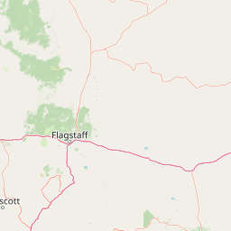
Grand Canyon National Park Geographic Boundary Map and Spatial Limits
Interactive boundary outlines the spatial footprint of Grand Canyon National Park within the regional terrain. Key geographic facts provide estimated area measurements, center coordinates, and spatial spans.
- Boundary area
- 4,866.3 km²
- Boundary perimeter
- 1,677.1 km
- Northernmost point
- 36.8657° N
- Southernmost point
- 35.7501° N
- Easternmost point
- 111.587° W
- Westernmost point
- 113.9799° W
- Geographic centre
- 36.1721° N, 112.6846° W
- North–south span
- 123.8 km
- East–west span
- 214.9 km
Elevation and terrain
Highland relief metrics and recorded natural features
Grand Canyon National Park Terrain and Elevation Profile
Recorded elevation metrics establish a peak elevation summary reaching 2,400 meters across highland terrain. Individual feature cards detail named valleys, viewpoints, and rapids located within the protected area.
- Maximum elevation
- 2,400 m
- Highest point
- 2,400 m
Selected named natural features
Rapids
Lava Falls Rapids
507 m
Peaks
Vishnu Temple
2,191 m
Cave entrances
Bat Cave
Peaks
Grandeur Point
2,145 m
Streams
House Rock Wash
Environmental setting
Arid highland relief, river corridors, and partial forest cover profiles
Grand Canyon National Park Environmental Classifications and Physical Setting
Recorded landscape features, habitat types, and climate zones offer complementary ways to read physical settings. Stored categories link directly to relevant atlas destinations for regional comparison.
- Relief
- Highland
- Climate
- Arid
- Water
- Major water bodies
- Forest cover
- Partial forest
- Seasonality
- Strongly seasonal
Landscape features
Canyon · Rivers · Plateau · Cliffs · Forest
Habitat types
Desert habitat · Temperate coniferous forest · Riverine habitat
Park atlas
Compare protected landscapes and regional park geography surrounding Grand Canyon National Park.
Explore Nearby National Parks and Protected Areas Beyond Grand Canyon National Park
Browse national parks and protected areas geographically close to Grand Canyon National Park, exploring a network of protected landscapes and distinct conservation zones. Gain broader geographic context, comparing diverse geological formations and ecological systems that complement the Grand Canyon's immense, ancient canyon system.
Protected landscapeUnited States of America
Park boundaries overlap#1 closest
Northeast

Glen Canyon National Recreation Area: Protected Landscape and High Desert Geography Map
Colorado Plateau canyons, sandstone strata, and reservoir environments
Explore the geological architecture of Glen Canyon National Recreation Area, a vast federal protected landscape. The area showcases towering Navajo Sandstone cliffs, deep blue reservoir arms, and remote backcountry canyons that exemplify the distinct high desert terrain of the Colorado Plateau in the United States.
- Area
- 5,075.23 km²
- Established
- 1972
- Visitors
- 5.2M annual
- Relief
- Upland

Protected landscapeArizona
Park boundaries overlap#2 closest
North
Kaibab National Forest: Protected Plateau Landscapes and Forested Geography in Arizona
High-elevation forest terrain bordering the Grand Canyon
Spanning over 1.6 million acres in Arizona, Kaibab National Forest is characterized by its split geographic configuration, with distinct sections flanking the North and South rims of the Grand Canyon. The terrain ranges from the high-altitude Kaibab Plateau to volcanic uplands near Williams, encompassing four designated wilderness areas and varied forest ecosystems that provide a critical buffer for the surrounding canyon country.
- Area
- 6,500 km²
- Established
- 1909
- Relief
- Mountain
- Climate
- Temperate
Wildlife reserveArizona
Park boundaries overlap#3 closest
Northwest
Kanab Creek Wilderness: Protected Canyon Landscapes and Geography of Northern Arizona
Extensive tributary canyon systems and plateau terrain
Kanab Creek Wilderness represents a vast protected area in northern Arizona, defined by deep gorges and vertical cliffs etched into the Kanab and Kaibab Plateaus. This geographic atlas entry provides insights into the canyon network that feeds the Colorado River, highlighting the extreme elevation gradients and archaeological significance of this rugged wilderness.
- Area
- 305 km²
- Established
- 1984
- IUCN
- Ib
- Relief
- Upland
Protected landscapeUnited States of America
Park boundaries overlap#4 closest
West
Lake Mead National Recreation Area: Desert Reservoir and Protected Landscape Atlas
United States protected geography and reservoir terrain
Spanning the lower Colorado River, Lake Mead National Recreation Area represents a unique convergence of desert ecosystems and large-scale water management. Its geography includes extensive reservoir shorelines, deep canyon corridors, and volcanic basin terrain that provide a foundational look at the arid environments of the American Southwest. The area remains a significant study of how engineered water features alter and interact with complex desert landscapes.
- Area
- 6,053.31 km²
- Established
- 1936
- IUCN
- V
- Visitors
- 6.4M annual
Wildlife reserveArizona
4.1 km away#5 closest
Northwest
Mount Trumbull Wilderness: A Detailed Geographic Overview of Northern Arizona Volcanic Protected Lands
Mapping basalt mesas and cinder cone ecosystems on the Uinkaret Plateau
Mount Trumbull Wilderness represents a distinct volcanic protected area located on the Uinkaret Plateau of the Arizona Strip. This rugged wilderness encompasses a massive basalt-capped mesa, scattered cinder cones, and deep ecological gradients ranging from pinyon-juniper woodlands to ancient ponderosa forests, providing a vivid look at the complex geological history near the Colorado River.
- Area
- 31 km²
- Established
- 1984
- IUCN
- Ib
- Relief
- Mountain
Wildlife reserveClark County
About 18 km away#6 closest
West
Jumbo Springs Wilderness: Geographic Profile and Protected Landscape Atlas
A rugged desert preserve in Clark County, Nevada
Jumbo Springs Wilderness preserves a dense concentration of desert geology within a compact footprint. Users can analyze the protected boundaries, which feature Precambrian metamorphic formations and granitic domes that rise above arid drainages. This area functions as a critical desert refuge near the Lake Mead reservoir, providing a distinct look at the transition between rocky mountain slopes and water-influenced desert microhabitats.
- Area
- 18.74 km²
- Established
- 2002
- IUCN
- Ib
- Relief
- Upland
Wildlife reserveArizona
About 54 km away#7 closest
West
Mount Tipton Wilderness: Protected Mountain Geography in Northwestern Arizona
High desert ridgelines and summit forest ecosystems
Mount Tipton Wilderness protects a striking segment of the Cerbat Mountains, characterized by its elevation-driven transition from arid desert lowlands to cooler, forested peaks. This rugged Arizona landscape features narrow spine ridges and the notable rock formations of the Cerbat Pinnacles, offering a preserved backcountry environment for those exploring the region's mountain geology and desert ecosystems.
- Area
- 124.5 km²
- Established
- 1990
- IUCN
- Ib
- Relief
- Mountain
Wildlife reserveArizona
69 km away#8 closest
Southeast
Kachina Peaks Wilderness; Geography and Protected Landscape Atlas of Arizona
High-altitude volcanic terrain and alpine ecosystems
Kachina Peaks Wilderness is a protected area in northern Arizona centered on the San Francisco Peaks. This geography includes the state's highest elevation at Humphreys Peak and a rare volcanic caldera known as the Inner Basin. The terrain transitions from dense mountain forests into an Arctic-Alpine zone, offering a distinct landscape for analyzing mountain evolution and high-elevation ecological patterns.
- Area
- 75 km²
- Established
- 1984
- IUCN
- Ib
- Relief
- Mountain
MoriAtlas Explorer
Continue Exploring Grand Canyon National Park's Protected Landscape and Regional Geography
Delve deeper into understanding Grand Canyon National Park's role as a protected area. Explore its specific geographic features and mapped boundaries to gain a richer perspective on Arizona's natural landscapes. This focused exploration supports a structured discovery of protected lands and their atlas context.
Browse next
Global natural geography
Explore related park routes
Explore MoriAtlas Global ParksBrowse All MoriAtlas ParksGlobal Park Map DiscoveryMoriAtlas: Browse All CountriesBrowse All MoriAtlas ContinentsNational Park Environment AtlasGrand Canyon National Park AtlasYellowstone National Park AtlasYosemite National Park Atlas and GeographySerengeti National Park AtlasGalápagos National Park Protected LandscapeBanff National Park Geography and AtlasKruger National Park Atlas EntryUluṟu-Kata Tjuṯa National Park AtlasExplore Uluru-Kata Tjuta National Park GeographyPlitvice Lakes National Park AtlasFiordland National Park Protected LandscapeGreat Smoky Mountains National Park AtlasAfghanistan National Parks and Protected AreasAlbania National Parks and Protected AreasAlgeria National Parks and Protected AreasAmerican Samoa National Parks and Protected AreasAndorra National Parks and Protected AreasAngola National Parks and Protected AreasAntarctica National Parks and Protected AreasAntigua and Barbuda Park List