
Mori Atlas logo
Protected areaGroßer Heuberg und Donautal

Mapping the landscape transition from high plateau juniper heaths to dramatic limestone river gorges

Großer Heuberg und Donautal: An Integrated Protected Area of the Swabian Alb and Danube Valley

(FFH-Gebiet Großer Heuberg und Donautal)

Großer Heuberg und Donautal serves as a significant protected landscape in southern Baden-Württemberg, anchoring a complex transition between the elevated Swabian Alb plateau and the deep break-through valley of the Upper Danube. This vast protected area encompasses a mosaic of nutrient-poor calcareous grasslands, steep rocky escarpments, and broadleaf beech forests. By tracing the topography from the rolling terrain of the Großer Heuberg to the winding river floodplains, the site offers a detailed look at the biodiversity and habitat connectivity that define this region of Germany.

FFH-GebietNatura 2000Swabian AlbDanube valleyjuniper heathscalcareous grasslands
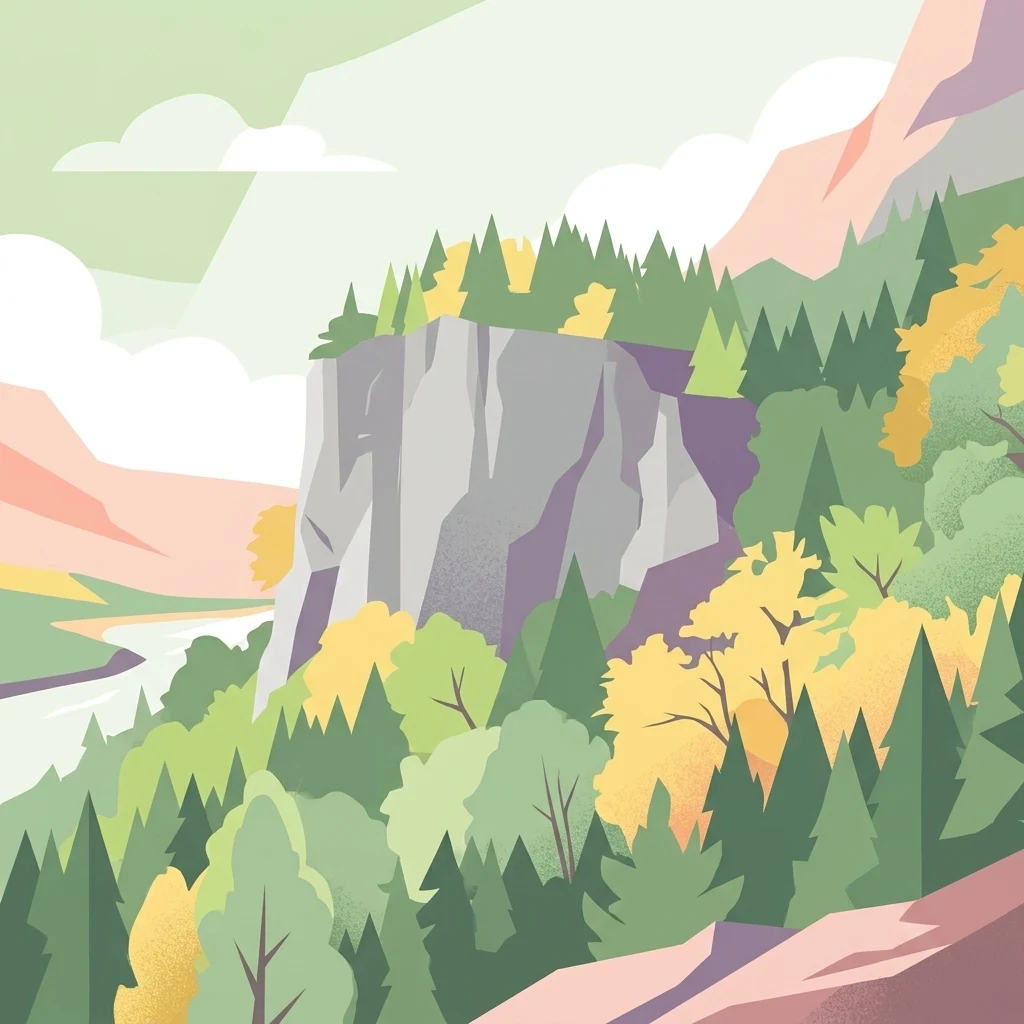
A digital illustration showing a prominent gray rock cliff face surrounded by a mix of evergreen and deciduous trees, with a winding river valley in the background under a soft sky.

Großer Heuberg und Donautal

Protected area

Park overview

Structured park overview, official facts, and landscape profile for Großer Heuberg und Donautal

Großer Heuberg und Donautal park facts, protected area profile, and essential visitor context

Review the core facts for Großer Heuberg und Donautal, including designation, size, terrain, visitor scale, habitats, and operating context in one park-focused overview.

About Großer Heuberg und Donautal

Großer Heuberg und Donautal is one of the wide-ranging Natura 2000 sites along the southwestern edge of the Swabian Alb in southern Germany. It lies where the high plateau of the Großer Heuberg meets the deeply incised Upper Danube valley, a landscape transition that has produced a remarkable patchwork of habitats within a single protected area. The site is formally designated as a Fauna-Flora-Habitat (FFH) area under the European Habitats Directive and forms an important link in the Natura 2000 ecological network across Baden-Württemberg.

The defining feature of the area is the juxtaposition of two very different landscapes: the open, elevated Großer Heuberg plateau with its juniper heaths, dry grasslands and small mires, and the steep, rocky slopes and cliffs of the Albtrauf along the Upper Danube. Between these lie forested slopes, isolated zeugenberg hills such as the Hohenkarpfen, and wetland complexes like the Dürbheimer Moos. The result is a protected area where calcareous and siliceous influences, dry and wet conditions, and open and forested habitats all occur in close proximity.

From a conservation perspective, the site is significant because many of these habitats have become rare across central Europe. Its juniper heaths, orchid-rich calcareous grasslands, calcareous pioneer grasslands, mountain hay meadows, beech forests and floodplain woodlands are among the priority habitat types protected under the Habitats Directive. The presence of rare and threatened species, including several bat species, the Eurasian beaver, the Alpine longhorn beetle Rosalia alpina, the lady orchid-related yellow lady's slipper orchid, and mosses dependent on old-growth conditions, gives the area a particularly high ecological value within the regional Natura 2000 system.

Quick facts and research context for Großer Heuberg und Donautal

Großer Heuberg und Donautal lies in the southern part of Baden-Württemberg and is administered by the Regierungspräsidium Freiburg. The site covers about 86.62 km² and was officially designated as an FFH area on 1 January 2015, although the constituent parts had been protected since 2005. It belongs to the European Natura 2000 network under the Habitats Directive, with the site code DE-7919-311 and WDPA ID 555623531. The protected landscape stretches across the natural regions of Baar, the southwestern Alb foreland, Hegaualb, Hohe Schwabenalb and Baaralb and Upper Danube Valley. It incorporates nineteen smaller nature reserves and represents one of the largest combined FFH sites along the Swabian Alb.

Protection and recognition

Examine documented terrestrial conservation frameworks and administrative records.

Großer Heuberg und Donautal Protection Status and International Recognition

Großer Heuberg und Donautal maintains a documented terrestrial protection status within global conservation databases. Verified administrative parameters and designation records outline the structural framework governing this natural area.

Protection details

Protection scope
Terrestrial
Transboundary protection
No
WDPA ID
555623531
Park context

Deeper park guide and search-rich context for Großer Heuberg und Donautal

Großer Heuberg und Donautal history, landscape, wildlife, and travel context

Explore Großer Heuberg und Donautal through its history, landscape character, ecosystems, wildlife, conservation priorities, cultural context, and seasonal travel timing in a structured park guide built for atlas discovery and search intent.

Why Großer Heuberg und Donautal stands out

Großer Heuberg und Donautal is especially known for the rare combination of juniper heaths, species-rich dry and semi-dry grasslands on calcareous soils, steep rocky slopes along the Danube break-through, and extensive beech and mixed forests. These habitats support orchids such as Cypripedium calceolus, bats like the greater horseshoe bat and Bechstein's bat, as well as the Eurasian beaver, the Alpine longhorn beetle and rare mosses such as Buxbaumia viridis.
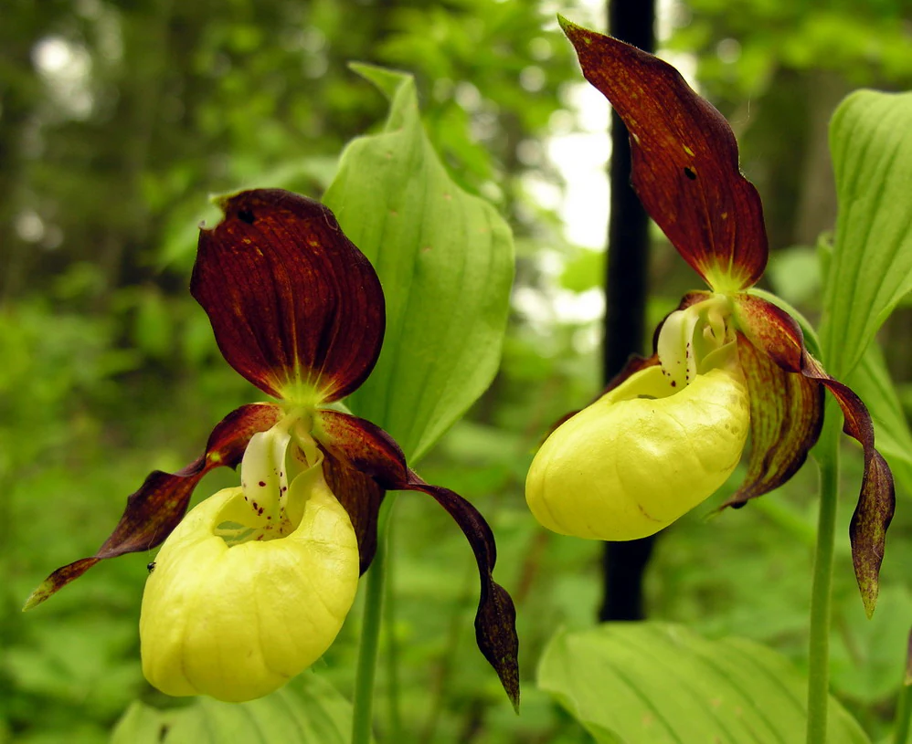
Close-up view of two lady slipper orchids with distinct yellow pouch-like labellums and dark brownish-purple petals against a blurred green forest background.
Two lady slipper orchids (Cypripedium calceolus), a rare plant species found in the protected habitats of the region.

Großer Heuberg und Donautal history and protected-area timeline

The protected area in its current form is relatively young in administrative terms. It was formally established as the FFH-Gebiet Großer Heuberg und Donautal on 1 January 2015 through a deliberate merger of three pre-existing FFH areas that were imposed in 2005: the former site Hohenkarpfen (7918-341), the Südwestlicher Großer Heuberg (7918-342) and the Donautal und Hochflächen von Tuttlingen bis Beuron (7919-341). The merger was carried out through the Regierungspräsidium Freiburg, the regional authority responsible for the site.

Before 2005 the various landscape elements that now make up the site were already protected as individual nature reserves, including areas such as the Irndorfer Hardt, the Buchhalde-Oberes Donautal, the Stiegelesfels-Oberes Donautal and the Hohenkarpfen. After 2005 the habitats fell under the umbrella of the EU Habitats Directive through the earlier smaller FFH designations, and after 2015 they have been managed jointly as a single large-scale Natura 2000 site. The official management plan for the combined FFH area was finalised in late 2015, prepared by the planning office PAN Planungsbüro für angewandten Naturschutz on behalf of the Regierungspräsidium Freiburg.

Großer Heuberg und Donautal landscape and geographic character

The landscape of Großer Heuberg und Donautal is shaped by two strong contrasts that meet within the protected area: the elevated plateau of the Großer Heuberg and the deeply cut valley of the Upper Danube. The plateau portion lies at the western end of the Swabian Alb and is characterised by gently rolling terrain with isolated volcanic zeugenberg hills, of which the Hohenkarpfen is the most prominent. Above the plateau, the land is largely open, covered with juniper heaths, mowed meadows and steep semi-dry grassland.

The other defining edge of the protected landscape is the Albtrauf, the abrupt escarpment where the Swabian Alb drops down to its foreland. Here the terrain becomes steep and rocky; the slopes carry calcareous scree, cliff vegetation and small caves or rock shelters. This is where the Upper Danube has carved its break-through valley, a section of the river between Tuttlingen and Beuron known for its sheer limestone cliffs, meanders and narrow gorges. Photographs such as the Breiter Felsen near Fridingen an der Donau show how vertical the limestone walls can be.

Between these two extremes the protected area also contains smaller-scale features: the Dürbheimer Moos on the western edge, mixed deciduous forests on the slopes, river floodplain fragments along the Danube, and dispersed small nature reserves such as the Hohnet, the Stettener Halde and the Trobenholz-Vogelbühl. Altogether the site reads as a transition zone where the karstic Alb plateau, the Danube valley and the more humid Alb foreland overlap within a single, continuous protected landscape.
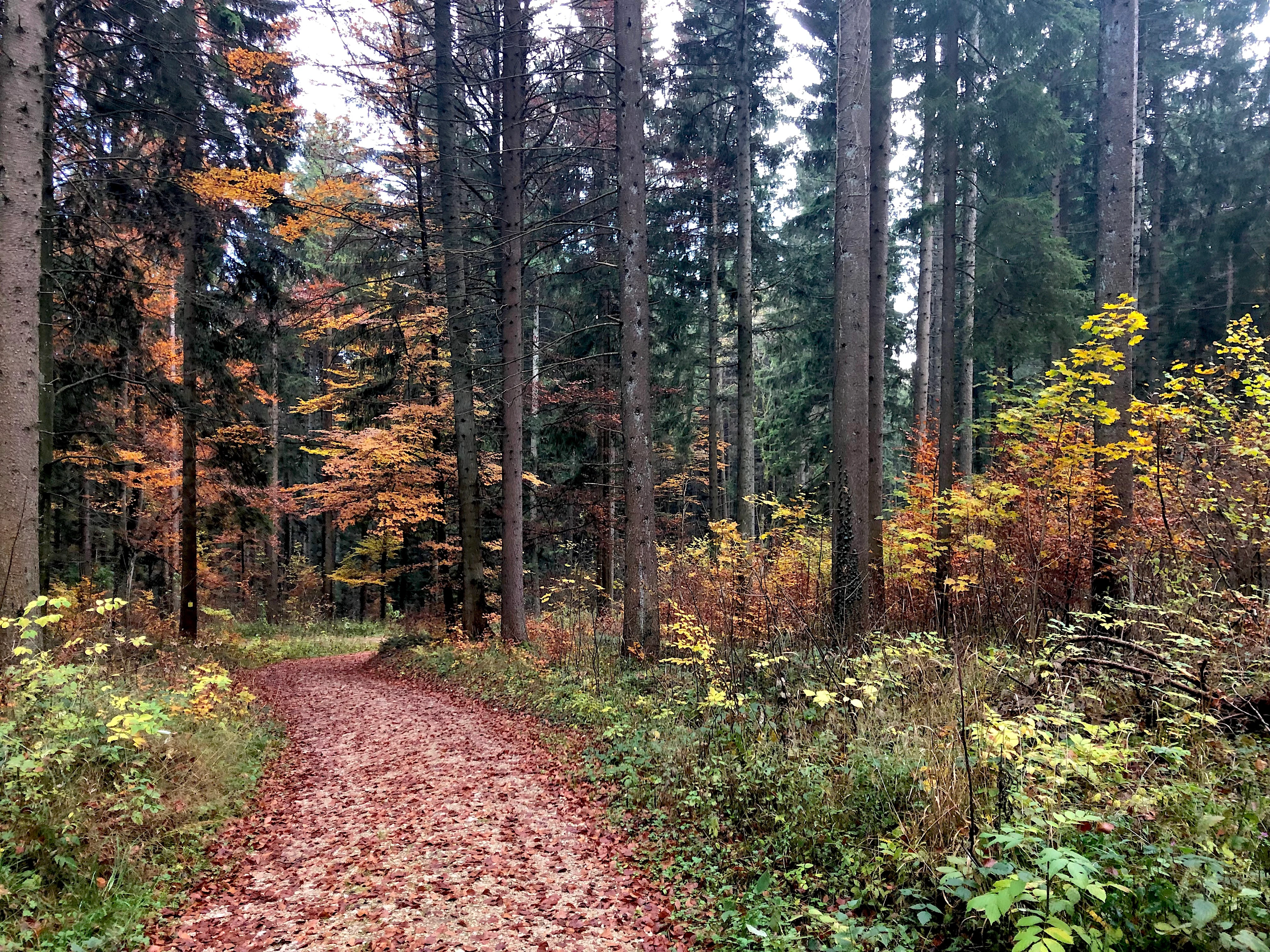
A dirt path leads through a dense, tall forest during autumn, with the ground covered in fallen red and brown leaves.
A forest trail covered in autumn leaves within the Großer Heuberg und Donautal protected area.

Großer Heuberg und Donautal ecosystems, habitats, and plant life

Ecologically, Großer Heuberg und Donautal is defined by the coexistence of calcareous dry habitats, open juniper heaths, montane hay meadows and species-rich broadleaf forests. The plateau's thin, base-rich soils have produced a remarkable diversity of habitat types within a relatively compact area, including European dry heaths (4030), juniper formations on calcareous soils (5130), pioneer calcareous grasslands (6110), orchid-rich calcareous dry grasslands (6210*), species-rich Nardus grasslands on siliceous substrates (6230*) and both flatland and mountain hay meadows (6510, 6520).

Forests form an equally important component. The site includes Asperulo-Fagetum beech forests (9130), orchid-rich calcareous beech forests (9150), Galio-Carpinetum oak-hornbeam forests (9170), and the priority habitat of Tilio-Acerion slope and ravine forests (9180*). Along the Danube and its tributaries there are alluvial forests dominated by alder, ash and willow (91E0*), while in drier, more continental-influenced places one finds steppe pine forests listed as 91U0.

Wet habitats are also represented, including naturally nutrient-rich lakes (3150), rivers with Ranunculus vegetation (3260), tall-herb humid meadows (6430) and transition mires with quaking mats (7140). Calcareous springs (7220*) and limestone scree slopes (8160*) add further habitat diversity. Together these habitat types make the site a near-textbook example of the ecological mosaic that the European Habitats Directive was designed to protect.

Großer Heuberg und Donautal wildlife and species highlights

The wildlife profile of Großer Heuberg und Donautal is shaped by the variety of habitats listed above. Calcareous grasslands, juniper heaths and cliff forests support a wide range of protected invertebrates, including the Spanish flag moth (Callimorpha quadripunctaria) and the Alpine longhorn beetle (Rosalia alpina), while the rare snail Vertigo angustior benefits from the site's humid microhabitats. The Danube and its tributaries host fish species such as the bitterling (Rhodeus sericeus) and the bullhead (Cottus gobio), along with amphibians such as the northern crested newt (Triturus cristatus).

Bats are particularly important in the area. The site regularly supports the greater horseshoe bat (Rhinolophus ferrumequinum), Bechstein's bat (Myotis bechsteinii) and the greater mouse-eared bat (Myotis myotis), often roosting in caves, balmen and old forest stands. The presence of the Eurasian beaver (Castor fiber) along the Danube adds a further conservation milestone to the area, as does the rich bryophyte flora, including Dicranum viride and Buxbaumia viridis, both indicators of old, ecologically intact forests.

Among the plants, the yellow lady's slipper orchid (Cypripedium calceolus) and the threatened grass Bromus grossus are among the most notable species of community interest recorded in the standard data form for the site. Forest herbs, orchids in beechwoods and the rich calcareous grassland flora contribute to a botanical diversity that, together with the fauna, gives the site a strong conservation identity within the broader Swabian Alb Natura 2000 network.

Großer Heuberg und Donautal conservation status and protection priorities

From a conservation standpoint, Großer Heuberg und Donautal is one of the most habitat-rich FFH sites along the southwestern Swabian Alb. Its significance rests on the unusually large concentration of Annex I habitats and Annex II species within a single Natura 2000 area, including several priority habitat types marked with an asterisk, such as orchid-rich calcareous grasslands (6210*), Tilio-Acerion slope forests (9180*), alluvial forests (91E0*), calcareous pioneer grasslands (6110*) and species-rich Nardus grasslands on siliceous substrates (6230*). The combination of these habitats within a relatively compact administrative boundary greatly increases the site's overall ecological importance.

Protection of the area is realised through the European Habitats Directive (92/43/EEC) and is nationally administered by the Regierungspräsidium Freiburg. The official management plan, completed in late 2015, coordinates habitat and species conservation across the former FFH sites Hohenkarpfen, Südwestlicher Großer Heuberg and Donautal und Hochflächen von Tuttlingen bis Beuron. Conservation measures focus on maintaining open habitats such as juniper heaths and calcareous dry grasslands, preserving old-growth forest structures for bats and bryophytes, protecting river corridors for the beaver and fish species, and integrating nineteen pre-existing nature reserves into a unified Natura 2000 framework.

Großer Heuberg und Donautal cultural meaning and human context

Although the area is primarily recognised for its ecological value, the landscape reflects a long history of agricultural use. The juniper heaths, dry grasslands and hay meadows are not natural wilderness, but cultural landscapes that have been maintained by centuries of grazing, mowing and traditional land management. Place names such as Heuberg, literally 'hay mountain', point to the historical role of hay production in the local rural economy, while long-standing settlements such as Fridingen an der Donau, Mühlheim an der Donau and Beuron are closely tied to the Danube gorge and its historic traffic routes. The Beuron area, in particular, has long been famous for its monastery and its role in shaping the cultural identity of the Upper Danube valley.

Top sights and standout views in Großer Heuberg und Donautal

Großer Heuberg und Donautal combines the open juniper heath and dry grassland plateau of the Großer Heuberg with the steep rocky slopes and meanders of the Upper Danube. It contains no fewer than nineteen integrated nature reserves and a remarkable range of priority habitat types under the EU Habitats Directive. Among its most distinctive features are orchid-rich calcareous grasslands, juniper heaths on limestone, beech and oak-hornbeam forests, floodplain woodlands along the Danube, and calcareous cliffs with cave vegetation. The site is particularly notable for its bat fauna, its populations of the Eurasian beaver, its populations of rare orchids such as Cypripedium calceolus, and its old-growth forest bryophytes like Buxbaumia viridis.

Best time to visit Großer Heuberg und Donautal

The character of Großer Heuberg und Donautal shifts clearly with the seasons. Late spring and early summer are the most rewarding time for the calcareous grasslands and hay meadows on the Großer Heuberg plateau, when orchids and other herb-rich flora are in full bloom and the juniper heaths contrast vividly with the flowering meadows. Summer offers the strongest experience of the Danube break-through, with the cliffs above Fridingen and Beuron best appreciated in long daylight and warm weather. Autumn is the most atmospheric season for the beech and oak-hornbeam forests, when fruiting bodies appear and the lime-rich forests turn colour. Winter brings a quieter but striking landscape of frost-covered juniper heaths and bare cliff faces along the Danube.

Monthly climate preview

Long-term representative monthly temperature and precipitation data measurements

Großer Heuberg und Donautal Climate Normals and Annual Weather Patterns

Representative coordinate records show recorded monthly average temperatures spanning from sub-zero lows to warm summer maximums alongside varying daily precipitation rates. Reviewing the complete twelve-month climatology profile provides precise statistical context for regional meteorological conditions.
Annual mean8 °C
-2 °C17 °C
Jan-2°
Feb-1°
Mar
Apr
May12°
Jun15°
Jul17°
Aug17°
Sep13°
Oct
Nov
Dec-1°
Warmest month
July

17.2 °C

Coolest month
January

-1.7 °C

Wettest month
June

3.7 mm/day

Driest month
February

1.9 mm/day

Park location guide

Geography guide, regional context, and park location map for Großer Heuberg und Donautal

Großer Heuberg und Donautal park geography, regions, and map view in Germany

Understand where Großer Heuberg und Donautal sits in Germany through a broader geographic reading of the surrounding landscape, nearby location context, and its mapped position within the national park landscape.

How Großer Heuberg und Donautal fits into Germany

Germany is a federal republic in Western and Central Europe with a population of over 83 million across sixteen constituent states. It is Europe's largest economy by nominal GDP and a major global exporter and importer. The capital is Berlin, and the country borders Denmark, Poland, Czech Republic, Austria, Switzerland, France, Luxembourg, Belgium, and the Netherlands.

Wider geography shaping Großer Heuberg und Donautal in Germany

Germany is located in Western and Central Europe, spanning 357,022 km². It borders Denmark to the north, Poland and the Czech Republic to the east, Austria and Switzerland to the south, and France, Luxembourg, Belgium, and the Netherlands to the west. The country has coastlines on the Baltic Sea and North Sea to the north, with the Alps located in the southern region.

Map view of Großer Heuberg und Donautal

Use this park location map to pinpoint Großer Heuberg und Donautal in Germany, understand its exact geographic position, and read its mapped placement within the surrounding landscape more clearly.

Pigeon | © OpenStreetMap contributors

Location context for Großer Heuberg und Donautal

Baden-Württemberg

Visual exploration of limestone cliffs, juniper heaths, and river valleys across the protected landscape.

Großer Heuberg und Donautal Photos and Landscape Scenery

Visual documentation captures the dramatic contrast between the elevated plateau and the deep limestone gorge of the Upper Danube. Protected habitats, rocky slopes, and rare grassland flora become clear through detailed terrain imagery.

Close-up view of two lady slipper orchids with distinct yellow pouch-like labellums and dark brownish-purple petals against a blurred green forest background.

A steep, light-colored limestone rock formation rising out of a dense, colorful deciduous forest during autumn.

A dirt path leads through a dense, tall forest during autumn, with the ground covered in fallen red and brown leaves.

Park atlas

Compare surrounding regional geography and connected conservation areas

Parks Near Grosser Heuberg und Donautal and Related Protected Landscapes

Browsing other protected areas near Grosser Heuberg und Donautal reveals similar upland plateaus and river valley ecosystems across southern Baden-Württemberg. Examining adjacent regional reserves provides broader context for understanding the ecological transitions of the Swabian Alb.
Protected landscapeBaden-Württemberg
About 8.2 km away#1 closest

North

Schafweiden im Unteren Bäratal bei Reichenbach: Regional Landscape and Protected Area Atlas

Baden-Württemberg cultural landscape and valley topography

This protected area captures the traditional sheep-grazed character of the Hohe Schwabenalb. The landscape mosaic consists of contrasting valley slopes that support rare orchid populations, mature forest fringes, and ancient pasture trees, providing deep insight into the regional conservation geography of the lower Bära valley.

Area
0.327 km²
Established
2019
IUCN
V
Watercolor painting depicting a gentle hill with forest cover and a winding river in the foreground, using soft pastel tones.
Protected landscapeLandkreis Tuttlingen
About 10 km away#2 closest

South

Honberg Protected Landscape: Geological Atlas and Mapped Terrain in Landkreis Tuttlingen

A preserved Danube Umlaufberg and historical cultural landmark.

The Honberg represents a rare example of a protected landscape fully integrated within an urban setting in southwestern Germany. Defined by its origin as a Danube river meander, the ridge showcases layered limestone formations, diverse meadow habitats, and ancient fortification sites that remain shielded from regional development. This site is essential for understanding the local topography of the Swabian Alb and the historical land-use patterns within the Danube valley.

Area
0.598 km²
Established
1986
IUCN
V
A watercolor painting showing a soft, panoramic view of green rolling hills and a winding river against a pale background of distant mountains.
Protected landscapeBaden-Württemberg
About 11 km away#3 closest

North

Oberhohenberg Protected Landscape: A Geographical Atlas of the Swabian Alb Zeugenberg

Mapping limestone summits, block forests, and relict meadow habitats.

Oberhohenberg is a designated protected landscape situated on the Swabian Alb. As a striking zeugenberg, the hill supports a complex environment consisting of limestone rock faces, remnant grasslands, and rare blockschuttwald forest types. This compact area offers a precise view into the geological and structural diversity defining the regional landscape of Baden-Württemberg.

Area
0.286 km²
Established
1953
IUCN
V
Relief
Mountain
Nature reserveGermany
About 11 km away#4 closest

North

Hintere Harrasbachtalwiesen Nature Reserve: Swabian Alb Valley and Meadow Geography

A mapped protected landscape in Baden-Wurttemberg, Germany

Hintere Harrasbachtalwiesen is a protected valley landscape in the Tuttlingen district, characterized by its stream network and distinctive forest-encircled wet meadows. This compact reserve provides a clear example of local Swabian Alb topography, linking small-scale riparian corridors to the extensive regional Natura 2000 protected land network.

Area
0.08 km²
Established
1944
Relief
Upland
Climate
Temperate
Protected landscapeBaden-Württemberg
About 18 km away#5 closest

Northwest

Wacholderheide Dissenhorn: Protected Landscape Mapping and Regional Geography in Baden-Württemberg

A preserved juniper heath mosaic within the Southwestern Alb Foothills

Wacholderheide Dissenhorn represents a vital protected landscape area near Göllsdorf, where the projecting Dissenhorn slope preserves a historic juniper heath mosaic. Defined by Middle Keuper geological formations, this terrain offers a clear look at local habitat management and the transition between open heath and mixed coniferous forest in Germany.

Area
0.101 km²
Established
1953
IUCN
V
Protected landscapeBaden-Württemberg
About 21 km away#6 closest

West

Hänge mit Wald und Hecken im Neckartal und Mückenbachtal Protected Landscape and Valley Map

Geographic study of the upper Neckar valley and Mückenbachtal terrain

Investigate the layered landscape of Hänge mit Wald und Hecken im Neckartal und Mückenbachtal, where open grassland plains meet steep, forest-covered valley walls. This protected area provides a clear look at regional river-valley morphology and the integration of natural habitats near the A 81 corridor within the Baden-Württemberg state boundaries.

Area
0.223 km²
Established
1953
IUCN
V
Relief
Upland
Protected landscapeBaden-Württemberg
About 21 km away#7 closest

Southwest

Hegau Protected Landscape in Baden-Württemberg: Atlas and Geographic Regional Map

Plateau landscape and agricultural heritage in Tuttlingen

The Hegau protected landscape in the Landkreis Tuttlingen preserves a characteristic segment of the Hegaualb plateau. Defined by undulating farmland, meadows, and the isolated Franzengrund woodland, this reserve offers a clear look at the rural geography and cultural landscape patterns typical of this part of southwestern Germany.

Area
2.723 km²
Established
1952
IUCN
V
Relief
Upland
A graphic illustration of a deep forest gorge featuring a winding stream in the foreground, tall trees on both sides, and a cascading waterfall against high cliff walls in the background.
Protected landscapeBaden-Württemberg
About 24 km away#8 closest

Northwest

Waldenbachtal Protected Landscape: A Geographic Profile of a Sandstone Gorge in Baden-Württemberg

Forested Klingen valley and stream-carved terrain mapping

Waldenbachtal serves as an ecologically significant protected landscape within the Rottweil district of Baden-Württemberg. Its map profile highlights a narrow gorge incised into Stubensandstein, defined by a distinct coniferous forest cover and linear stream drainage. This site provides a clear view into the region's Middle Keuper geological history and valley-based conservation patterns.

Area
0.149 km²
Established
1982
IUCN
V

Common questions about visiting, size, designation, and location context for Großer Heuberg und Donautal

Großer Heuberg und Donautal FAQs for park facts, access, geography, and protected area context

Find quick answers about Großer Heuberg und Donautal, including protected-area facts, park geography, trail and visitor context, and how the park fits into its surrounding country and regional landscape.
MoriAtlas Explorer

Continue Your Protected Areas Search Across the Global Atlas

Deepen your exploration by continuing the structured search for national parks and protected areas worldwide. Utilize the comprehensive filtering capabilities to compare different conservation landscapes and refine your understanding of global park geography. Discover more about the distribution and characteristics of protected natural areas.

Global natural geography