Mori Atlas logo
State or regional parkGuilarte State Forest

Mapping the altitudinal gradients and cloud forest ecosystems of this vital highland reserve

Guilarte State Forest: A Rugged Protected Landscape in the Cordillera Central of Puerto Rico

Guilarte State Forest anchors the eastern Cordillera Central in Puerto Rico, preserving a vertical landscape that transitions from dense Sierra palm forests to high-elevation montane cloud forest. This reserve protects the headwaters of critical island rivers and serves as a vital refuge for rare endemic species. Through this atlas, analyze the distinct ecological zones and steep mountainous terrain that define this protected mountain territory.

state forestCordillera CentralPuerto Ricocloud forestSierra palm forestmontane forest

Guilarte State Forest

State or regional park

Park overview

Structured park overview, official facts, and landscape profile for Guilarte State Forest

Guilarte State Forest park facts, protected area profile, and essential visitor context

Review the core facts for Guilarte State Forest, including designation, size, terrain, visitor scale, habitats, and operating context in one park-focused overview.

About Guilarte State Forest

Guilarte State Forest is a public state forest in the Cordillera Central of Puerto Rico and one of the cornerstone units of the island's public forest system. Centered on Monte Guilarte, the seventh-highest peak in Puerto Rico, the reserve spans roughly 4,822 acres across four municipalities and represents one of the more biologically concentrated protected landscapes in central Puerto Rico.

What sets Guilarte apart is the vertical compression of two strikingly different forest types within a small geographic footprint. At lower and middle elevations, the reserve is dominated by lush Sierra palm forests, a form of subtropical moist broadleaf forest characteristic of the wetter Puerto Rican mountains. Higher up, near and above Monte Guilarte's summit, conditions become cooler and wetter, supporting a montane rain forest with small-leaved evergreen trees draped in moss and frequently bathed in cloud moisture.

The forest's ecological role extends beyond its tree cover. The Arecibo, Añasco, and Guayanilla river systems all originate within the reserve, making Guilarte a critical source of freshwater for surrounding lowland communities. The forest also contributes to one of the most important upland bird habitats on the island and has been formally recognized as a component of the Cordillera Central Important Bird Area since 2007.

Managed by the Puerto Rico Department of Natural and Environmental Resources, Guilarte combines conservation, hydrological protection, and public recreation in a single relatively compact unit. Its network of trails, lookout points, and cabins provides access to summit views and forest immersion that differ sharply from the coastal experience most visitors associate with Puerto Rico.

Quick facts and research context for Guilarte State Forest

Guilarte State Forest lies within Puerto Rico's Cordillera Central and spans parts of four municipalities: Adjuntas, Guayanilla, Peñuelas, and Yauco. The protected area covers roughly 4,822 acres and ranges in elevation from about 2,500 to 3,950 feet above sea level. It is administered by the Puerto Rico Department of Natural and Environmental Resources and is classified ecologically as part of the Puerto Rican moist forests.

The forest's most prominent feature is Monte Guilarte, the seventh-highest peak in Puerto Rico. It protects two forest types, Sierra palm forest and montane cloud forest, and includes signposted trails, cabins, lookouts, and ranger facilities. Various important river basins, including those of the Arecibo, Añasco, and Guayanilla rivers, originate within its boundaries.

Protection and recognition

Documented terrestrial protection scope and official designation metrics

Guilarte State Forest Protection Status and International Recognition Data

Guilarte State Forest features a documented terrestrial protection scope and established administrative boundaries within the regional conservation network. Structured facts outline the recorded designation framework and baseline administrative metrics for this protected landscape.

Protection details

Protection scope
Terrestrial
Park context

Deeper park guide and search-rich context for Guilarte State Forest

Guilarte State Forest history, landscape, wildlife, and travel context

Explore Guilarte State Forest through its history, landscape character, ecosystems, wildlife, conservation priorities, cultural context, and seasonal travel timing in a structured park guide built for atlas discovery and search intent.

Why Guilarte State Forest stands out

Guilarte State Forest is best known for protecting two distinct mountain forest types on a single reserve: a Sierra palm-dominated subtropical moist broadleaf forest on lower slopes, and a true montane cloud forest in the highest elevations. This altitudinal layering is uncommon among Puerto Rico's protected forests and gives the reserve its distinctive ecological character. The forest is also recognized for harboring rare and endemic species. It is one of the few protected areas where the critically endangered palo de Ramón tree still survives in the wild, and it shelters endemic ferns, native coquís, the Puerto Rican boa, the Puerto Rican sharp-shinned hawk, and other threatened wildlife. Combined with its role as the source of multiple major river basins on the island, the forest holds an outsized conservation importance relative to its size.
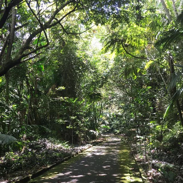
A narrow paved path leads through a dense, lush tropical forest with dappled sunlight and overhanging tree branches.
A shaded trail winding through the dense vegetation of Guilarte State Forest.

Guilarte State Forest history and protected-area timeline

Guilarte State Forest was established in 1935, when the Puerto Rico Reconstruction Administration acquired approximately 3,500 acres in and around Monte Guilarte in the municipality of Adjuntas. The original purpose was twofold: to preserve the area as a wildlife reserve protecting native plant and animal species, and to provide a managed site for forest-based recreation.

Over the following decades, the protected area was expanded and its administration transitioned to the Puerto Rico Department of Natural and Environmental Resources, the agency that still manages the forest today. Under the DRNA, holdings grew from the initial 3,500 acres toward the present-day extent of roughly 4,822 acres. The forest also became formally recognized as part of the Cordillera Central Important Bird Area in 2007, underscoring its growing conservation significance well beyond its original designation.

Guilarte State Forest landscape and geographic character

The physical setting of Guilarte State Forest is shaped by the eastern Cordillera Central, the rugged spine that runs across inland Puerto Rico. The reserve climbs from about 2,500 feet above sea level on its lower flanks to 3,950 feet at the summit of Monte Guilarte, giving it a steeper gradient than most of the island's coastal protected areas.

This vertical relief creates sharply different visual zones within a short distance. Lower slopes are blanketed in dense, uniform Sierra palm forest with a continuous canopy that gives the terrain a soft, layered appearance. As elevation increases, the forest type transitions into a stunted montane rain forest, where trees grow smaller and the landscape opens up into rocky ridges and summit clearings with expansive views across central Puerto Rico and, on clear days, toward the coast.

Rivers and streams descend from these slopes in deeply incised drainages, contributing to the visual intensity of the terrain. The combination of steep ridgelines, cloud-immersed summits, and dense palm-covered slopes defines the forest's signature scenery.

Guilarte State Forest ecosystems, habitats, and plant life

Ecologically, Guilarte State Forest occupies the Puerto Rican moist forests realm and is divided into two principal forest zones defined by elevation. The broader of these is the subtropical moist broadleaf forest expressed as Sierra palm forest, dominated by the Sierra palm and forms a dense, continuous canopy across much of the reserve.

Higher elevations support a montane rain forest, a cloud forest formation where cooler temperatures and persistent moisture shape a different community of small-leaved evergreen trees. Indicator species of these highest areas include Tabebuia shumanniana and Ocotea spatulata, along with Spanish elm and the naturalized swamp mahogany that thrives in cooler montane conditions.

The forest harbors around 227 documented tree species, of which four are considered endangered or threatened. The most significant of these is the palo de Ramón, a tree so rare that only about twenty individuals are known to survive in the wild, all within this reserve. Endemic elements such as the dwarf tree fern and the Monte Guilarte hollyfern, known from only two locations globally, further underscore the forest's botanical importance.

Beyond its forests, the reserve protects the headwaters of the Arecibo, Añasco, and Guayanilla river systems, making it a foundational landscape for freshwater and watershed protection in central Puerto Rico.

Guilarte State Forest wildlife and species highlights

Guilarte State Forest is recognized as one of the key protected areas for endangered and endemic wildlife in Puerto Rico. The reserve supports the Puerto Rican sharp-shinned hawk, a highly endangered island subspecies of the sharp-shinned hawk, as well as the Puerto Rican boa, a sizable endemic snake. It is also one of the strongholds for rare amphibians such as Eneida's coquí and the mountain coquí.

Forest bat populations include the red fruit bat, a species found only in Puerto Rico and the U.S. Virgin Islands. The forest's bird community is especially rich, featuring the Puerto Rican vireo, the scaly-naped pigeon, the Puerto Rican emerald hummingbird, the Puerto Rican tody, locally known as San Pedrito, and the Puerto Rican woodpecker, each representing a characteristic part of the island's montane avifauna.

Reptiles are also strongly represented. Several anole species occur in the forest, including the Puerto Rican twig anole, olive bush anole, yellow-bearded anole, emerald anole, and the large Puerto Rican giant anole. The Puerto Rican galliwasp, sometimes called the four-legged snake, also inhabits the reserve. In 2007, the forest was formally recognized as part of the Cordillera Central Important Bird Area, reflecting its contribution to the conservation of regional bird populations.

Guilarte State Forest conservation status and protection priorities

Guilarte State Forest carries conservation weight that extends well beyond its boundary. Its protection directly supports the survival of multiple critically endangered and endemic species, including rare trees such as the palo de Ramón, endemic ferns found nowhere else on Earth, and island-restricted wildlife like the Puerto Rican sharp-shinned hawk and the red fruit bat.

The forest's hydrological role is equally important. Because the Arecibo, Añasco, and Guayanilla rivers rise within its boundaries, the reserve is effectively the source region for major freshwater systems that supply communities across a wide swath of Puerto Rico. Maintaining the integrity of these watersheds depends heavily on the continued protection of the forest's upper slopes.

Recognition of the forest as part of the Cordillera Central Important Bird Area since 2007 reflects an expanded understanding of its ecological value, framing Guilarte not just as an isolated reserve but as a node within a broader landscape of upland forest ecosystems. Its elevation gradient, which supports two distinct forest types in a small area, also makes it a useful reference site for monitoring how Caribbean mountain ecosystems respond to changing climate conditions.

Top sights and standout views in Guilarte State Forest

Guilarte State Forest protects two distinct forest types, Sierra palm forest and montane cloud forest, compressed into a single relatively small reserve, a feature unusual among Puerto Rico's protected areas.

It hosts an exceptional concentration of rare and endemic species, including the palo de Ramón tree with only a handful of wild individuals and endemic ferns known only from this forest.

The reserve sits at the headwaters of the Arecibo, Añasco, and Guayanilla rivers, giving it foundational importance for freshwater and watershed protection in central Puerto Rico. Monte Guilarte, the seventh-highest peak on the island, anchors the landscape and provides summit-level viewpoints accessible via established hiking trails.

Best time to visit Guilarte State Forest

The broader mountain climate of Puerto Rico's Cordillera Central gives Guilarte State Forest a cooler, more humid feel than most of the island year-round, and visiting when skies are clearer tends to reward hikers with the widest panoramic views from Monte Guilarte's summit.

Drier seasonal windows are generally the most favorable for hiking the Pico Guilarte trail and for using the lookout points along the San Andrés Trail, since trails are less likely to be muddy and visibility from the peaks is more reliable. Birdwatching is productive across the year, though periods of slight migrants and active breeding are typically associated with the warmer months.

Because temperatures at elevation are noticeably cooler than the coast, visiting in light layers is broadly advisable regardless of season. Visitors should treat seasonal timing as atmospheric guidance rather than a guarantee, given Puerto Rico's variable weather patterns.
Monthly climate preview

Long-term temperature ranges and monthly precipitation averages for Guilarte State Forest

Guilarte State Forest Climate Normals and Annual Weather Patterns

Guilarte State Forest records measured monthly mean temperatures spanning from 24.44 degrees Celsius to 27.55 degrees Celsius alongside varying precipitation levels across the representative coordinate. Reviewing the complete twelve-month climatology profile provides deeper insight into long-term environmental rhythms and thermal variation.
Annual mean26 °C
24 °C28 °C
Jan24°
Feb25°
Mar25°
Apr26°
May27°
Jun27°
Jul27°
Aug28°
Sep27°
Oct27°
Nov26°
Dec25°
Warmest month
August

27.6 °C

Coolest month
January

24.4 °C

Wettest month
September

4.2 mm/day

Driest month
February

1.3 mm/day

Park location guide

Geography guide, regional context, and park location map for Guilarte State Forest

Guilarte State Forest park geography, regions, and map view in Puerto Rico

Understand where Guilarte State Forest sits in Puerto Rico through a broader geographic reading of the surrounding landscape, nearby location context, and its mapped position within the national park landscape.

How Guilarte State Forest fits into Puerto Rico

Puerto Rico is a Caribbean archipelago and island territory of the United States, classified as an unincorporated and organized territory under commonwealth status. Located in the North Atlantic Ocean east of the Dominican Republic, it serves as a significant cultural and economic hub in the region. The territory maintains its own constitution, governor, and legislative assembly while being represented in Congress by a resident commissioner.

Wider geography shaping Guilarte State Forest in Puerto Rico

Puerto Rico is a Caribbean island archipelago located in the North Atlantic Ocean, approximately 1,600 kilometers southeast of Florida. The main island spans about 177 kilometers in length and 65 kilometers in width, with a total land area of approximately 8,868 km². The terrain ranges from coastal plains to mountainous interior regions, with the highest point at Cerro Punta reaching 1,338 meters. The island is bordered by the Atlantic Ocean and Caribbean Sea.

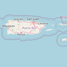
Map view of Guilarte State Forest

Use this park location map to pinpoint Guilarte State Forest in Puerto Rico, understand its exact geographic position, and read its mapped placement within the surrounding landscape more clearly.

Pigeon | © OpenStreetMap contributors

Visualizing mountain habitats and protected terrain across the Cordillera Central

Guilarte State Forest Photos and Landscape Scenery

Visual documentation captures the rugged topography, steep forest ridges, and altitudinal plant transitions that define Guilarte State Forest. Examination of these protected landscapes reveals the distinct ecological zones and cloud forest environments shaping the reserve.

A narrow paved path leads through a dense, lush tropical forest with dappled sunlight and overhanging tree branches.

Park atlas

Compare adjacent mountain reserves and regional forest landscapes across the Cordillera Central.

Explore Parks Near Guilarte State Forest and Surrounding Protected Areas

Browsing other protected areas near Guilarte State Forest reveals connected ecological corridors and rugged highland terrain across the surrounding region. Comparing these neighboring forest reserves provides deeper context into regional conservation landscapes and mountainous topography.
Protected areaAdjuntas
About 10 km away#1 closest

Northeast

Bosque del Pueblo: Protected Forest Geography and Cordillera Central Landscape

A mountain watershed and ecological corridor in Adjuntas

Bosque del Pueblo represents a key protected landscape within the central mountains of Puerto Rico. As a critical forest reserve located in Adjuntas, it preserves headwaters and supports rare bird populations, serving as a permanent ecological link between several major state forest units.

Area
2.987 km²
Established
1995
Relief
Mountain
Climate
Tropical
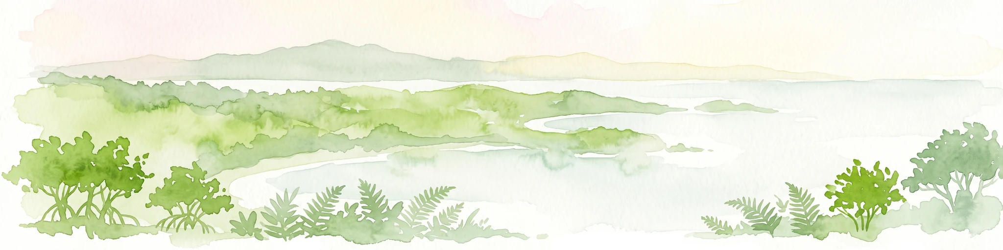
Watercolor painting of a hilly, green landscape featuring rolling mountains in the distance and vegetation in the foreground.
State or regional parkUnited States of America
About 18 km away#2 closest

East

Cerrillos State Forest: Protected Subtropical Woodland and Reservoir Geography

Foothill landscapes and watershed features in Ponce, Puerto Rico

This protected area features a mix of tabonuco forest and water-based recreational terrain. Spanning the slopes of the Cordillera Central foothills, the forest encompasses the Cerrillos River and the man-made Lake Cerrillos reservoir, offering a distinct example of subtropical moist forest ecology within the United States commonwealth system.

Area
0.79 km²
Established
1996
Relief
Upland
Climate
Subtropical
Watercolor painting of a coastal dry forest scene with mangrove-like trees and hills in the background.
State or regional parkPuerto Rico
About 21 km away#3 closest

Southwest

Guánica State Forest: Mapped Geography and Protected Landscapes in Puerto Rico

A diverse Caribbean subtropical dry forest reserve spanning karst terrain and coastal habitats

Guánica State Forest serves as a primary protected natural area in southwestern Puerto Rico, defined by its arid subtropical climate and exceptional ecological diversity. This reserve incorporates a complex mosaic of ecosystems, including deciduous dry forest, mangrove channels, salt flats, and offshore keys. The landscape provides critical habitat for numerous endemic species while preserving the integrity of the Southern Karst geological zone and its surrounding maritime boundaries.

Area
39.97 km²
Established
1919
Relief
Lowland
Climate
Tropical
State or regional parkPuerto Rico
About 24 km away#4 closest

West

Maricao State Forest: A Detailed Map and Geographic Overview of Puerto Rico's Mountain Wilderness

Endemic-rich mountain forests and serpentinite terrain in the Cordillera Central

Maricao State Forest represents a vital protected landscape in the western Cordillera Central of Puerto Rico. This site features distinctive serpentinite geology, complex mountainous watersheds, and diverse endemic bird habitats. The forest serves as a primary geographic anchor along the Ruta Panorámica, providing clear insight into the rugged environmental character of the central island spine.

Area
43.72 km²
Established
1919
Relief
Mountain
Climate
Tropical
State or regional parkPuerto Rico
About 25 km away#5 closest

Northeast

Los Tres Picachos State Forest: A Geographic Guide to Puerto Rico's Mountain Protected Areas

Cloud forests, volcanic terrain, and watershed protection

Los Tres Picachos State Forest encompasses a striking landscape in the Puerto Rican interior, marked by deep river valleys and its namesake triple peaks. This atlas feature provides insights into the forest's layered ecological zones and its role as a crucial hydrological anchor for the Toro Negro and Cialitos river systems within the Cordillera Central.

Established
1999
Relief
Mountain
Climate
Tropical
Access
Remote access
State or regional parkUnited States of America
About 26 km away#6 closest

North

Río Abajo State Forest: Mapping the Karst Terrain and Protected Landscapes of Puerto Rico

Protected karst landscape and regional forest geography

Río Abajo State Forest serves as an essential example of Caribbean karst ecosystems, defined by its steep limestone mogotes, hidden ravines, and extensive sinkhole networks. Located in the northern karst belt of Puerto Rico, the forest provides deep insight into complex subterranean drainage patterns and serves as a primary hub for endangered species recovery within its uniquely broken, three-dimensional terrain.

Area
14.1 km²
Established
1943
Relief
Upland
Climate
Tropical
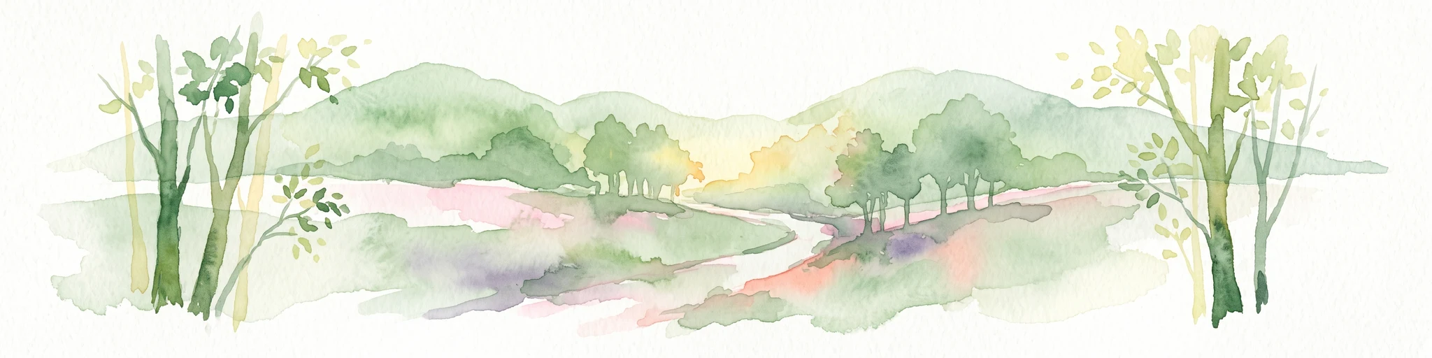
A wide watercolor illustration showing a forest scene with trees in the foreground, a winding path or river, and green hills in the background.
Nature reservePuerto Rico
About 40 km away#7 closest

Northeast

Cambalache Forest Reserve: A Detailed Look at Northern Puerto Rico Karst Geography

Protected karst landscape and forest mosaic

Focusing on the rugged limestone mogotes that define the Northern Karst Belt, Cambalache Forest Reserve serves as a vital protected area for endemic flora and fauna. This record provides geographic context on its low-elevation forest structure, the ecological significance of its varied microclimates, and its role as a persistent research site since the mid-twentieth century.

Established
1943
Relief
Upland
Access
Easy access
Scope
Terrestrial
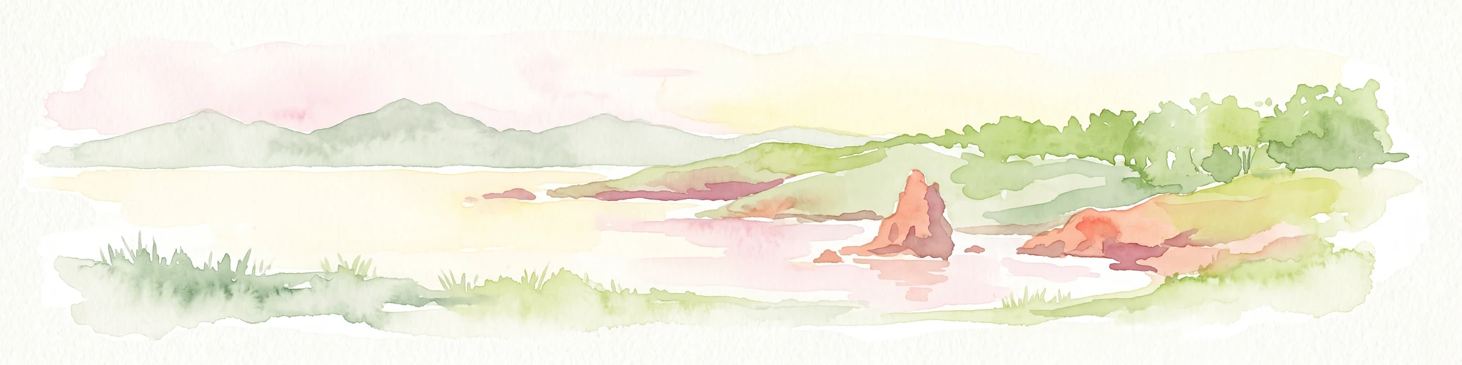
A soft watercolor illustration featuring a coastal scene with a calm bay, rocky outcroppings, green hills in the background, and pale pinkish lighting.
State or regional parkPuerto Rico
About 40 km away#8 closest

Southwest

Boquerón State Forest: Geographic Overview of Protected Coastal Wetlands in Puerto Rico

Coastal karst geology and mangrove-lined estuarine habitats

Spanning across Cabo Rojo, Lajas, and Mayagüez, Boquerón State Forest forms an essential protected landscape on the southwestern coast of Puerto Rico. The area provides a detailed atlas of ecological convergence, where extensive mangrove systems meet the dramatic limestone cliffs of the Los Morrillos peninsula and historic salt flats. This resource provides a deep look into the spatial distribution of these coastal habitats and their critical function in supporting Caribbean biodiversity and migratory bird flyways.

Established
1918
Relief
Lowland
Climate
Tropical
Access
Easy access

Common questions about visiting, size, designation, and location context for Guilarte State Forest

Guilarte State Forest FAQs for park facts, access, geography, and protected area context

Find quick answers about Guilarte State Forest, including protected-area facts, park geography, trail and visitor context, and how the park fits into its surrounding country and regional landscape.
MoriAtlas Explorer

Continue Your Protected Areas Search Across the Global Atlas

Deepen your exploration by continuing the structured search for national parks and protected areas worldwide. Utilize the comprehensive filtering capabilities to compare different conservation landscapes and refine your understanding of global park geography. Discover more about the distribution and characteristics of protected natural areas.

Global natural geography