Mori Atlas logo
State or regional parkMaricao State Forest

Mapping the geology and endemic-rich ecosystems of the largest state forest in Puerto Rico

Maricao State Forest: A Rugged Protected Mountain Landscape in the Cordillera Central of Puerto Rico

Spanning over 10,800 acres across the western Cordillera Central, Maricao State Forest stands as the most extensive protected unit in the state forest system of Puerto Rico. This high-rainfall landscape is defined by its unusual serpentinite-derived soils; a geological characteristic that fosters a dense, endemic-rich forest environment. The terrain creates a deeply sculpted network of ridges and ravines, offering a detailed perspective on the ecological significance of the island's central mountain spine.

state forestmountain forestCordillera Centralserpentinite soilsendemic floraendemic birds

Maricao State Forest

State or regional park

Park overview

Structured park overview, official facts, and landscape profile for Maricao State Forest

Maricao State Forest park facts, protected area profile, and essential visitor context

Review the core facts for Maricao State Forest, including designation, size, terrain, visitor scale, habitats, and operating context in one park-focused overview.

About Maricao State Forest

Maricao State Forest is the flagship reserve of Puerto Rico's state forest system, a 10,803-acre tract of humid mountain forest in the western Cordillera Central. Created by gubernatorial proclamation in 1919, it predates most of the island's formal forest reserves and remains the largest of the twenty forestry units currently managed by the Puerto Rico Department of Natural and Environmental Resources. Its nickname, Monte del Estado, reflects this pioneering role: it was one of the first reserves in Puerto Rico to be officially designated a state forest.

The forest spans the municipalities of Maricao, Sabana Grande, and San Germán, sitting in one of the wettest upland areas of the island. Its setting on the western Cordillera Central gives it a humid montane character shaped by high rainfall, mists, and deeply dissected terrain. Streams descend toward the southwestern coast, and in clear weather the high ground reveals long panoramas that link the mountains to the Caribbean Sea.

What truly distinguishes Maricao is its geology. Nearly all of its soils are derivatives of serpentinite, a metamorphic rock that weathers into shallow, acidic, iron- and aluminum-rich red clay. These demanding soils limit what can grow there, but they also isolate populations of plants adapted to them, producing an unusually high rate of endemism. The forest hosts 23 of Puerto Rico's 128 endemic plant species, alongside plantations of introduced species such as mahogany, eucalyptus, and Caribbean pine that reflect decades of reforestation and management work.

For visitors, the forest functions as both a natural and a cultural landscape. It lies along the Ruta Panorámica, a scenic route that connects many of Puerto Rico's mountain communities, and its trails lead to waterfalls such as Salto Curet, El Pilón, and La Iglesia. Historic New Deal-era features, including the Stone House ruins built by the Civilian Conservation Corps in the 1930s and the Torre de Piedra observation tower, sit alongside the older Maricao Fish Hatchery, a National Register of Historic Places site. Birdwatching, hiking, and scenic driving converge to make the forest a key node in Puerto Rico's network of mountain and forest reserves.

Quick facts and research context for Maricao State Forest

Maricao State Forest is a 10,803-acre protected forest in the western Cordillera Central of Puerto Rico, extending across the municipalities of Maricao, Sabana Grande, and San Germán. It was established in 1919 by Governor Arthur Yager as one of Puerto Rico's earliest forest reserves and is administered by the Puerto Rico Department of Natural and Environmental Resources. Its soils are almost entirely derived from serpentinite, which gives the forest a distinctive ecological character uncommon elsewhere on the island, and supports 23 of Puerto Rico's 128 endemic plant species alongside 23 endemic bird species among 136 recorded bird species.

Protection and recognition

Examine the official protection framework and documented management scope for Maricao State Forest.

Maricao State Forest Protection Status and Terrestrial Conservation Scope

Maricao State Forest maintains a documented terrestrial protection scope within its designated natural boundary. Official records outline the conservation framework and management assignments associated with this protected area.

Protection details

Protection scope
Terrestrial
Transboundary protection
No
Park context

Deeper park guide and search-rich context for Maricao State Forest

Maricao State Forest history, landscape, wildlife, and travel context

Explore Maricao State Forest through its history, landscape character, ecosystems, wildlife, conservation priorities, cultural context, and seasonal travel timing in a structured park guide built for atlas discovery and search intent.

Why Maricao State Forest stands out

Maricao State Forest is best known for its unusual serpentinite-derived soils, which create one of Puerto Rico's most distinctive high-rainfall forest environments and support an exceptional concentration of endemic plants and birds. It is also recognized as the largest unit in Puerto Rico's state forest system and as a premier birdwatching destination tied to the Ruta Panorámica scenic route. The combination of rugged Cordillera Central terrain, endemic-rich flora, and accessible viewpoints like the Torre de Piedra defines its identity.
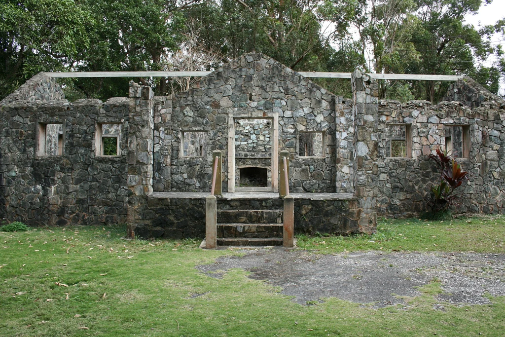
A partial stone structure known as Casa de Piedra, featuring walls and a central doorway, set against a background of green forest.
The remains of the Casa de Piedra stone structure in Maricao State Forest.

Maricao State Forest history and protected-area timeline

Maricao State Forest was formally created on December 22, 1919, through a proclamation by the Governor of Puerto Rico, Arthur Yager. Its establishment marked one of the earliest formal forest reserves on the island and laid the groundwork for what would become Puerto Rico's full state forest system, in which it remains the largest of twenty units.

During the 1930s the forest was reshaped by New Deal-era public works programs. The Civilian Conservation Corps built infrastructure throughout the reserve, including the Stone House, Casa de Piedra, now preserved as ruins and recognized as part of the New Deal constructions in Puerto Rico's forest reserves. The Maricao Fish Hatchery was constructed in 1937 for fisheries research and is now listed on the National Register of Historic Places. These projects embedded a layer of institutional, scientific, and architectural history into the forest's landscape.

Over the following decades the forest expanded its role from a primarily protective reserve into a recreation and research site, gaining panoramic overlooks, hiking trails, and connections to the Ruta Panorámica scenic corridor. Plantation forestry with mahogany, eucalyptus, and Honduras pine was introduced as part of soil stabilization and reforestation efforts on the challenging serpentinite terrain.

Maricao State Forest landscape and geographic character

Maricao State Forest occupies a steep, dissected segment of the western Cordillera Central, Puerto Rico's principal mountain spine, at elevations reaching roughly 1,400 feet. Streams carved into the mountains drain toward the southwestern coast, producing a deeply sculpted terrain of ridges, ravines, and forested valleys.

The defining physical feature of the landscape is its geology. Almost the entire forest floor sits on serpentinite, a metamorphic rock that breaks down into shallow, red, argillaceous soil rich in iron and aluminum oxides. These soils are generally thin and lie close to bedrock, which constrains vegetation and exposes rocky outcrops across much of the terrain.

Above and within this rocky substrate, the forest builds a dense canopy of native and introduced species, interrupted by sharp overlooks and distant views toward the coast. The Santa Ana Observation Tower, known as Torre de Piedra, captures the broader setting: on clear days it frames panoramas of the Cordillera Central, the Mayagüez lowlands, and even Mona Island far out to sea. Water features like Curet Falls on the Lajas River, and the El Pilón and La Iglesia waterfalls, punctuate the terrain with concentrated vertical relief.

Maricao State Forest ecosystems, habitats, and plant life

The ecological identity of Maricao State Forest is shaped by the unusual chemistry of its serpentinite soils and by the consistently humid, high-rainfall climate of the western Cordillera Central. These two factors together produce an environment that feels distinct from more typical Caribbean forest habitats and that filters which species can persist there.

Around 1,164 plant species have been recorded in the forest. Of those, twenty-three belong to the broader set of 128 plant species endemic to Puerto Rico, giving the reserve an outsized share of the island's endemic flora. Mixed with the native vegetation are silvicultural plantations of mahogany, eucalyptus, and Honduras pine, planted to stabilize soil, demonstrate alternative forestry, and add structure to the canopy.

Below the tree layer, the forest sustains an unusually rich bird community, with 136 recorded species and twenty-three endemics. The combination of endemic-rich plant communities, varied canopy height, and persistent moisture makes the reserve a notable biological island within the larger Cordillera Central, distinct from drier coastal and northern forests on the island.

Maricao State Forest wildlife and species highlights

Maricao State Forest hosts one of the most bird-rich forest avifaunas in Puerto Rico, with 136 bird species recorded, including 23 endemics. The forest's mix of montane humidity, serpentinite-driven botanical distinctiveness, and varied canopy supports populations of both widespread Caribbean birds and species found nowhere else.

Among the most significant residents is the Puerto Rican sharp-shinned hawk, an endangered endemic subspecies whose continued presence in places like Maricao is central to its survival on the island. The forest also hosts the Puerto Rican emerald hummingbird, an endemic species typical of montane and forested habitats in western Puerto Rico.

A high number of endemic birds combined with the dense, humid forest structure has made Maricao a recognized destination for Caribbean birdwatching, with observers seeking out endemics in a setting that also functions as a refuge for less range-restricted species that respond to the forest's altitude and climate.

Maricao State Forest conservation status and protection priorities

Maricao State Forest holds an unusually important position in Puerto Rico's conservation framework. As the largest of twenty units in the state forest system, it serves as a flagship reserve for forest protection on the island and a reference point for how the system functions across different mountain and coastal regions.

Its conservation value is closely linked to its serpentinite soils. These soils are chemically demanding and restrict which plants can thrive, which in turn produces the conditions that allow endemic species to persist. By protecting one of the most extensive areas of serpentinite-derived forest in Puerto Rico, the reserve safeguards habitat for 23 endemic plant species, numerous endemic birds including an endangered subspecies of sharp-shinned hawk, and a distinctive ecological community that does not occur in the same form elsewhere on the island.

Long-running plantation forestry with mahogany, eucalyptus, and Honduras pine has also been used as a conservation and restoration tool, helping stabilize soils on the thin, rocky substrate. Together with its research infrastructure, including the historic Maricao Fish Hatchery, the forest functions as a living laboratory for soil, watershed, and biodiversity management in a tropical montane setting.

Maricao State Forest cultural meaning and human context

The cultural context of Maricao State Forest is closely tied to Puerto Rico's broader history of forest conservation and to New Deal-era public works in the Caribbean. The forest was created during the early U.S. territorial period, and its institutional identity as one of the first official state forests reflects the role of forestry thinking in early twentieth-century Puerto Rico.

Later decades left a tangible cultural footprint. Construction projects by the Civilian Conservation Corps in the 1930s introduced infrastructure such as the Stone House, Casa de Piedra, now preserved as ruins, while the 1937 Maricao Fish Hatchery stands as one of the New Deal constructions listed on the National Register of Historic Places in Puerto Rico's forest reserves. The Torre de Piedra observation tower is another enduring feature of this era.

In modern times, the forest is integrated into the Ruta Panorámica, the scenic highway that threads through Puerto Rico's mountain communities, linking the reserve to regional identity as a destination for nature-based recreation, birdwatching, and scenic driving.

Top sights and standout views in Maricao State Forest

Maricao State Forest combines several layers of distinction that reinforce each other. Its serpentinite-driven soils produce one of Puerto Rico's most endemic-rich forest environments, with 23 endemic plant species and 23 endemic bird species recorded among 136 bird species overall. The reserve's breadth, 10,803 acres, makes it the largest unit of the island's state forest system.

Visitors encounter a rare mix of geological, ecological, and historic features. Serpentinite terrain, montane streams, waterfalls such as Salto Curet, El Pilón, and La Iglesia, and panoramic views from Torre de Piedra sit alongside New Deal-era ruins and the National Register-listed Maricao Fish Hatchery. The forest's location along the Ruta Panorámica ties it into Puerto Rico's wider mountain tourism and birdwatching circuits.

Best time to visit Maricao State Forest

Maricao State Forest is a year-round destination shaped primarily by its humid mountain climate. Summer brings warm, humid conditions with frequent thunderstorms, daytime heat in the mid-eighties and nighttime temperatures that often drop into the low sixties, producing rich green vegetation and active birdlife. Rain and mist are common but typically short-lived.

Winter is the drier season, with milder daytime temperatures and noticeably cooler nights, occasionally dropping into the low forties with wind chill in the mid-thirties. Cooler, clearer conditions can improve visibility from the Torre de Piedra overlook and make hiking more comfortable, while still maintaining green forest conditions. Birdwatching and scenic driving along the Ruta Panorámica are rewarding across both seasons, with bird activity and forest atmosphere varying with rainfall patterns rather than abrupt seasonal change.
Monthly climate preview

Track representative monthly weather averages across the protected forest terrain

Maricao State Forest Climate Normals, Long-Term Temperature and Precipitation Rhythm

Measured coordinates for Maricao State Forest record consistent long-term temperature swings and monthly precipitation variations from historical climate data. Access the complete twelve-month normals breakdown to evaluate full seasonal averages across the representative location.
Annual mean26 °C
24 °C28 °C
Jan24°
Feb25°
Mar25°
Apr26°
May27°
Jun27°
Jul27°
Aug28°
Sep27°
Oct27°
Nov26°
Dec25°
Warmest month
August

27.6 °C

Coolest month
January

24.4 °C

Wettest month
September

4.2 mm/day

Driest month
February

1.3 mm/day

Park location guide

Geography guide, regional context, and park location map for Maricao State Forest

Maricao State Forest park geography, regions, and map view in United States of America

Understand where Maricao State Forest sits in United States of America through a broader geographic reading of the surrounding landscape, nearby location context, and its mapped position within the national park landscape.

How Maricao State Forest fits into United States of America

The United States of America is a federal presidential republic and one of the world's largest countries by area and population. It consists of 50 states across a vast territory spanning multiple time zones, with its capital in Washington, D.C. and largest city in New York City. The nation has a diverse economy, influential political system, and significant cultural and military presence globally.

Wider geography shaping Maricao State Forest in United States of America

The United States occupies a vast territory in North America, bordered by Canada to the north and Mexico to the south. The 48 contiguous states stretch from the Atlantic to the Pacific Ocean, while Alaska occupies the northwestern region and Hawaii is an archipelago in the Pacific. The country encompasses diverse terrain including the Rocky Mountains, Appalachian Mountains, Great Plains, and extensive river systems.

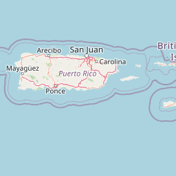
Map view of Maricao State Forest

Use this park location map to pinpoint Maricao State Forest in United States of America, understand its exact geographic position, and read its mapped placement within the surrounding landscape more clearly.

Pigeon | © OpenStreetMap contributors

Location context for Maricao State Forest

Puerto Rico

Visual reference for the rugged terrain, serpentinite geology, and mountain forest habitats of Puerto Rico

Maricao State Forest Photos: Scenery, Landscapes, and Protected Habitats

Photographs capture the steep mountain ridges, rocky serpentinite soils, and dense forest canopy that define the protected landscape. Visual documentation reveals the remote watershed character, elevation changes, and high-altitude habitats of the Cordillera Central.

A partial stone structure known as Casa de Piedra, featuring walls and a central doorway, set against a background of green forest.

A small mountain stream flows through a lush, dense forest, with water cascading around a large, moss-covered boulder.

Park atlas

Compare regional mountain geography and connected protected areas across the western spine.

Exploring Other Parks Near Maricao State Forest and Surrounding Protected Landscapes

Browse protected areas and mountain reserves situated near Maricao State Forest to evaluate regional terrain variations. Connecting these conservation lands provides broader context for tropical forest habitats and watershed geography across the surrounding landscape.
Watercolor painting of a coastal dry forest scene with mangrove-like trees and hills in the background.
State or regional parkPuerto Rico
About 20 km away#1 closest

Southeast

Guánica State Forest: Mapped Geography and Protected Landscapes in Puerto Rico

A diverse Caribbean subtropical dry forest reserve spanning karst terrain and coastal habitats

Guánica State Forest serves as a primary protected natural area in southwestern Puerto Rico, defined by its arid subtropical climate and exceptional ecological diversity. This reserve incorporates a complex mosaic of ecosystems, including deciduous dry forest, mangrove channels, salt flats, and offshore keys. The landscape provides critical habitat for numerous endemic species while preserving the integrity of the Southern Karst geological zone and its surrounding maritime boundaries.

Area
39.97 km²
Established
1919
Relief
Lowland
Climate
Tropical
A soft watercolor illustration featuring a coastal scene with a calm bay, rocky outcroppings, green hills in the background, and pale pinkish lighting.
State or regional parkPuerto Rico
About 22 km away#2 closest

Southwest

Boquerón State Forest: Geographic Overview of Protected Coastal Wetlands in Puerto Rico

Coastal karst geology and mangrove-lined estuarine habitats

Spanning across Cabo Rojo, Lajas, and Mayagüez, Boquerón State Forest forms an essential protected landscape on the southwestern coast of Puerto Rico. The area provides a detailed atlas of ecological convergence, where extensive mangrove systems meet the dramatic limestone cliffs of the Los Morrillos peninsula and historic salt flats. This resource provides a deep look into the spatial distribution of these coastal habitats and their critical function in supporting Caribbean biodiversity and migratory bird flyways.

Established
1918
Relief
Lowland
Climate
Tropical
Access
Easy access
State or regional parkPuerto Rico
About 24 km away#3 closest

East

Guilarte State Forest: Protected Mountain Ecosystems and Cordillera Central Geography

Highland conservation and mapped mountain terrain in central Puerto Rico

Guilarte State Forest represents a essential protected area in the Cordillera Central of Puerto Rico. The reserve encompasses steep altitudinal shifts, ranging from mid-slope palm forests to summit-level cloud forests. As a headwater region for major river basins, the forest is a focal point for understanding the island's mountainous geography and conservation priorities for endemic species.

Area
19.514 km²
Established
1935
Relief
Mountain
Climate
Tropical
Protected areaAdjuntas
About 32 km away#4 closest

East

Bosque del Pueblo: Protected Forest Geography and Cordillera Central Landscape

A mountain watershed and ecological corridor in Adjuntas

Bosque del Pueblo represents a key protected landscape within the central mountains of Puerto Rico. As a critical forest reserve located in Adjuntas, it preserves headwaters and supports rare bird populations, serving as a permanent ecological link between several major state forest units.

Area
2.987 km²
Established
1995
Relief
Mountain
Climate
Tropical
A soft watercolor illustration of green hills and foliage against a pale background.
State or regional parkPuerto Rico
About 32 km away#5 closest

North

Guajataca State Forest: Geography and Protected Karst Landscapes in Puerto Rico

Explore the mogotes and cave systems of this regional forest

Guajataca State Forest protects a significant limestone karst landscape in northwestern Puerto Rico. The area is defined by its conical mogote hills, deep sinkhole drainage, and complex cave networks, including the notable Cueva del Viento. As a key part of the regional forest system, it offers a window into the geological and ecological makeup of the Northern Karst belt.

Area
9.26 km²
Established
1943
Relief
Upland
Climate
Tropical
State or regional parkUnited States of America
About 38 km away#6 closest

Northeast

Río Abajo State Forest: Mapping the Karst Terrain and Protected Landscapes of Puerto Rico

Protected karst landscape and regional forest geography

Río Abajo State Forest serves as an essential example of Caribbean karst ecosystems, defined by its steep limestone mogotes, hidden ravines, and extensive sinkhole networks. Located in the northern karst belt of Puerto Rico, the forest provides deep insight into complex subterranean drainage patterns and serves as a primary hub for endangered species recovery within its uniquely broken, three-dimensional terrain.

Area
14.1 km²
Established
1943
Relief
Upland
Climate
Tropical
Watercolor painting of a hilly, green landscape featuring rolling mountains in the distance and vegetation in the foreground.
State or regional parkUnited States of America
About 42 km away#7 closest

East

Cerrillos State Forest: Protected Subtropical Woodland and Reservoir Geography

Foothill landscapes and watershed features in Ponce, Puerto Rico

This protected area features a mix of tabonuco forest and water-based recreational terrain. Spanning the slopes of the Cordillera Central foothills, the forest encompasses the Cerrillos River and the man-made Lake Cerrillos reservoir, offering a distinct example of subtropical moist forest ecology within the United States commonwealth system.

Area
0.79 km²
Established
1996
Relief
Upland
Climate
Subtropical
State or regional parkPuerto Rico
About 48 km away#8 closest

East

Los Tres Picachos State Forest: A Geographic Guide to Puerto Rico's Mountain Protected Areas

Cloud forests, volcanic terrain, and watershed protection

Los Tres Picachos State Forest encompasses a striking landscape in the Puerto Rican interior, marked by deep river valleys and its namesake triple peaks. This atlas feature provides insights into the forest's layered ecological zones and its role as a crucial hydrological anchor for the Toro Negro and Cialitos river systems within the Cordillera Central.

Established
1999
Relief
Mountain
Climate
Tropical
Access
Remote access

Common questions about visiting, size, designation, and location context for Maricao State Forest

Maricao State Forest FAQs for park facts, access, geography, and protected area context

Find quick answers about Maricao State Forest, including protected-area facts, park geography, trail and visitor context, and how the park fits into its surrounding country and regional landscape.
MoriAtlas Explorer

Continue Your Protected Areas Search Across the Global Atlas

Deepen your exploration by continuing the structured search for national parks and protected areas worldwide. Utilize the comprehensive filtering capabilities to compare different conservation landscapes and refine your understanding of global park geography. Discover more about the distribution and characteristics of protected natural areas.

Global natural geography