

Mori Atlas logo
Wildlife reserveHarris Sandhills National Wildlife Area

A detailed geographic look at stabilized dunes, mixed-grass prairie, and essential migratory bird habitats.

Harris Sandhills National Wildlife Area: Mapping Protected Prairie and Sandhill Terrain in Saskatchewan

Harris Sandhills National Wildlife Area represents a vital conservation landscape in south-central Saskatchewan, defined by its undulating stabilized sand dunes, native mixed-grass prairie, and secluded aspen groves. This wildlife reserve functions as a critical sanctuary within the broader Canadian prairie region, supporting diverse bird populations and native plant communities across its 372 hectares. The following data provides a clear view into its topographic structure and ecological boundaries within the regional geography of the Canadian prairies.

national wildlife areagrassland prairiemixed-grass prairiesand dunesbird habitatmigratory birds

Harris Sandhills National Wildlife Area

Wildlife reserve

Park overview

Structured park overview, official facts, and landscape profile for Harris Sandhills National Wildlife Area

Harris Sandhills National Wildlife Area park facts, protected area profile, and essential visitor context

Review the core facts for Harris Sandhills National Wildlife Area, including designation, size, terrain, visitor scale, habitats, and operating context in one park-focused overview.

About Harris Sandhills National Wildlife Area

Harris Sandhills National Wildlife Area sits within the rolling agricultural and prairie terrain of central Saskatchewan, a region shaped by centuries of grassland ecology and comparatively recent human settlement. The protected area lies within the Rural Municipality of Harris No. 316, northeast of the small town of Rosetown, in a landscape where native prairie, sand dunes, and cultivated land coexist.

Though covering only a few hundred hectares, the wildlife area plays an important role in the conservation of southern Canada's mixed-grass prairie ecosystem. The reserve's character is defined by stabilized dunes, native grass cover, low shrubs such as silverberry and chokecherry, scattered trembling aspen groves, and patches of cacti that mark the arid qualities of the local substrate. This combination creates a mosaic of microhabitats that is uncommon at this scale within an otherwise heavily cultivated region of the Prairies.

The wildlife area is administered by Environment and Climate Change Canada through the Canadian Wildlife Service, the federal body responsible for National Wildlife Areas across the country. Its designation as an IUCN Category IV protected area reflects a specific conservation focus: the management of habitats and species rather than large-scale landscape preservation. This management-oriented status aligns with the area's role in maintaining breeding bird habitat, supporting at-risk species, and preserving a representative section of the disappearing native prairie landscape.

Harris Sandhills should be understood less as a dramatic wilderness than as a carefully chosen fragment of prairie life. Its importance is regional and ecological: it represents the kind of habitat that once blanketed southern Saskatchewan and that today survives only in scattered patches, many of them protected through Canada's network of National Wildlife Areas.

Quick facts and research context for Harris Sandhills National Wildlife Area

Harris Sandhills National Wildlife Area is situated in central Saskatchewan, roughly 40 kilometres northeast of Rosetown, within a rural landscape of cultivated fields, native prairie, and stabilized sand dunes. The protected area is classified as IUCN Category IV (habitat or species management area) and is administered by the Canadian Wildlife Service as part of Canada's national system of National Wildlife Areas.

The reserve protects a fragment of the southern Canadian mixed-grass prairie, including native bunch grasses, cacti, scattered shrubs, and small poplar groves together with open dune habitat. Its primary conservation purpose is safeguarding habitat for migratory grassland birds and several species considered at risk, continuing a prairie conservation tradition that dates back to the original Prairie National Wildlife Area established in 1978.

Protection and recognition

Documented terrestrial protection metrics and official conservation status records

Harris Sandhills National Wildlife Area Protection Status and Geographic Scope

Harris Sandhills National Wildlife Area maintains a documented terrestrial protection scope within the national conservation inventory. Verified management records outline the established designation framework and recognized territorial boundaries.

Protection details

Protection scope
Terrestrial
Transboundary protection
No
Park context

Deeper park guide and search-rich context for Harris Sandhills National Wildlife Area

Harris Sandhills National Wildlife Area history, landscape, wildlife, and travel context

Explore Harris Sandhills National Wildlife Area through its history, landscape character, ecosystems, wildlife, conservation priorities, cultural context, and seasonal travel timing in a structured park guide built for atlas discovery and search intent.

Why Harris Sandhills National Wildlife Area stands out

Harris Sandhills is best known for its protection of native mixed-grass prairie in Saskatchewan, particularly habitat that supports migratory grassland birds and threatened prairie species. The area reflects the broader ecological character of the Canadian Prairies: open plains dotted with stabilized sand dunes, low shrub patches, and isolated aspen groves. Its conservation significance lies in maintaining breeding and stopover habitat for birds such as the Sprague's pipit, chestnut-collared longspur, and western meadowlark, as well as providing range for larger mammals such as mule deer, moose, and white-tailed deer that move through this working prairie landscape. The reserve also preserves one of the few documented populations of plains hognose snake within the surrounding region.

Harris Sandhills National Wildlife Area history and protected-area timeline

The origins of Harris Sandhills National Wildlife Area reach back to 1978, when the Prairie National Wildlife Area was established as a large, multi-unit reserve composed of 26 distinct sites scattered across southern Saskatchewan. That original reserve represented an early federal effort to protect representative prairie habitat across a broad geographic range of the province.

Over time, scientific standards for the creation of National Wildlife Areas evolved. In October 2020, a rigorous scientific review applied the criteria established in 2005 to each of the 26 original Prairie National Wildlife Area units. The review concluded that only seven of those units met the modern criteria for continued protection as National Wildlife Areas. In response, the federal government decided to reorganize the system: the historic 26-unit reserve would be replaced by five smaller, more focused reserves, while 19 of the original units would be removed from formal protection.

Harris Sandhills corresponds to Unit 13 of the former Prairie National Wildlife Area. On 12 March 2025, the Prairie National Wildlife Area was formally abolished, and the same day the Harris Sandhills National Wildlife Area was officially established as one of the successor reserves. This transition reflects a shift in Canadian prairie conservation policy toward smaller, more ecologically targeted protected areas rather than a single sprawling, multi-unit designation.

Harris Sandhills National Wildlife Area landscape and geographic character

The landscape of Harris Sandhills is built around stabilized sand dunes, which give the protected area its name and much of its visual character. These dunes are no longer active shifting formations; they have become anchored by vegetation over time, creating undulating terrain that supports dryland grasses, low shrubs, and scattered cactus. The sandhill topography distinguishes the reserve from the flatter agricultural prairie that surrounds it.

Within the reserve, the vegetation mosaic includes native mixed-grass prairie interspersed with cultivated clearings, isolated patches of trembling aspen, and small groves that break up the open plain. Plains prickly pear cactus adds an arid character to the flora, while shrubs such as silverberry and chokecherry occupy transitional zones between open sand and sheltered draws. The terrain shifts gradually between open dune crests, gentle swales, and more sheltered microhabitats beneath the aspen clusters, giving the small area real topographic variety.

Harris Sandhills National Wildlife Area ecosystems, habitats, and plant life

Ecologically, Harris Sandhills belongs to the southern Canadian mixed-grass prairie region, one of the most altered ecosystems in North America. The reserve protects a slice of this ecosystem that combines characteristic grass species, dryland forbs, cactus, and shrub communities, lending it genuine botanical value despite its modest size.

Native grasses dominate the ecological character of the area. Needle-and-thread grass, plains muhly, and western wheatgrass form the core of the bunchgrass cover, while cheatgrass appears as an introduced annual that reflects the broader pressures on the prairie system. The combination of dune, shrub, cactus, and grass communities gives the reserve meaningful habitat diversity within a small footprint, supporting both resident species and seasonal wildlife movement across the surrounding agricultural matrix.

Harris Sandhills National Wildlife Area wildlife and species highlights

Harris Sandhills supports an especially rich bird community for its size, reflecting its focus on preserving grassland bird habitat in a region where such habitat has become scarce. The reserve is a known presence area for chestnut-collared longspur, Baird's sparrow, vesper sparrow, western meadowlark, Sprague's pipit, McCown's longspur, and horned lark, all species strongly associated with native prairie.

Beyond birds, the reserve hosts mule deer, white-tailed deer, moose, and coyote, all of which use the protected habitat as part of their broader range across the Saskatchewan prairie landscape. Snakes are notable as well: the plains hognose snake is documented within the area, lending the reserve additional significance as habitat for one of the prairie's more distinctive reptile species.

Harris Sandhills National Wildlife Area conservation status and protection priorities

From a conservation perspective, Harris Sandhills represents a deliberate effort to preserve a measurable piece of Canada's disappearing native mixed-grass prairie. The southern Prairie region has lost the vast majority of its original native grass cover to cultivation, making each surviving fragment ecologically significant, particularly when it retains the native plant communities, dune features, and shrub layers visible at Harris Sandhills.

The reserve is part of a broader transition in Canadian prairie conservation: the 2020 scientific review of the older Prairie National Wildlife Area prioritized protection based on contemporary ecological criteria, leading to the creation of smaller, more targeted reserves such as Harris Sandhills. Its IUCN Category IV status as a habitat and species management area further emphasizes that the protected area is intended for active biodiversity management, not simply passive preservation of scenery.

Harris Sandhills National Wildlife Area cultural meaning and human context

Harris Sandhills exists primarily as an ecological rather than cultural site, and the available source material does not describe a meaningful indigenous, historical, or community narrative tied to this specific reserve. The surrounding region of central Saskatchewan has a long agricultural and settler history, but the wildlife area itself is presented as a federal conservation designation rather than a place with distinct cultural or heritage associations. As such, the cultural dimension of this protected area is limited and does not warrant a separate detailed section.

Top sights and standout views in Harris Sandhills National Wildlife Area

Harris Sandhills is distinguished by its combination of native mixed-grass prairie, stabilized sand dunes, small aspen groves, and cactus-bearing terrain within a compact 372-hectare footprint. Its strongest conservation value lies in preserving habitat for several migratory grassland bird species and supporting one of the more regionally uncommon reptile species, the plains hognose snake.

The reserve also stands out for its administrative significance. Established on 12 March 2025 as a successor to part of the older 1978 Prairie National Wildlife Area, Harris Sandhills reflects the modern evolution of Canadian prairie conservation policy, in which smaller and more ecologically focused reserves replace older, broader multi-unit designations.

Best time to visit Harris Sandhills National Wildlife Area

Because Harris Sandhills is a federal National Wildlife Area rather than a typical visitor-oriented park, meaningful visitation is generally limited and weather-dependent. The most ecologically expressive seasons are late spring and early summer, when native grasses are green, wildflowers bloom among the dunes, and migratory grassland birds are actively nesting and singing across the reserve. Late summer brings warmer, drier conditions and mature grass cover, while autumn highlights the tawny tones of the mixed-grass prairie once the growing season ends.

Monthly climate preview

Long-term temperature ranges and monthly precipitation records across Saskatchewan

Harris Sandhills National Wildlife Area Climate Normals and Annual Weather Patterns

Historical climate records for Harris Sandhills National Wildlife Area outline measured shifts in annual temperature and monthly precipitation normals across a representative coordinate point. Analyzing the complete twelve-month meteorological profile reveals detailed seasonal variations in long-term atmospheric conditions.
Annual mean4 °C
-13 °C20 °C
Jan-13°
Feb-10°
Mar-3°
Apr
May12°
Jun17°
Jul20°
Aug19°
Sep13°
Oct
Nov-4°
Dec-11°
Warmest month
July

20.1 °C

Coolest month
January

-13.3 °C

Wettest month
June

2.7 mm/day

Driest month
February

0.5 mm/day

Park location guide

Geography guide, regional context, and park location map for Harris Sandhills National Wildlife Area

Harris Sandhills National Wildlife Area park geography, regions, and map view in Canada

Understand where Harris Sandhills National Wildlife Area sits in Canada through a broader geographic reading of the surrounding landscape, nearby location context, and its mapped position within the national park landscape.

How Harris Sandhills National Wildlife Area fits into Canada

Canada is a federal parliamentary constitutional monarchy spanning North America from the Atlantic to the Pacific and Arctic Oceans. With a population of over 41 million, it is officially bilingual in English and French at the federal level. The country gained independence from the United Kingdom through a gradual process culminating in 1982.

Wider geography shaping Harris Sandhills National Wildlife Area in Canada

Canada occupies the northern portion of North America, sharing its longest international border with the United States. The country extends from the Atlantic Ocean to the Pacific Ocean and northward into the Arctic Ocean, giving it the longest coastline of any nation.

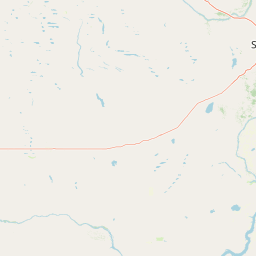
Map view of Harris Sandhills National Wildlife Area

Use this park location map to pinpoint Harris Sandhills National Wildlife Area in Canada, understand its exact geographic position, and read its mapped placement within the surrounding landscape more clearly.

Pigeon | © OpenStreetMap contributors

Location context for Harris Sandhills National Wildlife Area

Saskatchewan
Park atlas

Compare regional prairie reserves and adjacent conservation areas across central Saskatchewan

Explore Parks Near Harris Sandhills National Wildlife Area and Surrounding Protected Landscapes

Browse other protected areas and regional reserves connected to the unique mixed-grass prairie ecosystems surrounding Harris Sandhills National Wildlife Area. Comparing adjacent conservation lands reveals the broader ecological patterns shaping the natural terrain of the Canadian Prairies.
Protected areaSutherland
About 87 km away#1 closest

Northeast

Zugvogelschutzgebiet Sutherland: Regional Geography and Protected Area Context

Historic migratory bird habitat in the Saskatchewan prairie landscape

The Zugvogelschutzgebiet Sutherland protected area serves as an important migratory refuge on the Canadian Prairies. While the site integrates diverse land uses including a zoo and research facilities, its remaining native grasslands continue to provide essential feeding and resting grounds for geese, swans, and ducks. This analysis maps the sanctuary within its broader regional context.

Area
1.3 km²
Established
1924
Relief
Lowland
Climate
Temperate
Wildlife reserveSaskatchewan
About 119 km away#2 closest

Northeast

St. Denis National Wildlife Area: Geographic Profile and Protected Prairie Landscape

A research-focused wildlife reserve in central Saskatchewan.

St. Denis National Wildlife Area represents a critical nexus for prairie ecology, defined by its dense network of shallow ponds and native grassland communities. As a dual-designated National Wildlife and Research Area, this site offers a clear window into the delicate balance of wetland habitats, saline soil conditions, and agricultural landscape integration across Saskatchewan.

Area
3.6 km²
Established
1967
IUCN
IV
Wildlife reserveSaskatchewan
About 141 km away#3 closest

North

Thickwood Hills National Wildlife Area: Geography and Protected Landscape Analysis

A study of transitional Saskatchewan prairie and aspen ecosystems

Located northeast of Blaine Lake, this Canadian wildlife reserve encompasses a precise 299-hectare footprint. The site serves as a vital example of regional conservation, maintaining wetlands and native grasslands that define the transition between open prairie and northern boreal forest landscapes.

Area
2.99 km²
Established
2025
IUCN
IV
Relief
Lowland
Wildlife reserveSaskatchewan
About 143 km away#4 closest

North

Scent Grass Lake Migratory Bird Sanctuary: Regional Geography and Wetland Protected Area Maps

Key waterfowl breeding and molting ground in Saskatchewan.

Examine the ecological significance of Scent Grass Lake Migratory Bird Sanctuary, a critical wildlife reserve within the Saskatchewan Aspen Parkland. This protected area offers essential open water and sedge marsh environments for migratory waterfowl, serving as a vital staging and breeding site that maintains regional habitat stability in the Canadian prairies.

Area
6.47 km²
Established
1948
IUCN
IV
Relief
Lowland
Wildlife reserveSaskatchewan
About 166 km away#5 closest

Southwest

Great Sandhills National Wildlife Area: Saskatchewan Protected Dune and Prairie Landscapes

Mapping the natural features and protected boundaries of this significant wildlife reserve.

The Great Sandhills National Wildlife Area represents a vital contemporary conservation effort in southwestern Saskatchewan. It encompasses a compact but biologically dense mosaic of stabilized dune fields, native mixed-grass prairie, and alkaline wetland basins. This protected area stands as a representative example of Canada's evolving strategy to preserve the most ecologically significant parcels of the prairie landscape, offering deep insights into the region's specific terrain and habitat patterns.

Area
4.7 km²
Established
2025
IUCN
IV
Relief
Lowland
Wildlife reserveSaskatchewan
About 198 km away#6 closest

Northeast

Raven Island National Wildlife Area: Geographic Overview and Protected Island Landscape

Essential conservation geography within Saskatchewan

Located in the saline prairie basins of central Saskatchewan, Raven Island National Wildlife Area is a 112-hectare protected habitat. This site plays a strategic role in the Lenore Lake migratory bird complex, preserving crucial island breeding grounds within a gentle prairie landscape. Explore the physical boundaries and ecological context of this Canadian wildlife reserve.

Area
1.12 km²
Established
1982
IUCN
IV
Scope
Terrestrial
National parkSaskatchewan
About 222 km away#7 closest

North

Prince Albert National Park: Saskatchewan National Park and Protected Area Geography

Mapped Landscape Boundaries and Regional Natural Terrain Context

Prince Albert National Park represents a distinct national park entity within Saskatchewan, vital for understanding regional geography and protected landscapes. This page offers detailed insights into its mapped boundaries and the surrounding natural terrain. It is designed to help users comprehend the park's specific protected area identity and its contribution to the broader geographic atlas of Canada's natural spaces.

Area
3,874 km²
Established
1927
IUCN
II
Visitors
287.4K annual
Wildlife reserveSaskatchewan
About 255 km away#8 closest

Southeast

Wascana Lake Migratory Bird Sanctuary: Geographic Overview and Protected Wetland Boundaries

A vital wildlife reserve located in Regina, Saskatchewan

Explore the unique geography of Wascana Lake Migratory Bird Sanctuary, where a managed reservoir creates a rich wetland habitat for migratory waterfowl. This protected area stands as a significant ecological site within the Saskatchewan prairie landscape, offering a rare look at riparian terrain integration inside a major urban center.

Area
1.04 km²
Established
1956
Relief
Lowland
Climate
Temperate

Common questions about visiting, size, designation, and location context for Harris Sandhills National Wildlife Area

Harris Sandhills National Wildlife Area FAQs for park facts, access, geography, and protected area context

Find quick answers about Harris Sandhills National Wildlife Area, including protected-area facts, park geography, trail and visitor context, and how the park fits into its surrounding country and regional landscape.
MoriAtlas Explorer

Continue Your Protected Areas Search Across the Global Atlas

Deepen your exploration by continuing the structured search for national parks and protected areas worldwide. Utilize the comprehensive filtering capabilities to compare different conservation landscapes and refine your understanding of global park geography. Discover more about the distribution and characteristics of protected natural areas.

Global natural geography