Mori Atlas logo
Park earthquake history

A historical catalogue of epicentres identified by geographic proximity to the reserve.

Recorded Seismic Activity and Earthquake History of Kærsgård Strand, Vandplasken og Liver Å

This collection presents a catalogue of historical earthquakes recorded within the vicinity of Kærsgård Strand, Vandplasken og Liver Å. Each entry provides event details including origin date, magnitude, depth, and the calculated distance between the seismic epicentre and the park boundaries. The records are sourced from standardized datasets to provide a clear view of regional seismic history surrounding this protected coastal area.

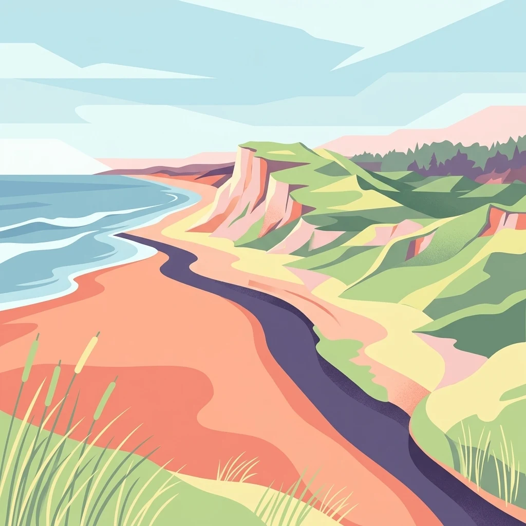
A digital illustration of a coastal landscape with sand dunes, grassy slopes, a stream flowing towards the ocean, and cliffs under a pale sky.

A calcium-rich dune landscape and stream valley on the Skagerrak coast, sheltering some of Denmark's rarest plant and insect life.

Kærsgård Strand, Vandplasken og Liver Å

Kærsgård Strand, Vandplasken og Liver Å is a Natura 2000 protected site on the northwestern coast of Vendsyssel in northern Denmark. Designated as an EU Habitat Area, it sits along the Skagerrak shoreline south of Hirtshals and stretches inland across a varied dune landscape shaped on both raised seafloor and older post-glacial terrain. The area combines coastal dune habitats with the quiet, meandering valley of the Liver Å stream and the unusual clear-water Lobelia lake known as Vandplasken. The site is widely noted for its exceptionally rich flora, including several rare and nationally responsible species, and for populations of vulnerable amphibians and dragonflies. It represents one of the most species-rich natural areas in Denmark and is a key reference site for calcareous dune ecology in northwestern Europe. Despite its modest overall size, the diversity of habitats found within a relatively compact coastal stretch is unusually high. Its ecological importance is matched by a layered protection history, with early twentieth-century nature reserves adding onto later European-level designation under the Natura 2000 network. The combination of dune lakes, wet hollows, spring-fed mires, and alder-ash forest gives Kærsgård Strand, Vandplasken og Liver Å a distinctive character that stands apart from the surrounding plantation and summerhouse landscapes of the Vendsyssel coast.

Location
Denmark
Park type
Nature reserve
Established
2011
Area
4.4 km²
Kærsgård Strand, Vandplasken og Liver Å Geography

Inspect Kærsgård Strand, Vandplasken og Liver Å event evidence

Earthquakes near Kærsgård Strand, Vandplasken og Liver Å

Kærsgård Strand, Vandplasken og Liver Å is linked to earthquake records by epicentre and distance from the Skagerrak reserve’s dunes, lake, spring mires, wetlands, and stream. Timing, magnitude, depth, place, separation, and source provide historical evidence without proving interior occurrence or alleging coastal effects, current risk, cause, damage, or future activity.

Sort by
Magnitude
Location

This page describes catalogued earthquakes associated with the park by epicentre location and distance. It does not establish causation, assess current danger, or predict future earthquakes.

No earthquake records match the current filters

Park atlas

Beyond Kærsgård Strand, Vandplasken og Liver Å earthquake history

More parks after Kærsgård Strand, Vandplasken og Liver Å

The destinations following Kærsgård Strand, Vandplasken og Liver Å broaden discovery beyond its earthquake catalogue and dune–fen landscape. Inclusion does not imply shared calcareous dunes, lobelia lakes, spring mires, Danish designation, proximity, seismic history, hazard, risk, or dedicated earthquake coverage; each profile remains independent.
Protected areaRegion Nordjylland
About 15 km away#1 closest

Northeast

Natura 2000-område nr. 5 Uggerby Klitplantage og Uggerby Å's udløb Protected Area

Coastal dune and riverine landscape mapping in Region Nordjylland

Explore the varied terrain of this 717-hectare site featuring a complete sequence of green dune habitats, fresh water slacks, and the Uggerby Å river estuary. The area displays a dense concentration of coastal geomorphology and protected plant species, providing a deep look into the natural landscape character of the northern Danish coast along the Skagerrak.

Area
7.17 km²
Relief
Lowland
Climate
Temperate
Scope
Terrestrial
Protected areaRegion Nordjylland
24 km away#2 closest

East

Jerup Hede, Råbjerg og Tolshave Mose: Protected Area and Ridge and Pool Terrain

Geographic landscape overview in Region Nordjylland

Jerup Hede, Råbjerg og Tolshave Mose contains the largest continuous area of ridge and pool landscapes in Denmark. The site features an undulating terrain of hummocks and wet hollows typical of intact raised bogs, transitioning from inland heaths to coastal dune formations near the Skagerrak coast. It remains an essential site for studying Northern European mire ecosystems and wetland habitat patterns.

Area
40.24 km²
Relief
Lowland
Climate
Temperate
Access
Access unknown
Watercolor illustration of a lush green valley with rolling hills, meadows, and trees in soft, muted tones.
Nature reserveNordjylland
32 km away#3 closest

East

Åsted Ådal Nature Reserve: Glacial Valley Mapping and Protected Land Context in Nordjylland

A diverse Natura 2000 habitat mosaic in Northern Denmark

Åsted Ådal serves as a premier example of Danish glacial topography, offering a deep dive into the complex environmental transitions of a moraine-carved valley. The protected site highlights a rich botanical and avian assemblage, anchored by its unique stream corridor and steep slopes, providing a comprehensive view of regional landscape character.

Area
1.24 km²
Relief
Upland
Climate
Temperate
Scope
Terrestrial
A soft watercolor painting of a low-lying coastal scene with rolling green hills and a light foreground.
Nature reserveRegion Nordjylland
About 42 km away#4 closest

East

Natura 2000-område nr. 4 Hirsholmene, havet vest herfor og Ellinge Å's udløb: Mapping Protected Landscapes

A dual marine and coastal nature reserve in Region Nordjylland

Analyze the marine and coastal topography of this significant Natura 2000 site. The mapped region spans from the Kattegat bubble reefs to the freshwater influence of the Ellinge Å outlet, offering a clear perspective on the distribution of sandbanks, island groups, and terrestrial habitats that characterize this protected Danish geography.

Area
95.33 km²
Established
2011
Relief
Lowland
Climate
Temperate
Nature reserveRegion Nordjylland
46 km away#5 closest

Southeast

Solsbæk Nature Reserve: Geographic Profile and Protected Coastal Dune Landscapes

A rare calcareous dune ecosystem in Region Nordjylland, Denmark.

Solsbæk is a designated nature reserve on the Vendsyssel coast, notable for its concentrated series of coastal dune habitats. Formed by lime-rich shell sand, the landscape sustains a diverse array of vegetation including grey and green dunes, juniper scrub, and dune heath. This compact site provides a vital reference for understanding the ecological structure and botanical variety of protected coastal lands in northern Denmark.

Area
0.33 km²
Established
1972
Relief
Lowland
Climate
Temperate
Nature reserveLæsø Municipality
61 km away#6 closest

East

Nordre Rønner: Protected Island Landscapes and Geographic Mapping of Læsø Municipality

Remote coastal nature reserve and marine habitat within the Danish Kattegat sea

Nordre Rønner represents a significant cluster of islets in the Kattegat, showcasing the interplay of post-glacial land rise and coastal ecology. Managed within Læsø Municipality, these eleven hectares of protected land include essential nesting grounds for terns and harbor seals. This resource outlines the physical geography, mapped island connections, and the status of this unique maritime nature reserve.

Area
0.11 km²
Relief
Lowland
Climate
Temperate
Access
Moderate access
Nature reserveRegion Nordjylland
68 km away#7 closest

Southwest

Lild Strand og Lild Strandkær: A Detailed Look at Denmark's Protected Coastal Dune Terrain

Mapping the dune heath, wetlands, and inland lakes of western Thy

Lild Strand og Lild Strandkær encompasses a significant protected landscape in Region Nordjylland. This site features a continuous stretch of coastal dune zonation, including foredunes and grey-green dunes, set against a chain of distinctive brown-water and Lobelia lakes. Its habitat mosaic offers a clear window into the ecological diversity of the Thy coastline through a structured geographic lens.

Area
7.49 km²
Established
2011
Relief
Lowland
Scope
Terrestrial
Protected areaDenmark
About 70 km away#8 closest

Southeast

Aalborg Bugt: Geography and Protected Area Overview in Northern Denmark

Coastal wetlands, shallow marine habitat, and fjord systems

Aalborg Bugt represents a defining seascape for northern Denmark, stretching along the Kattegat coast to include diverse coastal features like dunes, salt meadows, and rich fens. As the largest Natura 2000 site in the country, the bay supports a continuous conservation corridor that bridges marine environments with inland fjord networks, offering a deep look into the regional geography and protected-land dynamics of the Jutland peninsula.

Area
1,774 km²
MoriAtlas Explorer

Continue Exploring Kærsgård Strand, Vandplasken og Liver Å Protected Landscapes

Deepen your understanding of Kærsgård Strand, Vandplasken og Liver Å through our structured MoriAtlas documentation. Trace the complex boundaries of this Region Nordjylland nature reserve and examine how its unique coastal dunes and wetland terrain form one of the most botanically rich sites in the country.