
Mori Atlas logo
Nature reserveKærsgård Strand, Vandplasken og Liver Å

A detailed geographic study of calcareous dune hollows, rare fen habitats, and meandering stream valleys

Kærsgård Strand, Vandplasken og Liver Å: Protected Coastal Landscapes and Mapped Dune Ecology

(Natura 2000-område nr. 6 Kærsgård Strand, Vandplasken og Liver Å)

Kærsgård Strand, Vandplasken og Liver Å forms a vital protected nature reserve along the Skagerrak coast of Region Nordjylland. This site features a unique convergence of post-glacial terrain, where calcareous dune hollows, clear-water Lobelia lakes, and the meandering Liver Å valley support an exceptionally rich concentration of rare flora and aquatic ecosystems. The mapped boundaries encompass a complex array of wet hollows, spring-fed mires, and alder-ash woodlands that define this significant site in northwestern Denmark.

calcareous dunesLobelia lakespring miresrich fenscoastal dunesNatura 2000
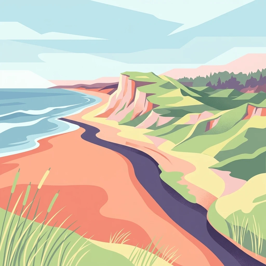
A digital illustration of a coastal landscape with sand dunes, grassy slopes, a stream flowing towards the ocean, and cliffs under a pale sky.

Kærsgård Strand, Vandplasken og Liver Å

Nature reserve

Park overview

Structured park overview, official facts, and landscape profile for Kærsgård Strand, Vandplasken og Liver Å

Kærsgård Strand, Vandplasken og Liver Å park facts, protected area profile, and essential visitor context

Review the core facts for Kærsgård Strand, Vandplasken og Liver Å, including designation, size, terrain, visitor scale, habitats, and operating context in one park-focused overview.

About Kærsgård Strand, Vandplasken og Liver Å

Kærsgård Strand, Vandplasken og Liver Å is a compact but ecologically dense coastal protected area on the Skagerrak in northwestern Vendsyssel. Designated as Natura 2000 area number 6 and classified as an EU Habitat Area, it spans about 442 hectares between the coastal dunes just south of Hirtshals and inland dune, mire, and forest systems that mark the transition from the raised seafloor of the younger landscape to the older shorelines of the Stone Age sea. The protected zone sits in Hjørring Kommune within Region Nordjylland, framed by the dune plantations of Tornby Klitplantage to the east and Skallerup Klit to the south.

The defining character of the site lies in the unusual fertility of its dunes. Because the dune sands here are calcareous, the dune hollows support a far wider range of plant communities than the more acidic dunes typical of the Danish North Sea coast. Permanent and temporary dune lakes, including several Lobelia lakes such as the protected Vandplasken, lie alongside spring mires, rich fens, small amphibious plant communities, and reed-dominated wetlands. The meandering course of the Liver Å stream cuts through the area, leaving behind a chain of cut-off oxbow pools and wet meadows that further diversify the habitat pattern.

What sets the area apart from other coastal stretches of Vendsyssel is the relative absence of intensive development. Much of the surrounding coast has been converted into summerhouse areas or planted with conifer dune plantations, while Kærsgård Strand, Vandplasken og Liver Å has retained a more natural mosaic of dunes, lakes, and wetlands. This combination of calcareous substrate, varied hydrology, and limited disturbance has produced one of Denmark's most species-rich natural sites, important not only for vascular plants but also for bryophytes, molluscs, dragonflies, butterflies, amphibians, and stream-dependent fauna.

Quick facts and research context for Kærsgård Strand, Vandplasken og Liver Å

Kærsgård Strand, Vandplasken og Liver Å is a Natura 2000 habitat area covering 442 hectares in Hjørring Kommune, Region Nordjylland, Denmark. It lies along the Skagerrak roughly 10 kilometers northwest of Hjørring, between the dune plantations of Tornby Klitplantage and Skallerup Klit, immediately south of Hirtshals. The site is designated under the EU Natura 2000 network and combines protected calcareous dunes, freshwater habitats, and the catchment of the Liver Å stream, with a southern portion carrying older national nature reserve status.

Protection and recognition

Documented terrestrial protection scope, designation history, and Natura 2000 records.

Kærsgård Strand, Vandplasken og Liver Å Protection Status and Recognition Data

Kærsgård Strand, Vandplasken og Liver Å features documented terrestrial protection status and formal Natura 2000 recognition dating from 2011. Records compile official designation boundaries and international source data to provide clear conservation context.

International recognition

Protection details

Protection scope
Terrestrial
Designated year
2011
Transboundary protection
No
Park context

Deeper park guide and search-rich context for Kærsgård Strand, Vandplasken og Liver Å

Kærsgård Strand, Vandplasken og Liver Å history, landscape, wildlife, and travel context

Explore Kærsgård Strand, Vandplasken og Liver Å through its history, landscape character, ecosystems, wildlife, conservation priorities, cultural context, and seasonal travel timing in a structured park guide built for atlas discovery and search intent.

Why Kærsgård Strand, Vandplasken og Liver Å stands out

The site is best known for its calcium-rich, species-rich dune landscape, where calcareous dune hollows hold an exceptional concentration of rare plants, springs, mires, and small lakes. It is regarded as one of the most botanically rich places in Denmark, hosting some of the country's largest populations of the orchid mygblomst and the rare moss mørk knappenålsmos, alongside unique fen and spring-fed communities.
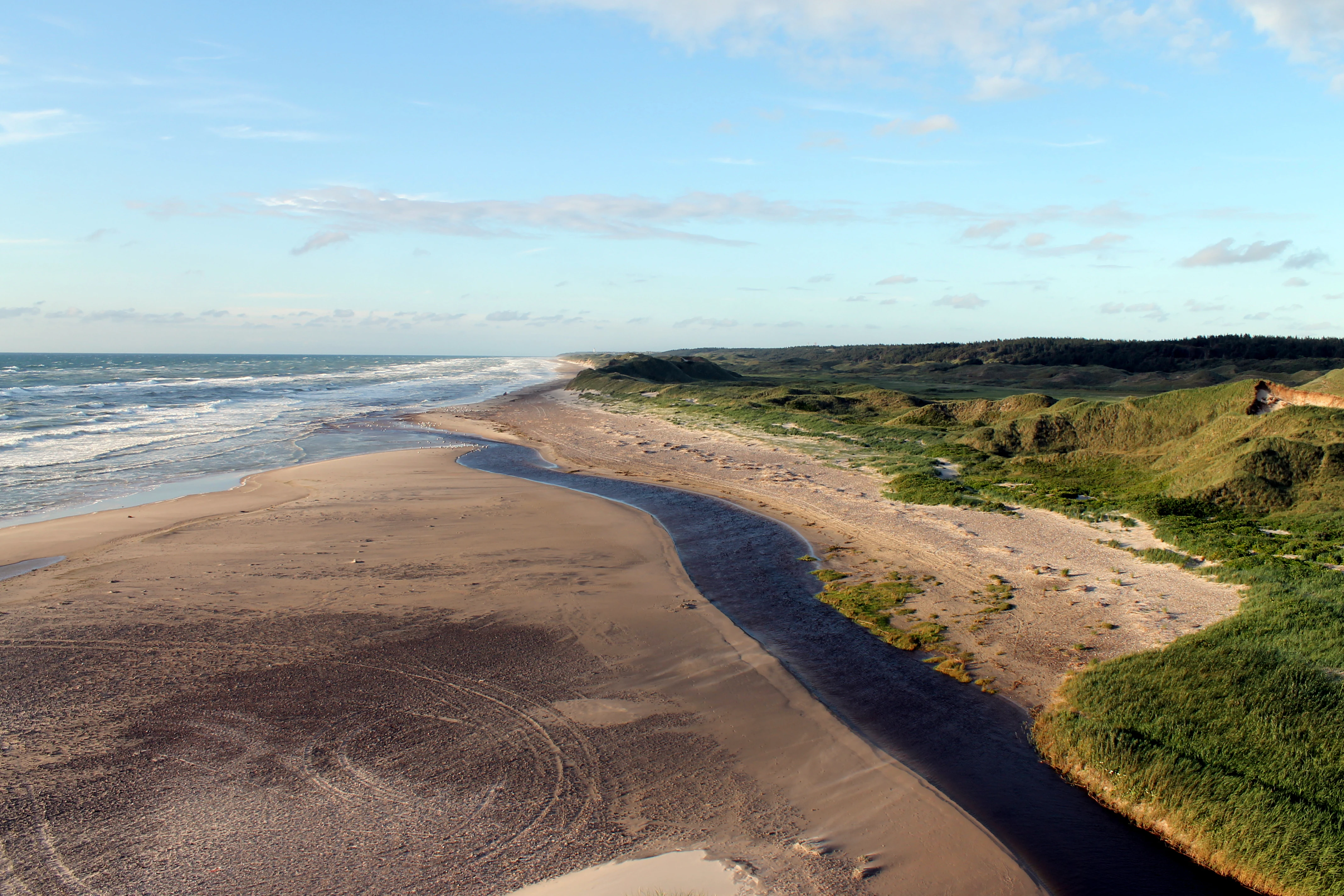
An aerial-style view of a river mouth emptying into the sea across a wide sandy beach, with vegetated dunes on the right.
The estuary of the Liver Aa river as it meets the Skagerrak coast at Kærsgård Strand.

Kærsgård Strand, Vandplasken og Liver Å history and protected-area timeline

The protection history of Kærsgård Strand, Vandplasken og Liver Å developed in stages, beginning with national-level conservation in the mid-twentieth century and culminating in European-level designation. The areas around the mouth of the Liver Å, covering roughly 115 hectares, were protected by national nature reserve order in 1956. A second reserve followed in 1962, extending protection over about 188 hectares covering Vandplasken and additional dune areas around Kærsgård Strand.

Following Denmark's integration into the broader European conservation framework, the site was incorporated into the Natura 2000 network as area number 6. Under this designation it is formally recognized as an EU Habitat Area, with the southern portion retaining its earlier national reserve status. A Natura 2000 management plan for the site was adopted in 2011, establishing binding implementation plans that municipalities and Naturstyrelsen must follow.

The current planning cycle runs through the Naturplan 2022 to 2027, prepared by Miljøstyrelsen Nordjylland and coordinated with the Water Plan for the northern Kattegat and Skagerrak. The site also forms part of the DragonLIFE initiative, a targeted conservation program focused on the acutely threatened large goldenring dragonfly and the vulnerable natterjack-like amphibian species found in these dune wetlands.

Kærsgård Strand, Vandplasken og Liver Å landscape and geographic character

The landscape of Kærsgård Strand, Vandplasken og Liver Å is shaped by post-glacial coastal dynamics on two different timescales. The seaward portion of the site sits on relatively young raised seafloor, deposited when the land rebounded after the last glaciation, while the inland parts lie above the older shoreline of the Stone Age sea. Where the dunes sit atop calcareous substrate, they form a varied terrain of white and grey dunes, dune heaths dominated by sea buckthorn and grey willow, juniper dune scrub, and humid hollows known locally as klitlavninger.

The dune hollows are the most distinctive physiographic feature of the site, holding a series of small freshwater lakes and seasonally flooded depressions. The largest and best known of these is Vandplasken, a clear-water Lobelia lake set within undisturbed, protected dune. Permanent dune lakes alternate with temporary pools that fill in wet seasons and support amphibious plant communities during favorable years.

The Liver Å stream cuts through the interior in a series of tight meanders. Former meanders have been cut off from the main channel and now appear as small isolated lakes and mires strung along the valley floor. This gives the inland section a distinctly complex wetland pattern, transitioning from open water and reedbeds through water meadow and fen toward alder-ash woodland along the valley margins.

Kærsgård Strand, Vandplasken og Liver Å ecosystems, habitats, and plant life

Ecologically, the site is defined by the unusual fertility of its dune substrate and the resulting habitat diversity. Calcareous sands allow the dunes to support white, grey, green, juniper, sea buckthorn, and grey willow dune communities across the classical North Sea dune successional sequence. Within the dune hollows, the fertility of the substrate supports a mosaic of spring mires, rich fens, herbaceous fringes, periodically wet meadows, and Lobelia-type clear-water lakes.

Vegetation communities include spring-fed mires with constant groundwater influence, rich fens dominated by sedges and brown mosses, reedbeds, and fringing herbaceous zones along lake edges. The Liver Å valley adds riparian and wet woodland habitats, including stands of alder and ash forest that are recognized as a priority habitat type under the European habitat classification.

The hydrological link between dunes, lakes, and stream is central to the site's habitat identity. Groundwater moving through the calcareous dune sands emerges at the surface as springs, feeding base-rich fens and clear-water lakes while also sustaining the Liver Å system further inland. This combination of stable spring flow, mineral-rich substrate, and historical lack of drainage disturbance is what has allowed the unusually rich plant communities to persist.

Kærsgård Strand, Vandplasken og Liver Å wildlife and species highlights

Kærsgård Strand, Vandplasken og Liver Å is significant at the national scale for its invertebrate fauna as well as its flora. The site is recognized as one of Denmark's most important areas for day-flying butterflies, and the dune hollows and wetland edges support rich and varied communities of dragonflies and other insects. The site hosts important populations of the large goldenring, a dragonfly considered acutely threatened in Denmark, as well as other wetland-specialist dragonflies.

Among vertebrates, the Liver Å supports lamprey species adapted to clean, sandy-bottomed streams, and the otter is known to use the stream system and surrounding wetlands. The dune wetlands provide habitat for amphibians of conservation concern, including the vulnerable natterjack toad, which benefits from the temporary pools found in dune hollows.

Molluscs are also part of the site's conservation profile. The spring-fed habitats support the spring-snail species known as the kildevældsvindelsnegl, with the Kærsgård area representing the only known population of this snail in the Vendsyssel region. Together, these faunal elements reinforce the site's status as a national stronghold for rare, habitat-specialist species.

Kærsgård Strand, Vandplasken og Liver Å conservation status and protection priorities

Conservation significance at Kærsgård Strand, Vandplasken og Liver Å operates at both national and European levels. The site is part of the Natura 2000 network as an EU Habitat Area, and the southern portion carries additional national nature reserve status dating back to the mid-twentieth century. This layered designation reflects the area's ecological importance and the long-standing recognition that its calcareous dune wetlands require active protection.

The current Naturplan 2022 to 2027, prepared by Miljøstyrelsen Nordjylland, sets out binding management actions for the period. Protection of the Lobelia lakes, spring mires, and rich fens is central, and public access around Vandplasken is restricted under the original reserve designation to preserve the undisturbed character of the lake and its surroundings. The plan is also coordinated with the Water Plan for the northern Kattegat and Skagerrak, ensuring that aquatic habitat quality in the Liver Å and its associated lakes is considered alongside the terrestrial management regime.

The site's inclusion in the DragonLIFE initiative underscores its role in targeted species conservation. The program supports specific actions to safeguard viable populations of the large goldenring dragonfly and the natterjack toad, both of which depend on the calcareous dune wetland habitats that the protected area sustains. Priority habitat types represented in the designation, including alder-ash forest and calcareous dune communities, give the area particular weight in Denmark's contribution to the EU Habitats Directive.

Kærsgård Strand, Vandplasken og Liver Å cultural meaning and human context

The site sits within a coastal landscape of Vendsyssel that has long been shaped by the tension between natural dune processes and human land use. Elsewhere along the same stretch of the Skagerrak coast, dunes have been extensively planted with conifer forests to stabilize sand movement, or built over with summerhouse developments. The protected area represents one of the remaining stretches where the original dune and wetland systems have been left largely free of these interventions, which gives it cultural as well as ecological significance as a reference for what the northwestern Vendsyssel coast once looked like more broadly.

Access restrictions around Vandplasken and the older reserve areas also reflect a long-standing tradition in Danish nature protection of balancing public enjoyment of coastal landscapes with the need to safeguard sensitive dune lakes and mires. The site's location between agricultural inland landscapes and heavily developed coastal zones makes it an important reference for regional discussions of land use, conservation, and the preservation of open coastal nature in northern Jutland.

Top sights and standout views in Kærsgård Strand, Vandplasken og Liver Å

Kærsgård Strand, Vandplasken og Liver Å stands out for the combination of calcareous dune habitats, clear-water Lobelia lakes, spring mires, and the meandering Liver Å valley within a single protected site. It is recognized as one of Denmark's most botanically rich areas, with especially strong populations of rare orchids, mosses, and fen plants, and as one of the country's premier sites for day-flying butterflies and specialist dragonflies.

Best time to visit Kærsgård Strand, Vandplasken og Liver Å

The protected area offers different seasonal experiences through the year. Late spring and early summer are widely recognized as the most rewarding period for visiting calcareous dune sites of this type, when rich fen and orchid plants are in flower and the dune wetlands support active populations of butterflies, dragonflies, and other insects. Late summer and early autumn bring warm, settled weather that is favorable for observing dragonflies around the dune lakes.

In winter the dune landscape takes on a quieter character, and the botanical richness is less visible, though the streams and mires retain their ecological importance. Public access is restricted around Vandplasken itself under the original nature reserve order, so visitors who want to experience the lake should plan to view it from the surrounding dunes rather than approach the water closely. Because the area's appeal is strongly natural-history oriented, visits timed to the flowering and insect seasons generally offer the richest experience.
Monthly climate preview

Long term temperature and precipitation measurements across representative park coordinates

Climate Normals and Annual Weather Patterns for Kærsgård Strand, Vandplasken og Liver Å

Representative coordinate data records measured annual temperature ranges alongside consistent monthly precipitation rates for Kærsgård Strand, Vandplasken og Liver Å. Detailed monthly climate normals expand on these baseline figures to clarify long term meteorological trends.
Annual mean9 °C
2 °C17 °C
Jan
Feb
Mar
Apr
May11°
Jun14°
Jul17°
Aug17°
Sep14°
Oct10°
Nov
Dec
Warmest month
August

17 °C

Coolest month
February

1.5 °C

Wettest month
October

3.1 mm/day

Driest month
April

1.7 mm/day

Park location guide

Geography guide, regional context, and park location map for Kærsgård Strand, Vandplasken og Liver Å

Kærsgård Strand, Vandplasken og Liver Å park geography, regions, and map view in Denmark

Understand where Kærsgård Strand, Vandplasken og Liver Å sits in Denmark through a broader geographic reading of the surrounding landscape, nearby location context, and its mapped position within the national park landscape.

How Kærsgård Strand, Vandplasken og Liver Å fits into Denmark

Denmark is a constitutional monarchy and Nordic country in Northern Europe. It is the southernmost of the Scandinavian countries, bordering Germany to the south, Norway to the north, and Sweden to the southwest. The country consists of the Jutland peninsula and an archipelago of islands, with Copenhagen as its capital and largest city. Denmark has a population of over 6 million and is characterized by flat, arable land, sandy coasts, and a temperate climate.

Wider geography shaping Kærsgård Strand, Vandplasken og Liver Å in Denmark

Denmark occupies the Jutland peninsula and roughly 406 islands in Northern Europe. It is situated between the North Sea to the west and the Baltic Sea to the east. The country borders Germany to the south and is connected to Sweden via the Øresund Bridge. Denmark is predominantly flat terrain with low elevation, the highest point being Møllehøj at 170.86 meters.

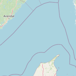
Map view of Kærsgård Strand, Vandplasken og Liver Å

Use this park location map to pinpoint Kærsgård Strand, Vandplasken og Liver Å in Denmark, understand its exact geographic position, and read its mapped placement within the surrounding landscape more clearly.

Pigeon | © OpenStreetMap contributors

Location context for Kærsgård Strand, Vandplasken og Liver Å

Region Nordjylland
Recorded earthquake history

View Recorded Seismic Events for Kærsgård Strand, Vandplasken og Liver Å

Examine the documented history of seismic activity in the vicinity of Kærsgård Strand, Vandplasken og Liver Å. This dedicated MoriAtlas record tracks historical epicentres to offer geographic context on the seismic environment surrounding this protected dune and wetland ecosystem.

Kærsgård Strand Earthquake History

Catalogued events

1 event

Strongest magnitude

Magnitude 3.3

Most recent event

Mar 11, 1991

This history includes earthquakes recorded inside the park or within 50 km of its borders

Explore detailed park photography showcasing dune terrain, coastal wetlands, and rare botanical ecosystems.

Visualizing Kærsgård Strand, Vandplasken og Liver Å: Landscapes, Scenery, and Protected Habitats

Examine authentic photographic records capturing the diverse coastal dune systems, spring-fed mires, and meandering stream valleys of Kærsgård Strand, Vandplasken og Liver Å. Visual documentation reveals the distinct topography and rare ecological features that define the protected landscape.

An aerial-style view of a river mouth emptying into the sea across a wide sandy beach, with vegetated dunes on the right.

Park atlas

Discover adjacent coastal habitats, regional wetland reserves, and connected northern landscapes

Explore Parks Near Kærsgård Strand, Vandplasken og Liver Å and Compare Protected Areas

Continue comparing protected areas by browsing other natural reserves situated near Kærsgård Strand, Vandplasken og Liver Å. Expand regional geographic context by analyzing nearby coastal dunes, wetland valleys, and related habitats across northern Denmark.
Protected areaRegion Nordjylland
About 15 km away#1 closest

Northeast

Natura 2000-område nr. 5 Uggerby Klitplantage og Uggerby Å's udløb Protected Area

Coastal dune and riverine landscape mapping in Region Nordjylland

Explore the varied terrain of this 717-hectare site featuring a complete sequence of green dune habitats, fresh water slacks, and the Uggerby Å river estuary. The area displays a dense concentration of coastal geomorphology and protected plant species, providing a deep look into the natural landscape character of the northern Danish coast along the Skagerrak.

Area
7.17 km²
Relief
Lowland
Climate
Temperate
Scope
Terrestrial
Protected areaRegion Nordjylland
24 km away#2 closest

East

Jerup Hede, Råbjerg og Tolshave Mose: Protected Area and Ridge and Pool Terrain

Geographic landscape overview in Region Nordjylland

Jerup Hede, Råbjerg og Tolshave Mose contains the largest continuous area of ridge and pool landscapes in Denmark. The site features an undulating terrain of hummocks and wet hollows typical of intact raised bogs, transitioning from inland heaths to coastal dune formations near the Skagerrak coast. It remains an essential site for studying Northern European mire ecosystems and wetland habitat patterns.

Area
40.24 km²
Relief
Lowland
Climate
Temperate
Access
Access unknown
Watercolor illustration of a lush green valley with rolling hills, meadows, and trees in soft, muted tones.
Nature reserveNordjylland
32 km away#3 closest

East

Åsted Ådal Nature Reserve: Glacial Valley Mapping and Protected Land Context in Nordjylland

A diverse Natura 2000 habitat mosaic in Northern Denmark

Åsted Ådal serves as a premier example of Danish glacial topography, offering a deep dive into the complex environmental transitions of a moraine-carved valley. The protected site highlights a rich botanical and avian assemblage, anchored by its unique stream corridor and steep slopes, providing a comprehensive view of regional landscape character.

Area
1.24 km²
Relief
Upland
Climate
Temperate
Scope
Terrestrial
A soft watercolor painting of a low-lying coastal scene with rolling green hills and a light foreground.
Nature reserveRegion Nordjylland
About 42 km away#4 closest

East

Natura 2000-område nr. 4 Hirsholmene, havet vest herfor og Ellinge Å's udløb: Mapping Protected Landscapes

A dual marine and coastal nature reserve in Region Nordjylland

Analyze the marine and coastal topography of this significant Natura 2000 site. The mapped region spans from the Kattegat bubble reefs to the freshwater influence of the Ellinge Å outlet, offering a clear perspective on the distribution of sandbanks, island groups, and terrestrial habitats that characterize this protected Danish geography.

Area
95.33 km²
Established
2011
Relief
Lowland
Climate
Temperate
Nature reserveRegion Nordjylland
46 km away#5 closest

Southeast

Solsbæk Nature Reserve: Geographic Profile and Protected Coastal Dune Landscapes

A rare calcareous dune ecosystem in Region Nordjylland, Denmark.

Solsbæk is a designated nature reserve on the Vendsyssel coast, notable for its concentrated series of coastal dune habitats. Formed by lime-rich shell sand, the landscape sustains a diverse array of vegetation including grey and green dunes, juniper scrub, and dune heath. This compact site provides a vital reference for understanding the ecological structure and botanical variety of protected coastal lands in northern Denmark.

Area
0.33 km²
Established
1972
Relief
Lowland
Climate
Temperate
Nature reserveLæsø Municipality
61 km away#6 closest

East

Nordre Rønner: Protected Island Landscapes and Geographic Mapping of Læsø Municipality

Remote coastal nature reserve and marine habitat within the Danish Kattegat sea

Nordre Rønner represents a significant cluster of islets in the Kattegat, showcasing the interplay of post-glacial land rise and coastal ecology. Managed within Læsø Municipality, these eleven hectares of protected land include essential nesting grounds for terns and harbor seals. This resource outlines the physical geography, mapped island connections, and the status of this unique maritime nature reserve.

Area
0.11 km²
Relief
Lowland
Climate
Temperate
Access
Moderate access
Nature reserveRegion Nordjylland
68 km away#7 closest

Southwest

Lild Strand og Lild Strandkær: A Detailed Look at Denmark's Protected Coastal Dune Terrain

Mapping the dune heath, wetlands, and inland lakes of western Thy

Lild Strand og Lild Strandkær encompasses a significant protected landscape in Region Nordjylland. This site features a continuous stretch of coastal dune zonation, including foredunes and grey-green dunes, set against a chain of distinctive brown-water and Lobelia lakes. Its habitat mosaic offers a clear window into the ecological diversity of the Thy coastline through a structured geographic lens.

Area
7.49 km²
Established
2011
Relief
Lowland
Scope
Terrestrial
Protected areaDenmark
About 70 km away#8 closest

Southeast

Aalborg Bugt: Geography and Protected Area Overview in Northern Denmark

Coastal wetlands, shallow marine habitat, and fjord systems

Aalborg Bugt represents a defining seascape for northern Denmark, stretching along the Kattegat coast to include diverse coastal features like dunes, salt meadows, and rich fens. As the largest Natura 2000 site in the country, the bay supports a continuous conservation corridor that bridges marine environments with inland fjord networks, offering a deep look into the regional geography and protected-land dynamics of the Jutland peninsula.

Area
1,774 km²

Common questions about visiting, size, designation, and location context for Kærsgård Strand, Vandplasken og Liver Å

Kærsgård Strand, Vandplasken og Liver Å FAQs for park facts, access, geography, and protected area context

Find quick answers about Kærsgård Strand, Vandplasken og Liver Å, including protected-area facts, park geography, trail and visitor context, and how the park fits into its surrounding country and regional landscape.
MoriAtlas Explorer

Continue Your Protected Areas Search Across the Global Atlas

Deepen your exploration by continuing the structured search for national parks and protected areas worldwide. Utilize the comprehensive filtering capabilities to compare different conservation landscapes and refine your understanding of global park geography. Discover more about the distribution and characteristics of protected natural areas.

Global natural geography