
Peaks
Park geography
A comprehensive analysis of spatial boundaries, mountainous terrain, and natural geography
Kanangra-Boyd National Park: Detailed Geographic Mapping and Regional Landscape Context
Examine the technical geographic characteristics of Kanangra-Boyd National Park, covering its total surface area of 686.6 square kilometers and distinct mountainous terrain. This profile details the spatial span, climate zones, and major natural features located within the protected boundary, including prominent peaks, canyon systems, and waterfall sites.
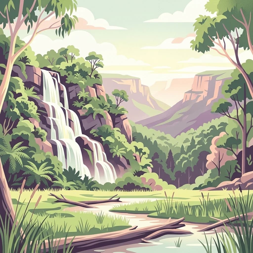
Rugged wilderness on the south-western edge of the Greater Blue Mountains World Heritage Area
Kanangra-Boyd National Park
Kanangra-Boyd National Park is a protected wilderness area located in the Central Tablelands of New South Wales, approximately 180 kilometres south-west of Sydney. The 68,660-hectare park sits on the south-western edge of the Greater Blue Mountains World Heritage Area, contiguous with Blue Mountains National Park to the north and east, and Nattai National Park to the south. The park encompasses two distinct land units: the elevated, gently undulating Boyd Plateau and the dramatic landscape of creeks, rivers, gorges and ridges into which the plateau falls away. The landscape is characterised by rugged terrain, deep gorges, and prominent geological features including the Thurat Spires, Kanangra Walls, and Mount Cloudmaker. Three notable waterfall systems cascade through the park: the Kalang Falls, the two-tiered 225-metre Kanangra Falls, and Morong Falls. The park also contains extensive karst landforms with cave systems that offer exploration opportunities for experienced cavers. The Kanangra-Boyd Wilderness is among the largest and most rugged wilderness areas in New South Wales. The park holds IUCN Category Ib designation as a wilderness area and forms part of the Greater Blue Mountains Area, which was inscribed on the UNESCO World Heritage List in 2000. The geological character is notably distinct from the Permian sandstone formations that dominate the rest of the Blue Mountains, with Palaeozoic basement rocks including quartzite, diorite, Devonian rhyolites, and Silurian phyllites exposed at the surface.
- Location
- Australia
- Park type
- National park
- Established
- 1969
- Area
- 686.6 km²
Location overview
Located entirely within the New South Wales regional boundary
Geographic Position of Kanangra-Boyd National Park in Australia
Kanangra-Boyd National Park is located within the state of New South Wales in Australia. The terrestrial protected area exists entirely inside a single territory with no coastal or transboundary borders.
- Countries
- Australia
- Regions
- New South Wales
- Primary location
- New South Wales
- Geographic setting
- Inland
Boundary and coordinates
Spatial limits and coordinate spans of the 686.6 square kilometer park
Kanangra-Boyd National Park Boundary Map and Geographic Limits
The mapped boundary outline provides essential spatial context for the protected reserve. Accompanying geographic facts detail the 686.6 square kilometers of land area, center coordinates, and regional spans.
- Boundary area
- 718.2 km²
- Boundary perimeter
- 338.1 km
- Northernmost point
- 33.6893° S
- Southernmost point
- 34.151° S
- Easternmost point
- 150.2408° E
- Westernmost point
- 149.9643° E
- Geographic centre
- 33.9403° S, 150.0921° E
- North–south span
- 51.2 km
- East–west span
- 25.6 km
Terrain and natural features
Explore recorded peaks, streams, ridges, and waterfalls within the park
Kanangra-Boyd National Park Mountain Terrain and Named Natural Features
This protected area features a mountain terrain classification encompassing multiple recorded peaks, streams, ridges, and waterfalls. Linked feature cards supply names, types, and spatial relationships for each recorded natural element.
Selected named natural features
Streams
Cyclops Gully
Peaks
Joalah Mountain
Waterfalls
Hidden Falls
Peaks
Ghosts Mountain
Streams
Kanangra Creek
Environmental setting
Temperate climate zones, mountain relief, and major forest cover types
Kanangra-Boyd National Park Environmental Classifications and Physical Settings
Recorded landscape features and habitat types frame the physical setting across varied terrain zones. Connected category records link directly to relevant atlas destinations for broader regional exploration.
- Relief
- Mountain
- Climate
- Temperate
- Water
- Major water bodies
- Forest cover
- Mostly forested
- Seasonality
- Seasonal
Landscape features
Mountains · Plateau · Valleys · Cliffs · Canyon · Forest · Wetland · Rivers · Waterfalls · Karst
Habitat types
Montane forest · Temperate broadleaf forest · Shrubland · Wetland · Karst habitat
Park atlas
Trace the regional geography of protected landscapes contiguous with Kanangra-Boyd National Park, comparing diverse wilderness areas within New South Wales.
Explore Other National Parks and Protected Areas Surrounding Kanangra-Boyd National Park in New South Wales
After exploring Kanangra-Boyd National Park, expand your discovery to nearby national parks and protected areas, including those within the Greater Blue Mountains World Heritage Area and surrounding wilderness regions of New South Wales. Compare their distinct rugged terrain, deep gorges, and karst landscapes to trace connected conservation efforts and broader geographic patterns across the Central Tablelands.

Nature reserveNew South Wales
About 1.6 km away#1 closest
Northwest

Jenolan Karst Conservation Reserve
Protected nature reserve in the New South Wales Central Tablelands
Jenolan Karst Conservation Reserve, in New South Wales, Australia. Landscapes: mountains, valleys, and cliffs.
- Area
- 30.83 km²
- Established
- 1997
- IUCN
- III
- Visitors
- 250K annual
Regional parkNew South Wales
About 9.6 km away#2 closest
Northeast
Ngula Bulgarabang Regional Park: Geography and Protected Land Profile
Upper Blue Mountains plateau and escarpment terrain
Located in the upper Blue Mountains of New South Wales, Ngula Bulgarabang Regional Park encompasses a distinct plateau characterized by both natural eucalypt bushland and a twentieth-century radiata pine plantation. This protected area overlooks the Megalong Valley, providing a vital connection between local escarpment ecosystems and the broader heritage-listed terrain of the region.
- Area
- 3.06 km²
- Established
- 2020
- Relief
- Upland
- Climate
- Temperate

National parkNew South Wales
13 km away#3 closest
Southeast
Nattai National Park: Protected Landscape Within New South Wales Geography
Mapped boundaries and regional context for this national park.
Nattai National Park represents a distinct protected landscape within the broader geographic context of New South Wales, Australia. This entry focuses on its identity as a national park, detailing its mapped boundaries and its significance for structured geographic and atlas exploration. Users can uncover the specific park identity and its role within the regional mapped terrain.
- Area
- 489.84 km²
- Established
- 1991
- IUCN
- II
- Visitors
- 1K annual
National parkNew South Wales
15 km away#4 closest
Southwest
Abercrombie River National Park: A Protected Landscape in New South Wales
Explore its national park designation and mapped geography.
Delve into the details of Abercrombie River National Park, a designated national park situated in New South Wales. This entry focuses on its identity as a protected landscape, providing a geographically specific atlas perspective. Understand the extent of its mapped boundaries and its contribution to the regional geography, offering a clear view of its protected area status for discovery and reference.
- Area
- 190 km²
- Established
- 1995
- IUCN
- II
- Relief
- Mountain

National parkNew South Wales
19 km away#5 closest
South
Mares Forest National Park: New South Wales National Park Atlas and Protected Landscape
Explore mapped boundaries and forest terrain.
Mares Forest National Park, situated in New South Wales, offers a distinct protected landscape defined by its wet eucalyptus forest and kurrajong trees. As a national park, it provides valuable insight into the regional geography of the Southern Tablelands, showcasing its unique terrain and role as wildlife habitat. This park serves as an essential point for atlas-based exploration of Australia's conservation estate, highlighting its mapped boundaries and natural features.
- Area
- 25.59 km²
- Established
- 2010
- IUCN
- II
- Relief
- Upland
Nature reserveNew South Wales
About 22 km away#6 closest
South
Wombeyan Caves Nature Reserve: Exploring the Marble Karst Landscapes of New South Wales
Geological formations and forest refuges in the Southern Highlands
The Wombeyan Caves karst reserve offers a distinct window into marble geology, featuring complex chambers and sculpted flowstone formations beneath the forested ridges of the Southern Highlands. This protected landscape serves as both a site of significant geological interest and a refuge for native wildlife, providing a layered terrain of subterranean paths and surface forest tracks across this part of New South Wales.
- Area
- 5.68 km²
- Established
- 1997
- Relief
- Mountain
- Climate
- Temperate

National parkNew South Wales
About 30 km away#7 closest
Northeast
Blue Mountains National Park
Explore New South Wales park geography and natural terrain.
Blue Mountains National Park, in New South Wales, Australia. Landscapes: valleys, cliffs, and forests.
- Area
- 2,679.54 km²
- Established
- 1959
- IUCN
- II
- Visitors
- 8.4M annual
National parkNew South Wales
32 km away#8 closest
South
Bangadilly National Park: Protected Sandstone Plateau and Gorge Landscape in NSW
Explore its unique terrain and Wingecarribee River geography.
Bangadilly National Park, situated in New South Wales, is a critical protected area characterized by its striking sandstone plateau and gorge formations bordering the Wingecarribee River. As a strict nature reserve, it safeguards a significant transition zone for local flora and provides essential habitat for numerous rare and threatened species, making it a key site for understanding regional landscape ecology and protected area distribution in Australia.
- Area
- 21.35 km²
- Established
- 2001
- IUCN
- Ia
- Relief
- Mixed relief
MoriAtlas Explorer
Continue Exploring Kanangra-Boyd National Park's Geographic and Protected Landscape Identity
Delve deeper into Kanangra-Boyd National Park to uncover its specific geographic features and its role as a protected landscape within New South Wales. Understanding the mapped context and regional setting of this national park enhances your exploration of Australia's diverse natural terrain. Continue your atlas journey by examining the unique attributes that define this protected area.
Browse next
Global natural geography
Explore related park routes
Explore MoriAtlas Global ParksBrowse All MoriAtlas ParksGlobal Park Map DiscoveryMoriAtlas: Browse All CountriesBrowse All MoriAtlas ContinentsNational Park Environment AtlasGrand Canyon National Park AtlasYellowstone National Park AtlasYosemite National Park Atlas and GeographySerengeti National Park AtlasGalápagos National Park Protected LandscapeBanff National Park Geography and AtlasKruger National Park Atlas EntryExplore Uluru-Kata Tjuta National Park GeographyPlitvice Lakes National Park AtlasFiordland National Park Protected LandscapeGreat Smoky Mountains National Park AtlasZion National Park Protected Landscape AtlasAfghanistan National Parks and Protected AreasAlbania National Parks and Protected AreasAlgeria National Parks and Protected AreasAmerican Samoa National Parks and Protected AreasAndorra National Parks and Protected AreasAngola National Parks and Protected AreasAntarctica National Parks and Protected AreasAntigua and Barbuda Park List