
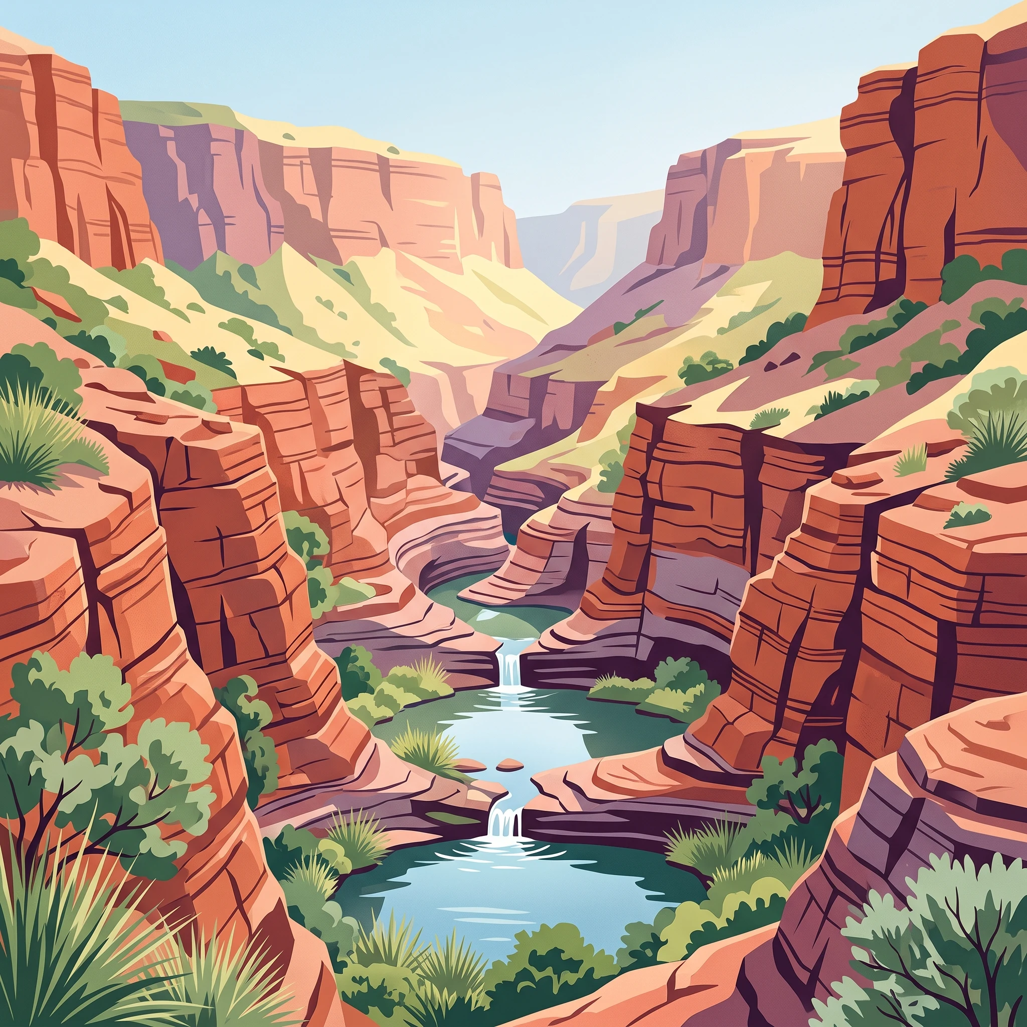
Trip Timing Basics
Finding the Optimal Time to Visit Karijini National Park
For those planning a journey to Karijini National Park, the best time to visit is during the cooler, drier months from May through September. This period provides the most reliable conditions for exploring the park deep, ancient gorge systems where hiking, canyoning, and swimming are the primary attractions. By choosing to travel during this window, visitors benefit from stable daytime temperatures that fall within a comfortable range, avoiding the extreme heat that characterizes the Pilbara region for the remainder of the year. While the intensity of the sun is a constant factor in this semi-arid environment, the winter months mitigate the risks associated with heat exhaustion, allowing for safer access to the park more challenging trails and remote water pools.
The Relationship Between Heat and Accessibility
Karijini is defined by a landscape that demands physical exertion, as navigating into and out of the deep slot canyons and gorge floors requires significant energy. The primary trade-off for any traveller is between comfortable ambient temperatures and the unavoidable reality of extreme summer heat. From October through April, daytime temperatures frequently climb beyond 40 degrees Celsius. These conditions do not merely limit comfort; they effectively constrain the range of safe activities. When heat levels are high, the park floor can become a trap for thermal energy, making strenuous physical activity both taxing and hazardous. Most visitors prioritize the cooler months to ensure that the environment remains an asset rather than a primary safety challenge.
Seasonal Climate Variability
Beyond the midday temperature, the park climate is marked by significant diurnal shifts. Even during the peak of the winter season, when days are warm and clear, nighttime temperatures can drop sharply. It is not uncommon for visitors to experience cool or even frosty conditions under clear desert skies after a day of mild warmth. This wide fluctuation in daily temperature means that preparation for a variety of conditions is essential, regardless of when you arrive. While the winter months are broadly categorized by lower rainfall and lower humidity, the transitional periods in early spring or late autumn can introduce unpredictable shifts.
Defining Your Travel Priorities
Deciding exactly when to go involves balancing your tolerance for heat against the desire for specific experiences. The park is vast, and the accessibility of its geological features is directly tied to the prevailing weather. While the period from May to September is widely regarded as the most manageable time for the average visitor, your personal priorities regarding crowd density, photographic light, or specific water-based activities may influence your choice of dates within this broad window. Rather than seeking a single ideal day or week, think of your timing as a tactical decision to align your physical capabilities with the park inherent environmental demands.
Seasonal Comparison
Best Months to Visit Karijini National Park at a Glance
Peak Hiking and Exploration Season: May to September
The most recommended window for visiting the park is the austral winter, spanning May through September. During this period, the Pilbara experiences stable, high-pressure weather characterized by clear, sunny days and significantly lower humidity. Daytime temperatures are typically mild, often hovering in the high 20s to low 30s Celsius. This period is the primary choice for those intending to undertake the park's extensive gorge walks and canyon trails, as the cooler air and dry ground conditions minimize heat-related risks that define the austral summer. Visitors during this time should be prepared for cold nights, as temperatures can occasionally drop near freezing, necessitating appropriate gear for overnight stays in the elevated terrain.
Transition Windows: April and October
The shoulder months of April and October serve as volatile transition periods. These months offer a significant trade-off between the stability of the winter season and the onset of extreme heat. In April, the park is moving out of the humid summer regime, and while temperatures begin to moderate, the risk of late-season heat spikes remains present. October represents the shift into the peak summer climate, where average maximums quickly climb toward 40 degrees Celsius. Travelers who choose these months for a visit should prioritize flexibility, ensuring they are prepared to curtail strenuous activity if a heatwave occurs. These months can be advantageous for avoiding the peak density of mid-winter visitors, though the weather consistency is markedly lower.
The Summer Heat Threshold: November to March
Visiting between November and March requires a significant shift in expectations. During these months, the park experiences intense solar radiation, with average daily maximums frequently exceeding 40 degrees Celsius. The environment during this period is challenging, often involving high humidity and potential for sudden, intense meteorological events including thunderstorms and tropical cyclone activity. For many, the high heat makes midday physical exertion in the deep gorges unsafe or unsustainable. Travelers who still choose to visit during this time generally shift their activity schedules to the early morning hours, retreating during the heat of the afternoon. It is essential to recognize that the park's natural features, such as the deep, shaded slot canyons, can provide limited heat relief, but the surrounding terrain remains subject to extreme temperatures. This period is less about sustained exploration and more about careful, localized engagement with the landscape during the cooler, pre-dawn and post-sunset phases of the day.
Annual Climate Overview
Monthly Weather and Temperature Patterns in Karijini National Park
Understanding the climate of the Pilbara region requires looking beyond daily high temperatures to the dramatic shifts that occur between the intense summer and the temperate winter months. These long-term climate normals, based on data recorded between 1991 and 2020 at an elevation of approximately 681 metres, illustrate a cycle defined by extreme thermal variation and highly seasonal precipitation patterns. While these figures provide a reliable baseline for planning, they are not local forecasts and cannot account for the specific microclimates found within deep gorge systems or changing weather patterns in a given year.
The Cool and Dry Winter Pattern
From May through September, the park experiences its most stable and temperate conditions. June and July represent the coldest months, with average daily minimums often dipping to 4.4 to 5.1 degrees Celsius. During this period, visitors should expect brisk, cool mornings and clear, comfortable days where average maximums hover around 28 degrees. This shift toward cooler air is accompanied by low humidity, typically ranging between 35 and 47 percent. The lack of significant rainfall during these months contributes to clear visibility and predictable conditions, making it the most reliable period for outdoor exploration. However, the drop in temperature during the night is significant; visitors staying in the park must prepare for cold nights that stand in stark contrast to the warmth of the afternoon sun.
Transition into High Heat
As the calendar moves into October and November, the climate transitions rapidly toward the summer peak. Average maximum temperatures climb steadily from 35.6 degrees in September to nearly 40 degrees by October. Humidity remains relatively low during these early transition months, but the intensity of the solar radiation becomes a primary factor for any outdoor activity. This period marks the end of the mild weather window, and those visiting during this time will notice the landscape warming quickly, with average mean temperatures climbing above 26 degrees. It is a time when the gap between early morning comfort and afternoon heat begins to widen significantly.
The Summer Peak and Precipitation Cycles
December through March represents the height of the summer climate, characterised by maximum temperatures that frequently exceed 40 degrees Celsius. January is typically the warmest month, with an average maximum of 43.2 degrees. Unlike the arid winter, these months see an increase in precipitation and humidity. January and February record the highest rainfall averages, often occurring as intense thundery downpours. The higher relative humidity, which can exceed 50 percent in February, adds to the physical stress of the heat, making the environment feel considerably more stifling. While daylight hours are at their longest, extending past 13 hours in December and January, the thermal intensity during midday often makes sustained activity impossible.
Interpreting Daylight and Wind Factors
Daylight hours follow a predictable arc, peaking at over 13 hours during the summer solstice period and narrowing to approximately 10.6 hours in mid-winter. While the variation in daylight duration is important for planning hiking times, wind speeds remain relatively consistent throughout the year, usually ranging between 4 and 4.8 metres per second. Because the park is situated within ancient, exposed ranges, these winds can have a cooling effect on open plateaus but may be significantly different when descending into the protected environments of the gorges. Always verify current weather alerts, as regional cyclonic activity can significantly alter these monthly norms during the summer months.
Seasonal Weather
Understanding Climate Cycles and Seasonal Weather at Karijini National Park
The Rhythm of the Pilbara Dry and Wet Seasons
Karijini National Park operates on a climate cycle dictated by the movement of the tropical monsoon, resulting in a binary seasonal rhythm: the dry season and the wet season. While some visitors expect a traditional four-season calendar, the park is better understood through the distinct environmental shifts between these two dominant phases. The dry season, stretching from May through September, is defined by high pressure systems that bring clear skies, minimal precipitation, and stable, cooler air. In contrast, the wet season, which encompasses the summer months, introduces high humidity, intense heat, and the potential for erratic, high-intensity storm activity. These transitions are not immediate, as the landscape undergoes a gradual shift in atmospheric moisture and thermal intensity that typically bookends the calendar.
The Cool, Dry Winter Phase
The peak visiting window occurs within the cool, dry phase that spans from May to September. During this time, daytime conditions are generally predictable, with average maximums ranging from approximately 28 to 35 degrees Celsius. This period is favored for hiking because the reduced humidity and lower average temperatures minimize the risks associated with heat exposure. Visitors often experience crisp, clear days perfect for exploring the deep gorge systems. However, the nights and early mornings serve as a stark reminder of the park's desert-like characteristics. As the sun sets, temperatures drop significantly, and frost is not uncommon in the more exposed areas or sheltered gorge basins. This thermal gap requires visitors to be prepared for both warm sun and biting cold within a single 24-hour cycle.
The Hot, Humid Summer Transition
As October arrives, the climate begins a transition toward the hot, humid summer phase. This period is marked by a steady climb in maximum temperatures, which frequently exceed 40 degrees Celsius by December and January. The atmosphere becomes increasingly heavy with humidity, and the risk of sudden, localized thundery downpours increases. These summer conditions are not merely uncomfortable; they significantly limit safe outdoor movement. The heat absorbed by the deep iron-rich rock of the gorges can persist long after sunset, keeping surface temperatures dangerously high. During the height of the summer wet season, the risk of flash flooding in canyon environments is a serious safety concern. Rainfall in this region is often characterized by short, violent bursts that can transform dry stream beds into surging torrents in minutes, making low-lying gorge areas hazardous for hikers and swimmers.
Navigating the Shoulder Periods
The transition months,April and October,act as shifting buffers between the stable winter and the volatile summer. April marks the tail end of the wet season influences, where humidity levels begin to drop, but temperatures remain warm. October signals the return of extreme heat, often catching visitors off-guard with temperatures approaching the summer peak. These shoulder windows offer the greatest variability in conditions. While they can provide quieter trails before or after the main visitor rush, they demand flexibility. Visitors during these transitions should remain particularly alert to local weather alerts, as the atmospheric patterns of the coming or outgoing season can clash, leading to unpredictable spikes in wind or sudden rainfall that do not always align with long-term climate averages.
Seasonal Experiences
What Visiting Karijini National Park is Like Through the Year
Navigating Gorge Environments Through the Seasons
The physical demands of exploring the Karijini gorge system vary significantly based on the time of year, directly influencing the feasibility of specific trails. During the cooler winter months (May through September), the lower daytime temperatures and lower relative humidity make strenuous activities such as descending into Dales Gorge or navigating the slot canyons of Joffre and Hancock Gorges significantly more manageable. The reduced heat stress allows for longer exploration periods, as hikers are less likely to encounter the rapid exhaustion often associated with the high-intensity sun and thermal reflection from red cliff faces during summer.
Conversely, the late spring and summer months (October through March) transform these same geological features. As average maximum temperatures rise consistently above 38 degrees Celsius, the environmental conditions within the gorges become increasingly volatile. Heat is trapped within the deep rock formations, often creating conditions where ambient temperatures on the canyon floors exceed those recorded at higher elevations. Visitors should recognize that the same trails accessible in July may require substantial alterations to timing or may become prohibitive due to heat exposure as the year progresses toward summer.
Accessing Natural Water Features and Swimming Holes
Water-based experiences at sites like Fern Pool, Handrail Pool, and Hamersley Gorge are deeply tied to the seasonal climate cycle. During the dry, cool season, these pools provide a refreshing, albeit chilly, respite after a hike. Because the water in these deep, shaded canyons remains cool year-round, the sensory contrast is most pronounced when the air temperature is mild. In contrast, the summer months bring a higher probability of irregular precipitation and the potential for flash flooding. While water flow in these systems is generally sustained by groundwater, heavy seasonal rains can alter the accessibility of lower-lying areas and safety margins within the gorge network. Readers should always verify the current status of specific swimming areas and tracks through official park channels before finalizing their itinerary, as seasonal precipitation patterns can create localized hazards that are not reflected in long-term climate normals.
Timing for High-Elevation Hikes
Exposed ridge walks, such as the route up Mount Bruce, are particularly sensitive to thermal patterns. The absence of shade on these high-altitude trails makes them exceptionally challenging outside of the winter months. In the cooler window, the ascent is manageable for prepared hikers. However, as the season shifts toward the heat of November and December, the lack of wind protection and the direct intensity of the sun can make even moderate paths feel arduous. Travelers focusing on these panoramic viewpoints are advised to plan for the early hours of the day during any visit, though the necessity of this precaution becomes non-negotiable as the region enters its peak heat phase.
Travel Priorities
Choosing the Best Time to Visit Karijini National Park Based on Travel Priorities
Planning for Strenuous Gorge Hiking
If your primary goal is to undertake challenging gorge traverses or climb the park's peaks, the period from June through August offers the most suitable climate. During these months, daytime maximums generally range between 27 and 29 degrees Celsius, providing the necessary thermal buffer to manage physical exertion without the extreme heat that characterizes the rest of the year. The primary trade-off for these comfortable daytime conditions is significantly colder overnight temperatures, which often drop into the low single digits. Hikers must prepare for sharp temperature transitions, meaning you will need a layered clothing system that accommodates both the crisp, early-morning starts and the warmer, sun-exposed afternoons within the gorges.
Prioritizing Milder Temperatures for Scenic Exploration
Visitors who prefer moderate weather for general exploration, photography, or shorter walks often find the shoulder months of April and May, or September, to be the most agreeable. In April, the daily temperatures begin to stabilize as the humidity levels from the wet season subside, though average maximums can still reach into the mid-30s. By May, the transition to the cooler, drier phase of the year is more pronounced, offering a balance where the sun remains warm enough for swimming in cool pools while the heat is rarely oppressive. September acts as the mirror to this period, featuring increasing warmth that allows for extended time outdoors before the October heat rise, but with significantly lower humidity than the early part of the year. The main compromise during these shoulder months is that you must accept higher variability in temperatures compared to the absolute stability of mid-winter.
Maximizing Time in the Water
For those drawn specifically to the park's famous swimming holes, such as Fern Pool or the pools within Dales Gorge, the timing requires balancing air temperature against water comfort. While the water remains relatively cool throughout the year, the experience is most rewarding when the ambient air temperature is high enough to make an immediate transition from the shade of the cliffs into the water feel refreshing rather than chilly. Late August and September are excellent for this, as the air warms sufficiently to invite prolonged swimming sessions. In contrast, mid-winter swims can be bracing, requiring a resilient attitude toward the cold. The trade-off for visiting during these warmer months is the return of higher solar exposure, which makes navigating the rim walks or exposed gorge access tracks more strenuous than it would be in the depths of July.
Avoiding Peak Heat for Safety and Comfort
If your travel priority is avoiding heat-related strain, the window from June to early August is non-negotiable. This is the period when the risk of extreme heat, which can easily exceed 40 degrees Celsius during the shoulder months and summer, is at its lowest. By confining your visit to this narrow winter window, you align your activity with the lowest solar intensity, significantly reducing the dehydration risks associated with exploring deep, enclosed canyons where heat can become trapped. The trade-off is the necessity of early starts and high-quality cold-weather gear for nights and early mornings, as the park's desert-like climate demands specialized preparation that is unnecessary in more temperate environments.
Access and Logistics
Seasonal Access and Operational Considerations for Karijini National Park
Access and Facility Availability Throughout the Year
Navigating the logistics of a visit requires an understanding that while climatic trends are predictable, park operations are subject to real-time adjustments. Access to specific gorges, trail conditions, and the availability of the visitor centre can shift due to maintenance, seasonal weather impacts, or environmental management decisions. During the warmer months, elevated temperatures may necessitate temporary trail closures for safety reasons. Always consult the official Western Australian Parks and Wildlife Service website or contact the park office directly before departure to confirm the current status of roads and tracks.
Transport and Arrival Planning
Reaching the park involves traveling through remote areas of the Pilbara region. Road conditions, including the suitability of access routes for two-wheel versus four-wheel drive vehicles, can change following significant weather events. While the main access roads are generally well-maintained, travelers should verify the latest regional road alerts provided by relevant transport authorities. Reliable transport is essential, and those planning to visit during the shoulder or winter periods should be prepared for high demand on local infrastructure. It is critical to confirm if your vehicle type is suitable for the specific routes you intend to traverse and to check for any local alerts that may restrict travel to certain park entry points.
Visitor Centre Services and Operational Hours
The park visitor centre serves as the primary hub for information regarding current trail status, cultural significance, and safety procedures. While historical operating hours have typically centered on a standard daytime window, these hours are not fixed and can be affected by staffing levels or seasonal shifts. Visitors should verify current opening hours through the official government park portal before arrival to ensure they can access resources upon entry. The centre is an essential resource for understanding site-specific warnings, such as those related to areas with historical asbestos concerns, and for obtaining the most up-to-date guidance on navigating the gorge environments safely.
Navigating Permit and Regulatory Requirements
Entry to the park generally requires payment of a park entry fee, which is a standard regulatory measure for national parks in Western Australia. These requirements, along with any specific permits for commercial activities or organized tours, should be checked well in advance. Regulations regarding site access, camping, and protected area usage can be updated at any time. Rather than relying on historical trip reports or third-party travel blogs, verify all current permit requirements and park entry fees directly through the official government authority responsible for the park. Following these steps ensures that your planning is based on the most current legal and operational mandates for the season of your travel.
Safety and Preparation
Seasonal Safety and Essential Packing for Karijini National Park
Navigating Thermal Extremes in the Pilbara
The primary safety consideration for any visit to the park centers on managing the dramatic shifts in temperature between the summer and winter months. During the peak summer period from December through March, average daily maximums frequently exceed 40 degrees Celsius. In these months, exposure to intense heat can be relentless, and the environmental impact on physical exertion is profound. Visitors should be aware that the high heat levels recorded in historical normals reflect the reality of the Pilbara climate, where direct sun exposure is extreme and thermal radiation off the ancient rock formations can increase perceived heat. Planning for these conditions requires a rigorous focus on scheduling outdoor activities for the coolest hours of the day, typically at sunrise, and maintaining a constant awareness of personal heat tolerance. Always check current weather forecasts and local heat advisories provided by park authorities, as extreme heat warnings can dictate the feasibility of specific trails or remote area access on any given day.
Preparing for Diurnal Temperature Shifts
While the heat defines the summer, the winter months, specifically June and July, introduce a different set of challenges centered on significant diurnal temperature variations. It is common for daytime temperatures to remain comfortable, often averaging in the high 20s, while nighttime lows can drop towards 4 or 5 degrees Celsius. This rapid cooling after sunset means that visitors should pack versatile clothing that can be layered effectively. Relying on lightweight summer apparel throughout the day is insufficient for the chilly mornings and evenings that accompany the clear, dry skies of the peak winter season. Proper equipment for sleep systems, if camping, is essential for comfort during these colder night hours, and failing to prepare for this shift is a frequent oversight for visitors expecting a universally warm desert experience.
Assessing Environmental Hazards and Safety Protocols
Beyond temperature management, safety in the gorge environment requires vigilance regarding flash flooding and geological conditions. While precipitation is generally low throughout the year, the summer months bring a higher potential for intense, localized storm events. Gorge systems are inherently susceptible to rapid water rises, and current park alerts regarding flood risks or trail closures must be the primary guide for activity planning. Furthermore, be aware that certain historical mining areas, particularly Yampire and Wittenoom Gorges, present unique environmental risks due to the presence of asbestos. Official signage and restricted area warnings are in place to protect public health and must be respected at all times. Always verify the current status of all hiking routes and restricted zones through official park updates before entering the backcountry, as environmental conditions can change rapidly and necessitate immediate changes to your planned itinerary.
Trip Resolution
Deciding the Best Time for Your Karijini National Park Visit
Balancing Your Comfort and Activity Goals
The final step in choosing your travel dates involves matching your personal tolerance for extreme heat against your desired level of physical activity. For visitors whose primary goal is exploring the deep gorge trails, navigating slot canyons, or completing the more strenuous ridgeline walks, the cooler months between May and September remain the most suitable. These months provide the necessary thermal relief required to safely undertake long periods of exertion in an environment where natural shade is limited and ambient temperatures can rise rapidly by midday. While the nights in these months will be significantly colder, requiring proper gear to maintain body warmth, the safety advantage of lower daytime heat far outweighs the inconvenience of a chilly morning.
Managing Risk During the Shoulder and Summer Periods
Travelers considering a trip in the shoulder months of April or October should be prepared for significant variability. These transition periods can experience unexpected heat waves or sudden shifts in weather, making flexibility in your daily itinerary essential. If your priorities lie elsewhere, such as photography or simply enjoying the visual drama of the landscape, you might find the shoulder seasons rewarding, provided you maintain a conservative approach to midday activity. Conversely, the summer months from November to March pose inherent risks due to intense heat and humidity. During this period, the physical demands of navigating the terrain increase exponentially. If you visit during this time, your focus must shift toward minimal exertion, with all significant exploration confined to the earliest hours of the day. This timing is not recommended for those who have not accounted for the physiological strain of working in extreme, dry heat.
Next Steps for Finalizing Your Itinerary
There is no single perfect time to visit, as the ideal choice depends entirely on your willingness to prioritize safety over the desire for consistent, moderate weather. Once you have narrowed your window based on your activity level and heat sensitivity, your final preparation should be rooted in the current reality of the park rather than long-term climatic trends. Climate normals provide a baseline for what you might expect, but they are not weather forecasts. Before finalizing your bookings or embarking on your journey, verify current road conditions, trail access statuses, and official heat or safety alerts provided by the park authorities. By aligning your chosen dates with your physical requirements and confirming current operating information, you can ensure your visit is both rewarding and safe.