
Trip Timing Fundamentals
When to Visit Karkaraly State National Nature Park: The Best Time for Your Trip
Deciding the Right Moment for Your Karkaraly Trip
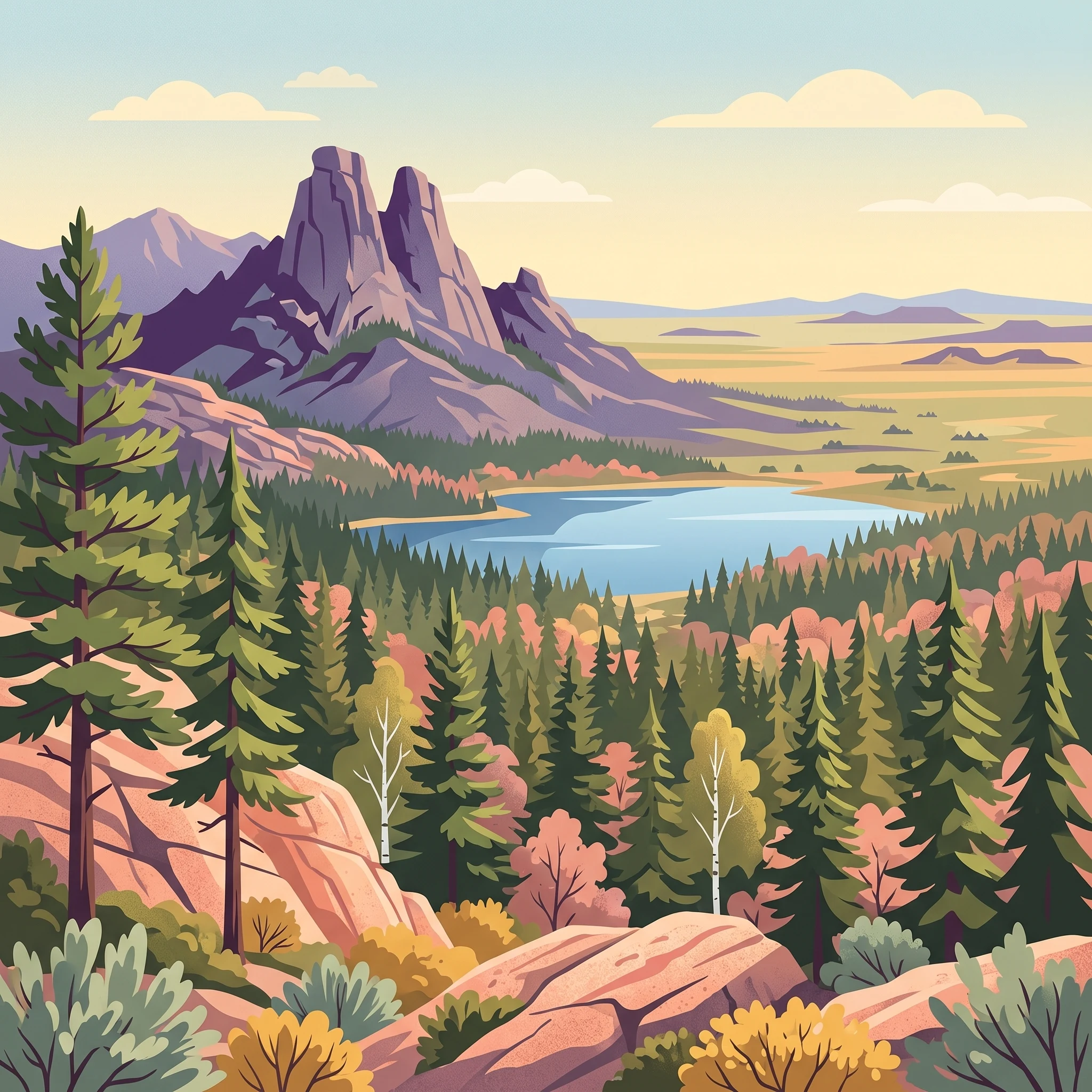
The best time to visit Karkaraly State National Nature Park is generally during the core summer months, stretching from late May to early September. During this window, the park experiences its most reliable weather, characterized by mild temperatures that facilitate exploration of the granite massifs and the dense pine forests that define this ecological island. Because the park is situated within the expansive central Kazakhstan steppe, its internal climate is significantly influenced by altitude and forest cover, creating a stark contrast with the exposed, flat grasslands surrounding it. Choosing when to arrive requires balancing a preference for the longest daylight hours and moderate warmth against the reality of a brief, intense summer season that can be punctuated by sudden thunderstorms.
Navigating the Sharp Seasonal Divide
The fundamental timing trade-off for any traveller is the extreme disparity between the temperate summer phase and the harsh winter period. While mid-summer days see temperatures rise, sometimes reaching 30 degrees Celsius or higher, the winter climate is defined by prolonged, severe sub-zero conditions. The transition periods in spring and autumn are remarkably short, often lasting only a few weeks. In late spring, specifically May, the park undergoes a rapid transformation as snow melts from the canyons and the landscape shifts from dormant to vibrant. Conversely, autumn offers a brief, highly visual period in September where the deciduous trees change color before the onset of the deep freeze in November.
Essential Environmental Factors
Visitors must account for three primary environmental variables that dictate the feasibility of outdoor activities: daylight availability, precipitation patterns, and temperature fluctuations. Daylight reaches its peak in mid-summer, providing extensive hours for navigating the trails toward sites like Lake Shaitankol or the Kent Mountains. However, the summer precipitation pattern typically manifests as showers and sporadic thunderstorms, which can affect ground conditions on steeper terrain. During the shoulder months, the rapid loss of daylight and the risk of nocturnal freezes become critical factors for those planning extended outings.
Rather than seeking a single ideal month, prospective visitors should frame their trip around their tolerance for these shifting conditions. The warmer months provide the best access to the park's archaeological heritage and peak elevations, while the colder seasons,though visually striking with snow cover,require specialized winter preparation and significantly limit the accessibility of the park's more remote features. Regardless of the chosen window, it is essential to monitor current weather reports and consult with the park administration, as local conditions can change rapidly and differ substantially from regional forecasts, particularly in the more elevated zones of the Karkaraly range.
Seasonal Planning
Best Months to Visit Karkaraly State National Nature Park
Choosing when to visit Karkaraly requires balancing the desire for mild outdoor temperatures against the dramatic shifts in the central Kazakhstan climate. The annual calendar is dominated by a brief summer season, which provides the most accessible conditions for hikers and explorers, contrasted with a harsh winter period that fundamentally changes the landscape and logistical requirements of the park. ### Peak Summer Accessibility (June to August) For most travelers, the period from June through August represents the most comfortable window for engagement with the park's granite peaks, archaeological sites, and mountain-forest trails. Daytime temperatures during these months reach comfortable averages, typically climbing into the high 20s or low 30s degrees Celsius. This is the period when the landscape is most vibrant, offering the best conditions for accessing remote locations like Lake Shaitankol. The primary trade-off during these months is the potential for short, sharp weather events. Summer thunderstorms and brief showers are common, requiring visitors to remain flexible with their outdoor itineraries. Additionally, as this is the period with the most reliable access, it is when fellow travelers are most likely to encounter others on popular paths near the Aulietas rock formations. ### The Transitional Beauty of September September serves as a distinct, shorter visiting window that separates the heat of summer from the rapid cooling of October. As temperatures moderate and the average daily highs drop into the high 20s or low 20s, the park experiences its most colorful phase. This month is particularly suited for those who prefer cooler temperatures for active exploration, such as hiking between the Bronze Age settlement of Kent and the Dzungar-era ruins. September remains largely dry and stable compared to the transition into late autumn, making it a high-value month for photography and lower-intensity exploration. The main compromise is the shortening daylight hours compared to June, which necessitates more careful planning for return trips from remote trailheads. ### Spring Emergence (May) May serves as a unique, though narrower, window for visitors interested in the awakening of the park's mountain-forest ecosystem. While temperatures are volatile and night-time frosts remain common, May provides a lush, floral landscape that is absent during the drier summer months. This period suits travelers who are comfortable with variable weather and prioritize seeing the park during its transition from the deep winter freeze. Visitors during this month should be prepared for the fact that some high-altitude areas or shady canyons may still harbor lingering snow, and trails may be saturated with seasonal meltwater. ### The Winter Constraint (November to March) From November through March, the park enters a phase of extreme cold, with temperatures frequently dropping well into the sub-zero range. While the landscape is visually striking under snow, this is not a general-purpose visiting season. Winter activity is primarily limited to specialized interests such as cross-country skiing. Travelers considering a winter visit must be prepared for the logistical challenges posed by sustained deep freezes and limited daylight, which significantly narrow the daily window for safe exploration. Regardless of the month chosen, visitors should always verify current park conditions and route accessibility before departing, as regional weather and operational standards can fluctuate significantly year to year.
Annual Climate Overview
Monthly Weather and Climate Trends in Karkaraly State National Nature Park
Thermal Patterns and the Continental Extremes
Karkaraly experiences a severe continental climate defined by sharp thermal contrasts between its short summer and prolonged winter. Long-term climate normals highlight a dramatic swing in temperatures that directly influence the park’s accessibility. While winter months consistently record mean temperatures well below freezing, the transition into spring is rapid. By May, the mean temperature climbs to 12.15 degrees Celsius, yet the threat of nightly frosts remains significant, with average minimums still dipping below zero. The peak of the summer heat occurs in July, when mean temperatures reach 19.2 degrees Celsius and daytime maximums can frequently exceed 30 degrees Celsius. These variations are not forecasts but represent the typical intensity of the mountain-forest environment.
Precipitation, Humidity, and Seasonal Moisture
Rainfall in the park is relatively modest, as the granite ranges act as an island in the dryer surrounding steppe. Precipitation is most frequent during the summer months, with July showing the highest monthly normal at 1.69 mm per day. These summer rains often arrive as brief, intense convective showers or thunderstorms, which can cause sudden shifts in hiking conditions. In contrast, the winter months are exceptionally dry in terms of liquid precipitation, though moisture accumulates as significant snowpack that can persist in shaded canyons well into late May. Humidity levels reflect this seasonality, remaining high during the deep winter months at over 90 percent and dropping to roughly 50 percent during the transition of early summer.
Daylight Duration and the Mountain Landscape
Daylight duration is a primary factor for planning time in the mountains, as the park’s latitude leads to pronounced annual cycles. The summer solstice period offers nearly 16 hours of daylight, providing an extensive window for exploring the trails and archaeological sites like the Kent settlement. This stands in stark contrast to the winter months, where daylight hours shrink to roughly 8 hours. By late November, the combination of rapidly diminishing light, dropping temperatures, and increased wind speeds creates a challenging environment that is fundamentally different from the temperate conditions experienced between June and August.
Interpreting Wind and Atmospheric Stability
Wind is a consistent influence on the park’s climate, particularly during the transition months. The strongest winds are recorded in December and March, averaging above 5.5 m/s. These winds, combined with the extreme sub-zero temperatures typical of the colder months, create wind chill effects that significantly amplify the severity of the winter. During the peak summer window, wind speeds typically subside, providing the most stable atmospheric conditions for those visiting the higher granite formations and exposed peaks. Visitors should treat these long-term normals as a baseline for understanding the park’s environment, always verifying current local forecasts before heading into the mountains, as individual years can deviate significantly from these historical averages.
Seasonal Dynamics
Seasonal Weather Transitions and Climate Patterns in Karkaraly
The Continental Rhythm of Karkaraly
Karkaraly operates on a sharp, binary climatic scale that dictates its seasonal viability. Rather than a traditional four-season model, visitors should view the year as two primary phases: the brief, hospitable window of biological activity and the extended, endurance-based dormant period. This rhythm is driven by the park's status as a mountain-forest oasis rising from the arid Kazakh Steppe, where temperature swings between winter lows and summer highs are extreme and physically demanding.
The Growth and Visitation Window: June through September
This period defines the effective annual cycle for most travelers. It begins in late spring, characterized by a rapid surge in both temperatures and moisture as the last of the shaded snowpacks melt. By June, the climate stabilizes into its warmest phase, with mean temperatures often reaching their annual peak. This is the period when the landscape is most accessible for hiking, photography, and exploring archaeological sites like the Kent settlement.
Rainfall during this phase is sporadic, often arriving as intense but brief thunderstorms that contrast with the dry, wind-swept nature of the surrounding steppe. By August, the moisture levels typically drop, and the transition toward the crisp, cooling air of September begins. This window is not merely about comfort but about basic environmental access, as the mountain trails are most navigable and the daylight hours remain sufficient for extended outdoor excursions.
The Dormant and Transitional Phases
Outside of the summer growth window, the park shifts into a volatile transitional state that makes typical tourism difficult. From late October, the onset of persistent sub-zero temperatures and the arrival of seasonal snow cover transform the geography. While the shift is sometimes labeled as autumn, it is more accurately a transition into a harsh winter regime. Temperatures in November can plummet, and the relative humidity levels begin to rise as the environment loses its solar energy input.
This winter phase, extending through the beginning of March, is characterized by deep snow cover that can reach up to one meter in drifts. The park’s climate during these months is dominated by cold, high-velocity winds and limited daylight, often dropping to around eight hours. While the winter conditions provide a stark, aesthetic landscape and opportunities for specialized activities like cross-country skiing, the park experiences true ecological dormancy.
Navigating the Shoulder Periods
March, April, and May represent the most unpredictable stretch of the calendar. As the deep winter yields, the park enters a phase of rapid transformation where the thermal profile is highly inconsistent. Daytime temperatures can reach levels that suggest spring, but nighttime minimums often remain well below freezing. For a traveler, this means that even a warm afternoon can be followed by dangerous ice conditions or mud as ground-level snow melts. This period is the true transition, lacking the stability of the summer window or the established, predictable frost of the winter season. Visitors during these months must remain prepared for sudden shifts in weather, as the environment is fundamentally changing from a frozen state to one of renewed growth.
Seasonal Experiences
What Visiting Karkaraly State National Nature Park Is Like Through the Year
Navigating Granite Landscapes and Forest Trails
The park's terrain is defined by its dramatic granite formations, which require specific attention to timing for safe and comfortable exploration. The primary activity of boulder hopping and trekking through the Kent and Karkaraly ranges is most viable when conditions are dry. In the peak summer window from late June through August, when precipitation remains relatively low compared to the volatility of spring, granite surfaces provide the best traction for navigating the rocky terrain. Because many of the signature formations, such as those near Aulietas, are exposed, the lack of cloud cover during the height of summer offers the clearest views of the mountain-forest mosaic. Travelers should note that when the rocks are damp, these surfaces become exceptionally slick, significantly increasing the risk of slips during the cooler, more moisture-prone transitions in May or late September.
Accessing Cultural and Archaeological Sites
The park hosts over 30 archaeological sites, including the ruins of the 17th-century Kyzyl Kensh Palace and the Bronze Age settlement of Kent. Visiting these historical landmarks is most effective during the extended daylight hours of June and July. With sunset occurring well into the evening, visitors have the necessary time to traverse the park's network of paths without the pressure of rapidly changing light conditions. Exploring the remnants of the Bronze Age city or the Buddhist monastery is best scheduled for days when the humidity is lower, as these open-air sites offer little shade. During the heat of midday in July, when temperatures can reach their highest monthly averages, planning these cultural excursions for the cooler morning or late afternoon hours is a practical strategy to manage the thermal intensity typical of this continental climate.
Wildlife Observation and Natural Photography
Photography enthusiasts and wildlife observers often prioritize the late summer period for access to the park's diverse mountain-forest ecosystems. The argali, or wild mountain sheep, represent a primary wildlife interest. Because the park's topography involves sharp rises from the steppe, wildlife movement is heavily influenced by temperature. During the warmest months, animals often seek the respite of the forested slopes. The transition into early September often provides a balance between manageable temperatures for hikers and the active presence of wildlife within the park’s protected zones. While the park is accessible throughout much of the year, the logistical complexity of reaching remote areas increases significantly once the first frosts of autumn arrive or when deep winter snows render off-path exploration difficult. Visitors aiming to reach iconic viewpoints like those surrounding Lake Shaitankol should prioritize the months when trails are clearly defined, as vegetation growth can obscure paths during the height of the summer growing season.
Visitor Priorities
Timing Your Visit to Karkaraly State National Nature Park Based on Travel Priorities
Planning for Optimal Hiking Conditions and Surface Stability
For those primarily interested in navigating the granite-rich terrain of the Karkaraly Range, mid-summer through early autumn offers the most reliable conditions. Granite rock formations, such as those found at Aulietas, become significantly safer when dry. While the region experiences localized summer precipitation in the form of showers and thunderstorms, the overall climate from July through early September provides the most consistent surface traction. Hikers should prioritize this window to avoid the slick conditions that occur during the spring thaw or following late-autumn precipitation. The tradeoff for this stability is exposure to the season's highest temperature averages, which can necessitate starting treks early in the day to avoid peak afternoon solar intensity.
Prioritizing Maximum Daylight for Archaeological Exploration
Visitors whose primary goal is to examine the region's rich cultural history, such as the Bronze Age settlement of Kent or the ruins of the 17th-century Buddhist monastery, benefit most from the extended daylight hours of June and early July. During this period, the park experiences its longest days, reaching approximately 16 hours of daylight. This provides a distinct tactical advantage for those moving between scattered archaeological sites, as it minimizes the pressure to rush through outdoor sites before sunset. The limitation of this timeframe is the higher probability of heat-related fatigue, particularly when exploring open steppe-adjacent areas where shade is sparse. If your itinerary involves extensive time documenting or photographing historical remains, this high-daylight period is superior, provided you balance your schedule to account for the mid-day temperature peaks.
Selecting for Milder Temperatures and Walking Comfort
If your primary preference is avoiding the extremes of the summer heat while still enjoying the park's forested mountain environment, September serves as an excellent, though brief, window. As the mean temperatures drop to more manageable levels compared to the intense heat of July, the environment becomes significantly more comfortable for extended walking and observation. This period also marks a reduction in the relative humidity levels that often accompany summer storms, leading to crisper air. The inherent compromise in choosing September is the narrowing margin for error regarding weather transitions. Early frosts can occur, and daylight hours decrease noticeably as the month progresses, meaning that while the air is more pleasant, your daily operating window is shorter than it would be during the height of summer.
Navigating Wind Exposure and Seasonal Airflow
Wind patterns in the Karkaraly mountains are relatively consistent throughout the year, but their impact on visitor comfort varies based on seasonal activity levels. Spring months, particularly April and May, experience sustained wind speeds that can affect the perceived temperature, often making the air feel cooler than the ambient thermometer readings suggest. For travellers who are sensitive to wind exposure during outdoor activities, the mid-summer months of July and August present the most stable, calmer atmospheric conditions. While wind is a persistent factor in a high-elevation environment surrounded by vast flatlands, choosing the peak of summer provides the best insurance against the biting, gusty conditions that characterize the transition into the colder months.
Visitor Access
Seasonal Access and Practical Planning for Karkaraly National Park
Access to the Karkaraly State National Nature Park is defined by its location within a remote, inland region of central Kazakhstan where road connectivity is the sole means of entry. While the park attracts visitors for its granite formations and ancient archaeological sites, travel planning must account for the reality that the park lacks direct air or rail infrastructure. Most visitors arrive via the city of Karaganda, which serves as the primary regional transport hub. Before finalizing travel dates, it is essential to verify the current road accessibility and local transport schedules, as regional infrastructure status can shift.
Road Travel and Regional Connections
The road distance between Karaganda and the park is approximately 244 kilometers. While this journey is typically manageable in a standard vehicle, travelers should anticipate a drive time of roughly 2.5 to 3 hours depending on road conditions. The route is situated within a vast steppe environment, and refueling options are limited. There is generally only one reliable location for fuel between the regional hub and the park entrance, typically situated about 45 minutes into the journey in the town of Botakara. Always consult current maps and local transit updates before departure, as road maintenance or weather impacts in the steppe can affect travel times.
Local Transit Options
Visitors relying on public transport or hired vehicles should plan according to local availability. Taxis are available for hire near the main bus station in Karaganda, though these are often shared-ride arrangements where departure is contingent upon filling the vehicle. Travelers should be aware that these local transport arrangements are informal and may not match the safety or service standards found in larger international transport networks. Regular bus services also operate on the route, though schedules are subject to change. For the most accurate and up-to-date departure times, tickets, and route availability, visitors must check the official bus station websites or inquire directly at the terminal in Karaganda before beginning the trip.
Regulatory Requirements and Park Entry
Entry into the national park area, including access to specific hiking trails or archaeological sites such as the Kent settlement or the Kyzyl Kensh ruins, may be subject to park management protocols, entry fees, or permit requirements. These rules are subject to update by the park administration. It is imperative to contact the park authority or check the official park portal immediately before your visit to confirm current access policies, any required registration, or potential seasonal restrictions on trail usage. Do not assume that historical or past access protocols remain in effect without current verification.
Safety and Preparation
Seasonal Safety and Practical Preparation for Karkaraly National Park
Preparing for Extreme Continental Temperature Swings
Visitors to the Karkaraly range must prepare for a climate defined by extreme variability rather than a gradual seasonal progression. Long-term climate normals demonstrate that even within the temperate summer window, daytime temperatures can climb past 30°C while nighttime lows remain crisp. Preparation should focus on a multi-layered clothing system, as the high-altitude sun during the day provides intense heat, but temperatures drop significantly once the sun dips behind the granite peaks. In the transitional months of May and September, sudden shifts are common, and hikers should remain prepared for rapid cooling if cloud cover moves in over the mountains. Always consult local forecasts immediately before entering the park, as the continental climate can trigger localized weather patterns that differ substantially from broader regional predictions.
Navigating Rugged Terrain and Variable Ground Conditions
While the park features well-known sites like the granite towers of Zhirensakal Peak and the cliffs around Lake Shaitankol, the terrain is physically demanding. Effective preparation involves wearing footwear with reliable grip, particularly for the uneven, often rocky ground found along mountain trails. During early spring, melting snow in shaded canyons can persist into late May, creating slippery or muddy stretches that may persist longer than they do on exposed slopes. Conversely, in the heat of July and August, dust and dry conditions prevail. Because the landscape includes steep rock formations and canyon environments, assess your own comfort with unpaved, uneven surfaces before choosing your daily route. Check the status of specific trails with park authorities, as conditions can change rapidly after heavy rainfall or during the spring thaw.
Adapting to Daylight and Solar Exposure
Daylight availability fluctuates significantly throughout the year, spanning from over 15 hours in June to just over 8 hours in December. Planning your daily activities around these cycles is essential for safety, particularly for long hikes or trips to archaeological sites located further from the main park access points. The high elevation and clear, dry air of the central Kazakh steppe often result in strong sun exposure, even on cooler days. Relying on sun protection and planning for sufficient shade during the peak midday hours is advisable, as the mountain-forest environment offers varying degrees of tree cover. Regardless of the season, always inform local contacts or park staff of your intended itinerary and expected return time, ensuring you are prepared for the isolation of this mountain-forest island before venturing onto remote trails or into the deeper canyons of the Kent range.
Final Planning Decisions
How to Choose the Right Time to Visit Karkaraly State National Nature Park
Balancing Climate Comfort and Activity Objectives
Choosing when to visit requires aligning your specific objectives with the park's sharp seasonal divide. The most reliable window for outdoor exploration is the period from June through August. During these months, the daily temperatures are at their highest, and the risk of encountering lingering snow or deep mud on remote trails is significantly reduced. This is the optimal window if your primary goal is accessing the high-altitude archaeological sites or conducting extensive hiking across the granite ridges. The extended daylight hours in mid-summer provide maximum flexibility for long-distance movement through the park's forest-mountain interior.
Navigating Shoulder Season Trade-offs
For travellers who prefer cooler temperatures over peak summer heat, the transition months of late May and September offer a meaningful alternative. May brings the park to life with early floral blooms, but you must be prepared for more volatile weather, including the possibility of late-season frost or wet conditions in shadowed canyons where snowmelt persists. September is arguably the most stable of the transitional periods, providing cooler, manageable temperatures that are excellent for photography or walking, though daylight hours begin to decline rapidly by the final week of the month. Choosing these months requires a higher tolerance for shifting daily conditions compared to the established stability of mid-summer.
Making Your Final Decision
Ultimately, there is no universal best time to visit that satisfies every traveler's preference. If you prioritize consistent access to the full range of trails and cultural sites, aim for the heart of summer. If you prefer to avoid the intensity of the mid-summer sun and are comfortable with more variable daily temperatures, the shoulder weeks in early autumn provide a distinct set of advantages. Regardless of the season you select, remember that climate normals are long-term historical averages rather than real-time weather forecasts. Always verify current operating status, local trail access, and recent weather alerts with park authorities shortly before your departure. By matching your personal tolerance for thermal extremes and daylight availability to these seasonal patterns, you can select the window that best supports your individual travel priorities.