
Mori Atlas logo
Nature reserveKeischel bei Weimar

A study of calcareous grasslands and traditional agricultural mosaics in the West Hessian Depression

Keischel bei Weimar Nature Reserve: Mapping the Protected Landscapes of Northern Hesse

(Naturschutzgebiet Keischel bei Weimar)

Keischel bei Weimar stands as a significant nature reserve within the Landkreis Kassel district, representing a specialized mosaic of semi-natural habitats. This protected area centers on sun-exposed limestone slopes that support rare calcareous grasslands, complemented by traditional orchards, pastures, and fallow fields. Through careful sheep grazing and active conservation, the site maintains its ecological integrity within the broader geological context of the West Hessian Depression.

calcareous grasslandKalkmagerrasennature reserveNaturschutzgebietFFH-GebietHabitats Directive site
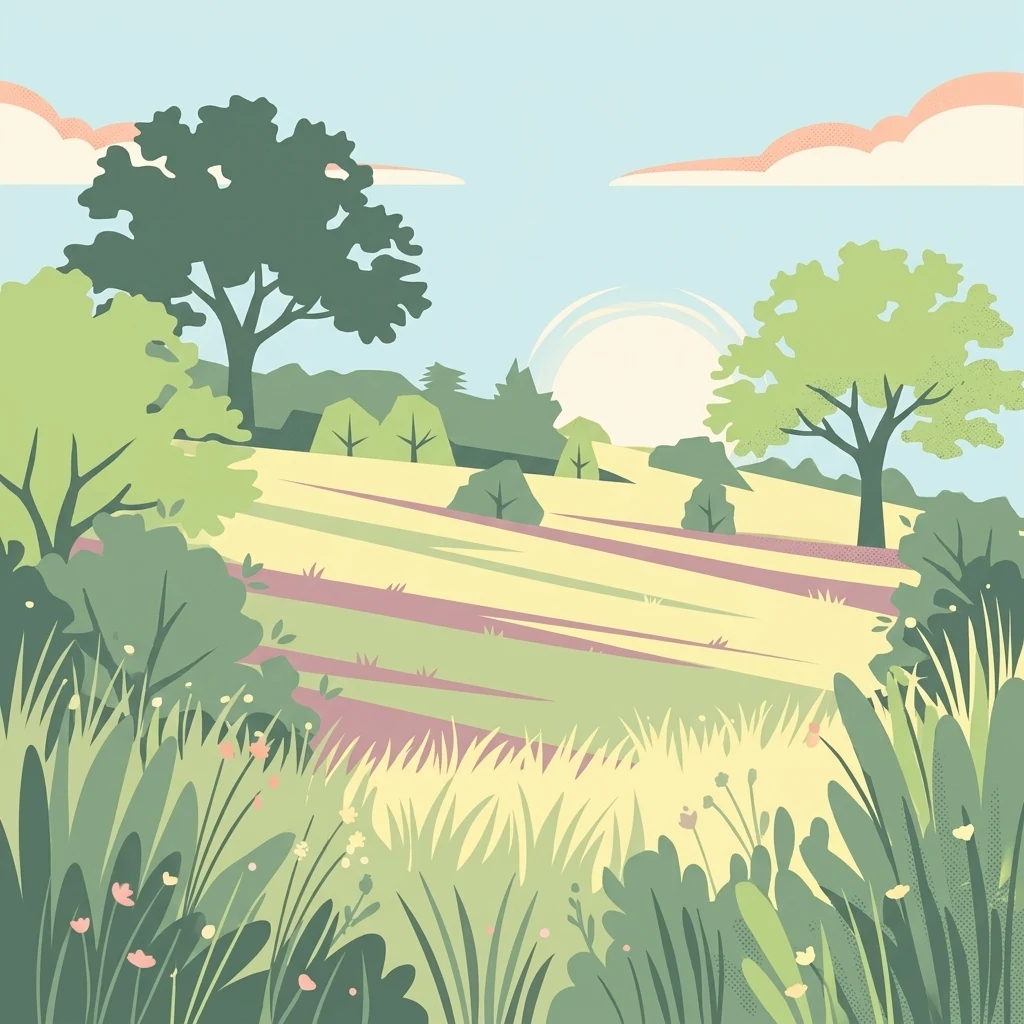
A stylized digital illustration of a peaceful, sunny landscape with rolling grassy meadows, interspersed with green bushes and leafy trees under a pale sky.

Keischel bei Weimar

Nature reserve

Park overview

Structured park overview, official facts, and landscape profile for Keischel bei Weimar

Keischel bei Weimar park facts, protected area profile, and essential visitor context

Review the core facts for Keischel bei Weimar, including designation, size, terrain, visitor scale, habitats, and operating context in one park-focused overview.

About Keischel bei Weimar

Keischel bei Weimar is a compact but ecologically rich protected landscape in the eastern foothills of the Hessian lowland, sitting just north of the village of Weimar in the municipality of Ahnatal. It belongs to a regional cluster of small nature reserves in Landkreis Kassel that focus on calcareous grasslands, scrub, and traditional agricultural mosaics on the Muschelkalk and Buntsandstein bedrock typical of this part of Hesse.

The site occupies a narrow belt of land, roughly 1.5 kilometers long and 140 meters wide, on a gentle slope between about 260 and 327 meters in elevation. Soils here derive mainly from Triassic limestone and sandstone, producing the thin, base-rich conditions that allow chalk-loving plants to thrive. This geological foundation, combined with centuries of grazing and mowing, has produced the calcareous grassland community that is the core reason the area was protected in 1992.

Roughly half of the reserve's central area consists of dry and semi-dry grassland in varying stages of openness; some plots remain richly flowered, while others are becoming partially shrubby and require active management. Sheep grazing and targeted bush clearance keep the sward open, preserving habitat for specialized plants and the invertebrates that depend on them. Surrounding this core are elements of a more traditional cultural landscape: small orchards (Streuobstwiesen), horse and cattle pastures, narrow arable strips, fallow land, and a single young spruce afforestation. Outside the strict reserve, a landscape protection zone of about 22.7 hectares provides a buffer and helps safeguard the wider setting from inappropriate change.

The reserve is also recognized under European Union nature law as part of the Natura 2000 network, with the site code DE 4622-301, reinforcing its role in protecting Habitats Directive habitat types and species. Despite its small size, Keischel bei Weimar illustrates many of the central themes of conservation in the West Hessian lowlands: working with geology rather than against it, sustaining traditional land use, and maintaining ecological continuity through ongoing management rather than purely passive protection.

Quick facts and research context for Keischel bei Weimar

Keischel bei Weimar is a nature reserve in the municipality of Ahnatal, within the Landkreis Kassel in Hesse, Germany. It coincides with the EU Habitats Directive site DE 4622-301 and is embedded in a larger landscape protection area of about 22.7 hectares. The reserve covers roughly 19.74 hectares at elevations between about 260 and 327 meters above sea level and was officially designated as a protected area in 1992.

The reserve's principal feature is approximately 8 hectares of calcareous dry grassland growing on Muschelkalk and Buntsandstein parent rock. Land use within the site is a deliberate mix of conservation, traditional grazing, and small-scale agriculture, including orchards, horse and cattle pasture, arable fields, fallow land, and a spruce afforestation. The reserve is accessible via field paths and is valued for its dry-grassland flora and butterfly fauna.

Protection and recognition

Documented terrestrial designation history, management scope, and Natura 2000 records

Keischel bei Weimar Protection Status and International Recognition

Keischel bei Weimar encompasses a documented terrestrial protected area established in 1992 with associated Natura 2000 recognition sources. Structured designation records outline the historical establishment and institutional framework supporting the protected landscape.

International recognition

Protection details

Protection scope
Terrestrial
Designated year
1992
Transboundary protection
No
Park context

Deeper park guide and search-rich context for Keischel bei Weimar

Keischel bei Weimar history, landscape, wildlife, and travel context

Explore Keischel bei Weimar through its history, landscape character, ecosystems, wildlife, conservation priorities, cultural context, and seasonal travel timing in a structured park guide built for atlas discovery and search intent.

Why Keischel bei Weimar stands out

Keischel bei Weimar is best known for its calcareous dry grasslands (Kalkmagerrasen), one of the more characteristic and ecologically valuable semi-natural habitat types found on the limestone slopes of the West Hessian Depression. These open, sun-warmed meadows, kept clear through sheep grazing and manual bush removal, support a specialized community of plants such as fringed gentians, orchids, and large anemones, alongside butterflies and reptiles associated with dry, flower-rich turf. The reserve is also valued as a compact example of how traditional land use, small-scale farming, and modern conservation measures can coexist within a single protected site, with orchards, pastures, fields, fallows, and even a spruce plantation all part of the same mosaic. Its status as both a German Naturschutzgebiet and a European Habitats Directive site reflects its recognized importance for habitat and species protection at multiple levels.
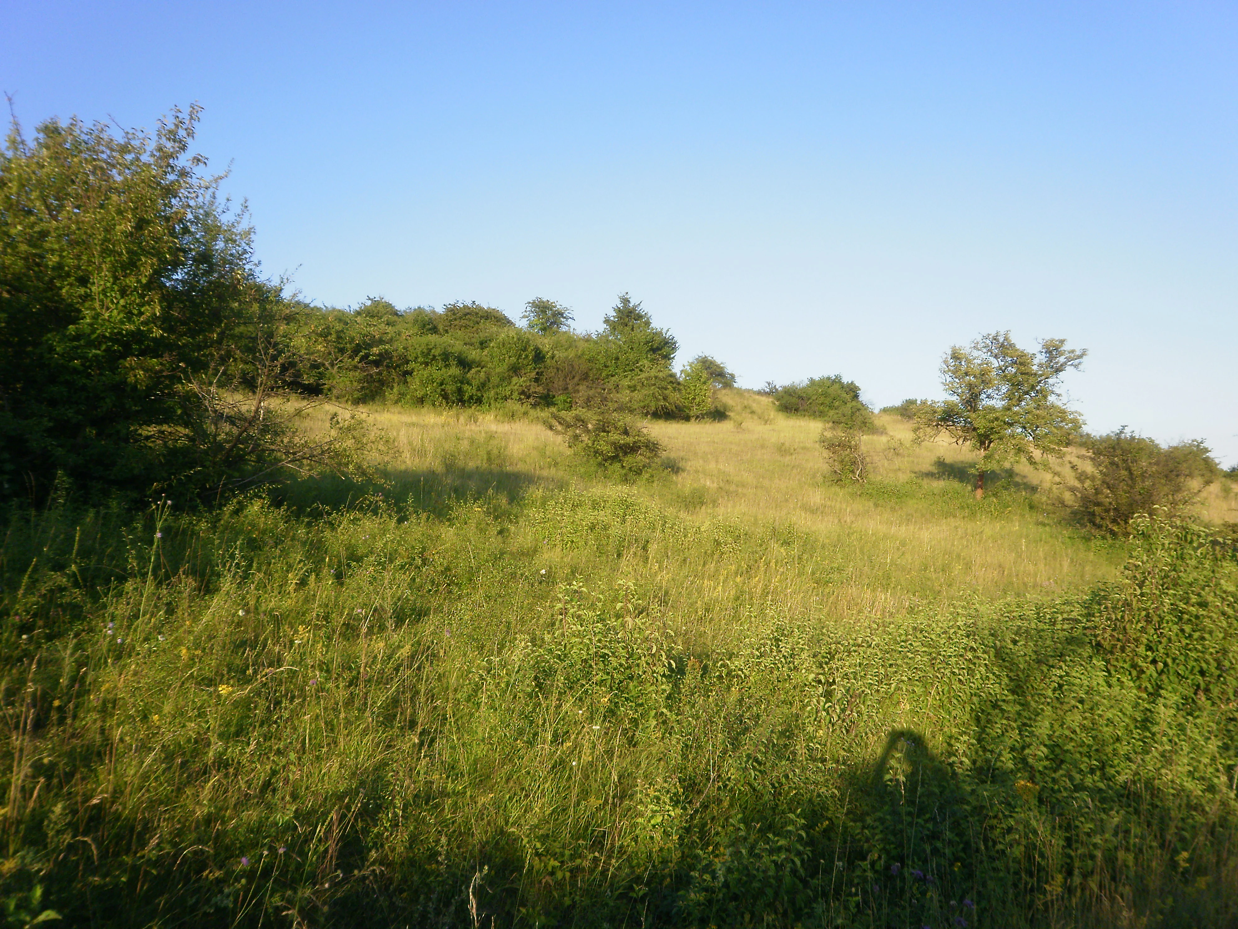
A sunny, slightly overgrown grassy hillside featuring scattered shrubs and low trees under a clear blue sky.
Calcareous grassland landscape within the Keischel nature reserve.

Keischel bei Weimar history and protected-area timeline

The area that is now Keischel bei Weimar has a long background of traditional agricultural use, with grazing and small-scale farming shaping the open, semi-natural vegetation seen today. The decisive moment in its modern history came on 17 November 1992, when the Regierungspräsidium Kassel formally designated it both as a landscape protection area (Landschaftsschutzgebiet Keischel bei Weimar) and as a strict nature reserve (Naturschutzgebiet Keischel bei Weimar), publishing the legal ordinance in the Staatsanzeiger für das Land Hessen.

Following designation, the reserve was incorporated into Hesse's Natureg information system under the identifier 1633033 and, separately, into the European Natura 2000 network as the Habitats Directive site DE 4622-301. These steps embedded the site within both regional and EU-level frameworks for monitoring and conservation. The reserve has also been the subject of local publications on Hessen's nature reserves and on calcareous grasslands and heath in the Kassel area, helping to document its botanical and management value.

In parallel with its formal protection, the area has faced ongoing management challenges. Reports in local press and community publications have noted repeated incidents of illegal dumping of construction rubble on reserve and buffer land, reflecting tensions between strict conservation status and the behavior of nearby residents. Efforts to maintain the reserve through grazing, scrub control, and public engagement continue alongside these threats.

Keischel bei Weimar landscape and geographic character

Keischel bei Weimar lies in the Westhessische Senke, a broad geological depression in northern Hesse where Triassic strata of Muschelkalk limestone and Buntsandstein (including Röt) come close to the surface. The reserve sits on a long, narrow strip of sloping terrain, roughly 1.5 kilometers in length and only about 140 meters wide, with elevations stepping up from around 260 meters at the base of the slope to about 327 meters at the higher edge. A district road and the small Erlebach stream run roughly parallel to the site along its lower boundary, giving the protected area a clearly defined southern edge.

The most visually distinctive element of the landscape is its patchwork of open ground: sun-exposed limestone slopes with thin, stony soils support the calcareous grasslands that give the site its character, while flatter stretches hold a mix of orchard meadow, rough pasture, small fields, and fallow. Patches of scrub and a compact spruce plantation break up the otherwise open vegetation, adding structural variety. Beyond the strict reserve boundary the landscape continues into the surrounding 22.7-hectare landscape protection area, where similar landforms and traditional land uses extend the visual and ecological context of the protected core.

Keischel bei Weimar ecosystems, habitats, and plant life

Ecologically, Keischel bei Weimar is defined by its calcareous grassland habitats, which together account for roughly half of the reserve area. These dry and semi-dry grasslands are typical of warm, base-rich limestone soils and host a specialized flora adapted to thin, free-draining substrates. Sheep grazing and manual brush clearance are used to counter scrub encroachment, keeping light levels high and maintaining the open character that these communities require.

Surrounding the core grassland is a mosaic of complementary habitats. Traditional orchard meadows (Streuobstwiesen) provide a partially shaded, structurally diverse environment, while horse and cattle pastures, arable fields, and fallow land add further microhabitat variation. A small spruce afforestation introduces a contrasting wooded element within an otherwise open setting. Together, these features create a layered landscape in which calcareous grassland specialists exist alongside more generalist species of farmland and edge habitats, increasing overall biodiversity within a very compact footprint.

Keischel bei Weimar wildlife and species highlights

The wildlife profile of Keischel bei Weimar is closely tied to its dry and semi-dry calcareous grasslands, which support a community of plants and animals typical of this habitat type in central Germany. Among the more conspicuous animals is the sand lizard (Zauneidechse, Lacerta agilis), a reptile characteristic of warm, open, stony ground, which uses the reserve's sunny slopes and patchy scrub for basking and shelter.

The reserve is also particularly notable for its butterfly fauna. Dry-grassland specialists such as the Dark Green Fritillary (Großer Perlmuttfalter, Mesoacidalia aglaja) and the Weaver's Fritillary (Magerrasen-Perlmuttfalter, Boloria dia) are recorded here, depending on the diverse nectar sources and larval host plants of the open limestone turf. Beyond these highlighted groups, the mosaic of grassland, orchard, pasture, and field provides habitat for a broader range of invertebrates and small vertebrates typical of traditionally used countryside in the Kassel region.

Keischel bei Weimar conservation status and protection priorities

Conservative significance at Keischel bei Weimar operates on several overlapping levels. Nationally, the site is protected as a Naturschutzgebiet under Hessian nature conservation law, with the strict reserve ring-fencing core calcareous grassland and the surrounding Landschaftsschutzgebiet of about 22.7 hectares providing a buffer of compatible land use. Internationally, the site is part of the European Natura 2000 network as the Habitats Directive site DE 4622-301, reflecting its role in protecting habitat types and species of EU-level concern.

The core conservation value lies in its calcareous dry grasslands, a habitat type that has declined sharply across much of central Europe due to changes in land use, abandonment, or conversion to cropland. By maintaining roughly 8 hectares of this community through active grazing and scrub control, the reserve contributes to the regional survival of plants and invertebrates that depend on open, base-rich turf. The site also illustrates the value of integrating strict protection with traditional uses such as orchard husbandry and livestock grazing, helping to sustain both biodiversity and the cultural character of the surrounding landscape. Ongoing concerns about illegal dumping of construction waste highlight the continued need for active management and community engagement to keep the reserve ecologically intact.

Keischel bei Weimar cultural meaning and human context

The cultural context of Keischel bei Weimar is closely tied to the long agricultural history of the West Hessian lowlands. The slopes on which the reserve sits have been shaped by generations of grazing, haymaking, and small-scale cultivation, traditions that produced and maintained the open, species-rich grasslands protected today. Elements such as orchard meadows, horse and cattle pastures, and small arable plots still reflect a working countryside rather than purely wild nature.

The local community around Weimar and Ahnatal retains a strong connection to this landscape, evident in the way conservation activities such as sheep grazing and manual bush clearance are embedded in regional practice rather than imposed externally. At the same time, episodes of illegal dumping reported in local publications show that maintaining this shared cultural-natural heritage depends on continued cooperation between reserve managers, local authorities, and residents.

Top sights and standout views in Keischel bei Weimar

Compact 19.7-hectare nature reserve centered on about 8 hectares of calcareous dry grassland on Muschelkalk and Buntsandstein bedrock. Designation as both a German Naturschutzgebiet and a European Habitats Directive site (DE 4622-301) underscores its formal conservation importance. A traditional land-use mosaic of orchard meadows, horse and cattle pastures, fields, fallows, and a small spruce plantation surrounds the open core. Notable for dry-grassland specialists including fringed gentians, wild orchids, sand lizards, and dry-meadow butterflies such as the Dark Green Fritillary and the Weaver's Fritillary.

Best time to visit Keischel bei Weimar

Late spring through early summer is generally the most rewarding period to visit calcareous grasslands of this type, when many of the characteristic flowering plants, including gentians, orchids, and anemones, are in bloom and butterflies are most active across the open, sun-warmed turf. Late summer and early autumn can still offer good observations, particularly of late-flying insects and fruiting grassland plants, although some areas may appear drier and more parched.

Visiting on mild, sunny days maximizes opportunities to see reptiles such as the sand lizard basking along slope edges and to observe the full diversity of nectar-seeking butterflies. Cool or overcast conditions significantly reduce insect activity, while very wet weather can make the stony tracks slippery. Because traditional grazing and scrub control continue year-round, visitors may also see sheep, horses, or cattle on pasture depending on the season.

Monthly climate preview

Long-term temperature and precipitation averages recorded at representative terrain coordinates

Keischel bei Weimar Climate Normals and Monthly Weather Patterns

Recorded monthly temperature and precipitation normals outline the multi-year climate rhythm measured across representative park elevations in Landkreis Kassel. Exploring the full twelve-month profile provides complete historical averages for detailed temperature and precipitation analysis.
Annual mean8 °C
-1 °C18 °C
Jan-1°
Feb
Mar
Apr
May12°
Jun16°
Jul18°
Aug18°
Sep14°
Oct
Nov
Dec
Warmest month
July

18 °C

Coolest month
January

-0.6 °C

Wettest month
July

2.5 mm/day

Driest month
April

1.5 mm/day

Park location guide

Geography guide, regional context, and park location map for Keischel bei Weimar

Keischel bei Weimar park geography, regions, and map view in Germany

Understand where Keischel bei Weimar sits in Germany through a broader geographic reading of the surrounding landscape, nearby location context, and its mapped position within the national park landscape.

How Keischel bei Weimar fits into Germany

Germany is a federal republic in Western and Central Europe with a population of over 83 million across sixteen constituent states. It is Europe's largest economy by nominal GDP and a major global exporter and importer. The capital is Berlin, and the country borders Denmark, Poland, Czech Republic, Austria, Switzerland, France, Luxembourg, Belgium, and the Netherlands.

Wider geography shaping Keischel bei Weimar in Germany

Germany is located in Western and Central Europe, spanning 357,022 km². It borders Denmark to the north, Poland and the Czech Republic to the east, Austria and Switzerland to the south, and France, Luxembourg, Belgium, and the Netherlands to the west. The country has coastlines on the Baltic Sea and North Sea to the north, with the Alps located in the southern region.

Map view of Keischel bei Weimar

Use this park location map to pinpoint Keischel bei Weimar in Germany, understand its exact geographic position, and read its mapped placement within the surrounding landscape more clearly.

Pigeon | © OpenStreetMap contributors

Location context for Keischel bei Weimar

Landkreis Kassel

Visualizing the calcareous dry grasslands and habitat mosaic of northern Hesse

Keischel bei Weimar Photos, Limestone Scenery, and Protected Area Landscapes

Visual documentation captures the sloping limestone terrain, calcareous dry meadows, and traditional orchard patches that define the protected area. Examining field photographs reveals the distinctive vegetation structures and geological features characteristic of the regional depression.

A sunny, slightly overgrown grassy hillside featuring scattered shrubs and low trees under a clear blue sky.

A wide, eye-level shot of a grassy meadow framed by green bushes and scattered trees in the Keischel nature reserve in Germany.

Park atlas

Compare regional limestone landscapes and connected habitats across northern Hesse.

Explore Other Parks and Protected Areas Near Keischel bei Weimar

Continue exploring protected areas near Keischel bei Weimar by browsing adjacent nature reserves and regional limestone landscapes. Comparing nearby sites reveals broader ecological patterns across the West Hessian Depression.
A soft watercolor illustration of a winding stream flowing through a green meadow with rolling hills in the background and a small cluster of pine trees in the foreground.
Nature reserveHessen
About 3.7 km away#1 closest

Northeast

Jungfernbach und Brandteich bei Calden: Protected Forest and Stream Valley Geography

Regional nature reserve landscape located in northern Hessen

Examine the mapped boundaries and natural terrain of Jungfernbach und Brandteich bei Calden. This nature reserve offers a detailed look at lowland stream corridors, pond ecosystems, and riparian forest patches nestled within the rolling landscape of northern Hessen, reflecting the region's diverse protected land character.

Area
0.343 km²
Established
1985
A horizontal watercolor painting depicting a soft, rolling landscape with green hills, conifer trees, and misty purple mountains in the background against a white backdrop.
Nature reserveLandkreis Kassel
About 3.8 km away#2 closest

West

Dörnberg Nature Reserve: Geographic Map and Protected Landscape Overview in Landkreis Kassel

Analyzing the limestone slopes and volcanic terrain of the Dörnberg massif.

Explore the Dörnberg nature reserve through a geographic lens, focusing on its protected status within the Landkreis Kassel region. This area encompasses 116 hectares of steep limestone slopes, supporting a dense collection of calcareous grasslands and rare orchid species. The site is physically defined by its striking Miocene basalt outcrop, providing a clear focal point for studying regional Hessian topography and conservation-led land management.

Area
1.166 km²
Established
1978
Relief
Mountain
Climate
Temperate
Watercolor painting of a calm wetland landscape with soft green trees along the water edge under a light, misty sky.
Nature reserveHessen
6.3 km away#3 closest

Northeast

Rothenberg bei Burguffeln Protected Wetland Landscape and Nature Reserve in Hessen

A specialized pond and meadow mosaic in the Hessian lowlands

Rothenberg bei Burguffeln preserves a vital wetland complex near Immenhausen, structured across three distinct sections, including the Rothenküler Teich and Tonkaule. The area represents a significant example of culturally shaped lowland geography, blending historic aquaculture with contemporary habitat management. Its protected status reflects a commitment to maintaining intricate riparian corridors and meadow ecosystems within the wider Hessian countryside.

Area
0.278 km²
Established
1983
Watercolor painting of a rolling forested landscape with distant hills under a soft light.
Nature reserveHesse
About 7.1 km away#4 closest

Southwest

Erlebach bei Ehlen Nature Reserve: Protected Terrain and Brook Valley Geography in Hesse

Mapped beech forest mosaic and riparian habitat corridors

Located in the Hoher Habichtswald, Erlebach bei Ehlen preserves a distinctive transition between mature beech forest and open grassland valley. This nature reserve serves as an essential case study for understanding riparian ecology, stream-side woodland distribution, and habitat connectivity within the regional topography of Hesse, Germany.

Area
0.342 km²
Established
1996
A watercolor painting in soft pastel tones showing a winding river or path flanked by small clusters of green trees, with gently rolling hills in the background against a white backdrop.
Nature reserveKassel
8.3 km away#5 closest

South

Dönche Nature Reserve: Investigating the Protected Landscapes and Urban Geography of Kassel

Exploring the historic grassland and wetland mosaic in northern Hesse

Dönche serves as a primary example of an inner-city nature reserve in Germany, preserving 170 hectares of open countryside within the Kassel urban fabric. Its landscape is shaped by the Dönchebach and Krebsbach streams, forming a rhythmic structure of ponds, beech wood pastures, and tall herb communities that offer a deep look into regional ecology and historical land use.

Area
1.709 km²
Established
1983
Water
Minor water
A watercolor painting showing a soft, panoramic view of rolling green hills, lush vegetation, and water, with a light and airy artistic style.
Nature reserveHesse
About 9.5 km away#6 closest

North

Meßhagen bei Niedermeiser Nature Reserve: Protected Landscape and Regional Geography

A mapped conservation site in the woodlands of Northern Hesse

Meßhagen bei Niedermeiser represents a key nature reserve in Northern Hesse, characterized by its transition between old beech forest and managed calcareous grasslands. This protected area, part of the wider Kelzer Holz network, provides a study in managed habitat succession, where meadow flora and invertebrate populations thrive in the intersection of open terrain and dense woodland edges.

Area
0.546 km²
Established
1996
Relief
Upland
Climate
Temperate
A horizontal watercolor illustration depicting rolling green hills, patches of forest, and a calm river in the foreground, rendered in soft, pastel tones.
Nature reserveHesse
About 9.6 km away#7 closest

East

Kragenhof bei Fuldatal Nature Reserve: Mapped Floodplain Landscapes in Hesse, Germany

Protected riparian ecosystems and river meander geography

Located in the state of Hesse, Kragenhof bei Fuldatal is a significant nature reserve protecting a complex mosaic of Fulda River floodplain habitats. The area features shifting currents, small wooded islands, and open grassland within a distinctive meander-driven landscape. Explore the geographic boundaries and ecological structure of this important regional waterbird refuge.

Area
0.077 km²
Established
1981
Nature reserveHesse
About 10 km away#8 closest

North

Kelzer Teiche Nature Reserve: Mapped Geography and Protected Wetland Boundaries in Hesse

A historic managed fishpond landscape in the Kassel region of northern Germany.

Kelzer Teiche encompasses 18.5 hectares of lowland countryside defined by its twin fishponds and fringe habitats. This nature reserve plays a recognizable role in the regional network of protected sites in Hesse, offering essential shelter for reed dwelling and migratory birds within a broader agricultural setting.

Area
0.185 km²
Established
1977
Water
Major water bodies

Common questions about visiting, size, designation, and location context for Keischel bei Weimar

Keischel bei Weimar FAQs for park facts, access, geography, and protected area context

Find quick answers about Keischel bei Weimar, including protected-area facts, park geography, trail and visitor context, and how the park fits into its surrounding country and regional landscape.
MoriAtlas Explorer

Continue Your Protected Areas Search Across the Global Atlas

Deepen your exploration by continuing the structured search for national parks and protected areas worldwide. Utilize the comprehensive filtering capabilities to compare different conservation landscapes and refine your understanding of global park geography. Discover more about the distribution and characteristics of protected natural areas.

Global natural geography