
Mori Atlas logo
Nature reserveDörnberg

Tracing the limestone slopes, basalt outcrops, and calcareous grassland habitats of the Dörnberg massif.

Dörnberg Nature Reserve: A Detailed Map and Geographic Overview of Protected Hessian Landscapes

(Naturschutzgebiet Dörnberg)

The Dörnberg nature reserve represents a significant protected area within the Landkreis Kassel district of Hesse. This geographic detail page maps the reserve's crescent-shaped boundaries around the Dörnberg massif, showcasing its unique combination of Muschelkalk limestone slopes and the weathered basalt intrusion known as the Wichtelkirche. Users can analyze the terrain, identify the ecological importance of its managed calcareous grasslands, and understand the historical pastoral context that maintains this diverse xerothermic habitat.

calcareous grasslandorchid habitatlimestone slopebasalt outcropnature reserveHesse
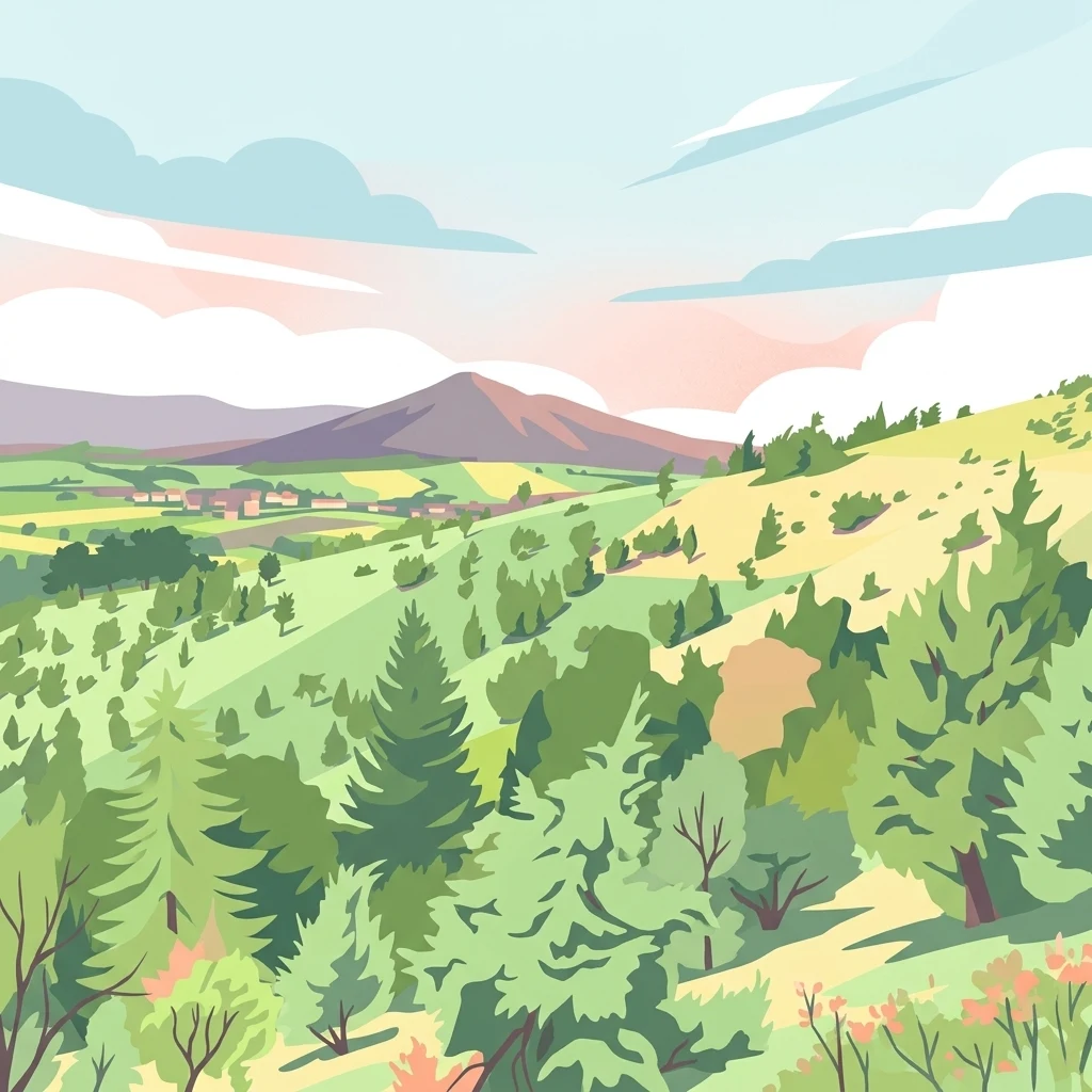
A stylized digital illustration of a rolling green landscape with evergreen and deciduous trees, a distant mountain peak, and a soft pastel sky with clouds.

Dörnberg

Nature reserve

Park overview

Structured park overview, official facts, and landscape profile for Dörnberg Nature Reserve

Dörnberg Nature Reserve park facts, protected area profile, and essential visitor context

Review the core facts for Dörnberg Nature Reserve, including designation, size, terrain, visitor scale, habitats, and operating context in one park-focused overview.

About Dörnberg Nature Reserve

The Dörnberg Nature Reserve protects one of the more ecologically distinctive hillside landscapes in northern Hesse. While the summit plateaus of the Hoher Dörnberg and Kleiner Dörnberg, with their gliding airfield, lie outside the protected boundary, the reserve itself wraps around the basalt dome of the Kleiner Dörnberg in a broad arc, capturing the steepest and botanically richest parts of the massif.

Geologically, the area tells a layered story. The slope consists largely of Lower Muschelkalk limestone and marlstone, while the soft Röt claystones at the foot of the hill shape the undulating surrounding countryside. Cutting through this sedimentary sequence is a Miocene basalt intrusion, now exposed as the freestanding basalt crag called the Wichtelkirche, historically also referred to as the Blumenstein. This combination of calcareous bedrock and volcanic remnant creates the unusual substrate conditions that drive the area's botanical richness.

Ecologically, the reserve's identity is defined by semi-natural calcareous grasslands that originated through centuries of grazing. These open meadows are now home to more than 200 species of ferns and flowering plants, including a remarkable twelve orchid species, with cowslip, early purple orchid, and fragrant orchid forming spectacular seasonal displays. The reserve also preserves populations of rare plants such as Lothringen flax.

Beyond plants, Dörnberg supports a rich invertebrate fauna, including dozens of butterfly species and a community of grasshoppers adapted to warm, dry conditions, while also harboring the mountain cicada. Management of the reserve is closely tied to its cultural and ecological history, using large-scale sheep grazing to maintain the open character that makes the habitat so valuable.

Quick facts and research context for Dörnberg Nature Reserve

The Dörnberg Nature Reserve is a roughly 116 hectare site in Hesse, Germany, designated in 1978 under the official identifier 1633006. It lies east of Zierenberg in the Landkreis Kassel district, on the slopes of the Dörnberg massif at elevations between approximately 300 and 440 meters above sea level.

Geologically, the reserve is built on Lower Muschelkalk limestone and marlstone, crowned by a basalt intrusion from the Miocene period. Ecologically, it is recognized for large calcareous grassland complexes that support more than 200 vascular plant species and twelve orchid species, and it is managed through seasonal sheep grazing.

Protection and recognition

Documented terrestrial protection scope, designation history, and management data.

Dörnberg Protection Status and International Recognition Records

Terrestrial protection status, management scope, and official international designations define the conservation framework surrounding Dörnberg. Verified records outline the baseline protected area designation and administrative context for this natural landscape.

Protection details

Protection scope
Terrestrial
Transboundary protection
No
WDPA ID
81531
Park context

Deeper park guide and search-rich context for Dörnberg Nature Reserve

Dörnberg Nature Reserve history, landscape, wildlife, and travel context

Explore Dörnberg Nature Reserve through its history, landscape character, ecosystems, wildlife, conservation priorities, cultural context, and seasonal travel timing in a structured park guide built for atlas discovery and search intent.

Why Dörnberg Nature Reserve stands out

Dörnberg is known primarily for its extensive, species-rich calcareous grasslands, which host mass blooms of cowslip and several orchid species and are considered ecologically exceptional within Hesse. The dramatic basalt outcrops of the Wichtelkirche, a weathered Miocene intrusion on the otherwise limestone slope, add a distinctive geological signature to the reserve's landscape. The reserve also stands out for its strong historical-cultural connection between nature conservation and traditional pastoral land use, with grazing maintained as a living link to the centuries-old land management that originally shaped the meadows.
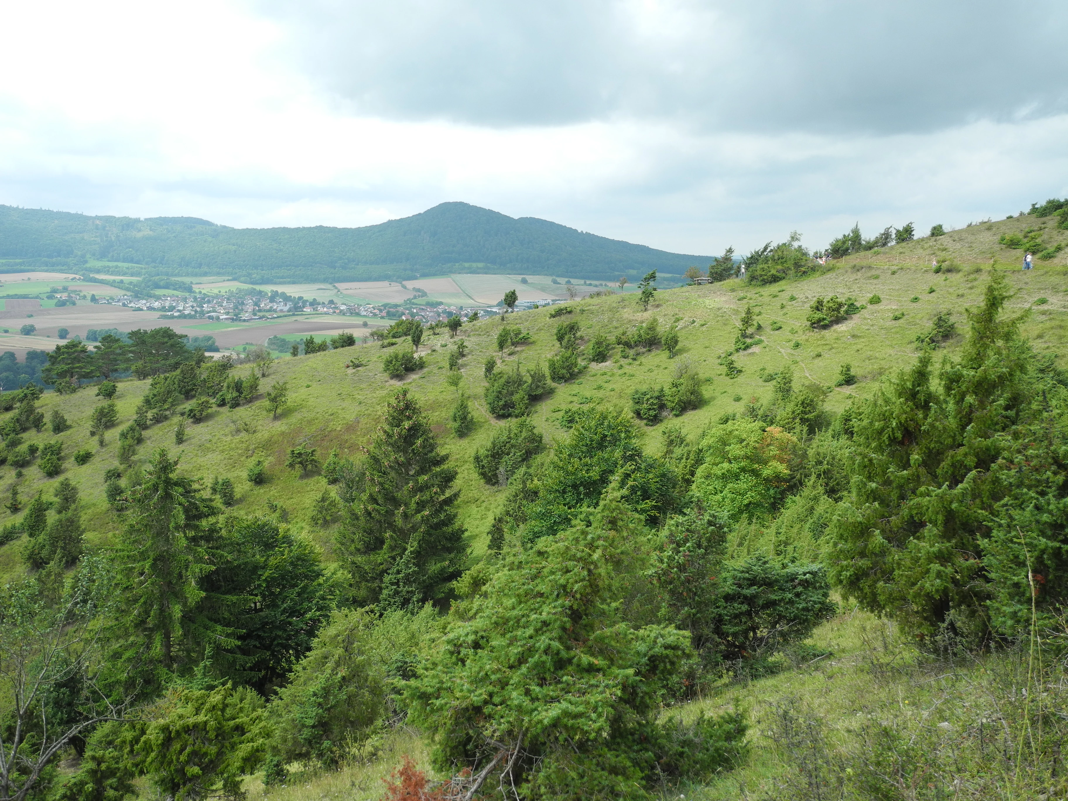
A wide landscape view of a green, grassy hillside dotted with juniper bushes and scattered trees under a cloudy sky.
Limestone grassland with juniper bushes on the slopes of the Dörnberg massif.

Dörnberg Nature Reserve history and protected-area timeline

The Dörnberg Nature Reserve was formally placed under protection in 1978, when the Hessian authorities designated the site with the official identifier 1633006. Its protected status was rooted in the recognition that centuries of traditional grazing had produced an exceptionally rich calcareous grassland landscape on the slopes around the Kleiner Dörnberg.

Through most of its documented history, the area was effectively open countryside, almost treeless until the early twentieth century. A small beech wood was planted on the northwestern slope in the mid-nineteenth century, and later large areas of the same slope were afforested with spruce. The conifer plantations of that later period were largely lost during the drought and bark beetle outbreaks between 2018 and 2020.

Early conservation work in the reserve focused on manual clearing to prevent shrubs from overtaking the grasslands through natural succession. Over time, management shifted toward grazing-based stewardship, reflecting an effort to preserve the historical land use that originally created the meadows.

The reserve's broader scientific context is documented in regional publications on Hessian protected areas, including contributions to a 2003 volume covering the Stadt Kassel, Landkreis Kassel, and Schwalm-Eder-Kreis areas.

Dörnberg Nature Reserve landscape and geographic character

The landscape of the Dörnberg Nature Reserve is shaped by the contrast between gentle surrounding lowlands and the steep slopes of the Dörnberg massif itself. The protected area rises from roughly 300 meters above sea level near its base to about 440 meters along the upper slopes, framing the basalt dome of the Kleiner Dörnberg in a characteristic crescent pattern.

The geology is dominated by Lower Muschelkalk limestone and marlstone, whose layered character creates the steep, erosion-prone slopes typical of the reserve. At the foot of the hill, softer Röt claystones form a gentler, rolling agricultural landscape that lies outside the protected boundary but contributes to the visual setting of the reserve.

A defining landscape feature within the reserve is the Wichtelkirche, a freestanding basalt crag that represents a weathered Miocene intrusion. This dark volcanic remnant stands notably apart from the surrounding pale limestone slopes, lending the reserve a distinct micro-topography and a recognizable focal point on the hillside.

Dörnberg Nature Reserve ecosystems, habitats, and plant life

Ecologically, the Dörnberg Nature Reserve is defined by its calcareous grasslands, a habitat type that has become increasingly rare and fragmented across central Europe. These open, sun-exposed meadows sit atop thin, nutrient-poor soils derived from Muschelkalk limestone, producing the conditions in which a disproportionately rich community of specialized plants can thrive.

The grassland vegetation is characterized by strong seasonal transitions, beginning with mass flowering of cowslip and early purple orchid in spring, followed by extensive stands of fragrant orchid later in the growing season. In autumn, fringed gentian species add a second distinctive flush of color to the meadows. Beyond these headline species, the reserve's grasslands support more than 200 fern and flowering plant species in total.

Forest cover is limited. The northwestern slope includes a small historical beech planting from the nineteenth century and areas once managed as spruce plantations, much of which was lost during the late 2010s drought and bark beetle outbreaks. Outside these planted stands, woodland plays only a minor role within the reserve itself.

Dörnberg Nature Reserve wildlife and species highlights

The wildlife character of the Dörnberg Nature Reserve is dominated by its invertebrate communities, which are closely tied to the warm, dry conditions of the calcareous grasslands. The reserve is documented as supporting twenty-nine endangered butterfly species, making it an important site for Lepidoptera conservation within Hesse.

The grasshopper fauna is similarly shaped by the dry, sun-exposed habitat. Among ten recorded grasshopper species, five are associated with xerothermic, or warm-dry, environments, reinforcing the reserve's identity as a refuge for warmth-loving grassland specialists. The mountain cicada, a species group recently split into several closely related small species, occurs frequently here, adding an acoustic element to the grassland habitat.

Vertebrate wildlife is less prominently documented, but the mosaic of open grassland, scattered shrubs, and small forest patches provides habitat for the typical range of species found in similar Hessian hillside landscapes.

Dörnberg Nature Reserve conservation status and protection priorities

The conservation significance of the Dörnberg Nature Reserve lies in its role as one of the more important refuges for calcareous grassland in northern Hesse. This habitat type, shaped over centuries by grazing, is highly valued for its botanical richness and for the specialized invertebrate communities it supports, but it depends on active management to prevent natural succession from converting open meadows into shrubland and woodland.

Designation in 1978 formalized long-standing recognition of the site's ecological value. The reserve's protection objectives focus on preserving the open grassland character, the rare plant populations such as Lothringen flax, and the assemblages of butterflies, grasshoppers, and other grassland invertebrates that depend on these conditions.

Management has evolved alongside the reserve's history. Manual scrub-cutting was the earliest conservation tool, but the current approach is built around seasonal grazing by a flock of roughly 500 sheep, supplemented at times by goats. This grazing strategy deliberately mirrors the historical land use that produced the grasslands in the first place, making the conservation effort both ecological and cultural in character.

The drought and bark beetle events of 2018 to 2020 also affected the reserve, killing large areas of spruce plantation on the northwestern slope and reshaping the site's forest composition, with implications for ongoing habitat management.

Dörnberg Nature Reserve cultural meaning and human context

The cultural character of the Dörnberg Nature Reserve is inseparable from its history of pastoral use. The open landscapes protected today were created through centuries of grazing, and the reserve's management approach deliberately preserves that agricultural legacy. The use of a roughly 500-head sheep flock, sometimes supplemented with goats, reflects a conscious effort to keep traditional land-use practices alive as a conservation tool.

Local naming traditions also leave traces in the landscape, with historical alternate names such as Blumenstein for the Wichtelkirche basalt crag reflecting older regional references. The site is documented in regional guidebooks on Hessian protected areas, including a 2003 publication by the Naturschutzring Nordhessen and the Philippi-Gesellschaft, indicating long-standing local interest in the area's natural heritage.

Top sights and standout views in Dörnberg Nature Reserve

Among the Dörnberg Nature Reserve's standout features, the calcareous grasslands with their twelve documented orchid species rank first, representing one of the more concentrated orchid communities in northern Hesse. The seasonal bloom sequence, from cowslip and early purple orchid in spring to fragrant orchid and fringed gentians later in the year, gives the reserve a strong temporal identity.

The Wichtelkirche basalt outcrop offers a second highlight, providing both a geological signature and a landscape focal point within the broader hillside setting. The reserve's combination of active grazing management, rare plant populations such as Lothringen flax, and a rich assemblage of endangered butterflies and xerothermic grasshoppers makes it a compact but unusually rich conservation site in the region.

Best time to visit Dörnberg Nature Reserve

Late spring is one of the most rewarding times to experience the Dörnberg Nature Reserve, when the calcareous grasslands come alive with the mass flowering of cowslip and early purple orchid. Early to mid summer brings the fragrant orchid displays and the peak activity of grassland insects, including many of the reserve's butterfly species.

Autumn offers a different character, with fringed gentians appearing across the meadows and the grazing flocks visible on the slopes. The reserve's hillsides and exposed grasslands are most atmospheric in clear weather, while the basalt outcrops and limestone slopes retain their geological character through most of the year, making the site broadly appealing across the warmer months.

Monthly climate preview

Examine measured monthly temperature swings and precipitation averages across the protected terrain.

Dörnberg Climate Normals and Long Term Temperature Patterns

Representative coordinates record annual temperature progression alongside steady monthly precipitation rates from long term NASA observations. Exploring the full twelve month profile reveals detailed weather by month data and comprehensive climate normals for Dörnberg.
Annual mean8 °C
-1 °C18 °C
Jan-1°
Feb
Mar
Apr
May12°
Jun16°
Jul18°
Aug18°
Sep14°
Oct
Nov
Dec
Warmest month
July

18 °C

Coolest month
January

-0.6 °C

Wettest month
July

2.5 mm/day

Driest month
April

1.5 mm/day

Park location guide

Geography guide, regional context, and park location map for Dörnberg Nature Reserve

Dörnberg Nature Reserve park geography, regions, and map view in Germany

Understand where Dörnberg Nature Reserve sits in Germany through a broader geographic reading of the surrounding landscape, nearby location context, and its mapped position within the national park landscape.

How Dörnberg Nature Reserve fits into Germany

Germany is a federal republic in Western and Central Europe with a population of over 83 million across sixteen constituent states. It is Europe's largest economy by nominal GDP and a major global exporter and importer. The capital is Berlin, and the country borders Denmark, Poland, Czech Republic, Austria, Switzerland, France, Luxembourg, Belgium, and the Netherlands.

Wider geography shaping Dörnberg Nature Reserve in Germany

Germany is located in Western and Central Europe, spanning 357,022 km². It borders Denmark to the north, Poland and the Czech Republic to the east, Austria and Switzerland to the south, and France, Luxembourg, Belgium, and the Netherlands to the west. The country has coastlines on the Baltic Sea and North Sea to the north, with the Alps located in the southern region.

Map view of Dörnberg Nature Reserve

Use this park location map to pinpoint Dörnberg Nature Reserve in Germany, understand its exact geographic position, and read its mapped placement within the surrounding landscape more clearly.

Pigeon | © OpenStreetMap contributors

Location context for Dörnberg Nature Reserve

HessenLandkreis Kassel

Examine limestone slopes, basalt crags, and protected orchid habitats in central Germany

Dörnberg Photos and Landscape Scenery Visual Exploration

Visual documentation captures the dramatic contrast between steep limestone escarpments and dark volcanic basalt intrusions across the protected massif. Detailed field photography reveals the rare calcareous grasslands and specialized botanical communities that define the conservation landscape.

A wide landscape view of a green, grassy hillside dotted with juniper bushes and scattered trees under a cloudy sky.

Park atlas

Compare regional conservation areas and nearby limestone terrain

Explore Other Parks Near Dörnberg and Surrounding Protected Landscapes

Browse protected areas and national parks located near Dörnberg to examine surrounding regional geography and similar calcareous grassland habitats. Comparing adjacent reserves helps reveal broader ecological patterns across central Germany and the Landkreis Kassel district.
A horizontal watercolor painting showing a soft, hazy landscape with green hills, patches of grass, and purple-tinted distant mountains under a white sky.
Nature reserveLandkreis Kassel
About 3.8 km away#1 closest

East

Keischel bei Weimar: Nature Reserve Protected Area and Regional Geography

A calcareous grassland mosaic in the Landkreis Kassel district

Keischel bei Weimar preserves a 19.7-hectare landscape defined by Muschelkalk limestone bedrock and traditional agricultural practices. This nature reserve serves as a critical refuge for specialized flora and insect species, showcasing the value of integrated land management within the broader West Hessian Depression and northern Hesse regional geography.

Area
0.197 km²
Established
1992
Relief
Upland
Climate
Temperate
Watercolor painting of a rolling forested landscape with distant hills under a soft light.
Nature reserveHesse
About 4.3 km away#2 closest

South

Erlebach bei Ehlen Nature Reserve: Protected Terrain and Brook Valley Geography in Hesse

Mapped beech forest mosaic and riparian habitat corridors

Located in the Hoher Habichtswald, Erlebach bei Ehlen preserves a distinctive transition between mature beech forest and open grassland valley. This nature reserve serves as an essential case study for understanding riparian ecology, stream-side woodland distribution, and habitat connectivity within the regional topography of Hesse, Germany.

Area
0.342 km²
Established
1996
A soft watercolor illustration of a winding stream flowing through a green meadow with rolling hills in the background and a small cluster of pine trees in the foreground.
Nature reserveHessen
About 7.9 km away#3 closest

Northeast

Jungfernbach und Brandteich bei Calden: Protected Forest and Stream Valley Geography

Regional nature reserve landscape located in northern Hessen

Examine the mapped boundaries and natural terrain of Jungfernbach und Brandteich bei Calden. This nature reserve offers a detailed look at lowland stream corridors, pond ecosystems, and riparian forest patches nestled within the rolling landscape of northern Hessen, reflecting the region's diverse protected land character.

Area
0.343 km²
Established
1985
A soft watercolor painting depicting rolling green hills against a faint, light-colored background.
Nature reserveHessen
About 8.1 km away#4 closest

West

Festberg bei Philippinenthal Nature Reserve: Geography and Protected Landscape Context

A rare calcareous grassland ecosystem in northern Hessen.

Festberg bei Philippinenthal encompasses a ridge of tilted Muschelkalk limestone rising above the Lohbach stream in Hessen. This nature reserve protects a vital combination of juniper heath, dry calcareous grassland, and small-scale forest habitats maintained by historic and modern conservation grazing, offering a clear example of local geology shaping biodiversity.

Area
0.143 km²
Established
1992
IUCN
IV
A watercolor painting in soft pastel tones showing a winding river or path flanked by small clusters of green trees, with gently rolling hills in the background against a white backdrop.
Nature reserveKassel
About 9.1 km away#5 closest

Southeast

Dönche Nature Reserve: Investigating the Protected Landscapes and Urban Geography of Kassel

Exploring the historic grassland and wetland mosaic in northern Hesse

Dönche serves as a primary example of an inner-city nature reserve in Germany, preserving 170 hectares of open countryside within the Kassel urban fabric. Its landscape is shaped by the Dönchebach and Krebsbach streams, forming a rhythmic structure of ponds, beech wood pastures, and tall herb communities that offer a deep look into regional ecology and historical land use.

Area
1.709 km²
Established
1983
Water
Minor water
Watercolor painting of a soft, rolling landscape with green fields, distant hills, and low foreground vegetation.
Protected areaGermany
About 9.6 km away#6 closest

South

Langenberger Huete bei Breitenbach: Mapped Geography and Protected Area Landscape Context

Nature reserve terrain and grassland boundaries in northern Hesse

Examine the geographic layout of Langenberger Huete bei Breitenbach, a protected dry grassland area near Schauenburg, Germany. This site preserves open meadow habitats along the forested Langenberg ridge, offering insight into traditional land use and small-scale conservation within the Habichtswald region. Access detailed boundary data and terrain information to understand its position within the surrounding agricultural and woodland zones.

Area
0.14 km²
Established
1992
Relief
Upland
Climate
Temperate
Watercolor painting of a calm wetland landscape with soft green trees along the water edge under a light, misty sky.
Nature reserveHessen
About 10 km away#7 closest

Northeast

Rothenberg bei Burguffeln Protected Wetland Landscape and Nature Reserve in Hessen

A specialized pond and meadow mosaic in the Hessian lowlands

Rothenberg bei Burguffeln preserves a vital wetland complex near Immenhausen, structured across three distinct sections, including the Rothenküler Teich and Tonkaule. The area represents a significant example of culturally shaped lowland geography, blending historic aquaculture with contemporary habitat management. Its protected status reflects a commitment to maintaining intricate riparian corridors and meadow ecosystems within the wider Hessian countryside.

Area
0.278 km²
Established
1983
A watercolor painting showing a soft, panoramic view of rolling green hills, lush vegetation, and water, with a light and airy artistic style.
Nature reserveHesse
About 11 km away#8 closest

North

Meßhagen bei Niedermeiser Nature Reserve: Protected Landscape and Regional Geography

A mapped conservation site in the woodlands of Northern Hesse

Meßhagen bei Niedermeiser represents a key nature reserve in Northern Hesse, characterized by its transition between old beech forest and managed calcareous grasslands. This protected area, part of the wider Kelzer Holz network, provides a study in managed habitat succession, where meadow flora and invertebrate populations thrive in the intersection of open terrain and dense woodland edges.

Area
0.546 km²
Established
1996
Relief
Upland
Climate
Temperate

Common questions about visiting, size, designation, and location context for Dörnberg Nature Reserve

Dörnberg Nature Reserve FAQs for park facts, access, geography, and protected area context

Find quick answers about Dörnberg Nature Reserve, including protected-area facts, park geography, trail and visitor context, and how the park fits into its surrounding country and regional landscape.
MoriAtlas Explorer

Continue Your Protected Areas Search Across the Global Atlas

Deepen your exploration by continuing the structured search for national parks and protected areas worldwide. Utilize the comprehensive filtering capabilities to compare different conservation landscapes and refine your understanding of global park geography. Discover more about the distribution and characteristics of protected natural areas.

Global natural geography