
Mori Atlas logo
Nature reserveRothenberg bei Burguffeln

A structured geographic overview of medieval fish ponds and integrated wetland mosaic habitats

Rothenberg bei Burguffeln Nature Reserve and Protected Wetland Landscape in Hessen, Germany

(Naturschutzgebiet Rothenberg bei Burguffeln)

Rothenberg bei Burguffeln comprises a compact, ecologically dense protected area in northern Hessen, defined by a series of medieval fish ponds and modern conservation wetlands. The reserve covers roughly 28 hectares, tracing the lowland floodplain of the Esse stream and the lower slopes of the Rothenberg hill. This diverse terrain integrates reedbeds, sedge marshes, and alluvial woodland into a mosaic that serves as a vital habitat for waterbirds, dragonflies, and various amphibian species.

pond landscapefish pondsreedbedssedge marsheswet meadowsalluvial woodland
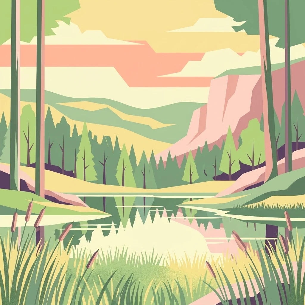
A graphic illustration showing a tranquil landscape with a still pond in the foreground, surrounded by tall grasses and cattails. A forest of pine trees occupies the midground, with rolling hills and a light orange sunset sky in the background.

Rothenberg bei Burguffeln

Nature reserve

Park overview

Structured park overview, official facts, and landscape profile for Rothenberg bei Burguffeln

Rothenberg bei Burguffeln park facts, protected area profile, and essential visitor context

Review the core facts for Rothenberg bei Burguffeln, including designation, size, terrain, visitor scale, habitats, and operating context in one park-focused overview.

About Rothenberg bei Burguffeln

Rothenberg bei Burguffeln sits in the gently rolling countryside of northern Hesse, just west of Immenhausen and within the municipal area of the small town of Grebenstein. The landscape here is defined by the Esse, a stream in the Diemel river system, and by a small tributary that joins it near the Rothenberg hill. The nature reserve hugs the lowland floodplain of this watercourse and reaches partway up the lower slopes of the hill, producing a setting where open water, marsh, grassland, and woodland fragments lie in close contact with surrounding farmland.

The reserve is made up of three discrete sections arranged roughly from south to north. The southernmost and largest is the Rothenküler Teich area, the middle section is known as the Tonkaule, and the smallest is the Lindenmühle area in the north. Each section centers on one or more ponds, and together they define the protected landscape's character. Two of the larger ponds, including the Rothenküler Teich, have medieval origins and were historically operated as fish ponds, an agricultural past that is still legible in their embankments and water management structures. By contrast, the smaller ponds in the Lindenmühle section and a small pond at Tonkaule were created in 1983 as deliberate conservation measures to extend the wetland habitat.

Beyond the open water, the reserve is shaped by what grows around and between the ponds. Reedbeds, large sedge marshes dominated by the swamp sedge, and tall-herb vegetation fringe many of the waterbodies, grading into wet meadows and small patches of moist grassland. Where the terrain rises onto the lower slopes of the Rothenberg, alder woods, including a near-complete cover of black alder around the Lindenmühle ponds and a fragmentary willow gallery near the Rothenküler Teich, close the habitat mosaic from above. The whole complex sits in a working agricultural landscape, and most sections of the reserve are bordered by cultivated fields and meadows, an arrangement that gives the protected area a strong edge character between intensively used land and ecologically valuable wetland.

Ecologically, Rothenberg bei Burguffeln is far richer than its modest size suggests. It is documented as a breeding and habitat area for waterbirds such as marsh harrier, mute swan, coot, water rail, little grebe, reed bunting, marsh warbler, and reed warbler, and it supports amphibians including northern crested newt, alpine newt, palmate newt, smooth newt, pool frog, common frog, and common toad. The pond margins are rich in dragonflies, including several hawker, emerald, and damselfly species, and the surrounding grasslands host a characteristic community of meadow butterflies. The combination of medieval ponds, deliberately created water bodies, reed and sedge vegetation, and small woodland fragments has turned this small reserve into a representative example of lowland Hessian pond landscapes, which is reflected in its dual designation as a national nature reserve and an EU Habitats Directive site.

Quick facts and research context for Rothenberg bei Burguffeln

Rothenberg bei Burguffeln is a combined nature reserve (Naturschutzgebiet) and EU Flora-Faura-Habitat site (FFH-Gebiet) in the Landkreis Kassel in northern Hesse. It lies west of Immenhausen, administratively within the town of Grebenstein, and centers on pond and wetland systems in the lower Esse valley at the foot of the Rothenberg hill. The protected area is approximately 28 hectares overall, with roughly the same footprint recognized at the European level. Protection has been in force since 9 August 1983, and the site is catalogued under the German nature reserve number 1633011 and the Natura 2000 site code 4522-302.

Protection and recognition

Explore documented conservation listings and official Natura 2000 recognition records.

Rothenberg bei Burguffeln Protection Status and Designated Area Recognition

Examine official protected area designation records and international recognition sources assigned to Rothenberg bei Burguffeln. Review documented Natura 2000 listings and registered database identifiers that establish the conservation status of the territory.

International recognition

Protection details

WDPA ID
82452
Park context

Deeper park guide and search-rich context for Rothenberg bei Burguffeln

Rothenberg bei Burguffeln history, landscape, wildlife, and travel context

Explore Rothenberg bei Burguffeln through its history, landscape character, ecosystems, wildlife, conservation priorities, cultural context, and seasonal travel timing in a structured park guide built for atlas discovery and search intent.

Why Rothenberg bei Burguffeln stands out

Rothenberg bei Burguffeln is best known for its medieval fish ponds and the surrounding wetland complexes that have developed around them. The reserve is unusual in bringing together centuries-old aquaculture heritage and active ecological management within a single protected landscape. The three-part structure of the area, combining the large Rothenküler Teich and Tonkaule ponds with the smaller Lindenmühle section, gives the reserve a strong identity as a pond-and-reedbed landscape. Its additional value lies in supporting rich communities of waterbirds, amphibians, dragonflies, and grassland butterflies in a small but intensively structured setting that has been formally protected for decades.
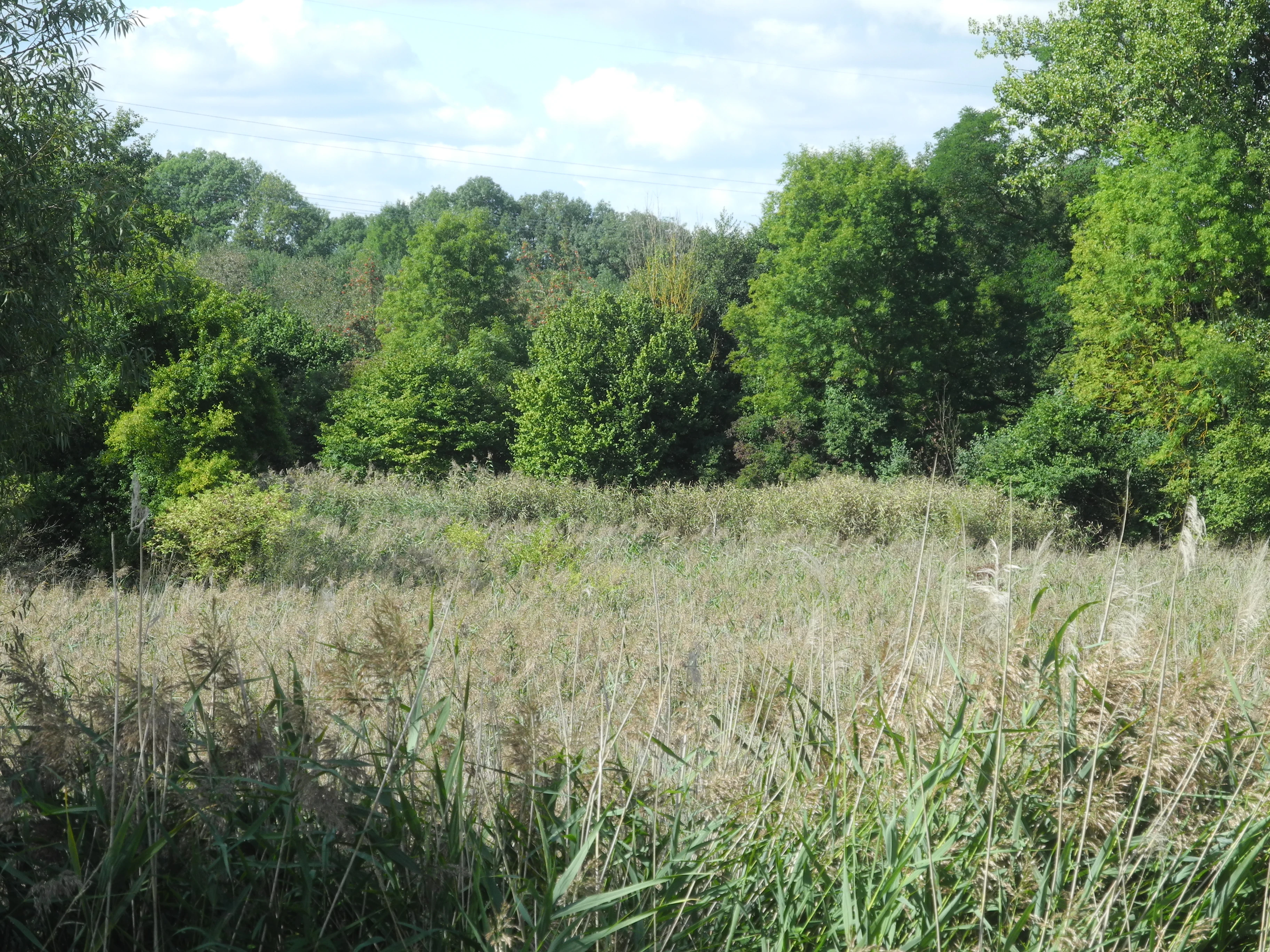
A view of a wetland pond area surrounded by dense green trees and tall grasses under a partly cloudy sky.
The Tonkaule pond and surrounding wetland habitat in the Rothenberg bei Burguffeln nature reserve.

Rothenberg bei Burguffeln history and protected-area timeline

The landscape of Rothenberg bei Burguffeln carries a long human history that is still visible in its water bodies. The larger ponds at the heart of the reserve, including the Rothenküler Teich and the larger ponds in the Tonkaule section, are of medieval origin and were originally developed and maintained as fish ponds. Their embankments and hydrological structure reflect centuries of aquaculture use, and the ponds have shaped both the ecological character and the cultural identity of the area for generations.

Modern nature conservation at the site began formally on 9 August 1983, when the area was designated as the Naturschutzgebiet Rothenberg bei Burguffeln under the Hessian nature protection framework. At the same time, additional smaller ponds were created in the Lindenmühle section and at Tonkaule as part of deliberate habitat creation measures associated with the protection declaration, extending the wetland habitat beyond the historical fish ponds. In parallel, the area was included in the European Union's Natura 2000 network as a Flora-Fauna-Habitat site under the Habitats Directive, recognizing its value at the continental level and giving it a parallel designation as an FFH-Gebiet alongside its national protection status.

Since designation, the reserve has been the subject of formal ecological surveys and management planning under the oversight of the Regierungspräsidium Kassel, including a baseline Flora-Fauna-Habitat survey in 2006 and a subsequent management plan component published in 2016. These documents have guided ongoing conservation of the ponds, reedbeds, sedge communities, and adjacent woodland fragments, anchoring the site's modern history in active habitat management rather than passive protection.

Rothenberg bei Burguffeln landscape and geographic character

The landscape of Rothenberg bei Burguffeln is shaped by a small but well-defined valley system at the foot of the Rothenberg hill. The lowest part of the reserve follows the floodplain of the Esse, a tributary of the Diemel, and the lower reaches of a side stream that feeds into it. This lowland setting produces a flat to gently sloping terrain where water collects, soils are seasonally or permanently wet, and natural pond basins have long been used and modified by human activity.

Above the wet lowland, the reserve extends onto portions of the lower slopes of the Rothenberg itself. Here the terrain rises slightly, supporting drier conditions that allow woodland to develop. The combination of low-lying pond land, gently sloping wetland margins, and the steeper, wooded flanks of the hill gives the small protected area a surprisingly varied relief for its size. From south to north, the three sections, Rothenküler Teich, Tonkaule, and Lindenmühle, follow this topographic sequence, with the largest pond landscapes in the south and progressively smaller, more enclosed water bodies to the north.

The visual impression of the reserve is one of intimate wetland scenery framed by farmland. Open water surfaces are bordered by reed margins, sedge marshes, and tall-herb vegetation, giving way to wet meadows and finally to alder and willow woods on the slopes. Beyond the reserve boundary, agricultural fields and pastures take over, so the protected landscape reads as a clearly delimited green and blue mosaic set within an otherwise cultivated working countryside.
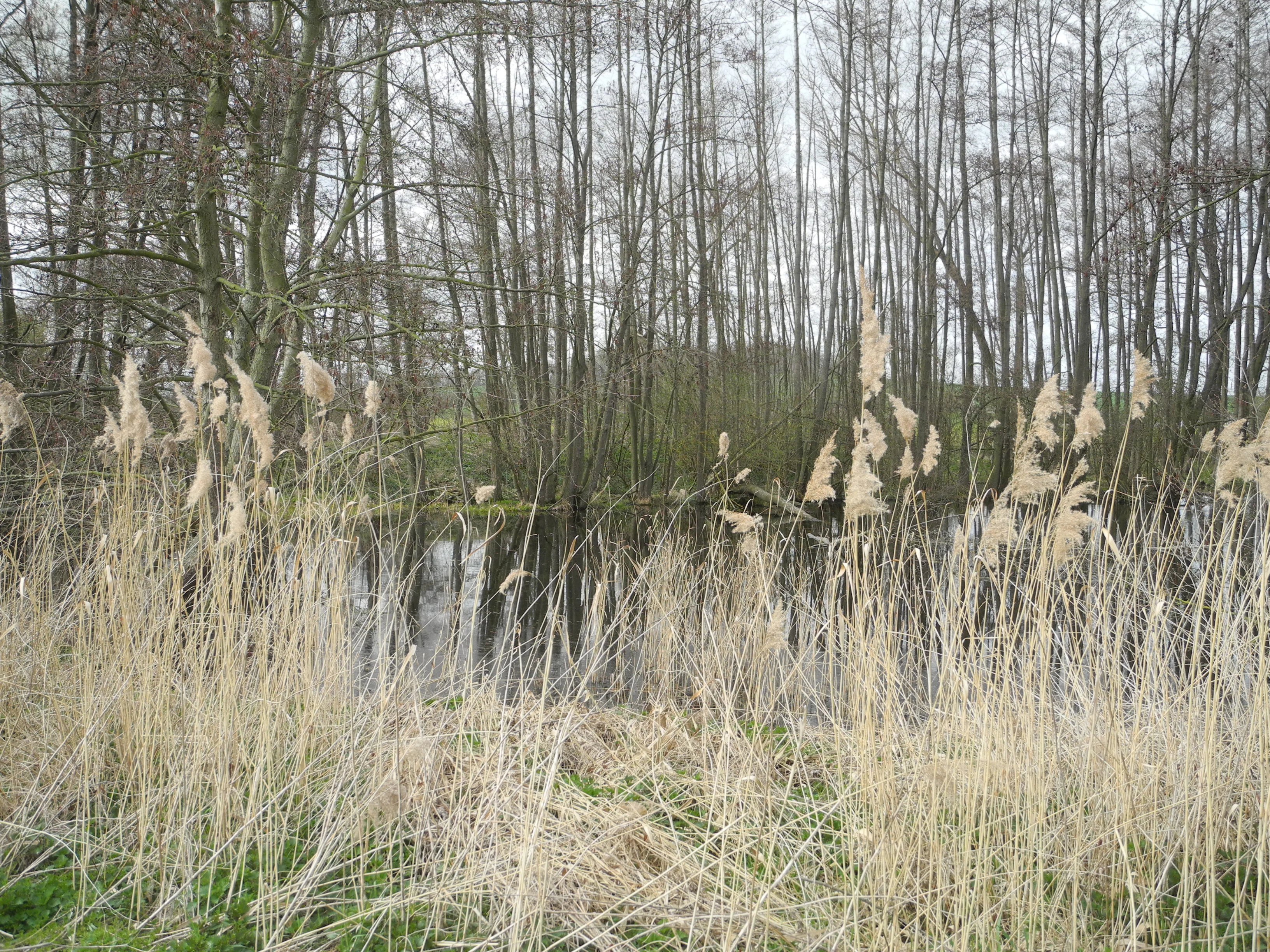
A view across a small pond surrounded by a dense thicket of bare deciduous trees, with tall dry reeds and grasses in the foreground.
The Lindenmühle pond in the Rothenberg bei Burguffeln nature reserve.

Rothenberg bei Burguffeln ecosystems, habitats, and plant life

Ecologically, Rothenberg bei Burguffeln is a compact lowland wetland reserve whose value rests on the diversity of habitats packed into a small area. Ponds of medieval and modern origin anchor the system, and their margins are lined with extensive reedbeds, large sedge marshes, and tall-herb marsh communities that together form the richest part of the protected mosaic. Water sedge dominates many of the sedge stands, accompanied by marsh horsetail, water knotweed, and broad-leaved bulrush in the wetter transitions between open water and land.

Around the ponds and marshes, the reserve includes patches of wet meadow and other moist grassland, which introduce a different floral character. Species such as broad-leaved marsh orchid, Deptford pink, tower mustard, couch grass, nipplewort, ragwort, and small bindweed contribute to the grassland communities, depending on local soil moisture and management. Where the slopes rise toward the Rothenberg, woodland takes over. The Lindenmühle section is notable for being almost entirely enclosed by alder forest in which black alder is the dominant tree, while only a fragmentary willow gallery remains around parts of the Rothenküler Teich, reflecting the more exposed, historically managed character of that pond.

The structural richness of these habitats, layering open water, reed and sedge marsh, wet meadow, and alder or willow woodland, is what gives nature conservation value to the reserve well beyond its size. Each habitat supports different groups of species, and the close proximity of wet and slightly drier conditions allows the site to maintain ecological gradients unusual for such a small protected area.
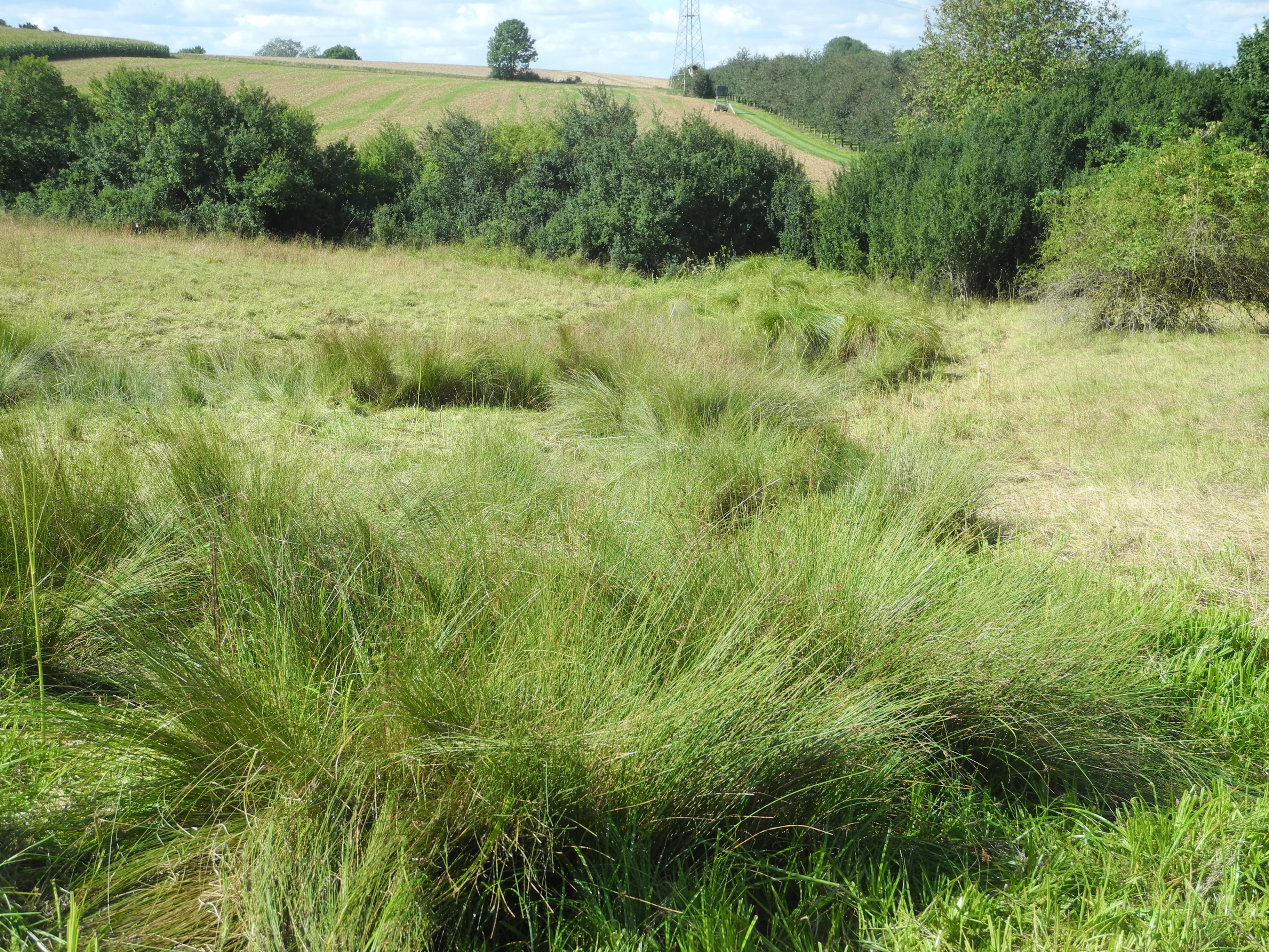
A green meadow with tall grasses and shrubs, backed by rolling hills and trees in the Rothenberg bei Burguffeln nature reserve.
A view of the wetland and meadow landscape at the Tonkaule site within the Rothenberg bei Burguffeln nature reserve.

Rothenberg bei Burguffeln wildlife and species highlights

Wildlife is one of the strongest elements of Rothenberg bei Burguffeln's profile. The reserve is documented as breeding habitat for a varied community of waterbirds associated with reeds and open water, including marsh harrier, mute swan, coot, water rail, little grebe, reed bunting, marsh warbler, and reed warbler. These species together indicate a functioning pond-and-reedbird community rather than just occasional visitors.

Amphibians are well represented, with breeding populations of northern crested newt, alpine newt, palmate newt, and smooth newt recorded in and around the ponds, alongside pool frog, common frog, and common toad. The combination of newts and frogs points to ponds that maintain good water quality and appropriate marginal vegetation through at least part of the year. Dragonflies are particularly diverse, with the reserve hosting species such as the emperor dragonfly, the downy emerald, the blue-tailed damselfly, the early damselfly, the spreadwing damselfly, the common blue damselfly, and a species of baskettail, taking advantage of the range of pond sizes and reed cover.

On the drier margins, the grasslands and tall-herb vegetation support a characteristic community of meadow and edge butterflies, including red admiral, orange tip, comma, painted lady, meadow brown, small heath, small copper, small tortoiseshell, pearl-bordered fritillary, and marbled white. The presence of both wetland and dry-grassland fauna in close proximity is unusual for a site of this size and is one of the main reasons for the area's broader ecological recognition.

Rothenberg bei Burguffeln conservation status and protection priorities

Rothenberg bei Burguffeln has a layered conservation status that reflects both its national and its European importance. At the German level, it has been a designated Naturschutzgebiet since 9 August 1983, giving it the strongest form of area protection available under Hessian nature conservation law. At the European level, the area is part of the Natura 2000 network as a Flora-Fauna-Habitat site under the Habitats Directive, with the vast majority of its territory recognized as habitat of community interest.

The conservation significance of the reserve lies in the combination of habitats it preserves in close proximity: medieval fish ponds with their reed and sedge margins, modern conservation ponds, wet meadows, and fragments of alluvial woodland on the slopes of the Rothenberg. These elements together represent a culturally shaped but ecologically valuable lowland wetland system that has become increasingly rare in intensively farmed parts of central Germany. Maintaining this mosaic requires ongoing water and vegetation management, supported by formal baseline surveys and management plans prepared by the Regierungspräsidium Kassel.

The reserve also plays a role in the broader conservation networks of northern Hesse. It links, in ecological terms, to other wetland and pond reserves in Landkreis Kassel, and the surrounding agricultural landscape creates both pressures and opportunities for maintaining the protected habitat mosaic. Its formal recognition at both Hessian and EU levels underlines that the value of Rothenberg bei Burguffeln extends well beyond its modest size.

Rothenberg bei Burguffeln cultural meaning and human context

The cultural context of Rothenberg bei Burguffeln is closely tied to its medieval fish ponds and to the long-standing agricultural use of the Esse valley. The larger ponds at the heart of the reserve were developed and maintained for fish production over many centuries, embedding the site in the regional tradition of pond management that shaped much of the Hessian and Lower Saxon lowlands. The surviving embankments and water management features of these ponds remain visible in the modern landscape and form part of the area's local heritage.

The later deliberate creation of additional ponds in 1983 reflects a shift from purely productive use toward conservation-oriented landscape management. Together, the medieval ponds and modern conservation ponds illustrate a transition from historical fish farming to active habitat creation, with the surrounding agricultural community still working fields and pastures that border the protected area. The small town of Grebenstein, in whose territory the reserve lies, and the nearby town of Immenhausen, west of which the reserve is located, define the immediate regional setting for this small but culturally rich protected landscape.

Top sights and standout views in Rothenberg bei Burguffeln

Three connected pond sections, Rothenküler Teich, Tonkaule, and Lindenmühle, form the structural backbone of the reserve and give it a clear, easy-to-grasp layout for visitors and researchers alike. The contrast between medieval fish ponds and ponds deliberately created in 1983 for conservation adds a distinctive historical-management dimension to the site. Surrounding reedbeds, sedge marshes, wet meadows, and alder woodland turn these water bodies into a richly layered wetland mosaic within a small footprint.

Ecologically, the reserve is a strong example of how a very small protected area can support unusually diverse communities of waterbirds, amphibians, dragonflies, and butterflies if its habitat structure is right. Its dual status as a Hessian Naturschutzgebiet and an EU Flora-Fauna-Habitat site confirms that Rothenberg bei Burguffeln is recognized not just locally but at the European scale for its wetland and pond habitat value.

Best time to visit Rothenberg bei Burguffeln

Rothenberg bei Burguffeln is a small wetland reserve whose character changes through the year mainly through its vegetation and visible wildlife. Late spring and early summer tend to bring out the full development of the reedbeds, tall-herb marsh, and wet meadows, and are also the period when waterbird, amphibian, and dragonfly activity around the ponds is at its most visible. Reedbed-nesting species and breeding amphibians are most readily experienced during this season.

In late summer and early autumn, the reed and sedge communities are at their most visually prominent, with seeding grasses and herbs creating a dense, golden-green appearance at the pond margins. Dragonflies remain active in warm weather, and butterfly diversity on the surrounding grassland edges is often at its peak in this period. Winter generally brings a quieter, more open atmosphere, with reduced vegetation cover making the structure of the ponds and embankments easier to see, while some waterbirds remain on the unfrozen water bodies where conditions allow. As a working agricultural landscape surrounding a small protected reserve, the site is best experienced quietly, on foot, and in tune with the rhythm of the seasons rather than at any fixed calendar moment.

Monthly climate preview

Long term monthly averages for temperature and precipitation patterns in Hessen

Rothenberg bei Burguffeln Climate Normals and Annual Temperature Rhythm

Representative point measurements from 1991 to 2020 record the measured annual temperature and precipitation rhythm across twelve distinct monthly intervals for Rothenberg bei Burguffeln. Examining the complete monthly climate normals provides deeper insight into long term weather by month variations and average temperature ranges.
Annual mean8 °C
-1 °C18 °C
Jan-1°
Feb
Mar
Apr
May12°
Jun16°
Jul18°
Aug18°
Sep14°
Oct
Nov
Dec
Warmest month
July

18 °C

Coolest month
January

-0.6 °C

Wettest month
July

2.5 mm/day

Driest month
April

1.5 mm/day

Park location guide

Geography guide, regional context, and park location map for Rothenberg bei Burguffeln

Rothenberg bei Burguffeln park geography, regions, and map view in Germany

Understand where Rothenberg bei Burguffeln sits in Germany through a broader geographic reading of the surrounding landscape, nearby location context, and its mapped position within the national park landscape.

How Rothenberg bei Burguffeln fits into Germany

Germany is a federal republic in Western and Central Europe with a population of over 83 million across sixteen constituent states. It is Europe's largest economy by nominal GDP and a major global exporter and importer. The capital is Berlin, and the country borders Denmark, Poland, Czech Republic, Austria, Switzerland, France, Luxembourg, Belgium, and the Netherlands.

Wider geography shaping Rothenberg bei Burguffeln in Germany

Germany is located in Western and Central Europe, spanning 357,022 km². It borders Denmark to the north, Poland and the Czech Republic to the east, Austria and Switzerland to the south, and France, Luxembourg, Belgium, and the Netherlands to the west. The country has coastlines on the Baltic Sea and North Sea to the north, with the Alps located in the southern region.

Map view of Rothenberg bei Burguffeln

Use this park location map to pinpoint Rothenberg bei Burguffeln in Germany, understand its exact geographic position, and read its mapped placement within the surrounding landscape more clearly.

Pigeon | © OpenStreetMap contributors

Location context for Rothenberg bei Burguffeln

Hessen

Visual exploration of medieval fish ponds, reedbeds, and protected habitats in northern Hesse

Rothenberg bei Burguffeln Landscape Photos and Wetland Scenery

Visual records capture the distinctive pond landscapes, reed margins, and wetland mosaics that define the protected area. Examining terrain and habitat imagery reveals how centuries of water management shaped the local ecosystem.

A view of a wetland pond area surrounded by dense green trees and tall grasses under a partly cloudy sky.

A calm, still pond surrounded by dense green forest and lush shoreline vegetation.

A view across a small pond surrounded by a dense thicket of bare deciduous trees, with tall dry reeds and grasses in the foreground.

A green meadow with tall grasses and shrubs, backed by rolling hills and trees in the Rothenberg bei Burguffeln nature reserve.

Park atlas

Compare regional protected areas and neighboring wetland reserves across northern Hesse

Parks Near Rothenberg bei Burguffeln and Other Protected Landscapes to Explore Next

Browsing parks near Rothenberg bei Burguffeln reveals similar lowland reserves and valley habitats throughout the surrounding district of Kassel. Expanding the geographic comparison highlights interconnected wetland mosaics and protected natural spaces across the Hessian region.
A soft watercolor illustration of a winding stream flowing through a green meadow with rolling hills in the background and a small cluster of pine trees in the foreground.
Nature reserveHessen
About 2.7 km away#1 closest

Southwest

Jungfernbach und Brandteich bei Calden: Protected Forest and Stream Valley Geography

Regional nature reserve landscape located in northern Hessen

Examine the mapped boundaries and natural terrain of Jungfernbach und Brandteich bei Calden. This nature reserve offers a detailed look at lowland stream corridors, pond ecosystems, and riparian forest patches nestled within the rolling landscape of northern Hessen, reflecting the region's diverse protected land character.

Area
0.343 km²
Established
1985
A soft watercolor illustration showing a band of green trees reflecting in calm water, with a light hilly background.
Nature reserveHessen
About 3.9 km away#2 closest

East

Bennhäuser Teich und Rothbalzer Teich bei Immenhausen: Protected Nature Reserve and Landscape Atlas

Mapped woodland and wetland habitats in Hessen, Germany.

This nature reserve centers on historic impoundment ponds and complex valley hydrology. Its landscape features rare dragonfly habitats and successional carr woodlands that define the ecological identity of this protected area within the northern Hessen countryside.

Area
0.315 km²
Established
1998
Nature reserveHesse
About 5.2 km away#3 closest

Northwest

Kelzer Teiche Nature Reserve: Mapped Geography and Protected Wetland Boundaries in Hesse

A historic managed fishpond landscape in the Kassel region of northern Germany.

Kelzer Teiche encompasses 18.5 hectares of lowland countryside defined by its twin fishponds and fringe habitats. This nature reserve plays a recognizable role in the regional network of protected sites in Hesse, offering essential shelter for reed dwelling and migratory birds within a broader agricultural setting.

Area
0.185 km²
Established
1977
Water
Major water bodies
A horizontal watercolor painting showing a soft, hazy landscape with green hills, patches of grass, and purple-tinted distant mountains under a white sky.
Nature reserveLandkreis Kassel
6.3 km away#4 closest

Southwest

Keischel bei Weimar: Nature Reserve Protected Area and Regional Geography

A calcareous grassland mosaic in the Landkreis Kassel district

Keischel bei Weimar preserves a 19.7-hectare landscape defined by Muschelkalk limestone bedrock and traditional agricultural practices. This nature reserve serves as a critical refuge for specialized flora and insect species, showcasing the value of integrated land management within the broader West Hessian Depression and northern Hesse regional geography.

Area
0.197 km²
Established
1992
Relief
Upland
Climate
Temperate
A watercolor painting showing a soft, panoramic view of rolling green hills, lush vegetation, and water, with a light and airy artistic style.
Nature reserveHesse
About 7.1 km away#5 closest

Northwest

Meßhagen bei Niedermeiser Nature Reserve: Protected Landscape and Regional Geography

A mapped conservation site in the woodlands of Northern Hesse

Meßhagen bei Niedermeiser represents a key nature reserve in Northern Hesse, characterized by its transition between old beech forest and managed calcareous grasslands. This protected area, part of the wider Kelzer Holz network, provides a study in managed habitat succession, where meadow flora and invertebrate populations thrive in the intersection of open terrain and dense woodland edges.

Area
0.546 km²
Established
1996
Relief
Upland
Climate
Temperate
A soft watercolor illustration depicting a green, marshy landscape with small pools of water, a line of forest, and rolling hills in the background under a pale sky.
Nature reserveHesse
About 7.6 km away#6 closest

East

Bruch an der Eichkanzel im Reinhardswald: Protected Nature Reserve Geography in Hesse

Mapped birch swamp forests and highland bog terrain

Examine the geographic profile of Bruch an der Eichkanzel im Reinhardswald, a nature reserve in Hesse defined by its upland plateau. Learn about the interaction between its birch swamp forests and open moorland habitats, characterized by sphagnum mosses and aquatic features, within the broader context of the Reinhardswald forest region.

Area
0.175 km²
Established
1992
Relief
Upland
Scope
Terrestrial
A soft watercolor painting of rolling green and yellow hills under a clear sky, featuring sparse shrubbery and a gentle, layered horizon.
Nature reserveHessen
7.8 km away#7 closest

Northwest

Mittelberg bei Hofgeismar: Nature Reserve and Protected Calcareous Grassland Site

A high-quality conservation landscape located in northern Hessen, Germany.

This nature reserve protects an ecologically rich slope habitat west of Hofgeismar. Defined by its sun-exposed calcareous soil and dry grassland, the site supports ten orchid species and a diverse assemblage of Red List butterflies. It stands as a textbook example of a small, high-density biodiversity hotspot embedded within the broader agricultural geography of the Kassel district.

Area
0.432 km²
Established
1991
Relief
Upland
Climate
Temperate
A horizontal watercolor illustration depicting rolling green hills, patches of forest, and a calm river in the foreground, rendered in soft, pastel tones.
Nature reserveHesse
About 7.9 km away#8 closest

Southeast

Kragenhof bei Fuldatal Nature Reserve: Mapped Floodplain Landscapes in Hesse, Germany

Protected riparian ecosystems and river meander geography

Located in the state of Hesse, Kragenhof bei Fuldatal is a significant nature reserve protecting a complex mosaic of Fulda River floodplain habitats. The area features shifting currents, small wooded islands, and open grassland within a distinctive meander-driven landscape. Explore the geographic boundaries and ecological structure of this important regional waterbird refuge.

Area
0.077 km²
Established
1981

Common questions about visiting, size, designation, and location context for Rothenberg bei Burguffeln

Rothenberg bei Burguffeln FAQs for park facts, access, geography, and protected area context

Find quick answers about Rothenberg bei Burguffeln, including protected-area facts, park geography, trail and visitor context, and how the park fits into its surrounding country and regional landscape.
MoriAtlas Explorer

Continue Your Protected Areas Search Across the Global Atlas

Deepen your exploration by continuing the structured search for national parks and protected areas worldwide. Utilize the comprehensive filtering capabilities to compare different conservation landscapes and refine your understanding of global park geography. Discover more about the distribution and characteristics of protected natural areas.

Global natural geography