
Mori Atlas logo
Wildlife reserveKimberling Creek Wilderness

Mapping the trail-free mountain forests and steep ridge geography of the Bland County wilderness reserve

Kimberling Creek Wilderness: A Comprehensive Geographic Overview of Protected Appalachian Landscapes

Kimberling Creek Wilderness serves as a vital protected area within the Jefferson National Forest, encompassing approximately 5,900 acres of rugged Appalachian terrain. This geographic analysis traces the rise from creek bottoms to the summit of Hogback Mountain, highlighting the dense rhododendron thickets and recovering forest ecosystems. By examining the drainage network and slope complexity, users gain a precise understanding of this remote, trail-free wilderness landscape in southwestern Virginia.

wilderness areaAppalachian forestold growth recoverynational foresttrail-free wildernessmountain forest
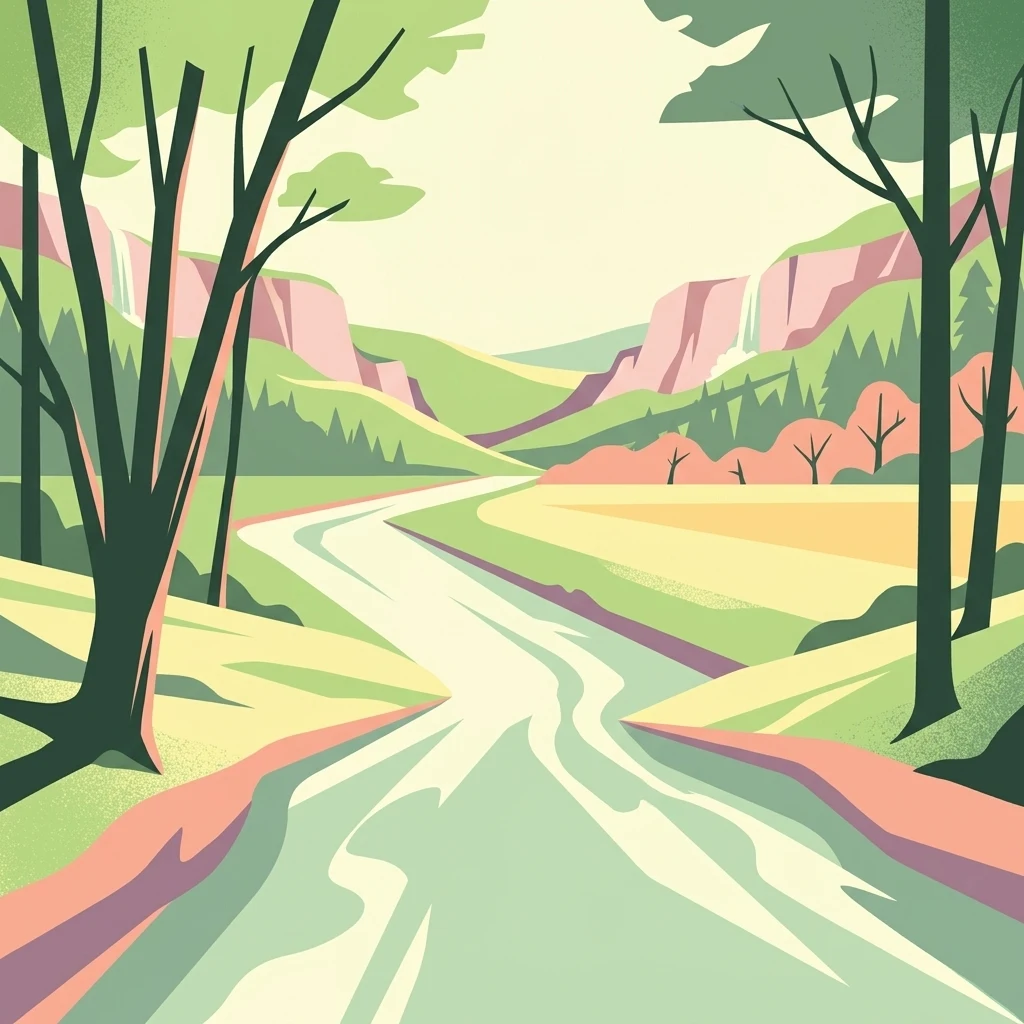
A flat-style digital illustration showing a winding river flowing through a valley between gentle hills, framed by silhouetted trees in the foreground.

Kimberling Creek Wilderness

Wildlife reserve

Park overview

Structured park overview, official facts, and landscape profile for Kimberling Creek Wilderness

Kimberling Creek Wilderness park facts, protected area profile, and essential visitor context

Review the core facts for Kimberling Creek Wilderness, including designation, size, terrain, visitor scale, habitats, and operating context in one park-focused overview.

About Kimberling Creek Wilderness

Kimberling Creek Wilderness occupies a steep, forested section of the central Appalachian Mountains in Bland County, Virginia, and forms a compact but topographically dramatic slice of the Jefferson National Forest. The area extends for about five miles along the slopes of Hogback Mountain, with elevations climbing from Kimberling Creek near 2,282 feet to the ridgeline near 3,200 feet. This vertical range, combined with the area's deeply dissected drainages, creates a patchwork of sheltered coves, exposed ridgetops, and intermediate slopes that support clearly different forest communities within a relatively small footprint.

The wilderness was designated in 1984 under the Eastern Wilderness Act, placing it within the National Wilderness Preservation System and giving it the highest level of protection available to federal forest lands. It is managed by the U.S. Forest Service with the explicit goal of preserving its present, natural condition, free from road construction, mechanical intervention, and other significant human alteration. As part of the broader wilderness system, Kimberling Creek helps to maintain a diversity of plant and animal gene pools and contributes to the conservation of eastern forest ecosystems.

A defining aspect of the area is its lack of officially maintained trails. Visitors are expected to enter the wilderness through a handful of old roads and informal bushwhack routes, most notably North Fork, Ridgetop Trail, Sulphur Spring Trail, and Trail to the Ridge, each accessible only from dirt forest roads such as Forest Service Road 640 and Virginia Route 281. This unusual trail-free status means that exploring the wilderness requires solid outdoor skills, careful route-finding on steep and rugged terrain, and a tolerance for solitude. Because there are no maintained pathways, the experience emphasizes self-reliance and a direct encounter with the recovering forest landscape rather than a structured recreational visit.

The wilderness sits adjacent to other conservation areas associated with the Kimberling Creek Cluster, including Little Walker Mountain, Long Spur, Seven Sisters, Crawfish Valley, and Brushy Mountain. Together, these areas form an important network of protected forest habitats in southwestern Virginia, contributing to landscape-scale ecological connectivity across the Appalachian highlands.

Quick facts and research context for Kimberling Creek Wilderness

Kimberling Creek Wilderness is located in Bland County, in southwestern Virginia, United States, and falls within the Jefferson National Forest. Established in 1984 under the Eastern Wilderness Act, it covers about 5,900 acres of mountainous forest along Hogback Mountain between roughly 2,282 and 3,200 feet in elevation.

Administratively classified as an IUCN Category Ib wilderness area and managed by the U.S. Forest Service, it sits within the Kimberling Creek Cluster of nearby conservation areas. The wilderness has no officially maintained trails, reflecting its emphasis on preserving a roadless, naturally evolving landscape rather than providing visitor infrastructure.

Protection and recognition

Explore the terrestrial protection scope and official recognition details.

Kimberling Creek Wilderness Protection Status and Recognition Data

Terrestrial protection status and management scope details define the conservation framework for Kimberling Creek Wilderness. Recorded administrative facts outline the official designation history and international recognition sources associated with this protected landscape.

Protection details

Protection scope
Terrestrial
Transboundary protection
No
Park context

Deeper park guide and search-rich context for Kimberling Creek Wilderness

Kimberling Creek Wilderness history, landscape, wildlife, and travel context

Explore Kimberling Creek Wilderness through its history, landscape character, ecosystems, wildlife, conservation priorities, cultural context, and seasonal travel timing in a structured park guide built for atlas discovery and search intent.

Why Kimberling Creek Wilderness stands out

Kimberling Creek Wilderness is best known for its pure, trail-free wilderness character in the Appalachian region, a rare condition east of the Mississippi. The area is especially notable for its recovering old growth forest, where second-growth trees have begun to develop the structure, age diversity, and ecological complexity typical of older eastern forests, even though individual trees remain smaller than their western counterparts. Equally distinctive is the way the protected landscape climbs from Kimberling Creek up the steep flanks of Hogback Mountain, combining sheltered cove forests, ridgetop oak and hickory stands, and dense rhododendron understory. This compact but rugged terrain embodies the kind of ecosystem diversity that the National Wilderness Preservation System was designed to safeguard in the eastern United States.
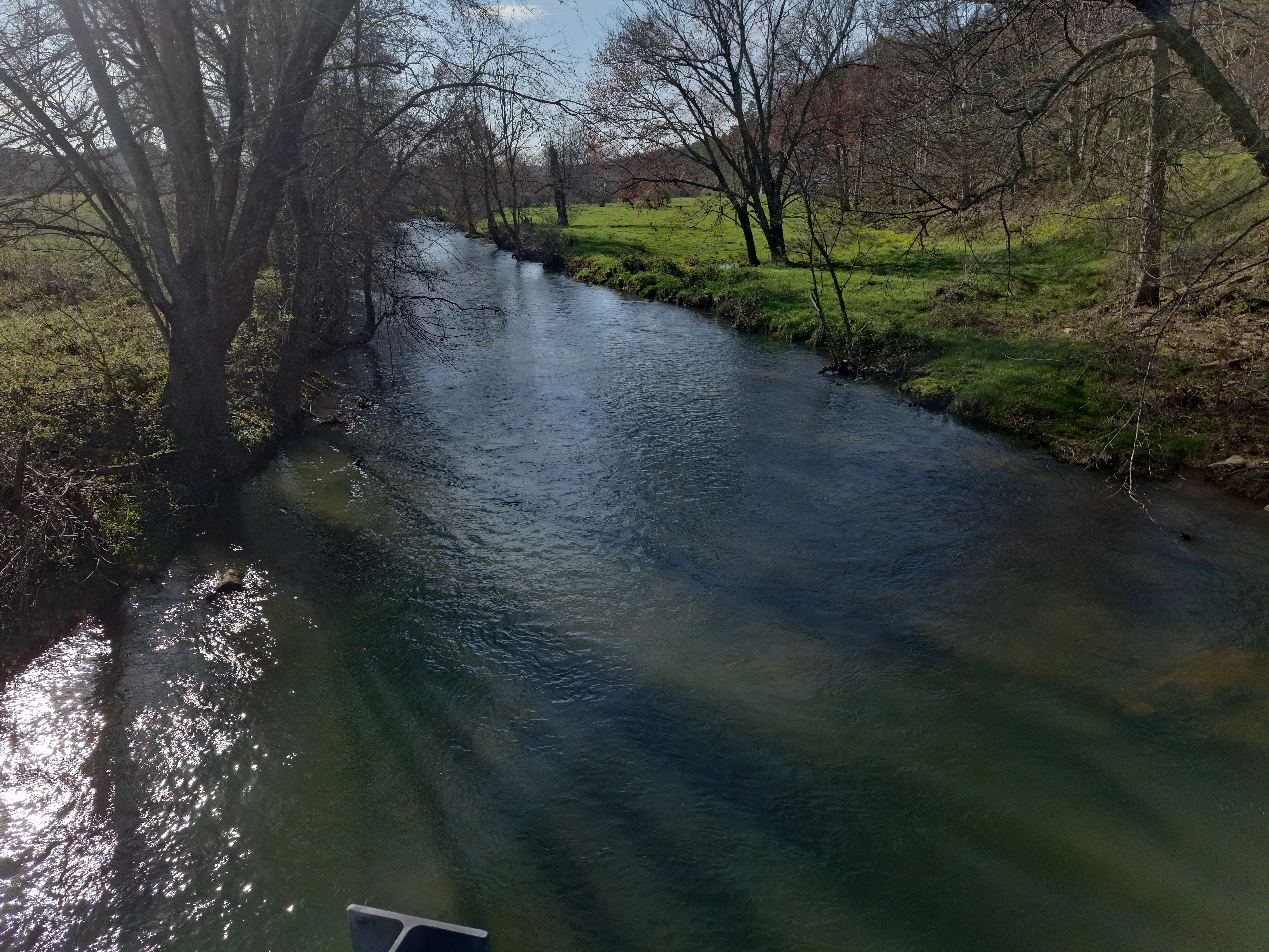
A view of Kimberling Creek flowing through a rural valley, flanked by trees and green fields.
Kimberling Creek flows through a landscape of open fields and bordering trees in Virginia.

Kimberling Creek Wilderness history and protected-area timeline

The modern history of Kimberling Creek Wilderness begins with the broader effort to designate federal lands in the eastern United States as protected wilderness. The area was formally established in 1984 under the Eastern Wilderness Act, which extended the principles of the original Wilderness Act of 1964 to eastern national forests. This designation brought the area into the National Wilderness Preservation System under the management of the U.S. Forest Service.

Before its protection, the landscape was heavily altered by industrial activity in the late 19th and early 20th centuries. Logging operations removed most of the original timber, and frequent fires swept across the cut-over slopes. Remnants of this period remain visible in the wilderness today: steel rails, cross ties, small bridge abutments, and large old stumps mark the routes once used to bring logs to nearby mills and kilns.

After logging ceased, the forest was left to recover on its own. Over more than a century, the regrown forest has gradually developed the structural complexity typical of older eastern woodlands, with multiple tree age classes and understory development now characterizing what ecologists describe as new old growth forest. The 1984 wilderness designation consolidated this recovery process by providing long-term legal protection against further road building, logging, and major surface disturbance, ensuring that the area's ecological recovery could continue largely undisturbed.

Kimberling Creek Wilderness landscape and geographic character

Kimberling Creek Wilderness occupies a steep, mountainous section of the central Appalachians, dominated by the long ridge of Hogback Mountain. The terrain rises sharply from Kimberling Creek near 2,282 feet to the upper slopes and ridge of Hogback Mountain near 3,200 feet, producing one of the more rugged wilderness landscapes in southwestern Virginia. Within this short elevation span, the topography shifts from narrow creek bottoms to steep coves, mid-slope benches, and exposed ridgelines.

The drainage network defines much of the area's geographic character. The central valley of North Fork begins on the upper slopes of Hogback Mountain, gathers water from numerous small tributary streams, and exits the wilderness into Kimberling Creek. Sulphur Spring Fork drains the southern side of the wilderness and is fed by Kimberling Spring along the boundary, while Wolfpen Branch drains the northern end. These streams have carved the deep, sheltered coves that the protected landscape is known for, and they contribute to the area's character as a moist, heavily forested drainage system.

Because of the steep slopes, dense vegetation, and absence of maintained trails, much of the terrain is difficult to access on foot. The combination of rugged topography and recovering forest cover makes the landscape feel more remote and wild than its relatively modest acreage would suggest, anchoring the wilderness's appeal for visitors seeking an undeveloped Appalachian setting.

Kimberling Creek Wilderness ecosystems, habitats, and plant life

The forest communities of Kimberling Creek Wilderness reflect the ecological complexity typical of steep, mid-elevation Appalachian terrain. Sheltered coves support stands of white oak, tulip poplar, Fraser magnolia, and yellow birch, while the higher ridges are dominated by mixtures of oak and hickory. Across all of these forest types, thickets of rhododendron form a dense, characteristic understory that gives the wilderness much of its visual identity and contributes to its humid, shaded microclimate.

A defining ecological feature of the area is its abundance of new old growth trees. Unlike the mature forests of the western United States, where old growth trees can reach very large sizes, eastern old growth that has regrown after past logging tends to consist of somewhat smaller, often scruffy-looking individuals of varying ages. These stands develop slowly, frequently requiring more than a century of uninterrupted growth before the forest begins to display the layered structure of older woodlands:

With multiple age classes of trees, decaying boles, and dense understory, the recovering forest provides important habitat structure for wildlife. The combination of protected coves, ridge-top forest, and stream corridors allows the wilderness to support a mosaic of plant communities within a relatively compact area, illustrating the role of topography in shaping eastern forest diversity.

Kimberling Creek Wilderness wildlife and species highlights

The mature and recovering forests of Kimberling Creek Wilderness provide important habitat for a range of Appalachian wildlife species, particularly those that depend on large blocks of unbroken forest. The dense canopy and abundance of older trees offer above-ground dens for black bear, while loose, flaking bark on aging trees provides summer roosting sites for the endangered Indiana bat, which depends heavily on hollow trees, exfoliating bark, and uninterrupted forest cover.

Beyond these headline species, the wilderness's combination of cove forests, oak-hickory ridges, rhododendron thickets, and stream corridors supports a broader community of forest interior birds, small and mid-sized mammals, and amphibians associated with Appalachian stream systems. The absence of roads, maintained trails, and other forms of regular human disturbance within the designated boundary enhances the area's value as a refuge for species that are sensitive to fragmentation and repeated human presence.

Kimberling Creek Wilderness conservation status and protection priorities

Kimberling Creek Wilderness was established in 1984 under the Eastern Wilderness Act and is administered by the U.S. Forest Service under the highest level of protection available to national forest lands in the United States. As part of the National Wilderness Preservation System, the area is managed primarily to preserve its natural ecological conditions, with restrictions on road construction, logging, mechanized use, and other forms of significant surface disturbance.

From a broader ecological perspective, the wilderness contributes to the preservation of forest interior habitat in a region where most of the landscape has been shaped by past logging, agriculture, and ongoing development. While the forest has not been logged for roughly a century, full ecological recovery from the heavy logging and repeated burning of the late 1800s and early 20th century is still underway. Protecting the area as wilderness helps ensure that this recovery can proceed without further disruption, allowing new old growth forest characteristics, complex understory structure, and associated wildlife habitat to develop over time.

The wilderness is also part of the Kimberling Creek Cluster, grouped with several adjoining conservation areas including Little Walker Mountain, Long Spur, Seven Sisters, Crawfish Valley, and Brushy Mountain. This clustering supports a landscape-scale conservation approach, helping to maintain ecological connectivity across the Appalachian highlands and increasing the long-term viability of forest-dependent wildlife populations in southwestern Virginia.

Kimberling Creek Wilderness cultural meaning and human context

The cultural history of Kimberling Creek Wilderness is closely tied to the timber industry that once dominated the Appalachian highlands of southwestern Virginia. During the late 19th and early 20th centuries, the area was heavily logged to feed local mills and kilns, and the cut-over slopes were frequently burned. Although these activities left a lasting imprint on the forest, they also shaped the economic identity of nearby communities such as Bastian and the broader Bland County landscape.

Today, the legacy of this timber era is preserved as a kind of unintentional cultural layer within the wilderness. Remnants of the logging infrastructure, including steel rails, cross ties, small bridge abutments, and large old stumps, remain visible in the forest and serve as quiet reminders of the area's transformation from industrial working landscape to protected wilderness. These features give modern visitors a tangible sense of how dramatically the Appalachian forest has been shaped by, and has recovered from, past human use.

Top sights and standout views in Kimberling Creek Wilderness

Kimberling Creek Wilderness stands out for its rare combination of trail-free solitude and recovering Appalachian old growth forest within a relatively small protected footprint. The wilderness's lack of maintained trails, combined with terrain that rises from Kimberling Creek to the ridge of Hogback Mountain, gives it a genuinely wild character that is unusual east of the Mississippi.

Other defining highlights include the dense rhododendron understory that blankets the slopes, the mix of cove forests and oak-hickory ridges, and the area's inclusion in the Kimberling Creek Cluster of adjoining conservation lands. Together, these qualities make the wilderness a notable example of how a comparatively small eastern wilderness area can still protect a diverse and ecologically significant stretch of Appalachian forest.

Best time to visit Kimberling Creek Wilderness

The most comfortable seasons for visiting Kimberling Creek Wilderness are typically late spring and early autumn, when moderate temperatures make off-trail travel through steep, rugged terrain more manageable. Spring tends to bring lush green foliage, full rhododendron growth, and active streams, while autumn usually offers cooler conditions, fewer biting insects, and the broader color change of the Appalachian hardwood canopy.

Because the wilderness has no maintained trails and offers limited access points along forest roads, visitors should plan for conditions that emphasize self-reliance rather than comfort-oriented recreation. Winter visits can be rewarding in terms of solitude but add significant difficulty due to slopes, weather exposure, and the absence of marked routes. Heavy summer heat and humidity can also make the steep, densely vegetated terrain more challenging to navigate, especially for those attempting longer bushwhack routes.

Monthly climate preview

Long-term representative point measurements of annual temperature and precipitation rhythm

Kimberling Creek Wilderness Climate Normals and Monthly Weather Patterns

Representative coordinate records show measured multiyear temperature ranges and monthly precipitation averages across Kimberling Creek Wilderness. Examining the complete twelve-month climatology profile reveals detailed seasonal variations in long-term atmospheric conditions.
Annual mean11 °C
-1 °C22 °C
Jan-1°
Feb
Mar
Apr10°
May15°
Jun19°
Jul22°
Aug21°
Sep18°
Oct11°
Nov
Dec
Warmest month
July

21.5 °C

Coolest month
January

-0.9 °C

Wettest month
July

3.6 mm/day

Driest month
October

2.5 mm/day

Park location guide

Geography guide, regional context, and park location map for Kimberling Creek Wilderness

Kimberling Creek Wilderness park geography, regions, and map view in United States of America

Understand where Kimberling Creek Wilderness sits in United States of America through a broader geographic reading of the surrounding landscape, nearby location context, and its mapped position within the national park landscape.

How Kimberling Creek Wilderness fits into United States of America

The United States of America is a federal presidential republic and one of the world's largest countries by area and population. It consists of 50 states across a vast territory spanning multiple time zones, with its capital in Washington, D.C. and largest city in New York City. The nation has a diverse economy, influential political system, and significant cultural and military presence globally.

Wider geography shaping Kimberling Creek Wilderness in United States of America

The United States occupies a vast territory in North America, bordered by Canada to the north and Mexico to the south. The 48 contiguous states stretch from the Atlantic to the Pacific Ocean, while Alaska occupies the northwestern region and Hawaii is an archipelago in the Pacific. The country encompasses diverse terrain including the Rocky Mountains, Appalachian Mountains, Great Plains, and extensive river systems.

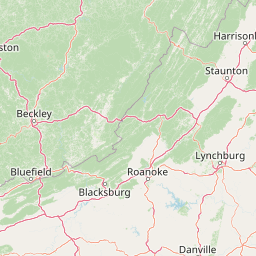
Map view of Kimberling Creek Wilderness

Use this park location map to pinpoint Kimberling Creek Wilderness in United States of America, understand its exact geographic position, and read its mapped placement within the surrounding landscape more clearly.

Pigeon | © OpenStreetMap contributors

Location context for Kimberling Creek Wilderness

Bland CountyVirginia
Recorded earthquake history

Examine the Historical Record of Earthquakes near Kimberling Creek Wilderness

Explore the documented seismic history for the region surrounding this protected Appalachian wilderness. This MoriAtlas collection presents historical earthquake records, including magnitudes and event dates, to provide a clear view of recorded activity patterns in the vicinity of Kimberling Creek Wilderness.

Kimberling Creek Wilderness Earthquake History

Catalogued events

4 events

Strongest magnitude

Magnitude 4.7

Most recent event

Sep 13, 2017

This history includes earthquakes recorded inside the park or within 50 km of its borders

Visual reference of protected forest habitats, steep coves, and ridgetop terrain

Kimberling Creek Wilderness Photos and Rugged Appalachian Mountain Landscapes

Visual records illustrate the rugged mountain terrain, dense rhododendron understory, and recovering old growth forests across Kimberling Creek Wilderness. Photographic documentation provides a clear view of steep Appalachian slopes, sheltered stream coves, and the remote character of this protected wilderness.

A view of Kimberling Creek flowing through a rural valley, flanked by trees and green fields.

Park atlas

Compare nearby mountain forests and connected conservation lands across the regional highlands.

Other Parks Near Kimberling Creek Wilderness and Surrounding Appalachian Protected Areas

Visitors exploring Kimberling Creek Wilderness can continue browsing adjacent national forest units and related protected landscapes in the surrounding region. Expanding the geographic scope reveals how similar rugged terrain and recovering forest ecosystems connect across the central Appalachians.
Wildlife reserveBland County
11 km away#1 closest

Southwest

Hunting Camp Creek Wilderness: Mapped Protected Landscapes in Bland County

Wildlife reserve terrain and Appalachian mountain geography

Hunting Camp Creek Wilderness encompasses an 8,471-acre protected area in Virginia, defined by the Garden Mountain and Brushy Mountain ridges. This wildlife reserve features deep valleys, dense forests, and a core section of the Appalachian Trail, serving as a critical refuge for local mountain biodiversity and wild backcountry exploration.

Area
34.28 km²
Established
2009
IUCN
Ib
Relief
Mountain
A watercolor painting showing a soft, stylized landscape with rolling green hills, a winding stream, and trees under a pale sky.
Protected areaVirginia
20 km away#2 closest

Southwest

Garden Mountain Wilderness: Appalachian Protected Area and Regional Landscape Geography

Old-growth forest and ridge-bound Appalachian terrain in Virginia

Garden Mountain Wilderness encompasses a significant Appalachian ridge and the deep Lick Creek valley within western Virginia. This protected area harbors diverse hardwood forests, old-growth remnants, and critical habitat for rare species. The topography is defined by parallel ridges and enclosed valleys, showcasing the geological complexity of the central Appalachians and the importance of localized conservation efforts.

Area
13.48 km²
Established
2009
IUCN
Ib
Relief
Mountain
A horizontal watercolor painting of rolling green hills, a winding path, and clusters of deciduous and coniferous trees.
Wildlife reserveWythe County
41 km away#3 closest

South

Little Dry Run Wilderness: Protected Wildlife Reserve Map and Geography

A detailed geographic study of southern Blue Ridge terrain.

Little Dry Run Wilderness is a protected mountain basin in Wythe County, marked by its dense hemlock-lined stream corridors and forested ridges. This record outlines the park boundaries, watershed structure, and the complex topography that characterizes this integral component of the Mount Rogers National Recreation Area.

Area
11.57 km²
Established
1984
IUCN
Ib
Relief
Mountain
Wildlife reserveVirginia
47 km away#4 closest

Northeast

Mountain Lake Wilderness: Protected Appalachian Geography and Mountain Landscapes

High-elevation wetlands and ridge-line geography in Virginia

Mountain Lake Wilderness protects a compact yet biologically diverse landscape where cool, moist conditions support rare mountain bogs and red spruce forests. This protected area along the Eastern Continental Divide features rocky outcrops like White Rocks and War Spur Overlook, providing panoramic views of the surrounding Ridge and Valley terrain within the Jefferson National Forest.

Area
44.66 km²
Established
1984
IUCN
Ib
Relief
Mountain
National parkWest Virginia
53 km away#5 closest

North

New River Gorge National Park and Preserve: Appalachian River Gorge Protected Landscape Atlas

Mapped terrain and geographic context within West Virginia.

Delve into the protected landscape identity of New River Gorge National Park and Preserve, a significant national park in West Virginia. This page details its role as a protected area, highlighting the dramatic river gorge geography, mapped terrain, and its place within the Appalachian Mountains. Understand the park's boundaries and the natural context that makes it a key destination for geographic discovery and conservation appreciation.

Area
294.64 km²
Established
2020
IUCN
V
Visitors
1.6M annual
Wildlife reserveVirginia
53 km away#6 closest

Southwest

Raccoon Branch Wilderness: Mapping Protected Wildlife Reserves in Southwest Virginia

Rugged quartzite ridges and Appalachian stream corridors

The Raccoon Branch Wilderness represents a significant protected area within the Southern Blue Ridge mountains. Its geography is characterized by parallel ridgelines and deeply cut drainage channels that support rare plant communities and endangered aquatic life. This wilderness serves as a vital component of the regional Mount Rogers cluster, preserving a representative segment of Appalachian highland terrain.

Area
17.1 km²
Established
2009
IUCN
Ib
Relief
Mountain
Wildlife reserveGrayson County
61 km away#7 closest

Southwest

Little Wilson Creek Wilderness: Protected Appalachian Forest and High Elevation Geography

Mapping the ridges, stream systems, and balds of Grayson County

Little Wilson Creek Wilderness is a significant protected area in southwestern Virginia, featuring elevations exceeding 4,800 feet. The region spans a diverse ecological landscape of rare high country bogs, northern hardwood forests, and old growth remnants that drain into the New River system. Gain insights into the terrain and boundaries of this prominent Blue Ridge Mountain wilderness.

Area
22.1 km²
Established
1984
IUCN
Ib
Relief
Mountain
Protected areaVirginia
63 km away#8 closest

Southwest

Lewis Fork Wilderness: Geography and Protected Land Profile in Southwestern Virginia

High-elevation Appalachian backcountry and ridgeline mapping

Spanning the ridgelines near the summit of Mount Rogers, Lewis Fork Wilderness serves as a key ecological anchor for Virginia. This protected backcountry offers a dense mosaic of forest types, ranging from oak-hickory stands to rare spruce-fir habitats. The landscape features steep terrain and pristine mountain streams, providing a concentrated look at the environmental complexity of the southern Appalachian Mountains.

Area
24.59 km²
Established
1984
IUCN
Ib
Relief
Mountain

Common questions about visiting, size, designation, and location context for Kimberling Creek Wilderness

Kimberling Creek Wilderness FAQs for park facts, access, geography, and protected area context

Find quick answers about Kimberling Creek Wilderness, including protected-area facts, park geography, trail and visitor context, and how the park fits into its surrounding country and regional landscape.
MoriAtlas Explorer

Continue Your Protected Areas Search Across the Global Atlas

Deepen your exploration by continuing the structured search for national parks and protected areas worldwide. Utilize the comprehensive filtering capabilities to compare different conservation landscapes and refine your understanding of global park geography. Discover more about the distribution and characteristics of protected natural areas.

Global natural geography