

Mori Atlas logo
Protected landscapeKintore Caves Conservation Reserve

Understanding the geological heritage, subterranean cave networks, and conservation boundaries within the Katherine regional setting.

Kintore Caves Conservation Reserve: A Mapped Analysis of Northern Territory Karst Landscapes and Protected Areas

Kintore Caves Conservation Reserve represents a focused protected landscape in Australia's Northern Territory, centered on an intricate karst limestone outcrop and its associated cave systems. This reserve serves as a critical geological and archaeological site, documenting the interplay between subterranean habitats, rare fauna, and long-term human occupation in the tropics. By examining its boundaries and surrounding rural topography, this atlas entry illustrates how compact conservation areas preserve essential geological heritage in the Katherine region.

karst landscapelimestone cavescave faunasubterranean habitattropical north australiakatherine region

Kintore Caves Conservation Reserve

Protected landscape

Park overview

Structured park overview, official facts, and landscape profile for Kintore Caves Conservation Reserve

Kintore Caves Conservation Reserve park facts, protected area profile, and essential visitor context

Review the core facts for Kintore Caves Conservation Reserve, including designation, size, terrain, visitor scale, habitats, and operating context in one park-focused overview.

About Kintore Caves Conservation Reserve

Kintore Caves Conservation Reserve is a focused, cave-centered conservation reserve in Australia's Northern Territory, set in the landscape west of Katherine. Although small in area, it protects a geologically distinctive patch of karst limestone that has given rise to an extensive network of caves, a relatively unusual feature in the regional context around Katherine.

The reserve's core significance lies in what those caves contain. Subterranean habitats across karst landscapes commonly shelter highly specialized fauna, and Kintore Caves is recognized for hosting rare species associated with its cave systems. This ecological value is tightly bound to the underlying geology: protecting the limestone and the integrity of the caves is, in practical terms, also protecting the habitat that these rare animals depend on.

Alongside its biological importance, the reserve holds evidence of lengthy human occupation. The combination of accessible shelter, reliable rock, and proximity to Katherine has made this area a long-used part of the landscape for people, and traces of that occupancy contribute to the conservation significance recognized in its IUCN Category V status. The reserve is bordered by the Northern Territory Rural College to the north and rural private land to the south, situating it within a working rural landscape where the surrounding land use and the protected site directly adjoin one another.

Administered by the Parks and Wildlife Commission of the Northern Territory since its establishment in 1965, Kintore Caves Conservation Reserve exemplifies the type of small, targeted protected area where a single geological and cultural feature defines the entire conservation purpose. Its identity is built around three intertwined layers: the karst landscape itself, the rare cave fauna it shelters, and the visible record of human history embedded in the same rocks.

Quick facts and research context for Kintore Caves Conservation Reserve

Kintore Caves Conservation Reserve is a small, focused protected area in the Northern Territory of Australia, covering approximately 423 hectares near the town of Katherine.

The reserve has been formally protected since 1965 and is managed by the Parks and Wildlife Commission of the Northern Territory. It is classified as an IUCN Category V protected landscape, recognizing both its natural and the long-term cultural values associated with the land. Its defining feature is an outcrop of karst limestone containing an extensive cave network that supports rare fauna and holds evidence of prolonged human use of the area.

Protection and recognition

Documented terrestrial protection scope and conservation recognition metrics

Kintore Caves Conservation Reserve Protection Status and Designation

Kintore Caves Conservation Reserve maintains a recorded terrestrial protection scope within the official geographic dataset. Detailed conservation designations and international recognition records outline the structured status of this protected area.

Protection details

Protection scope
Terrestrial
Transboundary protection
No
Park context

Deeper park guide and search-rich context for Kintore Caves Conservation Reserve

Kintore Caves Conservation Reserve history, landscape, wildlife, and travel context

Explore Kintore Caves Conservation Reserve through its history, landscape character, ecosystems, wildlife, conservation priorities, cultural context, and seasonal travel timing in a structured park guide built for atlas discovery and search intent.

Why Kintore Caves Conservation Reserve stands out

Kintore Caves Conservation Reserve is best known for its karst limestone geology and the extensive cave network that develops within it. The caves harbor rare fauna that depend on these subterranean environments, giving the reserve a strong biodiversity value tied directly to its geology. The site is also recognized for the archaeological and cultural traces it preserves. Evidence of a long history of human occupation within and around the caves links the reserve's natural significance to the deeper human story of the Katherine region, making the site a place where geological, ecological, and cultural heritage overlap.

Kintore Caves Conservation Reserve history and protected-area timeline

Kintore Caves Conservation Reserve was formally established in 1965, giving long-standing legal protection to a karst limestone area west of Katherine that had long attracted interest for its caves and their contents.

The establishment of the reserve reflected an early recognition that the site's combination of karst geology, rare subterranean fauna, and evidence of long human occupation warranted dedicated conservation management. Management responsibility rests with the Parks and Wildlife Commission of the Northern Territory, the territorial authority responsible for protected areas in the region.

The surrounding landscape continues to be shaped by rural land use, with the Northern Territory Rural College lying immediately to the north of the reserve and rural private property to the south. This setting frames the reserve as a protected island within a working rural environment rather than part of a larger contiguous wilderness.

Kintore Caves Conservation Reserve landscape and geographic character

The landscape of Kintore Caves Conservation Reserve is defined by karst limestone, a rock type that dissolves over time to produce underground voids, sinkholes, and cave systems. Although the reserve covers only a few hundred hectares, the character of the land surface and subsurface is shaped almost entirely by this geology, and the resulting caves form the most visually distinctive feature of the site.

Around the limestone outcrop, the broader Katherine region environment provides the climatic and vegetation backdrop, with the reserve sitting in the tropical north of Australia. The karst terrain influences drainage and soil patterns locally, and the contrast between rocky cave-bearing ground and the surrounding rural lands is part of what gives the reserve its visible identity.

The relatively small footprint of the reserve means that subtle changes in land use on neighboring properties potentially affect the integrity of the karst system, underlining why a dedicated protected area matters for features like the caves and the geological context that produced them.

Kintore Caves Conservation Reserve ecosystems, habitats, and plant life

Kintore Caves Conservation Reserve protects a habitat type that is genuinely uncommon in the region: a karst limestone system with an extensive underground cave network. Such environments support distinctive ecological communities, and the reserve is noted specifically for the rare fauna associated with its caves, indicating that the subterranean habitat is the primary driver of its ecological value.

Above ground, the reserve sits within the tropical landscape of the Katherine region, where vegetation and seasonal rainfall patterns typical of the northern Australian interior shape surface conditions. The combination of surface tropical habitat and underground karst habitat within a single protected boundary gives the reserve a layered ecological character.

Because the reserve is small and its ecological significance is concentrated in the karst and cave environments, the broader natural values of the site are tightly linked to the integrity of the limestone and the avoidance of disturbance to the cave systems.

Kintore Caves Conservation Reserve wildlife and species highlights

The wildlife significance of Kintore Caves Conservation Reserve centers on the rare fauna recorded within its cave systems. Karst environments across tropical Australia are known to host specialized species that depend on stable underground conditions, and the reserve is recognized as a habitat for such rare animals.

Surface wildlife typical of the Katherine region likely occurs in and around the reserve, but the defining wildlife value is clearly tied to the caves rather than to the broader open landscape. This makes the reserve an example of a protected area where a single habitat type, the cave system within the karst limestone, supports much of the formal conservation interest in fauna.

Protecting the cave environment, including the hydrogeological conditions that maintain humidity and stability underground, is therefore central to safeguarding the rare wildlife for which the reserve is recognized.

Kintore Caves Conservation Reserve conservation status and protection priorities

Kintore Caves Conservation Reserve holds conservation value on several levels: geological, ecological, and cultural. Its IUCN Category V designation reflects a management approach that recognizes not just the natural features but also the long interaction between people and the landscape, a framing that fits a site with documented evidence of extended human occupation within its caves.

The reserve's most concrete conservation contribution is the protection of karst limestone and its associated cave fauna. Karst systems are vulnerable to changes in water flow, surface disturbance, and contamination, and the formal protection of this particular outcrop near Katherine helps maintain the conditions that rare subterranean species require.

By being wedged between a rural college to the north and rural private land to the south, the reserve also serves a conservation planning role: it maintains a protected natural and cultural node within an actively used rural landscape, rather than being absorbed into broader land conversion. Its proximity to Katherine ensures that the site is accessible for ongoing monitoring and management by the Parks and Wildlife Commission of the Northern Territory.

Kintore Caves Conservation Reserve cultural meaning and human context

Kintore Caves Conservation Reserve carries a cultural dimension connected to the long history of human occupation in and around its caves. Caves in the Australian landscape have historically served as shelters, gathering places, and sources of material and symbolic resources, and the evidence of such prolonged use at Kintore Caves is part of why the site is formally protected under an IUCN Category that recognizes human-nature interaction.

The reserve's location west of Katherine and its setting among modern rural land uses, with a rural college on one side and private farmland on the other, places it within a contemporary territory where the broader cultural history of the Katherine region continues alongside current management and community life.

This combination of deep human history within the caves and ongoing rural land use around them gives the reserve a layered cultural context even where detailed cultural narratives are not the primary focus of public information about the site.

Top sights and standout views in Kintore Caves Conservation Reserve

Kintore Caves Conservation Reserve stands out for its compact but tightly defined combination of karst limestone, extensive cave systems, rare cave fauna, and evidence of long-term human occupation. Its protected status since 1965 and its IUCN Category V designation underscore that the site's value extends beyond pure wilderness into a recognition of people-and-landscape heritage.

The reserve's small footprint, its location close to Katherine, and its setting between institutional and rural neighbors give it a distinct identity as a focused conservation site rather than a broad landscape park. These qualities make it a useful example of how small protected areas can hold concentrated geological, ecological, and cultural significance at once.

Best time to visit Kintore Caves Conservation Reserve

As a conservation reserve in tropical northern Australia, Kintore Caves Conservation Reserve sits within a climate that is warm to hot for much of the year and that follows a distinct wet and dry seasonal pattern characteristic of the Katherine region.

For visitors interested in surface conditions and accessibility of the surrounding rural landscape, the cooler and drier months of the late dry season and the build-up period are generally more comfortable than the peak of the wet season, when heavy rains can affect tracks, surface conditions, and cave access in karst areas. Anyone planning a visit should consult the Parks and Wildlife Commission of the Northern Territory for current conditions and access guidance, rather than relying on general seasonal assumptions.
Monthly climate preview

Long-term temperature ranges and precipitation averages across the conservation landscape

Kintore Caves Conservation Reserve Climate Normals and Monthly Weather Patterns

Representative point measurements reveal the long-term annual rhythm of average temperatures and daily precipitation rates for Kintore Caves Conservation Reserve. Detailed monthly climate records outline comprehensive temperature variations and precipitation trends across the entire coordinate profile.
Annual mean27 °C
23 °C32 °C
Jan28°
Feb27°
Mar27°
Apr26°
May24°
Jun23°
Jul23°
Aug25°
Sep30°
Oct32°
Nov32°
Dec30°
Warmest month
October

32.1 °C

Coolest month
June

22.7 °C

Wettest month
January

8.7 mm/day

Driest month
July

0 mm/day

Park location guide

Geography guide, regional context, and park location map for Kintore Caves Conservation Reserve

Kintore Caves Conservation Reserve park geography, regions, and map view in Australia

Understand where Kintore Caves Conservation Reserve sits in Australia through a broader geographic reading of the surrounding landscape, nearby location context, and its mapped position within the national park landscape.

How Kintore Caves Conservation Reserve fits into Australia

Australia is a constitutional monarchy and federal parliamentary democracy comprising six states and ten territories. With a population of nearly 28 million, it is one of the world's most urbanised countries, with most people concentrated on the eastern seaboard. The country has a high Human Development Index and is known for its cultural diversity, ancient Aboriginal heritage, and unique wildlife.

Wider geography shaping Kintore Caves Conservation Reserve in Australia

Australia occupies the entire Australian continent, the island of Tasmania, and numerous smaller islands. It is the world's flattest and driest inhabited continent, featuring vast deserts in the interior (the Outback), tropical rainforests along the eastern coast, and a coastline bordering the Indian and Pacific Oceans.

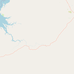
Map view of Kintore Caves Conservation Reserve

Use this park location map to pinpoint Kintore Caves Conservation Reserve in Australia, understand its exact geographic position, and read its mapped placement within the surrounding landscape more clearly.

Pigeon | © OpenStreetMap contributors

Location context for Kintore Caves Conservation Reserve

Northern Territory
Park atlas

Compare nearby national parks and connected conservation terrain across the surrounding territory.

Exploring Parks Near Kintore Caves Conservation Reserve and Regional Protected Landscapes

Continue browsing other protected areas near Kintore Caves Conservation Reserve to compare regional geological formations and surrounding terrain. Examining adjacent conservation lands provides deeper context on tropical karst environments and broader natural heritage.
National parkNorthern Territory
About 21 km away#1 closest

Northeast

Nitmiluk National Park: Detailed Protected Landscape and Geographic Context

Explore mapped park boundaries and regional terrain.

Delve into the specifics of Nitmiluk National Park, a designated national park within the Northern Territory of Australia. This section focuses on its protected-area status and how its geography contributes to the regional landscape. Users can explore the park's mapped extent and understand its placement within the broader geographical atlas, highlighting its importance as a distinct protected natural area.

Area
2,946.64 km²
Established
1977
IUCN
II
Visitors
309.8K annual
Nature reserveNorthern Territory
About 38 km away#2 closest

Southeast

Cutta Cutta Caves Nature Park: A Tropical Karst and Cave Reserve in Northern Territory

Protected tropical limestone karst and subterranean landscape geography.

Cutta Cutta Caves Nature Park is a specialized protected area in Australia, safeguarding a unique tropical limestone karst landscape near Katherine. This reserve manages subterranean cave systems, mineral-rich chambers, and the surrounding woodland terrain. As a significant ecological site, it provides essential habitat for rare wildlife, highlighting the complex intersection of geological formations and tropical biodiversity within the Northern Territory.

Area
14.99 km²
Established
1967
IUCN
III
Visitors
17.2K annual
Nature reserveNorthern Territory
About 69 km away#3 closest

Southwest

Giwining / Flora River Nature Park: Protected Limestone Landscapes of Northern Territory

Geological spring systems and tropical riverine corridors.

The landscape of Giwining / Flora River Nature Park is defined by a network of calcium-rich springs emerging from Tindall Limestone. These waters have sculpted tufa dams and cascading waterfalls along the Flora River, creating a unique geological environment within the savanna woodlands of the Northern Territory.

Area
78.24 km²
Established
1993
IUCN
V
Relief
Lowland
National parkAustralia
About 71 km away#4 closest

North

Kakadu National Park: Australia's Protected Landscape and Regional Geography

Explore Kakadu National Park's mapped boundaries and natural terrain.

Kakadu National Park stands as a significant national park entity within Australia, providing rich geographic context for atlas discovery. This page details the park's protected area identity, its mapped natural landscapes, and its place within the broader Australian continent's geography. Understand the unique regional setting and the specific topographic features that define Kakadu National Park for detailed exploration and comparative geographic analysis.

Area
19,804 km²
Established
1979
IUCN
II
Visitors
250K annual
National parkNorthern Territory
About 113 km away#5 closest

Southeast

Elsey National Park: Northern Territory National Park Atlas and Protected Landscape Context

Discover the mapped terrain and unique natural features of Elsey National Park.

Elsey National Park, located in Australia's Northern Territory, is a significant protected area known for its distinctive thermal springs and characteristic paperbark woodlands. This national park provides a valuable point of study for understanding regional geography, mapped natural landscapes, and the hydrological importance of its riverine environments, offering a concrete example of protected land within the tropical savanna biome.

Area
138.96 km²
Established
1991
IUCN
II
Visitors
207.7K annual
National parkNorthern Territory
About 133 km away#6 closest

North

Mary River National Park: National Park in Northern Territory, Australia

Mapped protected landscape and regional geographic context.

Mary River National Park is an officially designated national park located in the vast Northern Territory of Australia. This protected area offers rich opportunities for geographic discovery, allowing users to explore its mapped boundaries and understand its significance within the regional landscape. Discover the natural context and atlas positioning of Mary River National Park, contributing to a broader understanding of protected lands in Northern Australia.

Area
1,215.25 km²
Established
1966
IUCN
II
Visitors
336.4K annual
National parkNorthern Territory
About 141 km away#7 closest

West

Fish River Station National Park: Protected Landscapes and Geographic Atlas

Indigenous-managed conservation in the Northern Territory

Fish River Station serves as a critical conservation block south of Darwin, featuring a distinctive blend of riverine floodplains, billabongs, and rugged upland ranges. Its protected boundaries preserve a wide array of tropical habitats, highlighting the intersection of traditional land management and large-scale environmental preservation within the Australian National Reserve System.

Area
1,781 km²
Established
2010
IUCN
II
Relief
Mixed relief
Watercolor illustration showing rolling green hills, a red rock formation, and scattered trees
National parkNorthern Territory
About 144 km away#8 closest

Southwest

Judbarra National Park: Northern Territory National Park Protected Landscape and Geography

Discover its mapped terrain and ancient Indigenous rock art.

Judbarra National Park is a major national park in Australia's Northern Territory, recognized for its extensive Indigenous rock art, which constitutes a significant artistic province. Spanning a vast area with two distinct geographic sections, the park showcases a transition between tropical and semi-arid ecosystems. Users can explore its rugged terrain, sandstone escarpments, and mapped park boundaries to understand its unique regional geographic context and rich cultural heritage.

Area
13,004.1 km²
Established
1990
IUCN
II
Relief
Mixed relief

Common questions about visiting, size, designation, and location context for Kintore Caves Conservation Reserve

Kintore Caves Conservation Reserve FAQs for park facts, access, geography, and protected area context

Find quick answers about Kintore Caves Conservation Reserve, including protected-area facts, park geography, trail and visitor context, and how the park fits into its surrounding country and regional landscape.
MoriAtlas Explorer

Continue Your Protected Areas Search Across the Global Atlas

Deepen your exploration by continuing the structured search for national parks and protected areas worldwide. Utilize the comprehensive filtering capabilities to compare different conservation landscapes and refine your understanding of global park geography. Discover more about the distribution and characteristics of protected natural areas.

Global natural geography