
Mori Atlas logo
State or regional parkKleanza Creek Provincial Park

Geographic atlas of a rugged Coast Mountains corridor and its historic water-carved rock canyons

Kleanza Creek Provincial Park: Protected Canyon Landscapes and Salmon Habitat in British Columbia

Kleanza Creek Provincial Park represents a unique confluence of geology and aquatic life in northwestern British Columbia. This protected area features deep rock canyons carved into the forested slopes of the Coast Mountains; the cascading creek acts as a vital migratory corridor for pink salmon. The landscape preserves distinct natural features including exposed bedrock, narrow gorges, and forest-framed cascades that define this regional sanctuary.

coast mountainsrock canyoncascadessalmon habitatpink salmontributary creek
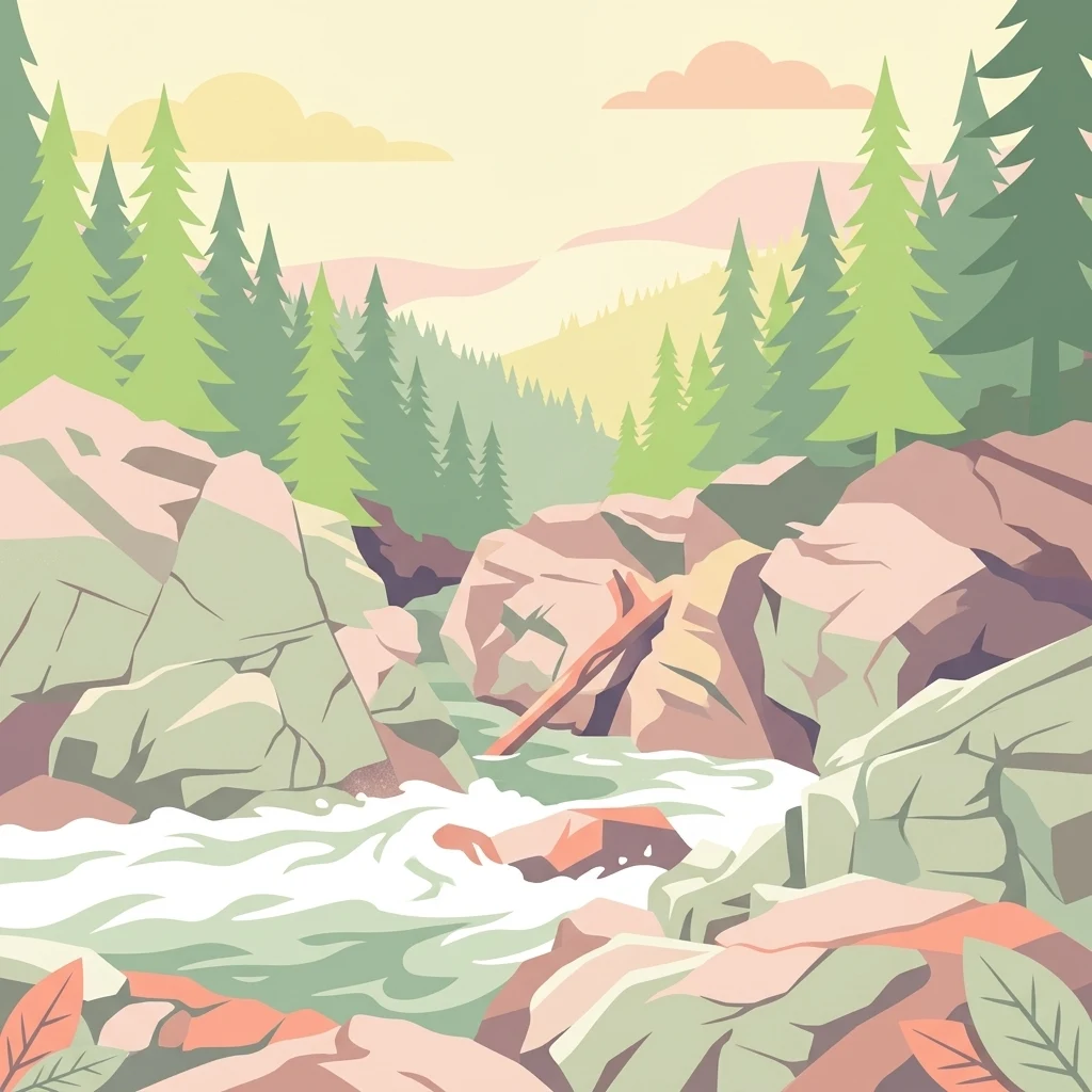
A flat-style vector illustration of a river flowing through a rocky canyon surrounded by evergreen trees under a soft-toned sky.

Kleanza Creek Provincial Park

State or regional park

Park overview

Structured park overview, official facts, and landscape profile for Kleanza Creek Provincial Park

Kleanza Creek Provincial Park park facts, protected area profile, and essential visitor context

Review the core facts for Kleanza Creek Provincial Park, including designation, size, terrain, visitor scale, habitats, and operating context in one park-focused overview.

About Kleanza Creek Provincial Park

Kleanza Creek Provincial Park is a compact but visually striking protected landscape in the Coast Mountains of northwestern British Columbia. Covering roughly 269 hectares, the park follows Kleanza Creek, a tributary of the Skeena River, through terrain where dense coastal forest gives way to steep rock walls and cascading water. Its setting near Terrace places it within one of the most rugged and resource-rich regions of the province, where mountains, rivers, and old-growth forests converge.

Although small in area, the park carries an outsized sense of place. The Kleanza Creek Canyon and its surrounding forests define the visual character of the site, with cascades spilling through narrow gorges and rocky outcrops interrupting the otherwise continuous tree cover. This combination of canyon topography, creek-side forest, and salmon-bearing waters gives the park layers of ecological and scenic interest well beyond what its modest size might suggest.

The park's history adds another dimension to its identity. The Gitxsan name 'Kleanza', meaning gold, points to the creek's nineteenth-century role as a placer-mining stream. Early miners attempted to extract gold from the creek in the 1890s but abandoned the effort because the water ran too deep and too fast. Old mine workings remain visible within the canyons, marking a brief but vivid chapter of the province's gold-rush era and connecting the park's natural landscape to British Columbia's broader frontier history.

Today, the park's importance lies chiefly in conservation: it protects both the canyon ecosystem and the aquatic habitat that supports returning salmon runs each fall. In this respect Kleanza Creek Provincial Park exemplifies how small provincial parks in British Columbia can safeguard surprisingly rich combinations of geology, forest, and freshwater habitat within the larger Coast Mountains environment.

Quick facts and research context for Kleanza Creek Provincial Park

Kleanza Creek Provincial Park is a 269-hectare provincial park in British Columbia, Canada, established in 1956 and managed by BC Parks. It is located along Kleanza Creek, a tributary of the Skeena River, near Terrace in the northwestern part of the province. The park sits within the Coast Mountains and protects a forested canyon landscape shaped by the creek, together with significant salmon spawning habitat.

Protection and recognition

Examine the documented terrestrial protection status and administrative designation framework.

Kleanza Creek Provincial Park Protection Status and Conservation Scope

Kleanza Creek Provincial Park maintains a documented terrestrial protection scope within its regional conservation framework. Official records compile the governing designation details and administrative recognition metrics for the protected area.

Protection details

Protection scope
Terrestrial
Transboundary protection
No
Park context

Deeper park guide and search-rich context for Kleanza Creek Provincial Park

Kleanza Creek Provincial Park history, landscape, wildlife, and travel context

Explore Kleanza Creek Provincial Park through its history, landscape character, ecosystems, wildlife, conservation priorities, cultural context, and seasonal travel timing in a structured park guide built for atlas discovery and search intent.

Why Kleanza Creek Provincial Park stands out

Kleanza Creek Provincial Park is best known for its forested rock canyons and cascades along Kleanza Creek, and for its role as a key pink salmon spawning stream. The park also carries a distinctive cultural and historical identity through its Gitxsan-derived name, 'Kleanza', meaning gold, which links the landscape to the placer gold-mining era of the 1890s.
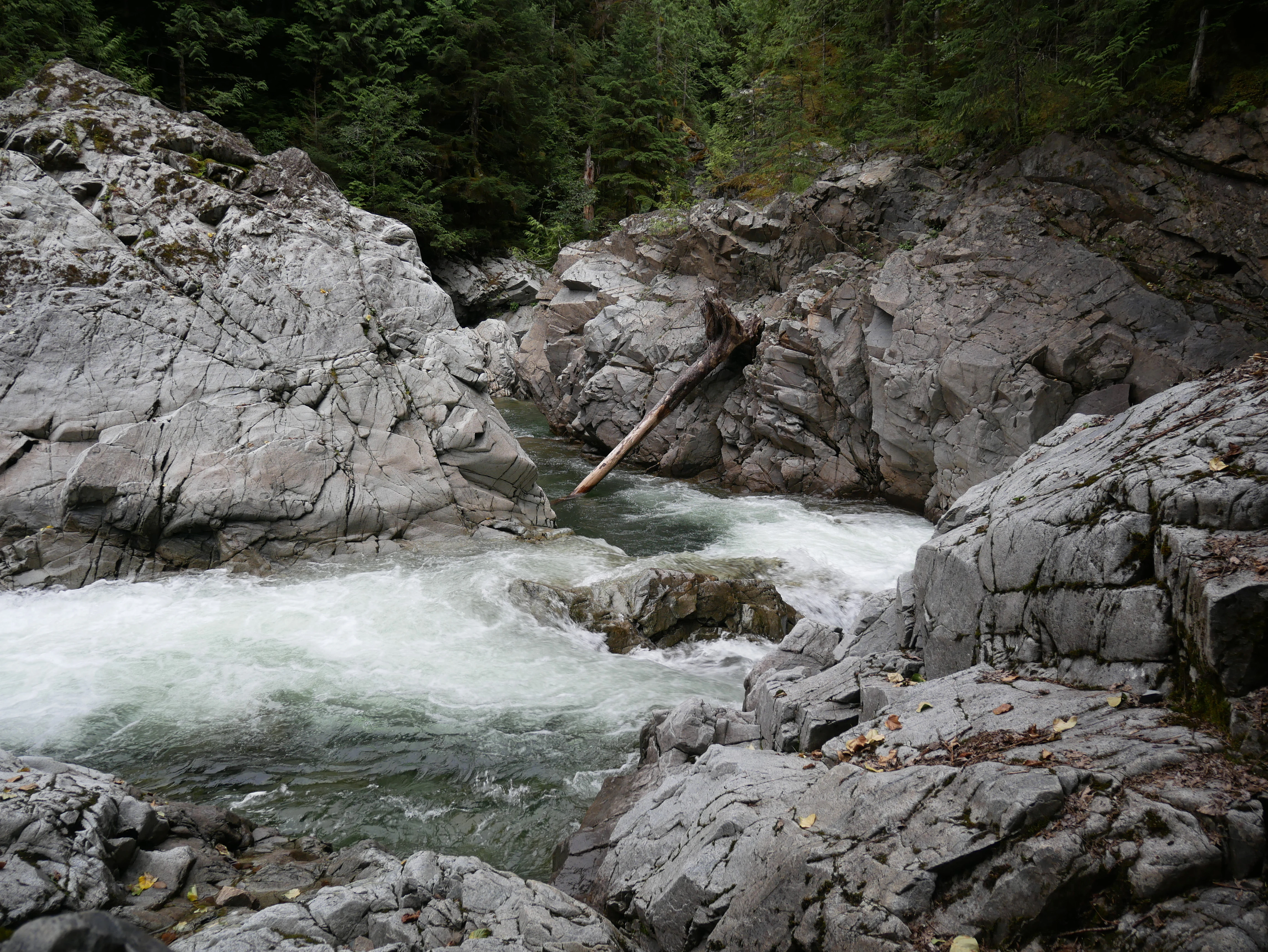
A rushing creek flows through a narrow, steep-sided canyon with exposed grey bedrock and evergreen trees along the banks.
Kleanza Creek rushing through a rocky canyon.

Kleanza Creek Provincial Park history and protected-area timeline

The history of Kleanza Creek Provincial Park begins with the creek itself and its nineteenth-century role in British Columbia's gold-rush era. The name 'Kleanza' derives from the Gitxsan word for gold, reflecting the long-standing recognition by Indigenous peoples of the area's mineral wealth. In the 1890s, placer miners arrived along the creek seeking gold in the gravels of the streambed.

That mining activity proved short-lived. The miners discovered that the creek was too deep and the volume of water too great to allow efficient extraction, and the workings were eventually abandoned. The physical traces of those early efforts, including old mine features, can still be observed within the rock canyons that define the park today, giving the landscape a tangible connection to this gold-rush past.

In 1956, the area was formally protected as Kleanza Creek Provincial Park, placing the canyon, the creek, and its surrounding forests under the management of BC Parks. Since then, the park's significance has shifted from mining heritage to ecological protection, particularly as a refuge for the salmon populations that continue to run up Kleanza Creek each year.

Kleanza Creek Provincial Park landscape and geographic character

Kleanza Creek Provincial Park occupies a visually dramatic slice of the Coast Mountains. The terrain is shaped by Kleanza Creek itself, which has cut a series of rock canyons through forested mountainside near Terrace. The result is a landscape of narrow gorges, exposed rock faces, and tumbling cascades, framed by the dense coniferous forest typical of British Columbia's coastal interior.

Rather than broad alpine vistas, the park's scenic character is defined by contrast: dark forested slopes pressing in against pale canyon walls and white water. The creek threads through this rocky corridor, creating a constantly shifting pattern of cascades, pools, and exposed bedrock. This intimate canyon-and-creek scenery, set within the larger Coast Mountains frame, is the defining feature of the park's physical geography.

Kleanza Creek Provincial Park ecosystems, habitats, and plant life

Ecologically, Kleanza Creek Provincial Park sits at the meeting point between coastal mountain forest and freshwater aquatic habitat. The hillslopes hosting the creek carry the characteristic coastal-interior forest cover of the region, dominated by conifers adapted to the wet, temperate conditions of northwestern British Columbia. Beneath this canopy, the rock-walled canyon system creates distinct microhabitats where forest, rock, and flowing water interact.

The creek is the ecological backbone of the park. Its cold, fast-moving waters and gravel beds support spawning habitat for salmon, while the surrounding canyon walls and riparian forest shelter the broader network of life tied to the stream. This combination of intact forest cover and a healthy, flowing creek gives the park a layered ecological identity, integrating forest, freshwater, and canyon ecosystems within a small but coherent protected footprint.

Kleanza Creek Provincial Park wildlife and species highlights

The wildlife profile of Kleanza Creek Provincial Park is shaped above all by the creek's role as a salmon-bearing river. Kleanza Creek is a major migratory waterway for pink salmon, which return to the creek during the fall to spawn in its gravel beds. These seasonal salmon runs are the most prominent and widely recognized wildlife feature of the park, drawing attention to the importance of protecting undisturbed spawning habitat.

Beyond the aquatic life centered on the salmon, the surrounding forest and canyon habitats support the broader fauna typical of the Coast Mountains in this part of British Columbia. The combination of intact forest cover, rocky canyon terrain, and a productive stream creates conditions favorable for the regional birdlife, mammals, and aquatic species associated with salmon-bearing creeks in northwestern BC.

Kleanza Creek Provincial Park conservation status and protection priorities

Kleanza Creek Provincial Park contributes to conservation in British Columbia by safeguarding both a distinctive canyon landscape and an ecologically important salmon stream. The park's protected status, established in 1956 and managed by BC Parks, ensures that the rock canyons carved by Kleanza Creek and the surrounding forested slopes remain intact, while also keeping the creek's waters free from the kinds of disturbance that can degrade spawning habitat.

The pink salmon run that returns to Kleanza Creek each fall is the park's central conservation concern. By protecting the creek corridor and its gravel spawning grounds, the park helps maintain a functioning stretch of salmon habitat within the larger Skeena River watershed, which is one of the most significant salmon systems on the Pacific coast of North America. In this way, a modest 269-hectare park plays a meaningful role in preserving both landscape character and freshwater biodiversity in the Coast Mountains.

Kleanza Creek Provincial Park cultural meaning and human context

The cultural significance of Kleanza Creek Provincial Park is closely tied to its name. 'Kleanza' is a Gitxsan word meaning gold, reflecting Indigenous knowledge of the creek's mineral content long before European-era mining arrived. The Gitxsan, whose traditional territory lies in the Skeena River region of northwestern British Columbia, have long-standing cultural and historical connections to the waterways around Terrace, including Kleanza Creek itself.

The 1890s placer gold rush then layered a second wave of cultural history onto the landscape. Although that mining effort was brief, abandoned because the creek ran too deep and too fast, the remnants of early workings remain visible in the canyons. Together, the Gitxsan origins of the name and the gold-rush heritage give the park a cultural depth that complements its natural values, anchoring the site within the broader human story of the Skeena region.

Top sights and standout views in Kleanza Creek Provincial Park

Kleanza Creek Provincial Park stands out for the unusual concentration of canyon scenery, forest, and salmon habitat packed into a small Coast Mountains protected area near Terrace. The cascades and rock-walled sections of Kleanza Creek give the park immediate visual appeal, while the seasonal return of pink salmon anchors its ecological identity.

Layered onto these natural attributes is the historical resonance of the Gitxsan-derived name and the surviving traces of late-nineteenth-century placer mining. This combination of canyon landscape, salmon-bearing waters, protected forest, and gold-rush heritage makes Kleanza Creek Provincial Park a distinctive and multi-layered destination within British Columbia's network of provincial parks.

Best time to visit Kleanza Creek Provincial Park

The character of a visit to Kleanza Creek Provincial Park shifts with the seasons in ways that reflect both landscape and wildlife. Late summer and early autumn are particularly significant because that is when pink salmon return to Kleanza Creek to spawn, making the river corridor a focal point of seasonal activity. Cooler autumn weather also tends to stabilize water levels, allowing the cascades to be seen under more typical flow conditions.

Spring and summer bring warmer conditions for exploring the canyon's forested approach and viewing the cascades under higher snowmelt-driven flow. Winter visits are possible but bring heavier precipitation, cooler temperatures, and potentially more challenging footing along the canyon terrain, which is best appreciated when rock, water, and forest can be experienced safely.
Monthly climate preview

Long-term temperature ranges and monthly precipitation averages for British Columbia

Kleanza Creek Provincial Park Climate Normals and Annual Weather Patterns

Representative coordinate measurements reveal annual temperature swings and precipitation rates across twelve distinct intervals at Kleanza Creek Provincial Park. Examining the complete monthly climate record provides deeper insight into long-term averages for temperature and moisture.
Annual mean1 °C
-9 °C11 °C
Jan-9°
Feb-8°
Mar-5°
Apr-1°
May
Jun
Jul11°
Aug11°
Sep
Oct
Nov-5°
Dec-8°
Warmest month
July

11.4 °C

Coolest month
January

-8.7 °C

Wettest month
October

5.4 mm/day

Driest month
May

2.5 mm/day

Park location guide

Geography guide, regional context, and park location map for Kleanza Creek Provincial Park

Kleanza Creek Provincial Park park geography, regions, and map view in Canada

Understand where Kleanza Creek Provincial Park sits in Canada through a broader geographic reading of the surrounding landscape, nearby location context, and its mapped position within the national park landscape.

How Kleanza Creek Provincial Park fits into Canada

Canada is a federal parliamentary constitutional monarchy spanning North America from the Atlantic to the Pacific and Arctic Oceans. With a population of over 41 million, it is officially bilingual in English and French at the federal level. The country gained independence from the United Kingdom through a gradual process culminating in 1982.

Wider geography shaping Kleanza Creek Provincial Park in Canada

Canada occupies the northern portion of North America, sharing its longest international border with the United States. The country extends from the Atlantic Ocean to the Pacific Ocean and northward into the Arctic Ocean, giving it the longest coastline of any nation.

Map view of Kleanza Creek Provincial Park

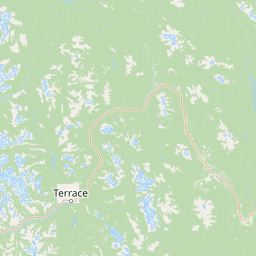
Use this park location map to pinpoint Kleanza Creek Provincial Park in Canada, understand its exact geographic position, and read its mapped placement within the surrounding landscape more clearly.

Pigeon | © OpenStreetMap contributors

Location context for Kleanza Creek Provincial Park

British Columbia

Visual exploration of rock canyons, forested terrain, and aquatic habitats

Kleanza Creek Provincial Park Photos and Protected Landscape Scenery

Visual documentation of Kleanza Creek Provincial Park reveals the dramatic topography of the Coast Mountains through detailed photography of forested rock canyons and cascading waters. Examining these protected landscapes provides clear insight into the rugged terrain, native salmon habitats, and unique environmental character found along the regional creek corridor.

A rushing creek flows through a narrow, steep-sided canyon with exposed grey bedrock and evergreen trees along the banks.

Park atlas

Compare surrounding regional geography and connected protected landscapes

Other Parks and Protected Areas Near Kleanza Creek Provincial Park

Browse nearby protected areas and connected regional park geography after viewing the rugged canyons of Kleanza Creek Provincial Park. Exploring adjacent natural reserves provides a broader perspective on the varied terrain and protected ecosystems spanning northwestern British Columbia.
State or regional parkBritish Columbia
About 28 km away#1 closest

Northwest

Kitsumkalum Provincial Park: Geography and Landscape Atlas of Northern British Columbia

Mapped protected areas and forest terrain in the Skeena region

Kitsumkalum Provincial Park serves as a compact protected node within the mountainous landscape of northern British Columbia. This record details the park's transition from lake to river outlet, the surrounding coniferous forests, and the geographic significance of the Skeena watershed. Gain spatial insight into the park boundaries and the historical context of its shoreline where early homesteading once flourished.

Area
0.4 km²
Established
1946
IUCN
II
Relief
Lowland
A soft watercolor illustration depicting a calm river scene with evergreen trees, a grassy riverbank, and distant rolling hills in pale green and pink tones.
State or regional parkBritish Columbia
About 65 km away#2 closest

Southwest

Exchamsiks River Provincial Park: Protected Old-Growth Forest Geography in British Columbia

A rare maritime Sitka spruce landscape in the Skeena River estuary

Situated at the meeting of the Exchamsiks and Skeena rivers, this provincial park protects a significant stand of unlogged old-growth coastal rainforest. The terrain provides a compact, ecologically essential example of the temperate habitat characteristic of British Columbia's north coast, featuring moisture-loving spruce and salmonberry understory landscapes.

Area
0.182 km²
Established
1956
Relief
Lowland
Climate
Temperate
State or regional parkBritish Columbia
About 89 km away#3 closest

West

Khutzeymateen Provincial Park: Protected Wilderness and Coastal Forest Geography

North Coast British Columbia protected area and estuary map.

Khutzeymateen Provincial Park represents a pivotal conservation achievement on the British Columbia North Coast. This wilderness sanctuary protects a critical estuarine complex where rugged mountain ranges meet a sheltered Pacific inlet. Beyond its designation as a grizzly bear stronghold, the park holds globally significant old-growth Sitka spruce forests, providing a rare look at an intact temperate rainforest landscape.

Area
450.52 km²
Established
1994
IUCN
Ib
Relief
Mountain
A soft watercolor painting of a winding river flowing through a lush, green landscape with forested hills in the background.
Nature reserveBritish Columbia
About 114 km away#4 closest

West

Gamble Creek Ecological Reserve: Protected Nature Reserve Geography and Forest Map

British Columbia North Coast forest and peatland research landscape.

Situated on the North Coast of British Columbia, Gamble Creek Ecological Reserve is a designated nature reserve comprising forest and bog ecosystems. The protected area serves as an important site for studying plant communities, including sphagnum moss and coastal bog species, within a unique altitudinal transition between coastal hemlock and subalpine zones.

Area
10.26 km²
Established
1991
IUCN
Ia
Relief
Mixed relief
A watercolor painting showing a lake, a forested shoreline, and distant mountains in a soft palette.
State or regional parkBritish Columbia
About 122 km away#5 closest

West

Diana Lake Provincial Park: Mapping Coastal Rainforest and Wetland Geography in British Columbia

An examination of North Coast forest and freshwater ecosystems

Diana Lake Provincial Park represents a significant protected area in British Columbia, showcasing the diverse ecological character of the North Coast. The park boundary encompasses a mosaic of old-growth rainforest, open blanket bogs, and freshwater aquatic systems. By protecting these varied terrains, the region maintains vital habitats for Pacific salmon species while providing a structured landscape for understanding the wet maritime environment of the Pacific Northwest.

Area
2.33 km²
Established
1980
IUCN
II
Relief
Upland
A horizontal watercolor painting showing a calm inlet surrounded by forested hills and distant mountains.
State or regional parkBritish Columbia
About 133 km away#6 closest

Southwest

Klewnuggit Inlet Marine Provincial Park: Regional Geography and Protected Area Mapping

Coastal inlet, freshwater lakes, and northern forest ecosystems.

Klewnuggit Inlet Marine Provincial Park showcases the dramatic meeting of mountain, forest, and sea. Spanning from the sheltered waters of the Grenville Channel to inland freshwater systems, the park offers a detailed study of northern coastal geography, fjord-like marine channels, and diverse bird and marine wildlife habitats.

Area
18 km²
Established
1993
IUCN
II
Relief
Mixed relief
A soft, light watercolor painting of a winding river flowing through a forested valley with distant, muted mountain ranges under a pale sky.
Protected areaBritish Columbia
About 133 km away#7 closest

South

Kitlope Heritage Conservancy: Coastal Temperate Rainforest and Mountain Watersheds

A vast protected area in the Kitimat-Stikine region of British Columbia

Spanning from the Gardner Canal to glaciated inland summits, the Kitlope Heritage Conservancy protects an entire, undisturbed watershed. It is defined by its transition from saltwater fjords through ancient, salmon-bearing river valleys to high granite peaks, acting as a vital benchmark for coastal ecosystem integrity in the Pacific Northwest.

Area
3,220.2 km²
Established
1996
IUCN
Ib
Relief
Mountain
Watercolor painting of a coastal scene with green islands, coniferous trees, and soft, hazy mountains in the background, set against a white background.
Marine protected areaBritish Columbia
About 133 km away#8 closest

West

Kitson Island Marine Provincial Park Map and Coastal Protected Area Atlas

Protected island and estuarine landscape in British Columbia

Kitson Island Marine Provincial Park encompasses a vital coastal island and the adjacent Flora Bank at the mouth of the Skeena River. This protected marine environment provides a rare example of accessible sandy beach terrain on the North Coast. Use this atlas resource to understand the park boundaries, island geography, and estuarine interface within the broader Inside Passage conservation network.

Area
0.45 km²
Established
1993
IUCN
II
Relief
Lowland

Common questions about visiting, size, designation, and location context for Kleanza Creek Provincial Park

Kleanza Creek Provincial Park FAQs for park facts, access, geography, and protected area context

Find quick answers about Kleanza Creek Provincial Park, including protected-area facts, park geography, trail and visitor context, and how the park fits into its surrounding country and regional landscape.
MoriAtlas Explorer

Continue Your Protected Areas Search Across the Global Atlas

Deepen your exploration by continuing the structured search for national parks and protected areas worldwide. Utilize the comprehensive filtering capabilities to compare different conservation landscapes and refine your understanding of global park geography. Discover more about the distribution and characteristics of protected natural areas.

Global natural geography