
Mori Atlas logo
Nature reserveKobersfelsen

A focused exploration of cliff-edge geology and specialized rock-crevice habitats in central Germany.

Kobersfelsen Nature Reserve: Mapped Silicate Cliff Landscapes in the Thuringian Slate Mountains

(Naturschutzgebiet Kobersfelsen)

Kobersfelsen stands as a distinctive nature reserve within the Thuringian Slate Mountains, defined by a dramatic silicate cliff overlooking the Burgkhammer reservoir on the River Saale. This protected area preserves a complex mosaic of vertical rock faces, slope woodlands, and rare pioneer vegetation that thrives in thin soil crevices. Serving as a vital component of the broader Burgk-Bleiberg-Kobersfelsen habitat network, the reserve offers a condensed example of the geological and ecological character found throughout the valley.

silicate cliffrock crevice vegetationslope mixed forestThuringian slate mountainsSaale valleysmall nature reserve
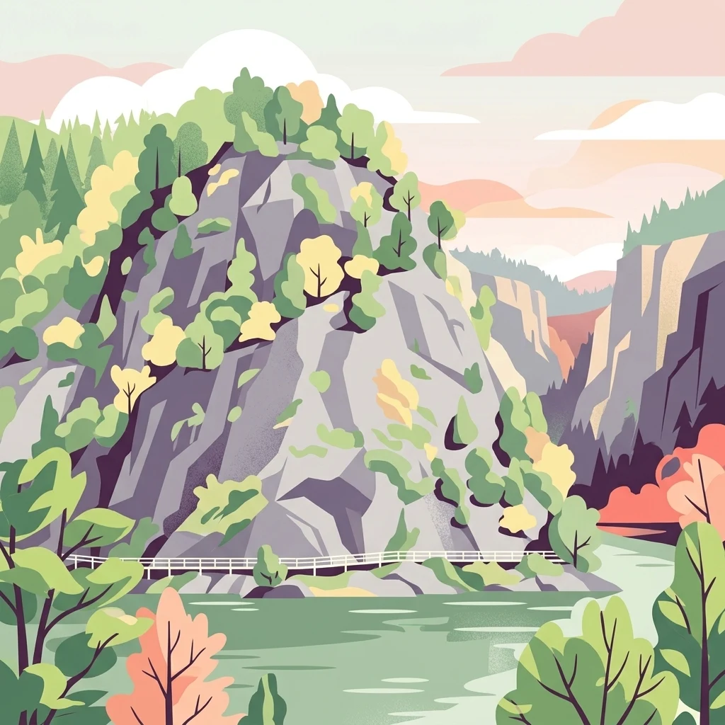
A stylized vector illustration of steep, rocky cliffs rising above a river with a small white footbridge crossing the base.

Kobersfelsen

Nature reserve

Park overview

Structured park overview, official facts, and landscape profile for Kobersfelsen Nature Reserve

Kobersfelsen Nature Reserve park facts, protected area profile, and essential visitor context

Review the core facts for Kobersfelsen Nature Reserve, including designation, size, terrain, visitor scale, habitats, and operating context in one park-focused overview.

About Kobersfelsen Nature Reserve

Kobersfelsen is a compact nature reserve in the eastern Thuringian highlands, where a steep silicate cliff plunges down toward the reservoir known as the Saale-Stausee Burgkhammer. Set within the Thuringian Slate Mountains, the reserve protects a sequence of habitats that converge on a single dramatic rocky outcrop: bare silicate rock, narrow crevices filled with pioneer vegetation, and mixed deciduous forests on the surrounding slopes. Although it spans only a few hectares, the site captures many of the ecological features that define the rock landscapes of this part of central Germany.

The reserve's designation in 1989 was driven largely by the botanical richness of the rock faces. Plants adapted to dry, sun-exposed silicate substrates find refuge in the cliff's fissures and ledges, while the adjacent slopes sustain mixed forest communities that contrast sharply with the open rock above. This layering of habitats over a very short distance makes Kobersfelsen especially valuable for studying how elevation, exposure, and soil depth interact to shape plant and animal communities in the slate highlands.

Beyond its ecological role, Kobersfelsen is woven into the cultural landscape of the upper Saale valley. The rock is named after a legendary knight, Kober, whose tragic leap across the Saale gave the cliff its identity and connected it to the nearby castle and monastery history of Burgk. Today the reserve remains both a working component of the regional Natura 2000 network and a scenic stop along the long-distance hiking trail that follows the Saale valley, linking Eisenach and Budapest as part of European long-distance path E3.

Quick facts and research context for Kobersfelsen Nature Reserve

Kobersfelsen lies in the Burgk district of Schleiz in the Saale-Orla-Kreis of Thuringia. It was established as a nature reserve in September 1989 by decision of the Gera District Council. The reserve covers approximately six hectares and is classified as an IUCN Category IV Habitat or Species Management Area. It is integrated into the Natura 2000 Habitats Directive site Burgk-Bleiberg-Kobersfelsen (DE-5436-301).

The defining habitats are silicate cliffs and rock domes with crevice and pioneer vegetation, alongside ravine and slope mixed forests. Two species are highlighted as particularly important for the reserve's conservation status: the Spanish flag moth and the greater mouse-eared bat. The site is accessed via a section of the long-distance Eisenach-Budapest friendship trail, part of European long-distance path E3.

Protection and recognition

Terrestrial protected area records and official recognition metadata

Kobersfelsen Protection Status and Documented Conservation Frameworks

Kobersfelsen maintains a recorded terrestrial protection status within global conservation databases. Verified administrative records outline the governance scope and international designation history associated with this protected landscape.

Protection details

Protection scope
Terrestrial
WDPA ID
164172
Park context

Deeper park guide and search-rich context for Kobersfelsen Nature Reserve

Kobersfelsen Nature Reserve history, landscape, wildlife, and travel context

Explore Kobersfelsen Nature Reserve through its history, landscape character, ecosystems, wildlife, conservation priorities, cultural context, and seasonal travel timing in a structured park guide built for atlas discovery and search intent.

Why Kobersfelsen Nature Reserve stands out

Kobersfelsen is primarily known for its silicate cliff exposures and the specialized plant communities that grow in its narrow rock crevices. These fissure and pioneer habitats support a small but characteristic set of species adapted to dry, thin-soiled rock surfaces, including the St. Bernard's lily, sometimes called the grape hyacinth-like lily, and the feathered pink of the Dianthus family. The cliff rises directly above the waters of the Burgkhammer reservoir, giving the reserve a striking vertical profile within the broader Thuringian Slate Mountains. Equally important is the reserve's role within the regional conservation network. Embedded in the larger Burgk-Bleiberg-Kobersfelsen Habitats Directive site, Kobersfelsen contributes to the protection of cliff and slope forest habitats that are otherwise rare in central Germany. The combination of geology, rock vegetation, and mixed woodland within a compact area is what gives the site its distinct identity.
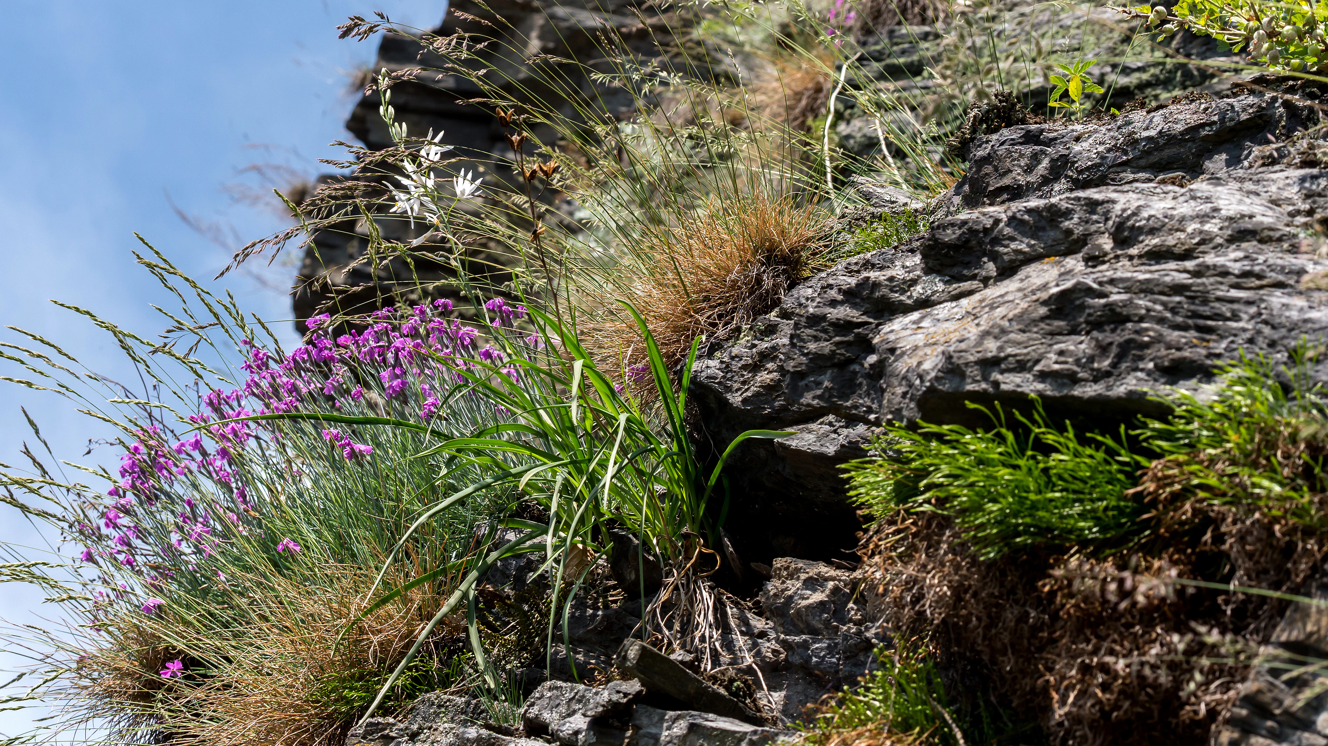
Close-up view of purple flowers and white lilies growing directly from the steep, layered silicate rock face of the Kobersfelsen nature reserve.
Silicate rock formations at Kobersfelsen, showing specialized cliff-crevice vegetation.

Kobersfelsen Nature Reserve history and protected-area timeline

The Kobersfelsen nature reserve was formally established in September 1989, when the district council of Bezirk Gera in the then-German Democratic Republic designated roughly six hectares around the cliff as a protected area. The motivation for the designation was the botanical value of the rock faces, particularly the fissure and pioneer vegetation that grows on the silicate substrate.

The site's identity, however, reaches back much further than its formal protection status. The cliff takes its name from a local legend concerning the medieval lords of Burgk castle on the Saale. According to the story, a knight named Kober attempted to leap his horse across the river for the love of the castle lord's daughter Elisabeth and died in the attempt. The name Kobersfelsen is documented in the nineteenth century, predating its later appearance as a nature reserve and showing that the rock has long held significance within the cultural landscape of the region.

Since designation, the reserve has been incorporated into the widerBurgk-Bleiberg-Kobersfelsen Habitats Directive site under the European Natura 2000 framework, anchoring its conservation role within a broader European ecological network.

Kobersfelsen Nature Reserve landscape and geographic character

The defining geographical feature of Kobersfelsen is a steep silicate rock face that rises directly from the waters of the Burgkhammer reservoir on the River Saale. The cliff sits within the Thuringian Slate Mountains, a region characterized by ancient sedimentary and metamorphic rocks that have been shaped by long-running erosion into narrow valleys, ridges, and exposed rock outcrops. At Kobersfelsen this geological character is expressed most visibly in the smooth, sloped formations of silicate rock that face the river.

The cliff itself forms only part of the protected scenery. Around and above it, mixed slope forests descend toward the base of the rocks, while the reservoir below provides a contrasting aquatic surface. The combination of vertical rock, wooded slopes, and open water creates a compressed but visually varied landscape within a very small area. The rocky exposures also feature crevices, ledges, and shallow soil pockets, all of which influence the kind of vegetation that can survive there.

The reserve's position above the Saale reservoir means that the cliff is visible from a distance across the water, giving it a landmark quality within the valley. The surrounding slate mountains continue in similar form on either side, but the combination of cliff exposure, slope woodland, and reservoir frontage makes Kobersfelsen a particularly concentrated expression of the regional terrain.

Kobersfelsen Nature Reserve ecosystems, habitats, and plant life

Ecologically, Kobersfelsen is defined by the contrast between exposed silicate rock and adjacent mixed forest. The bare rock surfaces and crevices support a community of specialized plants adapted to harsh, dry conditions, including pioneer species that colonize thin soil pockets. Among the characteristic plants of the cliff are the St. Bernard's lily and members of the Dianthus pink family, both of which are typical of sun-exposed silicate outcrops in central Germany.

Below the cliff, the slopes carry mixed deciduous and mixed woodland that transitions into ravine-influenced forest communities. These shade-dominant habitats provide a strong ecological contrast to the open rock above, supporting different plant and animal assemblages along the same vertical profile. The combination of fissure vegetation, pioneer communities, and mixed slope forest is the core ecological signature of the reserve.

The site also supports fauna adapted to both rock and forest. The Spanish flag moth, a colorful and increasingly rare species in central Europe, is highlighted as one of the species of conservation interest, while the greater mouse-eared bat uses the cliff and forest mosaic as part of its foraging range. The integration of these habitats within the Burgk-Bleiberg-Kobersfelsen Habitats Directive site extends the ecological value of Kobersfelsen across a wider landscape context.

Kobersfelsen Nature Reserve wildlife and species highlights

Kobersfelsen supports a relatively narrow but ecologically meaningful wildlife community shaped by its rocky terrain and adjacent forests. Among the most notable species is the Spanish flag moth, a striking, brightly patterned moth whose presence is regarded as one of the key conservation features of the reserve. The species reflects the value of the exposed rock faces and warm microclimates near the cliff.

The greater mouse-eared bat is likewise highlighted as a species of particular interest for the reserve's management. This bat relies on mosaic landscapes of woodland and open ground for foraging, and the combination of forested slopes, cliff faces, and reservoir edge at Kobersfelsen provides the kind of varied habitat it favors.

Beyond these two highlighted species, the reserve's fissures, mixed forests, and proximity to water offer habitat for the wider range of invertebrates, bats, and forest birds typical of the Thuringian slate highlands. The compact size of the protected area is balanced by its position within the larger Habitats Directive site, which extends its ecological role into the regional landscape.

Kobersfelsen Nature Reserve conservation status and protection priorities

Kobersfelsen holds its conservation significance primarily through the protection of silicate cliff and crevice habitats that are rare in central Germany. By safeguarding the rock faces, fissure vegetation, and adjacent mixed forests, the reserve preserves a small but representative example of the ecological systems associated with the Thuringian Slate Mountains. The habitats protected here are particularly sensitive to disturbance, both because of their fragility and because the species that depend on them often have very specific substrate and microclimate requirements.

At a broader scale, the reserve is embedded in the European Natura 2000 network through its inclusion in the Burgk-Bleiberg-Kobersfelsen Habitats Directive site. This linkage extends the conservation scope of Kobersfelsen beyond its own boundaries and ties it to protection efforts for similar rock and forest habitats elsewhere in the Saale-Orla district. The Habitats Directive framework recognizes the site's role in maintaining regional biodiversity and landscape connectivity.

The reserve is classified under IUCN Category IV as a Habitat or Species Management Area, indicating that its conservation approach combines habitat protection with active consideration of the species that depend on those habitats, including the Spanish flag moth and the greater mouse-eared bat.

Kobersfelsen Nature Reserve cultural meaning and human context

Kobersfelsen is embedded in a landscape shaped by the medieval history of the upper Saale valley. The nearby castle of Burgk, which overlooks the river above the reservoir, is the setting for the legend that gives the cliff its name. According to local tradition, a knight named Kober from this milieu attempted to leap his horse across the Saale for the love of Elisabeth, daughter of the lord of Burgk, and perished in the attempt.

The legend's continuation describes Elisabeth entering the Cistercian convent at Heiligkreuz monastery near Saalburg, linking the rock to a wider pattern of noble families donating daughters to religious houses after tragic events. Although the story sits within a tradition of romantic medieval legends found across many German river valleys, it has given the cliff cultural depth that goes beyond its natural values and connects the physical landscape to the human story of the Saale.

The name Kobersfelsen can be traced back into the nineteenth century, predating any later naturalist or conservation context. This long-standing place-name history shows that the rock has functioned as a recognizable feature of the valley for generations, and it remains the basis for the reserve's present-day identity.

Top sights and standout views in Kobersfelsen Nature Reserve

A small but ecologically dense reserve that captures the defining geological and botanical character of the Thuringian Slate Mountains within just a few hectares. The combination of exposed silicate cliff, crevice and pioneer vegetation, and adjacent mixed slope forest gives the site a layered ecological profile that is rare for such a compact area. Its inclusion in the Burgk-Bleiberg-Kobersfelsen Habitats Directive site ties it into a wider European conservation network, while the cliff's appearance above the Burgkhammer reservoir gives it a striking visual role within the Saale valley.

Best time to visit Kobersfelsen Nature Reserve

The character of a visit to Kobersfelsen is strongly seasonal. Late spring and early summer are typically the most rewarding periods for observing the cliff's fissure vegetation, when plants such as the St. Bernard's lily and associated rock pinks come into flower against the warm silicate rock. The same period offers favorable conditions for insects and for bat activity around the cliff and forest edge, including the Spanish flag moth.

Autumn brings its own appeal, with the surrounding mixed forests taking on seasonal color and the reservoir waters offering calmer, more reflective conditions below the rock. Winter experiences are quieter, with reduced wildlife activity but clearer visibility of the cliff's geological structure and the wider slate mountain landscape. Visitors throughout the year will encounter different aspects of the reserve, and any season can suit those primarily interested in scenery, hiking, or landscape appreciation rather than a specific botanical moment.

Monthly climate preview

Long-term temperature and monthly precipitation patterns sampled at 496 meters elevation

Kobersfelsen Climate Normals and Measured Annual Weather by Month

Kobersfelsen exhibits a recorded annual temperature rhythm spanning subzero winter minimums to warm summer maximums alongside consistent daily precipitation. Reviewing the complete twelve-month normals reveals detailed monthly variations in temperature and moisture for this representative coordinate.
Annual mean8 °C
-2 °C18 °C
Jan-2°
Feb-1°
Mar
Apr
May12°
Jun16°
Jul18°
Aug18°
Sep13°
Oct
Nov
Dec-1°
Warmest month
July

17.8 °C

Coolest month
January

-2.4 °C

Wettest month
July

2.8 mm/day

Driest month
April

1.4 mm/day

Park location guide

Geography guide, regional context, and park location map for Kobersfelsen Nature Reserve

Kobersfelsen Nature Reserve park geography, regions, and map view in Germany

Understand where Kobersfelsen Nature Reserve sits in Germany through a broader geographic reading of the surrounding landscape, nearby location context, and its mapped position within the national park landscape.

How Kobersfelsen Nature Reserve fits into Germany

Germany is a federal republic in Western and Central Europe with a population of over 83 million across sixteen constituent states. It is Europe's largest economy by nominal GDP and a major global exporter and importer. The capital is Berlin, and the country borders Denmark, Poland, Czech Republic, Austria, Switzerland, France, Luxembourg, Belgium, and the Netherlands.

Wider geography shaping Kobersfelsen Nature Reserve in Germany

Germany is located in Western and Central Europe, spanning 357,022 km². It borders Denmark to the north, Poland and the Czech Republic to the east, Austria and Switzerland to the south, and France, Luxembourg, Belgium, and the Netherlands to the west. The country has coastlines on the Baltic Sea and North Sea to the north, with the Alps located in the southern region.

Map view of Kobersfelsen Nature Reserve

Use this park location map to pinpoint Kobersfelsen Nature Reserve in Germany, understand its exact geographic position, and read its mapped placement within the surrounding landscape more clearly.

Pigeon | © OpenStreetMap contributors

Location context for Kobersfelsen Nature Reserve

Thuringia

Explore detailed imagery of the silicate rock face, slope forests, and river valley environment.

Kobersfelsen Photos and Landscape Scenery: Visualizing the Thuringian Cliff Habitat

Examine high-resolution photographs showcasing the steep silicate cliffs and specialized rock-crevice vegetation defining the protected reserve. Visual documentation reveals the striking vertical terrain and mixed woodland habitats rising above the Saale reservoir.

Close-up view of purple flowers and white lilies growing directly from the steep, layered silicate rock face of the Kobersfelsen nature reserve.

A steep, rocky cliff face covered in sparse greenery, reflecting into the calm water of a reservoir at the base.

Park atlas

Compare regional conservation lands and nearby highland reserves

Explore Parks Near Kobersfelsen and Surrounding Protected Areas

Browse other parks near Kobersfelsen to discover connected protected landscapes and similar geological formations across the surrounding region. Expanding beyond individual cliff habitats provides a broader view of regional conservation networks and valley terrain.
A horizontal watercolor painting showing a soft, stylized landscape of rolling green hills, gentle slopes, and a calm body of water against a light pastel sky.
Nature reserveThuringia
About 8.3 km away#1 closest

North

Plothener Teiche Nature Reserve: Geographic Map and Protected Wetland Landscape Overview

Historic pond landscapes in the Saale-Orla-Kreis region of Thuringia

Plothener Teiche serves as a defining example of medieval-origin fishpond management in central Germany. This protected landscape combines open water basins, reed-lined margins, and woodland edges within the Thüringer Schiefergebirge and Obere Saale Nature Park. The area provides essential habitat for migratory bird populations and stands as a restored model of European wetland ecology.

Established
1967
IUCN
IV
Relief
Lowland
Climate
Temperate
Protected landscapeBavaria
About 14 km away#2 closest

Southwest

Naturpark Frankenwald: Geographic Profile of Bavaria's Forested Protected Landscape

A vast, interconnected upland spanning the Bavaria and Thuringia border

Naturpark Frankenwald functions as a large-scale managed nature preserve that integrates cultural heritage with ecological conservation. The terrain consists of gentle mountainous ridges, narrow river valleys, and extensive mixed forests that form a continuous landscape belt across northern Bavaria. This profile provides an overview of the regional geography, boundary extent, and the natural features that define this significant central German upland area.

Area
1,023 km²
Established
1973
Relief
Upland
Climate
Temperate
A soft watercolor painting of a rolling landscape with green hills, scattered trees, and pale, earthy foreground textures.
Nature reserveThuringia
About 20 km away#3 closest

Northwest

Buchenberg bei Krölpa Nature Reserve: Mapped Geography and Protected Landscape Context

A restored limestone quarry habitat located in Thuringia, Germany.

Buchenberg bei Krölpa stands as a regionally significant nature reserve located east of Krölpa. Formerly a site of limestone extraction, the protected area now functions as a managed habitat, characterized by its broken, stepped terrain and slopes that host native orchid species and dry grassland vegetation within the broader Thuringian countryside.

Area
0.201 km²
Established
1996
IUCN
IV
Relief
Upland
A soft watercolor painting showing a pond landscape with rolling hills in the background, green trees in the midground, and tall grasses along the water edge.
Nature reserveSachsen
About 21 km away#4 closest

East

Großer Weidenteich Nature Reserve: Mapping the Biodiversity of the Saxon Vogtland

A vital protected landscape shaped by traditional grazing management

Großer Weidenteich acts as a crucial refuge for diverse species, including nearly 700 butterfly varieties and numerous breeding bird populations. The reserve's landscape is characterized by a mix of wetlands, meadows, and shrubby margins that rely on continuous sheep grazing for structural maintenance. This area provides a clear perspective on how small-scale water bodies and varied vegetation patches contribute to the health of the broader Saxon regional ecosystem.

Area
3.349 km²
Established
1994
IUCN
IV
A horizontal watercolor painting of a wooden boardwalk path cutting through a forest clearing with scattered pine trees, rendered in soft light tones.
Nature reserveThuringia
About 22 km away#5 closest

Northeast

Pöllwitzer Wald Nature Reserve: Geographic Overview and Protected Area Mapping

Historic forest landscapes in the Thuringia region

Pöllwitzer Wald represents a dense, historically significant nature reserve located near the Thuringia and Saxony border. This detailed overview covers the essential geographic features, including the unique moorland basin, coniferous forest transitions, and the remnants of early modern log floating infrastructure that shaped the regional topography.

Area
9.62 km²
Relief
Upland
Climate
Temperate
Access
Easy access
A horizontal watercolor illustration showing green rolling hills, distant light green ridges, and sparse trees against a white background.
Nature reserveThuringia
About 37 km away#6 closest

North

Spitzenberg-Schießplatz Rothenstein-Borntal Nature Reserve and Saale Valley Geography

Protected forest and grassland terrain in Thuringia

Spitzenberg-Schießplatz Rothenstein-Borntal is a protected nature reserve in Thuringia, covering hundreds of hectares of forest slopes, plateaus, and open clearings. This reserve is recognized for its unusual structural diversity, ranging from closed valley woodland to sun-exposed semi-dry grassland, providing essential habitat within the middle Saale valley region.

Area
5.542 km²
Established
1961
IUCN
IV
Protected areaThuringia
About 37 km away#7 closest

Northeast

Wälder um Greiz und Werdau: Protected Landscape and Regional Woodland Atlas for Thuringia

Continuous forest terrain on the Thuringia and Saxony border

The protected landscape of Wälder um Greiz und Werdau covers rolling hills and valleys between the Pleiße and Weiße Elster rivers. Use this atlas resource to understand the park's mapped boundaries, forest pond distribution, and its role as a green corridor between regional townscapes.

Area
62 km²
Established
1961
Relief
Upland
Climate
Temperate
Nature reserveThuringia
About 39 km away#8 closest

North

Leutratal und Cospoth Nature Reserve: Mapping Calcareous Grasslands in Thuringia

A study of limestone slopes and orchid-rich habitats in central Germany

Leutratal und Cospoth serves as a prime example of protected Muschelkalk landscape in Thuringia. This reserve captures the complex transition between open grasslands, scrub, and beech forests within the middle Saale valley, offering deep insights into the region's unique geological and botanical heritage.

Area
5.829 km²
Established
1961
IUCN
IV
Relief
Upland

Common questions about visiting, size, designation, and location context for Kobersfelsen Nature Reserve

Kobersfelsen Nature Reserve FAQs for park facts, access, geography, and protected area context

Find quick answers about Kobersfelsen Nature Reserve, including protected-area facts, park geography, trail and visitor context, and how the park fits into its surrounding country and regional landscape.
MoriAtlas Explorer

Continue Your Protected Areas Search Across the Global Atlas

Deepen your exploration by continuing the structured search for national parks and protected areas worldwide. Utilize the comprehensive filtering capabilities to compare different conservation landscapes and refine your understanding of global park geography. Discover more about the distribution and characteristics of protected natural areas.

Global natural geography