
Mori Atlas logo
Nature reserveKuala Selangor Nature Park

Tracing the Estuarine Landscape and Managed Wetland Habitats of this Coastal Conservation Area

Kuala Selangor Nature Park: A Protected Coastal Wetland and Forest Reserve in Selangor, Malaysia

Located at the estuary of the Selangor River, Kuala Selangor Nature Park stands as a significant protected area managing a transition between secondary forest and coastal wetland systems. The geography of this reserve is defined by engineered bunds and regulated water levels that support diverse bird populations and migratory species. Through this atlas, discover the layout of the mangrove fringe, inland forest trails, and freshwater pond systems that comprise this protected landscape in the heart of Selangor.

wetlandmangrovesecondary forestestuarybirdwatchingImportant Bird Area
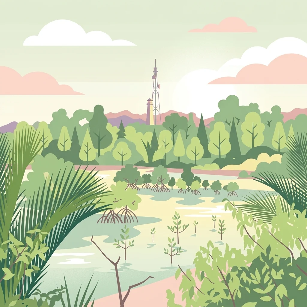
A flat vector style illustration depicting a mangrove wetland with various plants, trees, and a tall communication tower and lighthouse visible in the background against a soft pastel sky.

Kuala Selangor Nature Park

Nature reserve

Park overview

Structured park overview, official facts, and landscape profile for Kuala Selangor Nature Park

Kuala Selangor Nature Park park facts, protected area profile, and essential visitor context

Review the core facts for Kuala Selangor Nature Park, including designation, size, terrain, visitor scale, habitats, and operating context in one park-focused overview.

About Kuala Selangor Nature Park

Kuala Selangor Nature Park sits on the edge of the Selangor River estuary, where freshwater meets the tidal influence of the Strait of Malacca. The park occupies roughly 2.4 square kilometers of coastal lowland and is structured as a dual environment: a zone of regenerated secondary forest inland of a man-made coastal bund, and a wetland system on the seaward side that includes mangrove, open water, and a large managed pond connected to the river through a controlled water lock.

This combination of habitats gives the park an unusually rich ecological character for a site of its size. The forest zone provides refuge for mammals such as silvered-leaf monkeys, long-tailed macaques, and small carnivores, while the wetland attracts resident and migratory waterbirds, waders, and seabirds. The brackish and freshwater environments also support an extensive invertebrate community, including mudskippers, fiddler crabs, horseshoe crabs, mangrove crickets, and various mollusks.

The park's significance goes beyond its habitats. It is closely linked to the wider conservation movement in Malaysia: established through a petition by the Malayan Nature Society and the Asian Wetlands Bureau, it became the first park in the country to be managed by a non-governmental organization. Subsequent recognition as an Important Bird Area underlined its role in regional bird conservation, and ongoing proposals to declare it a wetland of international importance reflect the broader ecological value of the Selangor River estuary system.

Quick facts and research context for Kuala Selangor Nature Park

Kuala Selangor Nature Park is a 2.4 square kilometer protected area at the mouth of the Selangor River in Selangor, Malaysia. It was established on 27 September 1987 and has been managed by the Malaysian Nature Society since its founding, making it the first NGO-managed park of its kind in Malaysia. It was formally recognized as an Important Bird Area by BirdLife International in 1997.

Protection and recognition

Documented terrestrial protection scope and historical designation data

Kuala Selangor Nature Park Protection Status and Designation History

Kuala Selangor Nature Park features a documented terrestrial protection scope established in the designated year 1997. Official conservation data compiles management history and international recognition sources into a structured reference.

Protection details

Protection scope
Terrestrial
Designated year
1997
Transboundary protection
No
Park context

Deeper park guide and search-rich context for Kuala Selangor Nature Park

Kuala Selangor Nature Park history, landscape, wildlife, and travel context

Explore Kuala Selangor Nature Park through its history, landscape character, ecosystems, wildlife, conservation priorities, cultural context, and seasonal travel timing in a structured park guide built for atlas discovery and search intent.

Why Kuala Selangor Nature Park stands out

Kuala Selangor Nature Park is best known for its combination of secondary forest and restored coastal wetland at a major river estuary, and for the rich birdlife that this mosaic of habitats supports. It combines mangrove, freshwater pond, and tropical forest environments within a compact, accessible footprint, and it is particularly associated with large wading birds including egrets, herons, and the endangered milky stork. Recognition as an Important Bird Area and its history as the site of a milky stork breeding program have given the park a distinctive profile among Malaysian conservation sites. It also stands out as the country's first NGO-managed nature park, a model of cooperative conservation management between a state government and an environmental society.
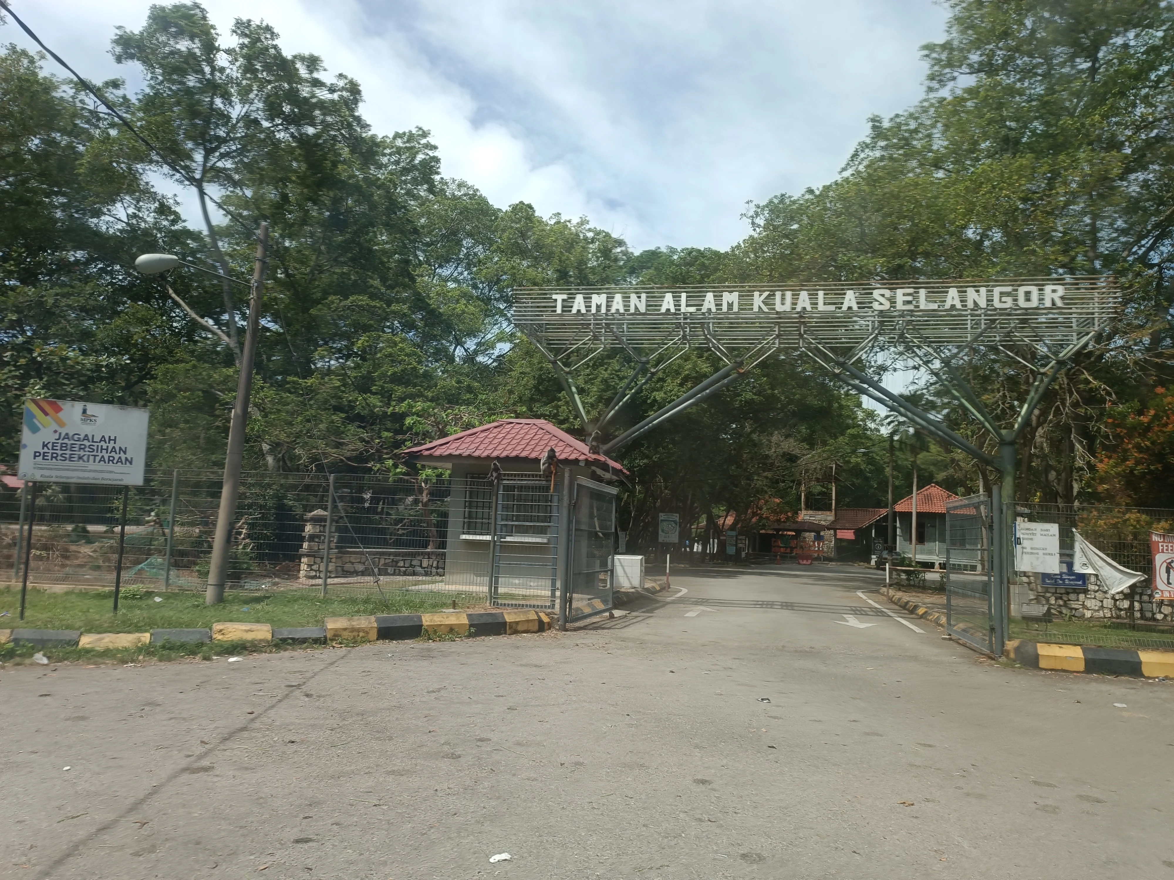
A paved road leads through a metal gate archway labeled Taman Alam Kuala Selangor, flanked by trees and a small guardhouse building.
The main entrance gate to Kuala Selangor Nature Park in Malaysia.

Kuala Selangor Nature Park history and protected-area timeline

The land that now forms Kuala Selangor Nature Park was once covered by virgin mangrove forest, but this natural cover was progressively altered during the twentieth century. Between 1965 and the 1970s, large portions of the mangrove were cleared to make way for salt evaporation ponds. In 1986, further land clearing began to develop a marina, prawn farm, and golf course; sand dredging associated with these projects killed extensive stretches of mangrove and left a degraded landscape of secondary growth.

Concern over this rapid coastal degradation prompted the Malayan Nature Society, together with the Asian Wetlands Bureau, to petition the Selangor state government to protect the area. As a result, the land was formally established as a nature park on 27 September 1987. Since then, it has been managed by the Malaysian Nature Society under a cooperative arrangement with the state, becoming the first park in Malaysia to be managed by a non-governmental organization.

The silvered-leaf monkey, an endangered primate found in the park, was adopted as the park's official logo. In 1997, Kuala Selangor Nature Park was recognized as a nature reserve for conservation and ecotourism and was simultaneously designated an Important Bird Area by BirdLife International. The park also hosted a captive-breeding program for the endangered milky stork, which was eventually suspended; an abandoned aviary associated with this program still stands in the park today.

Kuala Selangor Nature Park landscape and geographic character

The landscape of Kuala Selangor Nature Park is defined by the meeting point between a river estuary and the surrounding coastal plain. Low-lying terrain dominates the site, with much of the park shaped by water management rather than dramatic topography. A man-made coastal bund separates the inland forest zone from the tidal wetland, while a second bund encloses a large freshwater pond that lies within the park itself.

The water level of this central pond is regulated by a lock connecting it to the Selangor River, allowing managers to mimic natural wetland conditions. Beyond the bund, mangrove and estuarine habitats extend toward the river mouth, while the inland side of the park is covered with secondary forest that has regrown since the mid-twentieth-century clearing and dredging.

Walking the park's three routes, the Main Trail, the Bund Trail, and the Mangrove Walkway, gives a clear sense of how these zones fit together. Visitors move from shaded forest interior, along an engineered lake shoreline, and out into the mangrove fringe. Two watchtowers along the routes offer elevated views across the wetland, especially useful for observing the pond, the mangrove canopy, and the broader estuary beyond.
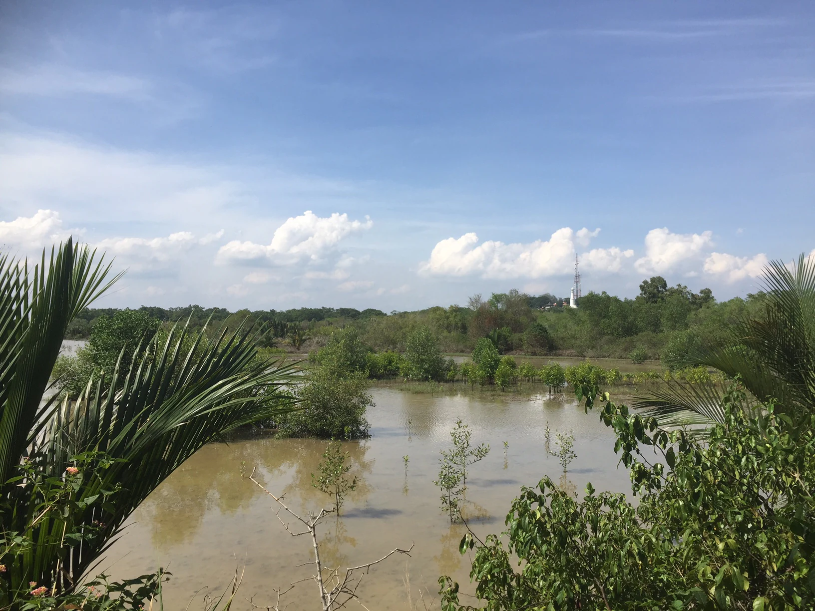
A wide shot of a shallow brackish lake surrounded by mangrove vegetation and trees under a blue sky with scattered clouds.
A view of the brackish lake within Kuala Selangor Nature Park.

Kuala Selangor Nature Park ecosystems, habitats, and plant life

Kuala Selangor Nature Park is essentially a mosaic of three interconnected ecosystems: secondary tropical forest, mangrove wetland, and an artificial freshwater pond system. Each of these contributes a different layer to the park's biodiversity, and the proximity of forest to wetland is what gives the site its particular ecological value.

The secondary forest, although regrown, supports a broad community of plants and animals typical of lowland Peninsular Malaysia. Common trees recorded here include species such as noni, sea almond, sea hibiscus, and the bird lime tree, while the canopy and understory provide habitat for primates, squirrels, civets, and small carnivores. The mangrove zone, with around thirteen recorded mangrove tree species including buta-buta, bakau kurap, and perepat, anchors the wet edge of the park.

The freshwater pond and tidal channels add a third dimension. Their muddy banks and brackish edges sustain invertebrates such as mudskippers, fiddler crabs, mangrove hermit crabs, peanut worms, and sea anemones, as well as fish like the banded archerfish and spotted green pufferfish. Together, these habitats create transitional conditions that support both resident wildlife and seasonal visitors, particularly migratory shorebirds and waterbirds that use the estuary as a staging and feeding ground.
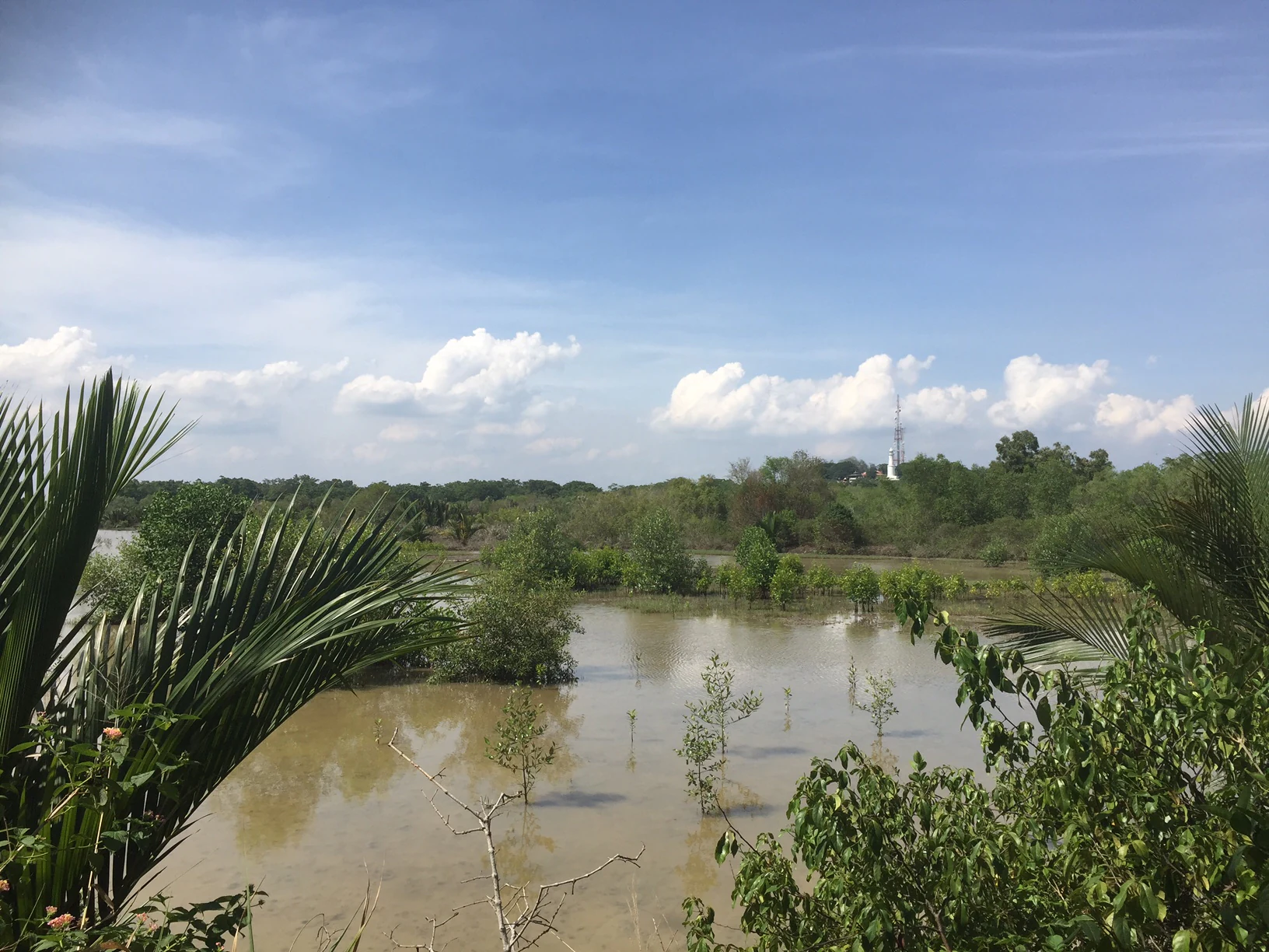
A wide view of a murky, calm lake with small, sparse trees growing out of the water, framed by palm fronds in the foreground and a blue, cloudy sky above.
A view of the brackish lake situated in the center of Kuala Selangor Nature Park, surrounded by secondary forest and mangroves.

Kuala Selangor Nature Park wildlife and species highlights

Wildlife is one of the strongest draws of Kuala Selangor Nature Park, largely because the park's mix of forest and wetland supports an unusually wide range of species for a small coastal reserve. The most prominent mammals are primates: the park is known for its populations of silvered-leaf monkeys, also called Selangor silvered langurs, and long-tailed macaques. Other recorded mammals include plantain squirrels, common palm civets, smooth-coated otters, short-tailed mongooses, leopard cats, and short-nosed fruit bats, giving the forest zone a rich small-mammal and mid-sized carnivore community.

Birdlife is the park's signature feature. Around 98 resident bird species have been recorded, including pink-necked pigeons, peaceful doves, great egrets, grey herons, little herons, milky storks, collared kingfishers, and brahminy kites. A further 57 migratory species have been documented, ranging from Mongolian plovers and common redshanks to blue-tailed bee-eaters and black-capped kingfishers. The presence of these migratory visitors confirms the park's role as a stopover and feeding area within larger regional bird routes.

Reptiles, amphibians, and invertebrates add further variety. Monitor lizards, dog-faced water snakes, and reticulated pythons are recorded, along with conspicuous invertebrates such as the coconut rhinoceros beetle, weaver ants, striped blue crows, mangrove crickets, fiddler crabs, mangrove hermit crabs, tree-climbing crabs, and horseshoe crabs. The combination of forest mammals, waterbirds, reptiles, and a rich invertebrate community means the park functions almost as a compact cross-section of Malaysia's coastal biodiversity.

Kuala Selangor Nature Park conservation status and protection priorities

Kuala Selangor Nature Park is significant as both a restored habitat and a model of cooperative conservation management. The site's history of clearance for salt ponds and later for marina and golf-course development means that every acre of present-day forest and wetland represents a recovery from documented degradation. The park's secondary forest and mangrove habitats are therefore not just natural assets but also active demonstrations of how coastal lowlands can be brought back under protection.

Its conservation profile rests on several formal recognitions. In 1997, the park was formally recognized as a nature reserve for conservation and ecotourism and was simultaneously designated an Important Bird Area by BirdLife International. The Malaysian Nature Society, which manages the park under a cooperative arrangement with the Selangor state government, has additionally proposed that it be declared a wetland of international importance under the Ramsar framework, given its position within the broader Selangor River estuary.

The park also has an unusual conservation legacy in species programs. It once hosted a breeding program for the endangered milky stork, an effort that, while eventually suspended, cemented the park's association with that iconic species and contributed to broader efforts to protect large wading birds in Malaysia. Taken together, these factors make the park not only a local nature reserve but also a nationally recognized reference point for wetland and bird conservation.

Kuala Selangor Nature Park cultural meaning and human context

The park does not emphasize indigenous or traditional cultural narratives in the way that some larger Malaysian reserves do. Its cultural relevance is largely tied to its proximity to Bukit Melawati, a nearby historical hill that is associated with the former Selangor kingdom and retains a lighthouse, fort remains, and panoramic viewpoints over the estuary. The surrounding Kuala Selangor area also has working fishing villages along the Selangor River, where seafood restaurants and small-scale maritime traditions continue alongside modern tourism.

The park itself also carries a notable institutional cultural significance: it was the first nature park in Malaysia to be managed by a non-governmental organization, the Malaysian Nature Society. This cooperative management model, in which a state government partners with a civil society body to run a protected area, has become an influential reference point in Malaysian conservation history.

Top sights and standout views in Kuala Selangor Nature Park

Kuala Selangor Nature Park is distinguished by the rare pairing of regenerating coastal forest and a working wetland system at a major river estuary, all within a single accessible site. The combination of the Main Trail, Bund Trail, and Mangrove Walkway makes it possible to experience forest interior, lake edge, and mangrove fringe in a single short visit.

For birdwatchers, the park's importance is hard to overstate: BirdLife International recognition, a long list of resident and migratory species, and a historical connection to milky stork conservation make it a notable destination. For visitors more broadly, the park also offers watchtowers with estuary views, environmental education programs, and easy pairing with nearby sites such as Bukit Melawati and the famous firefly colonies of Kampung Kuantan.

Best time to visit Kuala Selangor Nature Park

The park's character shifts meaningfully with the seasons. Migratory bird activity tends to peak during the northern winter months, when species such as Mongolian plovers, common redshanks, and blue-tailed bee-eaters move through or settle around the estuary, making this an especially rewarding period for birdwatchers. The local climate is governed by Peninsular Malaysia's monsoon pattern, with drier intervals offering clearer views across the wetland from the park's watchtowers, and wetter periods bringing higher water levels and more active mangrove and pond ecosystems.

Resident wildlife, including silvered-leaf monkeys, macaques, otters, and large wading birds such as egrets and milky storks, can generally be observed year-round. Many visitors prefer early morning or late afternoon, when bird activity is concentrated and temperatures are cooler, though the park's environmental education activities and guided programs are typically scheduled in alignment with daylight hours throughout the year.
Monthly climate preview

Long-term monthly temperature and precipitation averages for Kuala Selangor Nature Park

Kuala Selangor Nature Park Climate Normals and Annual Temperature Rhythm

Recorded measurements across the 1991 to 2020 climatology period establish consistent monthly temperature ranges alongside shifting daily precipitation volumes at Kuala Selangor Nature Park. Accessing the complete twelve-month profile provides a detailed breakdown of monthly precipitation rates and temperature fluctuations across the protected area.
Annual mean27 °C
26 °C28 °C
Jan26°
Feb27°
Mar27°
Apr28°
May28°
Jun27°
Jul27°
Aug27°
Sep27°
Oct27°
Nov27°
Dec26°
Warmest month
May

27.6 °C

Coolest month
January

26.4 °C

Wettest month
November

10.8 mm/day

Driest month
June

4.7 mm/day

Park location guide

Geography guide, regional context, and park location map for Kuala Selangor Nature Park

Kuala Selangor Nature Park park geography, regions, and map view in Malaysia

Understand where Kuala Selangor Nature Park sits in Malaysia through a broader geographic reading of the surrounding landscape, nearby location context, and its mapped position within the national park landscape.

How Kuala Selangor Nature Park fits into Malaysia

Malaysia is a federal constitutional monarchy located in Southeast Asia. The country consists of 13 states and three federal territories, divided by the South China Sea into Peninsular Malaysia on the Indochinese Peninsula and East Malaysia on the island of Borneo. With a population of over 34 million, it achieved independence from Britain in 1957 and became a modern federation in 1963. The country is recognized for its multicultural population, tropical climate, and significant economic role in the region.

Wider geography shaping Kuala Selangor Nature Park in Malaysia

Malaysia occupies a strategic position in Southeast Asia, split by the South China Sea into two distinct regions. Peninsular Malaysia lies on the Indochinese Peninsula, sharing a land border with Thailand to the north and maritime borders with Singapore, Vietnam, and Indonesia. East Malaysia occupies the northern portion of Borneo, sharing land borders with Brunei and Indonesia, and maritime borders with the Philippines and Vietnam. The country's terrain includes coastal plains, mountain ranges such as the Titiwangsa in the peninsula, and extensive tropical rainforests.

Map view of Kuala Selangor Nature Park

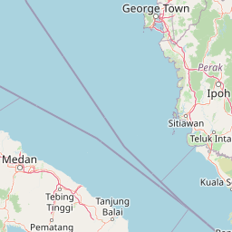
Use this park location map to pinpoint Kuala Selangor Nature Park in Malaysia, understand its exact geographic position, and read its mapped placement within the surrounding landscape more clearly.

Pigeon | © OpenStreetMap contributors

Location context for Kuala Selangor Nature Park

Selangor

Visualizing the coastal wetland habitats and forest terrain

Kuala Selangor Nature Park Photos and Landscape Scenery

Photographic records capture the diverse habitats, mangrove fringes, and secondary forests that define the protected landscape at the Selangor River estuary. Visual documentation reveals the low-lying terrain and water management features that shape this important bird sanctuary.

A paved road leads through a metal gate archway labeled Taman Alam Kuala Selangor, flanked by trees and a small guardhouse building.

Rows of young mangrove saplings growing in raised nursery beds against a backdrop of mature forest.

A wide shot of a shallow brackish lake surrounded by mangrove vegetation and trees under a blue sky with scattered clouds.

A wide view of a murky, calm lake with small, sparse trees growing out of the water, framed by palm fronds in the foreground and a blue, cloudy sky above.

Park atlas

Compare regional wetland habitats and connected coastal landscapes across Malaysia

Other Parks Like Kuala Selangor Nature Park and Nearby Protected Areas

Continue exploring regional conservation areas and coastal reserves situated near Kuala Selangor Nature Park. Examining these adjacent protected landscapes provides deeper context into Malaysian wetland geography and estuarine ecosystems.
Nature reserveSelangor
About 54 km away#1 closest

East

Templer Park: Protected Hill Forest Reserve and Landscape Geography in Selangor, Malaysia

Mature forest canopy and tropical stream terrain

Templer Park preserves a critical patch of mature lowland and hill forest within Selangor. Featuring multi-tiered waterfalls, shaded riverbanks, and limestone caves, the reserve supports high biological interest including rare endemic species. Its mapped boundaries reflect an essential green refuge amidst regional development, offering a window into the natural forest geography north of Kuala Lumpur.

Area
12.14 km²
Established
1954
Relief
Upland
Climate
Tropical
State or regional parkSelangor
About 59 km away#2 closest

East

Selangor State Park: Protected Rainforest and Geological Landscape Discovery

Highland water catchment and quartz ridge geography in Selangor

Selangor State Park forms a massive block of continuous tropical rainforest serving as the principal water supply for the Klang Valley. This protected area features rugged slopes, diverse river basins, and the dramatic 14-kilometer Klang Gates Quartz Ridge. Use this map-integrated record to understand the park's critical role in regional hydrological regulation and its significance as a research-anchored highland ecosystem.

Area
914.41 km²
Established
2007
Relief
Highland
Climate
Tropical
Nature reserveSelangor
About 71 km away#3 closest

Southeast

Kuala Langat North Forest Reserve: Mapped Boundaries and Ecological Terrain Overview

Ancient lowland peat swamp geography in Selangor, Malaysia

Kuala Langat North Forest Reserve is an ecologically vital peat swamp remnant that shelters a range of endemic species within its 8,000 year old forest canopy. Located in the lowland terrain of Selangor, the reserve exists as a critical forest island surrounded by a matrix of development. This overview provides mapped context for the reserve's internal landscape and its role as a protected area within the shifting geography of the Klang Valley.

Area
9.576 km²
Established
1927
Relief
Lowland
Climate
Tropical
Wildlife reservePahang
About 117 km away#4 closest

East

Tengku Hassanal Wildlife Reserve: Protected Forest and Mountain Geography in Pahang

Mapping a vast lowland dipterocarp forest sanctuary.

Spanning over 600 square kilometers, Tengku Hassanal Wildlife Reserve stands as a core protected area within Pahang. Its landscape includes riverine valleys and the steep montane terrain of the Benom Complex, supporting unique biodiversity and active wildlife conservation. This overview traces the park's geographic footprint and its role as an ecological corridor within the broader Titiwangsa mountain system.

Area
605.52 km²
Established
1923
Relief
Mountain
Climate
Tropical
Wildlife reserveMalacca
About 135 km away#5 closest

Southeast

Tanjung Tuan Wildlife Reserve: Coastal Geography and Forested Cape Mapping

Coastal dipterocarp forest and raptor sanctuary in Malacca.

This forested coastal cape is an essential protected landscape situated along the Strait of Malacca. Characterized by its dense lowland dipterocarp forest, rocky headlands, and offshore islets, the reserve provides a crucial ecological connection for migratory birds and preserves a rich history of colonial maritime navigation and defense. Its geography offers a compact view of diverse coastal environments, ranging from mangrove fringes to the elevated ridge of Batu Putih.

Area
0.607 km²
Established
1921
Relief
Upland
Climate
Tropical
Nature reserveMalaysia
About 135 km away#6 closest

East

Pasoh Forest Reserve: Lowland Dipterocarp Protected Area in Peninsular Malaysia

Mapping tropical rainforest boundaries and ecological research zones

Situated in the interior of Peninsular Malaysia, Pasoh Forest Reserve protects a vital fragment of lowland dipterocarp rainforest. The reserve is globally recognized for its long-term forest dynamics plot, which tracks hundreds of thousands of trees to inform modern understanding of rainforest ecology. The mapped landscape displays clear boundaries between the dense protected forest and surrounding agricultural plantations, offering a distinct view of land use and tropical conservation.

Area
24.5 km²
Established
1987
Relief
Upland
Scope
Terrestrial
A soft watercolor painting of a serene lake scene with rolling hills in the background, green vegetation along the banks, and pale pink blooms, likely lotus flowers, in the water.
Biosphere reservePahang
About 194 km away#7 closest

East

Chini Lake Biosphere Reserve: Protected Freshwater Geography in Pahang, Malaysia

Examining the interconnected lake basins and tropical wetland terrain

Chini Lake is an essential protected freshwater system in Pahang, Malaysia, comprising a series of twelve connected lake basins and tropical forest margins. This landscape is a recognized UNESCO Biosphere Reserve, characterized by seasonal lotus blooms, peat-influenced wetlands, and deep cultural connections to the indigenous Jakun communities. Discover the geography and environmental context of this river-fed ecosystem.

Area
50.85 km²
Established
2019
Relief
Lowland
Climate
Tropical
National parkPahang
About 204 km away#8 closest

Northeast

Taman Negara National Park: Pahang Protected Area with Mapped Boundaries for Geographic Discovery

Explore the unique landscape context within Pahang, Malaysia.

Delve into Taman Negara National Park, a significant protected area situated in Pahang, Malaysia. This detailed view highlights the park's mapped boundaries and its contribution to the regional geography. Understand the protected landscape and its place within the natural terrain of Peninsular Malaysia, essential for atlas-based geographic exploration.

Area
4,343 km²
Established
1938
IUCN
II
Relief
Mixed relief

Common questions about visiting, size, designation, and location context for Kuala Selangor Nature Park

Kuala Selangor Nature Park FAQs for park facts, access, geography, and protected area context

Find quick answers about Kuala Selangor Nature Park, including protected-area facts, park geography, trail and visitor context, and how the park fits into its surrounding country and regional landscape.
MoriAtlas Explorer

Continue Your Protected Areas Search Across the Global Atlas

Deepen your exploration by continuing the structured search for national parks and protected areas worldwide. Utilize the comprehensive filtering capabilities to compare different conservation landscapes and refine your understanding of global park geography. Discover more about the distribution and characteristics of protected natural areas.

Global natural geography