Mori Atlas logo
State or regional parkSelangor State Park

Tracing the mapped boundaries of an essential water catchment and ancient quartz ridge system.

Selangor State Park: A Massive Protected Rainforest and Geological Landmark in Peninsular Malaysia

(Taman Negeri Selangor (Taman Warisan Negeri Selangor))

Selangor State Park stands as a sprawling expanse of tropical rainforest within the Gombak District of Peninsular Malaysia. Encompassing over 108,000 hectares, the park serves as a vital water catchment for the Klang Valley while sheltering the globally significant Klang Gates Quartz Ridge. This terrain of steep highlands and dense river basins provides a unique study of ecological function and geological heritage near Malaysia's most developed urban corridor.

tropical rainforestwater catchmentwatershed protectionhighland forestgeotopequartz ridge

Selangor State Park

State or regional park

Park overview

Structured park overview, official facts, and landscape profile for Selangor State Park

Selangor State Park park facts, protected area profile, and essential visitor context

Review the core facts for Selangor State Park, including designation, size, terrain, visitor scale, habitats, and operating context in one park-focused overview.

About Selangor State Park

Selangor State Park is one of the most important protected landscapes in Malaysia, not primarily for its tourism profile but for the foundational ecological services it provides to the Klang Valley. Located in the Gombak District of Selangor, the park encompasses a vast expanse of tropical rainforest, much of it lying above 300 meters in elevation and crossed by steep slopes that are highly sensitive to disturbance.

The park functions as the upstream backbone of the region's water system. Forests within Selangor State Park feed the upper reaches of major rivers, including the Sungai Bernam, Sungai Selangor, Sungai Klang, and Sungai Langat, and supply the catchment areas for the five dams that collectively provide the overwhelming majority of water used in Selangor, Kuala Lumpur, and Putrajaya. By maintaining dense vegetation cover, organic-rich soils, and intact root systems, the park also serves as a natural buffer against flooding, soil erosion, and reservoir sedimentation that would otherwise intensify in the urban and peri-urban lowlands downstream.

Beyond water security, the park carries strong conservation significance. It harbors documented populations of more than 114 mammal species, 355 bird species, 104 freshwater fish species, and over 200 reptilian and amphibian species, alongside a substantial portion of the vascular plant diversity recorded for Selangor. This richness contributes meaningfully to Malaysia's standing among the world's mega-biodiversity countries. The landscape is also defined by the Klang Gates Quartz Ridge, a roughly 170 million year old quartz formation stretching about 14 kilometers above ground and recognized as a globally notable geotope.

The park is also an important hub for research and environmental education. Proximity to institutions such as the Forest Research Institute Malaysia in Kepong and the University of Malaya Field Studies Centre in Hulu Gombak makes Selangor State Park one of the most accessible and studied forest areas in Malaysia. Accessible forest patches such as the Ampang Recreational Forest provide easy entry points for visitors, while the broader reserve offers a retreat from the pressures of the surrounding metropolitan region.

Quick facts and research context for Selangor State Park

Selangor State Park covers over 108,000 hectares in the Gombak District of Selangor and is the third-largest park in Peninsular Malaysia. It was gazetted as a state park on 25 January 2007 under the National Forestry Act Enactment 2005 of Selangor and is managed by the Forestry Department of Selangor. The park supplies nearly all of the raw water for Selangor, Kuala Lumpur, and Putrajaya through five major dams: Sungai Selangor, Batu, Klang Gates, Langat, and Semenyih.

Protection and recognition

Documented establishment records and official conservation scope for Selangor State Park

Selangor State Park Protection Status and Terrestrial Designation History

Selangor State Park maintains a documented terrestrial protection status established in 2007 for regional conservation management. Structured records outline the official designation timeline and baseline environmental parameters associated with the protected landscape.

Protection details

Protection scope
Terrestrial
Designated year
2007
Transboundary protection
No
Park context

Deeper park guide and search-rich context for Selangor State Park

Selangor State Park history, landscape, wildlife, and travel context

Explore Selangor State Park through its history, landscape character, ecosystems, wildlife, conservation priorities, cultural context, and seasonal travel timing in a structured park guide built for atlas discovery and search intent.

Why Selangor State Park stands out

The park is best known as the primary forested water catchment for the Klang Valley, safeguarding the rivers and dams that supply nearly all of the region's water and reducing flood risk downstream. It is equally renowned for the Klang Gates Quartz Ridge, an approximately 14 kilometer quartz formation estimated to be around 170 million years old and recognized as a globally significant geological feature. Together, the park's hydrological role and its singular quartz ridge define its identity among Malaysia's protected areas.

Selangor State Park history and protected-area timeline

Selangor State Park was formally established on 25 January 2007, when the Selangor state government gazetted the area as a state park under the National Forestry Act Enactment 2005 of Selangor. Its designation consolidated and elevated the protection status of a vast, largely contiguous forest block that had long functioned informally as the upstream green infrastructure of the Klang Valley.

The park's creation reflected growing recognition, both within Malaysia and internationally, that intact highland forests were indispensable for sustaining clean water supply, flood regulation, and biodiversity in the country's most urbanized and economically important region. The institution chosen to oversee the area is the Forestry Department of Selangor, which has continued to manage the park as a multi-use protected landscape balancing conservation, research, recreation, and watershed protection.

Since its establishment, the park has come under increasing pressure from infrastructure proposals such as the KL Outer Ring Road, which has drawn objections from community groups and environmental organizations concerned about impacts on sensitive features including the Klang Gates Quartz Ridge and the Ampang Forest Reserve. These debates underscore the continuing tension between urban expansion and the protection of the ecological services that the park provides.

Selangor State Park landscape and geographic character

Selangor State Park's landscape is dominated by tropical rainforest stretching across much of the central spine of Peninsular Malaysia's west coast corridor. A large share of the park lies above 300 meters in elevation, and considerable portions of the terrain feature slopes steeper than 25 degrees, making the area both visually dramatic and highly sensitive to disturbance.

The most iconic landform is the Klang Gates Quartz Ridge, a striking white quartz outcrop that runs roughly 14 kilometers above ground and reaches up to about 50 meters wide in places. Formed of milky quartz and estimated to be around 170 million years old, the ridge resembles the back of a dragon as it rises above the surrounding forest. It is divided into two main stretches: Bukit Batu Tabor to the west and Bukit Chondong to the east, separated by the natural gap where the Klang Gates Dam was constructed.

Drainage networks shape much of the rest of the topography. The park contains the upper catchments of the Sungai Bernam, Sungai Selangor, Sungai Klang, and Sungai Langat, together with the reservoir catchments for the Sungai Selangor, Batu, Klang Gates, Langat, and Semenyih dams. Steep slopes, deeply incised valleys, and the dense canopy combine to create a landscape that is at once rugged and ecologically complex.

Selangor State Park ecosystems, habitats, and plant life

The natural character of Selangor State Park is shaped by extensive lowland and hill tropical rainforest, much of it forming part of the central forest spine that has persisted despite regional development. Because the park covers an enormous area and ranges across multiple river basins and elevation zones, it preserves a relatively intact mosaic of habitats that supports high levels of species richness.

Vegetation within the park includes a substantial portion of the roughly 3,140 vascular plant species recorded for Selangor, spanning canopy trees, understory plants, and the dense ground flora typical of mature Malaysian rainforest. The forest's deep organic soils, leaf litter layer, and extensive root systems are central to its ecological function, stabilizing slopes, absorbing rainfall, and feeding the rivers downstream.

Riparian habitats along the upper reaches of the major rivers and around reservoir catchments are particularly important, supporting freshwater fish populations and providing corridors for amphibians and reptiles. Together, the forest mosaic, steep uplands, and clean water systems create an environment in which both terrestrial and aquatic biodiversity can persist at a scale rarely found elsewhere near a major Southeast Asian metropolitan region.

Selangor State Park wildlife and species highlights

Wildlife in Selangor State Park reflects the broader richness of Peninsular Malaysia's central forest block, where forest cover, elevation variation, and intact watersheds converge to support a wide range of species. Documented fauna includes 114 mammal species, 355 bird species, 104 freshwater fish species, and 202 reptilian and amphibian species, illustrating the park's value as a refuge for diverse animal communities unusually close to a major urban region.

Mammals and birds benefit from the park's extensive forest canopy and its connection to surrounding forest complexes, allowing species that depend on large, undisturbed habitats to persist close to Kuala Lumpur and the surrounding urban areas. Freshwater fish thrive in the park's rivers and upper reservoir catchments, where relatively undisturbed waters and intact forest cover help preserve water quality.

Reptiles and amphibians occupy a wide range of microhabitats across the park, from streams and forest floor to steep rocky terrain such as that found along the Klang Gates Quartz Ridge. The park's ecological role is not merely the protection of any single species, but the maintenance of the ecological conditions and habitat continuity that allow these populations to survive amid one of Malaysia's most heavily developed landscapes.

Selangor State Park conservation status and protection priorities

Selangor State Park is one of the most strategically important protected areas in Malaysia from a conservation standpoint, because of the scale and intensity of the human pressures surrounding it. The park directly underpins clean water supply, flood reduction, and air and climate stability for the densely populated Klang Valley, including Selangor, Kuala Lumpur, and Putrajaya. Its forests absorb rainfall, reduce soil erosion, and act as a natural buffer against landslides on steep slopes that exceed 25 degrees in many places.

At a national level, the park plays a meaningful role in sustaining Malaysia's standing as a mega-biodiversity country by conserving a large share of the vascular plant species documented in Selangor and by supporting over 100 mammal species, hundreds of bird species, and significant freshwater and herpetofauna populations. Geologically, the Klang Gates Quartz Ridge is recognized as a geotope of outstanding value, anchoring the park's significance beyond purely biological conservation.

Conservation concerns remain substantial. Infrastructure proposals such as the alignment of the KL Outer Ring Road have raised fears of fragmentation and direct impact on sensitive areas such as the quartz ridge and the Ampang Forest Reserve, prompting sustained advocacy from local communities and environmental groups. Effective long-term protection of the park is therefore as much an issue of regional land-use planning as it is of forest management within park boundaries.

Top sights and standout views in Selangor State Park

The park's standout quality is its integration of large-scale forest protection with the everyday functioning of the Klang Valley, supplying water, regulating climate, and reducing flood risk for millions of people downstream. Few protected areas in Southeast Asia sit as close to a major metropolitan region while still encompassing such a vast and ecologically continuous forest ecosystem.

The Klang Gates Quartz Ridge adds a distinctive geological dimension, ranking among the longest quartz outcrops of its kind in the world and lending the park global scientific significance. Combined with the presence of major research institutions such as FRIM and the University of Malaya Field Studies Centre within or near the park, this makes Selangor State Park a unique meeting point of ecological function, geological heritage, and scientific study.

Best time to visit Selangor State Park

Selangor State Park's evergreen tropical rainforest means it can be visited year-round, with cooler and often more comfortable conditions in higher-elevation portions of the park. The surrounding region's climate is characterized by relatively uniform temperatures, with rainfall patterns shaping river flow, foliage vibrancy, and trail conditions more than seasonal extremes. Visitors tend to favor drier windows for outdoor activities, while the wetter periods bring lusher vegetation and fuller waterfalls and streams.
Monthly climate preview

Long-term monthly temperature averages and precipitation metrics for Selangor State Park

Selangor State Park Climate Normals, Annual Temperature and Precipitation Patterns

Selangor State Park records measured average temperatures ranging from 23.7 °C to 25.4 °C alongside varying monthly precipitation rates across the representative coordinate. Exploring the complete twelve-month climate profile reveals deeper baseline patterns in temperature and rainfall for the protected area.
Annual mean25 °C
24 °C25 °C
Jan24°
Feb24°
Mar25°
Apr25°
May25°
Jun25°
Jul24°
Aug24°
Sep25°
Oct25°
Nov24°
Dec24°
Warmest month
May

25.4 °C

Coolest month
January

23.7 °C

Wettest month
November

10.4 mm/day

Driest month
June

4.6 mm/day

Park location guide

Geography guide, regional context, and park location map for Selangor State Park

Selangor State Park park geography, regions, and map view in Malaysia

Understand where Selangor State Park sits in Malaysia through a broader geographic reading of the surrounding landscape, nearby location context, and its mapped position within the national park landscape.

How Selangor State Park fits into Malaysia

Malaysia is a federal constitutional monarchy located in Southeast Asia. The country consists of 13 states and three federal territories, divided by the South China Sea into Peninsular Malaysia on the Indochinese Peninsula and East Malaysia on the island of Borneo. With a population of over 34 million, it achieved independence from Britain in 1957 and became a modern federation in 1963. The country is recognized for its multicultural population, tropical climate, and significant economic role in the region.

Wider geography shaping Selangor State Park in Malaysia

Malaysia occupies a strategic position in Southeast Asia, split by the South China Sea into two distinct regions. Peninsular Malaysia lies on the Indochinese Peninsula, sharing a land border with Thailand to the north and maritime borders with Singapore, Vietnam, and Indonesia. East Malaysia occupies the northern portion of Borneo, sharing land borders with Brunei and Indonesia, and maritime borders with the Philippines and Vietnam. The country's terrain includes coastal plains, mountain ranges such as the Titiwangsa in the peninsula, and extensive tropical rainforests.

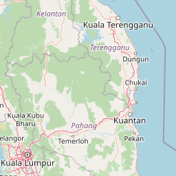
Map view of Selangor State Park

Use this park location map to pinpoint Selangor State Park in Malaysia, understand its exact geographic position, and read its mapped placement within the surrounding landscape more clearly.

Pigeon | © OpenStreetMap contributors

Location context for Selangor State Park

Selangor
Park atlas

Compare adjacent tropical rainforest reserves and regional conservation corridors.

Other Parks Near Selangor State Park and Connected Protected Landscapes

Browse protected areas near Selangor State Park to examine wider regional geography and interconnected highland forest complexes. Comparing adjacent tropical reserves provides deeper context into watershed protection and Peninsular Malaysia conservation networks.
Nature reserveSelangor
About 6.6 km away#1 closest

Southwest

Templer Park: Protected Hill Forest Reserve and Landscape Geography in Selangor, Malaysia

Mature forest canopy and tropical stream terrain

Templer Park preserves a critical patch of mature lowland and hill forest within Selangor. Featuring multi-tiered waterfalls, shaded riverbanks, and limestone caves, the reserve supports high biological interest including rare endemic species. Its mapped boundaries reflect an essential green refuge amidst regional development, offering a window into the natural forest geography north of Kuala Lumpur.

Area
12.14 km²
Established
1954
Relief
Upland
Climate
Tropical
Nature reserveSelangor
About 45 km away#2 closest

South

Kuala Langat North Forest Reserve: Mapped Boundaries and Ecological Terrain Overview

Ancient lowland peat swamp geography in Selangor, Malaysia

Kuala Langat North Forest Reserve is an ecologically vital peat swamp remnant that shelters a range of endemic species within its 8,000 year old forest canopy. Located in the lowland terrain of Selangor, the reserve exists as a critical forest island surrounded by a matrix of development. This overview provides mapped context for the reserve's internal landscape and its role as a protected area within the shifting geography of the Klang Valley.

Area
9.576 km²
Established
1927
Relief
Lowland
Climate
Tropical
A watercolor painting showing a winding river flowing through green wetlands and forests with distant rolling hills.
Nature reserveSelangor
About 59 km away#3 closest

West

Kuala Selangor Nature Park: Mapping the Coastal Wetland and Forest Mosaic of Selangor

A Managed Nature Reserve at the Selangor River Estuary

Kuala Selangor Nature Park represents a key protected landscape in Malaysia, where secondary forest meets an intricate system of estuarine wetlands. This atlas provides a detailed look at the park, focusing on the interplay between its freshwater ponds, mangrove fringes, and the coastal bunds that govern the habitat. It serves as an essential site for understanding coastal restoration and wetland ecology in the region of Selangor.

Area
2.4 km²
Established
1987
Relief
Lowland
Climate
Tropical
Wildlife reservePahang
About 70 km away#4 closest

Northeast

Tengku Hassanal Wildlife Reserve: Protected Forest and Mountain Geography in Pahang

Mapping a vast lowland dipterocarp forest sanctuary.

Spanning over 600 square kilometers, Tengku Hassanal Wildlife Reserve stands as a core protected area within Pahang. Its landscape includes riverine valleys and the steep montane terrain of the Benom Complex, supporting unique biodiversity and active wildlife conservation. This overview traces the park's geographic footprint and its role as an ecological corridor within the broader Titiwangsa mountain system.

Area
605.52 km²
Established
1923
Relief
Mountain
Climate
Tropical
Nature reserveMalaysia
About 78 km away#5 closest

Southeast

Pasoh Forest Reserve: Lowland Dipterocarp Protected Area in Peninsular Malaysia

Mapping tropical rainforest boundaries and ecological research zones

Situated in the interior of Peninsular Malaysia, Pasoh Forest Reserve protects a vital fragment of lowland dipterocarp rainforest. The reserve is globally recognized for its long-term forest dynamics plot, which tracks hundreds of thousands of trees to inform modern understanding of rainforest ecology. The mapped landscape displays clear boundaries between the dense protected forest and surrounding agricultural plantations, offering a distinct view of land use and tropical conservation.

Area
24.5 km²
Established
1987
Relief
Upland
Scope
Terrestrial
Wildlife reserveMalacca
About 103 km away#6 closest

South

Tanjung Tuan Wildlife Reserve: Coastal Geography and Forested Cape Mapping

Coastal dipterocarp forest and raptor sanctuary in Malacca.

This forested coastal cape is an essential protected landscape situated along the Strait of Malacca. Characterized by its dense lowland dipterocarp forest, rocky headlands, and offshore islets, the reserve provides a crucial ecological connection for migratory birds and preserves a rich history of colonial maritime navigation and defense. Its geography offers a compact view of diverse coastal environments, ranging from mangrove fringes to the elevated ridge of Batu Putih.

Area
0.607 km²
Established
1921
Relief
Upland
Climate
Tropical
A soft watercolor painting of a serene lake scene with rolling hills in the background, green vegetation along the banks, and pale pink blooms, likely lotus flowers, in the water.
Biosphere reservePahang
About 136 km away#7 closest

East

Chini Lake Biosphere Reserve: Protected Freshwater Geography in Pahang, Malaysia

Examining the interconnected lake basins and tropical wetland terrain

Chini Lake is an essential protected freshwater system in Pahang, Malaysia, comprising a series of twelve connected lake basins and tropical forest margins. This landscape is a recognized UNESCO Biosphere Reserve, characterized by seasonal lotus blooms, peat-influenced wetlands, and deep cultural connections to the indigenous Jakun communities. Discover the geography and environmental context of this river-fed ecosystem.

Area
50.85 km²
Established
2019
Relief
Lowland
Climate
Tropical
National parkPahang
About 176 km away#8 closest

Northeast

Taman Negara National Park: Pahang Protected Area with Mapped Boundaries for Geographic Discovery

Explore the unique landscape context within Pahang, Malaysia.

Delve into Taman Negara National Park, a significant protected area situated in Pahang, Malaysia. This detailed view highlights the park's mapped boundaries and its contribution to the regional geography. Understand the protected landscape and its place within the natural terrain of Peninsular Malaysia, essential for atlas-based geographic exploration.

Area
4,343 km²
Established
1938
IUCN
II
Relief
Mixed relief

Common questions about visiting, size, designation, and location context for Selangor State Park

Selangor State Park FAQs for park facts, access, geography, and protected area context

Find quick answers about Selangor State Park, including protected-area facts, park geography, trail and visitor context, and how the park fits into its surrounding country and regional landscape.
MoriAtlas Explorer

Continue Your Protected Areas Search Across the Global Atlas

Deepen your exploration by continuing the structured search for national parks and protected areas worldwide. Utilize the comprehensive filtering capabilities to compare different conservation landscapes and refine your understanding of global park geography. Discover more about the distribution and characteristics of protected natural areas.

Global natural geography