Mori Atlas logo
Nearby park discovery

Geographic overview of surrounding park boundaries and regional conservation terrain

Regional Protected Areas and Nature Landscapes Near Kuala Selangor Nature Park

Explore the broader geography of protected lands situated near Kuala Selangor Nature Park within the Selangor region of Malaysia. This assessment highlights the regional distribution of nature reserves and wetland habitats, providing a clear perspective on how these protected zones form a connected landscape across the local coastal plain and river estuary environments.

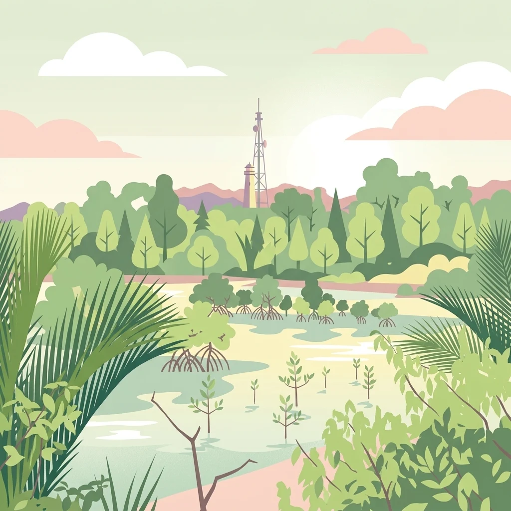
A flat vector style illustration depicting a mangrove wetland with various plants, trees, and a tall communication tower and lighthouse visible in the background against a soft pastel sky.

A coastal wetland and secondary-forest park at the mouth of the Selangor River, recognized as an Important Bird Area.

Kuala Selangor Nature Park

Kuala Selangor Nature Park is a protected natural area situated at the estuary of the Selangor River in the Kuala Selangor District of Selangor, Malaysia. Established in 1987 by the Selangor state government, the park combines a stretch of secondary forest with a coastal wetland system, separated by a man-made bund that protects the forest from tidal influence while preserving the wetland habitat beyond it. The park is best known for its birdlife. It supports a wide range of resident and migratory species and was once the site of a captive-breeding program for the endangered milky stork. The area is also home to primates such as silvered-leaf monkeys and long-tailed macaques, and it functions as a living example of how degraded coastal land can be returned to ecological use. Recognized in 1997 as an Important Bird Area by BirdLife International, the park has also been proposed for designation as a wetland of international importance. It carries additional historical significance as the first nature park in Malaysia to be managed by a non-governmental organization, the Malaysian Nature Society, operating under a cooperative arrangement with the state government.

Location
Malaysia
Park type
Nature reserve
Established
1987
Area
2.4 km²
Explore Kuala Selangor Nature Park Geography
Regional park map

See the ranked park cluster in its geographic setting

Nearby parks around Kuala Selangor Nature Park

This regional map shows the same 20 nearby parks ranked below around Kuala Selangor Nature Park. Select a ranked marker to highlight that park’s boundary where boundary data is available.
Reference park: Kuala Selangor Nature ParkRanked nearby park20 nearby parks shown
20 nearby parks

Distance-ranked collection and regional park geography surrounding Kuala Selangor Nature Park

Parks and Protected Areas Geographically Near Kuala Selangor Nature Park

Examine the ranked collection of nearby protected areas structured by geographic separation and direction from Kuala Selangor Nature Park. Assess surrounding landscape patterns and regional environmental characteristics through direct spatial comparison.
Nature reserveSelangor
About 54 km away#1 closest

East

Templer Park: Protected Hill Forest Reserve and Landscape Geography in Selangor, Malaysia

Mature forest canopy and tropical stream terrain

Templer Park preserves a critical patch of mature lowland and hill forest within Selangor. Featuring multi-tiered waterfalls, shaded riverbanks, and limestone caves, the reserve supports high biological interest including rare endemic species. Its mapped boundaries reflect an essential green refuge amidst regional development, offering a window into the natural forest geography north of Kuala Lumpur.

Area
12.14 km²
Established
1954
Relief
Upland
Climate
Tropical
State or regional parkSelangor
About 59 km away#2 closest

East

Selangor State Park: Protected Rainforest and Geological Landscape Discovery

Highland water catchment and quartz ridge geography in Selangor

Selangor State Park forms a massive block of continuous tropical rainforest serving as the principal water supply for the Klang Valley. This protected area features rugged slopes, diverse river basins, and the dramatic 14-kilometer Klang Gates Quartz Ridge. Use this map-integrated record to understand the park's critical role in regional hydrological regulation and its significance as a research-anchored highland ecosystem.

Area
914.41 km²
Established
2007
Relief
Highland
Climate
Tropical
Nature reserveSelangor
About 71 km away#3 closest

Southeast

Kuala Langat North Forest Reserve: Mapped Boundaries and Ecological Terrain Overview

Ancient lowland peat swamp geography in Selangor, Malaysia

Kuala Langat North Forest Reserve is an ecologically vital peat swamp remnant that shelters a range of endemic species within its 8,000 year old forest canopy. Located in the lowland terrain of Selangor, the reserve exists as a critical forest island surrounded by a matrix of development. This overview provides mapped context for the reserve's internal landscape and its role as a protected area within the shifting geography of the Klang Valley.

Area
9.576 km²
Established
1927
Relief
Lowland
Climate
Tropical
Wildlife reservePahang
About 117 km away#4 closest

East

Tengku Hassanal Wildlife Reserve: Protected Forest and Mountain Geography in Pahang

Mapping a vast lowland dipterocarp forest sanctuary.

Spanning over 600 square kilometers, Tengku Hassanal Wildlife Reserve stands as a core protected area within Pahang. Its landscape includes riverine valleys and the steep montane terrain of the Benom Complex, supporting unique biodiversity and active wildlife conservation. This overview traces the park's geographic footprint and its role as an ecological corridor within the broader Titiwangsa mountain system.

Area
605.52 km²
Established
1923
Relief
Mountain
Climate
Tropical
Wildlife reserveMalacca
About 135 km away#5 closest

Southeast

Tanjung Tuan Wildlife Reserve: Coastal Geography and Forested Cape Mapping

Coastal dipterocarp forest and raptor sanctuary in Malacca.

This forested coastal cape is an essential protected landscape situated along the Strait of Malacca. Characterized by its dense lowland dipterocarp forest, rocky headlands, and offshore islets, the reserve provides a crucial ecological connection for migratory birds and preserves a rich history of colonial maritime navigation and defense. Its geography offers a compact view of diverse coastal environments, ranging from mangrove fringes to the elevated ridge of Batu Putih.

Area
0.607 km²
Established
1921
Relief
Upland
Climate
Tropical
Nature reserveMalaysia
About 135 km away#6 closest

East

Pasoh Forest Reserve: Lowland Dipterocarp Protected Area in Peninsular Malaysia

Mapping tropical rainforest boundaries and ecological research zones

Situated in the interior of Peninsular Malaysia, Pasoh Forest Reserve protects a vital fragment of lowland dipterocarp rainforest. The reserve is globally recognized for its long-term forest dynamics plot, which tracks hundreds of thousands of trees to inform modern understanding of rainforest ecology. The mapped landscape displays clear boundaries between the dense protected forest and surrounding agricultural plantations, offering a distinct view of land use and tropical conservation.

Area
24.5 km²
Established
1987
Relief
Upland
Scope
Terrestrial
A soft watercolor painting of a serene lake scene with rolling hills in the background, green vegetation along the banks, and pale pink blooms, likely lotus flowers, in the water.
Biosphere reservePahang
About 194 km away#7 closest

East

Chini Lake Biosphere Reserve: Protected Freshwater Geography in Pahang, Malaysia

Examining the interconnected lake basins and tropical wetland terrain

Chini Lake is an essential protected freshwater system in Pahang, Malaysia, comprising a series of twelve connected lake basins and tropical forest margins. This landscape is a recognized UNESCO Biosphere Reserve, characterized by seasonal lotus blooms, peat-influenced wetlands, and deep cultural connections to the indigenous Jakun communities. Discover the geography and environmental context of this river-fed ecosystem.

Area
50.85 km²
Established
2019
Relief
Lowland
Climate
Tropical
National parkPahang
About 204 km away#8 closest

Northeast

Taman Negara National Park: Pahang Protected Area with Mapped Boundaries for Geographic Discovery

Explore the unique landscape context within Pahang, Malaysia.

Delve into Taman Negara National Park, a significant protected area situated in Pahang, Malaysia. This detailed view highlights the park's mapped boundaries and its contribution to the regional geography. Understand the protected landscape and its place within the natural terrain of Peninsular Malaysia, essential for atlas-based geographic exploration.

Area
4,343 km²
Established
1938
IUCN
II
Relief
Mixed relief
National parkJohor
About 237 km away#9 closest

Southeast

Endau-Rompin National Park: Ancient Tropical Rainforest Protected Landscape in Johor, Malaysia

Explore unique mapped geography and ancient geological features.

Endau-Rompin National Park in Johor, Malaysia, is a testament to Earth's ancient history, housing tropical rainforests built upon geological formations around 248 million years old. This protected area offers a detailed look at rugged mountainous terrain, vital river systems, and a diverse mapped landscape, crucial for understanding regional geography and conservation. Its status as one of the oldest rainforest complexes makes it a significant site for exploring the planet's prehistoric natural heritage and protected land distribution.

Area
870 km²
Established
1993
IUCN
II
Relief
Mountain
A watercolor painting showing a quiet lakeside scene with dense green forests in the background and soft, purplish mountains rising behind them.
State or regional parkPerak
About 239 km away#10 closest

North

Belum-Temengor: Ancient Rainforest Complex and Protected Landscape Geography in Perak

Mapping the forest ridges and lake archipelago of the northern Malay Peninsula

Spanning over 130 million years of ecological history, Belum-Temengor represents a massive, continuous block of tropical rainforest. The terrain transitions from high-altitude hill forests in the north to the flooded valleys and forested islands of Tasik Temengor. This complex serves as a vital water catchment and a sanctuary for diverse flora and fauna within the broader mountainous geography of the Perak region.

Area
1,175 km²
Established
2007
Relief
Mountain
Climate
Tropical
National parkMalaysia
About 251 km away#11 closest

Northwest

Penang National Park: Exploring Malaysia's National Park Atlas and Protected Landscapes

Understand the mapped geography and protected terrain of Penang National Park.

Penang National Park represents a crucial element within Malaysia's network of protected areas. This page offers detailed information for atlas-driven exploration, focusing on the park's specific geography, its mapped boundaries, and its contribution to the regional landscape. Gain a structured understanding of Penang National Park's identity as a protected national park, providing essential context for geographic discovery.

Area
12.13 km²
Established
2003
IUCN
II
Relief
Mixed relief
National parkIndonesia
About 277 km away#12 closest

West

Gunung Leuser National Park: A Critical Protected Landscape in Indonesia's Barisan Mountains

Discover its mountainous terrain and primate conservation significance.

Gunung Leuser National Park is a significant protected area in Indonesia, encompassing 3,208 square kilometers of diverse tropical rainforest and rugged mountainous terrain within the Barisan mountain range. Its designation as a national park highlights its role in preserving critical ecosystems, including one of the last remaining habitats for the Sumatran orangutan. This atlas entry provides a geographic overview of the park's landscape, focusing on its protected boundaries and ecological importance within the region.

Area
3,208 km²
Established
1980
IUCN
II
Relief
Mountain
A watercolor illustration of a wooden pier extending into calm wetland waters, with lush green shorelines and trees on both sides.
State or regional parkTerengganu
About 305 km away#13 closest

Northeast

Setiu Wetlands State Park: Geography and Protected Area Atlas of Terengganu

Coastal lagoons, mangrove forests, and riverine ecosystems

Encompassing the largest natural wetland on Malaysia's east coast, Setiu Wetlands State Park serves as a critical protected landscape where sea, sand, and forest meet. This atlas entry details the park's 23,000 hectare expanse, highlighting the complex hydrological network of lagoons and river basins that support diverse habitats, including peat swamps and seagrass beds.

Area
230 km²
Established
2018
Relief
Lowland
Climate
Tropical
A soft-toned watercolor painting of a tropical island beach with a natural rock arch formation and palm trees.
Protected areaTerengganu
About 308 km away#14 closest

Northeast

Kapas Island: A Detailed Geographic Overview of the Protected Terengganu Coastal Landscape

Topography, Marine Protection Zones, and Island Geography

Kapas Island offers a focused look at the intersection of coastal geography and conservation management. This small archipelago features a tropical jungle core and protected sandy perimeters, providing a clear map of local reef health and coastal biodiversity in the Terengganu region of Malaysia.

Area
1.5 km²
Relief
Lowland
Climate
Tropical
Access
Easy access
Protected areaTerengganu
About 319 km away#15 closest

Northeast

Tenggol Island: A Geographic Overview of Terengganu's Protected Tropical Marine Landscape

Mapping reefs, forest interior, and regional maritime terrain

Tenggol Island stands as a distinct protected area off the coast of Terengganu, defined by its sharp 272-meter forested peak and complex underwater topography. This overview provides data on its coastal bays, rocky points, and fringing reef zones, offering a clear understanding of the island's unique position within the East Coast of Peninsular Malaysia's marine geography.

Area
2.62 km²
Relief
Upland
Climate
Tropical
Access
Moderate access
Marine protected areaKedah
About 320 km away#16 closest

Northwest

Payar Island Marine Park: A Comprehensive Geographic Atlas of Marine Protected Areas

Mapping reef systems and island geography in the northern Strait of Malacca.

Payar Island Marine Park serves as a significant marine protected area centered on the islands of Payar, Kaca, Lembu, and Segantang. This profile details the park's coastal geography, its signature soft coral habitats like the Coral Garden, and its role as a regional sanctuary for marine biodiversity within the Kedah territorial waters.

Area
0.29 km²
Established
1994
Relief
Upland
Climate
Tropical
A watercolor painting showing a stylized, panoramic view of layered purple and pink mountains in the background with soft green forests and grassy plains in the foreground.
Marine protected areaTerengganu
About 325 km away#17 closest

Northeast

Lang Tengah Island Marine Protected Area: Geography, Reefs, and Island Terrain

A tranquil protected landscape in the Terengganu archipelago

Lang Tengah Island represents a significant marine protected area defined by its dense forested interior and surrounding coral reef ecosystems. Located within the Terengganu marine region, the island offers a unique study of protected coastal geography, seasonal turtle nesting grounds, and undisturbed tropical marine environments separated from more developed nearby archipelagos.

Area
1.3 km²
Relief
Lowland
Climate
Tropical
Access
Moderate access
A watercolor painting showing layers of soft green and pink rolling hills, with a line of trees in the midground and an open, flat foreground.
Protected areaJohor
About 327 km away#18 closest

East

Rawa Island Protected Area: Coastal Geography and Island Landscape Context in Johor

A protected coral island within the Johor archipelago

Rawa Island serves as a significant protected landscape off the coast of Johor, Malaysia. Defined by its sharp contrast between rocky cliffs and clear, coral-filled waters, the island represents a crucial node in regional island geography. Delve into the spatial characteristics and environmental features of this South China Sea destination through our map-driven atlas framework.

Area
0.23 km²
Water
Water-dominated
An illustrative style image of a dramatic mountain valley featuring cliffs, two waterfalls, and a forested foreground at sunset.
Marine protected areaTerengganu
About 328 km away#19 closest

Northeast

Perhentian Islands Marine Protected Area: Terengganu Coastal and Archipelago Geography

Mapped marine boundaries and tropical island terrain

An immersive look at the Perhentian Islands, a protected nine-island archipelago in the South China Sea. Analyze the distinct marine geography, from fringing coral reefs and shallow reef flats to the forested inland hills of Perhentian Besar and Perhentian Kecil. This overview provides spatial context for one of Malaysia's most recognizable marine environments, emphasizing the protected status of its surrounding waters and reef habitats.

Area
15.955 km²
Established
1994
Relief
Lowland
Climate
Tropical
National parkNorth Sumatra Province
About 330 km away#20 closest

Southwest

Batang Gadis National Park: North Sumatra Province Protected Landscape Atlas

Explore its national park status and mapped boundaries.

Batang Gadis National Park serves as a vital protected area within North Sumatra Province, contributing significantly to the regional geography and natural landscape atlas. This detail page focuses on its designation as a national park, highlighting its mapped geographic footprint and its place within the broader regional context. Users can explore its protected boundaries and understand its unique landscape characteristics for structured geographic discovery.

Area
1,080 km²
Established
2004
IUCN
II
Relief
Mountain
Distance methodology

Geographic measurements, not driving distances

How nearby park distances are calculated

Distances use park boundaries whenever the available geometry allows it. When one or both boundaries are missing, the mapped park locations provide a clearly labelled estimate. Every value represents straight-line geographic separation and does not use roads or routing.

Boundary distance

Calculated between the nearest points of both park boundaries.

Location-to-boundary estimate

Estimated from one mapped park location to the nearest boundary of the other park.

Mapped-location estimate

Estimated between the mapped locations of both parks.

MoriAtlas Explorer

Continue Exploring the Kuala Selangor Nature Park Protected Landscape and Map

Delve deeper into the geographic structure of Kuala Selangor Nature Park through the MoriAtlas database. Examine how the forest and wetland zones are mapped across the Selangor river estuary and understand the conservation importance of these managed coastal habitats.