Mori Atlas logo
National parkPenang National Park

Mapping the protected boundaries and natural terrain of this Malaysian national park.

Penang National Park: Protected Landscape and Geographic Context in Malaysia

(Taman Negara Pulau Pinang)

Penang National Park stands as a significant protected area within Malaysia, offering a focused point for geographic discovery and atlas exploration. This dedicated page provides insight into the park's mapped boundaries, its unique natural terrain, and its role within the broader Malaysian landscape. Understand the core identity of Penang National Park as a conservation landscape and its place in regional geography.

Coastal forestsTurtle nesting sitesMangrove ecosystemsBeach recreationDipterocarp forestsIsland parks

Penang National Park

National park

Park overview

Structured park overview, official facts, and landscape profile for Penang National Park

Penang National Park park facts, protected area profile, and essential visitor context
Review the core facts for Penang National Park, including designation, size, terrain, visitor scale, habitats, and operating context in one park-focused overview.

About Penang National Park

Penang National Park occupies the northwestern tip of Penang Island, creating a protected corridor where tropical forest meets the sea. The park's establishment in 2003 marked a pivotal moment in Malaysian conservation history, as it became the first area to be legally protected under the National Park Act of 1980. This designation reflected both state and federal government commitment to preserving Malaysia's natural heritage beyond purely commercial forest management.

The park's location on a peninsula means that visitors can experience multiple ecosystems within a single hike. The interior features tall dipterocarp trees including chengal, meranti seraya, and jelutong, while coastal areas give way to mangrove forests and sandy stretches popular with beachgoers. The landscape is punctuated by granite headlands and the unique meromictic lake, a body of water that maintains distinct chemical layers and supports specialized aquatic life despite low oxygen in its deeper regions.

Beyond its ecological value, the park serves as an outdoor laboratory and recreation area for the region. Trails wind through different habitat zones, allowing visitors to observe everything from towering trees to sensitive mangrove ecosystems. The beaches, particularly Monkey Beach and Pantai Kerachut, provide both recreational opportunities and wildlife viewing, with the latter serving as one of the few remaining turtle nesting sites on the island.

Quick facts and research context for Penang National Park

Penang National Park sits on the northwestern coast of Penang Island near the village of Teluk Bahang. It protects five distinct habitat types not commonly found together in other major Malaysian nature reserves: hill and lowland dipterocarp forests, mangrove forests, sandy beach ecosystems, a seasonal meromictic lake, and open coastal seas. The park supports over 1,000 plant species and is home to 417 flora and 143 fauna species. It holds significance as Malaysia's first national park established under the 1980 National Park Act.

Park context

Deeper park guide and search-rich context for Penang National Park

Penang National Park history, landscape, wildlife, and travel context
Explore Penang National Park through its history, landscape character, ecosystems, wildlife, conservation priorities, cultural context, and seasonal travel timing in a structured park guide built for atlas discovery and search intent.

Why Penang National Park stands out

Penang National Park is best known for its remarkable coastal forest ecosystem that combines lush tropical vegetation with accessible beaches and marine environments. The park is particularly famous for its turtle nesting beaches at Pantai Kerachut, where green turtles nest from April to August and olive ridley turtles from September to February. Its diverse habitats support populations of long-tailed macaques, dusky leaf monkeys, and occasional dolphin sightings along the coast. The meromictic lake within the park represents a rare ecological feature, while the steep slopes around Muka Head feature distinctive stands of seraya trees characteristic of coastal dipterocarp forests.

Penang National Park history and protected-area timeline

Penang National Park traces its origins to an earlier designation as the Pantai Acheh Forest Reserve, reflecting the conventional approach to land management in colonial and early post-independence Malaysia, which focused primarily on timber production rather than conservation. However, growing awareness of the ecological and scenic value of this coastal area prompted authorities to reconsider its status.

The transition from forest reserve to national park came in April 2003, when the area was officially redesignated under Malaysia's National Park Act of 1980. This transformation was significant because it shifted the primary purpose from resource extraction to preservation of biodiversity, scenic beauty, and scientific value. The park was established not only to protect flora and fauna but also to preserve geological, archaeological, historical, ethnological, and scenic interests.

As the first national park legally gazetted under the 1980 legislation, Penang National Park established a precedent for protected area management in Malaysia. Its creation demonstrated that national parks could be established not only in peninsular Malaysia but also on the island states, expanding the geographic scope of conservation efforts.

Penang National Park landscape and geographic character

The physical landscape of Penang National Park is defined by the transition from hilly interior terrain to coastal beaches and marine environments. The park's highest points rise in the vicinity of Muka Head, where steep slopes are covered in coastal dipterocarp forest dominated by seraya trees, a species characteristic of this elevation zone. The terrain slopes downward toward the coast, creating a sequence of distinct habitats from forest to mangrove to beach.

The coastline features multiple beaches of varying character, from the popular Monkey Beach to the more remote sandy stretches that serve as turtle nesting grounds. Rocky headlands alternate with sand beaches, and the marine zone extends into open coastal seas. Within the park lies a seasonal meromictic lake, a rare type of lake where water layers do not mix, creating unique chemical and ecological conditions. This lake represents one of the park's most distinctive geological features.

Mangrove forests occupy the transitional zone between terrestrial and marine environments, their complex root systems creating habitat for numerous species while stabilizing the shoreline. The combination of granite geology, coastal processes, and tropical climate has produced a landscape of considerable variety within a relatively compact area.

Penang National Park ecosystems, habitats, and plant life

The ecological character of Penang National Park centers on its remarkable diversity of habitats within a limited area. Five distinct habitat types occur here in a configuration not found in other major Malaysian nature reserves. Hill and lowland dipterocarp forests dominate the interior, with over 1,000 plant species recorded, belonging primarily to the families Dipterocarpaceae, Leguminosae, Apocynaceae, Anacardiaceae, Euphorbiaceae, and Moraceae. These forests feature tall canopy trees including chengal, meranti seraya, and jelutong, with a rich understory of ferns and wild orchids.

Mangrove forests line the water's edge, providing critical habitat for marine and terrestrial species alike. Sandy beach habitats support specialized coastal vegetation, while the meromictic lake represents a unique aquatic environment despite its limited biodiversity due to oxygen stratification. Open coastal seas complete the habitat mosaic, offering marine species access to protected waters.

Secondary forest dominates the park's vegetation, reflecting its history as a former forest reserve. Species such as gaharu, tongkat ali, pelawan, bintangor, sea almond, and casuarina contribute to the forest's composition, while along the coast screw pines and various fern species create distinct zones between land and sea.

Penang National Park wildlife and species highlights

The wildlife population of Penang National Park includes 143 documented fauna species across diverse taxonomic groups. Among the most commonly observed mammals are long-tailed macaques and dusky leaf monkeys, which are frequently seen along trails and near beaches. Wild boars, civets, smooth-coated otters, mouse deer, squirrels, bats, and various rodents round out the mammalian fauna. The coastal waters occasionally host dolphin sightings, adding marine mammal diversity to the park's inventory.

Birdlife is particularly well-represented with 46 species documented. Water-associated birds such as stork-billed kingfishers, white-breasted waterhens, and great egrets are common near the lake and coastal areas. Raptors including white-bellied sea eagles and brahminy kites soar above the canopy, while kingfishers are regularly spotted along the shoreline. The diverse bird community reflects the park's varied habitats.

Reptiles and amphibians include monitor lizards and various snake species, while the marine environment supports crabs, fishes, and prawns. Perhaps most notable is the park's role as a turtle nesting site. Pantai Kerachut beach serves as a nesting ground for green turtles from April to August and olive ridley turtles from September to February, representing significant conservation value for these threatened species.

Penang National Park conservation status and protection priorities

Penang National Park holds special significance within Malaysia's protected area network as the first area legally gazetted under the National Park Act of 1980. This designation established a precedent for national park establishment in Malaysia and demonstrated the potential for protecting coastal and marine ecosystems alongside terrestrial forests. The park's multi-objective mandate preserves not only flora and fauna but also geological, archaeological, historical, and scenic resources.

The park protects five habitat types that are not commonly found together in other Malaysian reserves, making it ecologically significant despite its relatively small size. This habitat diversity supports both common species and threatened ones, particularly the turtle populations that use Pantai Kerachut as a nesting beach. The protection of these nesting grounds is essential for the survival of green and olive ridley turtles, both of which face significant threats from habitat loss and human disturbance.

The meromictic lake represents a unique conservation challenge, as its specialized ecological conditions support limited but distinctive life forms. The brackish water environment sustains Faunus ater snails and other adapted species, demonstrating how even unusual habitats can harbor biodiversity worth protecting.

Penang National Park cultural meaning and human context

Penang National Park exists within a region of significant human history and cultural diversity. The island of Penang has long served as a maritime trading hub, and local communities have maintained connections to the coast for generations. The park's coastline and beaches have historically supported fishing communities and provided resources for local populations.

The area's management falls under the Department of Wildlife and National Parks Peninsular Malaysia, which oversees protected areas throughout peninsular Malaysia. While the park itself does not contain major cultural heritage sites, its establishment reflects contemporary values about preserving natural landscapes alongside human historical environments. The diverse naming of the park in Malay, Chinese, and Tamil reflects the multicultural character of Penang Island itself.

Top sights and standout views in Penang National Park

Penang National Park offers a rare combination of accessible tropical forest, scenic beaches, and wildlife observation opportunities within a compact coastal reserve. The turtle nesting beaches at Pantai Kerachut represent a particularly special feature, providing opportunities to witness green and olive ridley turtles during their breeding seasons. The trails to Monkey Beach and Muka Head reward hikers with views of coastal dipterocarp forests and opportunities to observe long-tailed macaques and other wildlife.

The park's ecological diversity, encompassing five habitat types in a relatively small area, makes it an excellent destination for nature education and scientific study. The meromictic lake offers a unique ecological feature rarely found in other protected areas, while the mangrove forests provide critical habitat for coastal species. The accessibility of these diverse environments from the park's entrance near Teluk Bahang makes Penang National Park valuable for both research and recreation.

Best time to visit Penang National Park

The optimal time to visit Penang National Park depends on interests, though certain seasons offer distinct advantages. For turtle enthusiasts, the nesting seasons provide the most compelling reason to visit, with green turtles active from April to August and olive ridley turtles from September to February. These periods offer the best opportunities to observe nesting activity at Pantai Kerachut, though visitors should note that night access may be restricted to protect the turtles.

The dry season typically offers more comfortable hiking conditions, though Penang's tropical climate means rainfall can occur year-round. The park's forest trails remain walkable in most conditions, and the beach areas are accessible throughout the year. Early morning visits tend to offer the best wildlife viewing opportunities, as animals are more active during cooler hours. The park is open year-round, though visitors should check current access regulations before planning their trip.
Park location guide

Geography guide, regional context, and park location map for Penang National Park

Penang National Park park geography, regions, and map view in Malaysia
Understand where Penang National Park sits in Malaysia through a broader geographic reading of the surrounding landscape, nearby location context, and its mapped position within the national park landscape.

How Penang National Park fits into Malaysia

Malaysia is a federal constitutional monarchy located in Southeast Asia. The country consists of 13 states and three federal territories, divided by the South China Sea into Peninsular Malaysia on the Indochinese Peninsula and East Malaysia on the island of Borneo. With a population of over 34 million, it achieved independence from Britain in 1957 and became a modern federation in 1963. The country is recognized for its multicultural population, tropical climate, and significant economic role in the region.

Wider geography shaping Penang National Park in Malaysia

Malaysia occupies a strategic position in Southeast Asia, split by the South China Sea into two distinct regions. Peninsular Malaysia lies on the Indochinese Peninsula, sharing a land border with Thailand to the north and maritime borders with Singapore, Vietnam, and Indonesia. East Malaysia occupies the northern portion of Borneo, sharing land borders with Brunei and Indonesia, and maritime borders with the Philippines and Vietnam. The country's terrain includes coastal plains, mountain ranges such as the Titiwangsa in the peninsula, and extensive tropical rainforests.

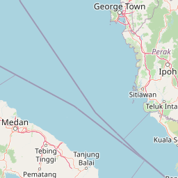
Map view of Penang National Park

Use this park location map to pinpoint Penang National Park in Malaysia, understand its exact geographic position, and read its mapped placement within the surrounding landscape more clearly.

Pigeon | © OpenStreetMap contributors

Location context for Penang National Park

Penang Island
Park atlas

Compare the regional spread of protected landscapes, mapping park geography across Penang Island and its environs.

Explore Nearby National Parks and Protected Areas: Penang National Park and Its Region
Explore additional national parks and protected areas across the Malaysian peninsula, tracing conservation landscapes beyond Penang National Park's unique coastal environment. This broader view allows for direct comparison of diverse park geography, highlighting regional ecosystems and shared conservation efforts in Southeast Asia.
Stylized illustration of a forested area featuring a waterfall, large leaves, and a winding path
National parkSatun Province

Thale Ban National Park: Mapped Protected Landscape and Unique Wetland Ecosystem in Satun Province

Explore karst and granite mountains, natural lake geography, and diverse biodiversity.

Thale Ban National Park offers a fascinating study in protected landscape geography, centered around a rare natural lake formed by geological damming. This national park in Satun Province, Thailand, showcases a striking contrast between ancient limestone karst formations and younger granite mountains, contributing to its unique biodiversity and ecosystems. Its position near the Malaysian border highlights its role in regional conservation, making it a key site for understanding mapped terrain and protected natural areas.

Area
196 km²
Established
1980
IUCN
II
Visitors
12K annual
National parkSongkhla Province

Khao Nam Khang National Park: National Park, Mapped Boundaries, and Regional Geography

Explore protected landscape identity and atlas context.

Gain detailed insights into Khao Nam Khang National Park, a key protected area situated within Songkhla Province. This national park serves as a critical reference point for understanding regional geography, its specific mapped boundaries, and its role as a conservation landscape. Discover its unique geographic context, vital for comprehensive atlas exploration of Thailand's natural heritage.

Area
212 km²
Established
1990
IUCN
II
Visitors
1.8K annual
National parkSatun Province

Tarutao National Park: National Park Exploration and Geographic Context in Satun Province

Mapped boundaries and regional landscape details await discovery.

Tarutao National Park stands as a protected national park entity, offering a specific focal point for exploring Thailand's natural landscapes within Satun Province. This page provides access to its protected-area identity and geographic mapping, essential for understanding its placement within the broader regional atlas. Investigate the park's distinct landscape features and its contribution to the protected areas of the Andaman Sea coast.

Area
1,490 km²
Established
1974
IUCN
II
Visitors
238.4K annual
National parkThailand

Mu Ko Phetra National Park: Thailand National Park Mapped Geography and Protected Landscape

Explore its mapped boundaries and regional atlas context.

Mu Ko Phetra National Park stands as a distinct protected area within Thailand, offering insights into its unique geographic setting. This detailed entry focuses on the park's mapped boundaries, its protected landscape characteristics, and its regional geography. Users can explore its placement within Thailand for a comprehensive understanding of its atlas significance and natural context.

Area
494 km²
Established
1984
IUCN
II
Visitors
129.9K annual
National parkNarathiwat Province

Budo, Su-ngai Padi National Park: Protected Tropical Rainforest Geography

Explore mapped boundaries and mountain landscapes in Southern Thailand.

Budo, Su-ngai Padi National Park is a critical protected area safeguarding one of Thailand's last significant tracts of intact tropical rainforest. Situated within the rugged Budo mountain range of Narathiwat Province, its landscape is defined by dense evergreen forests, steep terrain, and numerous waterfalls. This national park offers substantial geographic context for understanding conservation landscapes and regional terrain in peninsular Thailand, serving as a valuable addition to any atlas exploration.

Area
341 km²
Established
1999
IUCN
II
Relief
Mountain
National parkTrang Province

Hat Chao Mai National Park: National Park Protected Landscape and Geographic Context

Explore Trang Province's mapped protected areas and natural terrain.

Hat Chao Mai National Park serves as a focal point for understanding protected lands in Trang Province, Thailand. This entry offers insights into the park's specific geographic attributes and its designation as a national park. Users can explore the mapped boundaries and the surrounding regional geography, gaining a clear picture of this protected landscape within the MoriAtlas geographic framework. Understanding Hat Chao Mai National Park provides essential context for regional park exploration and mapped conservation areas.

Area
231 km²
Established
1981
IUCN
II
Visitors
83K annual
National parkThailand

Mu Ko Lanta National Park: Protected National Park and Mapped Landscape in Thailand

Explore its boundaries within Thailand's regional geography.

Mu Ko Lanta National Park is a significant protected area within Thailand, defined by its national park status and distinct geographic features. This page facilitates structured discovery of its mapped landscape and the regional context it occupies. Users can explore its protected-area identity and understand how it fits into the broader atlas of natural landscapes in Southeast Asia, emphasizing geographic specificity and atlas-driven insights.

Area
134 km²
Established
1990
IUCN
II
Visitors
217.4K annual
National parkThailand

Khao Pu, Khao Ya National Park: Explore Protected Boundaries and Thailand Geography

A key national park for understanding regional landscape context.

Khao Pu, Khao Ya National Park stands as a vital protected area in Thailand, offering rich geographic details for atlas exploration. This page details its specific mapped boundaries and its identity as a national park, providing essential context for understanding natural landscapes within Southeast Asia. Users can gain insights into its regional significance and its contribution to the country's protected land network.

Area
694 km²
Established
1982
IUCN
II
Visitors
167.3K annual

Common questions about visiting, size, designation, and location context for Penang National Park

Penang National Park FAQs for park facts, access, geography, and protected area context
Find quick answers about Penang National Park, including protected-area facts, park geography, trail and visitor context, and how the park fits into its surrounding country and regional landscape.
MoriAtlas Explorer

Continue Your Protected Areas Search Across the Global Atlas

Deepen your exploration by continuing the structured search for national parks and protected areas worldwide. Utilize the comprehensive filtering capabilities to compare different conservation landscapes and refine your understanding of global park geography. Discover more about the distribution and characteristics of protected natural areas.

Global natural geography