
Mori Atlas logo
Protected areaLake Roosevelt National Recreation Area

Tracing the 130-mile Columbia River reservoir corridor, basalt coulees, and historic plateaus of eastern Washington.

Lake Roosevelt National Recreation Area: Mapped Geography and Protected Landscape Context in Washington

Lake Roosevelt National Recreation Area extends across a significant corridor of the upper Columbia River in eastern Washington, created by the massive Grand Coulee Dam. This protected area encompasses a 130-mile reservoir that winds through the arid Columbia Plateau, framed by dramatic basalt cliffs, rolling shrub-steppe terrain, and important cultural landmarks like Fort Spokane. The geography reveals a unique interplay between engineered water systems and natural volcanic landscapes, marking a distinct boundary within the Pacific Northwest.

reservoirColumbia Rivereastern Washingtonnational recreation areadam and reservoirInland Northwest
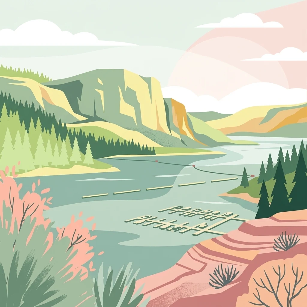
A flat style digital illustration of a lake landscape with rocky bluffs, evergreen forest, and a floating boat dock in the foreground.

Lake Roosevelt National Recreation Area

Protected area

Park overview

Structured park overview, official facts, and landscape profile for Lake Roosevelt National Recreation Area

Lake Roosevelt National Recreation Area park facts, protected area profile, and essential visitor context

Review the core facts for Lake Roosevelt National Recreation Area, including designation, size, terrain, visitor scale, habitats, and operating context in one park-focused overview.

About Lake Roosevelt National Recreation Area

Lake Roosevelt National Recreation Area is one of the more unusual units of the U.S. National Park System because it was created through administrative agreement rather than by Congress or presidential proclamation. The unit grew out of the construction of Grand Coulee Dam in the late 1930s and early 1940s, which transformed a stretch of the upper Columbia River into a long artificial lake. As the dam rose and waters backed up behind it, the federal government recognized the need to manage recreation, access, and cultural resources along this newly created shoreline.

In 1946, a memorandum of agreement between the Spokane Tribe, the Colville Indian Reservation, and the Bureau of Reclamation established the Coulee Dam Recreational Area. The unit expanded its mandate over the following decades, incorporating not only recreation but also the interpretation of historic sites along the former river corridor. In 1996, it was renamed Lake Roosevelt National Recreation Area in honor of President Franklin D. Roosevelt, a decision that drew objections from the Colville Tribe.

The recreation area encompasses approximately 100,000 acres along Franklin D. Roosevelt Lake, and the reservoir itself runs about 130 miles through a varied inland landscape. Inland Pacific Northwest terrain dominates the setting, with arid hills, grasslands, and basalt formations typical of the Columbia Plateau. Although not a wilderness park, the recreation area functions as an outdoor destination for residents of eastern Washington and northern Idaho, and it preserves a meaningful slice of regional history tied to the Columbia River.

Quick facts and research context for Lake Roosevelt National Recreation Area

Lake Roosevelt National Recreation Area is administered by the National Park Service and centers on Franklin D. Roosevelt Lake, the reservoir behind Grand Coulee Dam. It spans four counties in eastern Washington: Ferry, Stevens, Lincoln, and Grant. Visitors typically come from Spokane, the nearest major city. The recreation area is co-managed with the Bureau of Reclamation, the Bureau of Indian Affairs, the Confederated Tribes of the Colville Reservation, and the Spokane Tribe, reflecting its origins in a 1946 memorandum of agreement with the Spokane Tribe and the Colville Indian Reservation. It is one of only two national recreation areas, alongside Curecanti, that were never formally authorized by Congress or presidential proclamation.

Protection and recognition

Examine documented protected area designation data and management scope details.

Lake Roosevelt National Recreation Area Protection Status and Recognition

Lake Roosevelt National Recreation Area protection status details bring together documented management scope and official designation records. Reviewing conservation frameworks provides clear insight into administrative parameters and international recognition parameters without speculation.

Protection details

Protection scope
Mixed
Transboundary protection
No
Park context

Deeper park guide and search-rich context for Lake Roosevelt National Recreation Area

Lake Roosevelt National Recreation Area history, landscape, wildlife, and travel context

Explore Lake Roosevelt National Recreation Area through its history, landscape character, ecosystems, wildlife, conservation priorities, cultural context, and seasonal travel timing in a structured park guide built for atlas discovery and search intent.

Why Lake Roosevelt National Recreation Area stands out

Lake Roosevelt is best known for being the long, impounded stretch of the Columbia River behind Grand Coulee Dam, one of the largest concrete structures ever built in the United States. The recreation area is also associated with the cultural sites preserved along its shoreline, particularly Fort Spokane at the confluence of the Columbia and Spokane rivers, and St. Paul's Mission near the former location of Kettle Falls. The reservoir's length and its setting amid the dry, basalt country of eastern Washington give it a distinctive geographical identity compared to forested or alpine national parks elsewhere in the Pacific Northwest.
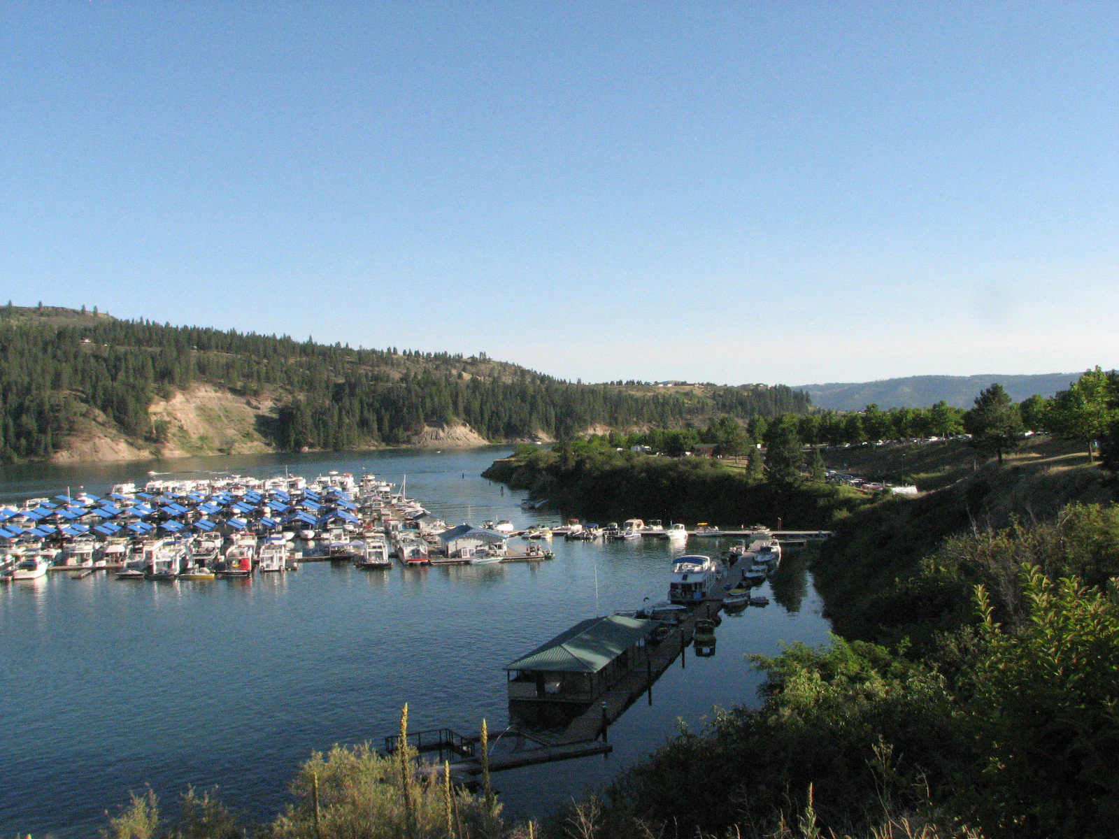
A wide angle view of a marina with numerous docked boats on calm lake waters, surrounded by forested hills under a clear blue sky.
View of Two Rivers Marina at Lake Roosevelt National Recreation Area.

Lake Roosevelt National Recreation Area history and protected-area timeline

The history of Lake Roosevelt National Recreation Area is inseparable from the history of Grand Coulee Dam. The dam, completed in 1941 as part of the broader Columbia River Basin development project, blocked the Columbia River and created Franklin D. Roosevelt Lake, dramatically reshaping the landscape, hydrology, and human use of the region. Within five years of the dam's completion, the federal government had begun planning for the recreational and cultural management of the new reservoir.

In 1946, the Coulee Dam Recreational Area was created through a memorandum of agreement signed by the Spokane Tribe, the Colville Indian Reservation, and the U.S. Bureau of Reclamation. From the beginning, the unit integrated Native tribal authority with federal recreation management, a model that continues today. Over time, the recreation area expanded its interpretive role, particularly around two significant historical sites.

St. Paul's Mission, originally established by Jesuits in the 1830s in cooperation with the Hudson's Bay Company, once stood near Fort Colville on a bluff overlooking the Kettle Falls reach of the Columbia. The falls themselves were submerged after the dam's construction, marking a profound cultural and environmental loss for Indigenous peoples of the region. Fort Spokane, meanwhile, served as a U.S. Army frontier outpost at the junction of the Columbia and Spokane rivers in Lincoln County, and was closed in 1929. In 1996, the recreation area was renamed in honor of President Franklin D. Roosevelt, a step that was welcomed in some quarters and contested by the Colville Tribe.

Lake Roosevelt National Recreation Area landscape and geographic character

The landscape of Lake Roosevelt National Recreation Area is defined by its reservoir and the dry country of eastern Washington. Franklin D. Roosevelt Lake snakes through a broad corridor of the upper Columbia River, producing a long, narrow body of water that is at times lake-like and at times more akin to the river it replaced. Its shores reflect the geology of the Columbia Plateau, with steep basalt cliffs, rolling hills, exposed rock, and patches of native shrub-steppe vegetation dominating the uplands.

The recreation area lies east of the Cascade Range, where the climate is markedly drier than in western Washington. Rain shadow effects produce arid summers and cooler winters, and vegetation tends toward drought-adapted grasses, sage, and scattered ponderosa pine rather than the dense coniferous forests more typical of the Cascades. Grand Coulee Dam itself, a massive concrete gravity structure on the Columbia, anchors the southern end of the recreation area and serves as a focal point for visitors approaching from the south.

Along the route toward Northport, near the Canadian border, the waters narrow and the surrounding country grows more rugged. Crescent Bay Lake in Grant County, just southwest of the main reservoir, also falls within the recreation area's jurisdiction, adding a quieter inland water component to the broader landscape. Throughout the recreation area, the interplay between engineered water and natural terrain offers a distinctive scenic character that sets it apart from wilderness parks in the region.

Lake Roosevelt National Recreation Area ecosystems, habitats, and plant life

Ecologically, Lake Roosevelt occupies a transition zone between the wetter forests of the Pacific Northwest and the drier shrub-steppe ecosystems of the inland Northwest. The reservoir creates a linear aquatic habitat surrounded by uplands that resemble the broader Columbia Plateau in their dryness and openness. Vegetation along the shore tends toward grasses, sagebrush, and juniper in drier zones, with denser tree cover in cooler draws and along tributary streams.

Birdlife is a noticeable feature of the area, as the open water attracts waterfowl and the surrounding uplands host raptors and songbirds typical of eastern Washington's shrub-steppe. Riparian habitats along small creeks and drainages that feed the reservoir provide comparatively rich cover and food resources, supporting a range of species in an otherwise arid setting. These zones are particularly important given the generally dry regional climate.

Because much of the recreation area's ecology is shaped by the reservoir's artificial origin, the management of natural resources involves balancing the demands of recreation, water level fluctuations behind the dam, water quality, and tribal interests in the watershed. The interplay between reservoir operations and shoreline ecology is a defining feature of the park's environmental character.

Lake Roosevelt National Recreation Area wildlife and species highlights

Wildlife at Lake Roosevelt reflects the mixture of aquatic and arid upland habitats found in the recreation area. The reservoir supports populations of fish that have made it a regional draw for anglers, including species associated with the Columbia River system such as walleye and various salmonids, though the specific composition of fisheries has been shaped by dam operations, stocking, and changes to migration routes since Grand Coulee Dam's construction.

On land, the surrounding shrub-steppe and grassland habitats host mammals and birds typical of eastern Washington. Species such as mule deer, coyotes, and smaller mammals are present across the recreation area, while the open terrain and cliff edges provide hunting grounds for raptors. Visitors occasionally encounter bighorn sheep in rougher terrain, where basalt outcrops and steep slopes mirror habitat found elsewhere in the Columbia Plateau.

The reservoir's length and openness also make it a route for migratory birds, particularly waterfowl and waterbirds moving along the broader Pacific Flyway. Bald eagles are a recognizable presence along the shoreline, especially near areas of fish activity and around historical sites such as Fort Spokane. Together, the wildlife patterns reflect the recreation area's dual identity as both a working reservoir and a refuge within a largely arid regional landscape.

Lake Roosevelt National Recreation Area conservation status and protection priorities

Conservation at Lake Roosevelt National Recreation Area is closely tied to the larger story of the Columbia River system. The construction of Grand Coulee Dam permanently altered the river's ecology, blocking historic salmon migrations and submerging important sites such as Kettle Falls. The recreation area exists in part to interpret and acknowledge this transformation, while also managing contemporary conservation priorities along the reservoir.

The recreation area is unusual within the National Park System for its governance structure. Management is shared among the National Park Service, the Bureau of Reclamation, the Bureau of Indian Affairs, and the Confederated Tribes of the Colville Reservation and the Spokane Tribe. This shared model recognizes the cultural and territorial ties of tribal nations to lands and waters that were significantly affected by the dam's construction. It also reflects the recreation area's origins in a 1946 memorandum of agreement rather than a traditional Congressional act.

Within the recreation area, conservation efforts focus on preserving historic structures such as Fort Spokane and the remains of St. Paul's Mission, protecting shoreline and riparian habitats from recreational impacts, and coordinating with tribal and federal partners on reservoir management. The recreation area's significance is therefore not only in its landscapes but also in its role as a place where ecological, cultural, and infrastructural histories intersect.

Lake Roosevelt National Recreation Area cultural meaning and human context

Lake Roosevelt National Recreation Area carries a layered cultural history that long predates its formal establishment. The Columbia River corridor around what is now the reservoir has been home to Indigenous peoples for thousands of years, including the ancestors of the Spokane Tribe and the Confederated Tribes of the Colville Reservation. Their connection to the river, its fisheries, and features such as Kettle Falls was fundamentally altered by the construction of Grand Coulee Dam.

The fur trade era added another layer of cultural history, exemplified by St. Paul's Mission. Built by Jesuits working with the Hudson's Bay Company in the 1830s near Fort Colville, the mission reflected the intertwined religious and commercial interests of European powers in the Pacific Northwest. Fort Spokane, a later U.S. Army outpost at the confluence of the Columbia and Spokane rivers, marked an additional era of federal presence in the region before its closure in 1929.

The renaming of the recreation area in 1996 for President Franklin D. Roosevelt was a reminder of the contested nature of public memory in the region, particularly for tribal nations. The cultural context of the recreation area therefore includes both shared heritage sites and ongoing conversations about whose histories are recognized and how the landscape is described.

Top sights and standout views in Lake Roosevelt National Recreation Area

Among Lake Roosevelt National Recreation Area's standout features is the sheer length of Franklin D. Roosevelt Lake itself, a 130-mile reservoir that traces the upper Columbia and gives the unit its dominant character. Grand Coulee Dam remains a defining landmark at the southern end of the recreation area and a focal point for visitors interested in mid-twentieth-century infrastructure.

The unit's historic sites, including Fort Spokane at the meeting of the Columbia and Spokane rivers and the legacy of St. Paul's Mission near the former Kettle Falls, distinguish it from recreation areas that lack significant cultural resources. Crescent Bay Lake's inclusion in the jurisdiction also broadens the recreational footprint beyond the main reservoir.

Finally, the unusual agreement-based origin of the recreation area and its shared tribal and federal governance set it apart administratively, making it one of the most distinctive recreational units in the National Park System.

Best time to visit Lake Roosevelt National Recreation Area

Lake Roosevelt National Recreation Area's climate is shaped by its position east of the Cascade Range, where summers are typically hot and dry and winters are cooler and wetter. Late spring through early fall is generally when the reservoir sees the most visitor activity, with stable water levels, warm temperatures suitable for swimming and boating, and longer daylight hours for shoreline exploration.

Fall can bring quieter conditions and changing light across the lake and surrounding basalt country, while spring runoff from snowmelt can affect water levels and shoreline access in some areas. Winter visits are less common and tend to focus on those interested in quieter landscapes, wildlife observation, and historic sites rather than water-based recreation. Because reservoir levels behind Grand Coulee Dam can vary, visitors interested in particular activities such as boat launching or shoreline camping may want to consider seasonal water conditions in advance.

Monthly climate preview

Long-term representative temperature ranges and monthly precipitation distributions

Lake Roosevelt National Recreation Area Climate Normals and Annual Weather Patterns

Lake Roosevelt National Recreation Area exhibits measured monthly temperature swings and precipitation variations based on long-term coordinate observations. Reviewing the complete twelve-month climatology dataset reveals detailed multi-year averages across every recorded period.
Annual mean8 °C
-5 °C21 °C
Jan-5°
Feb-2°
Mar
Apr
May12°
Jun16°
Jul21°
Aug21°
Sep15°
Oct
Nov
Dec-5°
Warmest month
July

21.5 °C

Coolest month
January

-4.8 °C

Wettest month
December

2.3 mm/day

Driest month
August

0.4 mm/day

Park location guide

Geography guide, regional context, and park location map for Lake Roosevelt National Recreation Area

Lake Roosevelt National Recreation Area park geography, regions, and map view in United States of America

Understand where Lake Roosevelt National Recreation Area sits in United States of America through a broader geographic reading of the surrounding landscape, nearby location context, and its mapped position within the national park landscape.

How Lake Roosevelt National Recreation Area fits into United States of America

The United States of America is a federal presidential republic and one of the world's largest countries by area and population. It consists of 50 states across a vast territory spanning multiple time zones, with its capital in Washington, D.C. and largest city in New York City. The nation has a diverse economy, influential political system, and significant cultural and military presence globally.

Wider geography shaping Lake Roosevelt National Recreation Area in United States of America

The United States occupies a vast territory in North America, bordered by Canada to the north and Mexico to the south. The 48 contiguous states stretch from the Atlantic to the Pacific Ocean, while Alaska occupies the northwestern region and Hawaii is an archipelago in the Pacific. The country encompasses diverse terrain including the Rocky Mountains, Appalachian Mountains, Great Plains, and extensive river systems.

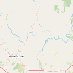
Map view of Lake Roosevelt National Recreation Area

Use this park location map to pinpoint Lake Roosevelt National Recreation Area in United States of America, understand its exact geographic position, and read its mapped placement within the surrounding landscape more clearly.

Pigeon | © OpenStreetMap contributors

Location context for Lake Roosevelt National Recreation Area

Washington

Visualizing the reservoir landscapes, basalt cliffs, and river terrain

Lake Roosevelt National Recreation Area Photos and Scenery

Examine professional national park photography to understand the distinct geography of Lake Roosevelt National Recreation Area. Detailed visual records capture the arid hills, expansive reservoir waters, and protected terrain that define the upper Columbia River.

A wide angle view of a marina with numerous docked boats on calm lake waters, surrounded by forested hills under a clear blue sky.

A high-angle view of a deep blue reservoir with dry, hilly landscapes in the background and a large white rock in the foreground.

Park atlas

Compare regional geography and connected protected landscapes across eastern Washington

Parks Near Lake Roosevelt National Recreation Area and Surrounding Protected Lands

Browsing other parks near Lake Roosevelt National Recreation Area reveals broader regional geography across the Columbia Plateau and Inland Northwest. Expanding the search helps travelers and researchers connect individual reservoir environments with nearby national parks and protected landscapes.
State or regional parkBritish Columbia
About 105 km away#1 closest

North

King George VI Provincial Park: Protected Riparian Woodland in Southeastern British Columbia

Ecological atlas of old growth cottonwood habitats

King George VI Provincial Park functions as a significant conservation enclave in southeastern British Columbia, known for its dense stands of old growth black cottonwood. These mature trees create a unique closed canopy environment that serves as critical nesting ground for specialized bird species. This park represents a focused, passive protected area that preserves rare riparian forest structure against a backdrop of regional highway corridors and mixed use terrain.

Area
1.619 km²
Established
1937
IUCN
III
Relief
Lowland
State or regional parkBritish Columbia
About 123 km away#2 closest

North

Jewel Lake Provincial Park: Geography and Protected Landscapes in British Columbia

A ridge-flanked valley lake with historic mining heritage

Jewel Lake Provincial Park preserves a narrow, forty-nine hectare freshwater ecosystem in the Boundary region of British Columbia. The area provides a detailed look at ridge-flanked mountain terrain and the historical mining landscape that defines this section of the West Kootenay-Boundary corridor.

Area
0.49 km²
Established
1981
IUCN
II
Climate
Temperate
A watercolor painting of a mountain landscape with soft-colored rolling hills, a green forest line, and foreground vegetation on a white background.
Protected landscapeWashington
About 124 km away#3 closest

West

Okanogan, Wenatchee National Forest: A Comprehensive Look at Washington's Protected Mountain Landscapes

Mapping ecological gradients and wilderness boundaries across the eastern Cascade Range

Spanning from the moist coniferous forests of the western Cascades to the arid plateaus of the Okanogan, this massive national forest protects an unmatched diversity of terrain. Explore the intricate geography of river-carved valleys, glacial cirques, and remote wilderness areas that characterize this critical environmental corridor in the Pacific Northwest.

Area
6,066.33 km²
Established
1911
Visitors
397K annual
Relief
Mountain
Watercolor painting of a calm river winding through a forested landscape with soft hills in the background at sunset.
State or regional parkBritish Columbia
About 125 km away#4 closest

Northwest

Kettle River Recreation Area: Protected Dry Belt Landscapes and River Geography in British Columbia

Mapping riparian corridors and southern interior ecological zones

Located within the Kootenay Boundary, Kettle River Recreation Area protects a rare intersection of dry ponderosa pine-bunchgrass communities and old growth cottonwood stands. The park creates a distinct geographic enclosure shaped by a sharp S-bend in the river, providing a significant reference point for dry-belt interior ecosystems within the broader British Columbia provincial park network.

Area
1.79 km²
Established
1972
IUCN
II
Relief
Upland
A soft watercolor painting depicting rolling mountains in the background with a line of forest in the midground and open terrain in the foreground.
Protected landscapeMontana
About 155 km away#5 closest

East

Kootenai National Forest: Geography and Protected Land Map for Northwestern Montana

Northern Rockies mountain ranges and watershed analysis.

Spanning over two million acres, Kootenai National Forest represents a critical protected landscape in the Northern Rockies. This atlas entry details the interplay between the Cabinet Mountains, regional river systems like the Kootenai and Clark Fork, and the dense conifer forests that define this uniquely wet corner of Montana.

Area
8,900 km²
Established
1907
Relief
Mountain
Climate
Temperate
Wildlife reserveWashington
About 155 km away#6 closest

West

Lake Chelan-Sawtooth Wilderness: Geographic Atlas and Protected Landscape Overview

North Cascades Wilderness in Washington State

Located in the north-central Cascade Range of Washington, this protected wilderness area contains 63 glacial lakes and extensive alpine terrain. The region offers a complex landscape of cirques, subalpine meadows, and forested valleys that connect directly to the larger North Cascades protected network. Use this atlas to examine its mountainous geography and defined conservation boundaries.

Area
619.4 km²
Established
1984
IUCN
Ib
Relief
Mountain
A soft, horizontal watercolor painting depicting a winding river through a grassy valley with distant, rolling mountains under a light sky.
Protected landscapeIdaho
About 155 km away#7 closest

East

Idaho Panhandle National Forests: Mapping the Inland Pacific Northwest Protected Landscapes

Geographic analysis of mountain ranges and river valley ecosystems

Spanning over 2.5 million acres, the Idaho Panhandle National Forests comprise a massive, interconnected network of mountain ranges, pristine lakes, and river corridors. This detailed look at the geography examines the structural backbone of the Selkirk, Cabinet, and Bitterroot ranges, highlighting the diverse ecological gradients and protected wilderness areas that characterize this significant portion of the inland Northwest.

Area
13,000 km²
Established
1912
Relief
Mountain
Climate
Temperate
A pale, minimalist watercolor painting showing a soft green treeline along a riverbank with light mountain silhouettes in the distance.
State or regional parkBritish Columbia
About 158 km away#8 closest

Northwest

Inkaneep Provincial Park: Mapped Geography and Protected Riparian Landscapes in British Columbia

Conserving riverine habitats and arid valley biodiversity in the Okanagan

Inkaneep Provincial Park occupies a distinct corridor along the Okanagan River, safeguarding vital riparian vegetation and cottonwood forests in one of Canada's driest regions. This protected area supports important ecological functions, ranging from salmon habitat restoration to providing refuge for rare bird species, representing a meaningful component of the south Okanagan geographic network.

Area
0.205 km²
Established
1956
IUCN
II
Relief
Lowland

Common questions about visiting, size, designation, and location context for Lake Roosevelt National Recreation Area

Lake Roosevelt National Recreation Area FAQs for park facts, access, geography, and protected area context

Find quick answers about Lake Roosevelt National Recreation Area, including protected-area facts, park geography, trail and visitor context, and how the park fits into its surrounding country and regional landscape.
MoriAtlas Explorer

Continue Your Protected Areas Search Across the Global Atlas

Deepen your exploration by continuing the structured search for national parks and protected areas worldwide. Utilize the comprehensive filtering capabilities to compare different conservation landscapes and refine your understanding of global park geography. Discover more about the distribution and characteristics of protected natural areas.

Global natural geography