Mori Atlas logo
State or regional parkJewel Lake Provincial Park

Examining the ridge-flanked valley geography and mapped shoreline of this regional protected area

Jewel Lake Provincial Park: A Protected Mountain Lake Landscape in British Columbia

Jewel Lake Provincial Park encompasses a forty-nine hectare protected landscape in the Boundary Country of south central British Columbia. This area centers on a three-kilometre long mountain lake, defined by narrow, ridge-flanked valley walls and the historic mining remnants of the surrounding region. The park maintains a distinct geographic identity where freshwater ecosystems meet a landscape shaped by industrial history.

Boundary CountryBritish Columbiafreshwater laketrout fishingfly fishingice fishing

Jewel Lake Provincial Park

State or regional park

Park overview

Structured park overview, official facts, and landscape profile for Jewel Lake Provincial Park

Jewel Lake Provincial Park park facts, protected area profile, and essential visitor context

Review the core facts for Jewel Lake Provincial Park, including designation, size, terrain, visitor scale, habitats, and operating context in one park-focused overview.

About Jewel Lake Provincial Park

Jewel Lake Provincial Park is a small British Columbia provincial park situated on the northwestern shore of Jewel Lake, in the Boundary Country of south central British Columbia. The park occupies 49 hectares (120 acres) and shares much of its footprint with an older recreational reserve that was originally created in 1949 and expanded in 1971. Its official establishment in 1981 marked the formal consolidation of public access and recreation management around the lake.

The park lies in a landscape shaped by both natural and industrial history. The lake itself is roughly three kilometres long and only about 300 metres wide, oriented in a north-easterly direction and framed by mountain ridges. Jewel Creek flows out at the south end, and the surrounding terrain carries the legacy of Boundary Country mining, including the closed Jewel Lake Gold Mines and remnants of rail lines, shafts, and collapsed buildings visible on the slopes above the shoreline.

Recreation is the core identity of the park. The site offers 26 vehicle-accessible campsites, a hand-pumped water source, pit toilets, a small day-use beach with picnic tables and barbecues, and car-top boat launching facilities. The lake is regularly stocked with brook trout and rainbow trout by the Summerland Trout Hatchery, making fly fishing in summer and ice fishing in winter popular activities. Canoeing and kayaking are also common, although motor size is restricted to 10 horsepower to protect the lake's quieter character.

For residents of nearby Greenwood and Midway, Jewel Lake Provincial Park fills a longstanding local need for an accessible freshwater recreation site within easy day-use distance. This practical origin, combined with the scenic setting and the mining-era backdrop, helps define the park's present-day character as a small, recreation-focused provincial park rather than a wilderness preserve.

Quick facts and research context for Jewel Lake Provincial Park

Jewel Lake Provincial Park is a 49-hectare (120-acre) BC Parks protected area in the Boundary Country of south central British Columbia. The park sits at the northwestern end of Jewel Lake, about 14 kilometres northeast of Greenwood and roughly 48 kilometres northwest of Grand Forks, and is reached via BC Highway 3 and Jewel Lake Road.

Established on October 22, 1981, it is managed under an IUCN Category II designation and administered by BC Parks, with day-to-day operations handled by a private contractor. The lake itself is approximately 3 kilometres long and about 300 metres wide, and is the park's defining recreational and scenic feature.

Protection and recognition

Terrestrial protected area records and formal conservation scope for Jewel Lake

Jewel Lake Provincial Park Protection Status and Mapped Designation Details

Terrestrial protection status records outline the documented management scope and conservation framework established for Jewel Lake Provincial Park. Formal designation data provides verified administrative facts for regional wilderness exploration and geographic analysis.

Protection details

Protection scope
Terrestrial
Park context

Deeper park guide and search-rich context for Jewel Lake Provincial Park

Jewel Lake Provincial Park history, landscape, wildlife, and travel context

Explore Jewel Lake Provincial Park through its history, landscape character, ecosystems, wildlife, conservation priorities, cultural context, and seasonal travel timing in a structured park guide built for atlas discovery and search intent.

Why Jewel Lake Provincial Park stands out

Jewel Lake Provincial Park is best known for its combination of small-scale lakeside camping, day-use swimming, and stocked trout angling in the Boundary Country of British Columbia. The lake's three-kilometre length, flanked by mountain ridges, gives the park a defined and intimate shoreline character despite its modest area. The park is also notable for its role in preserving recreational access in a region otherwise dominated by larger and busier lakes such as Christina Lake. Its proximity to historic mining sites, including the closed Jewel Lake Gold Mines, adds a layer of industrial heritage context that distinguishes it from purely wilderness-oriented parks in southern British Columbia.

Jewel Lake Provincial Park history and protected-area timeline

The lake at the heart of the present park was originally known as Long Lake, with the name documented as early as 1895 in connection with mining claims in the Boundary Country. In 1898, Randolph Stuart obtained a crown grant for land along the south and west sides of the lake, and the following year British aristocrat Arthur Norris Pelly acquired part of this land and attempted to subdivide it as the Long Lake townsite, a venture that did not develop significantly. The nearby Mount Pelly still carries his name.

In the mid-1920s the lake became known as Jewel Lake, with the official adoption of the name occurring in the 1950s; at the same time, the nearby Granite Creek was renamed Jewel Creek. Mining shaped the area in the years before the park existed, and the Jewel Lake Gold Mines eventually closed in the 1930s, leaving visible infrastructure such as rail lines, mine shafts, and collapsed buildings in the surrounding slopes.

A formal recreational reserve was created at the north end of the lake in 1949 and enlarged in 1971 to encompass roughly 49 hectares. By that decade, the southern end of the lake had already been privately developed, with Jewel Lake Resorts Ltd. providing camping, day-use facilities, boat rentals, and cottage accommodation. The reserve suffered from environmental damage linked to peak camping and fishing use in late spring and early fall.

Pressure from Greenwood–Midway residents for proper picnicking, swimming, and day-use facilities within reasonable distance from town drove the push to convert the reserve into a provincial park. After land exchanges were negotiated to create beach and picnic areas, Jewel Lake Provincial Park was officially established on October 22, 1981, retaining the size of the prior reserve and formalizing public access to the lake.

Jewel Lake Provincial Park landscape and geographic character

Jewel Lake Provincial Park sits in a compact, ridge-flanked valley setting typical of the Boundary Country. The lake itself runs roughly three kilometres from southwest to northeast and is about 300 metres across at its widest, giving the shoreline a long, narrow character. Mountain ridges rise on either side, framing the water and creating a strong sense of enclosure within the broader landscape.

The shoreline rises quickly into deeper water, with shallows near the edges that are nevertheless narrow before the lake bottom drops away. Jewel Creek forms the outflow at the south end of the lake, defining the southern boundary of the visible water system. The terrain around the park includes both forested ridge slopes and the disturbed ground of historic mining activity, with tailings and remnants of mine workings visible above parts of the shoreline.

Despite the park's modest 49-hectare size, the combination of lake, surrounding ridges, creek, and historic mining uplands produces a varied and visually layered landscape. It is a setting more defined by intimacy and historical texture than by dramatic scale, and it reflects the dual identity of the Boundary region as both a natural mountain environment and a landscape shaped by industrial-era resource extraction.

Jewel Lake Provincial Park ecosystems, habitats, and plant life

The ecology of the park is centered on Jewel Lake and its immediate shoreline. Jewel Creek at the south end provides outflow, and the combination of clear water, defined shoreline shallows, inflowing creek, and forested slopes supports a relatively healthy freshwater environment for a lake of its size and recreational pressure.

Vegetation in and around the park reflects the mixed-elevation slopes of the Boundary Country. Forested areas include the upland ridges framing the lake, while the lakeshore and lower terrain contribute to the aquatic and riparian character of the site. Mild environmental stress did occur historically, particularly from peak camping and fishing periods in the recreational reserve era, and was one of the factors that motivated the park's formal establishment.

The lake itself is supported as a stocked freshwater habitat through the efforts of the Summerland Trout Hatchery, which provides both brook trout and rainbow trout to maintain fish populations. Historic claims of very large rainbow trout catches at the lake have circulated locally but lack substantive documentation, while the creek outlet has historically provided enough spawning habitat to support fish stock.

Jewel Lake Provincial Park wildlife and species highlights

Wildlife at Jewel Lake Provincial Park is primarily associated with its freshwater environment, which supports populations of both brook trout and rainbow trout through ongoing stocking by the Summerland Trout Hatchery. Jewel Creek, which flows out at the south end of the lake, has historically provided enough spawning habitat to help maintain these fish stocks.

Angling pressure from fly fishing in summer and ice fishing in winter is part of the wildlife-related recreational appeal of the park. While the lake is managed primarily through stocking, the surrounding forested ridges and slopes would also support the typical mix of Boundary Country fauna associated with similar mixed-conifer and montane habitats, including birds and small mammals common to lakeside environments in southern British Columbia.

Jewel Lake Provincial Park conservation status and protection priorities

The park's conservation significance lies in its consolidation of public access and environmental management around Jewel Lake, a previously degraded recreational reserve that had suffered from overuse during peak camping and fishing periods in late spring and early fall. Formal park status in 1981 brought this damage under active management, including designated campsites, proper toilets, structured wastewater handling, garbage facilities, and improved but still gravel vehicle access.

A long-standing concern has been water quality, with the hand pump supplying campground water carrying a permanent boil water advisory. Tailings from the historic Jewel Lake Gold Mines near the southern shoreline have also been recognized as a contamination risk to the lake and were targeted for removal prior to beach restoration with clean sand.

By stabilizing a small but locally important lakeside ecosystem, restricting motor size on boats to 10 horsepower, and providing structured recreation infrastructure, the park plays a modest but meaningful conservation role within the broader Boundary Country landscape.

Jewel Lake Provincial Park cultural meaning and human context

The cultural context of Jewel Lake Provincial Park is closely tied to the mining-era history of the Boundary Country and to the small communities of Greenwood and Midway that border it. Originally known as Long Lake, the waterbody was first mentioned in 1895 in connection with mining claims, and the early subdivision of shoreline land in 1898–1899 by Randolph Stuart and Arthur Norris Pelly reflects the speculative land-use culture of the late nineteenth-century frontier.

The failed Long Lake townsite and the once-active Jewel Lake Gold Mines, which finally closed in the 1930s, give the park a tangible heritage dimension, with visible mining workings, rail lines, and collapsed buildings on the surrounding slopes. The mid-1920s renaming of the lake to Jewel Lake, later formalized in the 1950s alongside the renaming of Granite Creek to Jewel Creek, also reflects the transition from raw mining settlement to a more recreation-oriented identity.

For residents of Greenwood and Midway, the park has long served practical social and recreational needs: a local swimming, picnicking, and camping destination within reasonable day-use distance. The late Jim Harrison, an ice hockey figure, was associated with the resort operation at the south end of the lake, adding a further layer of regional personality to the park's modern history.

Top sights and standout views in Jewel Lake Provincial Park

Jewel Lake Provincial Park's highlights center on Jewel Lake itself: a long, narrow, clear lake roughly three kilometres long and 300 metres wide, flanked by mountain ridges and drained at the south end by Jewel Creek. The lake is stocked with brook trout and rainbow trout and offers fly fishing in summer and ice fishing in winter, while the ten-horsepower motor limit preserves a quieter boating atmosphere for canoes and kayaks.

Within the park, visitors find 26 vehicle-accessible campsites, a hand-pumped water source, pit toilets, a small day-use beach served by a 15-vehicle parking lot, and five picnic tables with two freestanding barbecues. Nearby, the closed Jewel Lake Gold Mines and the historic Long Lake townsite add a distinctive Boundary Country mining-era atmosphere that complements the natural setting.

Best time to visit Jewel Lake Provincial Park

The most comfortable period to experience Jewel Lake Provincial Park is summer, when the lake warms enough for swimming by early July and the full range of recreation, including fly fishing, canoeing, kayaking, and camping, is available. Unrestricted public access is generally available from May through September, with the later spring and early fall months historically being especially popular for camping and fishing at the lake.

Winter introduces a quieter, more focused atmosphere, with ice fishing permitted on the lake, though most camping infrastructure emphasizes the warmer months. Visitors planning to use the campground water should be aware of the permanent boil water advisory regardless of season.
Monthly climate preview

Long-term monthly temperature averages and precipitation metrics for British Columbia

Jewel Lake Provincial Park Climate Normals and Annual Temperature Patterns

Representative coordinates record measured multi-year temperature ranges spanning deep sub-zero winter minimums to warm summer maximums alongside consistent daily precipitation rates. Analyzing the complete monthly climate profile reveals detailed annual shifts in thermal behavior and moisture distribution across the protected landscape.
Annual mean4 °C
-8 °C17 °C
Jan-8°
Feb-7°
Mar-3°
Apr
May
Jun13°
Jul17°
Aug17°
Sep12°
Oct
Nov-3°
Dec-8°
Warmest month
July

17.2 °C

Coolest month
December

-8.5 °C

Wettest month
November

2.3 mm/day

Driest month
August

0.7 mm/day

Park location guide

Geography guide, regional context, and park location map for Jewel Lake Provincial Park

Jewel Lake Provincial Park park geography, regions, and map view in Canada

Understand where Jewel Lake Provincial Park sits in Canada through a broader geographic reading of the surrounding landscape, nearby location context, and its mapped position within the national park landscape.

How Jewel Lake Provincial Park fits into Canada

Canada is a federal parliamentary constitutional monarchy spanning North America from the Atlantic to the Pacific and Arctic Oceans. With a population of over 41 million, it is officially bilingual in English and French at the federal level. The country gained independence from the United Kingdom through a gradual process culminating in 1982.

Wider geography shaping Jewel Lake Provincial Park in Canada

Canada occupies the northern portion of North America, sharing its longest international border with the United States. The country extends from the Atlantic Ocean to the Pacific Ocean and northward into the Arctic Ocean, giving it the longest coastline of any nation.

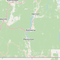
Map view of Jewel Lake Provincial Park

Use this park location map to pinpoint Jewel Lake Provincial Park in Canada, understand its exact geographic position, and read its mapped placement within the surrounding landscape more clearly.

Pigeon | © OpenStreetMap contributors

Location context for Jewel Lake Provincial Park

British Columbia
Park atlas

Compare regional valley landscapes and connected freshwater reserves across the Boundary Country.

Explore Other Parks Near Jewel Lake Provincial Park and Surrounding Protected Areas

Continue geographic comparison by browsing other protected areas located near Jewel Lake Provincial Park and the surrounding West Kootenay corridor. Expanding the regional park view helps reveal connected mountain terrain, valley lake environments, and historic conservation lands.
Watercolor painting of a calm river winding through a forested landscape with soft hills in the background at sunset.
State or regional parkBritish Columbia
About 29 km away#1 closest

West

Kettle River Recreation Area: Protected Dry Belt Landscapes and River Geography in British Columbia

Mapping riparian corridors and southern interior ecological zones

Located within the Kootenay Boundary, Kettle River Recreation Area protects a rare intersection of dry ponderosa pine-bunchgrass communities and old growth cottonwood stands. The park creates a distinct geographic enclosure shaped by a sharp S-bend in the river, providing a significant reference point for dry-belt interior ecosystems within the broader British Columbia provincial park network.

Area
1.79 km²
Established
1972
IUCN
II
Relief
Upland
State or regional parkBritish Columbia
About 60 km away#2 closest

East

King George VI Provincial Park: Protected Riparian Woodland in Southeastern British Columbia

Ecological atlas of old growth cottonwood habitats

King George VI Provincial Park functions as a significant conservation enclave in southeastern British Columbia, known for its dense stands of old growth black cottonwood. These mature trees create a unique closed canopy environment that serves as critical nesting ground for specialized bird species. This park represents a focused, passive protected area that preserves rare riparian forest structure against a backdrop of regional highway corridors and mixed use terrain.

Area
1.619 km²
Established
1937
IUCN
III
Relief
Lowland
A pale, minimalist watercolor painting showing a soft green treeline along a riverbank with light mountain silhouettes in the distance.
State or regional parkBritish Columbia
About 69 km away#3 closest

West

Inkaneep Provincial Park: Mapped Geography and Protected Riparian Landscapes in British Columbia

Conserving riverine habitats and arid valley biodiversity in the Okanagan

Inkaneep Provincial Park occupies a distinct corridor along the Okanagan River, safeguarding vital riparian vegetation and cottonwood forests in one of Canada's driest regions. This protected area supports important ecological functions, ranging from salmon habitat restoration to providing refuge for rare bird species, representing a meaningful component of the south Okanagan geographic network.

Area
0.205 km²
Established
1956
IUCN
II
Relief
Lowland
Protected landscapeBritish Columbia
About 91 km away#4 closest

North

Graystokes Provincial Park: Geographic Overview of British Columbia Protected Wilderness

Exploring the Okanagan Highland plateau and alpine wetland systems

Graystokes Provincial Park functions as a key protected landscape in the British Columbia interior. This backcountry expanse is defined by its rolling plateau terrain, encompassing alpine wetlands, meadows, and riparian habitats set against a backdrop of Engelmann spruce and subalpine fir forests.

Area
119.58 km²
Established
2001
Relief
Highland
Climate
Alpine
A watercolor painting of a mountain landscape with soft-colored rolling hills, a green forest line, and foreground vegetation on a white background.
Protected landscapeWashington
About 106 km away#5 closest

Southwest

Okanogan, Wenatchee National Forest: A Comprehensive Look at Washington's Protected Mountain Landscapes

Mapping ecological gradients and wilderness boundaries across the eastern Cascade Range

Spanning from the moist coniferous forests of the western Cascades to the arid plateaus of the Okanogan, this massive national forest protects an unmatched diversity of terrain. Explore the intricate geography of river-carved valleys, glacial cirques, and remote wilderness areas that characterize this critical environmental corridor in the Pacific Northwest.

Area
6,066.33 km²
Established
1911
Visitors
397K annual
Relief
Mountain
State or regional parkBritish Columbia
About 121 km away#6 closest

Northwest

Kalamalka Lake Provincial Park and Protected Area: Mapped Geography and Regional Context

A conservation landscape of the North Okanagan valley

Kalamalka Lake Provincial Park and Protected Area preserves 978 hectares of essential grassland and lakeshore habitats in British Columbia. The area features a complex mosaic of open meadows and mixed forest stands, offering a detailed perspective on the ecological transitions found within the Okanagan Valley. Its geography is defined by the shimmering turquoise waters of Kalamalka Lake, reflecting the unique interplay between seasonal mineral shifts and the surrounding arid terrain.

Area
9.78 km²
Established
1975
IUCN
II
Relief
Upland
A soft watercolor illustration depicting a winding river flowing through a gentle landscape with distant rolling hills and scattered trees.
Protected areaWashington
About 123 km away#7 closest

South

Lake Roosevelt National Recreation Area: An Atlas of Washington Reservoir Landscapes

A sprawling protected region spanning the Columbia River corridor.

Lake Roosevelt National Recreation Area represents a massive, water-defined corridor in eastern Washington. The park preserves the 130-mile Franklin D. Roosevelt Lake, where steep basalt terrain meets arid shrub-steppe. This protected unit offers deep insight into the regional geography of the Columbia Plateau, featuring historical sites and river-system infrastructure that define the landscape's character.

Area
406.3 km²
Established
1946
Visitors
1.2M annual
Relief
Lowland
A horizontal watercolor painting depicting a soft-focus mountain landscape with rolling green meadows, patches of coniferous forest, and distant pale mountains under a white sky.
State or regional parkBritish Columbia
About 146 km away#8 closest

West

E. C. Manning Provincial Park: A Comprehensive Geographic Atlas and Protected Area Overview

Mountainous terrain and ecological transitions in southern British Columbia

Spanning the cross section of the Canadian Cascades, E. C. Manning Provincial Park preserves a high-elevation landscape of wildflowers, glacial valleys, and mountain ridges. The protected area links temperate coastal rainforests with the arid interior, providing a study in regional hydrology and subalpine ecology defined by the Hozameen Range and the northern reaches of the Pacific Crest Trail.

Area
836.71 km²
Established
1941
IUCN
II
Visitors
1.1M annual

Common questions about visiting, size, designation, and location context for Jewel Lake Provincial Park

Jewel Lake Provincial Park FAQs for park facts, access, geography, and protected area context

Find quick answers about Jewel Lake Provincial Park, including protected-area facts, park geography, trail and visitor context, and how the park fits into its surrounding country and regional landscape.
MoriAtlas Explorer

Continue Your Protected Areas Search Across the Global Atlas

Deepen your exploration by continuing the structured search for national parks and protected areas worldwide. Utilize the comprehensive filtering capabilities to compare different conservation landscapes and refine your understanding of global park geography. Discover more about the distribution and characteristics of protected natural areas.

Global natural geography