Mori Atlas logo
Protected landscapeGraystokes Provincial Park

Tracing the highland terrain, alpine wetlands, and riparian corridors of British Columbia

Graystokes Provincial Park: A Comprehensive Geographic Atlas of Protected Plateau Landscapes

Graystokes Provincial Park encompasses a significant expanse of the Okanagan Highland within south-central British Columbia. This protected landscape preserves a unique mosaic of subalpine meadows, riparian habitats, and old-growth coniferous forests that provide critical interior wilderness corridors. The terrain remains largely undeveloped, maintaining the ecological integrity of the plateau as a vital refuge for large mammals and diverse highland vegetation systems.

alpine wetlandssubalpine meadowsold-growth forestOkanagan HighlandbackcountryBritish Columbia interior

Graystokes Provincial Park

Protected landscape

Park overview

Structured park overview, official facts, and landscape profile for Graystokes Provincial Park

Graystokes Provincial Park park facts, protected area profile, and essential visitor context

Review the core facts for Graystokes Provincial Park, including designation, size, terrain, visitor scale, habitats, and operating context in one park-focused overview.

About Graystokes Provincial Park

Graystokes Provincial Park represents one of the newer and more ecologically focused additions to British Columbia's protected area network. Located on the Okanagan Highland east of the Okanagan Valley, the park spans the boundary between the Central Okanagan and North Okanagan regional districts, an area that combines relatively easy access from the population centers around Kelowna with a remote and undeveloped highland environment.

The park occupies a plateau setting characterized by a rich mosaic of alpine wetlands, meadows, and riparian corridors embedded within the larger Okanagan dry forests ecoregion. This juxtaposition of wet highland habitats against the surrounding drier forest matrix gives the area a distinctive ecological profile. The highland elevations serve as an important seasonal refuge, providing productive habitat conditions during the mid-to-late summer period when the lower Okanagan Valley becomes hot and arid.

From a management standpoint, Graystokes is administered by BC Parks as a backcountry protected area with no developed trail system or running water. Access is restricted to non-motorized travel for most of the year, with the exception of snowmobile use during winter months. Hunting is permitted during open seasons, reflecting the park's orientation toward conservation of wildlife habitat and traditional land use rather than mass recreation. Its IUCN Category II designation underscores the strength of its protection status and signals that Graystokes is intended to function primarily as an ecological preserve within the surrounding regional landscape.

Quick facts and research context for Graystokes Provincial Park

Graystokes Provincial Park is a backcountry protected area in south-central British Columbia, situated on the Okanagan Highland east of the Okanagan Valley and shared between the Central Okanagan and North Okanagan regional districts. The nearest major city is Kelowna.

The park was established on 18 April 2001 under the management of BC Parks and is classified as an IUCN Category II protected area. It encompasses roughly 12,000 hectares of alpine wetlands, meadows, riparian zones, and old-growth coniferous forest, with motorized access restricted outside of winter snowmobile use.

Protection and recognition

Documented terrestrial protection metrics and official designation data

Graystokes Provincial Park Protection Status and Management Scope

Graystokes Provincial Park maintains a documented terrestrial protection scope within regional conservation frameworks. Designated records compile official status details alongside management parameters for environmental analysis.

Protection details

Protection scope
Terrestrial
Transboundary protection
No
Park context

Deeper park guide and search-rich context for Graystokes Provincial Park

Graystokes Provincial Park history, landscape, wildlife, and travel context

Explore Graystokes Provincial Park through its history, landscape character, ecosystems, wildlife, conservation priorities, cultural context, and seasonal travel timing in a structured park guide built for atlas discovery and search intent.

Why Graystokes Provincial Park stands out

Graystokes Provincial Park is best known for protecting a substantial expanse of the Okanagan Highland, one of the more ecologically distinctive plateau landscapes in southern British Columbia. The park's defining feature is the convergence of alpine wetlands, subalpine meadows, and riparian habitats set within the broader Okanagan dry forests ecoregion, an unusual combination of wet and dry ecological characters. The park is also recognized for its old-growth forest stands dominated by subalpine fir, Engelmann spruce, and Douglas fir, as well as for supporting large mammal species such as grizzly bear, mountain caribou, moose, and mule deer. Its backcountry character and strong IUCN Category II protection status reinforce its role as a conservation-focused landscape rather than a developed recreation destination.

Graystokes Provincial Park history and protected-area timeline

Graystokes Provincial Park was established on 18 April 2001 through the provincial park system of British Columbia. Its creation reflected a recognition of the ecological significance of the Okanagan Highland, a plateau region east of the Okanagan Valley that had historically received less formal protection than the valley floor and its lakeshore environments.

The park's establishment was part of a broader effort to conserve representative examples of the Okanagan's ecological diversity, particularly the highland habitats that complement the drier valley ecosystems. Since its designation, Graystokes has been managed by BC Parks as a backcountry area, with policies that limit motorized access and emphasize habitat preservation. Over time, the park has come to be recognized internationally through its IUCN Category II classification, aligning it with globally recognized standards for strongly protected natural areas.

Graystokes Provincial Park landscape and geographic character

The landscape of Graystokes Provincial Park is defined by the rolling plateau terrain of the Okanagan Highland, an elevated region east of the Okanagan Valley that transitions between dry forest environments and cooler, wetter upland conditions. The park captures the characteristic landforms of this highland zone, where open basins, ridgelines, and gentle slopes alternate with wetland-filled depressions and meadow systems.

Alpine and subalpine wetlands are among the most prominent landscape features, fed by snowmelt and seasonal precipitation that sustains wet meadows and riparian corridors well into the summer months. These wet elements contrast sharply with the surrounding Okanagan dry forests, producing a patchwork environment where saturated soils, marshy ground, and shrub-filled openings interrupt stands of coniferous forest. The result is a visually varied terrain that supports a richer range of habitats than the surrounding valley landscapes alone.

Because the park has no developed trail infrastructure, visitors experience this landscape as an unbroken backcountry expanse. Snowmobiles are among the few motorized vehicles permitted, and only during winter, leaving the rest of the year dominated by quiet forest, open meadow vistas, and the seasonal rhythms of highland wetland systems.

Graystokes Provincial Park ecosystems, habitats, and plant life

Graystokes Provincial Park protects an ecologically rich portion of the Okanagan Highland, a region notable for its mosaic of habitats within the larger Okanagan dry forests ecoregion. The defining ecological feature of the park is the presence of alpine and subalpine wetlands, meadows, and riparian systems set against a backdrop of coniferous forest and drier upland vegetation.

These wet habitats function as biological anchors for the surrounding landscape, maintaining higher moisture and productivity through the summer when the lower Okanagan Valley becomes increasingly arid. The combination of open wetlands, shrub-dominated meadows, and forest edge creates transitional zones that support a wide variety of plant communities and provide nesting, foraging, and refuge conditions for many animal species.

The park's vegetation is shaped by elevation and exposure, with old-growth forests of subalpine fir, Engelmann spruce, and Douglas fir representing the dominant tree cover. Open exposures support meadow and wetland plant communities typical of interior British Columbia's highland environments, contributing to the botanical diversity that makes the Okanagan Highland ecologically distinctive within the province.

Graystokes Provincial Park wildlife and species highlights

Graystokes Provincial Park supports a robust community of large mammals characteristic of the southern British Columbia interior. The highland habitats protected within the park provide seasonal range and refuge for several species of significant ecological and cultural importance.

Grizzly bear is among the most prominent species recorded in the area, reflecting the relatively undisturbed extent of suitable habitat. The park also provides range for mountain caribou, a species of conservation concern in British Columbia, as well as moose, mule deer, and white-tailed deer. The presence of such a diverse large-mammal community is closely tied to the park's combination of forest cover, wetland openings, and meadow systems, which together provide forage, cover, and seasonal movement corridors.

Hunting is a recognized activity within the park during open seasons, underscoring both the wildlife abundance of the area and its role in supporting traditional land uses. The seasonal importance of the highland as a refuge when the valley becomes dry reinforces the park's value for maintaining wildlife connectivity across the broader Okanagan landscape.

Graystokes Provincial Park conservation status and protection priorities

Graystokes Provincial Park plays an important conservation role in protecting a representative example of the Okanagan Highland, an ecologically distinctive region that complements the drier Okanagan Valley ecosystems. By securing a large, contiguous block of alpine wetlands, meadows, riparian areas, and old-growth forest, the park helps maintain ecological processes that operate at a landscape scale.

The park's IUCN Category II classification reflects a high level of protection, aligning it with the international standard for strongly protected natural areas. This designation underscores the intent to preserve the area's ecological integrity, rather than develop it for intensive public use. Restrictions on motorized vehicle access, the absence of trail development, and the maintenance of backcountry conditions all reinforce a conservation-oriented management approach.

Beyond its boundaries, Graystokes contributes to broader regional conservation goals by safeguarding habitat connectivity, maintaining water and wetland function in the highland catchment, and providing climate-sensitive seasonal range for species such as grizzly bear and mountain caribou. In this way, the park serves as a stronghold for ecological resilience in an otherwise heavily altered regional landscape.

Graystokes Provincial Park cultural meaning and human context

The Okanagan Highland, where Graystokes Provincial Park is located, lies within the traditional territories of the Okanagan Nation and neighboring Indigenous peoples who have historically relied on the highland environments for hunting, fishing, and seasonal travel. The presence of large mammal species such as moose, mule deer, and caribou, along with the continued practice of hunting within the park during open seasons, reflects the enduring connection between these landscapes and traditional land uses.

While the park itself does not contain major developed cultural sites, its protected status intersects with broader regional efforts to balance ecological preservation with the recognition of Indigenous land stewardship in the Okanagan. The park's backcountry orientation and limited infrastructure help maintain a landscape character that is consistent with long-standing patterns of land use across the highland plateau.

Top sights and standout views in Graystokes Provincial Park

Graystokes Provincial Park stands out for the scale and ecological integrity of the Okanagan Highland landscape it protects, including a notable concentration of alpine wetlands, meadows, and riparian habitats within the broader dry forests ecoregion. Its old-growth stands of subalpine fir, Engelmann spruce, and Douglas fir contribute to the park's botanical significance.

The combination of strong conservation status, limited development, and the presence of species such as grizzly bear and mountain caribou gives the park a clear identity as a backcountry stronghold rather than a developed recreation site.

Best time to visit Graystokes Provincial Park

Because Graystokes Provincial Park is an undeveloped backcountry area without trails or running water, the timing of a visit depends largely on how visitors intend to experience the highland landscape. Summer and early fall offer the richest ecological display, when alpine wetlands and meadows are most productive and large mammals are active across the highland terrain.

Winter opens the landscape to snowmobile access, making it the primary season for motorized travel within the park. Those seeking quieter, non-motorized experiences typically favor the snow-free months, when the combination of accessible highland meadows and surrounding forest offers the most rewarding conditions for backcountry exploration.
Monthly climate preview

Long-term representative point measurements of monthly temperature and precipitation rhythm

Graystokes Provincial Park Climate Normals and Annual Temperature Patterns

Representative coordinate records for Graystokes Provincial Park outline a measured annual sequence of monthly mean temperatures and precipitation rates from 1991 to 2020. Examining the full twelve-month profile provides deeper context on long-term climate normals across the protected landscape.
Annual mean2 °C
-9 °C15 °C
Jan-9°
Feb-8°
Mar-4°
Apr
May
Jun11°
Jul15°
Aug15°
Sep10°
Oct
Nov-4°
Dec-9°
Warmest month
July

15 °C

Coolest month
December

-9.3 °C

Wettest month
June

2.7 mm/day

Driest month
August

1.1 mm/day

Park location guide

Geography guide, regional context, and park location map for Graystokes Provincial Park

Graystokes Provincial Park park geography, regions, and map view in Canada

Understand where Graystokes Provincial Park sits in Canada through a broader geographic reading of the surrounding landscape, nearby location context, and its mapped position within the national park landscape.

How Graystokes Provincial Park fits into Canada

Canada is a federal parliamentary constitutional monarchy spanning North America from the Atlantic to the Pacific and Arctic Oceans. With a population of over 41 million, it is officially bilingual in English and French at the federal level. The country gained independence from the United Kingdom through a gradual process culminating in 1982.

Wider geography shaping Graystokes Provincial Park in Canada

Canada occupies the northern portion of North America, sharing its longest international border with the United States. The country extends from the Atlantic Ocean to the Pacific Ocean and northward into the Arctic Ocean, giving it the longest coastline of any nation.

Map view of Graystokes Provincial Park

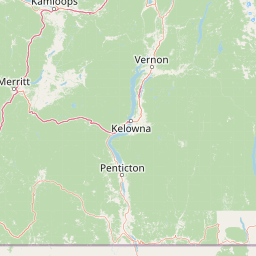
Use this park location map to pinpoint Graystokes Provincial Park in Canada, understand its exact geographic position, and read its mapped placement within the surrounding landscape more clearly.

Pigeon | © OpenStreetMap contributors

Location context for Graystokes Provincial Park

British Columbia
Park atlas

Compare surrounding highland landscapes, alpine wetlands, and regional dry forests.

Explore Other Parks and Protected Areas Near Graystokes Provincial Park

Browse protected areas and national parks near Graystokes Provincial Park to examine connected highland ecosystems across south-central British Columbia. Expanding the regional view helps place local backcountry terrain and rare wetland habitats within a broader conservation context.
State or regional parkBritish Columbia
About 38 km away#1 closest

Northwest

Kalamalka Lake Provincial Park and Protected Area: Mapped Geography and Regional Context

A conservation landscape of the North Okanagan valley

Kalamalka Lake Provincial Park and Protected Area preserves 978 hectares of essential grassland and lakeshore habitats in British Columbia. The area features a complex mosaic of open meadows and mixed forest stands, offering a detailed perspective on the ecological transitions found within the Okanagan Valley. Its geography is defined by the shimmering turquoise waters of Kalamalka Lake, reflecting the unique interplay between seasonal mineral shifts and the surrounding arid terrain.

Area
9.78 km²
Established
1975
IUCN
II
Relief
Upland
A watercolor painting showing a serene lake view with forested shoreline, grassy foreground, and rolling mountains in the distance, set against a soft, light background.
State or regional parkBritish Columbia
About 84 km away#2 closest

North

Mara Provincial Park: Protected Shoreline and Geographic Features in British Columbia

Mapping the Shuswap region's essential day-use lakeshore environment

Situated on the southern edge of Mara Lake, Mara Provincial Park functions as a key protected site in the Shuswap region of British Columbia. This area provides public access to sandy beaches and serves as the primary boat launch for the surrounding interior lake system, preserving natural terrain against private lakeshore development.

Area
0.05 km²
Established
1958
IUCN
II
Relief
Lowland
State or regional parkBritish Columbia
About 91 km away#3 closest

South

Jewel Lake Provincial Park: Geography and Protected Landscapes in British Columbia

A ridge-flanked valley lake with historic mining heritage

Jewel Lake Provincial Park preserves a narrow, forty-nine hectare freshwater ecosystem in the Boundary region of British Columbia. The area provides a detailed look at ridge-flanked mountain terrain and the historical mining landscape that defines this section of the West Kootenay-Boundary corridor.

Area
0.49 km²
Established
1981
IUCN
II
Climate
Temperate
Watercolor painting of a calm river winding through a forested landscape with soft hills in the background at sunset.
State or regional parkBritish Columbia
About 98 km away#4 closest

South

Kettle River Recreation Area: Protected Dry Belt Landscapes and River Geography in British Columbia

Mapping riparian corridors and southern interior ecological zones

Located within the Kootenay Boundary, Kettle River Recreation Area protects a rare intersection of dry ponderosa pine-bunchgrass communities and old growth cottonwood stands. The park creates a distinct geographic enclosure shaped by a sharp S-bend in the river, providing a significant reference point for dry-belt interior ecosystems within the broader British Columbia provincial park network.

Area
1.79 km²
Established
1972
IUCN
II
Relief
Upland
A pale, minimalist watercolor painting showing a soft green treeline along a riverbank with light mountain silhouettes in the distance.
State or regional parkBritish Columbia
About 99 km away#5 closest

Southwest

Inkaneep Provincial Park: Mapped Geography and Protected Riparian Landscapes in British Columbia

Conserving riverine habitats and arid valley biodiversity in the Okanagan

Inkaneep Provincial Park occupies a distinct corridor along the Okanagan River, safeguarding vital riparian vegetation and cottonwood forests in one of Canada's driest regions. This protected area supports important ecological functions, ranging from salmon habitat restoration to providing refuge for rare bird species, representing a meaningful component of the south Okanagan geographic network.

Area
0.205 km²
Established
1956
IUCN
II
Relief
Lowland
National parkBritish Columbia
About 122 km away#6 closest

Northeast

Mount Revelstoke National Park: Explore Protected Landscape Geography and Mapped Boundaries

British Columbia's National Park Atlas Entry

Delve into the protected landscape of Mount Revelstoke National Park, a critical national park located in British Columbia. This entry provides a detailed look at its mapped geographic extent and protected area identity, offering valuable context for regional atlas exploration. Understand the park's distinct contribution to the mapped natural landscapes of Canada.

Area
260 km²
Established
1914
IUCN
II
Visitors
775.2K annual
A watercolor painting showing a soft landscape with rolling hills, a winding stream or lake, and grassy vegetation.
State or regional parkBritish Columbia
About 125 km away#7 closest

West

Kentucky Alleyne Provincial Park: Glacial Landscapes and Interior Protected Areas

Mapping kettle lake geography in the British Columbia interior

Kentucky Alleyne Provincial Park preserves a compact, richly varied landscape of kettle lakes, eskers, and dry interior forest. Located in the Nicola region of British Columbia, this protected area offers a clear look at glacial landforms and sun-warmed Ponderosa pine woodlands, standing as a distinct geographic landmark within the Canadian interior range country.

Area
1.9 km²
Established
1981
IUCN
II
Relief
Upland
State or regional parkBritish Columbia
About 130 km away#8 closest

Southeast

King George VI Provincial Park: Protected Riparian Woodland in Southeastern British Columbia

Ecological atlas of old growth cottonwood habitats

King George VI Provincial Park functions as a significant conservation enclave in southeastern British Columbia, known for its dense stands of old growth black cottonwood. These mature trees create a unique closed canopy environment that serves as critical nesting ground for specialized bird species. This park represents a focused, passive protected area that preserves rare riparian forest structure against a backdrop of regional highway corridors and mixed use terrain.

Area
1.619 km²
Established
1937
IUCN
III
Relief
Lowland

Common questions about visiting, size, designation, and location context for Graystokes Provincial Park

Graystokes Provincial Park FAQs for park facts, access, geography, and protected area context

Find quick answers about Graystokes Provincial Park, including protected-area facts, park geography, trail and visitor context, and how the park fits into its surrounding country and regional landscape.
MoriAtlas Explorer

Continue Your Protected Areas Search Across the Global Atlas

Deepen your exploration by continuing the structured search for national parks and protected areas worldwide. Utilize the comprehensive filtering capabilities to compare different conservation landscapes and refine your understanding of global park geography. Discover more about the distribution and characteristics of protected natural areas.

Global natural geography