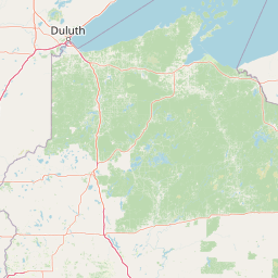
Why Lake Superior National Estuarine Research Reserve stands out
The Reserve is best known for containing Wisconsin Point, recognized as the world's largest freshwater bay mouth sand bar, and for protecting one of the largest complexes of estuarine wetlands in the entire Lake Superior Basin. It represents the lower St. Louis River freshwater estuary, the largest United States tributary to Lake Superior and a major contributor of freshwater, sediment, and nutrients to the lake. It is also notable for hosting the rare transition zone where boreal forest, northern hardwoods, and Great Lakes pine forest communities intermingle, alongside plant communities that occur nowhere else outside the Great Lakes region. The Reserve further stands out as one of only two Great Lakes sites in the national estuarine reserve network.
Lake Superior National Estuarine Research Reserve history and protected-area timeline
The Lake Superior National Estuarine Research Reserve was formally designated in 2010, becoming the first site in the National Estuarine Research Reserve System to represent the Great Lakes, Lake Superior biogeographic subregion. Its inclusion addressed a long-standing gap in the national network, which until then had no site representing the largest and most pristine freshwater estuary system in North America.
The Reserve's selection built on decades of recognition for the lower St. Louis River. Portions of the estuary and Wisconsin Point were already known to host Native American cultural sites, while the surrounding shoreline contained important remnants of historic lumbering and shipping activity tied to the region's industrial past. Several of the constituent lands, such as the Pokegama-Carnegie Wetlands, were recognized as Wisconsin State Natural Areas, and numerous sites within the Reserve were listed as Wisconsin Priority Wetlands.
More recently, Priority Conservation Opportunity Areas identified through Wisconsin's Wildlife Action Plan singled out the wetlands and boreal forest linked to the St. Louis River estuary as an area of continental significance for conservation. These overlapping layers of ecological and cultural recognition helped establish the framework under which the Reserve now coordinates research, monitoring, and stewardship of the freshwater estuary.
Lake Superior National Estuarine Research Reserve landscape and geographic character
The Reserve's landscape is shaped by the interplay of river, lake, and shoreline along the western tip of Lake Superior. The dominant physical features include the drowned river mouth of the St. Louis River, broad estuarine flats, and several miles of open sand beach backed by dunes along Wisconsin Point. The bay mouth sand bar at Wisconsin Point is recognized as the world's largest freshwater example of this landform.
Away from the open shoreline, the terrain includes steep, highly erodible red clay bluffs, low-lying wetlands, riverine islands, and gently undulating uplands. The four components of the Reserve, while not contiguous, fall within about ten miles of each other, forming a mosaic of water-level variation and shoreline exposure.
The hydrographic behavior of the site is unusual among estuarine reserves because the Reserve has no true oceanic tide. Instead, water levels fluctuate with wind-driven storm surges and seiche events, sometimes called slosh, which periodically raise and lower water across the estuary. Surface water runoff from the St. Louis River watershed provides the dominant freshwater input, producing a stratified circulation pattern within the estuary that supports a wide range of coastal habitats.
Lake Superior National Estuarine Research Reserve ecosystems, habitats, and plant life
The Reserve protects one of the most ecologically diverse freshwater coastal complexes in the Lake Superior Basin. Estuarine wetland communities dominate the lower St. Louis River area and include submergent marsh, emergent marsh, wet meadows and fens, and wet shrublands arranged in shifting mosaics shaped by water levels, sediment, and disturbance.
Upland habitats range from dry, open dune forests dominated by white and red pines, often described as xeric forest, to richer dry and hardwood forests inland. Aspen stands, interdunal wetlands, and coastal scrub swamps add further variety. Two Wisconsin State Natural Areas and eleven Wisconsin Priority Wetlands lie within the Reserve's boundaries, underscoring the concentration of high-quality habitats.
What makes the ecological character of the Reserve especially distinctive is the meeting of three major forest biomes. The boreal forest of the north, the northern hardwoods forest to the south, and the Great Lakes pine forest around the shoreline all converge here. The bay mouth bars support rare plant communities found only in the Great Lakes region, while inland areas contain boreal elements that are otherwise uncommon this far south in the continent.
Lake Superior National Estuarine Research Reserve wildlife and species highlights
The Reserve's mix of estuarine wetlands, sand dunes, forests, and shoreline provides habitat for a wide range of Great Lakes wildlife. The extensive wetland complex of the lower St. Louis River is a focal area for migratory waterfowl, shorebirds, and other waterbirds using the Lake Superior flyway. Submergent and emergent marshes produce dense foraging and nesting habitat for fish, amphibians, and aquatic invertebrates that in turn support birds and mammals.
Coastal shrublands and grasslands around the estuary serve as nesting and foraging zones for songbirds, while the dry pine forests and dunes of Wisconsin Point support specialist species adapted to sandy, open conditions. Wet shrublands, scrub swamps, and forested uplands host white-tailed deer, small mammals, and a variety of forest birds typical of both northern hardwoods and boreal communities.
Although the Reserve does not advertise a flagship mammal species, its overlooked ecological value lies in the integrity and size of its wetland mosaic. Wetlands of this scale and quality within the Lake Superior Basin are unusual, and they help sustain fish populations in the St. Louis River and Lake Superior as well as broader regional biodiversity.
Lake Superior National Estuarine Research Reserve conservation status and protection priorities
From a conservation standpoint, the Lake Superior Reserve fills a unique role in the United States estuarine network. It is one of only two Great Lakes freshwater estuaries in the National Estuarine Research Reserve System, alongside Old Woman Creek on Lake Erie in Ohio, and the only site representing the Lake Superior subregion. Its designation in 2010 was explicit recognition that freshwater estuaries of the Great Lakes warrant the same scientific and protective attention traditionally given to coastal marine estuaries.
Within Wisconsin, the Reserve incorporates land already recognized through overlapping conservation frameworks. Two State Natural Areas and eleven Priority Wetfalls fall inside its boundaries, and Priority Conservation Opportunity Areas identified for the state's Wildlife Action Plan classify the wetlands and boreal forest of the lower St. Louis River estuary as an area of continental significance. These layered designations confirm that the Reserve protects some of the most intact and ecologically valuable freshwater coastal habitat remaining in the upper Midwest.
While some portions of the Reserve show a legacy of human alteration from logging, shipping, and shoreline development, the coexistence of multiple layers of habitat recognition demonstrates that large sections remain relatively pristine. Its combination of research, monitoring, education, and land protection gives it an outsized role for understanding the ecology and stewardship of Lake Superior specifically and Great Lakes freshwater estuaries more broadly.
Lake Superior National Estuarine Research Reserve cultural meaning and human context
The lower St. Louis River and Wisconsin Point carry deep and continuing cultural significance. Native American cultural sites are documented throughout the estuary and along Wisconsin Point itself, indicating that the area has been an important landscape for Indigenous peoples for a long time. These sites remain an integral part of the Reserve's identity and management considerations.
The more recent industrial heritage of the region is also strongly visible. The Twin Ports of Duluth and Superior grew around the St. Louis River and Lake Superior corridor during the era of Great Lakes shipping and lumber transport, and historic lumbering and shipping sites line the estuary's shore. Some of that commercial legacy is reflected in property ownership patterns within the Reserve, where city, county, state, and university entities each hold different parcels.
Today the Reserve plays a role in regional identity for northwest Wisconsin, blending Indigenous cultural landscape, industrial maritime history, and modern scientific research. Its location at the western tip of the largest and most pristine of the Great Lakes gives it a distinctive role in discussions of freshwater heritage in the Upper Midwest.
Top sights and standout views in Lake Superior National Estuarine Research Reserve
Highlights of the Lake Superior Reserve include Wisconsin Point and its bay mouth sand bar, one of the largest freshwater examples of this landform in the world; the expansive coastal wetland complex of the lower St. Louis River, recognized as one of the most important in the Lake Superior Basin; the four-component design that combines riverine islands, marshes, dunes, red clay bluffs, and forests; and its position at the only National Estuarine Research Reserve site on Lake Superior.
The Reserve is also distinguished by the rare convergence of boreal forest, northern hardwoods forest, and Great Lakes pine forest within a single area, by the presence of plant communities found nowhere else outside the Great Lakes region, and by its role as a long-term research platform for freshwater estuarine science in partnership with the University of Wisconsin.
Best time to visit Lake Superior National Estuarine Research Reserve
Visiting timing at the Lake Superior Reserve is shaped more by Great Lakes seasonality than by conventional coastal tourism patterns. Late spring through early fall generally offers the most accessible conditions for exploring Wisconsin Point, sand dunes, and estuarine trails, with warmer weather supporting both waterfowl observation and shoreline walking.
Late spring and early summer tend to bring active wildlife and bird activity across the wetlands, while peak summer offers the most stable conditions for viewing the open sand beach and dune systems on Wisconsin Point. Autumn can also be rewarding, when cooler temperatures and shifting water levels influence waterfowl presence and forest coloration. Winter conditions are severe by Upper Midwest standards, with heavy snow, strong lake-effect weather, and ice along the shoreline, and visitors should expect most facilities and trails to reflect that seasonality.