Mori Atlas logo
National parkVoyageurs National Park

Discover the protected boundaries and geographic context of Voyageurs National Park in Minnesota.

Voyageurs National Park: National Park Geography and Mapped Protected Landscape in Minnesota

Voyageurs National Park represents a significant protected area within the geography of Minnesota. As a designated National Park in the United States, its unique landscape identity is crucial for atlas-based exploration and understanding regional conservation patterns. This park offers a distinct geographic perspective, inviting users to explore its mapped boundaries and place within the broader natural terrain.

Boreal ForestsWater-Based RecreationCanoeing and KayakingFishingDark Sky ParkGlacial Geology

Voyageurs National Park

National park

Park overview

Structured park overview, official facts, and landscape profile for Voyageurs National Park

Voyageurs National Park park facts, protected area profile, and essential visitor context

Review the core facts for Voyageurs National Park, including designation, size, terrain, visitor scale, habitats, and operating context in one park-focused overview.

About Voyageurs National Park

Voyageurs National Park preserves a remarkable landscape of ancient geology and water-dominated wilderness in northern Minnesota. Unlike most national parks where visitors arrive by car, Voyageurs is fundamentally a water-based park where the primary access is by canoe, kayak, motorboat, or houseboat. The park's name honors the French-Canadian voyageurs who navigated these waters during the fur trade era, carrying supplies and furs along established water routes between Lake Superior and the interior of the continent. The park's terrain is dominated by the Kabetogama Peninsula, a large land projection that contains most of the park's terrestrial area but can only be reached by crossing water. This geographic reality has preserved a wilderness character that remains largely intact, with the interior peninsula accessible only by boat in summer and by snowmobile, ski, or snowshoe across the frozen lakes in winter. The park's four major lakes create a vast aquatic playground, with Rainy Lake alone stretching 60 miles with nearly 930 miles of shoreline. To the east, the park borders the Boundary Waters Canoe Area Wilderness, extending the protected landscape across an even larger region of the Superior National Forest.

Quick facts and research context for Voyageurs National Park

Voyageurs National Park occupies parts of Saint Louis and Koochiching counties in northern Minnesota, bordering Canada. The park contains four major lakes: Rainy Lake, Kabetogama Lake, Namakan Lake, and Sand Point Lake, three of which straddle the U.S.-Canada border. The park sits on the Canadian Shield, with some of the oldest rocks in North America, ranging from 1 to 3 billion years old. The park maintains over 50 miles of hiking trails and was certified as an International Dark Sky Park in 2020. In 2025, the park welcomed approximately 206,000 visitors.

Protection and recognition

Documenting the transboundary framework and official protection history since 1975

Voyageurs National Park Protected Area Designation and Boundary Status

Geographic datasets trace the official protection status of Voyageurs National Park along the United States and Canada border. Reviewing transboundary attributes and historical management profiles helps conservationists trace how the lake-filled wilderness interacts with regional ecosystems.

Protection details

Protection scope
Mixed
Designated year
1975
Transboundary protection
Yes
Park context

Deeper park guide and search-rich context for Voyageurs National Park

Voyageurs National Park history, landscape, wildlife, and travel context

Explore Voyageurs National Park through its history, landscape character, ecosystems, wildlife, conservation priorities, cultural context, and seasonal travel timing in a structured park guide built for atlas discovery and search intent.

Why Voyageurs National Park stands out

Voyageurs National Park is best known for its exceptional water-based recreation opportunities and its boreal forest wilderness character. The park is a premier destination for canoeists and kayakers, offering a vast network of lakes and islands to explore. It is also renowned for its fishing, with walleye, northern pike, muskellunge, smallmouth bass, and crappie being prominent species in its waters. The park's landscape of glacially carved lakes, ancient Precambrian bedrock, and extensive boreal forests creates a distinctive northern wilderness that differs markedly from other U.S. national parks. The Kabetogama Peninsula, accessible only by water, preserves a large tract of interior wilderness that remains largely untouched by roads.

Voyageurs National Park history and protected-area timeline

The story of human presence at Voyageurs spans nearly 10,000 years, beginning with Paleo-Indian peoples who moved into the area as glacial Lake Agassiz receded. The region was later inhabited by the Anishinaabe (Ojibwe) peoples, who were the primary residents when European explorers arrived in the late 17th century. French explorer Jacques de Noyon wintered along the Rainy River in 1688, but it was the demand for beaver pelts that brought the voyageurs to the region in force during the 18th and 19th centuries. The park was first proposed in 1891 by the Minnesota Legislature requesting that the president create a national park, but it would take nearly 80 years for this vision to be realized. Federal legislation was signed into law by President Richard Nixon on January 8, 1971, and the park was officially established on April 8, 1975. Prior to becoming a national park, the area experienced logging operations that altered forest composition, a brief gold rush in the 1890s, and a commercial fishing industry. When the park was established, many private properties including resorts and cabins were incorporated into the park, with some historic structures retained for their significance.

Voyageurs National Park landscape and geographic character

The landscape of Voyageurs National Park is fundamentally shaped by its ancient Precambrian geology and the glacial processes that scoured and carved the terrain during the Wisconsin Glacial epoch. The park sits on the Canadian Shield, one of the oldest stable landmasses on Earth, with rocks dating between 1 and 3 billion years old. The underlying bedrock consists of ancient gneisses, granites, and schists that were compressed and folded under tremendous pressure and later intruded by molten lava flows. The surface terrain displays the results of glacial activity, with terminal moraines in the southern portion and glacially scoured lake basins dominating the north. Glacial striations and erratics are common throughout the park, marking the passage of massive ice sheets. The landscape is characterized by a labyrinth of lakes, islands, and peninsulas, with the Kabetogama Peninsula forming the park's central landmass. The rocky islands and mainland ridges form parallel formations that create the park's distinctive character, with exposed bedrock, boreal forest, and countless waterways creating a landscape that appears almost archipelagic in character despite being on the North American continent.

Voyageurs National Park ecosystems, habitats, and plant life

Voyageurs National Park supports a boreal forest ecosystem typical of the northern coniferous forests that stretch across Canada and into the upper Great Lakes region. According to vegetation classification systems, the park contains two primary vegetation types: Great Lakes Spruce/Fir and Great Lakes Pine, both associated with Northern Conifer Forest vegetation forms. The forest originally featured extensive white and red pine stands, though logging operations in the late 19th and early 20th centuries altered the forest composition, and today these pines are a minor component compared to their historical dominance. The aquatic environment is equally significant, with the park's lakes supporting diverse fish communities and serving as migration corridors for species like lake whitefish. The wetlands, islands, and lake edges provide diverse habitat structures, while the ancient bedrock and glacial deposits create unique ecological conditions. The proximity to Canada and the extensive protected lands to the east (the Boundary Waters Canoe Area Wilderness) contribute to the ecological integrity of the region, supporting species that require large, interconnected wild landscapes.

Voyageurs National Park wildlife and species highlights

The wildlife community at Voyageurs reflects the boreal forest ecosystem, with several notable species calling the park home. Large mammals include timber wolves (eastern wolf), American black bear, moose, and white-tailed deer, with moose being a particularly iconic species for the northwoods. Smaller mammals commonly observed include fox, beaver, river otter, muskrat, snowshoe hare, and weasel. In October 2022, a camera trap recorded a cougar within the park boundaries, representing an occasional visitor to the region. The avian community features prominent species including bald eagle, common loon, double-crested cormorant, various owl species, and numerous warblers. The Canada jay, also known as the gray jay, breeds within the park's boreal forest habitat and is a year-round resident. The park's lakes support diverse fish communities, with walleye, northern pike, muskellunge, smallmouth bass, and crappie being the primary sport fish species, while smaller lakes contain largemouth bass, lake trout, bluegill, and yellow perch. Lake sturgeon historically supported a commercial caviar industry in the area.

Voyageurs National Park conservation status and protection priorities

Voyageurs National Park represents Minnesota's only national park and preserves a significant tract of boreal wilderness that might otherwise have been lost to development. The park's water-centric character and the inaccessibility of its interior peninsula have naturally limited development and preserved large areas of relatively intact wilderness. The park's certification as an International Dark Sky Park in 2020 by the International Dark-Sky Association recognizes the exceptional quality of nocturnal darkness that remains in this remote region, an increasingly rare resource in the eastern United States. The park works to restore natural conditions as former resort properties and private cabins are acquired and structures removed. The integration of this landscape with the adjacent Boundary Waters Canoe Area Wilderness creates a larger protected corridor that supports ecological processes requiring extensive wild areas, particularly for wide-ranging species like wolves and moose. The presence of 13 abandoned mine sites within the park boundaries represents a historical impact that continues to be monitored, though these sites do not pose major hazards according to park assessments.

Voyageurs National Park cultural meaning and human context

The human history of the Voyageurs region spans millennia, beginning with Indigenous peoples who have occupied the area for nearly 10,000 years. The Anishinaabe (Ojibwe) peoples were the primary Indigenous residents when European explorers and traders arrived, with five bands historically living throughout what is now the park area. The French-Canadian voyageurs, after whom the park is named, were central to the fur trade economy, operating as skilled canoeists who transported goods and furs along the extensive water routes connecting Lake Superior with the northwestern territories. The gold rush of 1893 to 1898 brought a brief but intense period of development, including the boomtown of Rainy Lake City, which was abandoned by 1901. Logging operations from the 1880s through the 1930s shaped both the landscape and the communities of the region, with dams constructed at International Falls, Kettle Falls, and Squirrel Falls to power sawmills. The resort era that followed created a network of seasonal communities around the lakes, some of which were incorporated into the park in 1975.

Top sights and standout views in Voyageurs National Park

Voyageurs National Park offers a distinctive wilderness experience centered on water-based exploration. The park's four major lakes provide extensive paddling opportunities, with the interior Kabetogama Peninsula accessible only by boat creating a true backcountry experience. The Kettle Falls Hotel, constructed in 1910 and listed on the National Register of Historic Places, is accessible only by water and offers a unique historic lodging experience. The Rainy Lake gold rush sites, including Little American Island where gold was discovered in 1893, preserve tangible evidence of the brief but dramatic mining period. The Ellsworth Rock Gardens showcase a unique artistic legacy on Kabetogama Lake's northern shore. The park's winter season transforms the landscape, with snowmobile trails crossing frozen lakes providing access to a completely different character, though snowmobile use remains controversial. The International Dark Sky Park designation recognizes the exceptional stargazing opportunities, with the Voyageurs Forest Overlook, Beaver Pond Overlook, and Kettle Falls Dam area being popular locations.

Best time to visit Voyageurs National Park

Voyageurs National Park offers distinct seasons that each provide different experiences. The summer months, from late May through September, represent the primary visitor season when the park's lakes and islands are accessible by boat, canoe, or kayak. This period offers the warmest temperatures and longest days for water-based recreation, though summer also brings the highest visitation. Fall, particularly early autumn, brings cooler temperatures and spectacular fall color as the boreal forests transition, often cited as a particularly beautiful time to experience the park. Winter, from late November until early April, transforms the landscape into a snow-covered wilderness accessible by snowmobile, cross-country skiing, and snowshoe. The frozen lakes provide unusual access to the interior, though thin ice along river channels and narrows creates hazards. Spring offers the transition between ice-out and summer, though access can be limited as lakes clear of ice. The park's visitor centers operate seasonally, with the Rainy Lake Visitor Center remaining open year-round.
Park guides

Targeted answers for navigating northern Minnesota's water wilderness

Focused Guides and Planning Insights for Voyageurs National Park

Selected reference materials provide focused answers to core questions about visiting Voyageurs National Park. Detailed notes cover seasonal planning considerations, comparing ice-free boating periods against winter snowmobiling conditions.
Monthly climate preview

Long term seasonal temperature transitions and monthly precipitation patterns

Average Temperatures and Weather by Month in Voyageurs National Park

Long term climatology at the representative coordinate in Voyageurs National Park highlights a sharp continental shift, spanning sub zero winter averages to mild summer peaks around twenty degrees Celsius. Analyzing the complete twelve month profile reveals detailed precipitation shifts and monthly temperature ranges across the entire annual cycle.
Annual mean4 °C
-16 °C20 °C
Jan-16°
Feb-13°
Mar-4°
Apr
May12°
Jun17°
Jul20°
Aug19°
Sep14°
Oct
Nov-4°
Dec-12°
Warmest month
July

20.2 °C

Coolest month
January

-16.1 °C

Wettest month
June

3.6 mm/day

Driest month
February

0.7 mm/day

Park location guide

Geography guide, regional context, and park location map for Voyageurs National Park

Voyageurs National Park park geography, regions, and map view in United States of America

Understand where Voyageurs National Park sits in United States of America through a broader geographic reading of the surrounding landscape, nearby location context, and its mapped position within the national park landscape.

How Voyageurs National Park fits into United States of America

The United States of America is a federal presidential republic and one of the world's largest countries by area and population. It consists of 50 states across a vast territory spanning multiple time zones, with its capital in Washington, D.C. and largest city in New York City. The nation has a diverse economy, influential political system, and significant cultural and military presence globally.

Wider geography shaping Voyageurs National Park in United States of America

The United States occupies a vast territory in North America, bordered by Canada to the north and Mexico to the south. The 48 contiguous states stretch from the Atlantic to the Pacific Ocean, while Alaska occupies the northwestern region and Hawaii is an archipelago in the Pacific. The country encompasses diverse terrain including the Rocky Mountains, Appalachian Mountains, Great Plains, and extensive river systems.

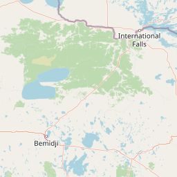
Map view of Voyageurs National Park

Use this park location map to pinpoint Voyageurs National Park in United States of America, understand its exact geographic position, and read its mapped placement within the surrounding landscape more clearly.

Pigeon | © OpenStreetMap contributors

Location context for Voyageurs National Park

Koochiching CountyMinnesotaSaint Louis County
Natural feature types

Browse the Complete Collection of Voyageurs National Park Natural Features

Navigate the complex geography of Voyageurs National Park by exploring its documented natural features and landforms. MoriAtlas provides a structured, map-focused perspective on the glacial history and hydrological composition of this unique wilderness area.
Park atlas

Trace the regional geography of protected landscapes, from northern Minnesota's boreal forests to adjacent wilderness areas.

Compare Nearby National Parks and Protected Areas around Voyageurs National Park

Explore the geographic context of national parks and protected areas surrounding Voyageurs National Park, focusing on similar boreal and aquatic landscapes. Compare their distinct features, mapped terrain, and conservation status to deepen your understanding of regional protected-area networks.
Nature reserveWisconsin
About 183 km away#1 closest

South

Lake Superior National Estuarine Research Reserve: Protected Landscape and Map Context

Freshwater estuarine geography in northwestern Wisconsin

Spanning the confluence of the St. Louis River and Lake Superior, this nature reserve preserves expansive coastal marshland, forested bluffs, and rare sand dune ecosystems. The area serves as a critical freshwater research site within the Great Lakes region, showcasing unique transitions between forest types and complex hydrologic structures shaped by wind driven seiche events.

Area
67.57 km²
Established
2010
Relief
Lowland
Scope
Mixed
Protected landscapeWisconsin
184 km away#2 closest

Southeast

Apostle Islands National Lakeshore: Wisconsin Protected Archipelago and Landscape Map

Geographic overview of sandstone sea caves and wilderness islands.

Apostle Islands National Lakeshore represents a significant protected area within the Great Lakes region of Wisconsin. Composed of twenty-one islands and a mainland shoreline, the landscape is defined by its dramatic red sandstone geology, historic maritime sites, and vast wilderness tracts. This dataset provides a clear view of the lakeshore's boundaries, surrounding water environments, and the interplay between its unique forest ecosystems and Lake Superior.

Area
281.4 km²
Established
1970
IUCN
V
Visitors
253.7K annual
Wildlife reserveBayfield County
223 km away#3 closest

Southeast

Rainbow Lake Wilderness: Protected Forest and Lake Mosaic in Bayfield County

Exploration of a designated wildlife reserve in northern Wisconsin

Rainbow Lake Wilderness presents a deeply forested landscape in northern Wisconsin, marked by a high density of sixteen named lakes and numerous ponds. Managed to maintain its natural character, this protected area in Bayfield County provides an essential look at the intersection of glacial geography, old-growth hardwood stands, and quiet aquatic habitats within a larger federal forest context.

Area
28.9 km²
Established
1975
IUCN
Ib
Relief
Upland
National parkKeweenaw County
239 km away#4 closest

East

Isle Royale National Park: Protected Landscape Atlas and Geographic Context

Explore mapped boundaries and natural terrain of this national park.

Isle Royale National Park offers a distinct opportunity for understanding protected landscapes through detailed map exploration. As a national park within Keweenaw County, its geographic identity and mapped boundaries provide valuable context for regional geography and atlas-based discovery. Investigate the natural terrain and protected land features that define this unique area, contributing to a richer comprehension of the surrounding protected areas.

Area
2,314 km²
Established
1940
IUCN
Ib
Visitors
29K annual
Wildlife reserveBayfield County
243 km away#5 closest

Southeast

Porcupine Lake Wilderness: Mapping the Protected Forest and Glacial Basins of Bayfield County

A federally designated wildlife reserve and forest landscape

Examine the geographic composition of Porcupine Lake Wilderness. This protected area features a dense network of glacial lakes, including the namesake Porcupine Lake and Eighteen Mile Spring Pond, surrounded by a rolling landscape of northern hardwoods and white pine. The mapped boundaries highlight a roadless wilderness that serves as a core forest habitat in northern Wisconsin.

Area
17.99 km²
Established
1984
IUCN
Ib
Relief
Upland
Protected landscapeMichigan
About 352 km away#6 closest

Southeast

Ottawa National Forest: Mapped Geography and Protected Landscape Context in Michigan

Glacial watersheds and waterfall corridors of the Upper Peninsula

Ottawa National Forest represents a primary protected landscape within the western Upper Peninsula of Michigan. This atlas entry covers its hydrological significance, ranging from Lake Superior tributaries to regional drainage divides, alongside its role in preserving old-growth white and red pine stands within a broader boreal forest mosaic.

Area
4,020 km²
Established
1931
IUCN
VI
Relief
Upland
Protected landscapeNorth Dakota
368 km away#7 closest

Southwest

Sheyenne National Grassland: Geography and Protected Landscape Identity in North Dakota

A rare tallgrass prairie protected area and ecological refuge.

Sheyenne National Grassland represents the only federally protected National Grassland within the tallgrass prairie ecosystem of the United States. Situated in southeastern North Dakota, its landscape of sand dunes and river corridors supports rare flora and fauna, offering a unique opportunity to map and study this complex Midwestern prairie habitat.

Area
285.08 km²
Water
Major water bodies
Wildlife reserveMichigan
376 km away#8 closest

Southeast

McCormick Wilderness: Protected Forest and Hydrology in Michigan's Upper Peninsula

A federally protected wildlife reserve and river headwaters landscape

Centrally located within the western Upper Peninsula of Michigan, McCormick Wilderness preserves 17,000 acres of dense, regrown northern forest. The area is defined by its unusual density of river headwaters, providing significant ecological value as a quiet, roadless tract within the Ottawa National Forest network.

Area
69 km²
Established
1987
IUCN
Ib
Relief
Upland

Common questions about visiting, size, designation, and location context for Voyageurs National Park

Voyageurs National Park FAQs for park facts, access, geography, and protected area context

Find quick answers about Voyageurs National Park, including protected-area facts, park geography, trail and visitor context, and how the park fits into its surrounding country and regional landscape.
MoriAtlas Explorer

Continue Your Protected Areas Search Across the Global Atlas

Deepen your exploration by continuing the structured search for national parks and protected areas worldwide. Utilize the comprehensive filtering capabilities to compare different conservation landscapes and refine your understanding of global park geography. Discover more about the distribution and characteristics of protected natural areas.

Global natural geography