Why Pukaskwa National Park stands out
Pukaskwa National Park is best known for preserving the longest undeveloped shoreline on the Great Lakes, a remarkable feat given the extensive industrial and recreational development along these massive freshwater seas. The park protects a transition zone where the boreal forest meets Lake Superior, creating a distinctive landscape of rocky headlands, cobble beaches, and dense forests. Its backcountry hiking trail system, featuring two dramatic suspension bridges across the White River and Willow River, draws experienced hikers seeking remote wilderness experiences. The park also contains rare Arctic-alpine plant species at their northernmost Canadian range, including populations of Pitcher's thistle growing in coastal dune areas.
Pukaskwa National Park history and protected-area timeline
Pukaskwa National Park was established in 1978 as part of Canada's national park system, representing a commitment to preserving the environmental integrity of the Lake Superior shoreline. Prior to designation, the area had limited industrial development due to its remote location and challenging terrain, leaving much of the landscape in a relatively natural state. The creation of the park protected both ecological values and cultural heritage sites, including the ancient Pukaskwa Pits, thousand-year-old stone structures created by Indigenous peoples that remain visible on cobblestone beaches throughout the park. The park's management by Parks Canada has focused on maintaining wilderness character while providing minimal infrastructure for backcountry access. The most recent State of the Park Report was published in 2008, providing a comprehensive assessment of ecological conditions at that time.
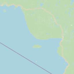
Pukaskwa National Park landscape and geographic character
The physical landscape of Pukaskwa National Park is defined by the intersection of the boreal uplands with the massive waters of Lake Superior. The park's coastline features dramatic rocky headlands, cobble and boulder beaches, and small sheltered harbours formed where rivers enter the lake. The highest point within the park is Tip Top Mountain, rising to 641 metres above sea level and providing panoramic views of the surrounding wilderness and lake. The interior contains a network of rivers including the Pukaskwa River, White River, Swallow River, Willow River, and Cascade River, each cutting through the boreal forest and creating cascading waterfalls such as Cascade River Falls. The landscape shows the influence of glaciation, with rounded rock formations, glacial erratics, and well-developed beach systems where wave action has sorted cobbles into distinctive ridges.
Pukaskwa National Park ecosystems, habitats, and plant life
Pukaskwa lies at the heart of Canada's boreal forest ecozone, where the typical coniferous forest of black spruce, white spruce, jack pine, and eastern white cedar dominates the upland areas. Trembling aspen and white birch provide deciduous variety throughout the forest matrix. The park is notable for containing plant species more typical of Arctic and alpine environments, including encrusted saxifrage, birds-eye primrose, and butterwort, which survive in specialized microhabitats along the coast. The park hosts the northernmost populations of Pitcher's thistle in Canada, with four self-sustaining colonies growing in coastal dune areas. Rare plant species including Franklin's lady-slipper and mountain huckleberry also occur within the park boundaries. The forests support numerous lichen and moss species, with sphagnum, reindeer moss, and lungwort varieties common in wetter areas.
Pukaskwa National Park wildlife and species highlights
The boreal forests of Pukaskwa support a classic array of Canadian wildlife species. Large mammals include moose, which are common in the forest wetlands, and black bears, which range throughout the park. Historically, the park supported a small population of boreal woodland caribou, though these animals have been locally extirpated due to wolf predation, declining from approximately 30 individuals in the 1970s to just four by 2012, with the last confirmed sighting in 2017. Medium-sized mammals include beavers, river otters, Canada lynx, and timber wolves, with the wolf population playing a significant ecological role as the primary predator affecting caribou survival. Bird species are well-represented, with bald eagles nesting along the shoreline and peregrine falcons hunting from cliff ledges. The coastline provides important habitat for waterbirds and migratory species moving along the Great Lakes flyway.
Pukaskwa National Park conservation status and protection priorities
Pukaskwa National Park represents a critical conservation area for several reasons. It protects the longest undeveloped shoreline on the Great Lakes, preserving natural coastal processes and wildlife habitat that has been lost or degraded throughout most of the Great Lakes region. The park maintains ecological corridors allowing wildlife to move between inland forests and lakeshore habitats. The protection of rare plant populations, particularly the Pitcher's thistle colonies and Arctic-alpine species at their range limits, ensures genetic diversity and evolutionary potential. The boreal forest ecosystem stores significant carbon and provides watershed protection for rivers flowing into Lake Superior. The presence of ancient Pukaskwa Pits on the beaches also preserves cultural heritage sites of significance to Indigenous peoples.
Pukaskwa National Park cultural meaning and human context
The name Pukaskwa carries deep cultural meaning rooted in Indigenous tradition. While English sources suggest possible translations like "eaters of fish" or "something evil," the Ojibway and Cree nations maintain that Pukasu describes the traditional practice of cooking marrow from animal bones in open fires, a culturally significant preparation method. The park contains numerous Pukaskwa Pits, ancient stone structures created by the original inhabitants of this region, estimated to be around a thousand years old. These structures can be found on many of the park's cobblestone beaches, representing physical evidence of Indigenous presence and land use long before European contact. The landscape has supported Indigenous communities for generations through its fish, game, and plant resources.
Top sights and standout views in Pukaskwa National Park
The defining highlight of Pukaskwa National Park is its remarkable shoreline, the longest undeveloped stretch along the Great Lakes, where rocky headlands meet the cold waters of Lake Superior in near-pristine condition. The Coastal Hiking Trail offers one of Ontario's most remote backcountry experiences, with suspension bridges spanning major rivers and campsites positioned to allow multi-day wilderness traversals. The shorter Mdaabii Miikna trail provides an Ojibwe-named alternative following the coastline through Picture Rock Harbour. Ancient Pukaskwa Pits scattered along beaches connect visitors to Indigenous heritage spanning millennia. The boreal forest setting, with its mix of coniferous and deciduous species, creates a distinctive northern wilderness character that differs markedly from more accessible southern parks.
Best time to visit Pukaskwa National Park
Pukaskwa National Park is best visited during the warmer months from late May through September, when trail conditions are favorable and the backcountry is accessible. The summer months offer the warmest temperatures and longest daylight hours for hiking and paddling, though mosquito and black fly activity can be significant in early summer. The shoulder seasons of late spring and early fall provide fewer visitors and changing scenery, though trail conditions may be more challenging and some services limited. Winter visits are not typical due to heavy snowfall and extreme cold, with temperatures regularly dropping below minus twenty degrees Celsius. Lake Superior strongly influences the park's climate, moderating temperatures in summer while contributing to significant lake-effect snow in winter.