Mori Atlas logo
National parkCuyahoga Valley National Park

Understand the mapped boundaries and natural terrain of this unique National Park in Ohio.

Cuyahoga Valley National Park: Exploring Ohio's Protected Landscape and Geographic Context

Cuyahoga Valley National Park represents a significant protected area within Ohio, offering a unique opportunity for geographic discovery. This page serves as your gateway to understanding the park's mapped boundaries, its position within the regional geography of the United States, and the inherent value of its protected landscape. Delve into the atlas-style context that defines Cuyahoga Valley National Park, revealing its natural terrain and its role as a key component of the nation's protected lands.

National ParkOhioWaterfallsHistoric CanalUrban-Proximate ParkForest

Cuyahoga Valley National Park

National park

Park overview

Structured park overview, official facts, and landscape profile for Cuyahoga Valley National Park

Cuyahoga Valley National Park park facts, protected area profile, and essential visitor context
Review the core facts for Cuyahoga Valley National Park, including designation, size, terrain, visitor scale, habitats, and operating context in one park-focused overview.

About Cuyahoga Valley National Park

Cuyahoga Valley National Park occupies a distinctive place among American national parks as Ohio's sole national park and a model for protecting natural and cultural landscapes within a heavily developed urban corridor. The park reclaims and preserves the industrial, commercial, and rural landscape along the Cuyahoga River between Akron and Cleveland, spanning 32,783 acres across Summit and Cuyahoga Counties. What makes Cuyahoga Valley particularly unusual is its collaborative management structure: while the National Park Service administers the park, the boundaries encompass areas independently managed as county parks, Cleveland Metroparks reservations, Summit Metro Parks facilities, and numerous public and private attractions. This integrated conservation approach demonstrates how protected areas can function within metropolitan regions while maintaining ecological integrity and providing recreational opportunities for millions of nearby residents. The park's creation story reflects decades of community advocacy in response to threats of urban sprawl and environmental degradation, including notable pollution problems that plagued the Cuyahoga River through the mid-twentieth century.

Quick facts and research context for Cuyahoga Valley National Park

Cuyahoga Valley National Park spans 32,783 acres across Summit and Cuyahoga Counties in Northeast Ohio, making it the only national park in the state and one of three in the Great Lakes Basin alongside Isle Royale and Indiana Dunes. The park follows the Cuyahoga River corridor between Cleveland and Akron, a river with an unusual V-shaped course that reflects glacial drainage patterns. The park contains approximately 100 waterfalls, with the 65-foot Brandywine Falls being the tallest in the park and one of the tallest in Ohio. The Ohio and Erie Canal Towpath Trail traverses nearly 21 miles through the park, following the historic canal built between 1825 and 1832. The park is administered by the National Park Service but includes areas managed by Cleveland Metroparks and Summit Metro Parks within its boundaries.

Park context

Deeper park guide and search-rich context for Cuyahoga Valley National Park

Cuyahoga Valley National Park history, landscape, wildlife, and travel context
Explore Cuyahoga Valley National Park through its history, landscape character, ecosystems, wildlife, conservation priorities, cultural context, and seasonal travel timing in a structured park guide built for atlas discovery and search intent.

Why Cuyahoga Valley National Park stands out

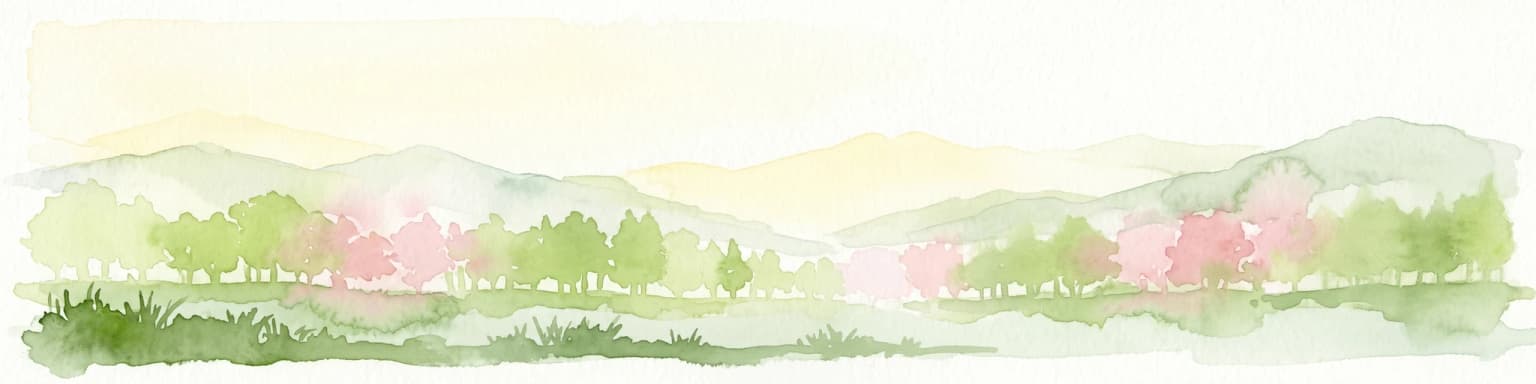
Cuyahoga Valley National Park is best known for its remarkable concentration of waterfalls, with Brandywine Falls standing as the park's signature cascade at 65 feet tall. The park is equally distinguished by its preservation of the Ohio and Erie Canal corridor, where visitors can walk the same towpath trail that mules once used to pull canal boats. The Ledges, a striking rock outcropping of Sharon Conglomerate formation, offers panoramic views across the forested valley below. The park's unusual urban-proximate character sets it apart from most American national parks, as it sits between two major metropolitan areas and incorporates active communities, roads, and even a scenic railroad within its boundaries. The combination of natural beauty, particularly the fall color displays that draw visitors seasonally, with deep historical layers of indigenous heritage, canal-era development, and industrial history makes this park a distinctive conservation model.

Cuyahoga Valley National Park history and protected-area timeline

The human history of Cuyahoga Valley spans thousands of years, beginning with the Hopewell Culture that inhabited the area by approximately 200 AD and constructed the Everett Mound near present-day Everett. The valley was traversed and inhabited by numerous indigenous nations including the Wyandot, Iroquois, Ottawa, Ojibwe, Munsee, Potawatomi, Miami, Catawba, and Shawnee, with the Lenapé Nation (Delaware) considered the Grandfathers of many upper Ohio River Valley nations. The 1795 Treaty of Greenville established the Cuyahoga River as the boundary between indigenous lands and European settlement, while the 1805 Treaty of Fort Industry ceded 500,000 acres including the present park area. European-American settlement accelerated with the canal era, as the Ohio and Erie Canal constructed between 1825 and 1832 transformed the region. The valley began providing recreation for urban dwellers in the 1870s through carriage rides and canal boat trips, while the Valley Railway of 1880 offered another escape from industrial cities. Park development commenced in the 1910s and 1920s through metropolitan park districts. In 1929, Cleveland businessman Hayward Kendall donated 430 acres around Ritchie Ledges and a trust fund, creating Virginia Kendall Park in honor of his mother. The Civilian Conservation Corps built much of the park's infrastructure in the 1930s, including the Happy Days Lodge and shelter structures. By the 1960s, citizen concerns about urban sprawl and river pollution led to advocacy that culminated in President Gerald Ford signing legislation establishing Cuyahoga Valley National Recreation Area on December 27, 1974. After decades of land acquisition and management development, Congress redesignated the area as Cuyahoga Valley National Park on October 11, 2000.

Cuyahoga Valley National Park landscape and geographic character

Cuyahoga Valley National Park encompasses a diverse landscape shaped by glacial activity and river processes. The Cuyahoga River follows an unusual V-shaped course, first flowing southwest before abruptly turning north to drain into Lake Erie near its origin. The left arm of this V corresponds to an older preglacial valley while the right arm represents relatively new drainage that cut into the old valley at Cuyahoga Falls. The valley contains impressive geological formations including the Berea Sandstone and Bedford Shale, deposited in a Lower Mississippian river delta environment, as well as Sharon Conglomerate rock formations that cap the highest hills and create the dramatic Ledges outcropping. The Defiance Moraine, a remnant of Wisconsin glaciation, protrudes south into the valley as far as Peninsula. The landscape features forests, rolling hills, narrow ravines, wetlands, and approximately 100 waterfalls that have formed as streams erode the softer Bedford Shale beneath the more resistant Berea Sandstone. Glacial drift fills the valley to depths of 400 feet, creating complex depositional environments from ancient lake systems including Lake Maumee, Lake Arkona, Lake Whittlesey, Lake Warren, and Lake Wayne.

Cuyahoga Valley National Park ecosystems, habitats, and plant life

Cuyahoga Valley supports diverse ecosystems that reflect its position in the mixed deciduous forest region of eastern North America. The park's forests contain a mix of maple, oak, pine, juniper, yew, magnolia, tulip tree, spruce, hemlock, and sycamore trees. Wetland areas and water corridors support sedge communities including Golden-fruited sedge, fox sedge, and needle spikerush, while spring wildflowers such as spring beauty, yellow trout lily, toothwort, hepatica, bloodroot, dwarf ginseng, Virginia bluebells, and jack-in-the-pulpit carpet the forest floor seasonally. Fern species including woodferns, bracken fern, horsetails, Christmas ferns, hay-scented fern, cinnamon fern, and royal fern thrive throughout the park. The combination of forest, wetland, and riverine habitats creates ecological diversity that supports numerous wildlife species despite the park's proximity to major urban areas.

Cuyahoga Valley National Park wildlife and species highlights

The wildlife community of Cuyahoga Valley reflects the park's position in the broader ecologies of Northeast Ohio. Mammals common to the area include raccoons, muskrats, coyotes, skunks, red foxes, beavers, opossums, multiple mole species, white-tailed deer, and gray foxes. Predatory species include river otters, minks, and bats, with seven bat species documented in the park. The park provides important habitat for birds of prey, including peregrine falcons and bald eagles, while waterfowl such as Canada geese and great blue herons frequent wetland and river areas. This wildlife community, while typical of Ohio's mixed habitats, thrives within the protected corridor and benefits from the park's management of diverse habitats ranging from forest to wetland to meadow.

Cuyahoga Valley National Park conservation status and protection priorities

Cuyahoga Valley National Park represents an important conservation model as one of the few American national parks established primarily to protect a landscape between major urban areas. The park's creation responded to mid-twentieth century concerns about urban sprawl consuming the Cuyahoga Valley's natural beauty and to environmental degradation of the Cuyahoga River, which suffered from industrial pollution and famously burned in 1952 and 1969. The park's unusual management structure, incorporating multiple jurisdictions and compatible-use sites, demonstrates a collaborative approach to conservation that allows protected areas to function within developed regions. A notable conservation challenge involved the Krejci Dump site, acquired in 1985 and later designated a Superfund site due to extreme contamination. Remediation efforts removed 371,000 short tons of contaminated materials by 2012, with restoration completed by 2015. In 2024, the park entered a sister-park agreement with Dartmoor National Park in England, establishing the first such partnership between the National Park Service and an English national park to advance mutual conservation goals.

Cuyahoga Valley National Park cultural meaning and human context

The cultural landscape of Cuyahoga Valley reflects thousands of years of human presence and activity. Indigenous peoples, particularly the Lenapé Nation, maintained connections to this landscape through trade networks and seasonal resource use before treaties and violent conflicts in the eighteenth and nineteenth centuries pushed them westward. The canal era of the early nineteenth century fundamentally transformed the region, as the Ohio and Erie Canal opened Ohio to broader trade networks and stimulated settlement. The historic canal infrastructure, including locks, aqueducts, and the towpath route, remains a central cultural feature of the park. The Western Reserve architectural heritage reflects the Connecticut Western Reserve's influence on early settlement, seen in structures like the Frazee House and Stanford House. The park also preserves evidence of sustainable farming and rural living through sites like Hale Farm and Village, an outdoor living history museum operated by the Western Reserve Historical Society. This layering of indigenous, canal-era, industrial, and agricultural history creates a cultural context as rich as the natural environment.

Top sights and standout views in Cuyahoga Valley National Park

Cuyahoga Valley National Park offers exceptional highlights that combine natural beauty with cultural heritage. Brandywine Falls, at 65 feet, stands as the park's tallest waterfall and one of Ohio's highest, while approximately 100 additional waterfalls cascade through the valley's ravines. The Ledges provide dramatic rock outcroppings with sweeping views, while the Everett Covered Bridge represents one of over 125 covered bridges once existing in Ohio and remains the only such bridge in Summit County. The 20-mile Ohio and Erie Canal Towpath Trail follows the historic canal corridor and serves as the primary recreational spine of the park for hiking, bicycling, and running. Stanford House offers unique in-park lodging in a historic 1830s Greek Revival home, while the Canal Exploration Center, Boston Store, and Hunt House provide visitor centers with exhibits on canal and agricultural history. The Cuyahoga Valley Scenic Railroad operates seasonal excursions that are especially popular for fall color viewing.

Best time to visit Cuyahoga Valley National Park

Cuyahoga Valley National Park offers distinct seasonal experiences throughout the year. Spring brings wildflower blooms and full waterfall flows following snowmelt and rain events, while summer provides optimal conditions for hiking, bicycling, and using the towpath trail system. Fall is particularly spectacular as the deciduous forest displays vibrant color changes, making the park extremely popular for leaf-peeping and photography, especially from the scenic railroad. Winter offers quieter visitation and opportunities for cross-country skiing and sledding at Kendall Hills. The park's proximity to Cleveland and Akron means that visitation increases significantly on weekends and during favorable weather, particularly in autumn. The humid continental climate means that visitors should prepare for hot, humid summers and cold winters with regular precipitation throughout the year.

Park location guide

Geography guide, regional context, and park location map for Cuyahoga Valley National Park

Cuyahoga Valley National Park park geography, regions, and map view in United States of America
Understand where Cuyahoga Valley National Park sits in United States of America through a broader geographic reading of the surrounding landscape, nearby location context, and its mapped position within the national park landscape.

How Cuyahoga Valley National Park fits into United States of America

The United States of America is a federal presidential republic and one of the world's largest countries by area and population. It consists of 50 states across a vast territory spanning multiple time zones, with its capital in Washington, D.C. and largest city in New York City. The nation has a diverse economy, influential political system, and significant cultural and military presence globally.

Wider geography shaping Cuyahoga Valley National Park in United States of America

The United States occupies a vast territory in North America, bordered by Canada to the north and Mexico to the south. The 48 contiguous states stretch from the Atlantic to the Pacific Ocean, while Alaska occupies the northwestern region and Hawaii is an archipelago in the Pacific. The country encompasses diverse terrain including the Rocky Mountains, Appalachian Mountains, Great Plains, and extensive river systems.

Map view of Cuyahoga Valley National Park

Use this park location map to pinpoint Cuyahoga Valley National Park in United States of America, understand its exact geographic position, and read its mapped placement within the surrounding landscape more clearly.

Pigeon | © OpenStreetMap contributors

Location context for Cuyahoga Valley National Park

Cuyahoga CountyOhioSummit County
Park atlas

Trace the regional geography of parks, forests, and other conservation landscapes.

Compare National Parks and Protected Areas Surrounding Cuyahoga Valley National Park, Ohio
Explore additional national parks and protected areas near Cuyahoga Valley National Park, mapping their geographic spread across the surrounding Ohio region and adjacent states. Broaden your understanding of regional conservation landscapes and compare diverse protected terrains, from urban-proximate green spaces to wider natural environments.
National parkOntario

Point Pelee National Park: Ontario's National Park Atlas and Protected Landscape Explorer

Mapped geography and protected area context within Ontario.

Point Pelee National Park is a designated national park in Ontario, Canada, offering a unique focus for geographic discovery. This entry details its protected landscape and mapped boundaries, essential for understanding its place within regional park atlases. Explore the core geographic identity of Point Pelee National Park and its significance as a protected natural area.

Area
15 km²
Established
1918
IUCN
II
Visitors
491.1K annual
National parkOntario

Rouge National Urban Park: Ontario's Mapped Protected Landscape Atlas

Explore national park boundaries and regional geography.

Investigate Rouge National Urban Park, a designated national park situated in Ontario, Canada. This page provides detailed atlas-style information focusing on its mapped boundaries, regional geographic context, and its identity as a significant protected natural landscape. Understand the park's role within the broader Canadian atlas for landscape exploration.

Area
79.1 km²
Established
2015
IUCN
V
Relief
Mixed relief
National parkWest Virginia

New River Gorge National Park and Preserve: Appalachian River Gorge Protected Landscape Atlas

Mapped terrain and geographic context within West Virginia.

Delve into the protected landscape identity of New River Gorge National Park and Preserve, a significant national park in West Virginia. This page details its role as a protected area, highlighting the dramatic river gorge geography, mapped terrain, and its place within the Appalachian Mountains. Understand the park's boundaries and the natural context that makes it a key destination for geographic discovery and conservation appreciation.

Area
294.64 km²
Established
2020
IUCN
V
Visitors
1.6M annual
Watercolor painting of rolling hills, trees, and a river in a scenic landscape
National parkVirginia

Shenandoah National Park: National Park Protected Landscape and Geography

Mapped terrain and protected area context in Virginia.

Shenandoah National Park is a designated national park in Virginia, offering a rich exploration of its protected landscape and geographic features. This page provides detailed atlas-oriented information, focusing on the park's mapped boundaries and its role within the regional geography. Discover the natural terrain and spatial identity of this important US protected area, ideal for understanding park landscapes.

Area
811.176 km²
Established
1935
IUCN
II
Visitors
1.7M annual
National parkOntario

Georgian Bay Islands National Park: Ontario National Park Protected Landscape Atlas

Explore mapped boundaries and regional geographic context.

Gain a comprehensive understanding of Georgian Bay Islands National Park as a distinct protected area within Ontario. This entry provides detailed geographic context, focusing on the park's mapped landscape, its protected status as a national park, and its position within the regional geography of Canada. It is designed for users seeking structured information about protected lands and their atlas-level significance.

Area
13.5 km²
Established
1929
IUCN
II
Visitors
27.5K annual
National parkOntario

Bruce Peninsula National Park: National Park Protected Landscape and Geographic Context in Ontario

Discover its mapped boundaries and regional landscape identity.

Bruce Peninsula National Park stands as a protected national park entity within Ontario, offering a distinct geographic profile. Its mapped boundaries and position within the regional atlas are crucial for understanding its landscape character. MoriAtlas facilitates exploration of the park's protected status and its contribution to the conservation landscape of Ontario.

Area
154 km²
Established
1987
IUCN
II
Visitors
460.4K annual
National parkUnited States of America

Indiana Dunes National Park: Protected Landscape Geography and Map Exploration

Explore the National Park's geographic boundaries and regional context.

Indiana Dunes National Park represents a distinct protected area within the United States of America, characterized by its unique landscape setting. This entry provides a detailed atlas-style view, highlighting the park's mapped boundaries and its contribution to the regional geography. Understanding this National Park means appreciating its specific natural terrain and its place within the conservation landscape of North America.

Area
62.12 km²
Established
1966
IUCN
II
Visitors
2.8M annual
Watercolor painting of green hills, islands, and a body of water under a pale yellow sky
National parkOntario

Thousand Islands National Park: Exploring Ontario's Protected Landscape Geography

Discover the mapped terrain and regional context of this national park.

Uncover the protected landscape identity of Thousand Islands National Park, a key national park located in Ontario. This resource focuses on its geographic setting, mapped boundaries, and overall atlas context, providing a clear understanding of its role as a protected area. Explore how its unique terrain contributes to the regional geography and the broader national park network, offering valuable insight for landscape-focused discovery.

Area
24.4 km²
Established
1904
IUCN
II
Visitors
109.3K annual

Common questions about visiting, size, designation, and location context for Cuyahoga Valley National Park

Cuyahoga Valley National Park FAQs for park facts, access, geography, and protected area context
Find quick answers about Cuyahoga Valley National Park, including protected-area facts, park geography, trail and visitor context, and how the park fits into its surrounding country and regional landscape.
MoriAtlas Explorer

Continue Your Protected Areas Search Across the Global Atlas

Deepen your exploration by continuing the structured search for national parks and protected areas worldwide. Utilize the comprehensive filtering capabilities to compare different conservation landscapes and refine your understanding of global park geography. Discover more about the distribution and characteristics of protected natural areas.

Global natural geography