
Mori Atlas logo
Nature reserveOld Woman Creek National Estuarine Research Reserve

A rare freshwater estuarine ecosystem on the northern Ohio Lake Erie coastline.

Old Woman Creek National Estuarine Research Reserve: Mapping Ohio Protected Landscapes

Old Woman Creek National Estuarine Research Reserve preserves a nearly intact freshwater estuary where the creek meets Lake Erie in northern Ohio. This protected area features a mosaic of freshwater marsh, swamp forest, and upland oak-hickory woodland separated from the open lake by a natural barrier beach. It serves as an essential reference site for studying Great Lakes estuarine systems, water quality, and coastal wetland ecology within the broader regional geography.

freshwater estuaryGreat Lakes estuaryLake Eriefreshwater marshswamp forestbarrier beach
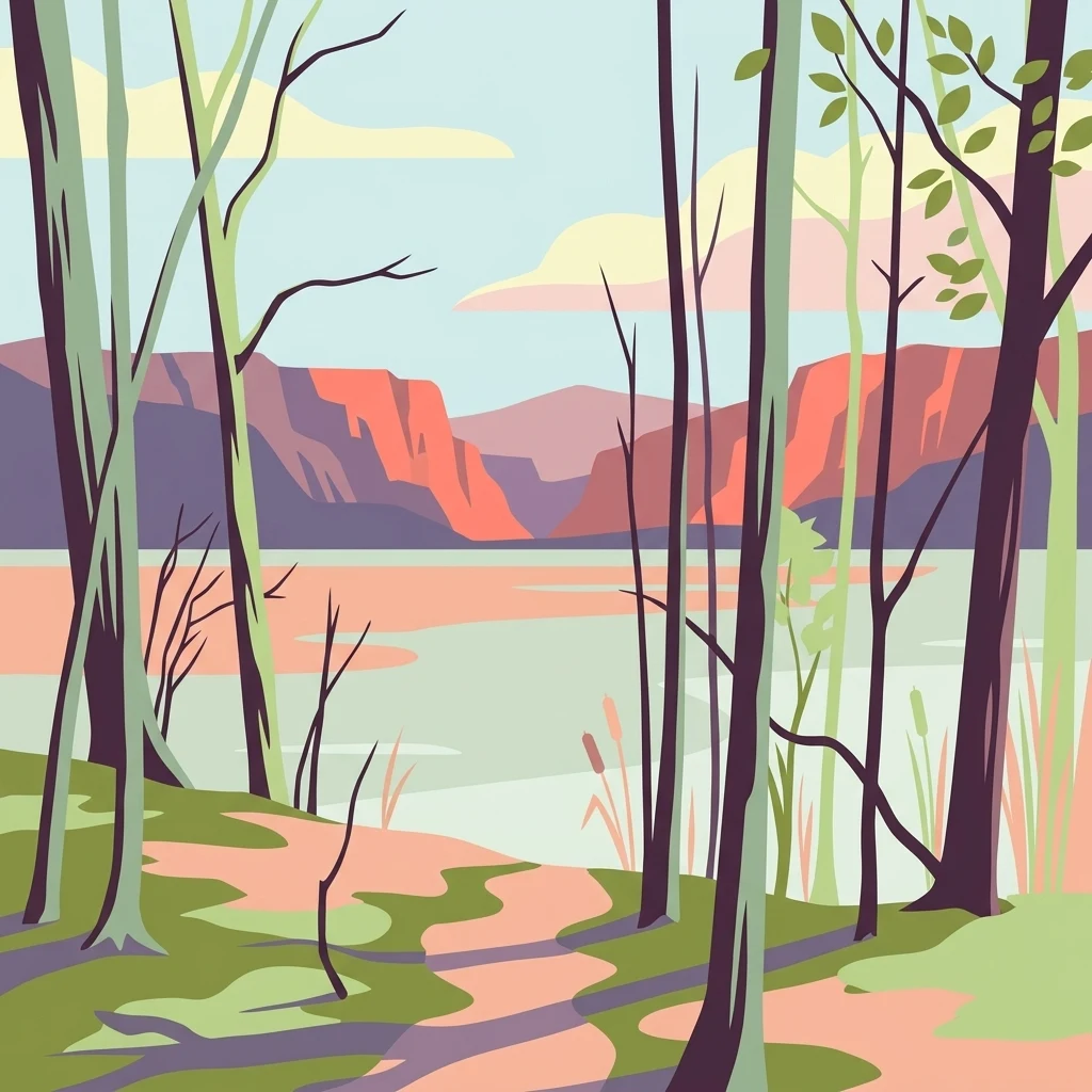
A stylized vector illustration of a forest path looking out over a body of water toward distant hills under a light sky.

Old Woman Creek National Estuarine Research Reserve

Nature reserve

Park overview

Structured park overview, official facts, and landscape profile for Old Woman Creek National Estuarine Research Reserve

Old Woman Creek National Estuarine Research Reserve park facts, protected area profile, and essential visitor context

Review the core facts for Old Woman Creek National Estuarine Research Reserve, including designation, size, terrain, visitor scale, habitats, and operating context in one park-focused overview.

About Old Woman Creek National Estuarine Research Reserve

Old Woman Creek National Estuarine Research Reserve is a protected freshwater estuary on the south-central shore of Lake Erie in Erie County, Ohio, situated where Old Woman Creek empties into the lake near the village of Huron and the larger city of Sandusky. At 573 acres, it is the smallest component of the National Estuarine Research Reserve System, a federal network of protected estuarine sites managed under NOAA. Its modest size, however, belies an unusually complete suite of habitats for a single site, including freshwater marsh, swamp forest, upland oak-hickory woodland, riparian stream corridor, a narrow barrier beach, and the estuarine open water itself.

The reserve is one of only two Great Lakes freshwater estuaries in the national system, the other being the Lake Superior reserve, giving Old Woman Creek a distinctive identity within both regional and national coastal conservation. Because more than 90 percent of Ohio's original coastal wetlands have been lost to drainage and development, this site now stands as one of the last relatively intact examples of a natural Lake Erie estuary, where freshwater flowing from the creek meets and mixes with the open water of the lake.

Managed jointly by NOAA and the Ohio Department of Natural Resources, the reserve operates as a living laboratory for long-term ecological research and monitoring. Programs focus on nutrient cycling, carbon storage, hydrology, and the relationship between land use in the watershed and water quality in both the estuary and the broader Lake Erie system. An on-site visitor and research center provides classrooms, laboratories, and interpretive exhibits that support public education, teacher training, and citizen-science engagement, making Old Woman Creek a hub for both research and environmental learning along Ohio's Lake Erie shore.

Quick facts and research context for Old Woman Creek National Estuarine Research Reserve

Old Woman Creek National Estuarine Research Reserve is a 573-acre protected freshwater estuary located in Erie County, Ohio, near the community of Huron and the city of Sandusky on Lake Erie. It was designated in 1980 and is the smallest reserve in the National Estuarine Research Reserve System, while also being one of only two Great Lakes freshwater estuaries included in the system.

The site is managed in partnership between NOAA's National Estuarine Research Reserve System and the Ohio Department of Natural Resources. Its protected habitats include freshwater marshes, swamp forest, upland oak-hickory woodland, a barrier beach, estuarine open waters, and the stream corridor of Old Woman Creek itself. The reserve also operates an on-site visitor and research center that supports ecological monitoring, public education, and citizen-science programs.

Protection and recognition

Documented terrestrial protection parameters and official recognition metrics

Old Woman Creek National Estuarine Research Reserve Protection Status and Management Scope

Old Woman Creek National Estuarine Research Reserve maintains documented terrestrial protection status within its regional conservation framework. Verified management scope records outline the official parameters established for this protected landscape.

Protection details

Protection scope
Terrestrial
Transboundary protection
No
Park context

Deeper park guide and search-rich context for Old Woman Creek National Estuarine Research Reserve

Old Woman Creek National Estuarine Research Reserve history, landscape, wildlife, and travel context

Explore Old Woman Creek National Estuarine Research Reserve through its history, landscape character, ecosystems, wildlife, conservation priorities, cultural context, and seasonal travel timing in a structured park guide built for atlas discovery and search intent.

Why Old Woman Creek National Estuarine Research Reserve stands out

Old Woman Creek is best known as one of the last naturally functioning freshwater estuaries on the Great Lakes, a rare example of the kind of transitional river-to-lake habitat that historically fringed southern Lake Erie. Its combination of freshwater marsh, swamp forest, barrier beach, and open estuarine water in a single compact reserve gives it an unusually complete representation of Great Lakes estuarine ecology. The reserve is also closely associated with long-term monitoring of nutrient cycling, carbon storage, and water quality in Lake Erie, including research on how land use in the surrounding watershed affects conditions in the estuary and the open lake. The presence of aquatic plants such as American water lotus and coontail, along with a broad fish, amphibian, and waterfowl community, reinforces its identity as a working freshwater estuary rather than simply a coastal wetland.
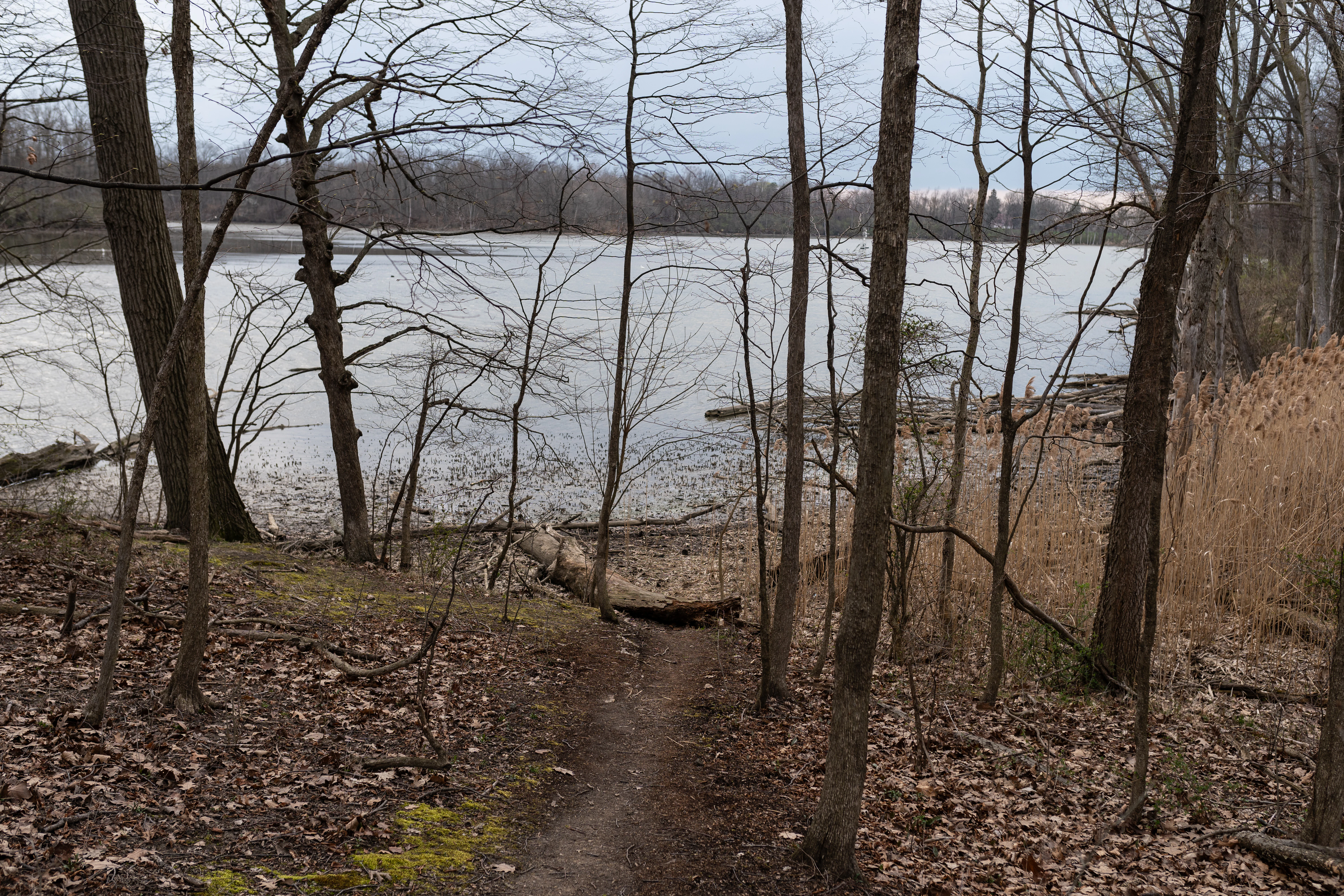
A dirt hiking trail leads from a forest floor with dry leaves toward the edge of a calm freshwater estuary under an overcast sky.
A view of the Old Woman Creek Estuary looking west, framed by deciduous trees in early spring.

Old Woman Creek National Estuarine Research Reserve history and protected-area timeline

Old Woman Creek was designated as a National Estuarine Research Reserve in 1980, becoming one of the early sites in the federal reserve system and giving formal protection to a freshwater estuary that was already recognized for its ecological significance. Its inclusion reflected growing awareness of how rapidly coastal wetlands across Ohio were being lost to drainage, filling, and shoreline development.

Since designation, the reserve has been co-managed by NOAA through the National Estuarine Research Reserve System and by the Ohio Department of Natural Resources. Research partnerships, including long-running work with Heidelberg University's National Center for Water Quality Research under figures such as Dr. Kenneth Krieger, have helped build detailed records of the reserve's invertebrates, water quality, and ecological change over time. The development of an on-site visitor and research center further expanded its role as a center for monitoring, education, and stewardship along Lake Erie.

Old Woman Creek National Estuarine Research Reserve landscape and geographic character

The landscape of Old Woman Creek is shaped by the meeting of a small stream, a sheltered freshwater estuary, and the broad waters of Lake Erie, all within a narrow coastal corridor of northern Ohio. A narrow barrier beach runs along the lakeshore, separating the calmer estuarine waters from the open lake and defining the spatial character of the reserve. Inland of the beach, the land rises gently into upland oak-hickory woodland and mixes with the wetter, flatter terrain of swamp forest and freshwater marsh along the creek.

This compressed mosaic of water, marsh, forest, and shore creates a visibly layered environment: open and reflective estuarine water in the center, dense marsh and swamp forest along the creek margins, a low wooded upland behind them, and the long pale line of the barrier beach meeting the lake. Small-scale features such as shallow embayments, riparian stream channels, and shoreline transitions are particularly important to the reserve's character, and they shift noticeably with fluctuating Lake Erie water levels.

Old Woman Creek National Estuarine Research Reserve ecosystems, habitats, and plant life

Ecologically, Old Woman Creek functions as a transitional zone between the flowing freshwater of Old Woman Creek and the open waters of Lake Erie, producing habitats that differ from typical rivers but also from open lake shoreline. The reserve's freshwater marshes and swamp forests harbor aquatic and semi-aquatic vegetation, while the surrounding uplands support oak-hickory woodland, creating a gradient from saturated wetland soils to drier, wooded uplands within a relatively small footprint.

The estuary's open and sheltered waters support aquatic plants such as American water lotus (Nelumbo lutea) and coontail (Ceratophyllum demersum), which in turn help sustain invertebrates, fish, and amphibians throughout the system. The combination of marsh, forest, open water, and beach produces habitat diversity out of proportion to the reserve's size, supporting both resident species and seasonal migrants that rely on the Lake Erie shoreline.

Old Woman Creek National Estuarine Research Reserve wildlife and species highlights

Old Woman Creek supports a rich mix of fish, amphibian, and bird communities typical of healthy Lake Erie estuaries. The protected waters and dense marsh areas provide breeding, rearing, and feeding habitat for fish moving between the creek and the lake, while the surrounding swamp forest and upland woodland add habitat for amphibians and a broader suite of resident wildlife.

The reserve is regionally important for birds, especially migratory waterfowl and other species that use the lake shore, marshes, and barrier beach as stopover or nesting habitat during migration seasons. Researchers and citizen scientists have documented diverse bird assemblages across the reserve's habitats, and the invertebrate fauna of the estuary has been the subject of detailed photographic atlas work led by Dr. Kenneth Krieger and colleagues at Heidelberg University, providing a strong baseline for understanding the reserve's broader wildlife community.

Old Woman Creek National Estuarine Research Reserve conservation status and protection priorities

Old Woman Creek's central conservation role is the protection of one of the last remaining natural freshwater estuaries on the Great Lakes in a state where more than 90 percent of the original coastal wetlands have been drained or developed. By preserving an intact transition between creek, marsh, and lake, the reserve safeguards ecological processes and habitat diversity that have nearly disappeared elsewhere on Ohio's Lake Erie shore.

The reserve also plays an important role in regional water quality, helping to reduce nutrient and sediment loads reaching Lake Erie through natural filtering in the estuary's marshes and fringing wetlands. Its long-term programs in nutrient cycling, carbon storage, hydrology, and land-use impact monitoring contribute directly to broader efforts to manage Lake Erie's health. Management addresses ongoing challenges, including fluctuating lake levels, invasive species, sedimentation, and watershed development pressures that affect both the estuary and the wider lake.

Top sights and standout views in Old Woman Creek National Estuarine Research Reserve

Among the reserve's most distinctive features is its status as one of only two Great Lakes freshwater estuaries in the National Estuarine Research Reserve System and the smallest reserve in that network, giving it an outsized role in freshwater estuarine science. The unusual completeness of its habitat mosaic, including barrier beach, marsh, swamp forest, upland oak-hickory woodland, and open estuarine water, makes it a concentrated example of Lake Erie coastal ecology.

Its long-running research partnerships, including detailed invertebrate documentation through Heidelberg University, and its well-developed education and citizen-science programs further distinguish it as both a working ecological observatory and a public engagement site along Ohio's Lake Erie shoreline.

Best time to visit Old Woman Creek National Estuarine Research Reserve

Because Old Woman Creek is a protected research reserve rather than a heavily developed visitor attraction, timing a visit is best shaped by the kind of experience a visitor wants rather than by fixed tourist seasons. Spring and fall are typically associated with strong migratory bird activity and seasonal change in the marsh and woodland habitats, while summer offers the most fully vegetated freshwater marsh and open estuary conditions, with the aquatic plants such as American water lotus at their most visible.

Winter and early spring bring lower water levels, exposed marsh edges, and quieter conditions that can make birdwatching and landscape observation easier, though weather along the Lake Erie shore can be harsh. Because the reserve's character is closely tied to Lake Erie's water levels, visitors should expect that conditions on the barrier beach and within the marshes can shift noticeably from season to season and year to year.

Monthly climate preview

Track long-term representative temperature and precipitation patterns across twelve recorded months

Climate Normals and Annual Temperature Rhythm for Old Woman Creek National Estuarine Research Reserve

Representative coordinate records show measured monthly temperature and precipitation baselines spanning a full annual cycle at Old Woman Creek National Estuarine Research Reserve. Detailed month-by-month climate norms provide a deeper statistical profile of long-term environmental patterns.
Annual mean10 °C
-3 °C23 °C
Jan-3°
Feb-2°
Mar
Apr
May14°
Jun20°
Jul23°
Aug22°
Sep19°
Oct12°
Nov
Dec
Warmest month
July

22.7 °C

Coolest month
January

-2.6 °C

Wettest month
June

3.1 mm/day

Driest month
February

1.8 mm/day

Park location guide

Geography guide, regional context, and park location map for Old Woman Creek National Estuarine Research Reserve

Old Woman Creek National Estuarine Research Reserve park geography, regions, and map view in United States of America

Understand where Old Woman Creek National Estuarine Research Reserve sits in United States of America through a broader geographic reading of the surrounding landscape, nearby location context, and its mapped position within the national park landscape.

How Old Woman Creek National Estuarine Research Reserve fits into United States of America

The United States of America is a federal presidential republic and one of the world's largest countries by area and population. It consists of 50 states across a vast territory spanning multiple time zones, with its capital in Washington, D.C. and largest city in New York City. The nation has a diverse economy, influential political system, and significant cultural and military presence globally.

Wider geography shaping Old Woman Creek National Estuarine Research Reserve in United States of America

The United States occupies a vast territory in North America, bordered by Canada to the north and Mexico to the south. The 48 contiguous states stretch from the Atlantic to the Pacific Ocean, while Alaska occupies the northwestern region and Hawaii is an archipelago in the Pacific. The country encompasses diverse terrain including the Rocky Mountains, Appalachian Mountains, Great Plains, and extensive river systems.

Map view of Old Woman Creek National Estuarine Research Reserve

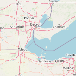
Use this park location map to pinpoint Old Woman Creek National Estuarine Research Reserve in United States of America, understand its exact geographic position, and read its mapped placement within the surrounding landscape more clearly.

Pigeon | © OpenStreetMap contributors

Location context for Old Woman Creek National Estuarine Research Reserve

Ohio

Visual exploration of coastal habitats, barrier beaches, and freshwater estuarine terrain

Old Woman Creek National Estuarine Research Reserve Photos and Scenery

Visual documentation captures the rare freshwater estuary and protective barrier beach of Old Woman Creek National Estuarine Research Reserve along Lake Erie. Detailed photography reveals the complex mosaic of swamp forest, marsh, and upland woodland that defines this protected coastal landscape.

A dirt hiking trail leads from a forest floor with dry leaves toward the edge of a calm freshwater estuary under an overcast sky.

Park atlas

Discover related protected areas and coastal landscapes in the surrounding region.

Explore Parks Near Old Woman Creek National Estuarine Research Reserve

Browse other protected areas and regional reserves connected to Old Woman Creek National Estuarine Research Reserve by shared freshwater and coastal ecosystems. Comparing adjacent habitats provides deeper geographic context for wetland conservation across the Great Lakes basin.
National parkOntario
About 37 km away#1 closest

North

Point Pelee National Park: Ontario's National Park Atlas and Protected Landscape Explorer

Mapped geography and protected area context within Ontario.

Point Pelee National Park is a designated national park in Ontario, Canada, offering a unique focus for geographic discovery. This entry details its protected landscape and mapped boundaries, essential for understanding its place within regional park atlases. Explore the core geographic identity of Point Pelee National Park and its significance as a protected natural area.

Area
15 km²
Established
1918
IUCN
II
Visitors
491.1K annual
National parkOhio
About 72 km away#2 closest

East

Cuyahoga Valley National Park: Detailed Atlas and Protected Landscape Information

Explore the mapped geography and natural terrain of Ohio's National Park.

Access detailed atlas information for Cuyahoga Valley National Park, a vital protected landscape in Ohio. Understand its geographic scope, mapped boundaries, and the surrounding natural terrain. This entry provides essential context for exploring the park's identity as a National Park and its significance within the broader mapped geography of the United States.

Area
132.7 km²
Established
2000
IUCN
II
Visitors
2.9M annual
Protected landscapeOhio
About 213 km away#3 closest

South

Wayne National Forest: Appalachian Protected Landscape and Geographic Atlas

An expansive forest territory within the Unglaciated Allegheny Plateau of Ohio.

Spanning diverse units across southeastern Ohio, Wayne National Forest preserves a rugged mosaic of second-growth forests and historic mining reclamation sites. This protected landscape provides a window into the geology of the Appalachian region, characterized by its distinctive sandstone formations, forested ravines, and extensive long-distance trail connections.

Area
971.65 km²
Established
1992
Relief
Upland
Climate
Temperate
A pale, soft watercolor painting of a rolling landscape with green hills, scattered trees, and a flat foreground.
Protected landscapePennsylvania
About 254 km away#4 closest

East

Allegheny National Forest: Geographic Analysis and Protected Landscape Mapping in Pennsylvania

Rolling plateau topography and expansive hardwood forest conservation zones.

Covering over half a million acres in northwestern Pennsylvania, Allegheny National Forest represents a pivotal protected landscape east of the Mississippi. This overview focuses on the intersection of even-aged timber management, old-growth hemlock stands, and the hydrology of the Allegheny Reservoir. Examine the forest's varied terrain, from ridgelines to riverine islands, through a lens of regional conservation and mapped environmental data.

Area
2,076.75 km²
Established
1923
Relief
Upland
Climate
Temperate
Watercolor painting of a green landscape featuring gentle rolling hills, a winding stream, and trees against a soft, pale background.
Protected areaPennsylvania
About 292 km away#5 closest

East

Allegheny National Recreation Area: Protected Geography and Highland Landscapes

Northwestern Pennsylvania plateau and river corridor mapping

Spanning the broad swells of the Allegheny Plateau, this protected area features extensive hardwood forests and the significant reservoir systems of northwestern Pennsylvania. The terrain is characterized by its deep valleys and long-distance trails, providing a comprehensive look at the highland geography preserved within the Allegheny National Forest administrative framework.

Area
81.55 km²
Established
1984
Relief
Upland
Climate
Temperate
Watercolor painting showing layers of soft green hills and mountain ridges fading into a light hazy background.
Protected landscapeWest Virginia
About 335 km away#6 closest

Southeast

Monongahela National Forest: Protected Appalachian Landscapes and Regional Geography

Mapping West Virginia wilderness and mountain terrain

Monongahela National Forest protects nearly one million acres of the central Appalachian Mountains. This massive federally managed landscape is defined by the Allegheny Front, the highest peak in the Allegheny range at Spruce Knob, and iconic geological formations like Seneca Rocks. The region represents a vital intersection of climate, hydrology, and biodiversity in the eastern United States, housing eight distinct wilderness areas and complex high-altitude ecosystems.

Area
3,727.8 km²
Established
1920
Visitors
3M annual
Relief
Mountain
Marine protected areaMichigan
About 349 km away#7 closest

North

Thunder Bay National Marine Sanctuary: Geography and Protected Maritime Landscape Context

Mapping underwater heritage in the Michigan Great Lakes region

Spanning 4,300 square miles of Lake Huron, Thunder Bay National Marine Sanctuary preserves a significant collection of shipwrecks within a glacially shaped freshwater terrain. This marine protected area offers a look at submerged geography ranging from shallow coastal bays to deep lake basins. It serves as a vital anchor for understanding maritime history and freshwater ecosystem stability across the Michigan shoreline.

Area
11,000 km²
Established
2000
Relief
Lowland
Climate
Temperate
National parkUnited States of America
About 362 km away#8 closest

West

Indiana Dunes National Park: Protected Landscape Geography and Map Exploration

Explore the National Park's geographic boundaries and regional context.

Indiana Dunes National Park represents a distinct protected area within the United States of America, characterized by its unique landscape setting. This entry provides a detailed atlas-style view, highlighting the park's mapped boundaries and its contribution to the regional geography. Understanding this National Park means appreciating its specific natural terrain and its place within the conservation landscape of North America.

Area
62.12 km²
Established
1966
IUCN
II
Visitors
2.8M annual

Common questions about visiting, size, designation, and location context for Old Woman Creek National Estuarine Research Reserve

Old Woman Creek National Estuarine Research Reserve FAQs for park facts, access, geography, and protected area context

Find quick answers about Old Woman Creek National Estuarine Research Reserve, including protected-area facts, park geography, trail and visitor context, and how the park fits into its surrounding country and regional landscape.
MoriAtlas Explorer

Continue Your Protected Areas Search Across the Global Atlas

Deepen your exploration by continuing the structured search for national parks and protected areas worldwide. Utilize the comprehensive filtering capabilities to compare different conservation landscapes and refine your understanding of global park geography. Discover more about the distribution and characteristics of protected natural areas.

Global natural geography