

Mori Atlas logo
National parkBruce Peninsula National Park

Discover the mapped boundaries and regional context of this national park in Ontario.

Bruce Peninsula National Park: Ontario's National Park Protected Landscape and Geography

Bruce Peninsula National Park represents a significant protected area within Ontario, Canada, offering a distinct landscape for geographic exploration. This national park's mapped boundaries are key to understanding its protected status and its place within the regional geography. MoriAtlas provides structured data for exploring the natural terrain and conservation landscapes that define this unique Canadian protected territory.

Niagara EscarpmentGeorgian BayDolomite CliffsKarst FormationsDark Sky PreserveBiodiversity Hotspot

Bruce Peninsula National Park

National park

Park overview

Structured park overview, official facts, and landscape profile for Bruce Peninsula National Park

Bruce Peninsula National Park park facts, protected area profile, and essential visitor context

Review the core facts for Bruce Peninsula National Park, including designation, size, terrain, visitor scale, habitats, and operating context in one park-focused overview.

About Bruce Peninsula National Park

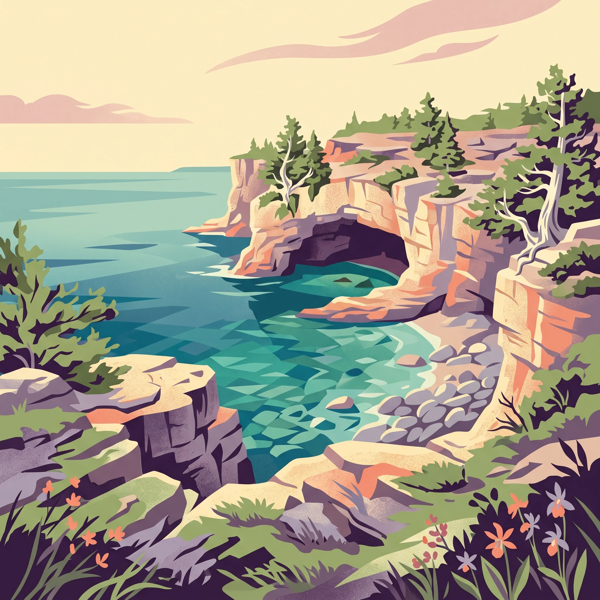
Bruce Peninsula National Park represents a crown jewel in Canada's protected areas network, preserving a unique segment of the Niagara Escarpment where 400-million-year-old Ordovician limestone and dolomite create a landscape of extraordinary geological and ecological significance. The park's location at the northern terminus of the Bruce Peninsula places it at the confluence of two Great Lakes, Georgian Bay to the east and Lake Huron to the west, creating a maritime-influenced environment that supports species more typical of boreal or coastal ecosystems. The dramatic shoreline features towering cliffs, arching rock formations, cobblestone beaches, and deep blue waters that have earned the region its reputation as one of Ontario's most scenic destinations. The park's interior contains a mosaic of habitats including mixed-wood forests, wetlands, alvars, talus slopes, and cliff faces, each supporting distinctive communities of plants and animals adapted to the challenging terrain. The Bruce Trail, Canada's longest hiking trail, traverses the park's length, providing access to some of the most spectacular viewpoints in the region where sunrise and sunset paint the dolomite cliffs in brilliant hues. This combination of accessible wilderness, geological wonder, and ecological diversity makes the park a destination of lasting importance.

Quick facts and research context for Bruce Peninsula National Park

Located on the Bruce Peninsula in Ontario, Canada, the park sits along the Niagara Escarpment formation that stretches from New York State through to Manitoulin Island. The nearest community is Tobermory, situated at the peninsula's northern tip. The park features over 100 kilometres of hiking trails connected to the Bruce Trail system, ranging from easy boardwalks to expert rock-climbing routes. The region experiences a humid continental climate moderated by Lake Huron and Georgian Bay, creating conditions that support unusual biodiversity for this latitude. The park was designated a Dark Sky Preserve in 2009, offering exceptional stargazing opportunities in southern Ontario.

Protection and recognition

Verifying the terrestrial protection scope and official establishment timeline of the park since 1987.

Bruce Peninsula National Park Protected Area Designation and Management Scope

Bruce Peninsula National Park maintains a documented terrestrial protection status established in 1987 to safeguard the geographic integrity of the Ontario landscape. Exploring verified designation records provides essential context regarding the historical conservation framework and regional management scope of the park.

Protection details

Protection scope
Terrestrial
Designated year
1987
Park context

Deeper park guide and search-rich context for Bruce Peninsula National Park

Bruce Peninsula National Park history, landscape, wildlife, and travel context

Explore Bruce Peninsula National Park through its history, landscape character, ecosystems, wildlife, conservation priorities, cultural context, and seasonal travel timing in a structured park guide built for atlas discovery and search intent.

Why Bruce Peninsula National Park stands out

Bruce Peninsula National Park is best known for the spectacular intersection of the Niagara Escarpment's dolomite cliffs with the pristine waters of Georgian Bay, creating one of the most visually striking landscapes in eastern North America. The Grotto, a naturally carved sea cave accessible via the Marr Lake Trail, exemplifies the park's dramatic karst geology and draws visitors from across the continent. The park protects half of the world's remaining population of the dwarf lake iris, one of North America's rarest orchids, alongside 34 other orchid species and 32 fern species. Its designation as part of the Niagara Escarpment World Biosphere Reserve underscores its global significance as a conservation area.

Bruce Peninsula National Park history and protected-area timeline

Bruce Peninsula National Park was established in 1987 through the federal parks creation process, specifically designated to protect the rock formations and shoreline of the Niagara Escarpment within this region. The establishment of the park represented recognition that this landscape, while remote in some respects, faced increasing pressure from development and tourism that threatened its unique geological and ecological features. Prior to national park designation, the area had been managed under various provincial protections, but the federal designation elevated its conservation status and brought comprehensive management through Parks Canada. The park's visitor infrastructure was significantly enhanced in 2006 with the opening of a modern visitors' centre designed by Andrew Frontini of Shore Tilbe Irwin + Partners, a CAD $7.82 million facility featuring sustainable design elements including greenhouse gas reduction technology. In 2009, the park was designated a Dark Sky Preserve, joining a small network of protected areas committed to preserving natural night sky conditions. The park's cultural history extends beyond its protected area status, having been the subject of a 2011 short film as part of the National Parks Project, directed by Daniel Cockburn and scored by Canadian musicians.

Bruce Peninsula National Park landscape and geographic character

The landscape of Bruce Peninsula National Park is defined by the massive geological force of the Niagara Escarpment, a formation that shapes the peninsula's backbone and creates the dramatic boundary between upland and shore. The escarpment's dolomite cliffs, harder and more resistant than the underlying limestone, form spectacular vertical faces along the Georgian Bay shoreline where wave action has carved arches, caves, and the renowned Grotto. The geological story written in these rocks dates back approximately 400 million years when this area lay beneath a shallow tropical sea, teeming with life similar to today's Great Barrier Reef. As the ancient sea evaporated, magnesium-rich waters transformed limestone into the harder dolomite that now dominates the cliff faces. Erosion since the last ice age has sculpted the softer limestone into overhangs, caves, and the distinctive karst topography that characterizes the interior trails. The shoreline transitions from cobblestone beaches to sheer cliff faces, while inland, the terrain rises through forested slopes to the exposed alvars and cliff tops of the escarpment plateau. Views from the cliff edges stretch across Georgian Bay toward the islands of Fathom Five National Marine Park, creating panoramic vistas that rank among the most impressive in the Great Lakes region.

Bruce Peninsula National Park ecosystems, habitats, and plant life

The ecological diversity of Bruce Peninsula National Park stems from its position at the intersection of multiple habitat types and the unique microclimates created by the Great Lakes and the escarpment topography. The park contains a remarkable variety of natural communities including mixed-wood forests dominated by eastern white cedar, spruce, fir, birch, poplar, maple, and beech, interspersed with wetlands, alvars, talus slopes, and cliff face ecosystems. The floral significance of the park cannot be overstated, with over 34 species of orchids recorded within its boundaries, including the eastern prairie fringed orchid, one of North America's rarest species, and the dwarf lake iris, of which the park protects half the global population. The park supports 32 species of ferns and maintains significant populations of wildflowers, algae, mosses, and lichen. The proximity of Georgian Bay and Lake Huron creates moderated temperatures that allow species at the northern edge of their range to thrive, while the varied elevation and aspect of the terrain creates numerous microhabitats supporting species from boreal, temperate, and alpine zones.

Bruce Peninsula National Park wildlife and species highlights

The wildlife community of Bruce Peninsula National Park reflects the park's position as a corridor between northern and southern ecosystems, supporting species typical of both boreal forests and Great Lakes coastal environments. Large mammals including black bears, white-tailed deer, coyotes, and porcupines inhabit the forested interior, while smaller mammals such as chipmunks, red foxes, raccoons, snowshoe hares, and skunks are common throughout the park. The park holds particular significance for reptile conservation as one of the last strongholds of the massasauga rattlesnake, a species now extirpated from much of its former range in southern Ontario. Birdlife is diverse, with migratory species using the peninsula as a flyway and numerous resident species inhabiting the various forest and cliff habitats. The wetlands and shoreline support waterfowl and shorebirds, while the cliff faces provide nesting habitat for raptors. Amphibians and insects are well-represented in the wetland areas, contributing to the park's overall biodiversity.

Bruce Peninsula National Park conservation status and protection priorities

Bruce Peninsula National Park serves as the core protected area within the Niagara Escarpment World Biosphere Reserve, a UNESCO-designated region recognizing the area's exceptional natural values and the need for sustainable human use. The park's protection of the Niagara Escarpment preserves not only geological features of global significance but also the ecological corridors that allow species to move between habitats and adapt to changing conditions. The protection of rare orchid populations, particularly the dwarf lake iris and eastern prairie fringed orchid, demonstrates the park's role in conserving species of continental importance. As a Dark Sky Preserve, the park also protects the nocturnal environment, recognizing that natural darkness is an essential component of ecosystem health and a heritage worth preserving. The management approach balances public enjoyment with conservation imperatives, implementing visitor education, trail management, and research programs that enhance understanding of this complex ecosystem.

Bruce Peninsula National Park cultural meaning and human context

The Bruce Peninsula has been inhabited by Indigenous peoples for thousands of years, with the Anishinaabe and other nations maintaining connections to these lands and waters long before European settlement. The landscape holds cultural significance for local communities, though the national park designation has separated this area from direct Indigenous governance. The modern community of Tobermory serves as the primary service centre for park visitors, a small settlement whose economy depends substantially on tourism related to the park and adjacent Fathom Five National Marine Park. The park's cultural dimension also includes its role in Canadian identity, representing one of the nation's protected natural spaces that embody the values of wilderness preservation and environmental stewardship.

Top sights and standout views in Bruce Peninsula National Park

The Grotto remains the park's signature destination, a sea cave where visitors can swim in the crystal-clear waters of Georgian Bay beneath overhanging cliffs. Lion's Head offers a challenging climb rewarded by panoramic views across the bay from a prominent cliff viewpoint. The Cyprus Lake trails wind through the most dramatic karst terrain, passing arches, caves, and the iconic flowerpot rock formations that give Flowerpot Island its name. The Bruce Trail provides the backbone for exploration, with the Georgian Bay Trail and Marr Lake Trail offering access to the most spectacular shoreline sections. Winter transforms the park into a cross-country skiing and snowshoeing destination, while the dark sky designation makes the cold-season nights ideal for stargazing.

Best time to visit Bruce Peninsula National Park

The park welcomes visitors year-round, with each season offering distinct experiences. Summer brings the warmest conditions for swimming and beach activities, with July and August offering the most reliable weather for exploring the shoreline trails and the Grotto. Fall provides stunning color as the deciduous forests display autumn foliage, and the smaller crowds allow for more contemplative exploration of the trails. Spring brings wildflower season and the chance to see orchids in bloom, though trail conditions may be wetter. Winter offers a completely different character, with snow-covered cliffs and frozen surfaces creating a wilderness experience for cold-weather enthusiasts, though services are limited. The shoulder seasons of May, June, September, and October often provide the most comfortable hiking conditions and the lowest visitor volumes.
Monthly climate preview

Analyzing historical monthly temperatures and precipitation rhythms in Ontario

Bruce Peninsula National Park Climate Normals and Monthly Weather Averages

Historical records from a representative coordinate at 176 meters elevation reveal mean monthly temperatures ranging from sub zero winter averages to mild summer highs near 19 degrees Celsius. Accessing the complete monthly profile provides detailed historical trends for daily minimums, maximums, and precipitation levels across the entire annual cycle.
Annual mean7 °C
-3 °C19 °C
Jan-3°
Feb-3°
Mar-1°
Apr
May
Jun11°
Jul17°
Aug19°
Sep17°
Oct11°
Nov
Dec
Warmest month
August

19.3 °C

Coolest month
February

-3.3 °C

Wettest month
September

1.9 mm/day

Driest month
March

1.1 mm/day

Park location guide

Geography guide, regional context, and park location map for Bruce Peninsula National Park

Bruce Peninsula National Park park geography, regions, and map view in Canada

Understand where Bruce Peninsula National Park sits in Canada through a broader geographic reading of the surrounding landscape, nearby location context, and its mapped position within the national park landscape.

How Bruce Peninsula National Park fits into Canada

Canada is a federal parliamentary constitutional monarchy spanning North America from the Atlantic to the Pacific and Arctic Oceans. With a population of over 41 million, it is officially bilingual in English and French at the federal level. The country gained independence from the United Kingdom through a gradual process culminating in 1982.

Wider geography shaping Bruce Peninsula National Park in Canada

Canada occupies the northern portion of North America, sharing its longest international border with the United States. The country extends from the Atlantic Ocean to the Pacific Ocean and northward into the Arctic Ocean, giving it the longest coastline of any nation.

Map view of Bruce Peninsula National Park

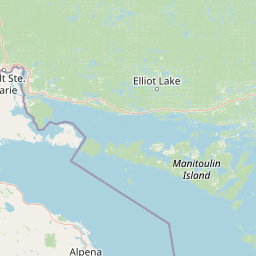
Use this park location map to pinpoint Bruce Peninsula National Park in Canada, understand its exact geographic position, and read its mapped placement within the surrounding landscape more clearly.

Pigeon | © OpenStreetMap contributors

Location context for Bruce Peninsula National Park

Ontario
Natural feature types

Browse the Natural Features and Geological Landmarks of Bruce Peninsula National Park

Deepen your understanding of the park landscape by exploring this structured collection of named geological features. MoriAtlas provides a clear map of the escarpment cliffs, karst caves, and coastal sites that characterize the complex natural geography of Bruce Peninsula National Park.
Park atlas

Explore surrounding national parks, compare regional protected areas, and trace the Niagara Escarpment's unique geographic spread.

Discover Related National Parks and Protected Areas near Bruce Peninsula National Park

Continue exploration from Bruce Peninsula National Park by browsing other national parks and protected areas, mapping their geographic spread across the Niagara Escarpment and Great Lakes region. Explore distinct protected landscapes, understand their regional context, and discover adjacent conservation areas through this focused atlas view for comprehensive geographic comparison.
Marine protected areaMichigan
66 km away#1 closest

West

Thunder Bay National Marine Sanctuary: Geography and Protected Maritime Landscape Context

Mapping underwater heritage in the Michigan Great Lakes region

Spanning 4,300 square miles of Lake Huron, Thunder Bay National Marine Sanctuary preserves a significant collection of shipwrecks within a glacially shaped freshwater terrain. This marine protected area offers a look at submerged geography ranging from shallow coastal bays to deep lake basins. It serves as a vital anchor for understanding maritime history and freshwater ecosystem stability across the Michigan shoreline.

Area
11,000 km²
Established
2000
Relief
Lowland
Climate
Temperate
National parkOntario
96 km away#2 closest

East

Georgian Bay Islands National Park: Ontario National Park Protected Landscape Atlas

Explore mapped boundaries and regional geographic context.

Gain a comprehensive understanding of Georgian Bay Islands National Park as a distinct protected area within Ontario. This entry provides detailed geographic context, focusing on the park's mapped landscape, its protected status as a national park, and its position within the regional geography of Canada. It is designed for users seeking structured information about protected lands and their atlas-level significance.

Area
13.5 km²
Established
1929
IUCN
II
Visitors
27.5K annual
Marine protected areaMichigan
About 130 km away#3 closest

West

Thunder Bay National Marine Sanctuary and Underwater Preserve: Geography and Protected Area Atlas

Maritime heritage sites and glacial freshwater geography in Lake Huron, Michigan.

Situated along the rugged northeastern coast of Lake Huron, Thunder Bay National Marine Sanctuary and Underwater Preserve protects over two hundred shipwreck sites spanning nearly two centuries of maritime history. This marine protected area offers a unique intersection of submerged archaeological resources, shallow shoals, coastal marshes, and limestone bedrock, forming a vital freshwater ecosystem in the Great Lakes region of Michigan.

Area
11,000 km²
Established
2000
Relief
Lowland
Climate
Temperate
Wildlife reserveOntario
About 156 km away#4 closest

East

Eleanor Island Wildlife Reserve: Protected Ontario Lake Landscape and Bird Habitat

A federal migratory bird sanctuary in the Canadian Shield

Eleanor Island is a strictly protected migratory bird sanctuary in Ontario that serves as a vital nesting ground for colonial waterbirds. Positioned within Lake Muskoka, this small but ecologically purposeful nature reserve demonstrates the importance of localized federal protection for regional breeding populations. Its status as a strict nature reserve underscores a commitment to safeguarding sensitive habitats within the broader Canadian Shield wilderness.

Area
0.006 km²
Established
1978
IUCN
Ia
Relief
Lowland
Protected landscapeMichigan
About 199 km away#5 closest

West

Huron, Manistee National Forests: Geography, Protected Land, and Michigan Landscape Atlas

Exploration of glacial terrain, river basins, and coastal wilderness.

The Huron, Manistee National Forests stand as a significant protected landscape in northern Michigan, featuring a vast network of inland rivers and lakes. This atlas entry provides geographic context on its glacial geology, the rare dune ecosystems along Lake Michigan, and the distribution of pine-dominated forest habitats across the two administrative units.

Area
3,960 km²
IUCN
VI
Relief
Lowland
Climate
Temperate
National parkOntario
217 km away#6 closest

Southeast

Rouge National Urban Park: Ontario's Mapped Protected Landscape Atlas

Explore national park boundaries and regional geography.

Investigate Rouge National Urban Park, a designated national park situated in Ontario, Canada. This page provides detailed atlas-style information focusing on its mapped boundaries, regional geographic context, and its identity as a significant protected natural landscape. Understand the park's role within the broader Canadian atlas for landscape exploration.

Area
79.1 km²
Established
2015
IUCN
V
Relief
Mixed relief
Protected landscapeUpper Peninsula of Michigan
222 km away#7 closest

West

Hiawatha National Forest: Geographic Overview and Protected Area Map of the Upper Peninsula

Coastal forest landscape and wilderness river corridors.

Hiawatha National Forest spans significant portions of the Upper Peninsula of Michigan, bridging the gap between northern hardwood forests and the boreal environments of the Great Lakes. This protected landscape encompasses extensive shorelines along Lake Superior, Lake Michigan, and Lake Huron, alongside six wilderness areas and five designated wild and scenic rivers.

Area
3,621.27 km²
Established
1931
IUCN
VI
Relief
Lowland
Wildlife reserveUnited States of America
About 241 km away#8 closest

West

Round Island Wilderness: Geographic Overview of the Straits of Mackinac Wildlife Reserve

Coastal marsh, conifer forest, and hardwood interior terrain

Round Island Wilderness encompasses nearly all of a 378-acre island sanctuary, distinguished by its mature beech-maple hardwood interior and boreal-leaning conifer forests. This protected land remains an essential study of Great Lakes island ecology, standing as a quiet, undisturbed wilderness edge along the transit routes of the Michigan straits.

Area
1.53 km²
Relief
Lowland
Climate
Temperate
Access
Remote access

Common questions about visiting, size, designation, and location context for Bruce Peninsula National Park

Bruce Peninsula National Park FAQs for park facts, access, geography, and protected area context

Find quick answers about Bruce Peninsula National Park, including protected-area facts, park geography, trail and visitor context, and how the park fits into its surrounding country and regional landscape.
MoriAtlas Explorer

Continue Your Protected Areas Search Across the Global Atlas

Deepen your exploration by continuing the structured search for national parks and protected areas worldwide. Utilize the comprehensive filtering capabilities to compare different conservation landscapes and refine your understanding of global park geography. Discover more about the distribution and characteristics of protected natural areas.

Global natural geography



