Mori Atlas logo
Park earthquake history

A structured geographical catalogue of historical seismic events in the Carpathian foothills

Recorded Earthquake History and Seismic Activity Associated with Łąki nad Młynówką

This collection provides a historical record of earthquakes associated by proximity with the protected meadows of Łąki nad Młynówką. Each entry offers data on event magnitude, depth, and epicentre distance relative to the Podkarpackie Voivodeship site. This catalogue serves as a geographic resource for understanding seismic occurrences in the region without suggesting causal links to local landscapes or predictive hazard assessments.

A flat vector-style illustration showing a winding river flowing toward a waterfall nestled between tall, rocky cliffs with coniferous trees and grassy banks under a pale sun.

A Natura 2000 meadowland valley along the Młynówka stream in the foothills of the Subcarpathians.

Łąki nad Młynówką

Łąki nad Młynówką is a small but ecologically rich protected area in southern Poland, designated as a Site of Community Importance (SCI) within the Natura 2000 network. Located in the Podkarpackie Voivodeship in Jasło County, it lies within the Pogórze Ciężkowickie foothills and protects a network of traditionally mown and grazed meadows that surround the upper course of the Młynówka stream, locally known as Cegielnianka or, historically, Trzciennica. The area is essentially a riverine meadowland valley. More than four fifths of the site consists of fresh and wet meadows, sedge-dominated wet communities, and accompanying shrubs, while mixed woodland covers only a small fraction. Because the Młynówka still flows as an unregulated, natural stream, its banks support reed beds, willow and alder carrs, ash-alder gallery forests, and fragments of Central European oak-hornbeam forest, creating a mosaic of habitats typical of the Carpathian foothills. Although Łąki nad Młynówką is not a national park or a landscape park, it is one of around 55 Sites of Community Importance on the Podkarpacie list formally ratified by the European Commission, underscoring its regional importance for biodiversity conservation. Its combination of traditionally managed meadows and a free-flowing stream gives the site particular value for species tied to semi-natural rural landscapes in the Polish Carpathians.

Location
Poland
Park type
Protected area
Established
2011
Area
0.5 km²
Łąki nad Młynówką Protected Area Atlas

Compare Łąki nad Młynówką events by date and distance

Explore historical earthquake records around Łąki nad Młynówką

Review historical seismic events around Łąki nad Młynówką (PLH180041), a 0.5102 km² terrestrial upland protected area in Poland with major water presence; results show their own epicentral locations together with date, magnitude, depth, locality, source citation, and site distance. Closeness does not mean boundary inclusion and is not used to explain its valleys and wetlands, evaluate damage, or forecast earthquakes.

Sort by
Magnitude
Location

This page describes catalogued earthquakes associated with the park by epicentre location and distance. It does not establish causation, assess current danger, or predict future earthquakes.

No earthquake records match the current filters

Park atlas

Take a broader atlas path beyond Łąki nad Młynówką

Browse other parks after the Łąki nad Młynówką records

After the earthquake catalogue for Łąki nad Młynówką, the atlas introduces other protected destinations as a separate discovery path. Their appearance should not be interpreted as shared site designation, environmental character, geography, geology, proximity, earthquake coverage, seismic importance, hazard conditions, risk, or equivalent supporting sources.
Protected areaPodkarpackie Voivodeship
1.1 km away#1 closest

East

Wisłoka z dopływami Protected Area: River Valley Landscape and Carpathian Foothills Atlas

Freshwater habitat mapping in southern Poland

Wisłoka z dopływami covers a long, ecologically rich segment of the Wisłoka river valley in the Carpathian foothills. This protected area connects diverse riparian, floodplain, and alluvial forests, serving as a critical habitat for six Annex II fish species and sixteen distinct riparian woodland types.

Area
26.51 km²
Established
2011
Relief
Mixed relief
Scope
Terrestrial
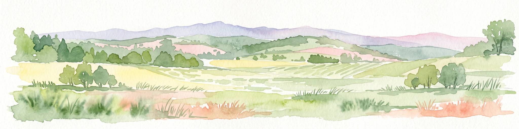
A horizontal watercolor painting depicting a soft, rolling landscape with green fields, patches of trees, and distant lavender-toned mountains under a pale sky.
National parkPodkarpackie Voivodeship
11 km away#2 closest

South

Magurski Park Narodowy: Geographic Overview and Protected Carpathian Forest Atlas

Transitional mountain landscapes in Podkarpackie Voivodeship

Magurski Park Narodowy encompasses a distinct Carpathian forest landscape within the Beskid Niski range. The terrain is defined by rounded mountain ridges, the upper Wisłoka river basin, and strict forest reserves that maintain the ecological integrity of this transitional zone. As a major protected area in Poland, the park provides an essential look at biodiversity-rich beech woodlands, rocky outcrops, and traditional cultural landscapes.

Area
194.39 km²
Established
1995
Visitors
40K annual
Relief
Mountain
Watercolor illustration showing a landscape with rolling hills, green trees, and distant mountains under a light sky
National parkSubcarpathian Voivodeship
11 km away#3 closest

South

Magura National Park: Mapped Protected Landscape & Carpathian Geography Atlas

Explore unique sandstone formations and mapped natural terrain.

Magura National Park, located in the Subcarpathian Voivodeship of Poland, offers a rich focus for protected-area exploration and geographic discovery. This national park is distinguished by its dramatic sandstone rock formations, forested Carpathian ridges, and its ecological importance as a transitional zone. Users engaging with Magura National Park can examine its mapped boundaries, understand its specific landscape context, and appreciate its role within the broader regional geography.

Area
194.39 km²
Established
1995
IUCN
II
Visitors
40K annual
Nature reservePodkarpackie Voivodeship
17 km away#4 closest

Northeast

Wisłok Środkowy z Dopływami Protected Nature Reserve in the Podkarpackie Voivodeship

River corridor geography and riparian ecosystem analysis

Wisłok Środkowy z Dopływami serves as a crucial Natura 2000 site, safeguarding the middle course of the Wisłok River and the Stobnica tributary. This nature reserve provides essential habitat for various protected fish species and butterfly populations within a terrain shaped by the transition between the Jasielsko-Krośnieńska Basin and the Carpathian foothills. The area represents a significant riparian landscape, offering a window into the natural freshwater geography of southeastern Poland.

Area
10.646 km²
Established
2011
Relief
Upland
Scope
Terrestrial
Protected areaPodkarpackie Voivodeship
18 km away#5 closest

Southeast

Łysa Góra Protected Area: Mapping Carpathian Mountain Landscapes in Podkarpackie Voivodeship

Forested ridgeline terrain within the Low Beskids range

Spanning a series of summits including Grzywacka Góra and Dania, Łysa Góra encompasses vital Carpathian beech forest and protected mountain habitats. This Natura 2000 site functions as a key element of the Low Beskids mountain geography, featuring dense woodland cover that supports large carnivore populations and rare forest species across its protected ridge terrain.

Area
27.438 km²
Established
2009
Relief
Mountain
Climate
Temperate
Protected areaPodkarpackie Voivodeship
19 km away#6 closest

East

Łąki nad Wojkówką: Geographic Overview of Protected Grassland Habitats in Podkarpackie

Mapped protected areas and terrain across the Polish Carpathian foothills

Focusing on the convergence of xerothermic grasslands and fresh Arrhenatheretum meadows, Łąki nad Wojkówką represents a vital conservation site. This overview details its distribution across three enclaves, providing mapped context within the Wisłok River valley and its integration into the Czarnorzecko-Strzyżowski Landscape Park.

Area
0.096 km²
Established
2011
Relief
Upland
Scope
Terrestrial
Nature reservePodkarpackie Voivodeship
22 km away#7 closest

East

Ostoja Czarnorzecka Nature Reserve: Mapped Protected Landscapes in Podkarpackie Voivodeship

Carpathian foothills forest and cave habitat mapping

Ostoja Czarnorzecka is a protected nature reserve located in the Dynów Foothills of Poland. The area is defined by its dense Carpathian beech forests and a network of small, undisturbed caves. As a critical component of the regional conservation framework, it provides unique ecological benefits through its mature woodland cover and protected bat habitats found across the Sucha Góra and Królewska Góra ridges.

Area
19.466 km²
Established
2009
Relief
Upland
Scope
Terrestrial
Nature reserveLesser Poland Voivodeship
23 km away#8 closest

Northwest

Ostoja w Paśmie Brzanki: Protected Beech Forest and Foothill Geography in Lesser Poland

A Natura 2000 nature reserve in the Polish Carpathian foothills

Located within the Lesser Poland Voivodeship, Ostoja w Paśmie Brzanki consists of dense, continuous beech woodlands draped over the rounded ridges of the Brzanka Range. This nature reserve serves as an essential ecological refuge, combining rare sycamore communities and riparian strips that support diverse amphibian populations across its forested ravine landscapes.

Area
7.889 km²
Established
2011
Relief
Upland
Water
Minor water
MoriAtlas Explorer

Trace the Protected Meadow Landscapes of Łąki nad Młynówką in Poland

Examine the mapped boundaries and natural terrain of Łąki nad Młynówką to understand its importance within the Podkarpackie Voivodeship. Use this MoriAtlas entry to investigate how traditional land management and unregulated watercourses sustain biodiversity in the Carpathian foothills.