

Mori Atlas logo
Protected areaŁąki nad Młynówką

Mapping the natural stream corridors and traditional meadow habitats of the Pogórze Ciężkowickie.

Łąki nad Młynówką: A Protected Meadowland Valley in the Podkarpackie Voivodeship Foothills

(Łąki nad Młynówką (PLH180041))

Łąki nad Młynówką represents a significant protected area within the Carpathian foothills, safeguarding a mosaic of fresh and wet meadows alongside the unregulated Młynówka stream. This geographically diverse site in the Podkarpackie Voivodeship demonstrates the ecological value of traditionally managed rural landscapes, where reed beds, willow thickets, and gallery forests create essential habitats for regional biodiversity.

meadowswet meadowsriverine valleyNatura 2000Podkarpackie VoivodeshipPogórze Ciężkowickie
A flat vector-style illustration showing a winding river flowing toward a waterfall nestled between tall, rocky cliffs with coniferous trees and grassy banks under a pale sun.

Łąki nad Młynówką

Protected area

Park overview

Structured park overview, official facts, and landscape profile for Łąki nad Młynówką

Łąki nad Młynówką park facts, protected area profile, and essential visitor context

Review the core facts for Łąki nad Młynówką, including designation, size, terrain, visitor scale, habitats, and operating context in one park-focused overview.

About Łąki nad Młynówką

Łąki nad Młynówką is a compact but ecologically dense protected landscape that revolves around a single valley in the Carpathian foothills. Stretching across roughly 51 hectares of meadow, shrub, and woodland habitat, it is one of the smallest formal conservation areas in the Podkarpackie region, but it captures a distinctive slice of the traditional agricultural landscape that once dominated the Pogórze Ciężkowickie.

The defining feature of the area is the Młynówka stream, which runs through the protected zone together with its tributaries and the immediately adjacent floodplain. Because the stream has not been channelized, it retains a natural character, with reed beds, sedge marshes, and willow, alder, and ash carrs along its banks. Fringing these wet habitats are extensive meadows; fresh meadows used for haymaking and wet meadows that often grade into sedge mires make up over four fifths of the site. Although intensively used in the past, many of these meadows have been managed extensively for decades, which has allowed a rich native flora and associated fauna to persist.

Beyond its meadowland identity, the site includes fragments of Central European oak-hornbeam forest on slightly higher ground, as well as smaller patches of mountain alder swamp forest where groundwater conditions remain high. This juxtaposition of dry, mesic, and wet habitats in a narrow valley gives the area a botanical diversity that belies its small size.

Łąki nad Młynówką is protected under Poland's Natura 2000 network as a Site of Community Importance proposed by the Polish government in 2009 and approved by the European Commission via a decision of January 2011, which took legal effect in March 2011. It is supervised by the Regional Directorate for Environmental Protection in Rzeszów and forms part of a broader cluster of Natura 2000 sites in the southern Podkarpacie, including the nearby Golesz, Liwocz, Wisłoka with tributaries, and Las Niegłowicki designations.

Quick facts and research context for Łąki nad Młynówką

Łąki nad Młynówką is a Polish Natura 2000 Site of Community Importance with the code PLH180041, covering approximately 51 hectares in the southern part of the Podkarpackie Voivodeship. It lies in Jasło County across two gminas: Skołyszyn, where it includes the village of Bączal Dolny, and Jasło (rural gmina), where it covers the villages of Opacie and Trzcinica.

The site belongs to the Pogórze Ciężkowickie physical-geographical mesoregion and centers on the valley of the Młynówka, a left-bank tributary of the Ropa river. Around 84 percent of its surface is made up of meadow and shrub habitats, with 12 percent in agricultural use and only about 4 percent in mixed forest. Supervision of the site is carried out by the Regional Directorate for Environmental Protection (RDOŚ) in Rzeszów.

Protection and recognition

Documented terrestrial conservation scope and official designation records

Official Protection Status and Natura 2000 Recognition for Łąki nad Młynówką

Terrestrial protection status and documented Natura 2000 recognition for Łąki nad Młynówką appear across structured conservation records. Official designation data details management parameters, boundary listings, and international source context.

International recognition

Protection details

Protection scope
Terrestrial
Transboundary protection
No
Park context

Deeper park guide and search-rich context for Łąki nad Młynówką

Łąki nad Młynówką history, landscape, wildlife, and travel context

Explore Łąki nad Młynówką through its history, landscape character, ecosystems, wildlife, conservation priorities, cultural context, and seasonal travel timing in a structured park guide built for atlas discovery and search intent.

Why Łąki nad Młynówką stands out

Łąki nad Młynówką is best known for its extensive, traditionally managed wet and fresh meadow habitats in a small foothill valley. These meadows are among the few remaining examples in the Pogórze Ciężkowickie area where traditional mowing and grazing have preserved rich botanical communities, including species such as marsh orchid, white helleborine, bog helleborine, and autumn crocus. The site is also recognized for the ecological value of the Młynówka stream itself. As an unregulated, meandering watercourse bordered by reed beds, sedge marshes, and gallery forests, it supports protected amphibians such as the yellow-bellied toad, wetland birds, and beavers whose dams can be seen within the protected zone. Together, the meadows and the stream form a coherent low-intensity rural landscape that the Natura 2000 designation was created to safeguard.
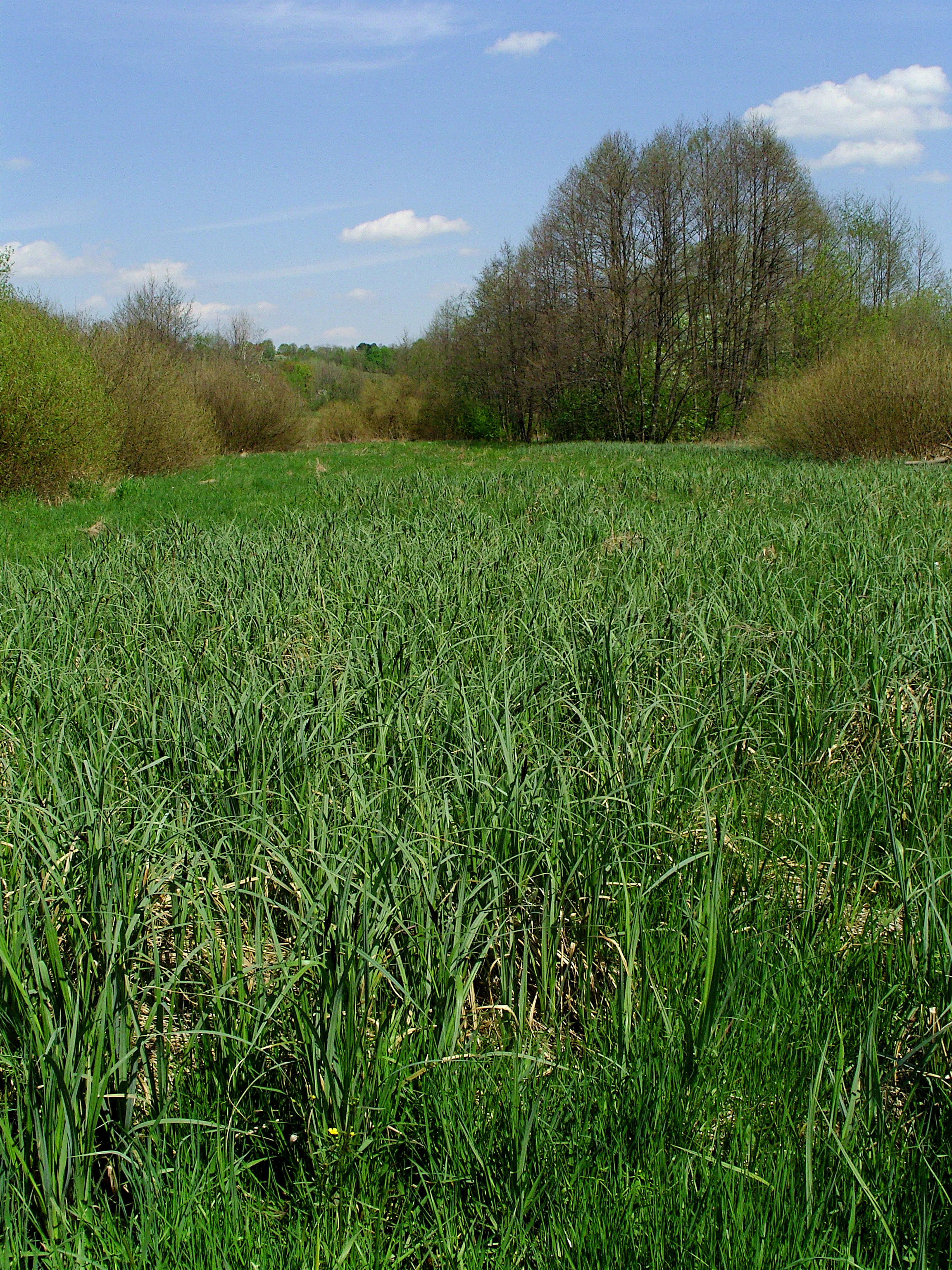
A wide, green, grassy meadow framed by deciduous trees under a partially cloudy blue sky.
A view of the meadows at Laki nad Mlynówka in Baczal Dolny.

Łąki nad Młynówką history and protected-area timeline

The area that today forms Łąki nad Młynówką entered the formal conservation system relatively recently. In 2009, the government of Poland proposed it as a candidate Site of Community Importance within the Natura 2000 framework, focusing on its meadow, shrub, and stream-associated habitats. The proposal was accepted at the European level through a decision of the European Commission dated January 2011, and the site was officially placed on the list of Sites of Community Importance, that is, proposed Special Areas of Conservation, in March 2011.

Before 2009, the meadows and stream valley had no separate protected status, although they formed part of a long-standing agricultural tradition in the villages of Bączal Dolny, Opacie, and Trzcinica. The European designation brought the area into the wider Podkarpackie network of 55 such sites ratified by the European Commission, giving the meadowland an institutional framework for habitat management, monitoring, and protection in the years that followed.

Łąki nad Młynówką landscape and geographic character

The landscape of Łąki nad Młynówką is that of a small, soft-shaped foothill valley. It lies within the Pogórze Ciężkowickie, one of the physical-geographical mesoregions of the Carpathian foothills, where rounded ridges and shallow valleys create a gentle topography. Within this setting, the Młynówka valley stands out through its combination of open meadow ground, streambank vegetation, and interspersed woodland.

The terrain is shaped by the Młynówka itself, which meanders through the site in an irregular, unregulated course. Its floodplain is bordered by reed beds, sedge mires, and willow carrs, while slightly higher terraces support fresh meadows and, on drier slopes, oak-hornbeam forest fragments. Because the topography of the valley is shallow and the water table has been allowed to fluctuate naturally, the scenery shifts noticeably between the meadow plain, the dark green willow thickets along the stream, and the higher forest patches on the valley margins.
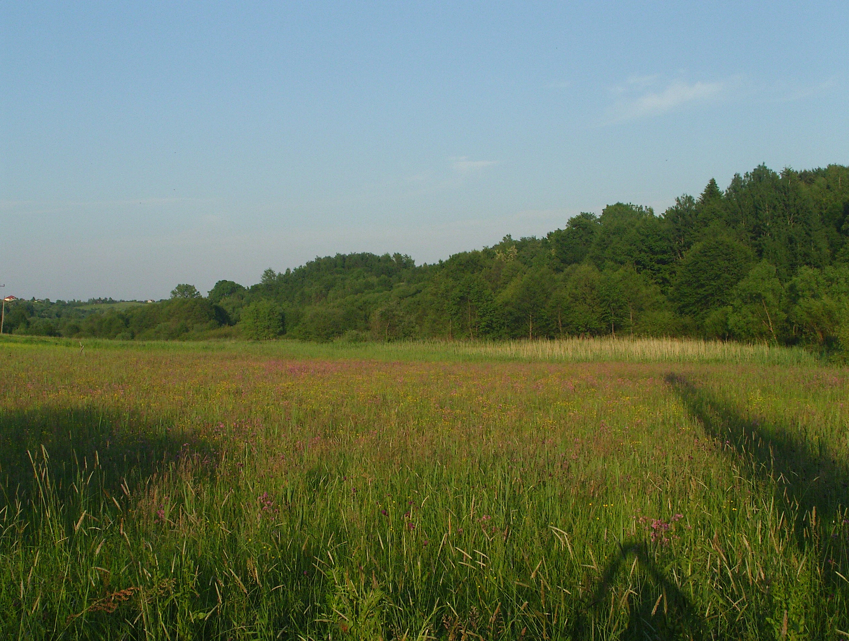
A wide meadow of tall green grass and small purple wildflowers, bordered by a dense forest under a clear blue sky.
A view of the meadow landscape at Łąki nad Młynówką.

Łąki nad Młynówką ecosystems, habitats, and plant life

The natural character of Łąki nad Młynówką is defined by a tightly knit mosaic of meadow, shrub, stream, and forest habitats held together by the Młynówka and its tributaries. Habitat surveys indicate that meadow and shrub communities together cover about 84 percent of the site, agricultural land makes up roughly 12 percent, and mixed forest about 4 percent, reflecting a landscape in which open wet habitats dominate.

The most prominent habitats are extensive fresh meadows on mineral soils and wet meadows that grade into sedge-dominated mires, both shaped by traditional mowing and grazing. Reed communities line the stream, and along its banks willow, poplar, alder, and ash gallery forests form continuous strips of woodland known in Polish ecological terminology as łęgi wierzbowe, topolowe, olszowe, and jesionowe. On drier sections of the valley slopes, small patches of Central European oak-hornbeam forest add a higher, older tree layer to the mosaic. Mountain alder swamp forest appears locally where groundwater rises close to the surface.

Among the protected habitats on the site, the most extensive are the extensively used mountain and lowland fresh meadows, the willow-poplar-alder-ash gallery forests, the Central European oak-hornbeam forest, and the variable moisture Molinia meadows. Smaller but ecologically notable features include mountain and riverside tall-herb communities, transitional mires, and trembling-bog vegetation, all of which depend on continued traditional management and the natural hydrology of the Młynówka.
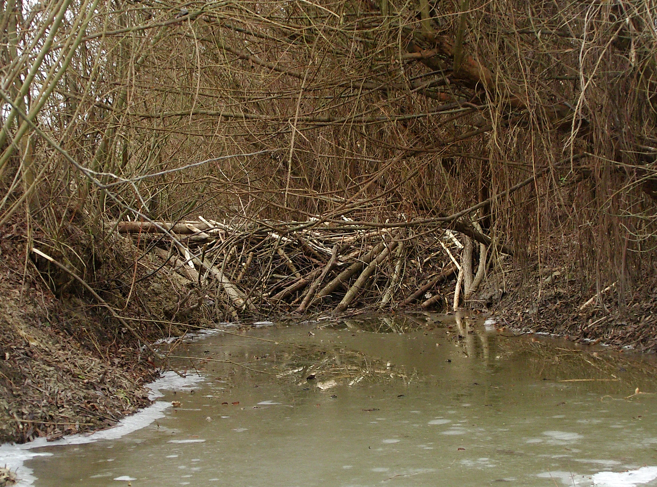
A wooden beaver dam constructed of sticks and branches spanning a narrow, murky stream in a wooded area during late autumn or winter.
A beaver dam built across the Młynówka stream.

Łąki nad Młynówką wildlife and species highlights

The wildlife of Łąki nad Młynówką reflects the combination of meadow, marsh, and wetland forest habitats that the protected area was designed to maintain. The site is known in particular for its birds and wetland fauna, several of which are listed in the annexes of the European Union Birds Directive and Habitats Directive.

In terms of birds, the area supports grey heron, lapwing, common pheasant, grey partridge, mallard, yellowhammer, and Ural owl, while black stork, white stork, and corncrake are explicitly tied to bird directive species in the site's documentation. The streams and wetlands also shelter European beavers, whose dams can be observed within the protected area along the Młynówka, along with amphibians such as the yellow-bellied toad, which is a Habitats Directive Annex II species. Together, these species give the meadowland valley a particular value for European-scale biodiversity conservation.
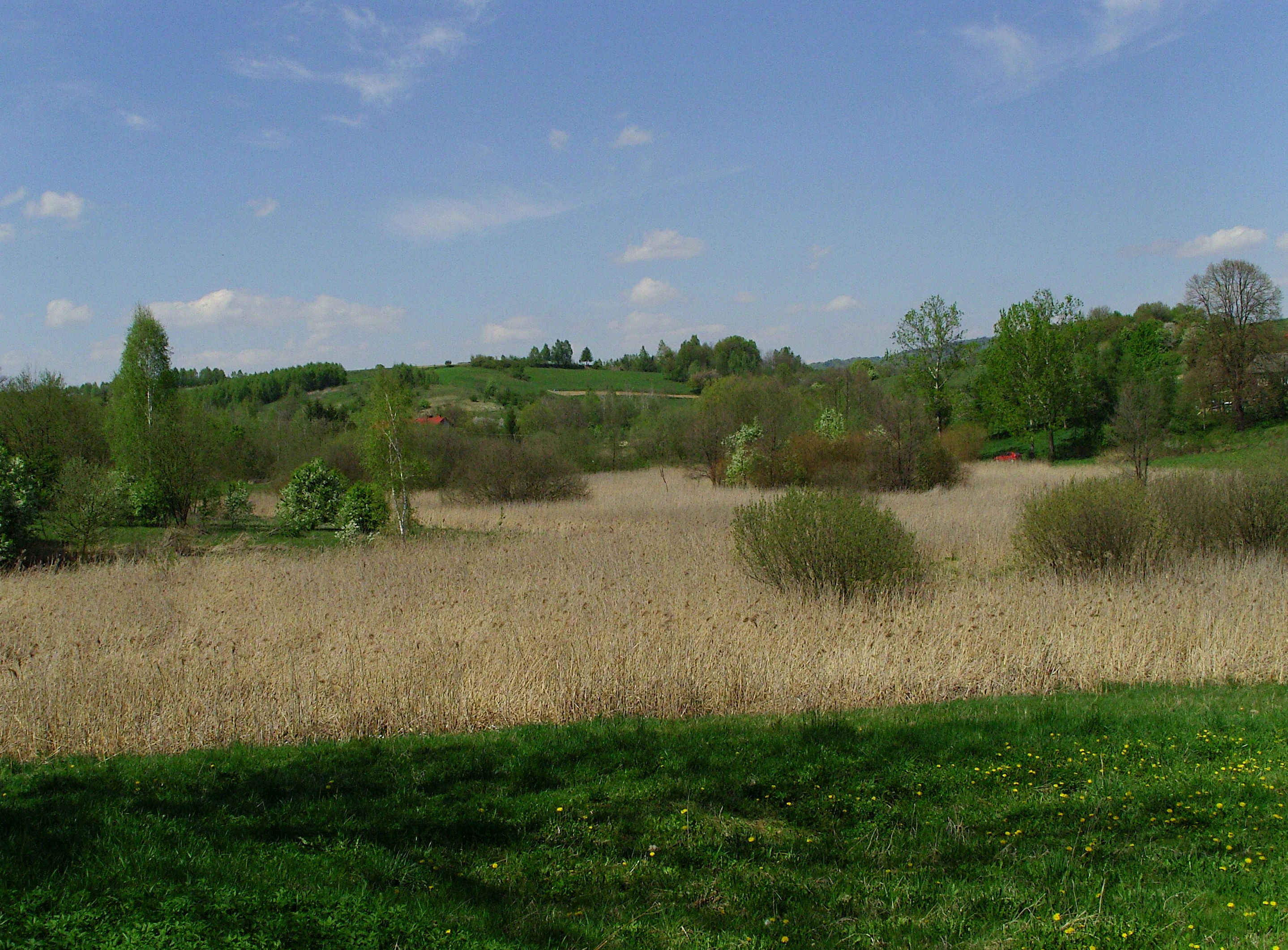
A wide view of a dry reed bed in a meadow, with green bushes and trees in the background under a blue sky.
Reed bed landscape in the Łąki nad Młynówką protected area, Poland.

Łąki nad Młynówką conservation status and protection priorities

The conservation significance of Łąki nad Młynówką lies in its role as one of the small but well-characterized Sites of Community Importance on the southern Podkarpacie list of Natura 2000 areas. Although it covers only about 51 hectares, its mix of meadow, shrub, and stream habitats, including protected habitat types such as extensively used fresh meadows, willow-ash gallery forests, oak-hornbeam forest, and transitional mires, is exactly the kind of semi-natural agricultural landscape that the European Union Habitats Directive seeks to safeguard.

The site protects habitat used by species listed in Annex I of the Birds Directive, including black stork, white stork, and corncrake, as well as Annex II species such as the yellow-bellied toad and European beaver. Its continued ecological value depends on maintaining the traditional mowing and grazing practices that keep the meadows open, together with the natural hydrology of the unregulated Młynówka. Supervision is provided by the Regional Directorate for Environmental Protection in Rzeszów, which coordinates monitoring, threat assessment, and any necessary protective measures across the site.

Łąki nad Młynówką cultural meaning and human context

Łąki nad Młynówką sits within a long-established rural landscape of the Jasło area, in communities such as Bączal Dolny, Opacie, and Trzcinica. The meadows protected by the Natura 2000 designation have been shaped by generations of small-scale agricultural use, in particular seasonal mowing and grazing, practices that continue to determine the botanical composition and open character of the site.

The Młynówka stream itself carries its own layer of cultural meaning. Known in its upper course as Cegielnianka from the historical brickworks (cegielnia) that once operated along it, and recorded in older sources as Trzciennica, the stream has long been a working element of the local landscape. Its old channel modifications, including former low weirs and small dams that the beaver-built structures now partly echo, are part of the rural heritage that surrounds the protected area.

Top sights and standout views in Łąki nad Młynówką

The strongest point of distinction for Łąki nad Młynówką is the persistence of traditional, extensively managed wet and fresh meadows in a single small foothill valley. Within a relatively compact territory, the site brings together protected habitat types from extensive hay meadows and Molinia meadows to willow-ash gallery forests and small patches of oak-hornbeam woodland, each dependent on a free-flowing stream and continued traditional land use.

Equally striking is the Młynówka itself, a natural, unregulated stream bordered by reed beds, sedge mires, willow thickets, and beaver dams. Combined with the presence of bird directive species such as corncrake, black stork, and white stork, and habitat directive species such as the yellow-bellied toad and European beaver, this compact valley provides an unusually complete example of the semi-natural agricultural landscapes that the Natura 2000 network in the Polish Carpathians was designed to protect.

Best time to visit Łąki nad Młynówką

As a lowland-to-foothill meadowland in the Carpathian foothills, Łąki nad Młynówką is most attractive in late spring and summer, when fresh and wet meadows are fully developed and the botanical richness of the site is most visible. Late spring is also the best period to observe meadow orchids and related flowering plants that thrive in the traditionally mown grasslands, while autumn brings flowering of later species such as autumn crocus in the meadow plots. Winter and early spring are quieter in terms of species visibility but reveal the structure of the stream valley, sedge mires, and gallery forests more clearly.

Because the area is a rural agricultural landscape, its appearance also depends on the local mowing calendar. Visitors interested in uncut, fully flowering meadows should aim for late spring or early summer, while later in the season the mosaic of freshly cut and uncut patches becomes a defining feature of the valley scenery.

Monthly climate preview

Measured monthly climate averages and representative point elevation statistics for Podkarpackie Voivodeship

Łąki nad Młynówką Climate Normals: Long Term Temperature and Precipitation Rhythm

Long term data from NASA POWER reveals the representative coordinate baseline for Łąki nad Młynówką, tracking twelve months of measured average temperatures and daily precipitation rates. Examining the full monthly climate profile provides deeper context on multiyear averages without relying on live forecasts.
Annual mean9 °C
-3 °C20 °C
Jan-3°
Feb-2°
Mar
Apr
May14°
Jun18°
Jul20°
Aug20°
Sep15°
Oct
Nov
Dec-2°
Warmest month
July

20.1 °C

Coolest month
January

-3.4 °C

Wettest month
July

3.3 mm/day

Driest month
December

1.3 mm/day

Park location guide

Geography guide, regional context, and park location map for Łąki nad Młynówką

Łąki nad Młynówką park geography, regions, and map view in Poland

Understand where Łąki nad Młynówką sits in Poland through a broader geographic reading of the surrounding landscape, nearby location context, and its mapped position within the national park landscape.

How Łąki nad Młynówką fits into Poland

Poland, officially the Republic of Poland, is a Central European country spanning from the Baltic Sea in the north to the Carpathian Mountains in the south. It borders Germany, Czech Republic, Slovakia, Ukraine, Belarus, Lithuania, and Kaliningrad Oblast. The country has a temperate climate, diverse landscapes, and is known for its rich history, cultural heritage, and strong economic position within the EU.

Wider geography shaping Łąki nad Młynówką in Poland

Poland occupies 312,696 km2 in Central Europe, extending from the Baltic Sea coast in the north to the Sudetes and Carpathian Mountains in the south. It borders Germany to the west, Czech Republic and Slovakia to the south, Ukraine and Belarus to the east, and Lithuania and Kaliningrad Oblast to the northeast. The landscape includes lowland plains, uplands, and mountain ranges.

Map view of Łąki nad Młynówką

Use this park location map to pinpoint Łąki nad Młynówką in Poland, understand its exact geographic position, and read its mapped placement within the surrounding landscape more clearly.

Pigeon | © OpenStreetMap contributors

Location context for Łąki nad Młynówką

Podkarpackie Voivodeship
Recorded earthquake history

Explore Historical Earthquake Records Associated with Łąki nad Młynówką

Consult the historical earthquake catalogue for Łąki nad Młynówką to review seismic data points recorded throughout the surrounding Podkarpackie Voivodeship region. MoriAtlas provides a clear, structured overview of associated event details to assist in your geographic exploration of this Carpathian protected area.

Łąki nad Młynówką Earthquake History

Catalogued events

3 events

Strongest magnitude

Magnitude 4.2

Most recent event

Mar 1, 1993

This history includes earthquakes recorded inside the park or within 50 km of its borders

Explore protected riverine meadows, meandering stream corridors, and diverse wetland vegetation.

Łąki nad Młynówką Photos and Landscape Scenery: Visualizing Carpathian Foothill Habitats

Visual records reveal the diverse terrain and ecological composition of the protected Młynówka valley. Examining these natural environments provides deeper insight into the rare meadowland habitats and regional topography of southern Poland.

A wide, green, grassy meadow framed by deciduous trees under a partially cloudy blue sky.

A small, calm stream flows through a lush green meadow, bordered by a dense line of trees under a clear blue sky.

A wide meadow of tall green grass and small purple wildflowers, bordered by a dense forest under a clear blue sky.

A wooden beaver dam constructed of sticks and branches spanning a narrow, murky stream in a wooded area during late autumn or winter.

A wide view of a dry reed bed in a meadow, with green bushes and trees in the background under a blue sky.

Park atlas

Discover related protected landscapes and surrounding foothill terrain across southern Poland.

Other Parks and Protected Areas Near Łąki nad Młynówką for Regional Comparison

Browsing other protected areas near Łąki nad Młynówką reveals a broader network of riverine valleys and managed meadow habitats. Comparing adjacent reserves helps place local Carpathian foothill ecosystems into wider regional conservation contexts.
Protected areaPodkarpackie Voivodeship
1.1 km away#1 closest

East

Wisłoka z dopływami Protected Area: River Valley Landscape and Carpathian Foothills Atlas

Freshwater habitat mapping in southern Poland

Wisłoka z dopływami covers a long, ecologically rich segment of the Wisłoka river valley in the Carpathian foothills. This protected area connects diverse riparian, floodplain, and alluvial forests, serving as a critical habitat for six Annex II fish species and sixteen distinct riparian woodland types.

Area
26.51 km²
Established
2011
Relief
Mixed relief
Scope
Terrestrial
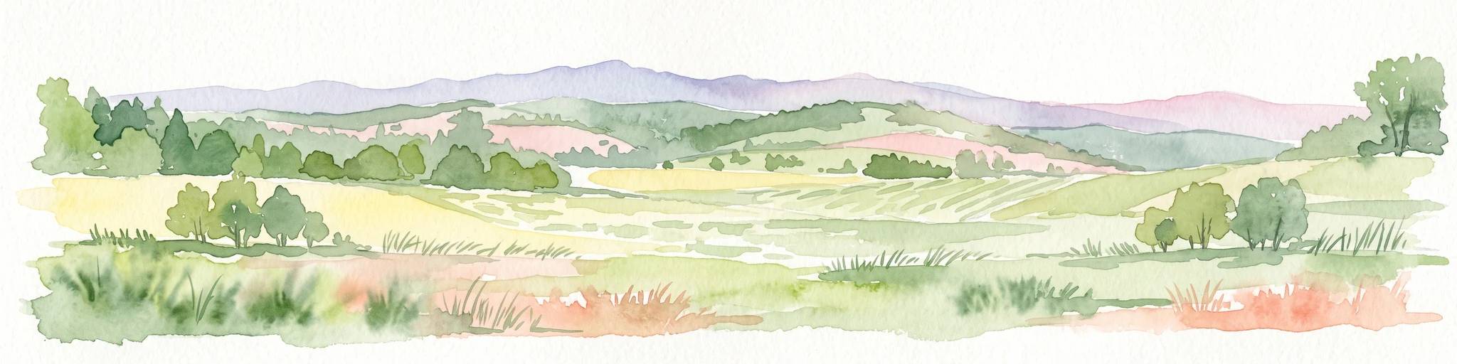
A horizontal watercolor painting depicting a soft, rolling landscape with green fields, patches of trees, and distant lavender-toned mountains under a pale sky.
National parkPodkarpackie Voivodeship
11 km away#2 closest

South

Magurski Park Narodowy: Geographic Overview and Protected Carpathian Forest Atlas

Transitional mountain landscapes in Podkarpackie Voivodeship

Magurski Park Narodowy encompasses a distinct Carpathian forest landscape within the Beskid Niski range. The terrain is defined by rounded mountain ridges, the upper Wisłoka river basin, and strict forest reserves that maintain the ecological integrity of this transitional zone. As a major protected area in Poland, the park provides an essential look at biodiversity-rich beech woodlands, rocky outcrops, and traditional cultural landscapes.

Area
194.39 km²
Established
1995
Visitors
40K annual
Relief
Mountain
Watercolor illustration showing a landscape with rolling hills, green trees, and distant mountains under a light sky
National parkSubcarpathian Voivodeship
11 km away#3 closest

South

Magura National Park: Mapped Protected Landscape & Carpathian Geography Atlas

Explore unique sandstone formations and mapped natural terrain.

Magura National Park, located in the Subcarpathian Voivodeship of Poland, offers a rich focus for protected-area exploration and geographic discovery. This national park is distinguished by its dramatic sandstone rock formations, forested Carpathian ridges, and its ecological importance as a transitional zone. Users engaging with Magura National Park can examine its mapped boundaries, understand its specific landscape context, and appreciate its role within the broader regional geography.

Area
194.39 km²
Established
1995
IUCN
II
Visitors
40K annual
Nature reservePodkarpackie Voivodeship
17 km away#4 closest

Northeast

Wisłok Środkowy z Dopływami Protected Nature Reserve in the Podkarpackie Voivodeship

River corridor geography and riparian ecosystem analysis

Wisłok Środkowy z Dopływami serves as a crucial Natura 2000 site, safeguarding the middle course of the Wisłok River and the Stobnica tributary. This nature reserve provides essential habitat for various protected fish species and butterfly populations within a terrain shaped by the transition between the Jasielsko-Krośnieńska Basin and the Carpathian foothills. The area represents a significant riparian landscape, offering a window into the natural freshwater geography of southeastern Poland.

Area
10.646 km²
Established
2011
Relief
Upland
Scope
Terrestrial
Protected areaPodkarpackie Voivodeship
18 km away#5 closest

Southeast

Łysa Góra Protected Area: Mapping Carpathian Mountain Landscapes in Podkarpackie Voivodeship

Forested ridgeline terrain within the Low Beskids range

Spanning a series of summits including Grzywacka Góra and Dania, Łysa Góra encompasses vital Carpathian beech forest and protected mountain habitats. This Natura 2000 site functions as a key element of the Low Beskids mountain geography, featuring dense woodland cover that supports large carnivore populations and rare forest species across its protected ridge terrain.

Area
27.438 km²
Established
2009
Relief
Mountain
Climate
Temperate
Protected areaPodkarpackie Voivodeship
19 km away#6 closest

East

Łąki nad Wojkówką: Geographic Overview of Protected Grassland Habitats in Podkarpackie

Mapped protected areas and terrain across the Polish Carpathian foothills

Focusing on the convergence of xerothermic grasslands and fresh Arrhenatheretum meadows, Łąki nad Wojkówką represents a vital conservation site. This overview details its distribution across three enclaves, providing mapped context within the Wisłok River valley and its integration into the Czarnorzecko-Strzyżowski Landscape Park.

Area
0.096 km²
Established
2011
Relief
Upland
Scope
Terrestrial
Nature reservePodkarpackie Voivodeship
22 km away#7 closest

East

Ostoja Czarnorzecka Nature Reserve: Mapped Protected Landscapes in Podkarpackie Voivodeship

Carpathian foothills forest and cave habitat mapping

Ostoja Czarnorzecka is a protected nature reserve located in the Dynów Foothills of Poland. The area is defined by its dense Carpathian beech forests and a network of small, undisturbed caves. As a critical component of the regional conservation framework, it provides unique ecological benefits through its mature woodland cover and protected bat habitats found across the Sucha Góra and Królewska Góra ridges.

Area
19.466 km²
Established
2009
Relief
Upland
Scope
Terrestrial
Nature reserveLesser Poland Voivodeship
23 km away#8 closest

Northwest

Ostoja w Paśmie Brzanki: Protected Beech Forest and Foothill Geography in Lesser Poland

A Natura 2000 nature reserve in the Polish Carpathian foothills

Located within the Lesser Poland Voivodeship, Ostoja w Paśmie Brzanki consists of dense, continuous beech woodlands draped over the rounded ridges of the Brzanka Range. This nature reserve serves as an essential ecological refuge, combining rare sycamore communities and riparian strips that support diverse amphibian populations across its forested ravine landscapes.

Area
7.889 km²
Established
2011
Relief
Upland
Water
Minor water

Common questions about visiting, size, designation, and location context for Łąki nad Młynówką

Łąki nad Młynówką FAQs for park facts, access, geography, and protected area context

Find quick answers about Łąki nad Młynówką, including protected-area facts, park geography, trail and visitor context, and how the park fits into its surrounding country and regional landscape.
MoriAtlas Explorer

Continue Your Protected Areas Search Across the Global Atlas

Deepen your exploration by continuing the structured search for national parks and protected areas worldwide. Utilize the comprehensive filtering capabilities to compare different conservation landscapes and refine your understanding of global park geography. Discover more about the distribution and characteristics of protected natural areas.

Global natural geography