

Mori Atlas logo
Nature reserveLaru Wetland National Nature Reserve

High-altitude reed marsh ecosystems within a unique urban-adjacent basin geography

Laru Wetland National Nature Reserve: Mapped Protected Landscapes in the Tibet Autonomous Region

Laru Wetland National Nature Reserve serves as a globally significant high-altitude marshland integrated directly into the urban fabric of Lhasa. This protected area captures seasonal runoff from the surrounding valley slopes, sustaining a vast peat-forming wetland ecosystem that functions as a critical refuge for migratory waterbirds. Situated in the Tibet Autonomous Region, the reserve provides a rare opportunity to study the intersection of plateau ecology and concentrated urban development through its mapped terrain and seasonal hydrological cycles.

high-altitude wetlandurban wetlandQinghai-Tibet Plateaureed marshpeat marshplateau birdlife
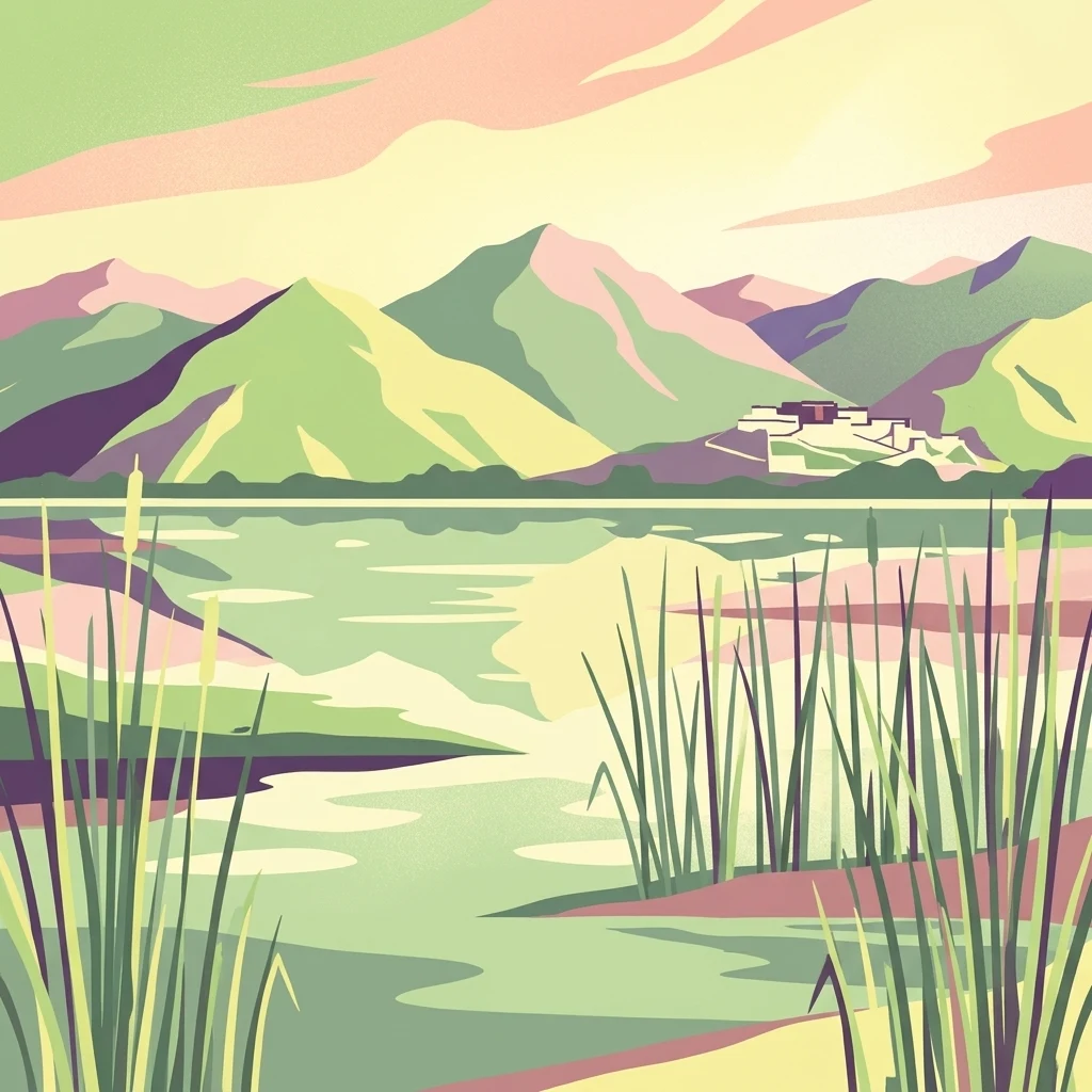
A digital illustration of the Laru Wetland with tall reeds in the foreground, calm water, and a mountain range with a building complex in the background under a soft light sky.

Laru Wetland National Nature Reserve

Nature reserve

Park overview

Structured park overview, official facts, and landscape profile for Laru Wetland National Nature Reserve

Laru Wetland National Nature Reserve park facts, protected area profile, and essential visitor context

Review the core facts for Laru Wetland National Nature Reserve, including designation, size, terrain, visitor scale, habitats, and operating context in one park-focused overview.

About Laru Wetland National Nature Reserve

Laru Wetland National Nature Reserve is a compact but ecologically significant protected area in northern Lhasa, the capital of the Tibet Autonomous Region. Although it covers only a few square kilometers, it is widely cited as the highest-elevation urban natural wetland in the world and the largest natural urban wetland on Earth, a status that has shaped both its scientific interest and its national conservation profile. Its setting within the Lhasa river basin, surrounded by the foothills of the broader Tibetan plateau landscape, gives it a defining mix of high-altitude conditions and relatively sheltered valley geography.

Ecologically, the reserve is a textbook example of a Qinghai-Tibet Plateau wetland. The terrain is flat and waterlogged, dominated by extensive reed beds backed by peat-forming marsh soils. The climate is cooler and more humid than much of the surrounding plateau, and the seasonal flow of the Liusha River, fed from the Duodi and Niangre valleys, sustains the wetland's hydrology between May and October. This seasonal rhythm supports a mosaic of open water, wet reed margins, and drained peat zones that together provide habitat for resident and migratory species.

The reserve is anchored in the broader plateau's identity rather than isolated as a purely local site. Its elevation of roughly 3,645 meters places it in the high-altitude band where many of the Tibetan plateau's most specialized bird and plant communities occur. Because it lies inside a major urban area, it also serves as a working example of how a high-altitude wetland can coexist with a historic city, after decades of institutional effort to formalize protection, manage grazing, control water pollution, and restore damaged land within its boundary.

Quick facts and research context for Laru Wetland National Nature Reserve

Laru Wetland National Nature Reserve lies within Lhasa, the capital of the Tibet Autonomous Region, in southwestern China. It is a national-level nature reserve established at the autonomous region level in 1999 and officially upgraded to a national nature reserve in 2005 by the State Council of the People's Republic of China. The reserve covers about 6.2 square kilometers and sits at an average elevation of roughly 3,645 meters, making it the highest-elevation urban natural wetland on Earth. It is also the only inland natural wetland located inside a Chinese city. Ecologically, it is a typical Qinghai-Tibet Plateau marsh system dominated by reed beds and peat-forming wetland vegetation, and it supports important populations of migratory and plateau-inhabiting birds, including the nationally protected black-necked crane.

Protection and recognition

Documented terrestrial protection scope, designation year, and management records

Laru Wetland National Nature Reserve Protection Status and Designation History

Laru Wetland National Nature Reserve maintains a terrestrial protection scope established through official designation records from 2005. Systematic conservation facts compile documented protection history and management frameworks for professional geographic reference.

Protection details

Protection scope
Terrestrial
Designated year
2005
Transboundary protection
No
Park context

Deeper park guide and search-rich context for Laru Wetland National Nature Reserve

Laru Wetland National Nature Reserve history, landscape, wildlife, and travel context

Explore Laru Wetland National Nature Reserve through its history, landscape character, ecosystems, wildlife, conservation priorities, cultural context, and seasonal travel timing in a structured park guide built for atlas discovery and search intent.

Why Laru Wetland National Nature Reserve stands out

Laru is best known for being the highest-elevation urban natural wetland in the world and the largest of its kind, situated directly adjacent to the historic core of Lhasa. Its profile is dominated by expansive reed and peat-forming marsh habitat at more than 3,600 meters above sea level, an unusual combination of high-altitude ecology and urban proximity. Birdlife is a defining feature: large flocks of ruddy shelducks, bar-headed geese, brown-headed gulls, larks, hoopoes, and skylarks use the reserve, and the area hosts a small but ecologically significant presence of black-necked cranes, a species of national conservation priority. Equally important is its role as a rare example of an intact, ecologically functioning natural wetland embedded within a major Tibetan city. The wetland's distinctiveness is also a product of its cultural landscape. The surrounding ridges of the Lhasa valley create a sheltered basin that channels water from the Duodi and Niangre valleys into the reserve through the seasonal Liusha River, sustaining the marsh system through the warmer half of the year. This combination of hydrology, high elevation, and proximity to one of Tibet's most culturally significant urban centers gives Laru its unique identity among China's protected areas.
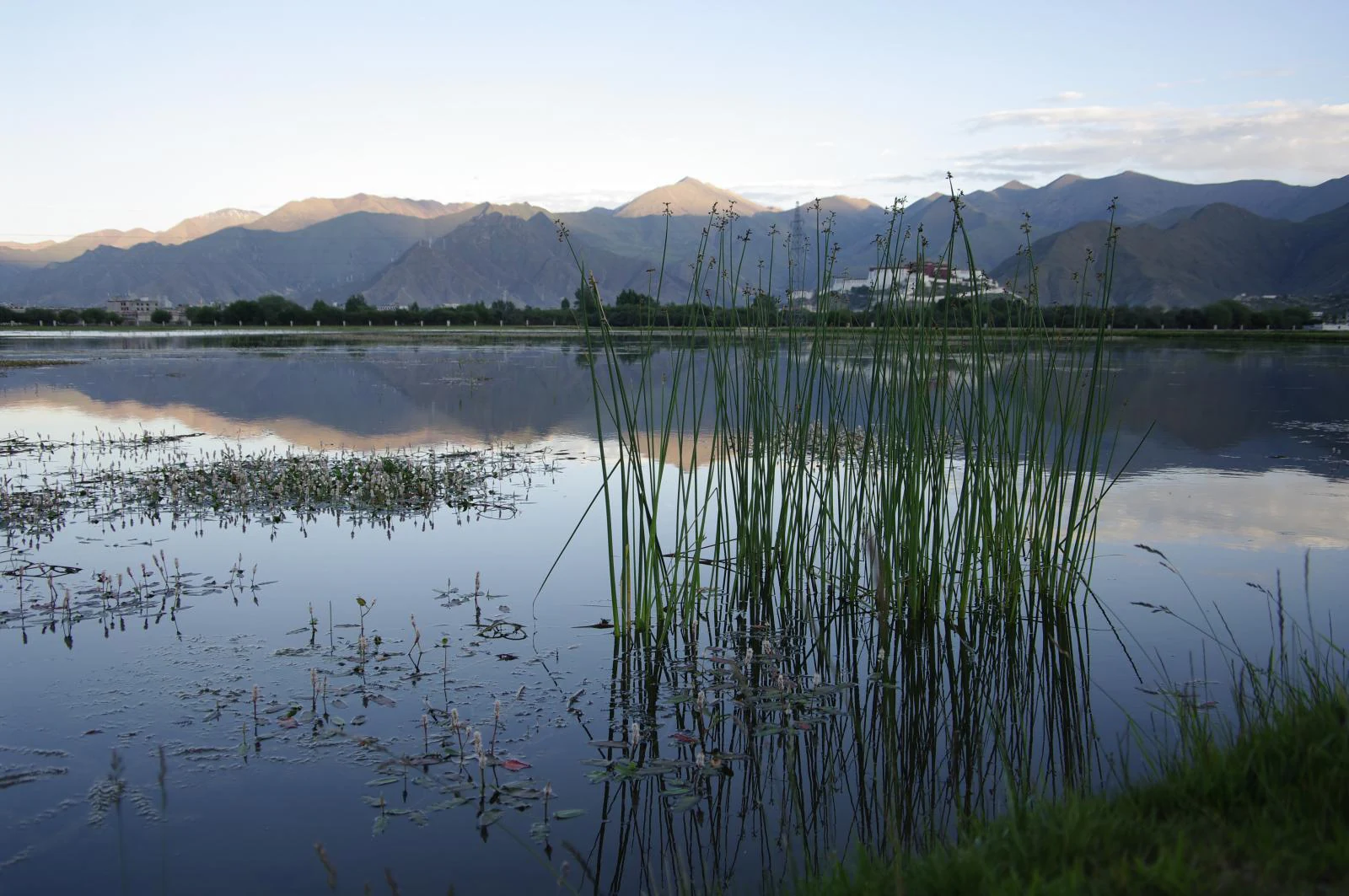
A wide view of a calm wetland reflecting distant mountain ranges, with tall reeds in the foreground.
A scenic view of the calm waters and tall reeds of the Laru Wetland.

Laru Wetland National Nature Reserve history and protected-area timeline

The land that now forms Laru Wetland was historically held by the Lha-lu family, one of the prominent aristocratic lineages of the Lhasa region, which is reflected in the reserve's name. For much of the twentieth century, the wetland functioned within a wider mosaic of pastoral and agricultural land uses around northern Lhasa, with grazing, sand extraction, and other local activities increasingly affecting its condition as the city expanded.

Formal protection began in 1995, when the Tibet Autonomous Region Government launched a comprehensive wetland conservation project for the area. In 1999, the regional government approved the establishment of Laru Wetland as an autonomous region-level nature reserve, and in 2000 the Lhasa municipal government issued management regulations and a master plan for the reserve, accompanied by the creation of a dedicated management station. The reserve was elevated to national nature reserve status on 23 July 2005 when the State Council of the People's Republic of China approved its designation, and the on-site management station was upgraded to a full management bureau in 2008.

Since 2005, the reserve has been the focus of repeated ecological restoration and governance efforts. A 2017 round of environmental remediation was particularly far-reaching: twelve households inside the reserve were relocated, a long-running warehouse lease by Drepung Monastery was discontinued, a former sand-mining site covering tens of thousands of square meters was cleaned and incorporated into the city's northern green belt, pollution-control plans were introduced for the Liusha River and surrounding canals, and several thousand livestock were purchased from local herders along with a grazing ban that prohibited domestic animals from entering the wetland.

Laru Wetland National Nature Reserve landscape and geographic character

Laru Wetland occupies a low-elevation basin in the northern Lhasa valley, framed by the gentle ridges and tributary valleys that descend toward the city. The terrain within the reserve is flat and waterlogged for much of its surface, marked by open shallow water, saturated reed beds, and accumulated peat soils. This basin setting helps the reserve capture seasonal runoff rather than drain away.

The defining hydrological feature is the Liusha River, a seasonal river formed by the confluence of streams from the Duodi and Niangre valleys in the foothills to the north. Between May and October this river feeds the wetland, after which flows fade for the colder months. On the margins of the reserve, the land gradually transitions back into the broader patterns of the Lhasa valley, including agricultural plots, village settlements, and the encroaching urban edge of Lhasa itself.

The visual impression of Laru is very different from either the surrounding urban areas of Lhasa or the bare high plateau beyond the valley. From within and adjacent to the reserve, the landscape reads as a flat, green sea of reeds and sedges, broken by slack water and narrow channels, with the city skyline of Lhasa visible not far away. This close juxtaposition of high-altitude marshland and a major historical city is the reserve's most striking landscape attribute.

Laru Wetland National Nature Reserve ecosystems, habitats, and plant life

Ecologically, Laru is a representative example of a high-altitude inland marsh, classified as a typical reed-and-peat wetland of the Qinghai-Tibet Plateau. The vegetation pattern is shaped by altitude, soil saturation, and seasonal water availability, with extensive stands of reeds and other marsh plants dominating the wettest parts and grading outward into drier peat and grassy margins. The cool, comparatively humid microclimate created by standing water and gentle topography supports a more luxuriant plant community than the surrounding uplands typically allow.

Because the wetland sits inside a major city, it also functions as an unusually intact fragment of natural wetland habitat within a heavily modified landscape. It retains hydrological and ecological functions, including water retention, sediment trapping, and local microclimate moderation, alongside its biodiversity role, making it ecologically valuable well beyond its modest area.

The reserve as a whole supports a mosaic of wetland habitats, from open water and reedbeds to slightly elevated peat hummocks and wet meadow transitions. This habitat diversity is significant for sustaining different feeding and roosting niches, and it is one of the main reasons why the reserve remains productive for birdlife even under the pressures of being embedded within an urban catchment.

Laru Wetland National Nature Reserve wildlife and species highlights

Birdlife is by far the most visible wildlife asset at Laru. The reserve attracts large numbers of waterbirds and open-country birds each year, especially during the warmer months when the seasonal river flow sustains open water and rich reed cover. Among the regularly recorded species are ruddy shelducks, yellow ducks, Tibetan sandgrouse, brown-headed gulls, bar-headed geese, larks, hoopoes, and skylarks, all of which use the wetland and its surroundings for feeding, roosting, or breeding.

The most ecologically significant presence is the black-necked crane, which is listed as a national first-class protected species in China. While the population using Laru is described as small, this occurrence gives the reserve a meaningful role in the broader conservation strategy for the species on the Tibetan plateau, where intact high-altitude wetlands are critical to its survival.

The wetland also functions as a habitat island within an urbanizing region, providing feeding and resting habitat for a broader community of plateau birdlife that uses the Lhasa valley as a seasonal corridor. Although specific non-avian fauna are not a focal point of the reserve's profile, the concentration of nesting waterbirds and seasonal migrants is what gives Laru its most recognized ecological identity.

Laru Wetland National Nature Reserve conservation status and protection priorities

Laru is nationally recognized as a reserve of high conservation value for two main reasons: its status as the world's highest-elevation urban natural wetland, and its ecological contribution to the broader network of high-altitude wetlands on the Qinghai-Tibet Plateau. The reserve was elevated from autonomous region-level to national nature reserve status in 2005, placing it within China's highest tier of terrestrial and wetland protection.

Conservation management has focused on three linked challenges: curbing grazing pressure, controlling water pollution, and repairing damage from sand extraction and informal land use. The 2017 environmental remediation campaign is a clear example of this approach, combining household relocation, restoration of former mining sites, antipollution plans for the Liusha River and nearby canal network, and a city-wide grazing ban with compensation for herders. Together these measures are aimed at restoring the wetland's hydrology, vegetation, and habitat quality.

Because the reserve sits inside a growing regional capital, its conservation role also includes acting as a buffer and filtration zone within the Lhasa urban environment, contributing to local water retention, microclimate stability, and habitat continuity across the broader valley landscape. This dual function, as both a biodiversity site and an urban ecological asset, gives Laru a distinctive place in China's national protected-area system.

Laru Wetland National Nature Reserve cultural meaning and human context

The reserve's identity is closely tied to the historical political geography of Lhasa. The land was historically the estate of the Lha-lu family, whose name appears in the reserve's title and whose legacy is associated with the broader aristocratic landscape around the city. This long-standing local association gives the wetland continuity as a named and recognized place rather than simply a generic nature conservation area.

The reserve's location at the edge of Lhasa also places it within sight of some of the city's most significant religious and cultural sites, including nearby monasteries and pilgrimage routes that shape the surrounding landscape. The 2017 restoration explicitly addressed this cultural dimension by resolving a long-standing land-use arrangement linked to Drepung Monastery, illustrating how the reserve's conservation work intersects with the management of monastic estates and traditional property relationships around the city.

For residents of Lhasa, the wetland remains a recognizable natural landmark at the urban edge, visible from surrounding roads, neighborhoods, and hilltop vantage points, and valued as part of the everyday horizon of the city as well as a destination for those interested in its birdlife and scenery.

Top sights and standout views in Laru Wetland National Nature Reserve

Laru Wetland stands out as one of the most unusual urban-adjacent nature reserves in the world: a functioning high-altitude wetland ecosystem embedded directly within the residential and administrative extent of Lhasa. It combines ecological functions, including a defined reed-and-peat plateau marsh ecosystem, significant seasonal bird presence including black-necked cranes, and a federally managed conservation regime that has been progressively strengthened since the late 1990s.

Equally distinctive is the wetland's modern conservation trajectory, marked by transition from informal land use to autonomous region-level protection, then to national nature reserve status, and finally to a comprehensive restoration phase that has addressed grazing pressure, water pollution, sand-mining legacy sites, and land-use arrangements with surrounding institutions. This mix of high plateau ecology, urban edge geography, and progressive management has made Laru a reference site for high-altitude urban wetland conservation in China.

Best time to visit Laru Wetland National Nature Reserve

Because Laru is a seasonal high-altitude wetland fed by the Liusha River from May through October, the warmer months are when the marsh is fullest and most biologically active. Late spring and summer bring the strongest water levels, the densest reed growth, and the highest bird activity, with migratory and breeding species present in larger numbers. This is broadly the most rewarding window to experience the wetland's character and birdlife.

Outside that active period, the colder months see reduced water availability and lower temperatures, which can mean drier or partly frozen conditions and quieter wildlife presence. Travelers with an interest in wintering birds and a calmer landscape may still find the reserve appealing in the colder season, but the marsh feels visually and ecologically subdued compared with its late spring and summer peak.

Monthly climate preview

Long term temperature and precipitation patterns across representative coordinates

Laru Wetland National Nature Reserve Climate Normals and Annual Weather Rhythm

Representative coordinate records show measured monthly temperature swings from subfreezing winter lows to mild summer highs alongside shifting daily precipitation averages. Examining the complete twelve month dataset provides deeper meteorological insight into long term climate normals for Laru Wetland National Nature Reserve.
Annual mean4 °C
-6 °C12 °C
Jan-6°
Feb-3°
Mar
Apr
May
Jun12°
Jul12°
Aug11°
Sep
Oct
Nov
Dec-4°
Warmest month
July

12.4 °C

Coolest month
January

-5.6 °C

Wettest month
July

4.2 mm/day

Driest month
January

0 mm/day

Park location guide

Geography guide, regional context, and park location map for Laru Wetland National Nature Reserve

Laru Wetland National Nature Reserve park geography, regions, and map view in China

Understand where Laru Wetland National Nature Reserve sits in China through a broader geographic reading of the surrounding landscape, nearby location context, and its mapped position within the national park landscape.

How Laru Wetland National Nature Reserve fits into China

China is a unitary communist state in East Asia, governed by the Chinese Communist Party. The country's capital is Beijing, while Shanghai is the largest city by urban population. China has 33 province-level divisions including provinces, autonomous regions, municipalities, and special administrative regions. The nation has a long history spanning thousands of years, with achievements including the invention of gunpowder, paper, printing, and the compass.

Wider geography shaping Laru Wetland National Nature Reserve in China

China is located in East Asia, bordering fourteen countries: Russia, North Korea, Vietnam, Laos, Myanmar, India, Bhutan, Nepal, Pakistan, Afghanistan, Tajikistan, Kyrgyzstan, Kazakhstan, and Mongolia. The country spans diverse terrain including deserts, mountains, plateaus, and river valleys. Major river systems include the Yellow River and Yangtze River. The coastline stretches along the East China Sea, South China Sea, and Yellow Sea.

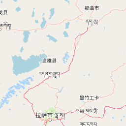
Map view of Laru Wetland National Nature Reserve

Use this park location map to pinpoint Laru Wetland National Nature Reserve in China, understand its exact geographic position, and read its mapped placement within the surrounding landscape more clearly.

Pigeon | © OpenStreetMap contributors

Location context for Laru Wetland National Nature Reserve

Tibet Autonomous Region

Visual exploration of plateau marsh habitats, reed beds, and valley terrain

Laru Wetland National Nature Reserve Photos and High Altitude Scenery

Visual records capture the expansive reed marshes, shallow open water, and unique basin terrain defining Laru Wetland National Nature Reserve. Examining protected area imagery reveals the striking juxtaposition of high altitude wetland ecosystems against the urban edge of Lhasa.

A wide view of a calm wetland reflecting distant mountain ranges, with tall reeds in the foreground.

Park atlas

Compare regional high-altitude reserves and connected valley ecosystems across the plateau.

Explore Parks Near Laru Wetland National Nature Reserve and Protected Plateau Landscapes

Visitors reviewing Laru Wetland National Nature Reserve can continue browsing related high-altitude reserves and regional protected landscapes across the surrounding Lhasa valley basin. Comparing connected wetland ecosystems and valley terrain provides broader geographic context for plateau conservation networks.
National parkBhutan
About 187 km away#1 closest

Southwest

Jigme Dorji National Park: Bhutan's Vast Protected Landscape and Himalayan Geography

Explore mapped boundaries and diverse ecosystems within this national park.

Jigme Dorji National Park, located in the heart of Bhutan, is a testament to the country's commitment to conservation, covering over 4,300 square kilometers of pristine Himalayan terrain. This national park encompasses diverse ecosystems, from lush subtropical forests in its lower reaches to barren alpine meadows and permanent snowfields at its highest elevations. The park's extensive mapped boundaries showcase a landscape vital for unique wildlife and sacred cultural sites, offering a comprehensive view for atlas-based geographic discovery.

Area
4,316 km²
Established
1974
IUCN
II
Relief
Mountain
National parkBhutan
About 210 km away#2 closest

South

Wangchuck Centennial National Park: Bhutan National Park Protected Landscape

Mapped geographic context and park identity in the Eastern Himalayas.

Wangchuck Centennial National Park stands as a protected national park within Bhutan, offering a detailed look at its geographic distribution and landscape characteristics. This page provides essential atlas-level information about its mapped boundaries and its significance as a protected area in the South Asian region.

Area
4,914 km²
Established
2008
IUCN
II
Relief
Mountain
Wildlife reserveTrashiyangtse District
About 211 km away#3 closest

South

Bumdeling Wildlife Sanctuary: Bhutan Wildlife Reserve with Mapped Protected Boundaries

Explore its regional geography and natural landscape context.

Bumdeling Wildlife Sanctuary is a designated wildlife reserve located in Bhutan's Trashiyangtse District. This page provides detailed atlas-style information on its protected landscape, including its geographic positioning and mapped boundaries. Understand how this reserve contributes to the regional geography and serves as a crucial element of Bhutan's protected areas.

Area
1,520.61 km²
Established
1998
Relief
Mountain
Access
Access unknown
National parkBhutan
About 265 km away#4 closest

South

Phrumsengla National Park: Protected Landscape and Geographic Context in Bhutan

Explore mapped boundaries and diverse Himalayan terrain.

Phrumsengla National Park serves as a vital protected area within Bhutan, characterized by its extensive altitudinal range and varied landscape. Spanning from subtropical valleys to alpine zones, the park showcases a remarkable transition of ecosystems, including significant old-growth fir forests. Its location and unique geographic features make it an important component of any study of the region's protected lands and Himalayan geography, offering rich data for atlas exploration and understanding natural landscapes.

Area
905.05 km²
Established
1998
IUCN
II
Relief
Mountain
National parkTrongsa District
About 274 km away#5 closest

South

Jigme Singye Wangchuck National Park: Bhutan National Park's Geographic and Landscape Atlas

Mapped protected area within Trongsa District's natural terrain.

Delve into the detailed geographic identity of Jigme Singye Wangchuck National Park, a protected national park situated in Bhutan's Trongsa District. This park provides essential context for understanding Bhutanese geography and conservation landscapes. Examine its mapped boundaries and place within the regional terrain, offering a structured exploration for anyone interested in national park geography and protected natural areas.

Area
1,730 km²
Established
1995
IUCN
II
Relief
Mountain
Wildlife reserveTrashigang District
About 278 km away#6 closest

South

Sakteng Wildlife Sanctuary: Protected Area and Wildlife Reserve in Bhutan's Trashigang District

Mapping the mountainous terrain and unique temperate ecosystems.

Sakteng Wildlife Sanctuary is a vital protected area in eastern Bhutan, recognized as a wildlife reserve. Spanning approximately 742 square kilometers within Trashigang District, it features a dramatic mountainous terrain characterized by steep valleys and alpine meadows. The sanctuary's landscape transitions from forested slopes to subalpine conifer forests, representing Bhutan's easternmost temperate ecosystems and offering rich geographic context for atlas exploration.

Area
742.46 km²
Established
2003
IUCN
IV
Relief
Mountain
Wildlife reserveBhutan
About 283 km away#7 closest

Southwest

Motithang Takin Preserve: Bhutan Wildlife Reserve with Unique Protected Landscape Context

Explore the mapped geography and national animal sanctuary.

The Motithang Takin Preserve offers a unique glimpse into Bhutan's dedication to its national animal, the takin. This wildlife reserve, located near the capital city, provides a defined protected area where the distinctive goat-antelope thrives. By examining the preserve's mapped boundaries and its forested terrain, users gain insight into Bhutan's approach to conservation and the cultural significance of this iconic species within the Himalayan landscape.

Area
0.034 km²
IUCN
IV
Relief
Upland
Climate
Temperate
Wildlife reserveArunachal Pradesh
About 307 km away#8 closest

Southeast

Sessa Orchid Sanctuary: Himalayan Foothills Wildlife Reserve and Mapped Protected Landscape

High-altitude forest geography in Arunachal Pradesh

Sessa Orchid Sanctuary is a pivotal wildlife reserve spanning the rugged Himalayan foothills of West Kameng, Arunachal Pradesh. Defined by deep gorges and high ridges, the sanctuary protects one of the most significant orchid habitats in India, featuring over 200 distinct species within its closed-canopy monsoon forests. This protected area stands as a central link in the Kameng Protected Area Complex, representing a critical region for scientific research, endemic flora, and continuous forest conservation.

Area
100 km²
Established
1989
IUCN
IV
Relief
Mountain

Common questions about visiting, size, designation, and location context for Laru Wetland National Nature Reserve

Laru Wetland National Nature Reserve FAQs for park facts, access, geography, and protected area context

Find quick answers about Laru Wetland National Nature Reserve, including protected-area facts, park geography, trail and visitor context, and how the park fits into its surrounding country and regional landscape.
MoriAtlas Explorer

Continue Your Protected Areas Search Across the Global Atlas

Deepen your exploration by continuing the structured search for national parks and protected areas worldwide. Utilize the comprehensive filtering capabilities to compare different conservation landscapes and refine your understanding of global park geography. Discover more about the distribution and characteristics of protected natural areas.

Global natural geography
