

Mori Atlas logo
Protected areaLas Piñas–Parañaque Wetland Park

Discover the ecological significance of these tidal barrier islands and mangroves in the Philippine capital region.

Las Piñas–Parañaque Wetland Park: A Protected Coastal Wetland Geography within Metro Manila

(Las Piñas–Parañaque Critical Habitat and Ecotourism Area)

Las Piñas–Parañaque Wetland Park represents a crucial protected area anchored along the shores of Manila Bay. This unique urban landscape consists of barrier islands, extensive mangrove forests, salt marshes, and tidal mudflats that function as an essential migratory stopover. By preserving these natural corridors against the surrounding metropolitan development, the park sustains rare Philippine biodiversity and serves as a critical wetland refuge within the dense geography of the National Capital Region.

urban wetlandmangrove foresttidal mudflatsmigratory birdsRamsar sitecoastal habitat
A flat-style digital illustration showing a wooden boardwalk leading into a mangrove forest with shallow water, set against a backdrop of distant cliffs and a sunrise.

Las Piñas–Parañaque Wetland Park

Protected area

Park overview

Structured park overview, official facts, and landscape profile for Las Piñas, Parañaque Wetland Park

Las Piñas, Parañaque Wetland Park park facts, protected area profile, and essential visitor context

Review the core facts for Las Piñas, Parañaque Wetland Park, including designation, size, terrain, visitor scale, habitats, and operating context in one park-focused overview.

About Las Piñas, Parañaque Wetland Park

The Las Piñas–Parañaque Wetland Park is a small but ecologically significant protected coastal area in Metro Manila, the Philippines. Although the park covers only around 181 hectares, it occupies a distinct ecological niche in a region otherwise dominated by dense urbanization, transportation corridors, and coastal reclamation. The site groups together mangrove forest, tidal mudflats, brackish lagoons, salt marshes, and fragments of beach forest, creating a habitat mosaic that supports both resident and migratory species along the shores of Manila Bay.

The park's two main islands, Freedom Island and Long Island, are themselves the product of land reclamation associated with the Manila–Cavite Coastal Road project. Rather than being purely natural landforms, they have become ecologically valuable landscapes over time, developing into functioning wetland habitats that now anchor conservation efforts in the metro area. Sediments and dredged materials deposited during road construction have matured into mangrove-covered terrain, tidal flats, and shallow lagoons that host a rich food web of invertebrates, fish, and waterbirds.

Beyond its physical setting, the park's significance lies in its role within the East Asian–Australasian Flyway, one of the world's most important bird migration corridors. Migratory species traveling between as far away as China, Japan, and Siberia use the site as a stopover during the August to April migration season, occasionally numbering thousands of individuals daily. At the same time, the park supports resident wildlife, including the endemic Philippine duck, which breeds at the site in what is widely regarded as the only known breeding population within Metro Manila.

The park also carries layered protection recognition: a national Critical Habitat designation dating back to 2007, a Ramsar listing under UNESCO's Ramsar Convention from 2013, and a National Protected Area status formalized under the Expanded National Integrated Protected Areas System Act in 2018. These overlapping layers of recognition reflect both the local and international conservation community's view of the site as a rare and valuable urban wetland that warrants strong protection, even as surrounding development pressures continue to grow.

Quick facts and research context for Las Piñas, Parañaque Wetland Park

The Las Piñas–Parañaque Wetland Park occupies a coastal location in Metro Manila, Philippines, between the cities of Las Piñas and Parañaque along the shores of Manila Bay. It is composed of two reclaimed barrier islands, Freedom Island and Long Island, and combines mangrove forest, tidal mudflats, lagoons, and salt marshes within a single protected boundary.

The site was proclaimed a Critical Habitat by the Philippine government in 2007 and was designated a Ramsar wetland of international importance in 2013 under UNESCO's Ramsar Convention. It was later legislated as a National Protected Area in 2018 under the country's expanded protected areas framework. Despite its protected status, the wetland remains surrounded by urban development, transportation infrastructure, and ongoing reclamation pressures.

Protection and recognition

Examining the documented protection scope, management framework, and historical designation timeline.

Las Piñas–Parañaque Wetland Park Protection Status and Designation History

Las Piñas–Parañaque Wetland Park maintains a documented mixed protection status established in the year 2013. Official records compile the recorded designation timeline and management scope without external conservation rankings.

Protection details

Protection scope
Mixed
Designated year
2013
Transboundary protection
No
Park context

Deeper park guide and search-rich context for Las Piñas, Parañaque Wetland Park

Las Piñas, Parañaque Wetland Park history, landscape, wildlife, and travel context

Explore Las Piñas, Parañaque Wetland Park through its history, landscape character, ecosystems, wildlife, conservation priorities, cultural context, and seasonal travel timing in a structured park guide built for atlas discovery and search intent.

Why Las Piñas, Parañaque Wetland Park stands out

The park is best known for being one of the last remaining mangrove forests in Metro Manila and for its role as a critical stopover for migratory birds on the East Asian, Australasian Flyway. Its combination of mangroves, tidal mudflats, and salt marshes within an urban setting makes it an unusually significant urban wetland, both ecologically and as a contrast to the dense development of the surrounding metropolitan region. It is also recognized for holding the only known breeding population of the endemic Philippine duck within Metro Manila, and for providing a refuge where migratory and resident waterbirds can feed and rest in close proximity to a megacity. The Ramsar designation reinforces its international standing as a wetland of global conservation importance.
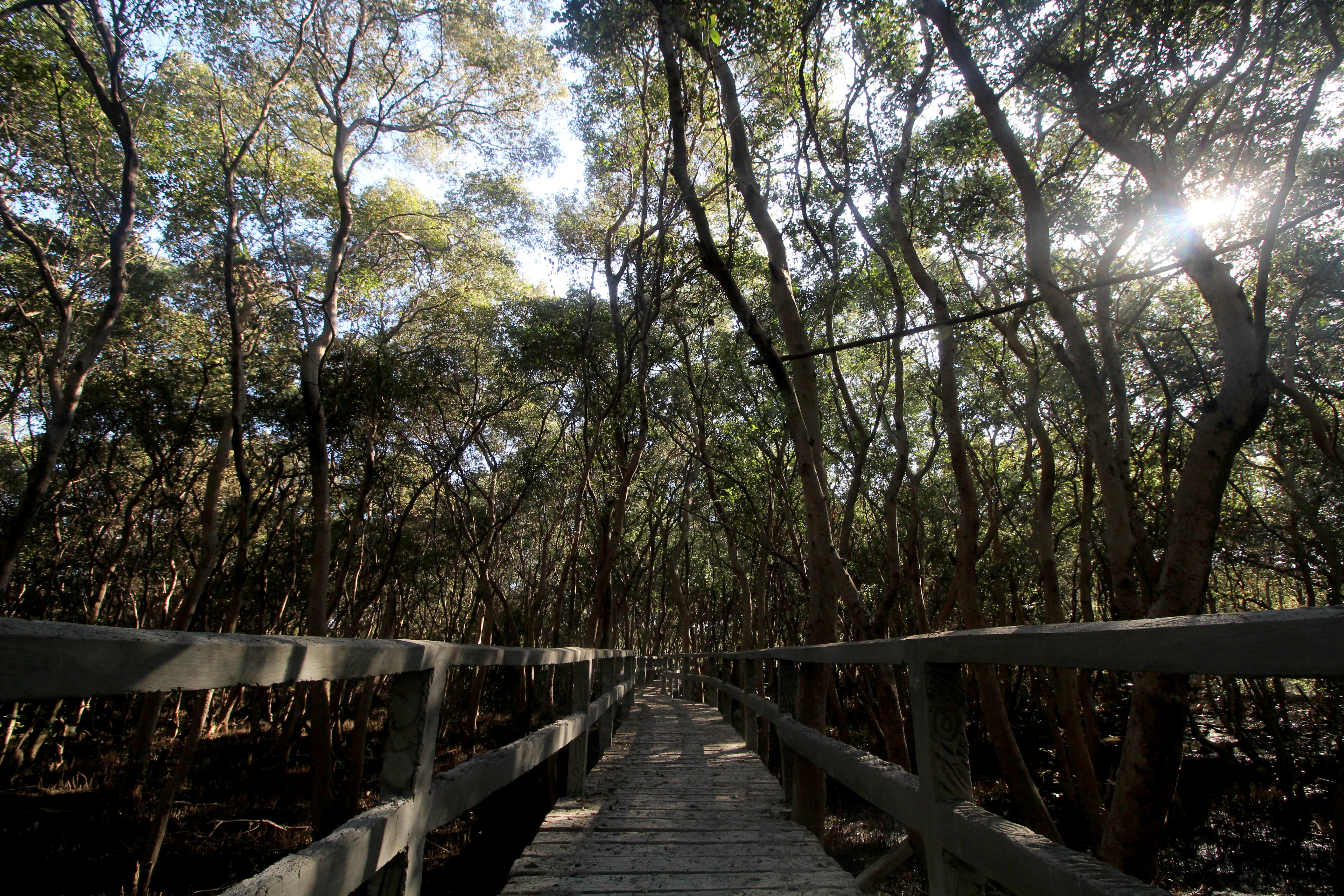
A raised wooden boardwalk path leading into a dense thicket of mangrove trees with sunlight filtering through the canopy.
A wooden boardwalk winding through the dense mangrove forest of Las Piñas, Parañaque Wetland Park.

Las Piñas, Parañaque Wetland Park history and protected-area timeline

The Las Piñas–Parañaque Wetland Park has a history that begins with major coastal infrastructure projects in the 1970s and 1980s. In November 1973, the Construction Development Corporation of the Philippines secured a contract for the Manila–Cavite Coastal Road and Reclamation Project, intended to extend Roxas Boulevard southward toward Cavite province. The construction of the 6.6-kilometer coastal road, completed in September 1985, involved significant land reclamation, during which the islands that today form the core of the protected area gradually took shape.

Although the islands emerged as a byproduct of road construction, their biological value eventually attracted conservation attention. On April 22, 2007, the Philippine government proclaimed the area as a Critical Habitat through Presidential Proclamation No. 1412, covering approximately 175 hectares of mangroves, beach forest, lagoons, and mudflats. This designation represented a pivot in how the islands were perceived, from disputed reclaimed land to formally recognized wildlife habitat.

The site's international profile grew in 2013, when it was listed as a Ramsar wetland of international importance under UNESCO's Ramsar Convention, with reference number 2124. Five years later, on June 22, 2018, the enactment of the Expanded National Integrated Protected Areas System Act (Republic Act No. 11038) legislated the area as a National Protected Area, expanding the formal footprint to roughly 181 hectares.

More recent history has been shaped by ongoing tensions between conservation and urban development. In 2019, the announcement of multiple Manila Bay reclamation projects raised concerns about the park's future. In February 2024, the Wetland Center Museum was inaugurated at the site to commemorate World Wetlands Day. By September 2025, legislative proposals to establish a buffer zone around the park were vetoed by the President, citing impacts on existing reclamation projects and concerns about bird strike risks near the Ninoy Aquino International Airport. Throughout these developments, the park has remained a focal point for debates about protecting functioning natural habitats within Metro Manila.

Las Piñas, Parañaque Wetland Park landscape and geographic character

The park's landscape is defined by its coastal position along Manila Bay and its composition of two main reclaimed barrier islands, Freedom Island and Long Island. Freedom Island lies in the northern portion of the protected area within Parañaque, while Long Island and a smaller neighboring island lie to the south within Las Piñas. A narrow landfill bridges the southern tip of Freedom Island to the mainland and to Long Island, threading the sites together across what is otherwise an artificial coastal corridor.

The islands are low-lying, with elevations ranging only between zero and seven meters above sea level. Freedom Island, the larger of the two principal islands and roughly 74 acres in extent, sits as a barrier island across from the Manila–Cavite Expressway, separated visually from the road by the waters of Manila Bay. Its substrate consists primarily of loam and dredged material pulled from the bay and adjacent lands during earlier reclamation projects.

The dominant landscape features are tidal and biological rather than topographic: extensive mangrove stands, shallow tidal mudflats, brackish lagoons, salt marshes, and patches of beach forest shape both the scenery and the ecological function of the site. Together these features create a soft, water-led landscape that contrasts sharply with the hardened edges of expressways, reclaimed waterfront districts, and residential developments that line the park's boundaries.
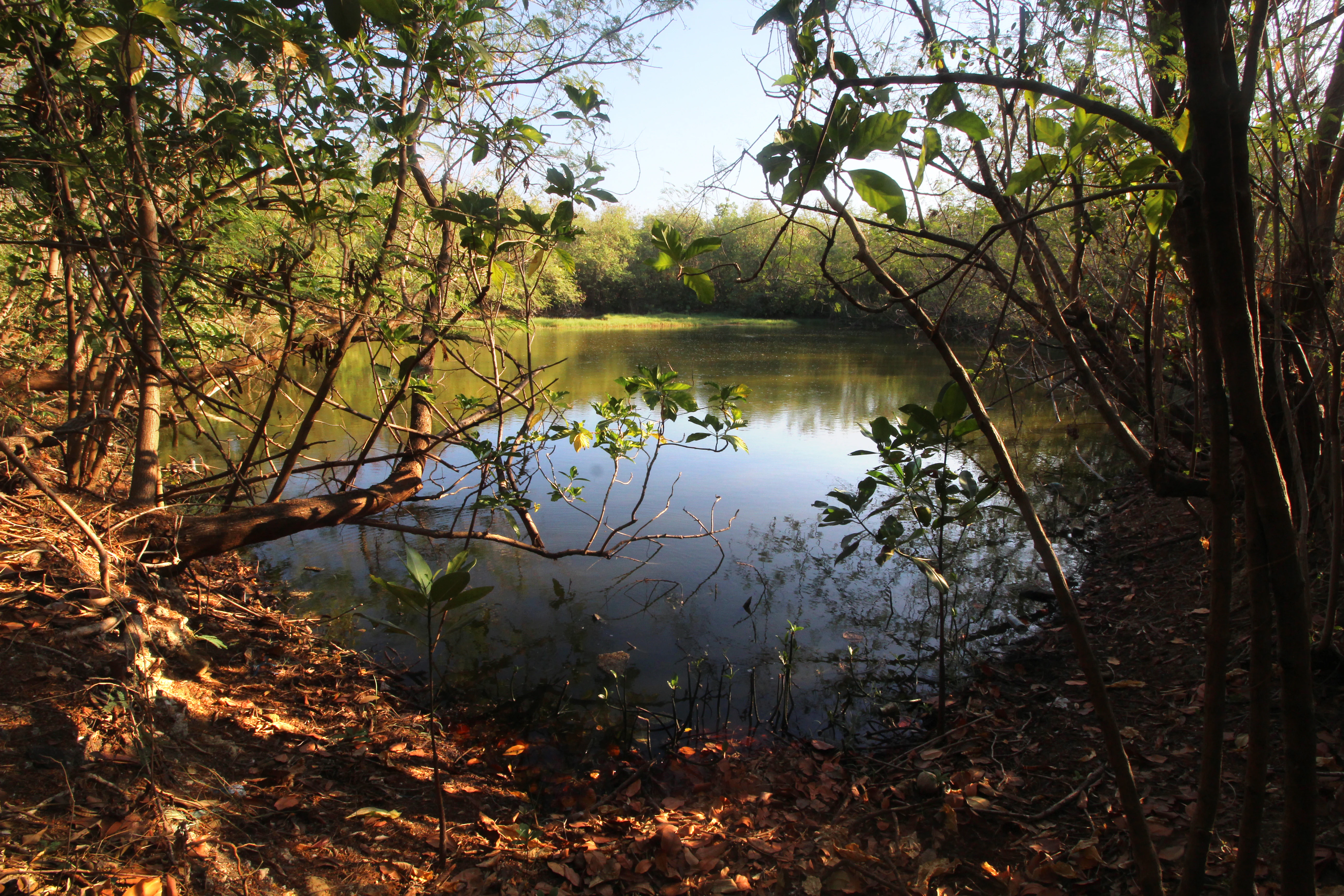
A calm, still pond surrounded by dense mangrove trees and sunlit foliage, viewed from a shaded bank with fallen branches.
A tranquil pond nestled within the mangrove forests of the Las Piñas, Parañaque Wetland Park.

Las Piñas, Parañaque Wetland Park ecosystems, habitats, and plant life

Ecologically, the park represents a compressed mosaic of coastal wetland habitats unusually concentrated within a metropolitan setting. Its roughly 30 hectares of mangrove forest, about 114 hectares of tidal mudflats, and additional zones of salt marsh and brackish lagoon together create layered habitat zones ranging from fully submerged tidal flats through mangrove-intermediate wetlands to slightly higher beach forest patches.

The mangroves are central to the park's ecological identity. The site hosts around 11 mangrove species, including Bungalon, Bakauan Babae, Bakauan Bato, Pototan, Kolasi, Pagatpat, Banalo, Tabigi, Saging-saging, Buta-buta, and Nilad, with Nilad introduced by the Department of Environment and Natural Resources through its National Capital Region office. These mangrove communities stabilize coastal sediments, shelter juvenile fish, and provide roosting and feeding habitat for waterbirds.

Beyond mangroves, the high saline content of soils in certain zones restricts plant growth to a small set of salt-tolerant herbs, grasses, and shrubs. This specialization is typical of functioning salt marsh ecosystems, and it reinforces the park's role as a refuge for species adapted to brackish, salty, and regularly inundated conditions. Across all habitat types, the park's natural character is shaped by tides, which alternately expose and conceal mudflats and invertebrate communities capable of sustaining rich feeding activity for birds and aquatic species.
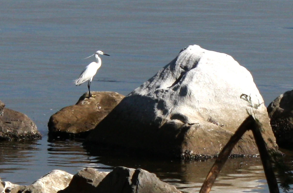
A white egret standing on a dark rock surrounded by water, with a larger, pale, mossy boulder next to it.
A white egret perched on a rock along the waters of the Las Piñas, Parañaque Wetland Park.

Las Piñas, Parañaque Wetland Park wildlife and species highlights

Wildlife activity at the park is closely tied to migratory bird movement along the East Asian–Australasian Flyway. The site has been recorded as hosting at least 41 migratory bird species, with visitors arriving from breeding grounds as far north as China, Japan, and Siberia. During the August-to-April migration season, daily counts can reach around 5,000 individual birds, a striking figure for a small urban-adjacent wetland.

Among the migratory and resident waterbirds regularly observed at the site are species such as the Little Egret, the Black-crowned Night Heron, and the Common Moorhen. These species rely on the park's mix of mangroves, mudflats, and lagoons for feeding, roosting, and shelter. During low tides, exposed mudflats reveal small invertebrates and macrobenthic organisms that form the base of the food web for birds and other small fauna.

The park also carries notable resident wildlife value. It is recognized as the only known breeding ground for the endemic Philippine duck within Metro Manila, giving the site a distinctive role in the conservation of a species found nowhere else in the world. In addition to birdlife, the surrounding waters function as a spawning ground, nursery, and sanctuary for various fish species, linking the wetland's ecological functions beyond avifauna into broader coastal food webs.

Las Piñas, Parañaque Wetland Park conservation status and protection priorities

The park holds unusually layered conservation recognition for a site of its size. Nationally, it began with a Critical Habitat proclamation in 2007 through Presidential Proclamation No. 1412, before being legislated as a National Protected Area in 2018 under the Expanded National Integrated Protected Areas System Act. Internationally, it has been recognized as a Ramsar wetland of international importance since 2013, placing it within a global network of wetlands valued for their ecological function.

Its conservation value stems from its role as a functioning coastal wetland embedded within one of Southeast Asia's most densely populated metropolitan regions. The combination of mangrove forest, tidal mudflats, salt marshes, and lagoons provides habitat for migratory birds, resident waterbirds, endemic fish, and the endemic Philippine duck. These habitat functions would be extremely difficult to replicate elsewhere in Metro Manila, making the park's preservation a singular conservation priority.

At the same time, the park's conservation context is shaped by significant pressure. Surrounding urban development, ongoing reclamation activity in Manila Bay, and proposed buffer zone expansions that could either protect or, depending on outcome, compromise the site have made the park a focal point for debates about balancing ecological preservation with infrastructure and real estate interests. Conservation management is administered through the Department of Environment and Natural Resources, with the park serving as both a protected natural system and a touchstone issue for urban wetland conservation in the Philippines.

Las Piñas, Parañaque Wetland Park cultural meaning and human context

The park carries a distinctive cultural dimension as a natural refuge within the urban fabric of Metro Manila. For residents of Las Piñas and Parañaque, the wetland offers an accessible encounter with coastal ecosystems, migratory birds, and mangrove landscapes that would otherwise require travel far from the capital region. The opening of the Wetland Center Museum at the site in February 2024, timed to World Wetlands Day, reflects efforts to build local public engagement and to embed the park into regional cultural and educational life.

While the site itself is not associated with longstanding indigenous cultural traditions, its identity is increasingly tied to community-led and government-supported eco-tourism initiatives that position the wetland as a shared natural and educational space. The ongoing local discourse about reclamation, buffer zones, and the park's future has also made the site a cultural reference point in conversations about urban environmental justice, the value of green spaces in megacities, and the relationship between Manila Bay communities and the bay's natural systems.

Top sights and standout views in Las Piñas, Parañaque Wetland Park

The park's strongest points of distinction are its combination of mangrove, mudflat, and salt marsh habitats within a heavily urbanized setting, and its standing as one of Metro Manila's last functional coastal wetlands. The site's role as a stopover on the East Asian–Australasian Flyway, hosting dozens of migratory bird species and thousands of individual birds seasonally, elevates it from a local park to a wetland of international migratory importance.

Equally distinctive is the park's status as the only known breeding ground for the endemic Philippine duck within Metro Manila, and its recognition as a Ramsar site under UNESCO's Ramsar Convention. Together, these features make the park a rare convergence of national and international conservation significance anchored in a single, accessible metropolitan location.

Best time to visit Las Piñas, Parañaque Wetland Park

The most ecologically active period for visiting the park coincides with the migratory bird season, which broadly runs from August through April. During these months, migratory species from the East Asian–Australasian Flyway are present in substantial numbers, and daily bird activity can peak around 5,000 individuals, making this window ideal for visitors interested in bird observation and wetland wildlife.

Outside migration season, the park's mangroves, mudflats, and lagoons remain accessible and continue to support resident wildlife such as waterbirds and the endemic Philippine duck. Tide cycles meaningfully shape the visitor experience, as low tides expose mudflats and invertebrate life, increasing feeding activity and visibility of shorebirds. Cooler, drier months within the broader August-to-April window generally offer more comfortable conditions for outdoor wildlife observation than the peak of the rainy season.

Monthly climate preview

Long-term representative monthly temperature and precipitation data patterns

Las Piñas–Parañaque Wetland Park Climate Normals and Annual Weather Rhythm

Representative coordinate measurements reveal the annual temperature range and monthly precipitation rhythm recorded across Las Piñas–Parañaque Wetland Park between 1991 and 2020. Reviewing the complete twelve-month climatology profile provides deeper context for examining long-term thermal variations and rainfall cycles at this protected location.
Annual mean26 °C
23 °C28 °C
Jan23°
Feb24°
Mar25°
Apr27°
May28°
Jun27°
Jul26°
Aug26°
Sep26°
Oct26°
Nov25°
Dec24°
Warmest month
May

27.8 °C

Coolest month
January

23.5 °C

Wettest month
December

12.4 mm/day

Driest month
April

3.3 mm/day

Park location guide

Geography guide, regional context, and park location map for Las Piñas, Parañaque Wetland Park

Las Piñas, Parañaque Wetland Park park geography, regions, and map view in Philippines

Understand where Las Piñas, Parañaque Wetland Park sits in Philippines through a broader geographic reading of the surrounding landscape, nearby location context, and its mapped position within the national park landscape.

How Las Piñas, Parañaque Wetland Park fits into Philippines

The Philippines, officially the Republic of the Philippines, is an archipelagic nation in Southeast Asia comprising approximately 7,641 islands categorized into three main geographical divisions: Luzon, Visayas, and Mindanao. Located in the western Pacific Ocean, it shares maritime borders with Taiwan, Japan, Palau, Indonesia, Malaysia, Vietnam, and China. Manila serves as the capital city, while Quezon City is the most populated city, both within Metro Manila.

Wider geography shaping Las Piñas, Parañaque Wetland Park in Philippines

The Philippines is an archipelagic nation in Southeast Asia, positioned in the western Pacific Ocean. Its islands are bounded by the South China Sea to the west, Philippine Sea to the east, and Celebes Sea to the south. The country shares maritime borders with Taiwan to the north, Japan to the northeast, Palau to the east and southeast, Indonesia to the south, Malaysia to the southwest, Vietnam to the west, and China to the northwest.

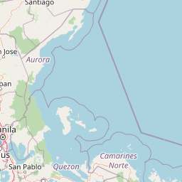
Map view of Las Piñas, Parañaque Wetland Park

Use this park location map to pinpoint Las Piñas, Parañaque Wetland Park in Philippines, understand its exact geographic position, and read its mapped placement within the surrounding landscape more clearly.

Pigeon | © OpenStreetMap contributors

Location context for Las Piñas, Parañaque Wetland Park

Metro Manila

Explore coastal scenery, tidal mudflats, and mangrove habitats across the protected urban sanctuary.

Las Piñas–Parañaque Wetland Park Photos and Visual Landscape Guide

Visual documentation reveals the intricate mosaic of tidal mudflats, salt marshes, and dense mangrove forests defining the coastal protected area. Photographic records illustrate the stark contrast between the functioning wetland sanctuary and the surrounding metropolitan landscape of Manila Bay.

A raised wooden boardwalk path leading into a dense thicket of mangrove trees with sunlight filtering through the canopy.

An aerial shot showing the green mangroves and dark water of the wetland park, bordered by urban development and a highway.

A calm, still pond surrounded by dense mangrove trees and sunlit foliage, viewed from a shaded bank with fallen branches.

A white egret standing on a dark rock surrounded by water, with a larger, pale, mossy boulder next to it.

Park atlas

Compare adjacent coastal ecosystems, mangrove reserves, and wetland habitats across the region

Parks Near Las Piñas–Parañaque Wetland Park and Regional Protected Areas

Browsing other parks near Las Piñas–Parañaque Wetland Park reveals broader regional conservation networks and coastal habitats. Evaluating adjacent protected areas provides valuable geographic context for urban wetland preservation and regional biodiversity spread.
A horizontal watercolor illustration of a soft, hazy landscape featuring rolling green hills, dense tree clusters, and gentle valleys.
Nature reserveMetro Manila
About 31 km away#1 closest

Northeast

La Mesa Watershed Reservation: Mapping the Urban Rainforest and Water Catchment

A critical nature reserve within the Metro Manila region.

La Mesa Watershed Reservation is the last major lowland forest block within Metro Manila, functioning as a vital nature reserve and drinking water catchment for the metropolitan area. The area features a complex mosaic of closed-canopy rainforest, reservoir wetlands, and swampforest, providing a distinct geographic counterpoint to the surrounding urban density. It remains a key case study in urban conservation and hydrological management for the Philippine capital.

Area
26.59 km²
Established
2007
Visitors
300K annual
Relief
Upland
Protected landscapeRizal
About 32 km away#2 closest

Northeast

Upper Marikina River Basin Protected Landscape: Watershed Geography and Sierra Madre Mapping

A critical forest reserve and hydrological basin in Rizal

Covering the upper reaches of the Marikina River, this protected landscape forms a massive forested block within the southern Sierra Madre. The area serves as a primary catchment system, defined by its rugged mountain ridges, descending river corridors, and long-standing role in regional water management. Mapping these protected lands reveals the essential link between mountain ecosystems and downstream hydrological stability.

Area
261.256 km²
Established
1904
IUCN
V
Relief
Mountain
National parkBataan
About 45 km away#3 closest

Northwest

Bataan National Park: Philippines Protected Landscape and National Park Geography

Mapped boundaries and regional natural landscape context.

This detail entry for Bataan National Park provides essential context for understanding its role as a protected landscape within the Philippines. Users can explore the park's mapped boundaries, its geographic setting in the Bataan region, and its identity as a national park. The focus is on atlas-style discovery, allowing for a deeper appreciation of the park's natural terrain and its place within the country's protected area network.

Area
236.88 km²
Established
1945
IUCN
II
Relief
Mountain
Watercolor painting of a rolling tropical mountain range with palm trees in the foreground, rendered in soft green, pink, and neutral tones.
Nature reserveCalabarzon
About 46 km away#4 closest

Southeast

Mount Makiling Nature Reserve: Volcanic Geography and Forest Landscapes in Calabarzon

A historic forest reserve and prominent volcanic landmark on Luzon

Mount Makiling represents a layered conservation landscape, functioning as both an active site for forest research and a significant volcanic massif within the Calabarzon region. The area features a complex of subsidiary cones, mud springs, and essential watersheds that define its ecological and cultural identity. Gain a deeper understanding of its geographic boundaries and its importance as a pioneering protected area in Philippine conservation history.

Established
1910
Relief
Mountain
Climate
Tropical
Access
Easy access
Protected landscapeCalabarzon
About 54 km away#5 closest

South

Taal Volcano Protected Landscape: Geographic Profile and Protected Area Map

Volcanic caldera and nested lake system in Calabarzon

Explore the layered topography of the Taal Volcano Protected Landscape. This protected area showcases a rare nested volcanic island within a freshwater lake, offering significant insights into the geological and aquatic geography of the Calabarzon region of the Philippines.

Area
622.92 km²
Established
1996
Water
Major water bodies
National parkLaguna
About 58 km away#6 closest

Southeast

Pagsanjan Gorge National Park: Philippines National Park & Protected Area Mapping

Explore the geographic context and mapped terrain.

Pagsanjan Gorge National Park represents a key protected natural area within the Laguna region, offering insights into Philippine national park geography. This entry focuses on understanding its mapped boundaries and the surrounding landscape context, providing a foundational element for anyone exploring protected lands through maps and regional atlases. It serves as a gateway to comprehending the park's specific geographic identity and its place within the natural environment of the Philippines.

Area
1.526 km²
Established
1939
IUCN
II
Relief
Upland
A soft, artistic watercolor painting depicting a winding river flowing through a lush green valley with distant mountain ranges.
Nature reserveBulacan
About 58 km away#7 closest

Northeast

Angat Watershed Forest Reserve: Mountain Watershed Geography and Protected Forest Terrain

A critical nature reserve in the Sierra Madre of Bulacan

This protected area anchors the water supply for Metro Manila while preserving extensive submontane forests and mountain ridges in Central Luzon. The landscape features deep river valleys, hydroelectric reservoirs, and peaks like Mount Oriod that define the local geography of this important conservation zone.

Area
623.09 km²
Established
1927
IUCN
VI
Relief
Mountain
National parkBulacan
About 69 km away#8 closest

North

Biak-na-Bato National Park: National Park Atlas and Geographic Context in Bulacan

Explore protected landscapes and mapped terrain.

Biak-na-Bato National Park is a key protected area in Bulacan, Philippines, identified for its national park designation. This entry provides specific details on its geographic positioning and mapped features, essential for atlas-based research and understanding the distribution of protected lands within the region. Dive into the landscape context and mapped boundaries that define this significant natural entity.

Area
21.17 km²
Established
1937
IUCN
V
Relief
Mountain

Common questions about visiting, size, designation, and location context for Las Piñas, Parañaque Wetland Park

Las Piñas, Parañaque Wetland Park FAQs for park facts, access, geography, and protected area context

Find quick answers about Las Piñas, Parañaque Wetland Park, including protected-area facts, park geography, trail and visitor context, and how the park fits into its surrounding country and regional landscape.
MoriAtlas Explorer

Continue Your Protected Areas Search Across the Global Atlas

Deepen your exploration by continuing the structured search for national parks and protected areas worldwide. Utilize the comprehensive filtering capabilities to compare different conservation landscapes and refine your understanding of global park geography. Discover more about the distribution and characteristics of protected natural areas.

Global natural geography