Mori Atlas logo
National parkBiak-na-Bato National Park

Trace the mapped boundaries and geographic context of this national park in Bulacan.

Biak-na-Bato National Park: A Protected Landscape in Bulacan, Philippines

Biak-na-Bato National Park stands as a significant protected natural area within the Bulacan region of the Philippines. This page offers an in-depth atlas perspective, detailing the park's geographic setting and its identity as a designated national park. Users can explore the mapped distribution of its protected lands and understand its place within the regional geography, providing a foundation for landscape-level discovery.

Cave systemsHistorical sitesSierra Madre mountainsProtected landscapeRevolutionary heritageRiver gorges

Biak-na-Bato National Park

National park

Park overview

Structured park overview, official facts, and landscape profile for Biak-na-Bato National Park

Biak-na-Bato National Park park facts, protected area profile, and essential visitor context
Review the core facts for Biak-na-Bato National Park, including designation, size, terrain, visitor scale, habitats, and operating context in one park-focused overview.

About Biak-na-Bato National Park

Biak-na-Bato National Park occupies a special place in the Philippines' system of protected areas, combining ecological significance with deep historical resonance. Located in the province of Bulacan, within the Sierra Madre mountain range, the park centers on a spectacular mountain gorge sliced by the Balaong River. The landscape is characterized by steep terrain, dense vegetation, and an extensive network of caves that have been formed over geological timescales. The park's establishment in 1937 by President Manuel L. Quezon recognized both the natural value of the area and its historical association with the Republic of Biak-na-Bato, a revolutionary government established in 1897. Today, the park extends beyond its original boundaries to include portions of San Ildefonso and Doña Remedios Trinidad municipalities, providing a broader protected landscape that encompasses multiple ecological habitats and historical sites. The proximity to Manila, approximately 80 kilometers away, has made the park increasingly popular as a weekend eco-adventure destination for urban dwellers seeking to explore both natural and cultural heritage within a manageable distance from the city.

Quick facts and research context for Biak-na-Bato National Park

Biak-na-Bato National Park covers 2,117 hectares within the Sierra Madre mountain range in Bulacan province, making it one of the oldest protected areas in the Philippines. The park is characterized by its rugged terrain, deep gorges, and extensive cave network, with the Balaong River cutting through the landscape. It was established in 1937 and is managed by the Department of Environment and Natural Resources. The park's historical significance stems from its role in the Philippine Revolutionary period, particularly as the seat of the Republic of Biak-na-Bato under Emilio Aguinaldo. The area contains over a hundred documented caves featuring crystalline mineral formations, with Aguinaldo Cave and Bahay Paniki (Bat Cave) among the most notable.

Park context

Deeper park guide and search-rich context for Biak-na-Bato National Park

Biak-na-Bato National Park history, landscape, wildlife, and travel context
Explore Biak-na-Bato National Park through its history, landscape character, ecosystems, wildlife, conservation priorities, cultural context, and seasonal travel timing in a structured park guide built for atlas discovery and search intent.

Why Biak-na-Bato National Park stands out

Biak-na-Bato National Park is best known for its extensive cave system and its dual identity as both a natural wonder and a site of Philippine revolutionary history. The park contains over a hundred caves, including the historically significant Aguinaldo Cave which served as the headquarters for Emilio Aguinaldo during the revolutionary period. The Bahay Paniki, or Bat Cave, houses large bat colonies and is a distinctive feature of the park's ecology. The dramatic mountain gorge carved by the Balaong River creates a scenic backdrop for the cave explorations and river activities. Mount Susong Dalaga and Tilandong Falls add to the park's natural attractions, while the ruins of stone fortifications and historical observation posts provide a tangible link to the 19th-century revolutionary republic.

Biak-na-Bato National Park history and protected-area timeline

Biak-na-Bato National Park carries a significant historical legacy that predates its formal protection as a national park. The area served as the headquarters and capital of the Republic of Biak-na-Bato, a revolutionary government established in 1897 during the Philippine struggle for independence from Spanish colonial rule. Under the leadership of Emilio Aguinaldo, the republic maintained its seat in what is now the park's territory, with Aguinaldo Cave serving as the revolutionary leader's headquarters. The site witnessed the signing of the Truce of Biak-na-Bato, an agreement between Spanish authorities and Filipino revolutionaries that temporarily halted hostilities. Following the establishment of the Commonwealth of the Philippines, President Manuel L. Quezon declared the area a national park on November 16, 1937, recognizing both its natural features and its historical importance. In recent decades, the park has faced challenges from illegal logging and mining operations that have contributed to environmental degradation and flash flood incidents. The area has also been the subject of legislative efforts to protect its original boundaries and preserve its historical and ecological integrity for future generations.

Biak-na-Bato National Park landscape and geographic character

The physical landscape of Biak-na-Bato National Park is defined by its dramatic mountain terrain within the Sierra Madre, the longest mountain range in the Philippines. The Balaong River has carved a deep gorge through the park, creating a rugged and scenic environment characterized by steep cliffs, rock formations, and dense vegetation cover. The park's terrain includes numerous hills and valleys that contribute to its topographic diversity. A defining feature of the landscape is the extensive cave network, with over a hundred caves of varying sizes distributed across the area. These caves feature crystalline mineral formations that have developed over geological time, creating unique underground environments. The surface landscape supports a variety of vegetation types typical of tropical forest ecosystems, with the area's elevation and moisture patterns supporting diverse plant communities. Notable surface features include Mount Susong Dalaga, a prominent peak within the park, and Tilandong Falls, which adds a waterfall element to the park's landscape diversity.

Biak-na-Bato National Park ecosystems, habitats, and plant life

The natural environment of Biak-na-Bato National Park supports a range of habitats characteristic of the Sierra Madre mountain ecosystem. The vegetation includes diverse plant communities such as orchids, various tree species, shrubs, ferns, and the locally referred to bokawe or buho. The forest cover provides habitat for various wildlife species, though the park is perhaps more notable for its geological and cave-based ecosystems. The cave systems within the park create unique underground habitats that support specialized organisms, including significant bat colonies in the Bahay Paniki or Bat Cave. The river systems, particularly the Balaong River, provide aquatic habitats and contribute to the overall ecological diversity of the park. The combination of forest, cave, and riverine environments creates a multifaceted natural setting that supports biodiversity while also serving as a protected area for the preservation of these ecosystems.

Biak-na-Bato National Park wildlife and species highlights

The wildlife in Biak-na-Bato National Park reflects the ecological diversity of the Sierra Madre region in central Luzon. The park's forest areas provide habitat for various bird species and small mammals typical of tropical forest environments in the Philippines. The cave systems, particularly the Bahay Paniki or Bat Cave, support significant bat populations that form a notable component of the park's wildlife. These bats play important ecological roles in pollination and seed dispersal, contributing to the broader ecosystem health of the surrounding landscape. The river systems support aquatic species and provide feeding and breeding habitat for various freshwater organisms. While the park is not specifically known for large populations of flagship species, the overall biodiversity of the area, combined with its protected status, helps preserve the wildlife communities that inhabit this section of the Sierra Madre mountain range.

Biak-na-Bato National Park conservation status and protection priorities

Biak-na-Bato National Park is designated as an IUCN Category V protected area, reflecting its status as a protected landscape that maintains cultural and natural values while allowing for sustainable human use. The park's conservation significance stems from its role in preserving a representative sample of Sierra Madre mountain ecosystem biodiversity, its geological features including the extensive cave system, and its cultural heritage sites. The park has faced conservation challenges from illegal logging and mining operations that have caused environmental degradation and contributed to flash flood risks in the area. Conservation efforts have included legislative initiatives to halt mining operations and protect the park's original boundaries, as well as ongoing management by the Department of Environment and Natural Resources. The historical dimension of the park adds a layer of cultural conservation, as the site contains remnants of fortifications and observation posts from the revolutionary period that require preservation alongside the natural environment.

Biak-na-Bato National Park cultural meaning and human context

Biak-na-Bato National Park holds profound cultural significance as the site of the Republic of Biak-na-Bato, a pivotal chapter in Philippine revolutionary history. The area was chosen by Emilio Aguinaldo as the seat of his revolutionary government in 1897, establishing what became the first Philippine republic with a written constitution and a structured government. The caves, particularly Aguinaldo Cave, served as administrative and strategic headquarters for the revolutionary forces. Trinidad Tecson, known as the Mother of Biak na Bato, was born in this area, adding to its historical importance. The park contains observable remnants of the revolutionary period, including stone fortifications and observation posts that provide tangible evidence of the area's historical role. The cultural context extends beyond the revolutionary era to include ongoing indigenous relationships with the landscape and traditional uses of natural resources by local communities who have inhabited this region for generations.

Top sights and standout views in Biak-na-Bato National Park

The highlights of Biak-na-Bato National Park center on its unique combination of natural wonders and historical significance. The Aguinaldo Cave stands as the park's most historically significant feature, serving as the headquarters for Emilio Aguinaldo during the revolutionary period and offering visitors a tangible connection to 19th-century Philippine history. The Bahay Paniki or Bat Cave provides an opportunity to observe large bat colonies in their natural habitat. The park's over one hundred caves offer exploration opportunities for visitors interested in geological formations and speleology. The Balaong River Gorge provides scenic beauty and opportunities for river-based activities. Mount Susong Dalaga and Tilandong Falls add surface-level attractions that complement the underground cave explorations. The historical ruins of stone fortifications and observation posts offer additional exploration opportunities for visitors interested in the revolutionary era.

Best time to visit Biak-na-Bato National Park

The best time to visit Biak-na-Bato National Park depends on balancing weather conditions with the nature of activities planned. The dry season, typically from November to May, generally offers more favorable conditions for cave exploration and outdoor activities, with reduced risk of flash floods that have historically occurred during periods of heavy rainfall. The rainy season brings lush vegetation and fuller waterfalls but carries risks associated with sudden weather changes and flooding, particularly in the river gorge and cave areas. Given the park's proximity to Manila, it serves primarily as a weekend destination, with Saturday and Sunday visits being most common. Visitors should check current conditions and avoid the area during or immediately after heavy rainfall due to the flash flood risks that have tragically affected previous visitors.

Park location guide

Geography guide, regional context, and park location map for Biak-na-Bato National Park

Biak-na-Bato National Park park geography, regions, and map view in Philippines
Understand where Biak-na-Bato National Park sits in Philippines through a broader geographic reading of the surrounding landscape, nearby location context, and its mapped position within the national park landscape.

How Biak-na-Bato National Park fits into Philippines

The Philippines, officially the Republic of the Philippines, is an archipelagic nation in Southeast Asia comprising approximately 7,641 islands categorized into three main geographical divisions: Luzon, Visayas, and Mindanao. Located in the western Pacific Ocean, it shares maritime borders with Taiwan, Japan, Palau, Indonesia, Malaysia, Vietnam, and China. Manila serves as the capital city, while Quezon City is the most populated city, both within Metro Manila.

Wider geography shaping Biak-na-Bato National Park in Philippines

The Philippines is an archipelagic nation in Southeast Asia, positioned in the western Pacific Ocean. Its islands are bounded by the South China Sea to the west, Philippine Sea to the east, and Celebes Sea to the south. The country shares maritime borders with Taiwan to the north, Japan to the northeast, Palau to the east and southeast, Indonesia to the south, Malaysia to the southwest, Vietnam to the west, and China to the northwest.

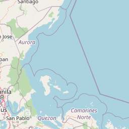
Map view of Biak-na-Bato National Park

Use this park location map to pinpoint Biak-na-Bato National Park in Philippines, understand its exact geographic position, and read its mapped placement within the surrounding landscape more clearly.

Pigeon | © OpenStreetMap contributors

Location context for Biak-na-Bato National Park

Bulacan
Park atlas

Explore regional protected landscapes, tracing connections to Biak-na-Bato National Park's unique history and cave systems.

Explore More Protected Areas and National Parks Near Biak-na-Bato National Park
After exploring Biak-na-Bato National Park's cave systems and historical significance, continue your geographic discovery by browsing other national parks and protected areas across the Philippines. Compare diverse landscapes, historical sites, and conservation efforts to gain a broader regional understanding of protected lands.
Illustration of a river with bamboo boats, people rowing, limestone cliffs, and trees
National parkNueva Ecija

Minalungao National Park: Protected Landscape and Geographic Context in Nueva Ecija

Explore the mapped boundaries of this Philippines national park.

Delve into the specifics of Minalungao National Park, a protected natural area identified as a national park in the Philippines. This exploration focuses on its distinct geographic identity within Nueva Ecija, highlighting the importance of its mapped boundaries and regional landscape. Understand the park's role as a protected land entity for atlas-based discovery.

Area
20.18 km²
Established
1967
IUCN
V
Relief
Upland
National parkPhilippines

Aurora Memorial National Park: A Protected Landscape in the Philippines' Sierra Madre

Explore mapped boundaries and endemic avian habitat.

Aurora Memorial National Park represents a critical conservation area situated within the Philippines' Sierra Madre mountain range. Spanning a significant stretch along the eastern mountain slopes, this national park is characterized by its lowland dipterocarp forest ecosystem, recognized for supporting diverse flora and fauna. It is particularly noted as an Important Bird Area, crucial for endemic species like the Philippine eagle and various other avian populations, highlighting its ecological significance within the archipelago's geography.

Area
56.76 km²
Established
1937
IUCN
V
Relief
Mountain
National parkZambales

Olongapo Naval Base Perimeter National Park: Philippines National Park & Protected Landscape in Zambales

Coastal terrain and historical military land context.

Discover Olongapo Naval Base Perimeter National Park, a protected landscape within Zambales province, Philippines. Established adjacent to the former U.S. Naval Base Subic Bay perimeter, this small national park preserves a unique coastal fringe. Its mapped boundaries offer insights into a transitional zone, serving as a green corridor and protecting a fragment of the region's natural habitat. Explore the distinct geographical and historical significance of this protected area.

Area
0.09 km²
Established
1968
IUCN
V
Scope
Terrestrial
National parkLaguna

Pagsanjan Gorge National Park: Philippines National Park & Protected Area Mapping

Explore the geographic context and mapped terrain.

Pagsanjan Gorge National Park represents a key protected natural area within the Laguna region, offering insights into Philippine national park geography. This entry focuses on understanding its mapped boundaries and the surrounding landscape context, providing a foundational element for anyone exploring protected lands through maps and regional atlases. It serves as a gateway to comprehending the park's specific geographic identity and its place within the natural environment of the Philippines.

Area
1.526 km²
Established
1939
IUCN
II
Relief
Upland
National parkNueva Vizcaya

Bangan Hill National Park: A Protected Landscape within Nueva Vizcaya's Geography

Explore its mapped terrain and cultural significance.

Bangan Hill National Park is a crucial protected area nestled in Nueva Vizcaya, Philippines. This page details its specific geography, including its role as a distinct hill within the broader Cagayan Valley landscape. Users can explore the park's mapped boundaries, understand its role as a national park, and discover the surrounding mountain context of the Caraballo and Cordillera Central ranges. It offers a unique perspective on the region's natural and historical significance, serving as a focal point for protected landscape exploration.

Area
0.139 km²
Established
1995
IUCN
II
Relief
Mixed relief
National parkPangasinan

Hundred Islands National Park: Detailed Map and Protected Landscape Context in Pangasinan

National Park in Pangasinan, Philippines

Explore Hundred Islands National Park, a protected natural landscape in Pangasinan, Philippines. This page provides detailed geographic context, highlighting the park's mapped boundaries and its status as a national park. Understand its placement within the regional geography and appreciate the structured discovery value for atlas-based exploration of this significant protected area.

Area
16.76 km²
Established
1940
IUCN
II
Relief
Mixed relief
National park

Fuyot Springs National Park: Philippines Protected Area with Springs, Caves & Waterfalls

Explore Sierra Madre mountain terrain and natural landscape features.

Fuyot Springs National Park offers a detailed look at a unique protected landscape within the Philippines' Sierra Madre mountain range. This atlas perspective focuses on the park's defining natural springs, its exploration-ready cave systems such as Main Cave and Altar Cave, and scenic features like Pinzal Falls. Understand the geographic context of this protected area and its mountainous terrain for landscape discovery.

Area
8.19 km²
Established
1938
IUCN
V
Relief
Mountain
National parkCordillera Administrative Region

Balbalasang, Balbalan National Park: Mapped Protected Area in Cordillera Administrative Region

Explore its national park geography and landscape context.

Balbalasang, Balbalan National Park offers a distinct protected landscape within the Philippines' Cordillera Administrative Region. This canonical detail page provides an atlas-driven perspective, focusing on the park's mapped boundaries and its regional geographic context. Users can delve into the specific terrain and natural features that define this national park, enhancing their understanding of its protected area status and its significance in landscape exploration.

Area
13.38 km²
Established
1972
IUCN
II
Relief
Mountain

Common questions about visiting, size, designation, and location context for Biak-na-Bato National Park

Biak-na-Bato National Park FAQs for park facts, access, geography, and protected area context
Find quick answers about Biak-na-Bato National Park, including protected-area facts, park geography, trail and visitor context, and how the park fits into its surrounding country and regional landscape.
MoriAtlas Explorer

Continue Your Protected Areas Search Across the Global Atlas

Deepen your exploration by continuing the structured search for national parks and protected areas worldwide. Utilize the comprehensive filtering capabilities to compare different conservation landscapes and refine your understanding of global park geography. Discover more about the distribution and characteristics of protected natural areas.

Global natural geography