
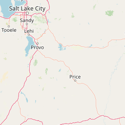
Streams
Park geography
Detailed analysis of terrain elevations, mountain features, and protected land coverage
Lone Peak Wilderness: Comprehensive Geographic Profile and Mapped Protected Area Boundaries
Examine the geographic characteristics and physical extent of the 121.76 square kilometer Lone Peak Wilderness in Utah. This profile details the alpine landscape, including the Wasatch Range, high-altitude peaks, and various stream networks, providing a precise spatial context for the protected area.
Related tags
wilderness areaalpine terrainWasatch Rangemountain wildernessglacial cirques
A high alpine wilderness in the central Wasatch Range, overlooking the Salt Lake Valley.
Lone Peak Wilderness
Lone Peak Wilderness is a roughly 30,000-acre federally designated wilderness area in the central Wasatch Range of northern Utah, lying within the Uinta and Wasatch-Cache National Forests. It sits along the Wasatch Front, with the Salt Lake and Utah Valleys to the west and the American Fork Twin Peaks to the east, and is bounded by Little Cottonwood Canyon to the north and American Fork Canyon to the south. The wilderness protects an alpine landscape of rugged peaks, glacially carved cirques and narrow canyons, with elevations ranging from canyon bottoms near 5,500 feet to summits above 11,000 feet. The area is most recognized for its high Wasatch scenery, including Lone Peak itself and the Pfeifferhorn, often called "Little Matterhorn Peak." It functions as both a wild backcountry landscape and a visual backdrop to one of Utah's fastest-growing urban corridors, offering a striking contrast between protected wilderness and the densely populated front-range communities. Establishment in 1978, as part of the Endangered American Wilderness Act, gave the area a strong conservation identity early in the modern Utah wilderness system. Within the broader context of American wilderness preservation, Lone Peak Wilderness holds a notable place as the only designated wilderness in Utah at the time of its creation, a status that would change only with the later Utah Wilderness Act of 1984.
- Location
- United States of America
- Park type
- Wildlife reserve
- Established
- 1978
- Area
- 121.8 km²
- Highest point
- 3,452 m
Location overview
Recorded Country and Administrative Location Details
Geographic Overview of Lone Peak Wilderness and Regional Setting
Lone Peak Wilderness is situated within the United States of America and the state of Utah. Recorded location memberships define the administrative boundaries and high-level geographic status.
- Countries
- United States of America
- Regions
- Utah
- Primary location
- Utah
- Geographic setting
- Inland
Boundary and coordinates
Interactive spatial geometry and calculated regional measurements
Lone Peak Wilderness Boundary Map and Geographic Extent
Mapped boundary outlines provide spatial context for protected-area geography. Accompanying measurements supply area calculations, coordinate limits, and geographic spans for analytical reference.
- Boundary area
- 123.4 km²
- Boundary perimeter
- 65.1 km
- Northernmost point
- 40.5732° N
- Southernmost point
- 40.4344° N
- Easternmost point
- 111.6494° W
- Westernmost point
- 111.8012° W
- Geographic centre
- 40.5083° N, 111.722° W
- North–south span
- 15.4 km
- East–west span
- 12.9 km
Elevation and terrain
A 1,676-to-3,452-metre summary with twenty records within
Lone Peak Wilderness mountain terrain, elevation, and features
Lone Peak Wilderness has mountain relief with elevations from 1,676 to 3,452 metres and a 3,452-metre highest point. Twenty within-area cards cover streams, peaks, cliffs, a valley, and Horsetail Falls, with names and feature types preserved.
- Minimum elevation
- 1,676 m
- Maximum elevation
- 3,452 m
- Highest point
- 3,452 m
Selected named natural features
Peaks
The Pfeifferhorn
3,453 m
Streams
East Fort Creek
Streams
Maybird Gulch
Mountain ranges
Wasatch Range
Streams
Fortknocker
Environmental setting
Alpine climate zones, partial forest cover, and diverse mountain relief classifications
Environmental Classifications and Physical Settings of Lone Peak Wilderness
Recorded landscape features and habitat types serve as interpretive categories for reading physical terrain settings across Lone Peak Wilderness. Structured classifications link stored environmental properties to relevant protected area destinations within the atlas.
- Relief
- Mountain
- Climate
- Alpine
- Water
- Minor water
- Forest cover
- Partial forest
- Seasonality
- Seasonal
Landscape features
Mountains · Valleys · Cliffs · Canyon · Forest · Grassland · Lakes · Rivers · Glacier
Habitat types
Temperate coniferous forest · Alpine meadow · Grassland · Glacial habitat
Park atlas
Compare adjacent Wasatch Range wilderness areas and connected regional protected lands.
Explore Parks Near Lone Peak Wilderness and Surrounding Protected Mountain Landscapes
Browsing other parks near Lone Peak Wilderness reveals the wider ecological context of the central Wasatch Range and surrounding alpine terrain. Comparing these adjacent protected landscapes provides deeper insight into regional mountain geography and conservation corridors.
Wildlife reserveUtah
2.1 km away#1 closest
South

Mount Timpanogos Wilderness: Mapping the Protected Alpine Landscape and High Wasatch Terrain
An iconic Utah protected area within the northern Wasatch Range.
Mount Timpanogos Wilderness preserves a dramatic segment of the Wasatch Range, centering on an iconic summit that rises above glacial basins and forested slopes. This protected area offers a distinct study of alpine geology, featuring high-altitude cirques, steep ridges, and the prominent presence of Emerald Lake. As a critical piece of Utah wilderness, it anchors the skyline above the urban corridor, providing a concentrated look at regional mountain ecosystems and rugged natural terrain.
- Area
- 42.56 km²
- Established
- 1984
- IUCN
- Ib
- Relief
- Mountain
Wildlife reserveUtah
About 9.5 km away#2 closest
Northwest
Mount Olympus Wilderness: Geographic Overview of the Iconic Wasatch Range Protected Landscape
Steep granite massif and alpine terrain in northern Utah
Explore the distinct topography of Mount Olympus Wilderness, a protected sanctuary in Utah featuring soaring granite outcrops and deep drainage systems. The park is anchored by a recognizable twin-peak silhouette that rises abruptly from the Salt Lake Valley, encompassing high alpine ridges and one of the deepest known cave systems in the United States within its rugged forested boundaries.
- Access
- Easy access

Protected landscapeUtah
56 km away#3 closest
South
Manti, La Sal National Forest: Geographic Overview of Utah's Mountain and Canyon Landscapes
Mapped protected forest boundaries across the Colorado Plateau
Spanning over one million acres, Manti, La Sal National Forest defines a critical segment of Utah geography. This protected landscape encompasses diverse terrain including subalpine mountains, aspen-rich uplands, and deep canyon networks. Use this atlas to examine the distinct environmental characteristics that separate the northern forested plateaus from the southern wilderness canyons.
- Area
- 5,143.09 km²
- Established
- 1950
- IUCN
- V
- Visitors
- 900K annual
Wildlife reserveUtah
About 68 km away#4 closest
South
Mount Nebo Wilderness: Protected Alpine Ridges and Canyons of the Southern Wasatch Range
Exploring the high-elevation terrain and geological diversity of central Utah
Mount Nebo Wilderness offers a detailed look at the southern terminus of the Wasatch Range, featuring high-altitude summits, subalpine forested corridors, and the iconic badland formations of the Devil's Kitchen. This protected area provides a critical geographic anchor for the region, overlooking Utah Valley and connecting to the wider desert landscapes of the Great Basin through a series of rugged mountain canyons and high-elevation ridgelines.
- Relief
- Mountain
- Climate
- Alpine
- Access
- Moderate access
- Scope
- Terrestrial
Protected landscapeUnited States of America
About 121 km away#5 closest
North
Wasatch-Cache National Forest Protected Area: Geography, Mountains, and Wilderness Mapping
Analyzing high-mountain terrain and watershed connectivity across the Intermountain West
Wasatch-Cache National Forest serves as a major ecological anchor in the United States. Its territory encompasses the iconic Wasatch Range, extensive designated wilderness zones, and alpine basins. The region provides critical watershed protection and supports diverse high-altitude ecosystems, from narrow, dissected ridges to broad, glaciated terrain throughout northern Utah and surrounding areas.
- Area
- 6,504.01 km²
- Established
- 1906
- Relief
- Mountain
- Access
- Easy access
Wildlife reserveUtah
131 km away#6 closest
North
Mount Naomi Wilderness: Mapping High-Altitude Protected Landscapes in Northern Utah
Alpine summits, forested ridges, and subalpine lake basins
Situated in the Bear River Range of northern Utah, Mount Naomi Wilderness stands as a protected corridor of rugged mountain terrain. This wilderness area preserves a diverse high-elevation environment, spanning from the steep western canyons of the Logan River to the prominent summits of Naomi Peak. It serves as a vital point of geographic interest for understanding the subalpine ecosystems and wilderness boundaries within the Uinta-Wasatch-Cache National Forest.
- Area
- 180.18 km²
- Established
- 1984
- IUCN
- Ib
- Relief
- Mountain
Protected areaWyoming
168 km away#7 closest
East
Flaming Gorge National Recreation Area: Protected Reservoir and Canyon Landscape Atlas
High desert geography and canyon terrain on the Wyoming and Utah border.
Flaming Gorge National Recreation Area features a complex geography where the Green River carves through vivid red sandstone cliffs. This protected area integrates large-scale reservoir management with mountain forest slopes and diverse river corridors, creating a unique mapped landscape that reflects the geologic character of the intermountain West.
- Area
- 839.17 km²
- Established
- 1968
- Relief
- Upland
- Climate
- Arid
Protected areaIdaho
179 km away#8 closest
Northwest
Curlew National Grassland: Protected Area Geography and Sagebrush Steppe Landscape in Idaho
Mapped regional geography and rangeland conservation context
Located in southeastern Idaho, Curlew National Grassland offers an expansive view of the Intermountain sagebrush steppe. This protected area provides a historical example of Depression-era land restoration and currently functions as a vital habitat for sagebrush-associated wildlife, showcasing the unique, rolling plains and semi-arid terrain characteristic of the northern Great Basin.
- Area
- 193.4 km²
- Established
- 1934
- Relief
- Upland
- Scope
- Terrestrial
MoriAtlas Explorer
Continue Exploring the Alpine Landscape and Boundaries of Lone Peak Wilderness
Deepen your understanding of Lone Peak Wilderness through our structured atlas data. Examine the glacially carved basins, granite ridgelines, and protected terrain that make this a vital feature of the Utah mountain geography. Explore the unique topography and mapped boundaries of the central Wasatch Range with MoriAtlas.
Browse next
Global natural geography
Explore related park routes
Explore MoriAtlas Global ParksBrowse All MoriAtlas ParksGlobal Park Map DiscoveryMoriAtlas: Browse All CountriesBrowse All MoriAtlas ContinentsNational Park Environment AtlasGrand Canyon National Park AtlasYellowstone National Park AtlasYosemite National Park Atlas and GeographySerengeti National Park AtlasGalápagos National Park Protected LandscapeBanff National Park Geography and AtlasKruger National Park Atlas EntryUluṟu-Kata Tjuṯa National Park AtlasExplore Uluru-Kata Tjuta National Park GeographyPlitvice Lakes National Park AtlasFiordland National Park Protected LandscapeGreat Smoky Mountains National Park AtlasAfghanistan National Parks and Protected AreasAlbania National Parks and Protected AreasAlgeria National Parks and Protected AreasAmerican Samoa National Parks and Protected AreasAndorra National Parks and Protected AreasAngola National Parks and Protected AreasAntarctica National Parks and Protected AreasAntigua and Barbuda Park List