
Mori Atlas logo
Regional parkParc naturel régional du Luberon

Tracing the limestone massifs, fossil-rich plateaus, and transitional terrain of this French protected area.

Parc naturel régional du Luberon: A Comprehensive Atlas of Protected Geological and Mountain Landscapes

Parc naturel régional du Luberon encompasses a striking array of limestone ridges, fossil-bearing plateaus, and Mediterranean woodlands within the Provence-Alpes-Côte d'Azur region. This protected landscape is defined by the parallel mountain ranges of Petit Luberon, Grand Luberon, and Luberon Oriental. Through detailed geographic mapping, one can study its complex geological history, including UNESCO-recognized reserves and the transition between Mediterranean plains and Alpine foothills.

regional nature parkProvencal landscapelow mountain rangelimestone massifUNESCO Global GeoparkUNESCO biosphere reserve
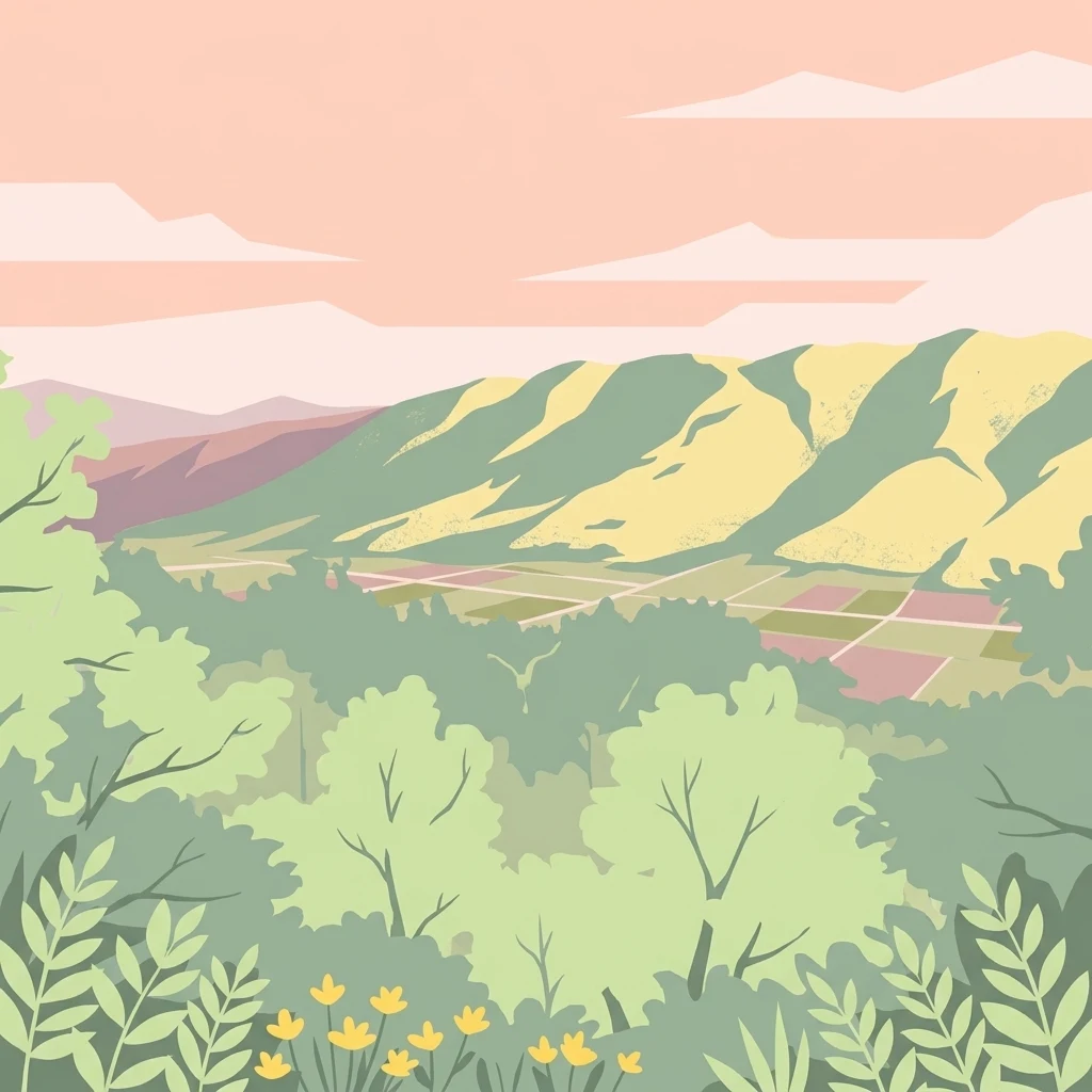
A flat-style digital illustration showing a panoramic view of rolling green hills, agricultural fields, and soft pink skies, framed by foreground foliage and small yellow flowers.

Parc naturel régional du Luberon

Regional park

Park overview

Structured park overview, official facts, and landscape profile for Luberon Regional Nature Park

Luberon Regional Nature Park park facts, protected area profile, and essential visitor context

Review the core facts for Luberon Regional Nature Park, including designation, size, terrain, visitor scale, habitats, and operating context in one park-focused overview.

About Luberon Regional Nature Park

The Luberon Regional Nature Park stretches across the heart of Provence in southeastern France, forming a protected crescent of low mountains that links the Monts de Vaucluse to the south-facing slopes overlooking the Durance valley. The park territory covers an area of roughly 175,000 hectares across the departments of Vaucluse and Alpes-de-Haute-Provence, organized around about 76 communes whose populations range from small mountain villages to towns such as Apt, Cavaillon, Manosque, Pertuis and Forcalquier.

At its center lies the Luberon massif, which gives the park its name and its defining geography. The massif is divided into three parallel ridges: the Petit Luberon to the south, the Grand Luberon in the middle, and the Luberon Oriental to the east. The southern slopes are abrupt and rocky, while the northern flanks descend more gently toward the Apt and Manosque-Forcalquier basins. To the north, the southern flanks of the Monts de Vaucluse extend the park's reach toward the foothills of Mont Ventoux and the Montagne de Lure, creating a continuous mosaic of ridges, valleys and plateaus.

The park protects a particularly rich Mediterranean environment. Its elevation range, from below 200 meters in the Durance valley to above 1,100 meters at Mourre Nègre in the Grand Luberon, sustains a wide variety of Mediterranean and sub-Mediterranean habitats. These range from holm oak and Aleppo pine forests, garrigue scrubland, chestnut woodlands and agricultural terraces to cliffs, fossil-bearing limestone plateaus and river valleys such as the Aiguebrun and the Calavon. The Luberon Geological Nature Reserve, covering fossil sites in 20 communes, preserves Oligocene, Eocene, Miocene and Pliocene sites that document the region's long paleontological history.

Internationally, the park has been part of the UNESCO-assisted Global Geoparks Network since 2004 and forms the coordinating structure for the Luberon UNESCO biosphere reserve, designated in 1997. It was also the first French regional nature park to systematically integrate night-sky conservation into its management policies, well before national legislation on light pollution was adopted. Together, these attributes place the Luberon among the most prominent regional nature parks in France for both natural and geological heritage.

The surrounding territory is equally shaped by human activity. Vineyards producing the Côtes du Luberon and Ventoux appellations, fruit orchards dating back to Roman times, truffle-producing oak plantations, lavender fields, beekeeping and the revival of heritage cereal varieties all coexist within the park's boundaries. The result is a living cultural landscape where agricultural tradition, geological heritage and biodiversity protection are managed together rather than as separate goals.

Quick facts and research context for Luberon Regional Nature Park

The Luberon Regional Nature Park is a French regional nature park (Parc naturel régional) covering a territory of roughly 175,000 hectares across two departments in Provence-Alpes-Côte d'Azur. Created in 1977 and renewed multiple times since, it includes about 76 communes organized around small Provençal towns such as Apt, Cavaillon, Manosque, Pertuis and Forcalquier.

The park holds dual international recognition: it is part of the UNESCO biosphere reserve network, designated in 1997, and was admitted to the UNESCO-backed Global Geoparks Network in 2004. It also includes the Luberon Geological Nature Reserve, which protects fossil sites spanning tens of millions of years of geological history, and is the first French regional nature park to formally integrate night-sky and light pollution protection into its policies.

Protection and recognition

Documented terrestrial protection scope, designation history, and official recognition records

Parc naturel régional du Luberon Protection Status and Protected Area Designation

Parc naturel régional du Luberon maintains a documented terrestrial protection status established in 2004 with reference identifier 6315. Structured conservation records compile designation history, management scope, and verified international recognition details.

Protection details

Protection scope
Terrestrial
Designated year
2004
Transboundary protection
No
WDPA ID
6315
Park context

Deeper park guide and search-rich context for Luberon Regional Nature Park

Luberon Regional Nature Park history, landscape, wildlife, and travel context

Explore Luberon Regional Nature Park through its history, landscape character, ecosystems, wildlife, conservation priorities, cultural context, and seasonal travel timing in a structured park guide built for atlas discovery and search intent.

Why Luberon Regional Nature Park stands out

The Luberon is best known for its emblematic Provençal landscapes: low limestone mountain ranges, deep colorful ochre formations near Roussillon and Gargas, fossil-rich geological plateaus, oak and Aleppo pine woodlands, and a constellation of perched villages such as Gordes, Ménerbes, Bonnieux and Lourmarin. Its combination of geological heritage, Mediterranean biodiversity and traditional agricultural landscapes makes the territory globally distinctive. It is also widely recognized for the contrast between the soft, rounded slopes of the Grand Luberon, the dramatic cliffs of the Petit Luberon, and the more gentle hills of the Luberon Oriental. This varied relief, combined with transitional climates and Mediterranean soils, gives the park an exceptional concentration of habitats despite its modest altitude range.
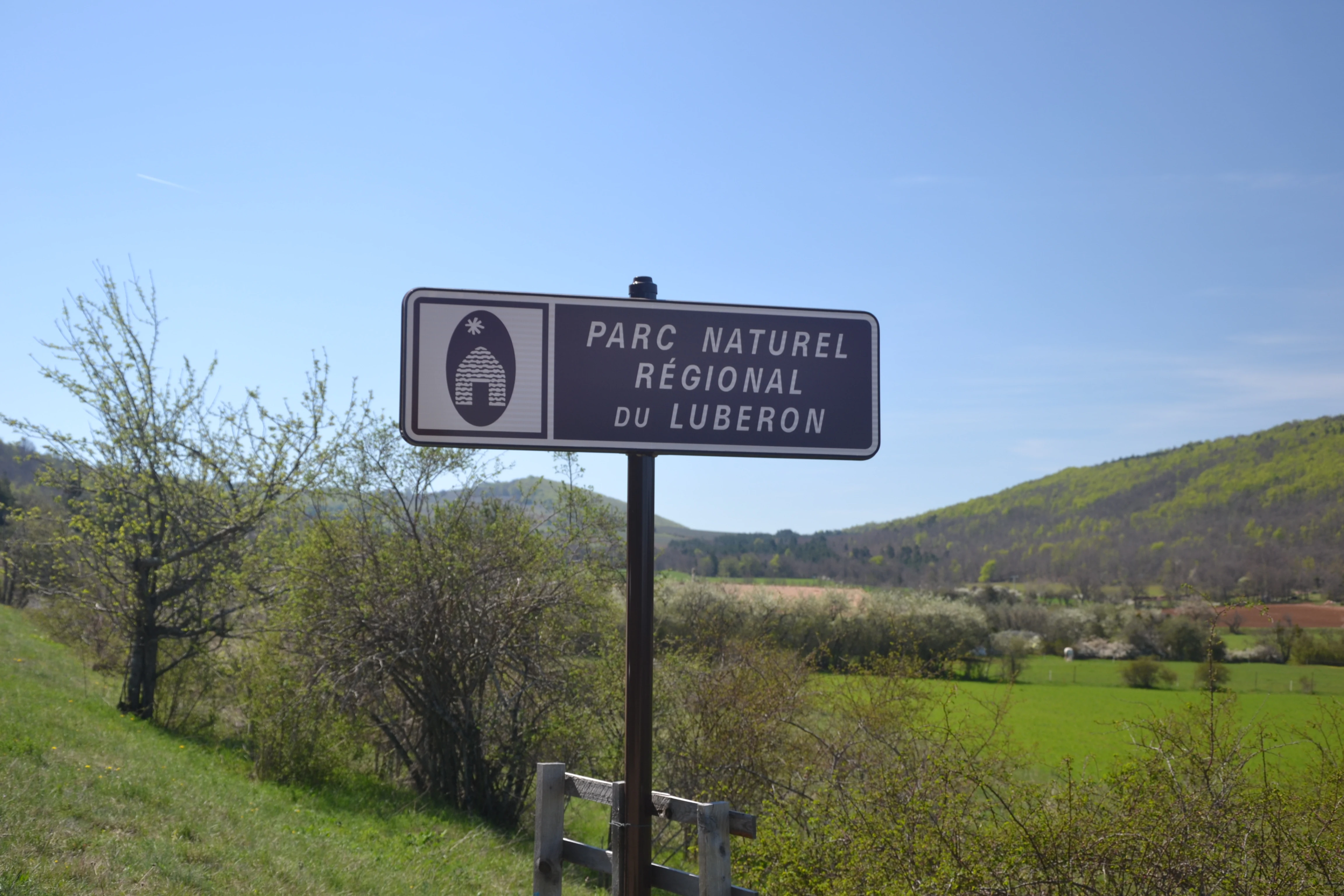
A brown metal road sign reads Parc naturel régional du Luberon, set against a background of green fields and rolling hills under a clear blue sky.
Official entrance sign for the Parc naturel régional du Luberon near Lagarde d'Apt.

Luberon Regional Nature Park history and protected-area timeline

The Luberon received its official designation as a French regional nature park on January 31, 1977, becoming the seventeenth such park in France and one of the earliest in the Provence-Alpes-Côte d'Azur region. The classification has been renewed three times since: first on December 19, 1980, then on May 28, 1997, and again for a twelve-year period by decree on May 20, 2009, with a further renewal cycle beginning in 2026 to extend through 2041.

The park's international standing began to grow in December 1997, when UNESCO admitted the Luberon to its worldwide network of biosphere reserves under the Man and the Biosphere programme, with the park serving as the coordinating structure for the broader surrounding territory. In 2004, the Luberon was admitted to the global network of Geoparks supported by UNESCO, formally recognizing the region's exceptional geological heritage, which had been locally protected earlier through the creation of the Luberon Geological Nature Reserve.

In parallel, the park pioneered practical environmental action, becoming the first French regional nature park to integrate night-sky and light pollution protection into its policies, testing energy-efficient lighting technologies and producing light pollution mapping for awareness campaigns well before the Grenelle I and Grenelle II laws. The park has also supported the rediscovery and multiplication of the Apt miller wheat, a heritage cereal variety, and in 2019 the revival of traditional cereal varieties in the Luberon was inscribed in France's Inventory of Intangible Cultural Heritage.

Luberon Regional Nature Park landscape and geographic character

The Luberon landscape is defined by three parallel mountain ridges, each with a distinct geological personality. To the south, the Petit Luberon is formed of a broad band of marly limestones cut by harder limestone beds that produce tall, dramatic cliffs. Its southern face, falling toward the Durance valley, is steep and rocky, while gentler northern slopes lead down to the basin of Apt. To the north of the park, the southern flanks of the Monts de Vaucluse form a continuous east-west counterfort beneath Mont Ventoux and the Montagne de Lure, reaching their highest point at the Signal de Saint-Pierre.

The Grand Luberon, the central and tallest of the three ridges, rises to Mourre Nègre at roughly 1,125 meters. It is shaped by softer marly limestones of Hauterivian age, producing a rounder, smoother profile than its southern neighbor. To the east, the Luberon Oriental transitions into a gentler relief of rounded hills and gentle slopes, dominated by the Bellevue summit. Between these ridges lie wide valleys, including the Coulon-Calavon valley and the Largue valley, the plains of Joucas and Coustellet, the Apt basin in the west, and the Manosque-Forcalquier basin in the east. The Durance forms the park's southern boundary, widening its bed in autumn and during snowmelt.

Geologically, the Luberon is built primarily of secondary and tertiary rocks, with the mountainous core formed during the Cretaceous at the end of the Mesozoic era and the surrounding plains composed of tertiary deposits. This combination makes the region one of France's richest areas for late Mesozoic fossils, particularly within the protected geological sites of the Luberon Geological Nature Reserve.
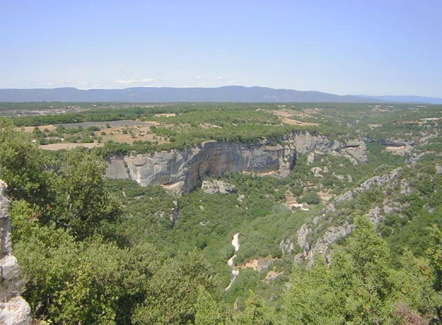
A wide-angle landscape view looking down into a wooded valley with limestone cliffs from a high vantage point, with a hazy mountain range visible on the horizon.
A view overlooking the Aiguebrun Valley in the Luberon Regional Nature Park.

Luberon Regional Nature Park ecosystems, habitats, and plant life

The Luberon supports an exceptional diversity of Mediterranean and sub-Mediterranean ecosystems within a relatively compact territory. Oak woodland dominates much of the park, with holm oak (Quercus ilex) and deciduous white oak (Quercus pubescens) stands covering many ridges and slopes. These oak forests are not only ecologically central but also economically important, as they provide the host trees for the region's renowned truffle production, particularly the black Tuber melanosporum.

Alongside oak woodland, Aleppo pine forests fill drier southern exposures, and chestnut groves occupy the cooler, more humid parts of the Luberon's valleys. Between these wooded zones, classic Provençal garrigue scrubland covers the thinnest, hottest soils, hosting aromatic species such as lavender, thyme, rosemary and savory, especially on the southern faces of the Petit Luberon. Agricultural terraces, vineyards, olive groves, almond and cherry orchards, and traditional dryland fields of heritage cereals create an additional semi-natural layer of habitat that supports a remarkable range of pollinators, birds and small mammals.

The park's range of elevations, exposures and substrates produces a striking concentration of habitats despite its modest maximum altitude. From the broadleaf oak forests of the northern slopes to the Mediterranean cliffs of the Petit Luberon, and from the fossil-rich plateaus of the Calavon valley to the riparian corridors along the Aiguebrun and the Durance, the Luberon preserves a continuous transition between the forests, garrigue and cultivations that define southern France.
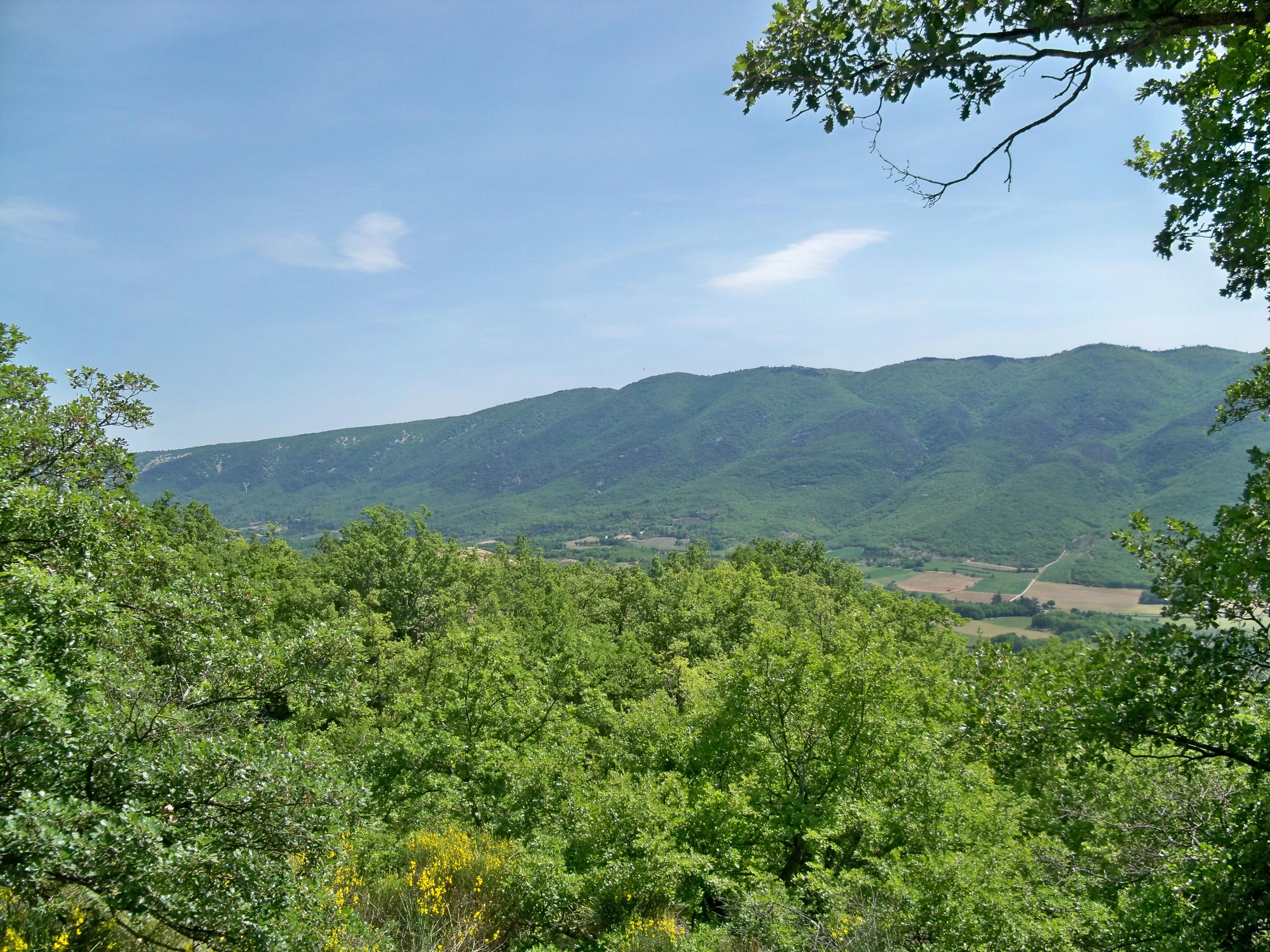
A wide view of the green, rolling slopes of the Luberon mountain range viewed from a forested hillside under a clear blue sky.
A view of the Luberon massif from Saint Martin de Castillon.

Luberon Regional Nature Park wildlife and species highlights

The Luberon's combination of woodland, garrigue, cliffs and farmland creates habitat for a notably rich Mediterranean fauna. The oak and chestnut forests support wild boar, roe deer and a variety of smaller mammals, while the cliff faces of the Petit Luberon and the Monts de Vaucluse provide breeding sites for raptors including golden eagles, Bonelli's eagles, peregrine falcons and various eagle-owl populations. Garrigue and open habitats host typical Mediterranean reptiles, along with abundant populations of insects and pollinators.

The park's mosaic of orchards, scrubland and woodlands makes it particularly valuable for birdlife, with breeding migrants, winter visitors and year-round residents sharing the territory. River valleys and wetlands associated with the Aiguebrun, the Calavon and the Durance support additional species, including amphibians, freshwater fish and wetland birds. The transition between Mediterranean lowlands and the cooler northern valleys of the Grand Luberon gives the park an unusually dense concentration of species within its relatively modest geographic extent.

Truffle-bearing oak forests, in particular, support complex food webs linking trees, fungi, small mammals and insects, contributing to broader ecological cycles throughout the park. While the Luberon is not a high-mountain or large-mammal wilderness, its biodiversity profile is exceptionally strong for a Mediterranean peri-urban landscape and remains central to the park's conservation mission.
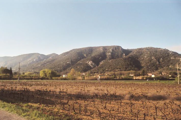
A wide shot showing a dormant vineyard in the foreground with a large, forested mountain ridge in the background under a clear sky.
A view of the Luberon mountains rising above the agricultural plains near Robion.

Luberon Regional Nature Park conservation status and protection priorities

Conservation in the Luberon has long combined landscape protection with cultural and economic stewardship. Beyond its general protected-area status as a regional nature park, the territory hosts the Luberon Geological Nature Reserve, which protects 28 fossil-bearing sites spread across 20 communes and covering Oligocene, Eocene, Miocene and Pliocene deposits of vertebrate footprints, fossil insects and fossil plants. This reserve, together with the park's broader geological heritage, underpinned the Luberon's inclusion in the UNESCO Global Geopark network in 2004, and forms a central pillar of the park's conservation identity.

Ecological conservation is supported by the diversity of Mediterranean habitats, the long-term protection of oak woodlands managed for both forestry and truffle cultivation, and the legal protections that limit cultivation on the steepest parts of the massif. The park has also been a national pioneer in night-sky conservation, mapping light pollution, testing energy-efficient LED street lighting powered in part by photovoltaic panels, and working to reduce light emissions well before French national legislation addressed the issue.

In parallel, the park supports the revival of traditional, locally adapted cereal varieties, including the Apt miller wheat rediscovered in 1985 and inscribed in 2019 on France's Inventory of Intangible Cultural Heritage. These efforts link biodiversity conservation, agricultural resilience and the protection of traditional landscapes, demonstrating the park's approach of integrating ecological preservation with the living human use of the land.

Luberon Regional Nature Park cultural meaning and human context

The Luberon is one of the most recognizable cultural landscapes in Provence, shaped by centuries of Mediterranean agriculture. Vineyards were first established by the Romans around 120 BCE and have remained central to the local economy, producing the Côtes du Luberon and Ventoux appellations on the northern slopes of the massif and across the surrounding valleys. Olive groves, almond and cherry orchards, lavender fields and truffle-bearing oak plantations continue a long tradition of small-scale, high-quality land use.

Historically, the region was also a major center for silkworm rearing, with magnaneries (silkworm houses) integrated into many rural buildings until the late nineteenth century, when silkworm disease and the emergence of artificial fibers ended the activity. The ochre deposits near Roussillon and Gargas, formed from sediments left by an ancient sea, were intensively exploited from the eighteenth century onward and gave the villages their distinctive red palette. The Luberon is also known internationally as a popular filming location, with many villages and ochre quarries serving as backdrops for films spanning several decades.

Local heritage initiatives led with the support of the park have revived heritage cereal varieties such as the Apt miller wheat, tied to traditional pastries including pompes à l'huile and galapian. These efforts were recognized in 2019 when the revival of traditional cereal varieties was added to France's national Inventory of Intangible Cultural Heritage, cementing the Luberon's identity as a region where agricultural tradition, landscape and rural culture are treated as inseparable elements of conservation.

Top sights and standout views in Luberon Regional Nature Park

Among the Luberon's most distinctive features are its three parallel ranges: the dramatic limestone cliffs of the Petit Luberon, the rounded marly limestone spine of the Grand Luberon, and the gentler hills of the Luberon Oriental, all framed by the wider Monts de Vaucluse. The Luberon Geological Nature Reserve protects fossil sites that document tens of millions of years of European geological history, making the territory one of the most important paleontological regions in France.

The park is also a pioneer in night-sky protection and a recognized leader in combining sustainable land use with biodiversity conservation. Its ochre landscapes around Roussillon and Gargas, its perched villages such as Gordes, Ménerbes, Bonnieux and Lourmarin, its truffle-bearing oak woodlands, and its UNESCO-recognized revival of traditional cereal varieties together make the Luberon a striking example of how natural, agricultural and cultural heritage can be managed as a single integrated landscape.

Best time to visit Luberon Regional Nature Park

The Luberon has a strongly seasonal character. Spring is one of the most rewarding periods to visit, with mild temperatures, blooming orchards, wildflowers in the garrigue and excellent birding as migrants return to the region. Summer brings hot, dry Mediterranean weather, with vivid lavender blooms, intense stone-and-ochre village colors and lively outdoor markets, but also strong sun and occasional mistral winds.

Autumn softens the light across the limestone ridges and is the traditional season for truffles, harvest festivals and the vendanges. Winters are generally mild in the southern parts of the park but can bring frost and occasional snow to the higher slopes of the Grand Luberon, while the rest of the park remains accessible and quieter. Overall, late spring and early autumn offer the most balanced combination of pleasant weather, vibrant landscapes and active agricultural life, although the park's varied elevation means that seasonal contrast can shift noticeably between its southern Durance-facing slopes and its northern valleys.
Monthly climate preview

Long-term representative point measurements tracking monthly temperature and precipitation rhythm

Parc naturel régional du Luberon Climate Normals and Annual Weather Patterns

Historical data records monthly temperature ranges from sub-zero winter minimums to warm summer maximums alongside varying precipitation rates across the representative coordinate. Analyzing the complete twelve-month climate profile reveals structured annual meteorological trends for further geographical study.
Annual mean11 °C
2 °C22 °C
Jan
Feb
Mar
Apr10°
May14°
Jun19°
Jul22°
Aug22°
Sep17°
Oct12°
Nov
Dec
Warmest month
July

22.2 °C

Coolest month
January

2.5 °C

Wettest month
November

3 mm/day

Driest month
July

0.8 mm/day

Park location guide

Geography guide, regional context, and park location map for Luberon Regional Nature Park

Luberon Regional Nature Park park geography, regions, and map view in France

Understand where Luberon Regional Nature Park sits in France through a broader geographic reading of the surrounding landscape, nearby location context, and its mapped position within the national park landscape.

How Luberon Regional Nature Park fits into France

France is a unitary semi-presidential republic and one of the world's largest economies. It borders Belgium, Luxembourg, Germany, Switzerland, Italy, Monaco, Andorra, and Spain, with a maritime border to the United Kingdom. The country is known for its cultural influence, art, cuisine, and political history spanning centuries.

Wider geography shaping Luberon Regional Nature Park in France

France is located in Western Europe. Metropolitan France extends from the Rhine to the Atlantic Ocean and from the Mediterranean Sea to the English Channel and North Sea. The country borders Belgium, Luxembourg, Germany, Switzerland, Italy, Monaco, Andorra, Spain, and has a maritime border with the United Kingdom.

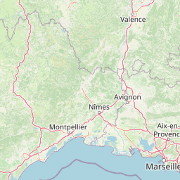
Map view of Luberon Regional Nature Park

Use this park location map to pinpoint Luberon Regional Nature Park in France, understand its exact geographic position, and read its mapped placement within the surrounding landscape more clearly.

Pigeon | © OpenStreetMap contributors

Location context for Luberon Regional Nature Park

Provence-Alpes-Côte d'Azur
Natural feature types

View the Natural Features and Geological Atlas of Parc naturel régional du Luberon

Continue exploring the distinct physical geography of the region. This collection provides a structured look at the named natural landforms, geological sites, and valleys that define the landscape of Parc naturel régional du Luberon.
Recorded earthquake history

Examine Historical Earthquake Data for Parc naturel régional du Luberon

Navigate to a structured catalogue of seismic events recorded near the mountain ridges and valleys of Parc naturel régional du Luberon. Gain technical insight into regional seismic history through documented events, magnitudes, and epicenter locations provided for geographical reference.

Parc naturel régional du Luberon Earthquake History

Catalogued events

84 events

Strongest magnitude

Magnitude 4.3

Most recent event

Aug 8, 2006

This history includes earthquakes recorded inside the park or within 50 km of its borders

Visual reference for limestone ridges, oak woodlands, and regional terrain character

Parc naturel régional du Luberon Photos and Protected Landscape Scenery

Visual documentation captures the diverse terrain and protected habitats defining Parc naturel régional du Luberon. Photographic records reveal geological formations, mountain relief, and Mediterranean ecosystems across the territory.

A brown metal road sign reads Parc naturel régional du Luberon, set against a background of green fields and rolling hills under a clear blue sky.

A multi-story peach-colored building with large windows and a wooden front door, situated on a square with trees in autumn foliage, parked cars, and a small stone fountain in the foreground.

A wide-angle landscape view looking down into a wooded valley with limestone cliffs from a high vantage point, with a hazy mountain range visible on the horizon.

A wide view of the green, rolling slopes of the Luberon mountain range viewed from a forested hillside under a clear blue sky.

A wide shot showing a dormant vineyard in the foreground with a large, forested mountain ridge in the background under a clear sky.

Park atlas

Compare adjacent limestone massifs, regional nature reserves, and Mediterranean terrain.

Parks Near Parc naturel régional du Luberon and Surrounding Protected Landscapes

Visitors exploring Parc naturel régional du Luberon can discover other protected areas sharing similar Mediterranean topography and regional wildlife habitats. Expanding the geographical search reveals connected ecological corridors and diverse regional park terrain across southeastern France.
Nature reserveProvence-Alpes-Côte d'Azur
About 0.4 km away#1 closest

Southeast

Réserve naturelle nationale géologique du Luberon: Geological Atlas and Protected Park Sites

Mapping Cenozoic fossil sites and limestone terrains in Provence

This protected area consists of 28 scattered sites documenting life from the Cenozoic Era through fossil-rich limestone, marl basins, and ancient lake sediments. It serves as a vital reference for field research and earth sciences, featuring rare trace fossils and mammal trackways embedded within the wider Provençal countryside.

Area
3.12 km²
Established
1987
IUCN
III
Nature reserveProvence-Alpes-Côte d'Azur
About 5.6 km away#2 closest

Northwest

Réserve naturelle régionale Ermitage-Escampeaux: A Protected Landscape in the Vaucluse Department

Mapping regional nature reserves within inland Provence-Alpes-Côte d'Azur.

Located in the Villes-sur-Auzon commune, the Réserve naturelle régionale Ermitage-Escampeaux stands as a significant addition to the protected lands of Provence-Alpes-Côte d'Azur. This 252.9-hectare reserve offers a focused look at the transition between Mediterranean garrigue and the higher Provençal uplands, providing essential habitat conservation within a traditional rural mosaic.

Area
2.529 km²
Established
2026
IUCN
IV
Nature reserveProvence-Alpes-Côte d'Azur
About 17 km away#3 closest

Southwest

Réserve naturelle régionale de la Poitevine-Regarde-Venir: Steppe Conservation and Geography

Protected dry steppe landscapes in the French Crau region

Delve into the geography of the Réserve naturelle régionale de la Poitevine-Regarde-Venir, a specialized nature reserve that safeguards the distinctive pebbly coussoul of the Crau plain. The area represents a fundamental piece of Mediterranean pastoral history, balancing fragile steppe ecosystems with traditional agricultural meadows.

Area
2.207 km²
Established
2009
IUCN
IV
A horizontal watercolor painting depicting a soft-focus landscape of grassy wetlands in the foreground with gentle, rolling hills in the background.
Nature reserveProvence-Alpes-Côte d'Azur
About 25 km away#4 closest

West

Réserve naturelle régionale de l'Ilon: Protected Wetland Atlas and Geographic Context

Mapping Mediterranean marshes in the Alpilles foothills.

Covering 176 hectares of diverse wetland habitat, Réserve naturelle régionale de l'Ilon preserves critical marshlands and floodable meadows. This site demonstrates the interplay between lowland water systems and the rocky Alpilles range, providing a essential refuge for diverse dragonfly and bird species within the heart of Provence.

Area
1.76 km²
Established
2012
IUCN
IV
Nature reserveProvence-Alpes-Côte d'Azur
About 32 km away#5 closest

East

Réserve naturelle régionale de Saint-Maurin: Geological Heritage in the Verdon Gorge

Travertine formations and cave habitats in Provence

Covering 25 hectares at the mouth of the Gorges du Verdon, this regional nature reserve protects a rare set of travertine terraces and tufa caves. Its geography creates a micro-refuge for specific cave-dwelling species and cliff-nesting raptors, standing as a significant example of geological and biological preservation in the Alpes-de-Haute-Provence department.

Area
0.248 km²
Established
2009
IUCN
IV
Relief
Upland
A horizontal watercolor illustration showing a marshy, grassy landscape with soft green and muted pink tones against a white background.
Regional parkProvence-Alpes-Côte d'Azur
32 km away#6 closest

Southwest

Parc naturel régional de Camargue: Mapping the Rhône Delta Protected Wetland Landscape

Regional park geography and wetland conservation zones

Parc naturel régional de Camargue is a sprawling protected landscape at the confluence of the Rhône and the Mediterranean. This regional park contains significant saline lagoons, coastal dunes, and fertile marshes that serve as a crucial site for waterbird migration. Understand the interplay between traditional salt-making, pastoral ranching, and the strictly protected nature reserves that shape this delta territory.

Area
856.9 km²
Established
1970
IUCN
V
Relief
Lowland
A soft watercolor painting of a rolling hilly landscape with muted greens, yellows, and purples on a white background.
Nature reserveProvence-Alpes-Côte d'Azur
About 33 km away#7 closest

East

Réserve naturelle géologique de Haute-Provence: Geological Protected Area and Map Atlas

Tracing fossil-rich outcrops across the French Pre-Alps regional landscape

Spanning 269 hectares, the Réserve naturelle géologique de Haute-Provence preserves iconic fossil sites like the Dalle aux Ammonites and diverse tectonic terrains. This repository offers insight into the reserve's unique sedimentary layers, folded mountain strata, and deeply incised river valleys that document prehistoric marine environments in France.

Area
2.69 km²
Established
1984
IUCN
III
Relief
Mountain
Nature reserveProvence-Alpes-Côte d'Azur
About 35 km away#8 closest

Southwest

Réserve naturelle régionale du Pourra - Domaine du Ranquet: Coastal Lagoon Protected Landscape

Regional Nature Reserve in Provence-Alpes-Côte d'Azur

Spanning over 300 hectares near Port-de-Bouc, this protected area preserves interconnected Mediterranean lagoons and surrounding marshlands. It offers a distinct geographic perspective on transitional coastal habitats situated within the heavily developed Bouches-du-Rhône department.

Area
3.153 km²
Established
2020
IUCN
IV

Common questions about visiting, size, designation, and location context for Luberon Regional Nature Park

Luberon Regional Nature Park FAQs for park facts, access, geography, and protected area context

Find quick answers about Luberon Regional Nature Park, including protected-area facts, park geography, trail and visitor context, and how the park fits into its surrounding country and regional landscape.
MoriAtlas Explorer

Continue Your Protected Areas Search Across the Global Atlas

Deepen your exploration by continuing the structured search for national parks and protected areas worldwide. Utilize the comprehensive filtering capabilities to compare different conservation landscapes and refine your understanding of global park geography. Discover more about the distribution and characteristics of protected natural areas.

Global natural geography