
Mori Atlas logo
Regional parkParc naturel régional de Camargue

Tracing the mapped boundaries, saline lagoons, and pastoral marshland terrain of a major French wetland complex

Parc naturel régional de Camargue: A Comprehensive Geographic Profile of the Rhône Delta Protected Landscape

Parc naturel régional de Camargue defines the complex geography of the Rhône delta, where vast saline lagoons, reed beds, and expansive salt flats meet the Mediterranean coastline. This protected area supports an intricate mosaic of habitats, ranging from the central Étang de Vaccarès to the managed rice fields and traditional grazing pastures that sustain unique horse and bull breeds. Through this atlas entry, identify the specific ecological boundaries and the layered conservation zones that define this essential Mediterranean wetland.

wetlandssalt flatsMediterranean deltabirdwatchingflamingosRhône delta
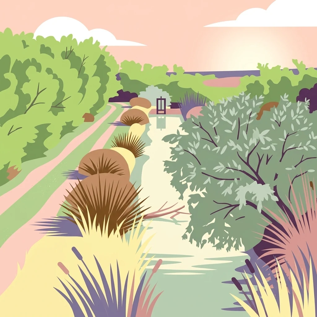
A stylized digital illustration of a wetland canal scene in the Camargue, featuring soft pastel colors, tall grasses, marsh vegetation, and a sunset sky.

Parc naturel régional de Camargue

Regional park

Park overview

Structured park overview, official facts, and landscape profile for Parc naturel régional de Camargue

Parc naturel régional de Camargue park facts, protected area profile, and essential visitor context

Review the core facts for Parc naturel régional de Camargue, including designation, size, terrain, visitor scale, habitats, and operating context in one park-focused overview.

About Parc naturel régional de Camargue

The Parc naturel régional de Camargue is the protected-area framework around one of the most distinctive delta landscapes in the Mediterranean. It lies in the Bouches-du-Rhône department of the Provence-Alpes-Côte d'Azur region, occupying most of the Grande Camargue, the broad alluvial plain formed between the Grand Rhône and the Petit Rhône as they approach the sea.

Geologically and ecologically, the Camargue is a young and dynamic landscape built from centuries of Rhône sediments. Salt-affected soils, brackish lagoons, reed-fringed étangs, low dunes, and seasonally flooded pastures define its scenery. The Vaccarès lagoon system forms the ecological heart of the territory and supports habitats ranging from open saline steppes to marsh and freshwater reedbed.

The park's identity is inseparable from its human cultures. Traditional Camargue ranching, centered on the manadiers and the Camargue horse, the "raço di Biòu" fighting bulls, and the AOC Camargue bull label, coexists with rice cultivation that has shaped large areas of the delta for centuries. Salt harvesting, fishing, and tourism add to the mosaic of rural and coastal land uses.

Quick facts and research context for Parc naturel régional de Camargue

The park sits on the western edge of the Provence-Alpes-Côte d'Azur region in France, in the Bouches-du-Rhône department, covering the majority of the Grande Camargue between the two arms of the Rhône delta. Classified as a Parc naturel régional in 1970 and revised in 1998, it combines inland and marine surfaces and is recognized by IUCN Category V as a protected landscape.

It is also a UNESCO Man and the Biosphere biosphere reserve and contains a Ramsar-listed wetland of international importance. Within it lies the Camargue National Nature Reserve around the Vaccarès lagoon, one of the largest wetland reserves in Europe. The park works alongside other designations such as Natura 2000 zones (ZPS and ZSC) to protect migratory and overwintering birds.

Protection and recognition

Documented management scope, establishment records, and conservation status data

Parc naturel régional de Camargue Protection Status and Designation History

Official records for Parc naturel régional de Camargue outline a mixed protection scope established in the designated year 1998. Structured conservation data provides reliable baseline information regarding protected area management history and international registry entries.

Protection details

Protection scope
Mixed
Designated year
1998
Transboundary protection
No
WDPA ID
6325
Park context

Deeper park guide and search-rich context for Parc naturel régional de Camargue

Parc naturel régional de Camargue history, landscape, wildlife, and travel context

Explore Parc naturel régional de Camargue through its history, landscape character, ecosystems, wildlife, conservation priorities, cultural context, and seasonal travel timing in a structured park guide built for atlas discovery and search intent.

Why Parc naturel régional de Camargue stands out

The park is best known for the Camargue wetland system at the mouth of the Rhône: vast shallow lagoons, salt flats, reedbeds, and open marshes that host exceptional numbers of waterbirds. It is a flagship European site for flamingos, herons, and many migratory and wintering species, and has historically ranked first in France for its wintering bird numbers. Equally iconic are the open landscapes that support extensive breeding of the Camargue horse and the Camargue bull, together with traditional rice fields. The combination of wildlife, pastoral culture, and delta scenery gives the Camargue a unique Mediterranean identity widely associated with southern France.
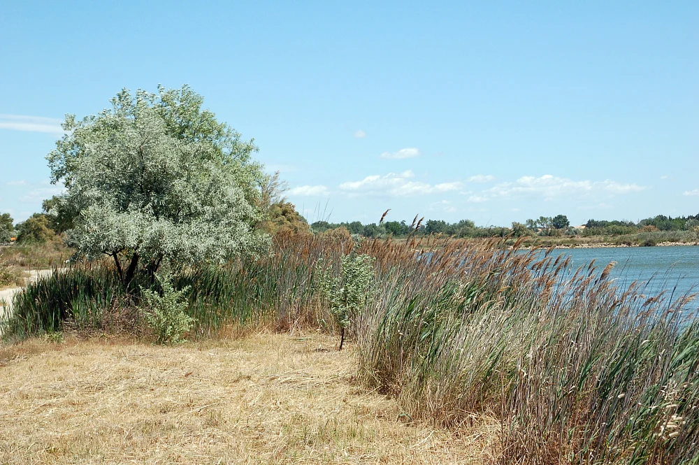
A wide view of a Camargue wetland scene under a clear blue sky, showing a grassy bank with a silvery-leaved tree in the foreground, transitioning to tall reeds along the shore of a calm body of water.
A typical wetland landscape near Aigues-Mortes in the Camargue, featuring salt-tolerant vegetation and reeds along the water's edge.

Parc naturel régional de Camargue history and protected-area timeline

The protected history of the Camargue begins in 1928, with the creation of the botanical and zoological reserve around the Vaccarès lagoon. A ministerial order on 24 April 1975 formally classified this area as a national nature reserve, making it one of the largest wetland reserves in Europe and placing its day-to-day management with the Société nationale de protection de la nature.

The regional nature park itself was created on 25 September 1970, initially operated through a private foundation dominated by large landowners. Its first president was the ornithologist François Hüe. The manadiers, dedicated to promoting the Camargue horse and the AOC Taureau Camargue, played a central role in this period, as did rice growers and bull breeders, whose extensive ranching was seen as essential to maintaining open wetland habitats.

Following the major floods of 1993, governance of the park came under scrutiny. Legislative changes affecting French regional nature parks prompted a renewed institutional framework, and in 2004 the park was reorganized under a public mixed syndicat. Law no. 2007-1773 of 17 December 2007 formally recognized the syndicat mixte as the sole legal management tool of the Parc label. A further extension, following an administrative appeal to the Conseil d'État, prolonged the park's classification to 18 February 2011.

Parc naturel régional de Camargue landscape and geographic character

The Camargue is a flat delta landscape dominated by water. Its scenery alternates between shallow saline lagoons like the Étang de Vaccarès, extensive reedbeds and marshes, low sandy coastal dunes, and broad flat pastures and rice plains inland. The two arms of the Rhône frame the territory, shaping a triangular delta that is permanently reshaped by sediments, tides, and seasonal flooding.

Salt is a recurring feature of the landscape. Salt flats and saltworks, salt-resistant vegetation, and saline prairies create a wide range of subtle gradients between dry land and open water. Inland, the marshlands transition into cultivated rice fields and to the traditional pastures used for Camargue bulls and horses.
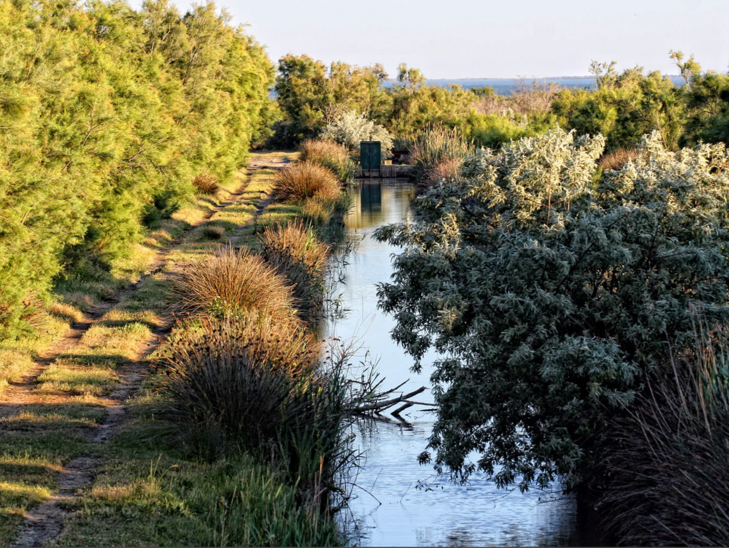
A narrow canal stretches into the distance, lined by shrubs and marsh grasses under a soft sky in a wetland park.
A tranquil canal flowing through the wetland landscape of Parc naturel régional de Camargue.

Parc naturel régional de Camargue ecosystems, habitats, and plant life

Ecologically, the park is centered on a Mediterranean wetland complex of exceptional extent and diversity. Saline steppes, halophytic vegetation, reedbeds, brackish lagoons, freshwater marshes, dunes, and a narrow coastal strip all coexist within the protected area, supporting a striking range of habitats in a relatively confined territory.

The combination of fresh, brackish, and saline conditions, together with the mild Mediterranean climate, sustains plant communities adapted to a wide spectrum of salinity and moisture. These habitats fuel high productivity for invertebrates, waterbirds, and fish, and they form the foundation of one of Europe's most important wetland ecosystems.
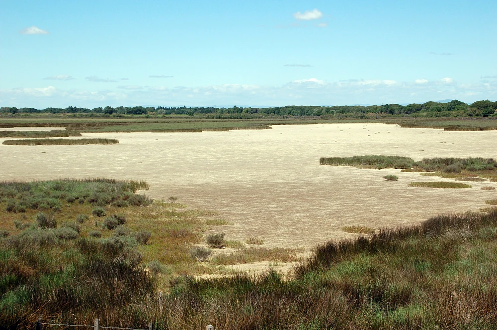
A wide, flat expanse of dry, light-colored soil, interspersed with patches of green marsh grass and shrubs under a blue, cloud-dotted sky.
A dry marshland landscape in the Camargue, illustrating the delta's characteristic saline environment.

Parc naturel régional de Camargue wildlife and species highlights

The Camargue is a continentally significant site for birds. Surveys and the park's national nature reserve together record around 276 bird species, of which roughly 258 are considered to have conservation interest. The lagoon system and surrounding marshes make the area a critical wintering ground, and during the early 2000s the Camargue regularly hosted around 122,000 wintering birds, the highest figure recorded for any French site at that time.

The Greater Flamingo is the park's signature species and a powerful symbol of the Camargue, with colonies visible across the lagoons. Beyond flamingos, the diversity of waterbirds, herons, ducks, waders, and raptors, along with winter visitors from northern Europe, gives the park outstanding ornithological value. The wetland mosaic also supports reptiles, amphibians, and a rich community of aquatic invertebrates that sustain the entire food web.
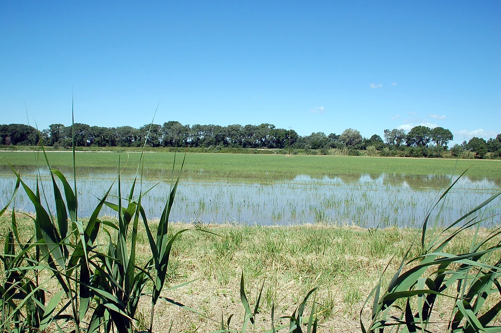
A wide, shallow flooded field under a clear blue sky, with tall green reeds in the foreground and a line of trees in the distance.
A flooded field in the Camargue, showcasing the region's characteristic wetland agriculture.

Parc naturel régional de Camargue conservation status and protection priorities

The Camargue's conservation status is unusually layered for a regional nature park. Its territory falls partly within the Camargue National Nature Reserve, Europe's one of the largest wetland reserves, focused on the Vaccarès lagoon system. The wider landscape is also recognized as a UNESCO Man and the Biosphere biosphere reserve covering roughly 193,000 hectares.

Much of the territory is integrated into the Natura 2000 network through both Special Protection Areas under the Birds Directive and Special Areas of Conservation under the Habitats Directive. In addition, around 114,000 hectares of the Gard Camargue and the Île de Camargue are listed under the Ramsar Convention as wetlands of international importance.

Extensive ranching of Camargue bulls and horses, traditional rice cultivation, and careful management of lagoon water levels are central to maintaining habitats. The park's mixed syndicat now coordinates this broad conservation framework alongside agricultural, cultural, and tourism interests.

Parc naturel régional de Camargue cultural meaning and human context

The Camargue has a strong sense of regional identity tied to its open landscapes. It is the cultural home of the Camargue horse, a hardy breed emblematic of the marshes and managed by manadiers, and of the Camargue bull recognized through the AOC label, including the traditional "raço di Biòu" fighting bulls bred extensively on the pastures.

Rice cultivation has long been an agricultural foundation of the delta, and saltmaking, fishing, and small-scale tourism also shape the human geography. Languedoc, Provençal, and Arlesian cultural influences all meet here, and the Camargue has been celebrated for centuries in regional literature, photography, and folklore, making it as much a cultural landscape as an ecological one.

Top sights and standout views in Parc naturel régional de Camargue

The Parc naturel régional de Camargue stands out for the sheer scale of its protected wetland. Few regions in Europe combine a national nature reserve, a UNESCO biosphere reserve, Ramsar-listed wetlands, and Natura 2000 zones within a single regional nature park. The Étang de Vaccarès and surrounding marshes form a year-round hub for waterbirds, while the Greater Flamingo remains the park's most iconic resident.

Beyond nature, the park showcases a living pastoral landscape in which Camargue horses, fighting and breeding bulls, and rice-growing traditions actively shape the habitats that attract so much wildlife. The result is a working landscape where Mediterranean delta culture and high-value conservation are closely intertwined.

Best time to visit Parc naturel régional de Camargue

The Camargue offers a distinct character in every season, with mild Mediterranean winters that concentrate large flocks of waterfowl on the lagoons and salt flats. Late autumn through early spring is widely considered the most rewarding period for birdwatching, when winter visitors swell populations and flamingos remain present in significant numbers.

Spring and early summer bring warmer conditions, active rice fields, and the dramatic festivals and events tied to Camargue bull and horse culture, though summer can be hot and occasionally mosquito-prone near standing water. Whatever the season, soft light over the lagoons, the wide horizons of the delta, and the visible rhythms of pastoral and rice agriculture make the Camargue an atmospheric destination.
Monthly climate preview

Long-term temperature ranges and precipitation averages across twelve recorded months

Parc naturel régional de Camargue Climate Normals and Annual Weather Patterns

Representative coordinates record measured monthly temperature swings from 7.81 degrees Celsius to 24.47 degrees Celsius alongside shifting daily precipitation rates. Opening the complete climate profile provides full monthly statistical breakdowns and historical averages for Parc naturel régional de Camargue.
Annual mean16 °C
8 °C24 °C
Jan
Feb
Mar11°
Apr14°
May18°
Jun22°
Jul24°
Aug24°
Sep20°
Oct17°
Nov12°
Dec
Warmest month
July

24.5 °C

Coolest month
January

7.8 °C

Wettest month
November

2.6 mm/day

Driest month
July

0.6 mm/day

Park location guide

Geography guide, regional context, and park location map for Parc naturel régional de Camargue

Parc naturel régional de Camargue park geography, regions, and map view in France

Understand where Parc naturel régional de Camargue sits in France through a broader geographic reading of the surrounding landscape, nearby location context, and its mapped position within the national park landscape.

How Parc naturel régional de Camargue fits into France

France is a unitary semi-presidential republic and one of the world's largest economies. It borders Belgium, Luxembourg, Germany, Switzerland, Italy, Monaco, Andorra, and Spain, with a maritime border to the United Kingdom. The country is known for its cultural influence, art, cuisine, and political history spanning centuries.

Wider geography shaping Parc naturel régional de Camargue in France

France is located in Western Europe. Metropolitan France extends from the Rhine to the Atlantic Ocean and from the Mediterranean Sea to the English Channel and North Sea. The country borders Belgium, Luxembourg, Germany, Switzerland, Italy, Monaco, Andorra, Spain, and has a maritime border with the United Kingdom.

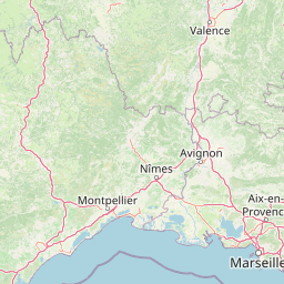
Map view of Parc naturel régional de Camargue

Use this park location map to pinpoint Parc naturel régional de Camargue in France, understand its exact geographic position, and read its mapped placement within the surrounding landscape more clearly.

Pigeon | © OpenStreetMap contributors

Location context for Parc naturel régional de Camargue

Provence-Alpes-Côte d'Azur
Recorded earthquake history

Examine the Recorded Earthquake History of Parc naturel régional de Camargue

Consult the dedicated collection of historical seismic events recorded near Parc naturel régional de Camargue. MoriAtlas provides a clear, structured view of documented earthquake occurrences by magnitude and location to support a deeper understanding of the regional geological record.

Earthquake History for Parc naturel régional de Camargue

Catalogued events

74 events

Strongest magnitude

Magnitude 3.6

Most recent event

Aug 8, 2006

This history includes earthquakes recorded inside the park or within 50 km of its borders

Explore protected wetland habitats, shallow lagoons, and pastoral scenery through curated photography.

Parc naturel régional de Camargue Photos and Landscapes: Visualizing the Rhône Delta

Visual records reveal the vast scale of shallow lagoons, extensive reedbeds, and coastal salt marshes across the regional nature park. Examining protected terrain photography helps clarify the unique intersection of wildlife habitats and traditional Mediterranean delta culture.

A wide view of a Camargue wetland scene under a clear blue sky, showing a grassy bank with a silvery-leaved tree in the foreground, transitioning to tall reeds along the shore of a calm body of water.

A small flock of greater flamingos standing and walking through shallow water; the birds have pink and white plumage, thin long legs, and curved necks; green reeds and vegetation line the bank in the background.

A narrow canal stretches into the distance, lined by shrubs and marsh grasses under a soft sky in a wetland park.

A wide, flat expanse of dry, light-colored soil, interspersed with patches of green marsh grass and shrubs under a blue, cloud-dotted sky.

A wide, shallow flooded field under a clear blue sky, with tall green reeds in the foreground and a line of trees in the distance.

Park atlas

Compare regional wetland habitats, coastal deltas, and neighboring Mediterranean nature reserves

Parks Near Parc Naturel Regional De Camargue And Surrounding Protected Areas

Browsing other protected areas near Parc naturel régional de Camargue reveals connected ecological corridors and diverse southern French landscapes. Expanding the geographical comparison allows travelers to trace similar wetland reserves, coastal lagoons, and delta ecosystems across the region.
A watercolor illustration of a tranquil marshland scene with soft green and muted pink tones, depicting reeds, sparse trees, and calm water.
Nature reserveFrance
Mapped location lies within the park boundary#1 closest

Southeast

Réserve naturelle régionale de la Tour du Valat: Mediterranean Wetland and Research Landscape Map

A critical protected area and ecological research estate in the Rhône delta of France.

Located in the Bouches-du-Rhône department, the Réserve naturelle régionale de la Tour du Valat serves as a reference point for Mediterranean wetland science. The reserve features an intricate landscape of marshes, salt meadows, and woodland patches that support diverse birdlife and habitats. This protected area demonstrates the integration of active pastoral land use with habitat management on a significant deltaic estate near Arles.

Area
18.44 km²
Established
2008
Relief
Lowland
Climate
Mediterranean
Watercolor painting of a marshy wetland scene with grassy foreground, scattered trees, and distant hills.
Nature reserveGard
About 6.4 km away#2 closest

West

Réserve naturelle régionale du Scamandre: Mapped Boundaries and Wetland Geography in Gard

Protected marshlands and salt steppe in southern France.

Deep dive into the ecological layout of Réserve naturelle régionale du Scamandre. Situated in the Gard department, this protected site preserves a mosaic of prairie, sansouïre, and marshland, creating a high-density wetland corridor essential for regional biodiversity and landscape analysis.

Area
1.467 km²
Established
2006
IUCN
IV
Relief
Lowland
A horizontal watercolor painting depicting a soft-focus landscape of grassy wetlands in the foreground with gentle, rolling hills in the background.
Nature reserveProvence-Alpes-Côte d'Azur
About 7.4 km away#3 closest

Northeast

Réserve naturelle régionale de l'Ilon: Protected Wetland Atlas and Geographic Context

Mapping Mediterranean marshes in the Alpilles foothills.

Covering 176 hectares of diverse wetland habitat, Réserve naturelle régionale de l'Ilon preserves critical marshlands and floodable meadows. This site demonstrates the interplay between lowland water systems and the rocky Alpilles range, providing a essential refuge for diverse dragonfly and bird species within the heart of Provence.

Area
1.76 km²
Established
2012
IUCN
IV
A horizontal watercolor painting depicting a soft, washed-out landscape of wetlands with green vegetation, calm water, and gentle hills in the distance.
Nature reserveOccitanie
About 8.5 km away#4 closest

West

Réserve naturelle régionale de Mahistre et Musette: Regional Nature Reserve and Wetland Atlas

Petite Camargue geography and protected marshland mosaic in Occitanie

Located in the Gard department of southern France, the Réserve naturelle régionale de Mahistre et Musette represents a successful case of wetland restoration. This protected area features a distinct landscape of reedbeds, saline flats, and ponds, providing critical habitat for numerous wetland species. Access detailed geographic context on how these restored marshes link to the broader Petit Camargue environmental network.

Area
2.616 km²
Established
1999
IUCN
IV
Nature reserveProvence-Alpes-Côte d'Azur
About 9.8 km away#5 closest

East

Réserve naturelle régionale du Pourra - Domaine du Ranquet: Coastal Lagoon Protected Landscape

Regional Nature Reserve in Provence-Alpes-Côte d'Azur

Spanning over 300 hectares near Port-de-Bouc, this protected area preserves interconnected Mediterranean lagoons and surrounding marshlands. It offers a distinct geographic perspective on transitional coastal habitats situated within the heavily developed Bouches-du-Rhône department.

Area
3.153 km²
Established
2020
IUCN
IV
Nature reserveProvence-Alpes-Côte d'Azur
About 20 km away#6 closest

East

Réserve naturelle régionale de la Poitevine-Regarde-Venir: Steppe Conservation and Geography

Protected dry steppe landscapes in the French Crau region

Delve into the geography of the Réserve naturelle régionale de la Poitevine-Regarde-Venir, a specialized nature reserve that safeguards the distinctive pebbly coussoul of the Crau plain. The area represents a fundamental piece of Mediterranean pastoral history, balancing fragile steppe ecosystems with traditional agricultural meadows.

Area
2.207 km²
Established
2009
IUCN
IV
A soft watercolor painting of a winding river flowing through a gentle, rolling green valley with hills in the background.
Nature reserveOccitanie
About 27 km away#7 closest

North

Réserve naturelle régionale des gorges du Gardon: Geography and Protected Area Overview

Mediterranean river valley and raptor conservation corridor

Examine the distinct topography of the Réserve naturelle régionale des gorges du Gardon. The protected area features steep limestone cliffs and a river corridor that sustains dense Mediterranean oak forests. This site remains a critical node for raptor conservation, specifically supporting nesting Egyptian vultures and Bonelli eagles within its structured valley geography.

Area
4.913 km²
Established
2007
IUCN
IV
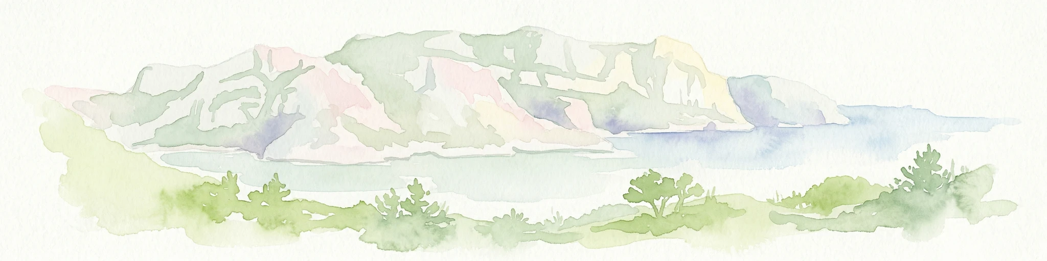
Watercolor illustration of coastal mountains and shoreline with scattered trees
National parkBouches-du-Rhône
31 km away#8 closest

Southeast

Calanques National Park: Mediterranean Limestone Cliffs and Marine Protected Area

France's First Peri-Urban National Park

Calanques National Park, situated in the Bouches-du-Rhône department, represents a significant protected landscape where dramatic limestone geology meets the Mediterranean Sea. This atlas-focused entry details the park's iconic calanques, its combined terrestrial and marine protected zones, and its rich prehistoric cultural significance. Understand its unique geographic setting and its importance as a conservation area accessible for map-based discovery and regional landscape context.

Area
520 km²
Established
2012
IUCN
II
Relief
Mountain

Common questions about visiting, size, designation, and location context for Parc naturel régional de Camargue

Parc naturel régional de Camargue FAQs for park facts, access, geography, and protected area context

Find quick answers about Parc naturel régional de Camargue, including protected-area facts, park geography, trail and visitor context, and how the park fits into its surrounding country and regional landscape.
MoriAtlas Explorer

Continue Your Protected Areas Search Across the Global Atlas

Deepen your exploration by continuing the structured search for national parks and protected areas worldwide. Utilize the comprehensive filtering capabilities to compare different conservation landscapes and refine your understanding of global park geography. Discover more about the distribution and characteristics of protected natural areas.

Global natural geography