Mori Atlas logo
National parkCalanques National Park

Discover the dramatic limestone calanques, marine territory, and prehistoric heritage of this French national park.

Calanques National Park: A Peri-Urban Protected Landscape on the Mediterranean Coast

(Parc national des Calanques)

Calanques National Park, located in France's Bouches-du-Rhône department, stands as a unique terrestrial and marine protected area on the Mediterranean coast. This national park is celebrated for its dramatic white limestone cliffs that plunge into vivid blue waters, forming iconic calanques. It offers a vital landscape for atlas exploration, revealing karst formations, prehistoric sites like Cosquer Cave, and rich marine ecosystems. Explore the distinct geographic identity and protected area status of Calanques National Park within its regional context.

Mediterranean coastLimestone cliffsMarine protected areaKarst landscapeCave artClimbing destination

Calanques National Park

National park

Park overview

Structured park overview, official facts, and landscape profile for Calanques National Park

Calanques National Park park facts, protected area profile, and essential visitor context
Review the core facts for Calanques National Park, including designation, size, terrain, visitor scale, habitats, and operating context in one park-focused overview.

About Calanques National Park

Calanques National Park occupies a remarkable position as France's first peri-urban national park, where wilderness preservation coexists directly alongside one of the country's largest metropolitan areas. The park protects a distinctive Mediterranean landscape of limestone cliffs, hidden coves, islands, and marine environments that have drawn human habitation and exploration for hundreds of thousands of years. The geological foundation consists primarily of sedimentary limestone formations from the Mesozoic era, dating roughly 250 to 65 million years ago, with the distinctive white Urgonian limestone characteristic of the region forming the dramatic cliffs and walls that define the calanques. The landscape is karstic, with numerous caves, sinkholes, and underground water sources carved into the soluble rock over geological time. The park encompasses several islands, including the archipelago of Frioul, the archipelago of Riou, and Île Verte, each supporting distinctive ecological communities. The marine component extends to 43,500 hectares of Mediterranean waters, including underwater canyons connecting the continental shelf to deeper waters. The tension between conservation and intense human use defines the park's character, as approximately 1.5 to 2 million visitors annually seek access to a landscape that has been shaped by millennia of human activity while remaining ecologically significant. The park's creation represented the culmination of over a century of advocacy, beginning with the 1923 formation of the Comité de défense des Calanques to prevent industrial development at En-Vau, through decades of negotiation with diverse user groups including fishers, hunters, climbers, and property owners.

Quick facts and research context for Calanques National Park

Calanques National Park lies in Bouches-du-Rhône, Provence-Alpes-Côte d'Azur, France, spanning the coastal Massif des Calanques between Marseille and the towns of Cassis and La Ciotat. The park covers 520 km² total (85 km² terrestrial, 435 km² marine) and was officially established on April 18, 2012, making it France's newest mainland national park. The highest point is Mont Carpiagne at 645 meters. The park is categorized as IUCN protected area management category II and is governed by Parcs nationaux de France. It receives approximately 1.5 to 2 million visitors annually, drawn to its unique blend of accessible wilderness, dramatic geology, and marine biodiversity.

Park context

Deeper park guide and search-rich context for Calanques National Park

Calanques National Park history, landscape, wildlife, and travel context
Explore Calanques National Park through its history, landscape character, ecosystems, wildlife, conservation priorities, cultural context, and seasonal travel timing in a structured park guide built for atlas discovery and search intent.

Why Calanques National Park stands out

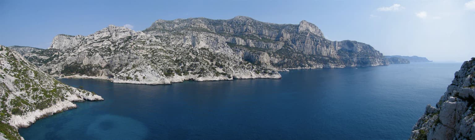
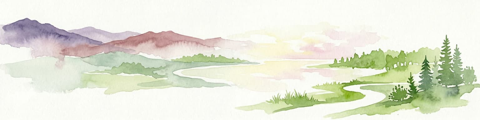
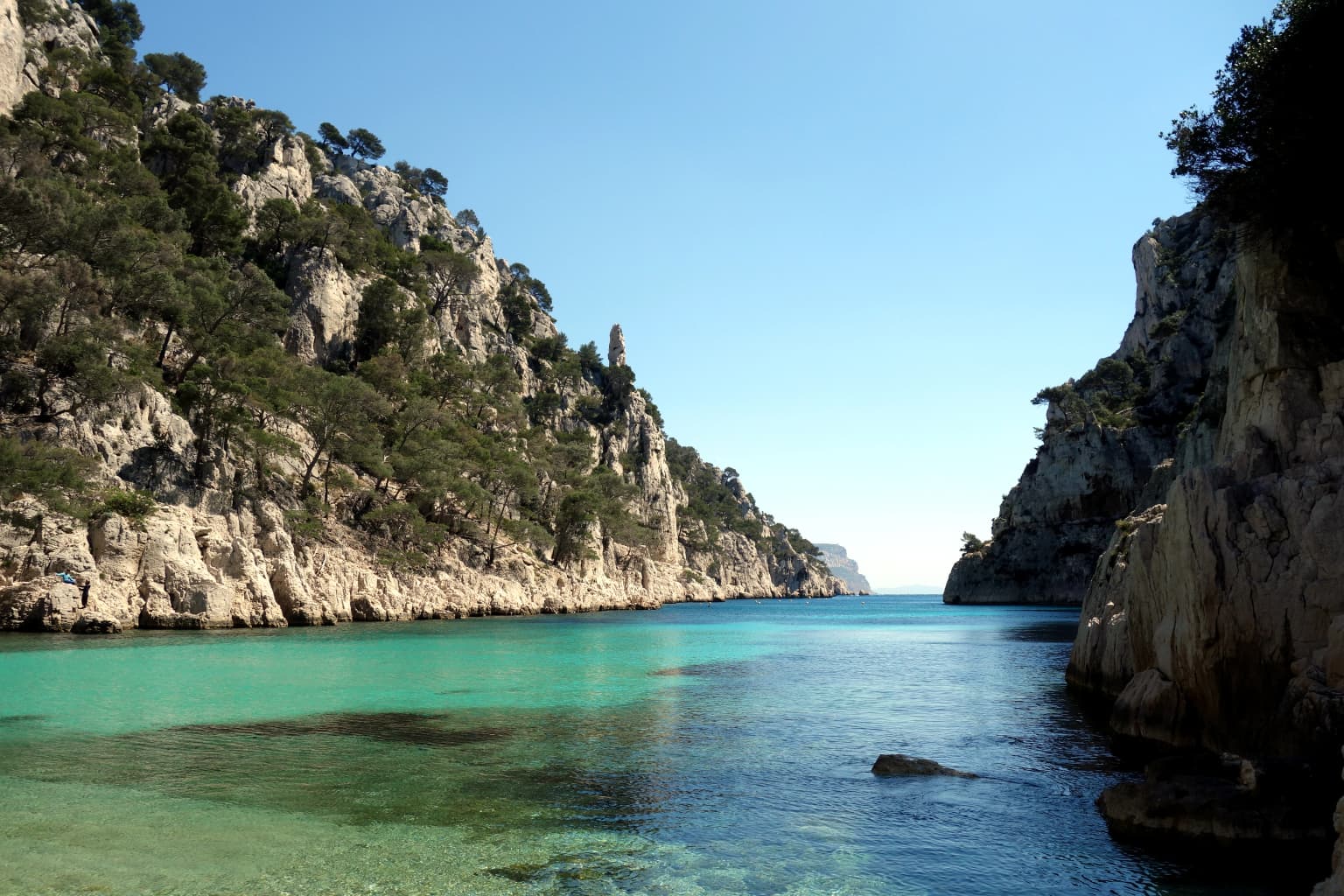
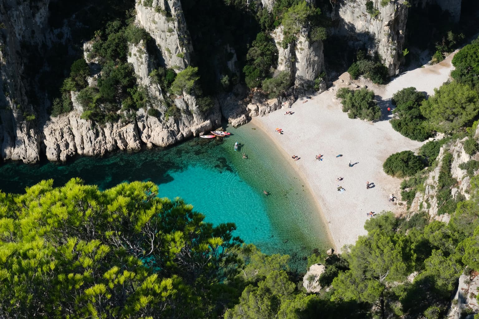
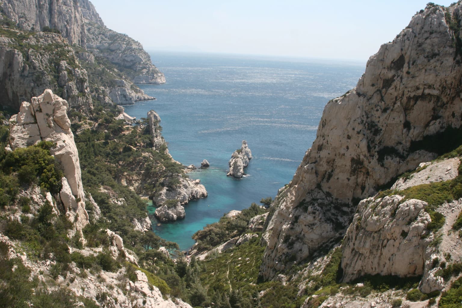
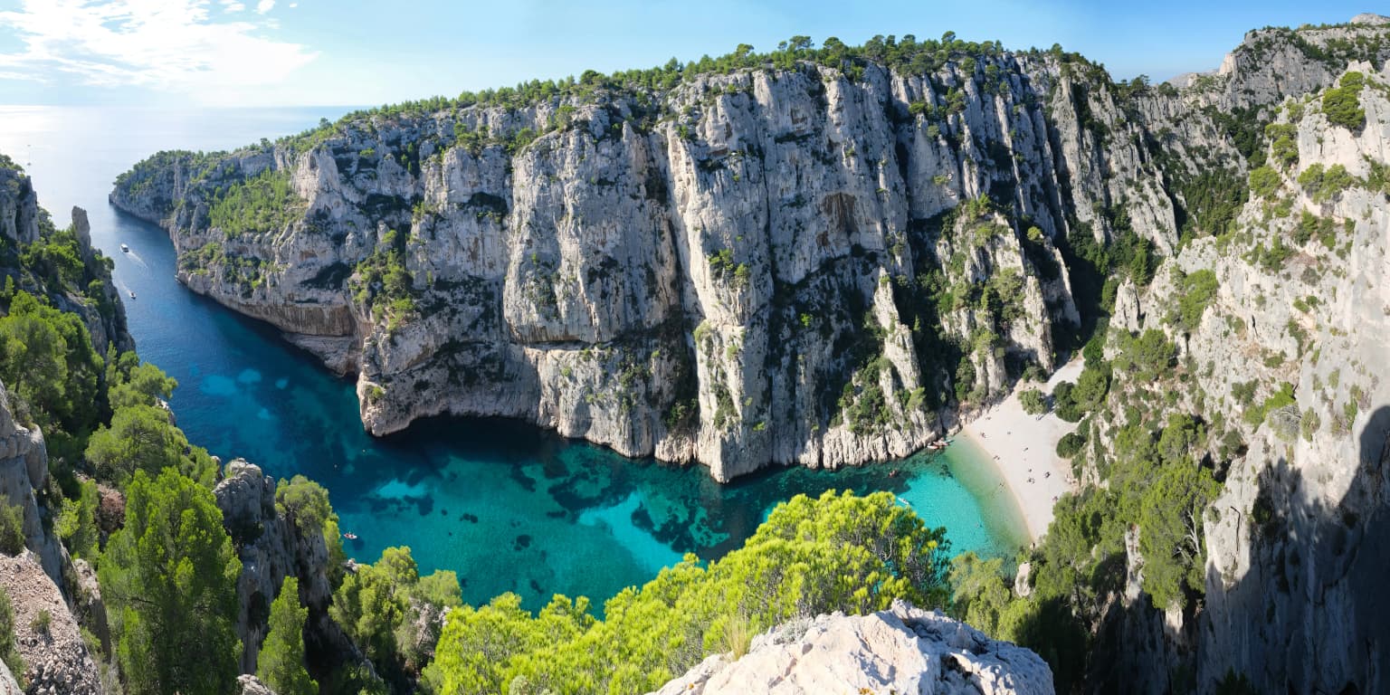
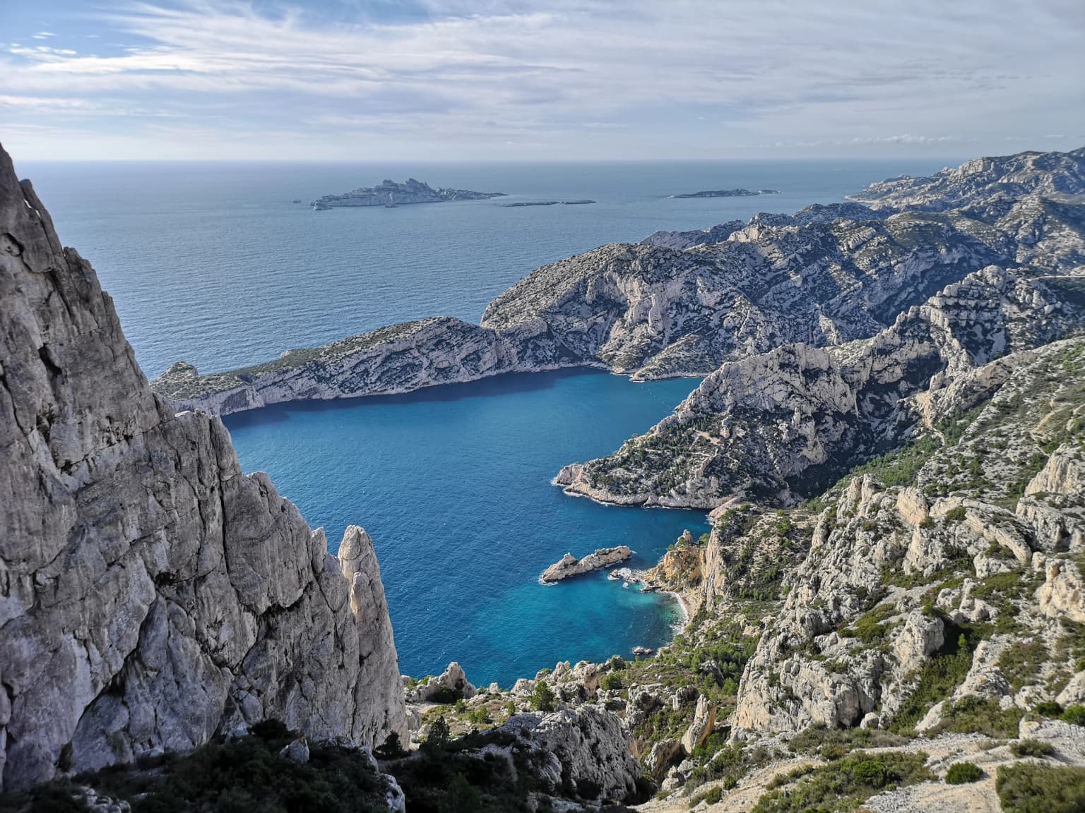
Calanques National Park is renowned for its exceptional limestone calanques, narrow, steep-walled inlets carved by fluvial erosion and sea-level changes into the Mesozoic rock of the Massif des Calanques. The park protects some of the Mediterranean coast's most spectacular scenery, including the iconic calanques of Sormiou, Morgiou, Port-Miou, Sugiton, and En-Vau, where massive white limestone cliffs plunge directly into azure waters. The marine component is equally significant, with extensive posidonia oceanica seagrass meadows, coralligenous communities, and underwater canyons. The prehistoric Cosquer Cave, accessible only by diving through its submerged entrance, contains one of the oldest known marine-themed cave art assemblages in Europe, with paintings and hand stencils dating to approximately 27,000 years BP. The park is also celebrated as one of Europe's premier climbing destinations, with over 3,400 documented climbing routes on its limestone walls.

Calanques National Park history and protected-area timeline

The protection of the Calanques area has roots extending to the early twentieth century, when local residents first organized to prevent industrial development that would have degraded the unique coastal landscape. In 1923, the Comité de défense des Calanques was established specifically to oppose plans for industrial extraction at the calanque d'En-Vau, marking the beginning of organized conservation advocacy for the region. This early movement reflected growing recognition of the Calanques' exceptional scenic and natural value, even as the area remained largely undeveloped due to its rugged terrain. The modern campaign for national park status began in earnest in the late twentieth century, with the groupement d'intérêt public (GIP) des Calanques founded in 1999 to coordinate preparations for creating a national park. The GIP spent over a decade engaged in extensive consultation, organizing 250 information meetings and 700 hours of discussions with stakeholders to address the diverse concerns of fishers, hunters, cabin owners, sailors, climbers, and other user groups who feared their activities would be restricted by new protections. After three draft versions were developed and refined through consultation, the third version was approved in 2011. On April 18, 2012, Prime Minister François Fillon signed the decree establishing Calanques National Park, making it France's newest mainland national park and the country's first peri-urban park combining both terrestrial and marine protection. The park's creation represented a compromise that excluded certain areas initially proposed, including the southern harbor of Marseille and the Frioul archipelago, to accommodate nautical and fishing interests.

Calanques National Park landscape and geographic character

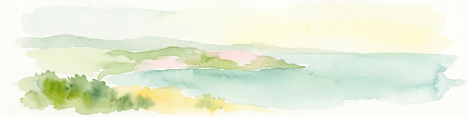
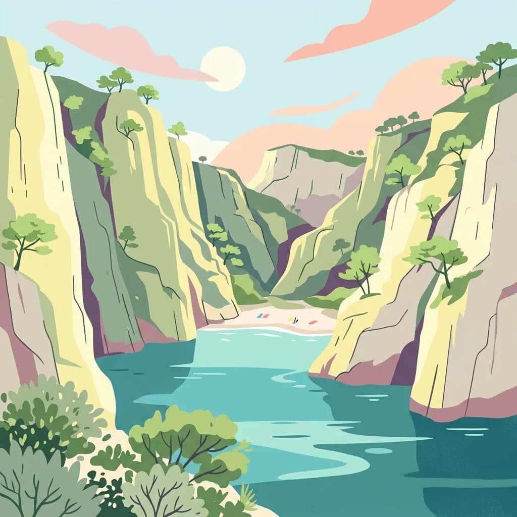
The landscape of Calanques National Park is defined by its dramatic limestone formations carved by millions of years of geological and marine erosion along the Mediterranean coast. The Massif des Calanques consists primarily of Jurassic and Cretaceous limestone that formed in warm, shallow tropical seas and later emerged through tectonic activity associated with the uplift of the Alps approximately 1.5 million years ago. The distinctive white Urgonian limestone, characterized by fossil rudist bivalves, creates the brilliant white cliffs and vertical walls that are emblematic of the region. The coastline is deeply indented with calanques—steep-sided inlets where stream-cut valleys have been drowned by rising sea levels, creating narrow, often nearly enclosed bodies of water flanked by cliffs that can rise hundreds of meters directly from the sea. The calanques of Sormiou, Morgiou, Port-Miou, Sugiton, and En-Vau represent the most famous examples of this landform. The park's highest point, Mont Carpiagne, rises to 645 meters within the Massif de Saint-Cyr, offering panoramic views over the coastal landscape and Mediterranean. The island landscapes include the archipelago of Frioul near Marseille, the more distant archipelago of Riou, and Île Verte, each with distinctive coastal formations. The underwater landscape is equally dramatic, with submarine canyons connecting the continental shelf to depths in the Fosse de Cassidaigne, and extensive rocky reefs supporting marine biodiversity.

Calanques National Park ecosystems, habitats, and plant life

The terrestrial and marine environments of Calanques National Park support remarkable biodiversity despite the park's intensive human use and Mediterranean climate. The terrestrial component encompasses approximately 26 distinct natural habitats, plus 40 mixed habitat types, supporting around 900 plant species and 83 protected species. The Mediterranean vegetation includes characteristic maquis shrubland, Aleppo pine forests in some areas, and garigue-type shrub communities on the drier slopes. The karstic geology creates unique habitat conditions, with caves and cavities providing shelter for specialized species. The marine environment is particularly significant, with posidonia oceanica seagrass meadows forming extensive underwater meadows that provide critical habitat and oxygen production for marine ecosystems. The coralligenous community develops on vertical walls and rocky substrates, creating complex three-dimensional structures that support exceptional biodiversity. Nearly 60 species of plants and animals in the marine environment receive conservation attention or protection, including red coral, posidonia, the green alga Caulerpa prolifera, the date mussel Lithophaga lithophaga, and the giant triton Charonia lampas. Several fish species face conservation concerns, including the brown grouper, corb, common dentex, and spotted seahorse.

Calanques National Park wildlife and species highlights

The wildlife of Calanques National Park encompasses diverse terrestrial and marine species adapted to the Mediterranean coastal environment. Among the notable avian species, Bonelli's eagle nests in the park's cliffs, while Cory's shearwater and Mediterranean shearwater breed on the islands and frequent coastal waters. The twelve reptile species and four amphibian species present reflect the Mediterranean climate and varied terrestrial habitats. The park's karstic cave systems provide critical roosting habitat for rhinolophid bats, which shelter in the underground cavities throughout the massif. The marine environment supports a rich community of invertebrates and fish. The posidonia meadows and coralligenous reefs provide essential habitat for numerous species, including the protected brown grouper, red coral, and various crustaceans such as the small European locust lobster, large locust lobster, European spiny lobster, and European lobster. Marine megafauna includes occasional sea turtles and dolphins, though the last monk seal in the Calanques was killed around 1945. The prehistoric Cosquer Cave paintings depict terrestrial animals including horses, Alpine ibex, chamois, bison, aurochs, deer, and antelopes, as well as marine species such as penguin and seal, providing evidence of the rich faunal communities present during the Last Glacial period when sea levels were much lower.

Calanques National Park conservation status and protection priorities

Calanques National Park represents significant conservation value in a heavily populated region of France, protecting both terrestrial and marine ecosystems that face multiple pressures. The park forms part of the European Natura 2000 network, with approximately 7,812 hectares designated under this conservation framework. The dual terrestrial-marine protection enables integrated management of a coastline where land and sea are ecologically interconnected through processes of sedimentation, nutrient exchange, and species migration. Several species of conservation concern receive targeted protection, including the Bonelli's eagle, the diadema sea urchin, the brown grouper, and the molosse de Cestoni bat. However, the park faces significant environmental challenges. Industrial pollution from the former Pechiney aluminum plant at Gardanne has resulted in the disposal of red mud into the Fosse de Cassidaigne marine canyon since 1966, with over 20 million tonnes deposited over five decades, introducing heavy metals and other contaminants into the marine environment. Fire risk remains high in the Mediterranean climate, with the park experiencing numerous wildfires over recent decades. The intense visitation pressure—approximately 1.5 to 2 million annual visitors—creates challenges for habitat preservation, particularly in the most popular calanques where visitor quotas have been implemented for sites like Sugiton and Pierres-Tombées during peak season.

Calanques National Park cultural meaning and human context

Human presence in the Calanques region extends continuously from the Lower Paleolithic period approximately 1.5 million years ago through to the present, creating a landscape where prehistoric, ancient, medieval, and modern cultural layers interweave with the natural environment. The Cosquer Cave, located beneath the Pointe de Morgiou with its entrance 37 meters below the current sea level, contains some of the oldest known cave art in Europe, with negative hand stencils dated to 27,000 years BP and paintings and engravings from approximately 18,000 years BP depicting both terrestrial mammals and marine species. Archaeological evidence from the Grotte des Trémies reveals Neanderthal occupation dating to approximately 300,000 years BP. During the antiquity period, the region was inhabited by the Ligures SEGOBRIGES tribe before Greek colonization by the Phocaeans established the port of Marseille around 600 BCE, with the calanques serving as navigation routes and sources of building stone. Medieval and early modern periods saw agricultural and pastoral use of the land, with sheep grazing on the islands contributing to deforestation. The historical pattern of human use has left traces throughout the landscape, from prehistoric cave sites to ancient quarries, medieval agricultural terraces, and defensive watchtowers built in the 1300s to guard against piracy. The cultural landscape also includes the traditional fishing villages within the calanques, where small cabins and harbors reflect centuries of maritime livelihood.

Top sights and standout views in Calanques National Park

The most distinctive features of Calanques National Park include its iconic calanques—deep, narrow limestone coves with dramatic white cliffs descending into vivid blue Mediterranean waters—and its unique status as Europe's first peri-urban national park combining terrestrial and marine protection. The park offers exceptional recreational opportunities, with over 3,400 climbing routes on its limestone cliffs making it one of France and Europe's premier climbing destinations, and an extensive network of hiking trails including the GR 51-98 crossing the massif. The prehistoric Cosquer Cave represents exceptional cultural heritage, with its submerged entrance accessible only by diving and cave paintings depicting marine species that would have been visible when the cave entrance sat well above sea level during the Last Glacial period. The marine environment features extensive posidonia meadows and coralligenous reefs supporting high biodiversity, while the islands of Riou and the Frioul archipelago provide important bird habitat and aesthetic contrast to the dramatic coastal cliffs.

Park location guide

Geography guide, regional context, and park location map for Calanques National Park

Calanques National Park park geography, regions, and map view in France
Understand where Calanques National Park sits in France through a broader geographic reading of the surrounding landscape, nearby location context, and its mapped position within the national park landscape.

How Calanques National Park fits into France

France is a unitary semi-presidential republic and one of the world's largest economies. It borders Belgium, Luxembourg, Germany, Switzerland, Italy, Monaco, Andorra, and Spain, with a maritime border to the United Kingdom. The country is known for its cultural influence, art, cuisine, and political history spanning centuries.

Wider geography shaping Calanques National Park in France

France is located in Western Europe. Metropolitan France extends from the Rhine to the Atlantic Ocean and from the Mediterranean Sea to the English Channel and North Sea. The country borders Belgium, Luxembourg, Germany, Switzerland, Italy, Monaco, Andorra, Spain, and has a maritime border with the United Kingdom.

Map view of Calanques National Park

Use this park location map to pinpoint Calanques National Park in France, understand its exact geographic position, and read its mapped placement within the surrounding landscape more clearly.

Pigeon | © OpenStreetMap contributors

Location context for Calanques National Park

Bouches-du-Rhône
Park atlas

Compare protected areas across the Bouches-du-Rhône department, tracing regional park geography and connected Mediterranean conservation landscapes.

Explore Parks Near Calanques National Park: Discover Nearby Protected Areas
After exploring Calanques National Park, continue discovering other national parks and protected areas across the Bouches-du-Rhône department and nearby Mediterranean coastal regions. This structured atlas view allows for geographic comparison of diverse protected landscapes, from marine environments to karst features, providing deeper context for regional conservation efforts.
Watercolor painting of a landscape with trees, hills, and a body of water
National park

Port-Cros National Park: French Mediterranean Island National Park & Marine Sanctuary

Discover mapped protected land and unique Mediterranean ecosystems.

Port-Cros National Park offers a glimpse into a pioneering model of integrated terrestrial and marine conservation within the Mediterranean. This park protects a distinctive island geography marked by rugged terrain, endemic species, and vital underwater habitats, including crucial posidonia meadows and rich marine life. Through MoriAtlas, explore the mapped boundaries and ecological significance of Port-Cros, understanding its role as a vital protected landscape in the European atlas.

Area
46 km²
Established
1963
IUCN
II
Visitors
1M annual
Watercolor illustration of a mountainous landscape featuring a river, rolling hills, and green vegetation
National park

Mercantour National Park: Mapped Alpine Protected Landscape and Regional Geography

Explore France's dramatic Alps, park boundaries, and unique ecotones.

Mercantour National Park stands as a premier protected area within the French Alps, distinguished by its remarkable geographic diversity and ecological significance. This national park encompasses mountainous terrain featuring dramatic peaks, deep glacial valleys, and a unique ecotone where Mediterranean and Alpine ecosystems converge. MoriAtlas facilitates a detailed atlas-style exploration of Mercantour National Park, highlighting its mapped protected boundaries, varied natural landscapes, and its pivotal role in regional geography and conservation efforts.

Area
679 km²
Established
1979
IUCN
II
Visitors
800K annual
Watercolor illustration of green fields, a river, and mountains under a soft pink and yellow sky
National parkOccitanie

Cévennes National Park: Explore its Mapped Terrain and Protected Landscape in Occitanie

Discover the unique geographic context and park boundaries.

Cévennes National Park, situated in Occitanie, France, offers a rich exploration of mid-mountain Mediterranean geography. As a protected landscape, its mapped terrain features dramatic limestone plateaus, deep river gorges, and distinct granite massifs. This entry provides essential geographic context for Cévennes National Park, highlighting its unique natural features and its significance as a protected area within the broader regional atlas.

Area
937 km²
Established
1970
IUCN
V
Visitors
800K annual
National park

Écrins National Park: Alpine Glaciated Terrain and Protected Landscape Details

Mapped boundaries and regional geography of a major French National Park.

Delve into Écrins National Park, a defining national park within the French Alps. This page provides a comprehensive overview of its protected landscape, focusing on its dramatic glaciated terrain, significant peaks such as the Barre des Écrins, and its position within the regional geographic context. Explore the mapped extent and understand the unique alpine environment of this protected area.

Area
925 km²
Established
1973
IUCN
II
National parkSavoie

Vanoise National Park: Explore France's Original National Park in the Savoie Alps

Mapped Alpine geography, glacial terrain, and protected landscape.

Vanoise National Park is France's pioneering national park, a protected landscape of immense alpine beauty situated in the Savoie department. Renowned for its dramatic glacial terrain, over 100 peaks above 3,000 meters, and the iconic Alpine ibex, this park offers a profound geographic context. Explore its mapped boundaries and discover the unique atlas-level insights into France's mountainous protected areas and their ecological significance.

Area
534 km²
Established
1963
IUCN
II
Relief
Mountain
Watercolor illustration depicting green valleys, forests, and distant mountain peaks
National park

Gran Paradiso National Park: Italy's National Park Protected Landscape Atlas

Mapped boundaries and regional geography for a key Italian protected area.

Gran Paradiso National Park is a distinct national park entity within Italy, offering rich potential for atlas-driven geographic discovery. This MoriAtlas profile focuses on its protected landscape identity, providing essential context for understanding its mapped boundaries and its role within the regional geography of Italy. Explore the structured geographic details that make Gran Paradiso National Park a valuable component of any mapped landscape analysis.

Area
703 km²
Established
1922
IUCN
II
Relief
Mountain
Watercolor painting of a river winding through a valley with green fields, trees, and distant hills
Protected area

Parc Natural Comunal de les Valls del Comapedrosa: Andorra's Highest Protected Alpine Landscape

Explore the Pyrenean terrain and mapped boundaries of Andorra's summit park.

Parc Natural Comunal de les Valls del Comapedrosa is the primary high-altitude protected area in Andorra, defined by its rugged alpine terrain and the presence of Coma Pedrosa, the country's highest peak. This protected landscape offers a significant geographic anchor for exploring the Pyrenees, highlighting the unique mountain conservation efforts. Its mapped boundaries encompass dramatic valleys and steep ridges, providing a clear context for understanding Andorra's mountainous geography through a structured atlas lens.

Area
15.43 km²
Established
2003
IUCN
IV
Relief
Mountain
Watercolor illustration of a coastal landscape with green hills, shoreline, and blue sea under a pale yellow sky
National parkSardinia

Asinara National Park: National Park Protected Landscape and Geographic Setting

Explore mapped terrain and protected area context within Sardinia.

Asinara National Park stands as a key protected landscape within the Italian national park system, located off the coast of Sardinia. This entry provides detailed geographic context, focusing on its mapped boundaries and the unique natural terrain that defines this island sanctuary. MoriAtlas facilitates a structured discovery of Asinara National Park, enabling users to understand its protected area status and its significant position within the broader regional geography of Sardinia for atlas exploration.

Area
51.7 km²
Established
1997
IUCN
II
Relief
Mixed relief

Common questions about visiting, size, designation, and location context for Calanques National Park

Calanques National Park FAQs for park facts, access, geography, and protected area context
Find quick answers about Calanques National Park, including protected-area facts, park geography, trail and visitor context, and how the park fits into its surrounding country and regional landscape.
MoriAtlas Explorer

Continue Your Protected Areas Search Across the Global Atlas

Deepen your exploration by continuing the structured search for national parks and protected areas worldwide. Utilize the comprehensive filtering capabilities to compare different conservation landscapes and refine your understanding of global park geography. Discover more about the distribution and characteristics of protected natural areas.

Global natural geography