
Mori Atlas logo
National parkCévennes National Park

Discover the mapped boundaries and geographic context of this distinctive French national park.

Cévennes National Park: A Protected Landscape of Mid-Mountain Mediterranean Terrain in Occitanie

(Parc national des Cévennes)

Cévennes National Park represents a unique protected landscape within the Occitanie region of France, characterized by its mid-mountain Mediterranean terrain. This atlas-focused entry details the park's distinct geographic entities, from granite peaks to limestone causse plateaus and deep river gorges. Explore the mapped boundaries and regional context of Cévennes National Park, understanding its role as a significant protected area defined by natural and cultural heritage.

national parkprotected landscapeUNESCO World Heritage Sitebiosphere reservedark sky reservemid-mountain ecosystems
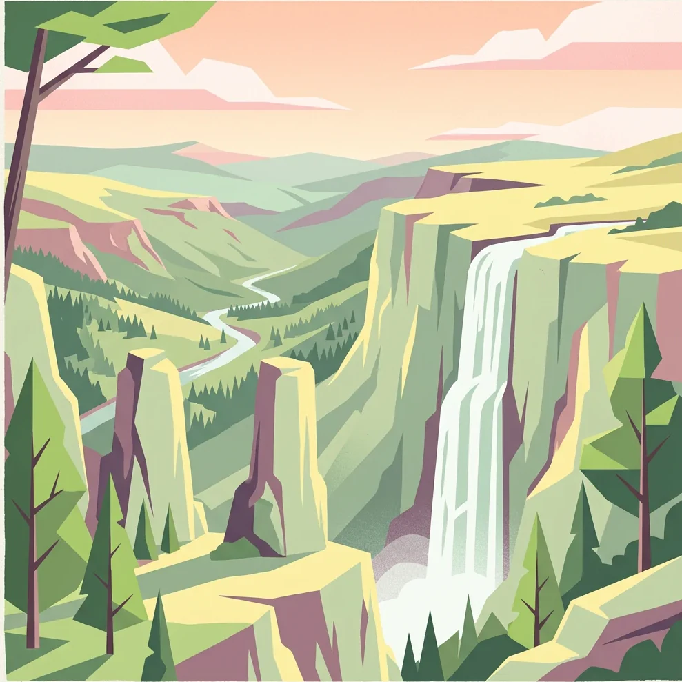
Stylized illustration of a mountain valley with cliffs, waterfall, and forested hills

Cévennes National Park

National park

Park overview

Structured park overview, official facts, and landscape profile for Cévennes National Park

Cévennes National Park park facts, protected area profile, and essential visitor context

Review the core facts for Cévennes National Park, including designation, size, terrain, visitor scale, habitats, and operating context in one park-focused overview.

About Cévennes National Park

Cévennes National Park occupies a unique position among French protected areas as the nation's only national park located in mid-mountain (moyenne montagne) terrain and the only one where the core protected zone maintains a permanent resident population engaged in agriculture. The park straddles the boundary between the Mediterranean and Atlantic climatic zones, creating ecological diversity that supports species from both regions. The landscape is characterized by four distinct geographical entities: the Mont Aigoual massif with its meteorological observatory, the Causse Méjean with the dramatic gorges of the Tarn and Jonte rivers, the granite peaks of Mont Lozère, and the steep schisteous vallées cévenoles that descend toward the Languedoc garrigue. The park's creation in 1970 followed decades of advocacy, including an early proposal by speleologist Édouard-Alfred Martel in 1913. The park's management model differs from other French national parks, incorporating the Mazerot contracts that compensate farmers for environmental stewardship, a compromise that helped overcome local opposition and prevent depopulation of the region.

Quick facts and research context for Cévennes National Park

Cévennes National Park covers approximately 938 km² in its core zone, with a broader adherence area of around 2,035 km² spanning 152 communes. The park sits at the crossroads of the Mediterranean and Atlantic climatic influences, creating a transition zone where vegetation ranges from meso-Mediterranean scrub to subalpine meadows. Mont Lozère's summit of Finiels reaches 1,699 metres as the park's highest point, while the lowest elevations around 117 metres occur near Anduze. The park is home to approximately 71,000 permanent residents, with about 600 living within the core protected zone. It holds dual designation as a UNESCO Biosphere Reserve since 1985 and as an International Dark Sky Reserve since 2018, making it the largest dark sky reserve in Europe.

Protection and recognition

Terrestrial conservation scope, WDPA records, and UNESCO Biosphere Reserve designations

Protected Area Status and UNESCO Recognition of Cévennes National Park

Cévennes National Park maintains a designated terrestrial protection status and is officially registered under the World Database on Protected Areas. Official sources recognize the region as a UNESCO Biosphere Reserve, offering verified parameters to study regional protection and international conservation designations.

International recognition

Protection details

Protection scope
Terrestrial
Designated year
1984
Transboundary protection
No
WDPA ID
660
Core area
938 km²
Buffer area
604.03 km²
Park context

Deeper park guide and search-rich context for Cévennes National Park

Cévennes National Park history, landscape, wildlife, and travel context

Explore Cévennes National Park through its history, landscape character, ecosystems, wildlife, conservation priorities, cultural context, and seasonal travel timing in a structured park guide built for atlas discovery and search intent.

Why Cévennes National Park stands out

Cévennes National Park is best known for its exceptional combination of mid-mountain Mediterranean landscapes, living agricultural heritage, and remarkable biodiversity. The park protects the dramatic limestone causse plateaus like Causse Méjean, the deep gorges of the Tarn and Jonte rivers with their vertical cliff walls, and the steep schist valleys of the Cévennes. It is famous for its successful vulture reintroduction program, with three species, griffon vulture, bearded vulture, and Egyptian vulture, now thriving in the gorges. The Stevenson Trail (GR70), the famous long-distance hiking route following Robert Louis Stevenson's 1879 journey with an donkey, traverses the park and remains a major attraction. The park is also notable as the only French national park where hunting is permitted in the core zone and where permanent residents continue traditional agricultural and pastoral activities.
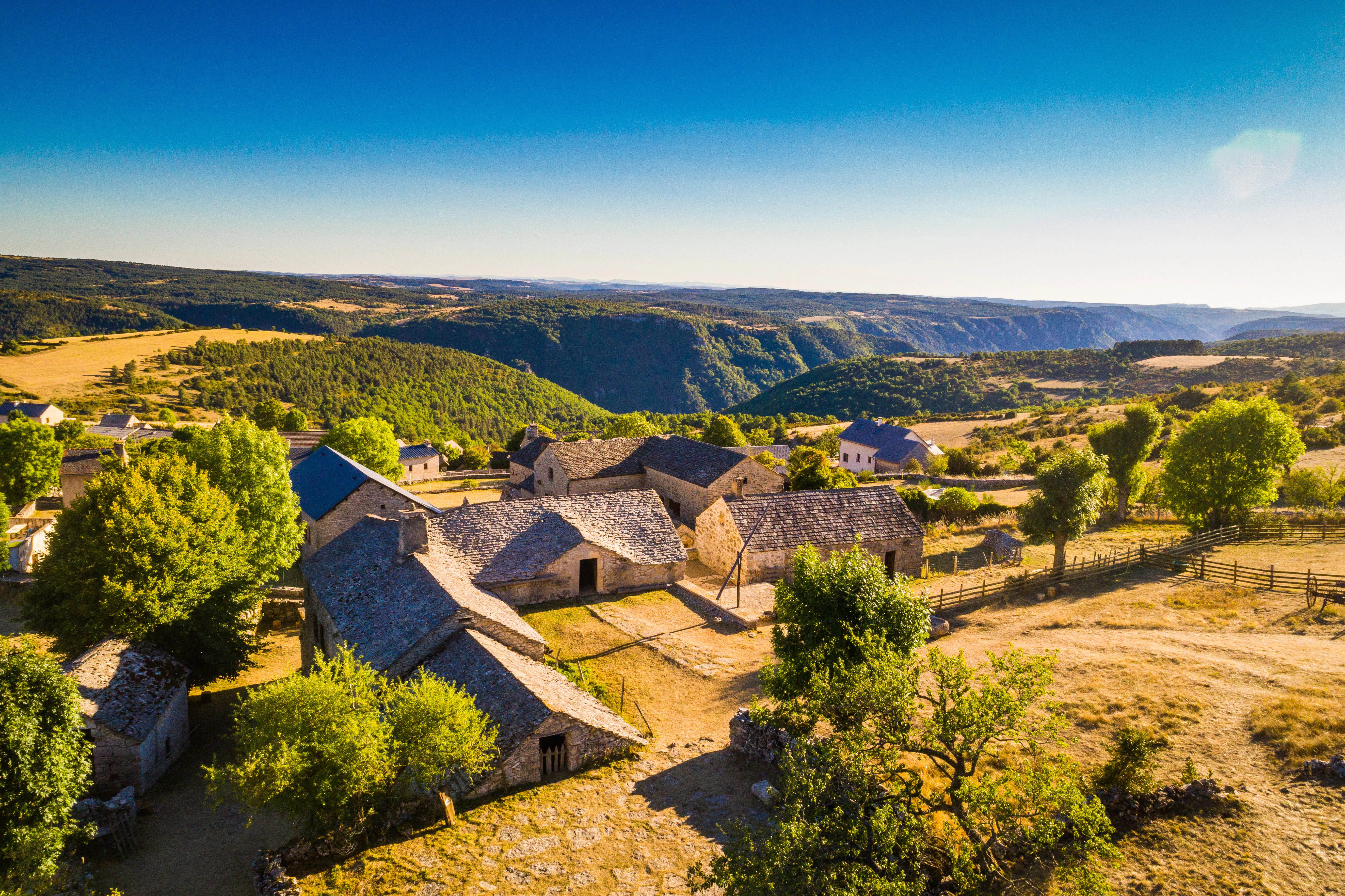
Stone farmhouse complex with stone roofs surrounded by trees and open fields, overlooking rolling hills and valleys under clear blue sky
Aerial view from Ferme Caussenarde showing Causse Méjean and Gorges de la Jonte with stone farmhouse in foreground

Cévennes National Park history and protected-area timeline

The Cévennes region carries a powerful historical identity rooted in Protestantism and the Camisard revolt of 1702-1704, an armed uprising following the revocation of the Edict of Nantes in 1685. The rebellion saw local Protestant peasants resist royal persecution in the mountainous terrain they knew intimately, and numerous sites throughout the park preserve memories of this conflict, including the temple at Le Rouve which now houses a permanent exhibition. The modern movement to protect the Cévennes emerged in the early 20th century, with spéléologist Édouard-Alfred Martel proposing a national park in 1913 and the Club Cévenol and other associations later advocating for preservation. After World War II, the Lozère departmental council revived the idea in 1956, leading to the creation of the Association du Parc National Culturel des Cévennes in 1957. The park was officially created by decree on September 2, 1970, becoming France's fourth national park. The establishment process involved significant negotiation, particularly regarding the rights of permanent residents—unlike other French national parks, the Cévennes was designed to allow continued agriculture and hunting in the core zone. In 1985, the park received UNESCO Biosphere Reserve designation, and in 2011, it became part of the World Heritage-inscribed Causses and the Cévennes, Mediterranean agro-pastoral Cultural Landscape.

Cévennes National Park landscape and geographic character

The physical landscape of Cévennes National Park encompasses remarkable topographical diversity across a relatively compact area. The park is formed of four distinct geographical entities: the Mont Aigoual massif in the south, the Causse Méjean with the gorges of the Tarn and Jonte in the west, Mont Lozère in the north, and the steep vallées cévenoles in the east. Mont Lozère's granite summit at Finiels reaches 1,699 metres, the park's highest point, while the lowest elevations around 117 metres occur near Anduze. The limestone causse plateaus, including Causse Méjean, rise between 800 and 1,200 metres and are deeply incised by river gorges whose vertical cliffs descend 500 to 600 metres in what are locally called « traits de scie » or saw-tooth patterns. The schist-dominated Cévennes slopes feature steep terrain with over 1,000 metres of elevation change, carved by successive serres (ridges) and narrow valleys. The geological foundation includes ancient Paleozoic rocks—schists, Carboniferous deposits, and granites dating approximately 300 million years—overlaid by Mesozoic limestone and dolomite formations. The park spans the watershed divide between the Atlantic (Garonne basin via the Lot and Tarn) and Mediterranean (Rhône basin via the Gardon, Cèze, and Hérault) drainage systems.
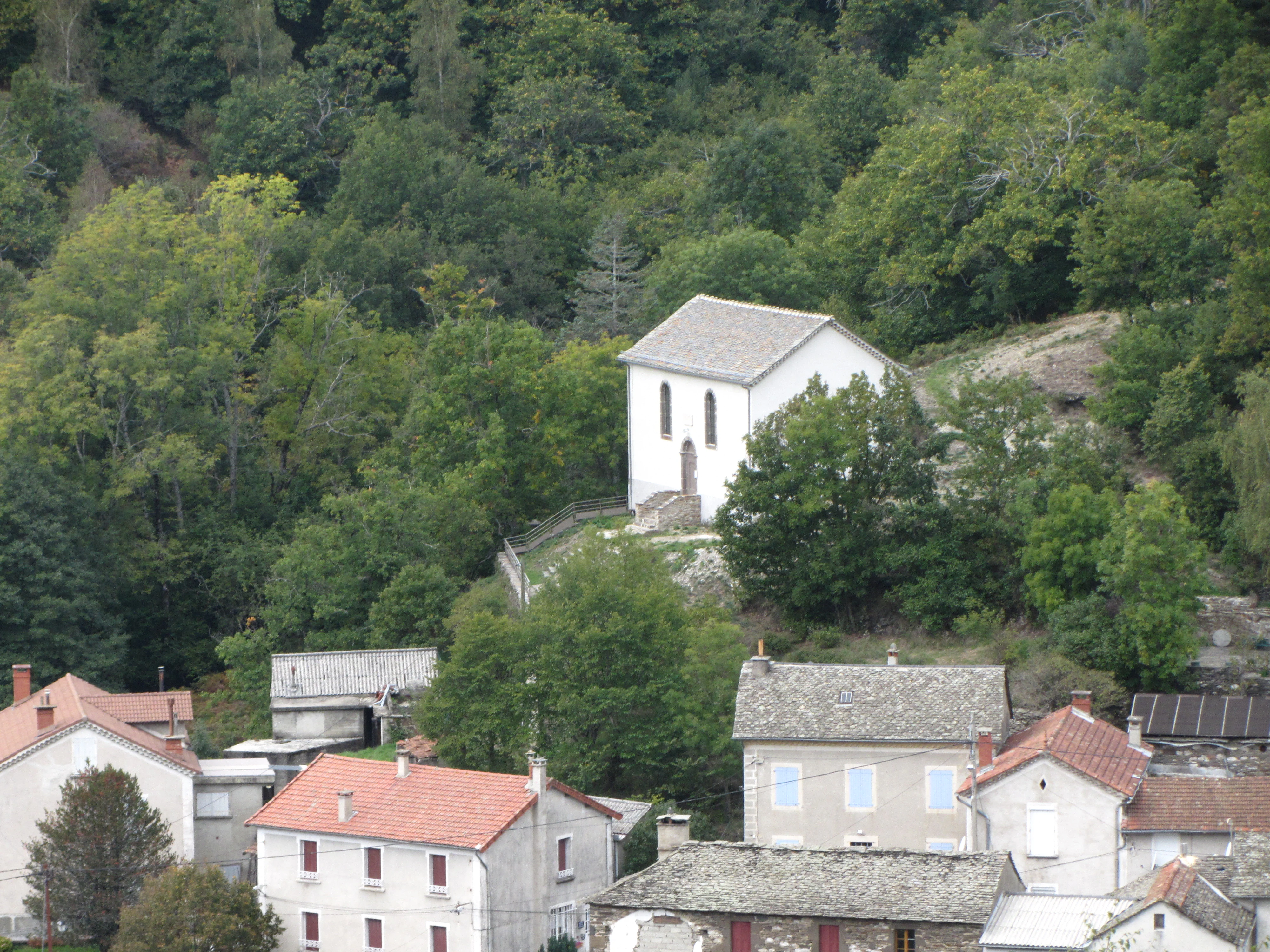
White building with gray roof on a hill surrounded by green trees and village buildings with red roofs
White memorial building on a hillside in Cévennes National Park

Cévennes National Park ecosystems, habitats, and plant life

The ecological character of Cévennes National Park reflects its position at the crossroads of Mediterranean and mountain biogeographical regions, creating exceptional habitat diversity within a relatively limited area. The park supports approximately 2,250 plant species, representing about 40% of France's total flora on just 0.5% of the national territory. Vegetation zones range from the meso-Mediterranean stage in the southern gorges through chestnut forest zones to subalpine conditions on Mont Lozère. The forests, covering over 70% of the park's territory, include ancient beech and oak woodlands, chestnut coppice groves emblematic of the Cévennes landscape, and increasingly diverse plantation forests. The karst geology of the causse plateaus creates distinctive underground ecosystems, while the river systems host diverse aquatic communities. The park's UNESCO Biosphere Reserve designation since 1985 recognizes this ecological significance, with the core zone designated as an IUCN Category II protected area. The Mediterranean agro-pastoral practices that have shaped the landscape for millennia maintain the critical balance between forested areas and open grasslands that supports the park's extraordinary biodiversity.
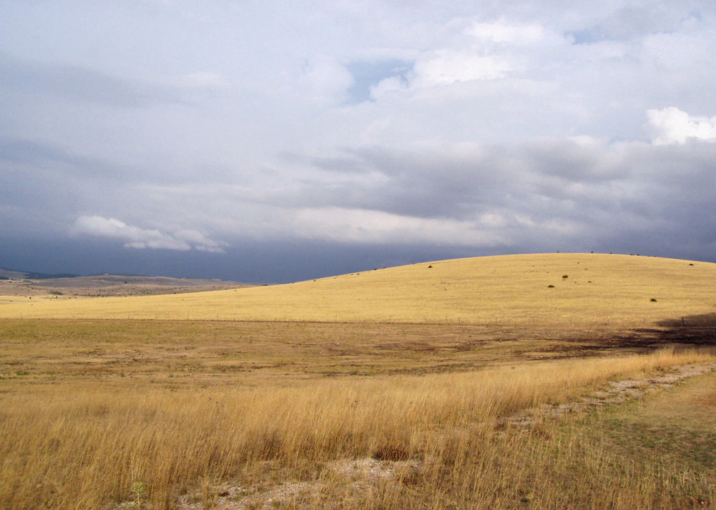
A wide grassy plateau under a partly cloudy sky with a narrow path visible on the right side
Causse Méjean plateau in Cévennes National Park, France

Cévennes National Park wildlife and species highlights

Cévennes National Park hosts an impressive diversity of wildlife, with over 2,400 animal species documented representing a remarkable concentration of France's fauna. The park supports 70 mammal species (out of 135 in France), 195 bird species (including 135 breeding species), 16 amphibian species, 15 reptile species, 23 fish species, and more than 2,000 invertebrate species including 1,824 insect species. The park is particularly renowned for its raptors, with more than twenty species of diurnal birds of prey and seven owl species, including the golden eagle, peregrine falcon, and eagle owl. The successful vulture reintroduction program stands as a conservation success story: griffon vultures were reintroduced in 1981 and by 2015, 443 breeding pairs inhabited the gorges of the Tarn and Jonte; bearded vultures have been reintroduced since 2012; and Egyptian vultures have returned naturally. Large ungulates including red deer, roe deer, and mouflon have returned or been reintroduced. The park also documents concerning trends, including the expansion of wild boar populations and the return of wolves since 2012, as well as the loss of species like the little bustard and grey partridge.
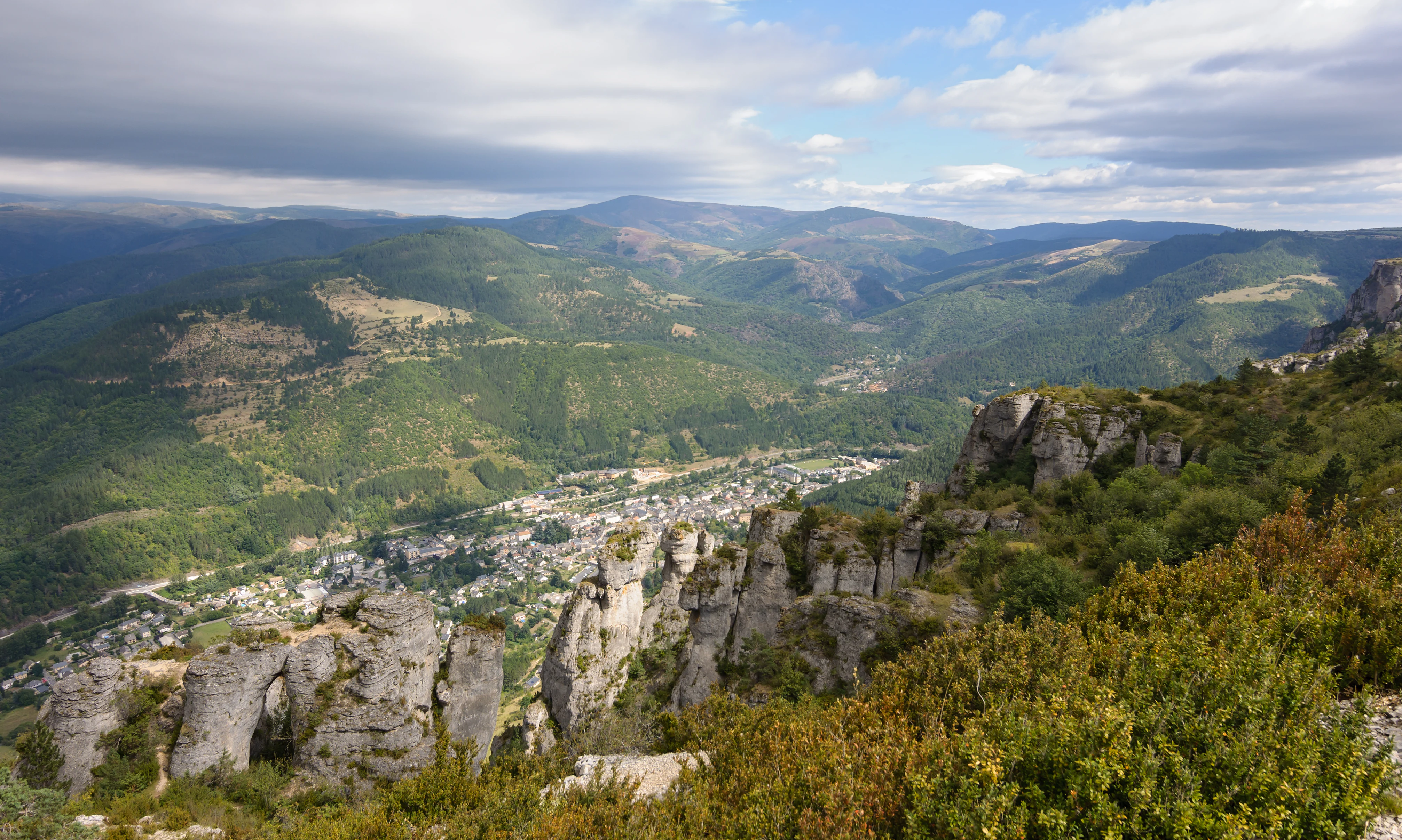
Wide landscape view of a mountain valley with rocky outcrops, a town below, and distant mountain ranges under a partly cloudy sky
Panoramic view from Causse Mejean overlooking Florac town and Mimente Valley within Cévennes National Park

Cévennes National Park conservation status and protection priorities

Cévennes National Park serves multiple conservation functions through its dual national park and UNESCO Biosphere Reserve designations, combined with its International Dark Sky Reserve status achieved in 2018, making it Europe's largest dark sky protected area. The park's conservation approach is distinctive because it integrates human activity into the protection model—the core zone remains inhabited and actively farmed, unlike other French national parks. Agricultural support programs encourage environmentally responsible practices through agri-environmental measures, and the park promotes agro-ecology and organic farming. The « Esprit parc national » branding helps market products from farms adhering to sustainable practices. Forest management in the core zone aims to increase natural character by promoting native species, natural regeneration, heterogeneous stand structures, and longer forestry cycles with deadwood retention. The park's 42 strictly threatened species include 11 endangered and 31 vulnerable species, while 103 species fall under the EU Habitats Directive and 48 under the Birds Directive. Hunting is permitted in the core zone with specific regulations, reflecting the park's Category V IUCN classification distinguishing it from strictly protected French national parks.

Cévennes National Park cultural meaning and human context

The cultural identity of Cévennes National Park is profoundly shaped by its Protestant heritage and the historical Camisard revolt that followed the revocation of the Edict of Nantes in 1685. The region became a center of armed resistance when Protestant peasants, familiar with every mountain path and hiding place, mounted a guerrilla campaign against royal forces. This history left enduring traces throughout the park's villages and landscapes, commemorated at sites including the temple at Le Rouve, now a memorial to the Camisard struggle. The Museum of the Desert near Anduze preserves the broader history of French Protestantism. Beyond this historical dimension, the park represents a living cultural landscape where agro-pastoral traditions have shaped both terrain and biodiversity for millennia. These Mediterranean farming practices, recognized by the UNESCO World Heritage inscription, create the mosaic of forests and open grasslands that defines the Causses and Cévennes. The park's unusual model allowing permanent residents and continued agriculture in the core zone emerged from the « Mazerot contracts » developed by the sub-prefect of Florac in the late 1960s, a compromise that prevented the depopulation that had afflicted other mountainous French regions following strict protection policies.
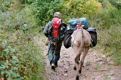
A hiker with a red backpack walking on a dirt trail alongside a donkey carrying large packs
Hiker leading a donkey on the GR70 Trail within Cévennes National Park

Top sights and standout views in Cévennes National Park

Cévennes National Park offers exceptional experiences across its varied terrain: exploring the deep gorges of the Tarn and Jonte where griffon vultures soar above vertical limestone cliffs; walking the Stevenson Trail (GR70) following Robert Louis Stevenson's 1879 journey through the Mont-Lozère region; visiting the Aven Armand cave with its monumental stalagmite formations on Causse Méjean; observing the vulture nesting colonies from the belvedere near Le Rozier; discovering the historic temples and museums commemorating the Camisard Protestant revolt; experiencing the Dark Sky Reserve on clear nights when the Milky Way spans the unpolluted sky; and exploring the chestnut grove landscapes that characterize the vallées cévenoles. The park's cultural heritage also includes the « Esprit parc national » network of local producers offering farm products, honey, and regional specialties. The administrative seat in Florac Castle provides visitor information about the park's multiple landscapes and protected species.

Best time to visit Cévennes National Park

Cévennes National Park offers distinct experiences across seasons: spring brings wildflower displays across the causse plateaus and is ideal for birdwatching as migratory species return; summer provides warm conditions for hiking the Stevenson Trail and exploring gorges, though afternoon thunderstorms can occur given the Mediterranean climate; autumn offers the celebrated chestnut harvest in the vallées cévenoles and the dramatic spectacle of vultures congregating before migration; winter transforms the higher terrain with snow on Mont Lozère while the lower valleys remain accessible. The « Cévenol episodes »—intense autumn rainfall events when Mediterranean moisture collides with Atlantic air over the mountains—can bring sudden heavy rains and flooding, particularly in September and October. The park's approximately one million annual visitors concentrate around summer and the October chestnut season, so spring and late autumn offer quieter exploration. The International Dark Sky Reserve designation makes the park particularly appealing for stargazing from September through April when nights are longest and clearest.
Monthly climate preview

Mapping annual temperature cycles and precipitation patterns from thirty years of weather data

Long-Term Climate Normals and Weather by Month in Cévennes National Park

Climatological records at a representative elevation of 472 meters reveal warm peak summers averaging above 22 degrees Celsius alongside cooler winter months that regularly dip below freezing. A complete twelve-month profile highlights historical precipitation fluctuations and temperature spreads necessary for analyzing regional conservation landscapes.
Annual mean12 °C
3 °C22 °C
Jan
Feb
Mar
Apr10°
May14°
Jun19°
Jul22°
Aug22°
Sep17°
Oct12°
Nov
Dec
Warmest month
July

22.2 °C

Coolest month
January

3.2 °C

Wettest month
October

3.7 mm/day

Driest month
July

1.1 mm/day

Park location guide

Geography guide, regional context, and park location map for Cévennes National Park

Cévennes National Park park geography, regions, and map view in France

Understand where Cévennes National Park sits in France through a broader geographic reading of the surrounding landscape, nearby location context, and its mapped position within the national park landscape.

How Cévennes National Park fits into France

France is a unitary semi-presidential republic and one of the world's largest economies. It borders Belgium, Luxembourg, Germany, Switzerland, Italy, Monaco, Andorra, and Spain, with a maritime border to the United Kingdom. The country is known for its cultural influence, art, cuisine, and political history spanning centuries.

Wider geography shaping Cévennes National Park in France

France is located in Western Europe. Metropolitan France extends from the Rhine to the Atlantic Ocean and from the Mediterranean Sea to the English Channel and North Sea. The country borders Belgium, Luxembourg, Germany, Switzerland, Italy, Monaco, Andorra, Spain, and has a maritime border with the United Kingdom.

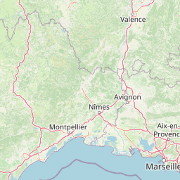
Map view of Cévennes National Park

Use this park location map to pinpoint Cévennes National Park in France, understand its exact geographic position, and read its mapped placement within the surrounding landscape more clearly.

Pigeon | © OpenStreetMap contributors

Location context for Cévennes National Park

ArdècheAveyronGardLozèreOccitanie
Natural feature types

Browse All Named Natural Features and Landmarks of Cévennes National Park

Access a detailed collection of mountains, plateaus, and valleys associated with Cévennes National Park. Use these structured records to trace the geographic distribution of features across the park departments and analyze the complex terrain of this Mediterranean mountain environment.
Recorded earthquake history

Explore the Historical Seismic Catalogue for Cévennes National Park

Examine the historical record of seismic activity documented in the vicinity of Cévennes National Park. This catalogue provides structured insights into recorded events, allowing users to trace seismic data points across the diverse mountain terrain of the region through MoriAtlas.

Cévennes National Park Earthquake History

Catalogued events

10 events

Strongest magnitude

Magnitude 4.3

Most recent event

Aug 3, 2011

This history includes earthquakes recorded inside the park or within 50 km of its borders

A visual guide to the park's diverse terrain, including granite massifs, limestone causse plateaus, and deep river gorges that define its natural environment.

Cévennes National Park Photography: Explore Mid-Mountain Landscapes and Protected Area Scenery

Delve into an extensive image collection highlighting the distinct landscapes of Cévennes National Park, from the dramatic granite peaks of Mont Lozère to the vast limestone plateaus and deep river valleys. These curated protected area photographs provide valuable visual context, enhancing your understanding of the park's varied terrain, unique ecosystems, and rich Mediterranean agro-pastoral heritage.

Stone farmhouse complex with stone roofs surrounded by trees and open fields, overlooking rolling hills and valleys under clear blue sky

Stone castle with two conical towers and a stone wall, surrounded by trees and hills

White building with gray roof on a hill surrounded by green trees and village buildings with red roofs

A wide grassy plateau under a partly cloudy sky with a narrow path visible on the right side

Wide landscape view of a mountain valley with rocky outcrops, a town below, and distant mountain ranges under a partly cloudy sky

Stone tower building with snow on ground, mountains in background, clear blue sky

A hiker with a red backpack walking on a dirt trail alongside a donkey carrying large packs

Park atlas

Browse regional park geography across Occitanie and adjacent protected landscapes in Southern France.

Explore Nearby National Parks and Protected Areas Around Cévennes National Park

Continue your exploration of France's protected areas by discovering national parks and regional natural parks in close proximity to Cévennes National Park. Compare their diverse mid-mountain landscapes, river gorges, and limestone plateaus within the broader geographic context of Occitanie and Southern France.
A watercolor illustration of a serene landscape with rolling hills, a meandering river, and soft light.
Regional parkAuvergne-Rhône-Alpes
6.3 km away#1 closest

Northeast

Parc naturel régional des Monts d'Ardèche: Protected Landscapes and Geographic Map Context

Volcanic highland terrain within the Auvergne-Rhône-Alpes region

Covering over 248,000 hectares, Parc naturel régional des Monts d'Ardèche represents a significant protected area in the southern Massif Central. The region is marked by its distinctive volcanic sucs, including Mont Gerbier-de-Jonc, and a complex network of Cévenol river valleys. It remains a focal point for understanding the transition between high volcanic plateaus and traditional terraced agricultural slopes in southeastern France.

Area
2,280 km²
Established
2001
IUCN
V
A soft watercolor painting showing a wide, panoramic view of rolling green hills, distant ridges, and gentle scrub vegetation against a white background.
Regional parkAuvergne-Rhône-Alpes
About 16 km away#2 closest

Northeast

Réserve naturelle régionale des Grads de Naves: Regional Park and Limestone Plateau Geography

Mediterranean habitat in the southern Ardèche region of France

Situated near Les Vans, the Réserve naturelle régionale des Grads de Naves is a small but biologically significant limestone plateau. This protected area demonstrates the natural reclamation of former cultivated farmland, now featuring a dense community of Mediterranean flora, breeding birds, and butterfly species within an iconic garrigue and oak-scrub landscape.

Area
0.12 km²
Established
1981
IUCN
IV
Relief
Upland
Natural monumentHérault
About 40 km away#3 closest

South

Site paléontologique de La Lieude: Geological Heritage and Permian Fossil Site in Hérault

Tracing ancient reptile pathways across preserved sedimentary rock

Located on the edge of the Massif Central, the Site paléontologique de La Lieude is a protected natural monument in the Hérault department. It showcases an exceptional Permian-age surface embedded with hundreds of trackways left by early synapsids, providing an essential geographic and scientific record of prehistoric life in France.

A wide watercolor illustration showing a river flowing through a green valley with distant purple mountains and a large reddish rock formation on the right bank.
Protected areaFrance
About 40 km away#4 closest

Northeast

Ripisylve et lit majeur de l'Ardèche: Protected Area and Alluvial River Geography

A vital riparian corridor in the French Ardèche valley.

This protected area centers on the active Ardèche river channel and its adjacent floodplain. The site features a rich diversity of humid habitats, ranging from quiet pools and side channels to sediment rich gravel deposits. It serves as an ecologically significant corridor for riparian woodland, providing a habitat structure that is central to the environmental health of the region.

Area
2.87 km²
Established
1999
Relief
Lowland
Climate
Temperate
A soft watercolor painting of a winding river flowing through a gentle, rolling green valley with hills in the background.
Nature reserveOccitanie
About 55 km away#5 closest

Southeast

Réserve naturelle régionale des gorges du Gardon: Geography and Protected Area Overview

Mediterranean river valley and raptor conservation corridor

Examine the distinct topography of the Réserve naturelle régionale des gorges du Gardon. The protected area features steep limestone cliffs and a river corridor that sustains dense Mediterranean oak forests. This site remains a critical node for raptor conservation, specifically supporting nesting Egyptian vultures and Bonelli eagles within its structured valley geography.

Area
4.913 km²
Established
2007
IUCN
IV
Watercolor painting of a low lying landscape with calm water, grassy wetlands in the foreground, and distant green hills under a soft sunset sky.
Protected areaHérault
About 63 km away#6 closest

South

Salins de Frontignan: An Atlas of Protected Coastal Wetlands in the Hérault Region

Explore saline landscapes and marshland geography on the Gulf of Lion.

Located in the Hérault department, Salins de Frontignan offers a fascinating study in coastal geography and ecological reclamation. This protected area features abandoned salt marshes that have evolved into a vital network of evaporation basins, salt steppes, and lagoon margins. The site serves as a crucial habitat for specialized halophytic plants, positioned uniquely between the Mediterranean shoreline and the limestone foothills of the Gardiole range.

Area
2.795 km²
Established
1980
IUCN
IV
Relief
Lowland
A horizontal watercolor painting depicting a soft, washed-out landscape of wetlands with green vegetation, calm water, and gentle hills in the distance.
Nature reserveOccitanie
About 71 km away#7 closest

Southeast

Réserve naturelle régionale de Mahistre et Musette: Regional Nature Reserve and Wetland Atlas

Petite Camargue geography and protected marshland mosaic in Occitanie

Located in the Gard department of southern France, the Réserve naturelle régionale de Mahistre et Musette represents a successful case of wetland restoration. This protected area features a distinct landscape of reedbeds, saline flats, and ponds, providing critical habitat for numerous wetland species. Access detailed geographic context on how these restored marshes link to the broader Petit Camargue environmental network.

Area
2.616 km²
Established
1999
IUCN
IV
A soft, light-toned watercolor painting showing rolling green hills and valley slopes under a pale sky.
Nature reserveOccitanie
About 73 km away#8 closest

Northwest

Réserve naturelle régionale des coteaux du Fel, A Protected Landscape in Occitanie, France

Regional nature reserve in the Aveyron department.

Located along the Lot valley, the Réserve naturelle régionale des coteaux du Fel preserves a mosaic of sun-drenched oak and chestnut woodlands, heathlands, and historic meadows. This nature reserve provides a critical study of small-area conservation and dryland habitat management within the rural landscape of Occitanie. Use this resource to understand the park's terrain, mapped boundaries, and its ecological importance in the northern Aveyron region.

Area
123.38 km²
Established
2011
IUCN
IV

Common questions about visiting, size, designation, and location context for Cévennes National Park

Cévennes National Park FAQs for park facts, access, geography, and protected area context

Find quick answers about Cévennes National Park, including protected-area facts, park geography, trail and visitor context, and how the park fits into its surrounding country and regional landscape.
MoriAtlas Explorer

Continue Your Protected Areas Search Across the Global Atlas

Deepen your exploration by continuing the structured search for national parks and protected areas worldwide. Utilize the comprehensive filtering capabilities to compare different conservation landscapes and refine your understanding of global park geography. Discover more about the distribution and characteristics of protected natural areas.

Global natural geography