
Mori Atlas logo
Protected areaSalins de Frontignan

Examine the transitional terrain between the Massif de la Gardiole and the Mediterranean lagoon system.

Salins de Frontignan: Mapped Geography and Protected Coastal Landscapes of Hérault, France

Salins de Frontignan serves as an essential ecological landmark within the Hérault department, representing the transformation of former industrial saltworks into a thriving Mediterranean wetland. This protected area encompasses a complex mosaic of saline basins, sansouires, and reedbeds nestled between the limestone slopes of the Massif de la Gardiole and the shallow waters of the Étang d'Ingril. Mapping the site reveals a layered coastal environment where industrial history and natural succession create a unique habitat for rare halophytic flora along the Gulf of Lion.

saltpanssaline wetlandsMediterranean coastGulf of Lionlagoonssansouires
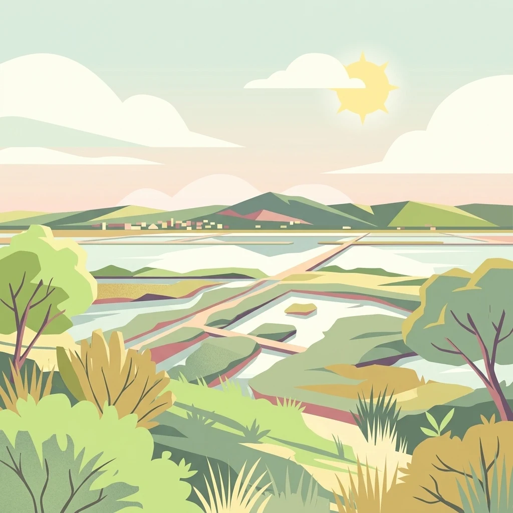
A flat-style digital illustration showing a wide view of salt marshes with low-lying water basins, dirt paths, and distant hills under a bright sun.

Salins de Frontignan

Protected area

Park overview

Structured park overview, official facts, and landscape profile for Salins de Frontignan

Salins de Frontignan park facts, protected area profile, and essential visitor context

Review the core facts for Salins de Frontignan, including designation, size, terrain, visitor scale, habitats, and operating context in one park-focused overview.

About Salins de Frontignan

Salins de Frontignan is a protected coastal nature site located in the Hérault department of southern France, on the western shore of the Gulf of Lion. Although it carries the identity of an inherited industrial landscape, having been shaped by centuries of salt production, it has come to be valued primarily for the saline ecosystems that have established themselves on the former saltpans.

Most of the site lies within the commune of Frontignan, with a smaller portion extending into Vic-la-Gardiole, and it sits along the D 612 road corridor between Sète and Montpellier. To the north rises the Massif de la Gardiole, a low limestone range whose slopes frame the site, while to the south lies the Étang d'Ingril, a coastal lagoon separated from the Mediterranean by the narrow Frontignan-Plage lido. This arrangement gives the area its characteristic layered profile: mountain backdrop, flat former marshland, lagoon edge, and sea horizon beyond.

From an ecological standpoint, Salins de Frontignan is a wetland mosaic. Its surface includes sansouires, the open salt flats dominated by low, salt-tolerant vegetation, as well as reedbeds, shallow evaporation basins known locally as carreaux, and an extensive network of old canals and rigoles that once carried seawater between basins. These artificial structures, now decaying into the landscape, create the small-scale topographic variation that supports a wide range of halophytic plant communities.

Acquired by the Conservatoire du littoral in 1989 and managed jointly with Thau agglo, the site is part of the network of protected coastal natural areas that line the French Mediterranean shore. Its protected status reflects both the conservation value of its saline flora and the importance of maintaining functional lagoon-side wetlands within a littoral corridor that is otherwise heavily developed.

Quick facts and research context for Salins de Frontignan

Salins de Frontignan is a protected natural area situated on the Mediterranean coast of the Hérault department, within the Occitanie region, primarily on the commune of Frontignan with a smaller portion on Vic-la-Gardiole. The site covers roughly 2,800 hectares of former salt marshes, lying between the Massif de la Gardiole and the Étang d'Ingril along the Gulf of Lion.

Established as a protected area in 1980 and acquired by the Conservatoire du littoral in 1989, the site is currently managed by Thau agglo, the intercommunal structure around the Bassin de Thau. It is classified under IUCN Category IV as a habitat and species management area, and its wetlands contribute to the broader ecological network of the Languedoc coast. The site contains more than 340 recorded plant species, including 14 of recognized heritage or patrimonial interest.

Protection and recognition

Documented conservation parameters and recognized protected area data for Salins de Frontignan.

Salins de Frontignan Protection Status and Territorial Management Records

Salins de Frontignan maintains a documented terrestrial protection scope within global conservation registries. Official records compile designated status, management parameters, and international recognition metrics without speculative outcomes.

Protection details

Protection scope
Terrestrial
Transboundary protection
No
WDPA ID
147447
Park context

Deeper park guide and search-rich context for Salins de Frontignan

Salins de Frontignan history, landscape, wildlife, and travel context

Explore Salins de Frontignan through its history, landscape character, ecosystems, wildlife, conservation priorities, cultural context, and seasonal travel timing in a structured park guide built for atlas discovery and search intent.

Why Salins de Frontignan stands out

Salins de Frontignan is best known for its mosaic of saline Mediterranean habitats developed on abandoned saltworks, including sansouires, reedbeds, still-visible evaporation basins, and historic salt-harvesting canals. The site is a textbook example of how former industrial coastal landscapes along the Gulf of Lion can evolve into ecologically rich wetlands adapted to high salinity and alternating wet and dry cycles. Another defining feature is the botanical diversity concentrated in such a small area: more than 340 plant species have been recorded, including several nationally protected halophytic plants such as Kickxia commutata, Limonium girardianum, and Althenia filiformis. Combined with its setting between the Massif de la Gardiole and the Étang d'Ingril, the site stands out as a compact lens of natural heritage within a heavily urbanized stretch of the French Mediterranean coast.
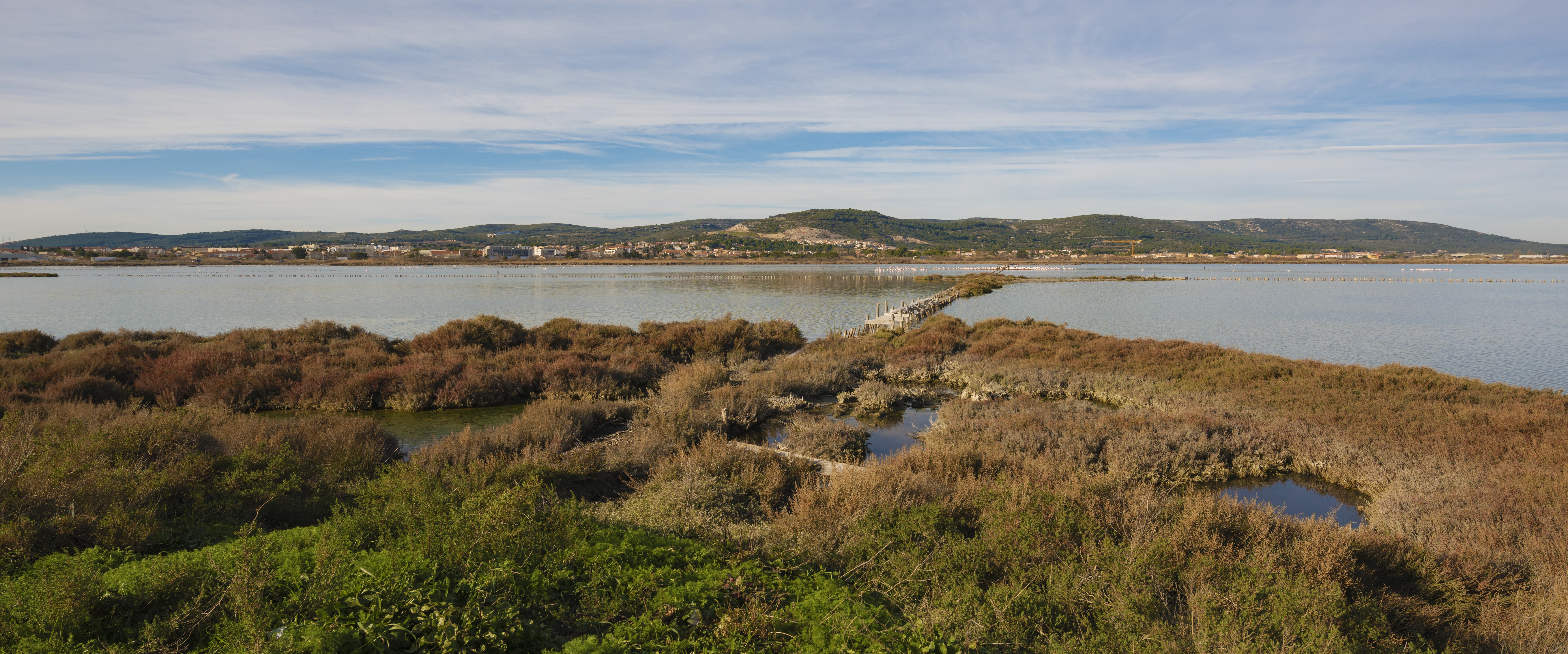
A wide, elevated view of the Salins de Frontignan wetlands featuring brown, marshy vegetation in the foreground and a large, calm salt water basin extending toward a low mountain range on the horizon under a pale sky.
The expansive wetland landscape of the former salt works at Salins de Frontignan, with the Massif de la Gardiole visible in the distance.

Salins de Frontignan history and protected-area timeline

The history of Salins de Frontignan reaches back well beyond the modern conservation era, with written evidence documenting salt production here from at least 1338. An act from that year, attributed to Peytavin de Montesquiou, bishop of Maguelone, references certain saltworks in the Frontignan area and notes that these salins had already existed for an indeterminate period before the document was drawn up.

Salt production intensified in the modern period after 11 July 1795, when the société commerciale des salins de Fontignan was founded. Over the course of the nineteenth century, the formerly fragmented saltworks, previously a patchwork of small operations owned by multiple small producers, were consolidated and expanded into the larger structural and spatial organization that survives today. Industrial activity during this period employed as many as three hundred workers in tasks such as salt harvesting and the manutention associated with the trade.

The saltworks finally closed in 1968, ending centuries of active production. The site then passed through several phases of abandonment and acquisition: purchased by the Conservatoire du littoral in 1989, briefly managed by the city of Frontignan from 1998, and then transferred in turn to the Communauté d'agglomération du Bassin de Thau. This transition from production to abandonment to conservation is the defining arc of the site's history.

Salins de Frontignan landscape and geographic character

Salins de Frontignan occupies a distinctive stretch of the Hérault littoral defined by the close proximity of three contrasting landforms. To the north looms the Massif de la Gardiole, a modest but visually prominent limestone range whose slopes give the site its mountain backdrop. Across the flat expanse of former marshes, the southern boundary is formed by the Étang d'Ingril, the broader sheet of shallow coastal water that defines the local lagoon system.

Between these two edges stretches the true terrain of the site: a mosaic of flat, low-lying ground made up of abandoned salt-harvesting basins, salt flats, slack-water channels, and overgrown berms and embankments. Salt steppes, or sansouires, dominate much of the visibly saline ground, while reedbeds and denser marsh vegetation occupy wetter zones, especially near the lagoon margin. The site is bounded on its western side by the D 612 road corridor, and on its seaward side by the narrow Frontignan-Plage lido that separates the lagoon system from the Mediterranean.

The result is a visually layered coastal landscape, where mountain, marsh, lagoon, and sea exist within a very short distance of one another. Despite the strong sense of flatness across the former saltworks themselves, the surrounding topography, in particular the Gardiole range, gives the site a remarkably varied visual frame for a marshland environment.
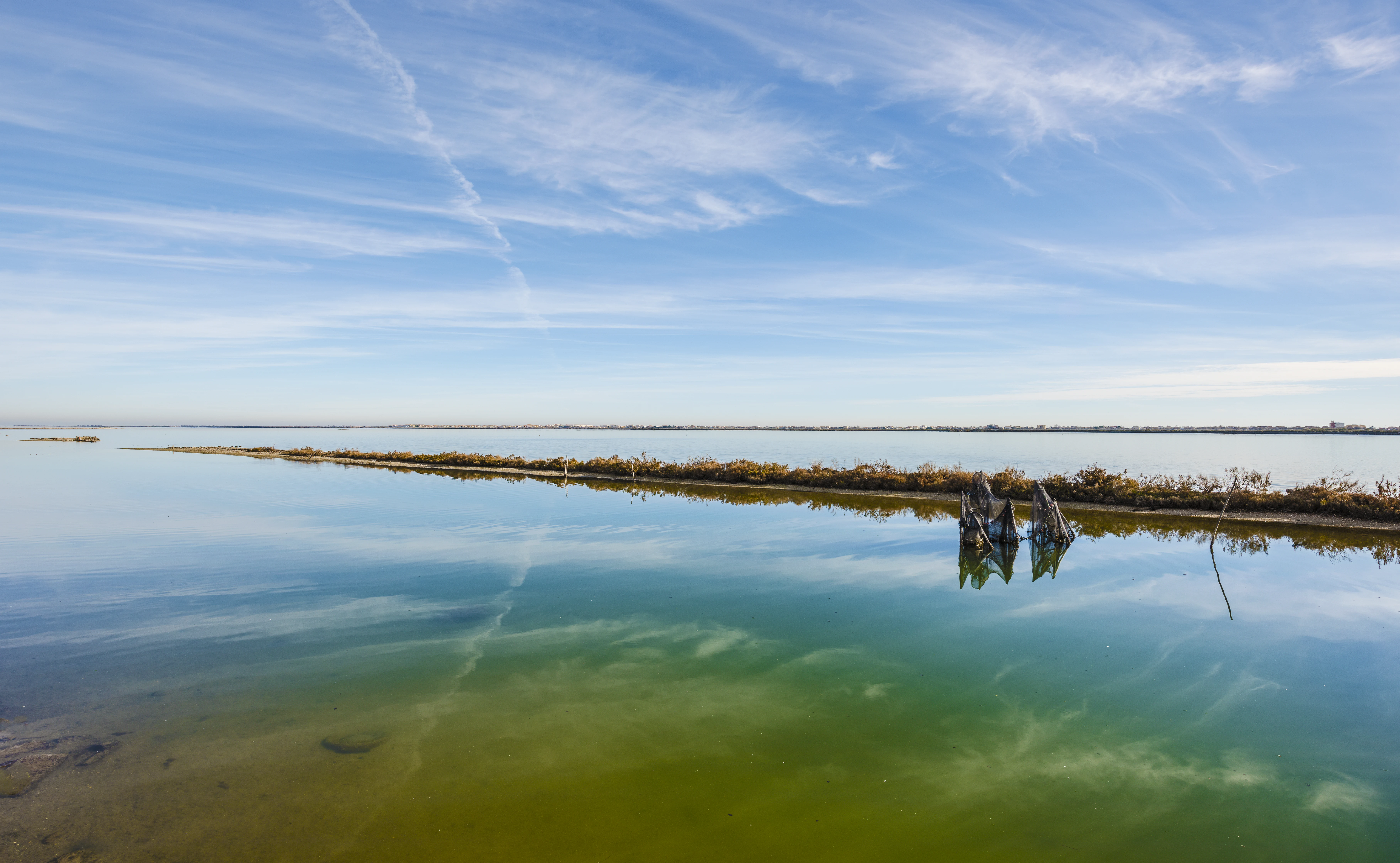
A wide, calm, shallow body of water reflecting a bright blue sky with wispy clouds, featuring a low, thin land strip covered in sparse vegetation and small wooden pilings in the water.
Calm waters of the Etang d'Ingril at the Salins de Frontignan.

Salins de Frontignan ecosystems, habitats, and plant life

Ecologically, Salins de Frontignan is defined by its highly saline, seasonally variable wetland character. The habitats present form a typical Mediterranean coastal saline complex: open sansouires and salt steppes, reedbeds and marsh edges, submerged aquatic communities in the shallow basins, and transitional scrub where terrestrial vegetation is gradually reclaiming the abandoned structures of the former saltworks.

Salinity is the dominant environmental filter. The site experiences alternating cycles of drying and flooding, with high evaporation in summer concentrating salts in surface soils, and seasonal reflooding through the old canal network. These conditions favor halophytic plants, or species tolerant of saline substrates, while excluding many common Mediterranean terrestrial plants. The result is a botanical community shaped less by climate alone than by chemistry and hydrology.

The mosaic of inherited human structures, including old basins, low embankments, canals, and the wooden pile alignments known as cairels, continues to influence ecological patterns. Slight differences in elevation and salinity between adjacent basins support noticeably different plant communities over very short distances, contributing to the unusually high plant diversity documented across the site.
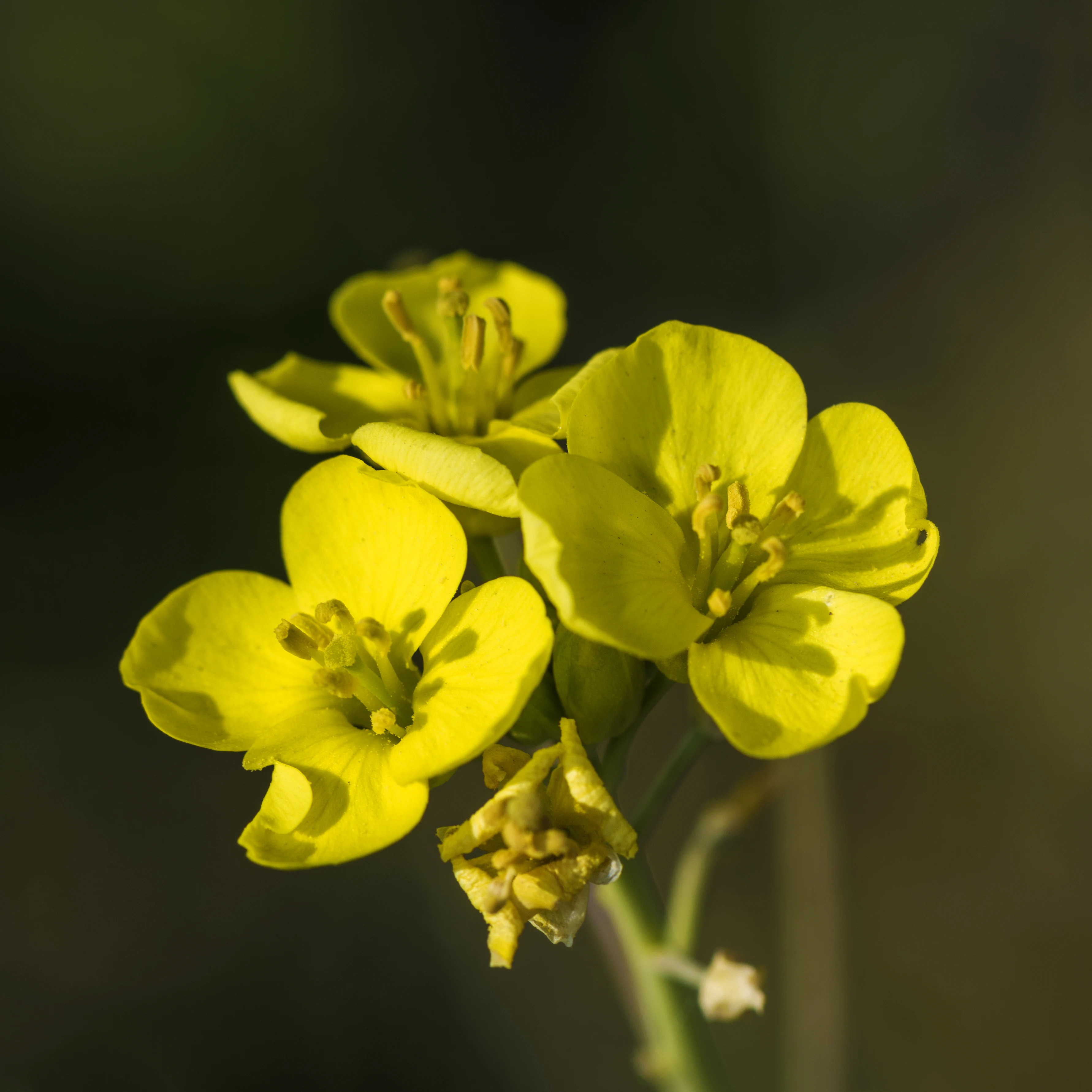
A cluster of vibrant yellow four-petaled flowers belonging to the Erysimum rhaeticum plant, set against a dark, blurred background.
A close-up view of Erysimum rhaeticum blossoms found in the Salins de Frontignan wetlands.

Salins de Frontignan wildlife and species highlights

While the available source material emphasizes flora more strongly than fauna, Salins de Frontignan's lagoon-edge setting and wetland mosaic support characteristic Mediterranean coastal wildlife. The reedbeds and shallow saline basins provide habitat for lagoon-associated birds, while the transitional scrub at the margins offers space for smaller passerines and other coastal species that benefit from the mixture of open marsh and fringing vegetation.

The Étang d'Ingril corridor, of which Salins de Frontignan forms a part, is part of the broader ecological continuum of the Thau lagoon system, supporting a network of seasonal and resident waterbird populations. The site's value for wildlife lies less in any single iconic species than in its role as a refuge of saline wetland habitat within a heavily developed coastal stretch.

Because the source material focuses primarily on vegetation, broader wildlife patterns are described here only at the level the available information supports, and no specific large-mammal or raptor claims are made.
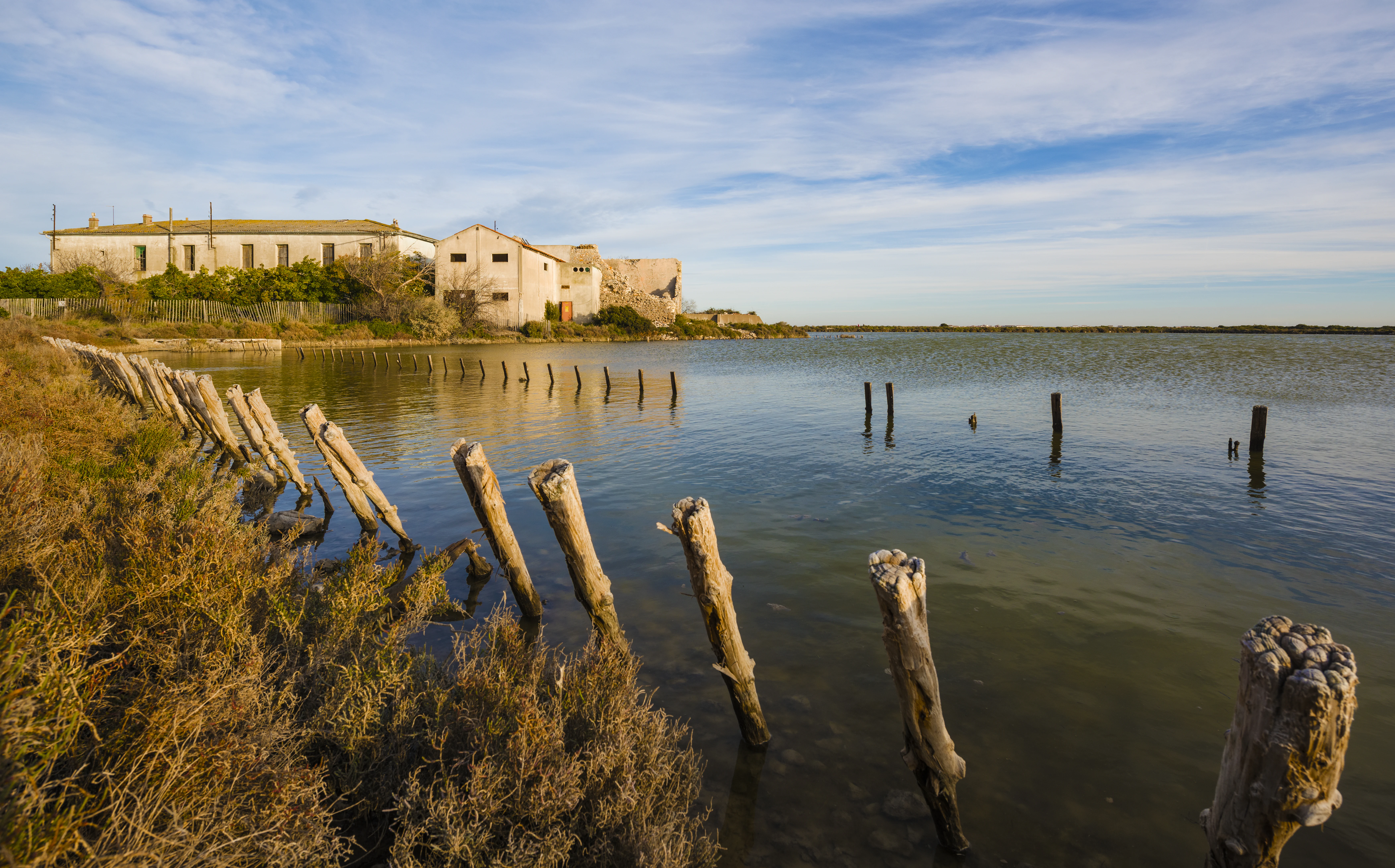
A row of weathered wooden posts protrudes from the calm, shallow water of the Salins de Frontignan, with abandoned stone buildings visible along the shore under a blue sky.
Historic salt production buildings reflected in the waters of the Salins de Frontignan.

Salins de Frontignan conservation status and protection priorities

Salins de Frontignan's conservation significance derives from the persistence of high-quality saline wetland habitat in a coastal corridor otherwise marked by intensive urbanization, tourism infrastructure, and port-related development around Sète, Frontignan, and Montpellier. The site is part of the network of coastal natural areas managed with the support of the Conservatoire du littoral, which acquired the property in 1989 and works to protect it against coastal development pressure.

Classified as IUCN Category IV, the area is recognized as a habitat and species management area, meaning its conservation regime emphasizes the maintenance of specific habitats and associated species rather than strict nature reserve conditions. In practice, this translates into active stewardship of a hybrid landscape, valued both as a working inheritance of salt-making heritage and as a functional saline ecosystem.

The site's botanical richness, including fourteen species of recognized heritage or patrimonial interest, underpins much of its formal conservation value. Several nationally protected taxa and species classified by the IUCN Red List depend on the unusual combination of salinity, seasonal flooding, and inherited small-scale topography that the site maintains.

Salins de Frontignan cultural meaning and human context

Salins de Frontignan carries a layered human imprint shaped by centuries of salt production. Long before any formal protection, the site was a working salt-making landscape whose economic and social rhythms structured the surrounding communities. The first written trace, from 1338, already presupposes a long-established activity, showing that salt production here predates the documentary record by an unknown margin.

The nineteenth-century consolidation of the salins and the related employment of large seasonal workforces left behind an enduring built heritage: saltworkers' housing, stables, storage buildings, workshops, a former customs post, and the structural remains of the basins themselves. Even as these structures decay and vegetation gradually reclaims the site, they remain visible features of the landscape and a tangible reference to the salt economy that once defined the southern Hérault coast.

Today, the site forms part of the cultural identity of Frontignan and the broader Bassin de Thau, where salt, lagoon fisheries, and Mediterranean port culture remain important regional reference points.
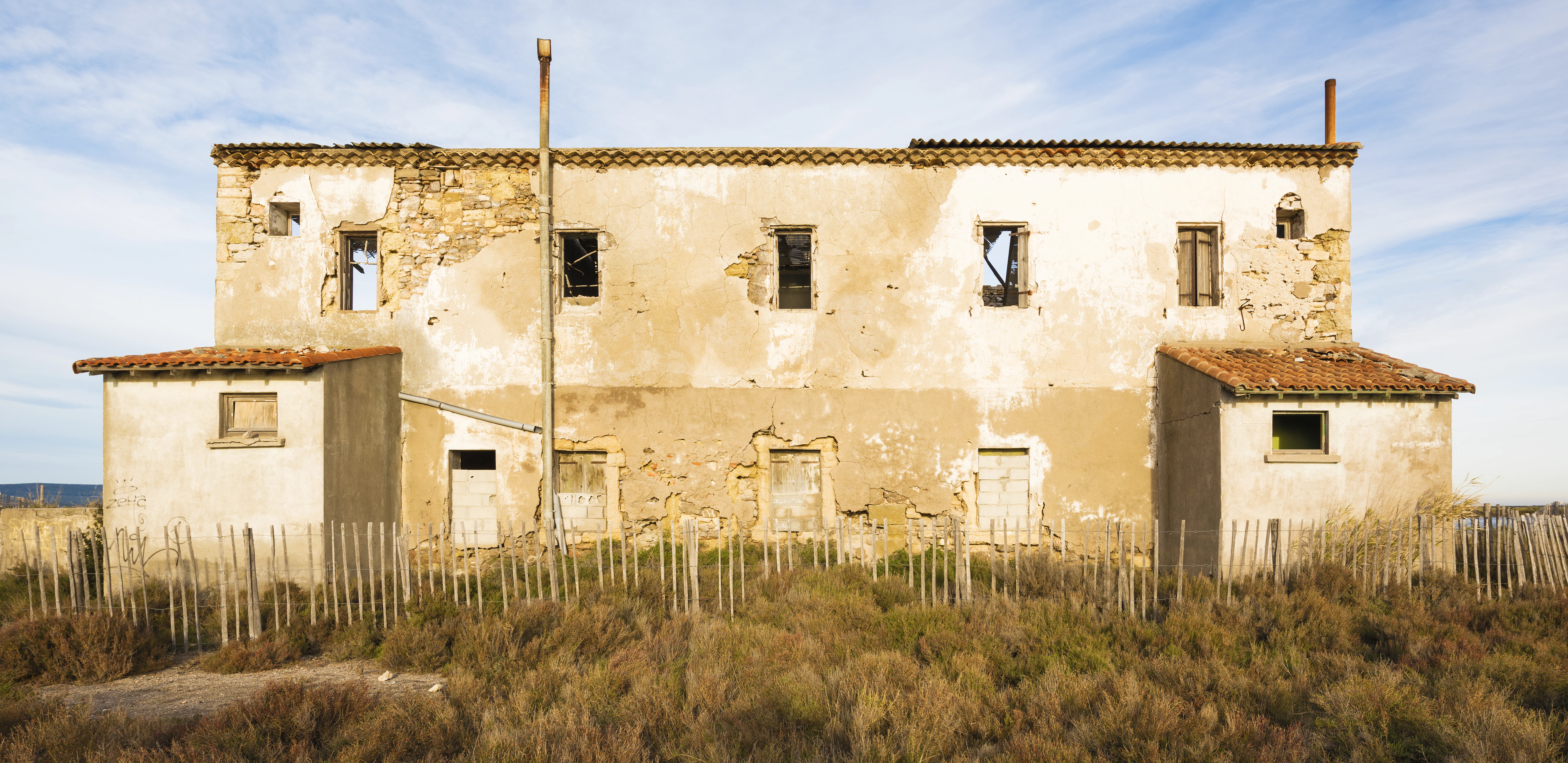
A weathered, abandoned two-story building with beige stucco walls, exposed stonework, and tiled roofs, situated behind a low wooden picket fence in a grassy area.
The abandoned historical salt production buildings at Salins de Frontignan, representative of the area's industrial heritage.

Top sights and standout views in Salins de Frontignan

Salins de Frontignan's most distinctive qualities are the convergence of inherited salt-making heritage with a thriving saline ecosystem on the Gulf of Lion coast. The unusual juxtaposition of the Massif de la Gardiole, flat former salt marshes, the Étang d'Ingril, and the Mediterranean lido creates a layered coastal geography in a very compact area.

Its botanical richness, including 340 recorded plant species and 14 of heritage or patrimonial interest, makes it a reference site for halophytic flora on the French Mediterranean coast. Combined with its formal protection by the Conservatoire du littoral and its management by Thau agglo, the site stands out as a compact, accessible example of how abandoned industrial coastal landscapes can be reclaimed by ecologically valuable Mediterranean wetland habitats.
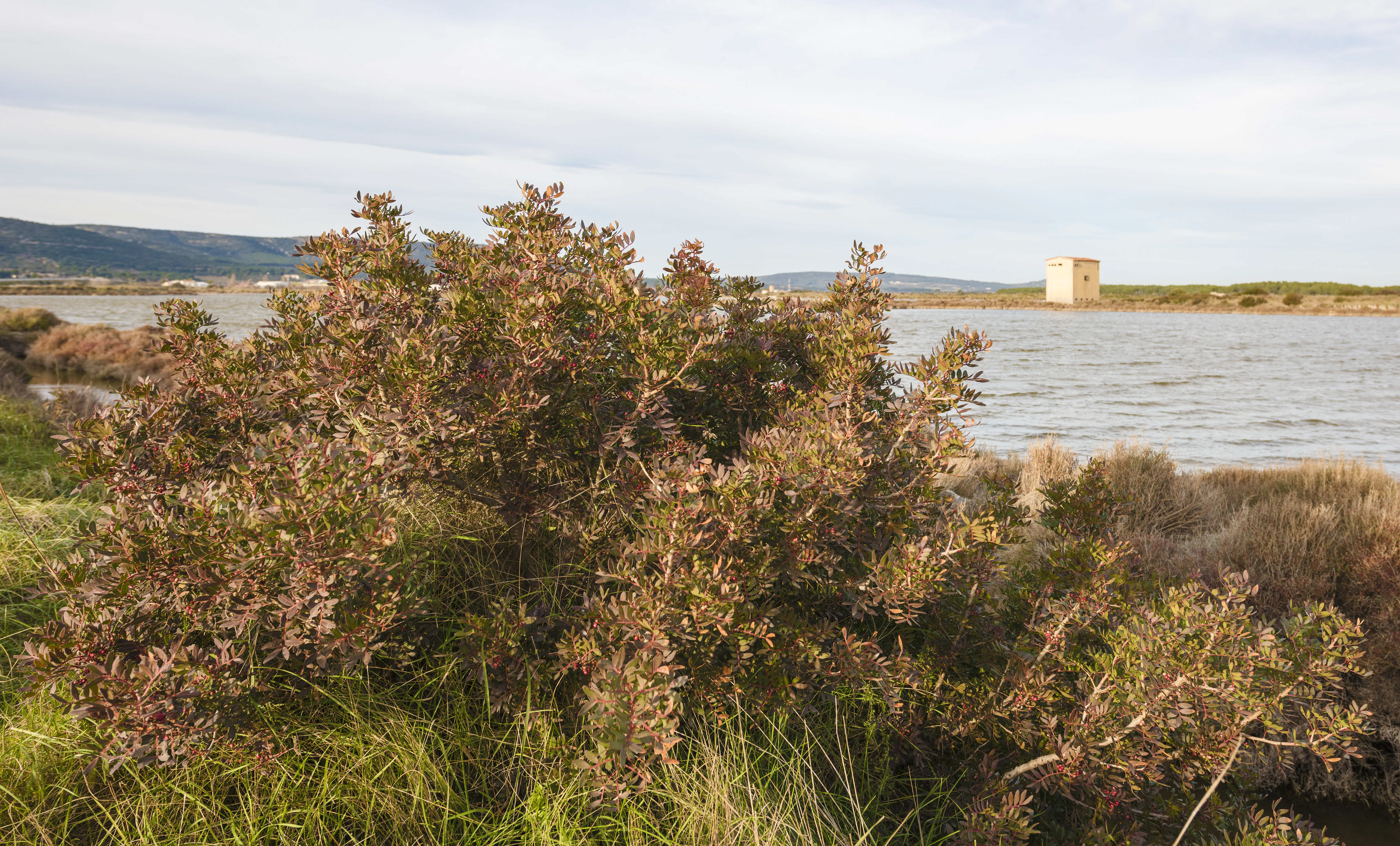
A medium-sized bushy tree with reddish-green leaves in the foreground, with calm wetland water and a small building in the background.
A Pistacia terebinthus shrub growing along the salt marshes of Salins de Frontignan.

Best time to visit Salins de Frontignan

Salins de Frontignan's character shifts meaningfully with the seasons in ways typical of Mediterranean saline wetlands. Spring is generally the most rewarding period for visiting, when milder temperatures coincide with active growth across the saline flora and the highest density of flowering among halophytic species, while bird activity around the lagoon edge is also notable.

Summer brings strong heat and high evaporation across the basins, concentrating salinity and exposing more of the bare sansouire surfaces, while autumn can offer quieter conditions and rich low-angle light across the marsh and lagoon. Winter is mild on this stretch of coast and can be interesting for waterbird observation along the Étang d'Ingril margin, though the saltworks themselves are at their least florally expressive during this period.
Monthly climate preview

Track monthly temperature ranges and precipitation averages across the protected terrain

Salins de Frontignan Climate Normals and Long-Term Weather Patterns by Month

Long-term climate records for Salins de Frontignan document measured shifts in average temperature and monthly precipitation across the representative coordinate. Reviewing the complete twelve-month profile provides detailed meteorological data for analyzing annual environmental rhythms.
Annual mean15 °C
7 °C24 °C
Jan
Feb
Mar10°
Apr13°
May17°
Jun21°
Jul24°
Aug24°
Sep20°
Oct16°
Nov11°
Dec
Warmest month
July

24.2 °C

Coolest month
January

7.2 °C

Wettest month
October

2.7 mm/day

Driest month
July

0.6 mm/day

Park location guide

Geography guide, regional context, and park location map for Salins de Frontignan

Salins de Frontignan park geography, regions, and map view in France

Understand where Salins de Frontignan sits in France through a broader geographic reading of the surrounding landscape, nearby location context, and its mapped position within the national park landscape.

How Salins de Frontignan fits into France

France is a unitary semi-presidential republic and one of the world's largest economies. It borders Belgium, Luxembourg, Germany, Switzerland, Italy, Monaco, Andorra, and Spain, with a maritime border to the United Kingdom. The country is known for its cultural influence, art, cuisine, and political history spanning centuries.

Wider geography shaping Salins de Frontignan in France

France is located in Western Europe. Metropolitan France extends from the Rhine to the Atlantic Ocean and from the Mediterranean Sea to the English Channel and North Sea. The country borders Belgium, Luxembourg, Germany, Switzerland, Italy, Monaco, Andorra, Spain, and has a maritime border with the United Kingdom.

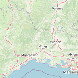
Map view of Salins de Frontignan

Use this park location map to pinpoint Salins de Frontignan in France, understand its exact geographic position, and read its mapped placement within the surrounding landscape more clearly.

Pigeon | © OpenStreetMap contributors

Location context for Salins de Frontignan

Hérault

Explore the unique terrain, saline habitats, and coastal scenery of the protected reserve

Salins de Frontignan Photos and Landscapes: Visual Guide to the Protected Wetland

Examine high-resolution photography documenting the diverse saline habitats and former saltworks of Salins de Frontignan. Visual records reveal the distinct transition from the limestone Massif de la Gardiole down to the coastal lagoon environment.

A wide, elevated view of the Salins de Frontignan wetlands featuring brown, marshy vegetation in the foreground and a large, calm salt water basin extending toward a low mountain range on the horizon under a pale sky.

A wide, eye level shot of a cluster of weathered, low-rise stone buildings sitting on the shore of a shallow, reflective wetland area, with low-lying coastal vegetation in the foreground and a clear blue sky above.

A wide, calm, shallow body of water reflecting a bright blue sky with wispy clouds, featuring a low, thin land strip covered in sparse vegetation and small wooden pilings in the water.

A cluster of vibrant yellow four-petaled flowers belonging to the Erysimum rhaeticum plant, set against a dark, blurred background.

A row of weathered wooden posts protrudes from the calm, shallow water of the Salins de Frontignan, with abandoned stone buildings visible along the shore under a blue sky.

A square, tan-colored industrial building stands in the center of a salt marsh, surrounded by low-lying vegetation and water with distant hills on the horizon.

A weathered, abandoned two-story building with beige stucco walls, exposed stonework, and tiled roofs, situated behind a low wooden picket fence in a grassy area.

A medium-sized bushy tree with reddish-green leaves in the foreground, with calm wetland water and a small building in the background.

A close-up view of a Reseda alba plant showing its upright, spike-like flower clusters with small white blossoms and green, pod-like buds, set against a blurred background.

Park atlas

Compare adjacent wetland reserves, lagoon systems, and Mediterranean regional landscapes

Parks Near Salins de Frontignan and Surrounding Coastal Protected Areas

Continue exploring protected natural areas near Salins de Frontignan by comparing adjacent Mediterranean wetlands, coastal lagoons, and restored salt marsh habitats. Examining these surrounding regional landscapes provides a broader geographic perspective on conservation along the Gulf of Lion littoral.
A horizontal watercolor illustration showing a marshy, grassy landscape with soft green and muted pink tones against a white background.
Regional parkProvence-Alpes-Côte d'Azur
About 37 km away#1 closest

East

Parc naturel régional de Camargue: Mapping the Rhône Delta Protected Wetland Landscape

Regional park geography and wetland conservation zones

Parc naturel régional de Camargue is a sprawling protected landscape at the confluence of the Rhône and the Mediterranean. This regional park contains significant saline lagoons, coastal dunes, and fertile marshes that serve as a crucial site for waterbird migration. Understand the interplay between traditional salt-making, pastoral ranching, and the strictly protected nature reserves that shape this delta territory.

Area
856.9 km²
Established
1970
IUCN
V
Relief
Lowland
A horizontal watercolor painting depicting a soft, washed-out landscape of wetlands with green vegetation, calm water, and gentle hills in the distance.
Nature reserveOccitanie
About 40 km away#2 closest

Northeast

Réserve naturelle régionale de Mahistre et Musette: Regional Nature Reserve and Wetland Atlas

Petite Camargue geography and protected marshland mosaic in Occitanie

Located in the Gard department of southern France, the Réserve naturelle régionale de Mahistre et Musette represents a successful case of wetland restoration. This protected area features a distinct landscape of reedbeds, saline flats, and ponds, providing critical habitat for numerous wetland species. Access detailed geographic context on how these restored marshes link to the broader Petit Camargue environmental network.

Area
2.616 km²
Established
1999
IUCN
IV
Natural monumentHérault
About 45 km away#3 closest

Northwest

Site paléontologique de La Lieude: Geological Heritage and Permian Fossil Site in Hérault

Tracing ancient reptile pathways across preserved sedimentary rock

Located on the edge of the Massif Central, the Site paléontologique de La Lieude is a protected natural monument in the Hérault department. It showcases an exceptional Permian-age surface embedded with hundreds of trackways left by early synapsids, providing an essential geographic and scientific record of prehistoric life in France.

Watercolor painting of a marshy wetland scene with grassy foreground, scattered trees, and distant hills.
Nature reserveGard
About 49 km away#4 closest

East

Réserve naturelle régionale du Scamandre: Mapped Boundaries and Wetland Geography in Gard

Protected marshlands and salt steppe in southern France.

Deep dive into the ecological layout of Réserve naturelle régionale du Scamandre. Situated in the Gard department, this protected site preserves a mosaic of prairie, sansouïre, and marshland, creating a high-density wetland corridor essential for regional biodiversity and landscape analysis.

Area
1.467 km²
Established
2006
IUCN
IV
Relief
Lowland
Watercolor illustration of green fields, a river, and mountains under a soft pink and yellow sky
National parkOccitanie
About 63 km away#5 closest

North

Cévennes National Park: Explore its Mapped Terrain and Protected Landscape in Occitanie

Discover the unique geographic context and park boundaries.

Cévennes National Park, situated in Occitanie, France, offers a rich exploration of mid-mountain Mediterranean geography. As a protected landscape, its mapped terrain features dramatic limestone plateaus, deep river gorges, and distinct granite massifs. This entry provides essential geographic context for Cévennes National Park, highlighting its unique natural features and its significance as a protected area within the broader regional atlas.

Area
937 km²
Established
1970
IUCN
V
Visitors
800K annual
A watercolor illustration of a tranquil marshland scene with soft green and muted pink tones, depicting reeds, sparse trees, and calm water.
Nature reserveFrance
About 72 km away#6 closest

East

Réserve naturelle régionale de la Tour du Valat: Mediterranean Wetland and Research Landscape Map

A critical protected area and ecological research estate in the Rhône delta of France.

Located in the Bouches-du-Rhône department, the Réserve naturelle régionale de la Tour du Valat serves as a reference point for Mediterranean wetland science. The reserve features an intricate landscape of marshes, salt meadows, and woodland patches that support diverse birdlife and habitats. This protected area demonstrates the integration of active pastoral land use with habitat management on a significant deltaic estate near Arles.

Area
18.44 km²
Established
2008
Relief
Lowland
Climate
Mediterranean
A soft watercolor painting of a winding river flowing through a gentle, rolling green valley with hills in the background.
Nature reserveOccitanie
About 74 km away#7 closest

Northeast

Réserve naturelle régionale des gorges du Gardon: Geography and Protected Area Overview

Mediterranean river valley and raptor conservation corridor

Examine the distinct topography of the Réserve naturelle régionale des gorges du Gardon. The protected area features steep limestone cliffs and a river corridor that sustains dense Mediterranean oak forests. This site remains a critical node for raptor conservation, specifically supporting nesting Egyptian vultures and Bonelli eagles within its structured valley geography.

Area
4.913 km²
Established
2007
IUCN
IV
Watercolor painting depicting a landscape with marshy green foreground, winding water, distant trees, and mountains under a light sky.
Nature reserveOccitanie
About 75 km away#8 closest

Southwest

Réserve naturelle régionale de Sainte-Lucie: Protected Coastal Geography in Occitanie

Coastal lagoons, island habitats, and Mediterranean marshlands.

This protected area profile explores the physical geography of Réserve naturelle régionale de Sainte-Lucie. Understand the interplay between the central island landform, brackish lagoon networks, and the Mediterranean beach ecosystems that define this unique French conservation landscape.

Area
8.25 km²
Established
2009
IUCN
IV
Relief
Lowland

Common questions about visiting, size, designation, and location context for Salins de Frontignan

Salins de Frontignan FAQs for park facts, access, geography, and protected area context

Find quick answers about Salins de Frontignan, including protected-area facts, park geography, trail and visitor context, and how the park fits into its surrounding country and regional landscape.
MoriAtlas Explorer

Continue Your Protected Areas Search Across the Global Atlas

Deepen your exploration by continuing the structured search for national parks and protected areas worldwide. Utilize the comprehensive filtering capabilities to compare different conservation landscapes and refine your understanding of global park geography. Discover more about the distribution and characteristics of protected natural areas.

Global natural geography