
Mori Atlas logo
Nature reserveRéserve naturelle régionale de la Tour du Valat

A vital research estate and Mediterranean nature reserve situated within the Rhône delta of southern France.

Réserve naturelle régionale de la Tour du Valat: Mapping the Wetland Landscapes and Protected Boundaries of the Camargue

The Réserve naturelle régionale de la Tour du Valat protects a complex mosaic of Mediterranean wetland and dryland habitats located in the heart of the Camargue. This significant research estate encompasses diverse terrain, including saline lagoons, seasonal marshes, and halophytic steppes known as sansouïres. Through long-term ecological monitoring, the reserve provides essential geographic context for the fluvio-lacustrine ecosystems of the Rhône delta, illustrating the intersection of conservation, traditional pastoralism, and hydrology in southern France.

CamargueMediterranean wetlandsregional nature reservesalt marshessansouïressalt meadows
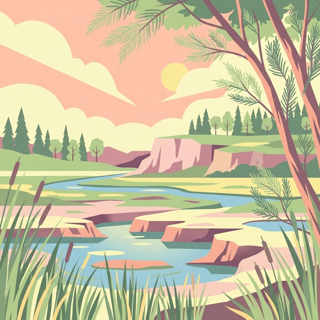
A flat-style digital illustration showing a winding river flowing through a wetland area with cliffs, pine trees, and tall reeds in the foreground under a pastel sky.

Réserve naturelle régionale de la Tour du Valat

Nature reserve

Park overview

Structured park overview, official facts, and landscape profile for Réserve naturelle régionale de la Tour du Valat

Réserve naturelle régionale de la Tour du Valat park facts, protected area profile, and essential visitor context

Review the core facts for Réserve naturelle régionale de la Tour du Valat, including designation, size, terrain, visitor scale, habitats, and operating context in one park-focused overview.

About Réserve naturelle régionale de la Tour du Valat

The Réserve naturelle régionale de la Tour du Valat occupies a significant part of the Domaine de la Tour du Valat, one of the most influential private conservation and research estates in the Camargue. The domaine was acquired in 1947 by Swiss ornithologist and conservationist Luc Hoffmann and was converted in 1954 into a dedicated biological research station under the governance of a non-profit foundation. Over the decades, the estate has become a benchmark site for wetland science in the Mediterranean, linking long-term ecological research with practical habitat management on the ground.

The reserve itself covers roughly 1,844 hectares of the fluvio-lacustrine central Camargue, a landscape shaped by the long history of Rhône river dynamics and by centuries of human intervention. The original 1,070 hectares were first protected as a voluntary nature reserve in 1986, a precursor designation that reflected the site's emerging conservation importance. In 2008, a regional council deliberation reclassified and expanded the protected area as a full regional nature reserve, integrating it more formally into the French regional protection framework.

Today the reserve is managed by the Fondation Tour du Valat and operates as a working estate as well as a protected area. Cattle and horses of the traditional Camargue breed graze the land, maintaining open landscape mosaics that benefit both pastoral heritage and biodiversity. The site is also equipped for public engagement, with free-access observation points and platforms, annual open days, and guided visits that connect visitors to the ecology of the Camargue delta.

Quick facts and research context for Réserve naturelle régionale de la Tour du Valat

This is a regional nature reserve of about 1,844 hectares in the central Camargue, on the commune of Arles in the Bouches-du-Rhône department of southern France. Classified by the regional council on 4 July 2008, it occupies a substantial portion of the Domaine de la Tour du Valat, a private estate founded in 1954 as a biological research station.

The reserve lies within the Parc naturel régional de Camargue and is embedded in a broader network of protected area designations, including ZNIEFF, ZICO, ZPS, ZSC, and a Ramsar site. Its IUCN category is IV (habitat and species management area), and it is managed by the Fondation Tour du Valat, a non-profit foundation recognized as being of public utility since 1978.

Protection and recognition

Documented terrestrial protection scope, designation framework, and conservation registry records

Protection Status and International Recognition for Réserve naturelle régionale de la Tour du Valat

Terrestrial protection status records for Réserve naturelle régionale de la Tour du Valat outline documented management scope and official administrative registry data. Verified database entries compile established conservation parameters without assuming external international recognitions.

Protection details

Protection scope
Terrestrial
Transboundary protection
No
WDPA ID
555514399
Park context

Deeper park guide and search-rich context for Réserve naturelle régionale de la Tour du Valat

Réserve naturelle régionale de la Tour du Valat history, landscape, wildlife, and travel context

Explore Réserve naturelle régionale de la Tour du Valat through its history, landscape character, ecosystems, wildlife, conservation priorities, cultural context, and seasonal travel timing in a structured park guide built for atlas discovery and search intent.

Why Réserve naturelle régionale de la Tour du Valat stands out

The reserve is best known for its dense concentration of Camargue wetland habitats on a single well-studied estate, particularly the combination of temporary and permanent marshes, sansouïres, and salt meadows that together form typical fluvio-lacustrine Camargue ecosystems. It is equally recognized as the core protected area of the Tour du Valat research estate, where long-term ecological monitoring has helped define modern understanding of Mediterranean wetland biodiversity in the Rhône delta. Birdlife is a major draw, with a wide inventoried avifauna that includes herons, the collared pratincole, the greater flamingo, and the Eurasian spoonbill.
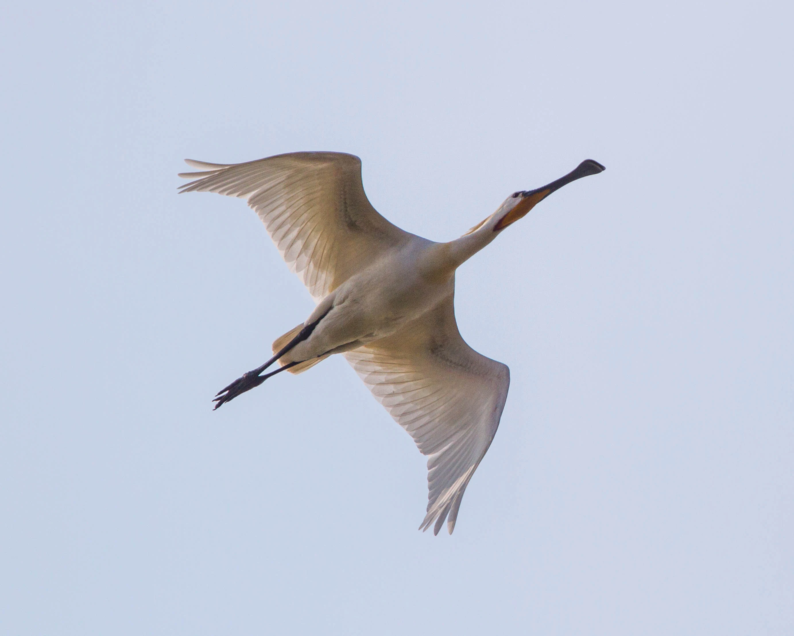
A white Eurasian spoonbill flying against a clear, pale sky, showing its distinctively shaped bill.
A Eurasian spoonbill in flight over the Tour du Valat nature reserve.

Réserve naturelle régionale de la Tour du Valat history and protected-area timeline

The history of the reserve is inseparable from the history of the Domaine de la Tour du Valat. The domaine was purchased in 1947 by Luc Hoffmann, who envisioned it as a long-term site for biological research in the Camargue. In 1954 it was reorganized as a managed biological research station under a foundation structure, and that foundation was later recognized as being of public utility in 1978.

The site's conservation trajectory began to take clearer legal shape in 1986, when around 1,070 hectares of the domaine were designated as a voluntary nature reserve. That early designation laid the groundwork for stronger protection of the area's wetland and dryland habitats, especially as the surrounding Camargue faced increasing pressure from agricultural intensification and water management changes.

The decisive step came on 4 July 2008, when a deliberation of the regional council formally classified the enlarged area as a regional nature reserve. The new designation, called RNR1, expanded the protected footprint to roughly 1,844 hectares and embedded the site within the regional network of nature reserves. Management planning has evolved through successive generations of plans, with the first plan adopted in 1986 and the fifth covering the period 2011-2015, a sign of the reserve's long-standing commitment to adaptive ecological governance.

Réserve naturelle régionale de la Tour du Valat landscape and geographic character

The reserve lies in the middle Camargue, in the fluvio-lacustrine subregion where freshwater and saline influences meet. The landscape here is the product of long interaction between the Rhône, its distributaries, nearby lagoons, and human-built hydraulic systems. Past embankment along the Rhône and an extensive network of canals and dikes have stabilized the physical environment, but they have also constrained natural hydrological dynamics, an ongoing consideration for habitat management.

Within this broader physical setting, the reserve contains a remarkable variety of Camargue landscape types. There are temporary, semi-permanent, and permanent marshes that reflect different water regimes across the year. Sansouïres, the distinctive halophytic steppes of the Camargue, occupy drier salty flats and are typically vegetated with salt-tolerant shrubs and grasses. Salt meadows, or prés salés, fringe the saline depressions, while dry grasslands add upland herbaceous elements to the mosaic. Patches of woodland and classified wooded areas introduce vertical structure into an otherwise open landscape.

The overall impression is one of a flat, low-lying Mediterranean delta plain, broken by subtle gradients of salinity, moisture, and vegetation cover. These transitions between aquatic, marshy, halophytic, and terrestrial habitats define much of the visual identity of the Camargue and make the reserve unusually compact yet diverse at the landscape scale.
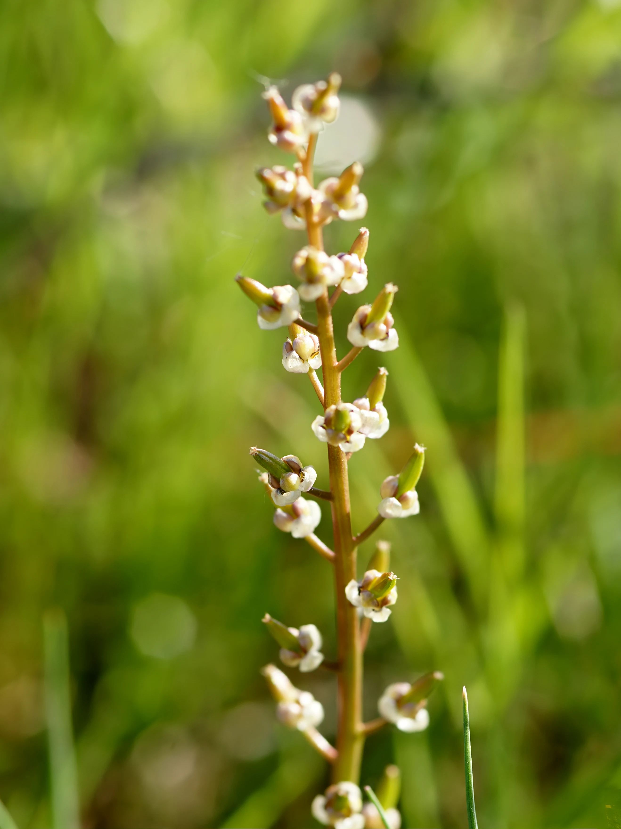
A vertical close-up shot of the flowering stalk of Triglochin barrelieri, with tiny greenish-white blossoms arranged along the stem against a soft-focus green background.
Triglochin barrelieri flowers in the Camargue, showcasing the delicate flora of the wetlands.

Réserve naturelle régionale de la Tour du Valat ecosystems, habitats, and plant life

Ecologically, the reserve is anchored in the fluvio-lacustrine hydrosystem of the central Camargue. Its habitats function as a connected mosaic, with water regimes and salinity acting as the main ecological filters that shape plant and animal communities. Although historical embankment and hydraulic infrastructure have stabilized conditions, they also limit the natural dynamism of flooding and drying cycles that historically sustained Camargue biodiversity.

Habitat diversity is one of the reserve's defining ecological features. Temporary marshes, driven by seasonal rainfall and managed water levels, support specialized aquatic and amphibious species. Semi-permanent and permanent marshes maintain more stable aquatic conditions, while the sansouïres and prés salés represent saline and hypersaline terrestrial habitats, each with distinctive floristic communities. Dry grasslands and wooded patches add upland and mesic habitats, generating ecological gradients that are rare to find compressed into a single protected area.

Botanical diversity is high, with around 590 plant species recorded on the site, including species protected at the national level and others protected at the regional level. The flora reflects the strong influence of salinity, hydrology, and Mediterranean climate, producing stands of salt-tolerant vegetation alongside Mediterranean dryland plant communities. Notable botanical features include orchid populations characteristic of Camargue grasslands, tamarisk formations fringing saline ponds, and halophytic assemblages typical of sansouïre edges.
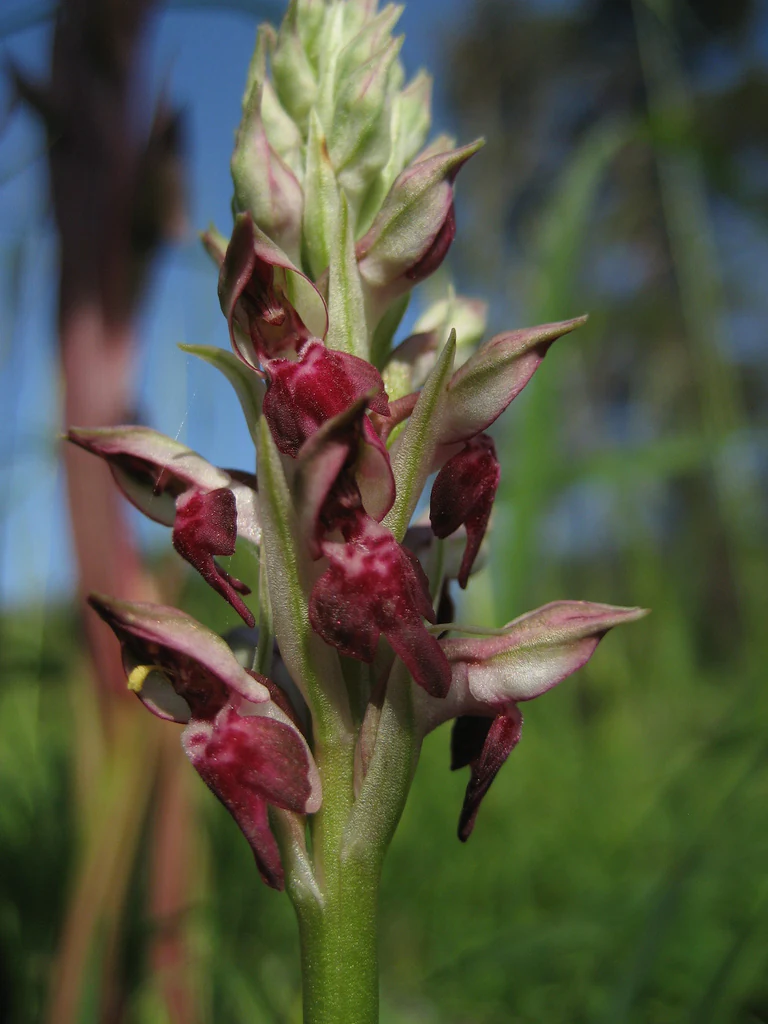
A vertical close up of a bug orchid, Anacamptis coriophora, with its dense, purplish-red flowers blooming against a blurred green and blue background.
A close up view of an Anacamptis coriophora, or bug orchid, in the Camargue region.

Réserve naturelle régionale de la Tour du Valat wildlife and species highlights

The reserve supports an exceptionally well-documented fauna, reflecting both its ecological diversity and the long history of research conducted on the Domaine de la Tour du Valat. Invertebrate inventories exceed 1,600 species, including rare odonates associated with temporary Mediterranean marshes. These invertebrate communities underpin the food webs of the reserve and are a focus of ongoing monitoring.

Aquatic and semi-aquatic wildlife is also significant. About 30 fish species have been recorded, including the European eel, a species of major conservation concern across European freshwater systems. The reserve hosts eight amphibian species, among them the western spadefoot toad, a specialist of Mediterranean temporary pools, and 14 reptile species, including the ocellated lizard, one of the most striking reptiles of the Camargue.

Birdlife is perhaps the reserve's most celebrated wildlife asset. Surveys have identified more than 300 bird species using the site, of which roughly 70 are nesting species. The reserve is an important area for herons and other ardeids, and for charismatic species such as the greater flamingo, the Eurasian spoonbill, and the collared pratincole. The combination of breeding habitat, stopover habitat for migratory species, and feeding areas in adjacent lagoons makes the site a key node in the broader Camargue bird system.
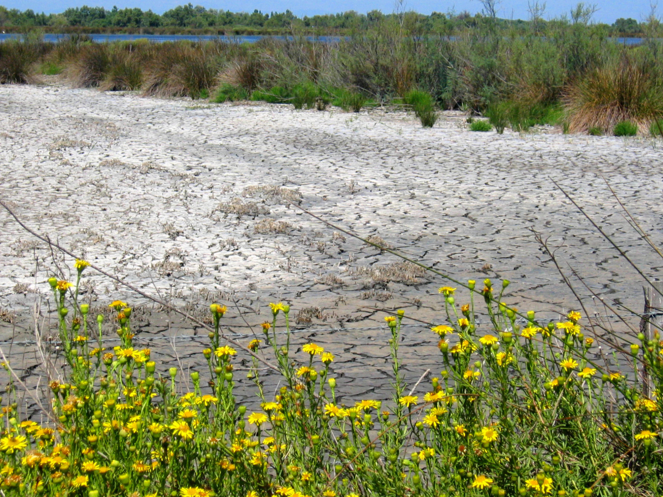
A close up view of bright yellow golden samphire flowers in the foreground, with a large area of cracked, dry, and salt-crusted earth in the midground and a line of green marsh vegetation along a distant waterway.
Yellow flowering Inula crithmoides, known as golden samphire, growing near the cracked, saline soil of a Camargue wetland.

Réserve naturelle régionale de la Tour du Valat conservation status and protection priorities

From a conservation perspective, the reserve holds particular importance because it protects a representative cross-section of central Camargue habitats within a single, well-managed estate. The mosaic of marshes, sansouïres, salt meadows, dry grasslands, and woodlands captures the very ecological gradients that define the Camargue as a Mediterranean wetland region, making the site valuable both for habitat conservation and as a reference for monitoring environmental change.

Its protected status is reinforced by a dense layering of complementary designations. In addition to its regional nature reserve status and IUCN Category IV classification, the area overlaps with ZNIEFF type I and type II inventories, an Important Bird Area (ZICO), a Special Protection Area under the Birds Directive (ZPS), a Site of Community Importance under the Habitats Directive (ZSC), and a Ramsar wetland site covering much of the Camargue. A portion of the wooded area is also classified under the French 'Espace boisé classé' designation, reinforcing long-term protection for forest cover.

Management is delivered through the Fondation Tour du Valat, supported by successive management plans that began with the first plan in 1986 and continue through ongoing iterations. The combination of research, long-term monitoring, traditional Camargue pastoralism, and public engagement makes the reserve a working example of integrated wetland conservation in a cultural landscape under pressure from climate change, water management, and land-use change.

Réserve naturelle régionale de la Tour du Valat cultural meaning and human context

The reserve is deeply embedded in the cultural landscape of the Camargue, where traditional livestock raising has long shaped both the ecology and the identity of the delta. The Domaine de la Tour du Valat maintains a herd of roughly 500 Camargue cattle and around 90 Camargue horses, animals strongly associated with regional heritage and the distinctive 'gardian' cowboy culture of the area.

Pastoral activities on the estate are not separate from conservation; they are part of the land's identity and contribute to maintaining open landscapes that benefit many of the reserve's habitats. This integration of working agriculture, scientific research, and habitat management is one of the site's defining cultural characteristics, reflecting a long tradition in the Camargue of human presence shaping, and being shaped by, the wetland environment.
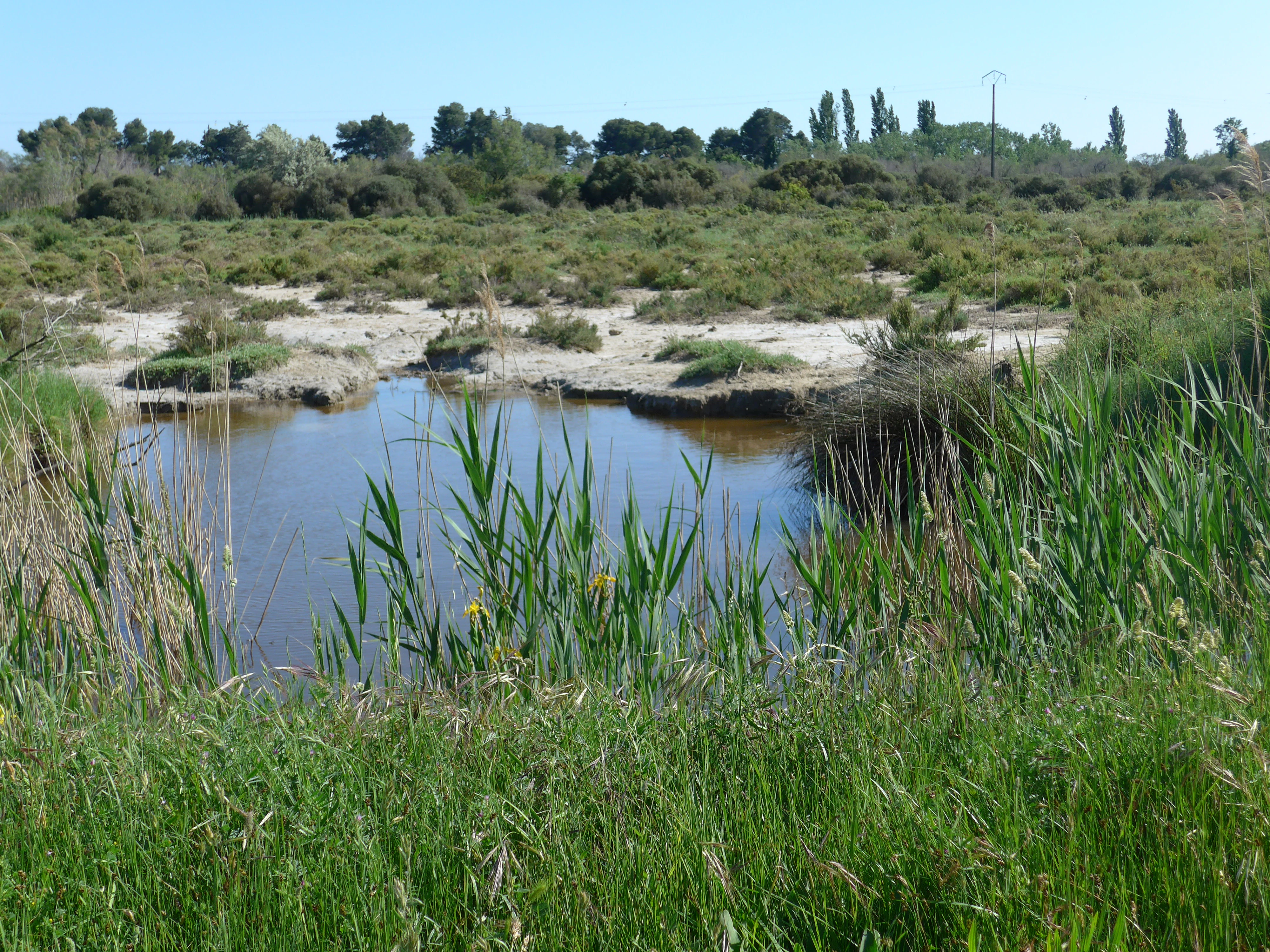
A small, still pool of water surrounded by tall green grasses, with a flat marshy landscape and trees in the background under a clear sky.
A wetland landscape featuring a small pond and marshy terrain in the Camargue region.

Top sights and standout views in Réserve naturelle régionale de la Tour du Valat

The reserve stands out for the concentration of Camargue wetland landscapes within a single protected estate, from temporary marshes to permanent pools, sansouïres, and prés salés, all set against the backdrop of traditional Camargue livestock raising.

It is also distinguished by its close association with the Fondation Tour du Valat, whose long-running research program has made the site a reference point for Mediterranean wetland science and bird conservation, while still maintaining a working pastoral estate and welcoming visitors through observation points and open days.
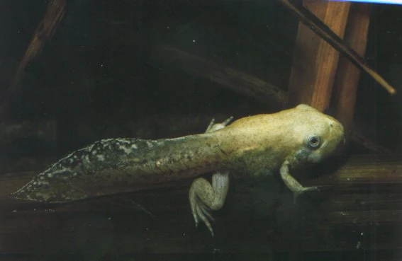
A tadpole with developing legs swimming in dark water, captured in a close-up shot.
A spadefoot toad tadpole in the Tour du Valat nature reserve.

Best time to visit Réserve naturelle régionale de la Tour du Valat

The character of a visit shifts with the seasons in ways that strongly reflect the Camargue's hydrology and bird cycles. Spring and early summer are typically the most rewarding periods for observing amphibians in temporary pools, for finding flowering plants across marshes and dry grasslands, and for seeing breeding waterbirds and Mediterranean orchid populations in bloom.

Late summer and autumn bring different conditions, with drier marshes concentrating wildlife around remaining permanent water bodies and supporting large numbers of post-breeding and migratory birds. Winter can offer quieter conditions and notable concentrations of waterfowl and overwintering species, particularly in and around the saline lagoons. Because habitat conditions in the Camargue depend heavily on rainfall and water management, visitors may find that temporary pools and certain meadows vary considerably from year to year.
Monthly climate preview

Long-term representative point measurements for annual temperature and precipitation cycles

Réserve naturelle régionale de la Tour du Valat Climate Normals and Temperature Rhythms

Long-term NASA Power climatology data records monthly mean temperatures ranging from 7.81 degrees Celsius to 24.47 degrees Celsius alongside varying daily precipitation rates at the designated park coordinate. Examining the complete twelve-month statistical profile clarifies the full range of representative thermal and moisture patterns across the protected landscape.
Annual mean16 °C
8 °C24 °C
Jan
Feb
Mar11°
Apr14°
May18°
Jun22°
Jul24°
Aug24°
Sep20°
Oct17°
Nov12°
Dec
Warmest month
July

24.5 °C

Coolest month
January

7.8 °C

Wettest month
November

2.6 mm/day

Driest month
July

0.6 mm/day

Park location guide

Geography guide, regional context, and park location map for Réserve naturelle régionale de la Tour du Valat

Réserve naturelle régionale de la Tour du Valat park geography, regions, and map view in France

Understand where Réserve naturelle régionale de la Tour du Valat sits in France through a broader geographic reading of the surrounding landscape, nearby location context, and its mapped position within the national park landscape.

How Réserve naturelle régionale de la Tour du Valat fits into France

France is a unitary semi-presidential republic and one of the world's largest economies. It borders Belgium, Luxembourg, Germany, Switzerland, Italy, Monaco, Andorra, and Spain, with a maritime border to the United Kingdom. The country is known for its cultural influence, art, cuisine, and political history spanning centuries.

Wider geography shaping Réserve naturelle régionale de la Tour du Valat in France

France is located in Western Europe. Metropolitan France extends from the Rhine to the Atlantic Ocean and from the Mediterranean Sea to the English Channel and North Sea. The country borders Belgium, Luxembourg, Germany, Switzerland, Italy, Monaco, Andorra, Spain, and has a maritime border with the United Kingdom.

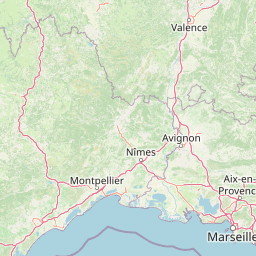
Map view of Réserve naturelle régionale de la Tour du Valat

Use this park location map to pinpoint Réserve naturelle régionale de la Tour du Valat in France, understand its exact geographic position, and read its mapped placement within the surrounding landscape more clearly.

Pigeon | © OpenStreetMap contributors

Location context for Réserve naturelle régionale de la Tour du Valat

Camargue

Visualizing Mediterranean wetlands, sansouïres, and protected habitats in the Camargue

Réserve naturelle régionale de la Tour du Valat Photos and Landscape Scenery

Visual documentation captures the diverse mosaic of permanent marshes, saline lagoons, and salt meadows defining the protected delta environment. Studying these landscape views reveals the intricate transition zones and ecological character of the research estate.

A white Eurasian spoonbill flying against a clear, pale sky, showing its distinctively shaped bill.

A greater flamingo in flight viewed from below against a clear blue sky, showing its pink, white, and black wing patterns.

A vertical close-up shot of the flowering stalk of Triglochin barrelieri, with tiny greenish-white blossoms arranged along the stem against a soft-focus green background.

A vertical close up of a bug orchid, Anacamptis coriophora, with its dense, purplish-red flowers blooming against a blurred green and blue background.

A close up view of bright yellow golden samphire flowers in the foreground, with a large area of cracked, dry, and salt-crusted earth in the midground and a line of green marsh vegetation along a distant waterway.

A view through the branches of a tamarisk tree overlooking a marshy wetland area in the Camargue, France.

A small, still pool of water surrounded by tall green grasses, with a flat marshy landscape and trees in the background under a clear sky.

A tadpole with developing legs swimming in dark water, captured in a close-up shot.

Park atlas

Compare adjacent wetland reserves, coastal lagoons, and delta habitats across the regional geography.

Parks Near Réserve naturelle régionale de la Tour du Valat and Surrounding Protected Landscapes

Browse protected areas near Réserve naturelle régionale de la Tour du Valat to compare adjacent wetland ecosystems, saline lagoons, and delta habitats across the broader Rhône basin. Extending your geographic comparison reveals interconnected conservation zones and diverse Mediterranean landscapes throughout the region.
A horizontal watercolor illustration showing a marshy, grassy landscape with soft green and muted pink tones against a white background.
Regional parkProvence-Alpes-Côte d'Azur
Mapped location lies within the park boundary#1 closest

Northwest

Parc naturel régional de Camargue: Mapping the Rhône Delta Protected Wetland Landscape

Regional park geography and wetland conservation zones

Parc naturel régional de Camargue is a sprawling protected landscape at the confluence of the Rhône and the Mediterranean. This regional park contains significant saline lagoons, coastal dunes, and fertile marshes that serve as a crucial site for waterbird migration. Understand the interplay between traditional salt-making, pastoral ranching, and the strictly protected nature reserves that shape this delta territory.

Area
856.9 km²
Established
1970
IUCN
V
Relief
Lowland
A horizontal watercolor painting depicting a soft-focus landscape of grassy wetlands in the foreground with gentle, rolling hills in the background.
Nature reserveProvence-Alpes-Côte d'Azur
About 22 km away#2 closest

North

Réserve naturelle régionale de l'Ilon: Protected Wetland Atlas and Geographic Context

Mapping Mediterranean marshes in the Alpilles foothills.

Covering 176 hectares of diverse wetland habitat, Réserve naturelle régionale de l'Ilon preserves critical marshlands and floodable meadows. This site demonstrates the interplay between lowland water systems and the rocky Alpilles range, providing a essential refuge for diverse dragonfly and bird species within the heart of Provence.

Area
1.76 km²
Established
2012
IUCN
IV
Nature reserveProvence-Alpes-Côte d'Azur
About 27 km away#3 closest

East

Réserve naturelle régionale du Pourra - Domaine du Ranquet: Coastal Lagoon Protected Landscape

Regional Nature Reserve in Provence-Alpes-Côte d'Azur

Spanning over 300 hectares near Port-de-Bouc, this protected area preserves interconnected Mediterranean lagoons and surrounding marshlands. It offers a distinct geographic perspective on transitional coastal habitats situated within the heavily developed Bouches-du-Rhône department.

Area
3.153 km²
Established
2020
IUCN
IV
Watercolor painting of a marshy wetland scene with grassy foreground, scattered trees, and distant hills.
Nature reserveGard
About 29 km away#4 closest

Northwest

Réserve naturelle régionale du Scamandre: Mapped Boundaries and Wetland Geography in Gard

Protected marshlands and salt steppe in southern France.

Deep dive into the ecological layout of Réserve naturelle régionale du Scamandre. Situated in the Gard department, this protected site preserves a mosaic of prairie, sansouïre, and marshland, creating a high-density wetland corridor essential for regional biodiversity and landscape analysis.

Area
1.467 km²
Established
2006
IUCN
IV
Relief
Lowland
Nature reserveProvence-Alpes-Côte d'Azur
About 31 km away#5 closest

Northeast

Réserve naturelle régionale de la Poitevine-Regarde-Venir: Steppe Conservation and Geography

Protected dry steppe landscapes in the French Crau region

Delve into the geography of the Réserve naturelle régionale de la Poitevine-Regarde-Venir, a specialized nature reserve that safeguards the distinctive pebbly coussoul of the Crau plain. The area represents a fundamental piece of Mediterranean pastoral history, balancing fragile steppe ecosystems with traditional agricultural meadows.

Area
2.207 km²
Established
2009
IUCN
IV
A horizontal watercolor painting depicting a soft, washed-out landscape of wetlands with green vegetation, calm water, and gentle hills in the distance.
Nature reserveOccitanie
About 37 km away#6 closest

West

Réserve naturelle régionale de Mahistre et Musette: Regional Nature Reserve and Wetland Atlas

Petite Camargue geography and protected marshland mosaic in Occitanie

Located in the Gard department of southern France, the Réserve naturelle régionale de Mahistre et Musette represents a successful case of wetland restoration. This protected area features a distinct landscape of reedbeds, saline flats, and ponds, providing critical habitat for numerous wetland species. Access detailed geographic context on how these restored marshes link to the broader Petit Camargue environmental network.

Area
2.616 km²
Established
1999
IUCN
IV
A soft watercolor illustration depicting layered rolling hills, distant mountain silhouettes, and clusters of trees in a pale color palette.
Regional parkProvence-Alpes-Côte d'Azur
About 44 km away#7 closest

Northeast

Parc naturel régional du Luberon: Regional Park Boundaries and Protected Landscape Atlas

Geology, mountain ridges, and Mediterranean ecosystems of Provence

Parc naturel régional du Luberon serves as a vital protected corridor in southeastern France. The park features three parallel limestone massifs, dramatic ochre formations, and fossil-rich plateaus. Its geography offers a case study in integrating sustainable land use with rich biodiversity across the Vaucluse and Alpes-de-Haute-Provence departments.

Area
1,747.26 km²
Established
1977
IUCN
V
Visitors
350K annual
A soft watercolor painting of a winding river flowing through a gentle, rolling green valley with hills in the background.
Nature reserveOccitanie
About 52 km away#8 closest

Northwest

Réserve naturelle régionale des gorges du Gardon: Geography and Protected Area Overview

Mediterranean river valley and raptor conservation corridor

Examine the distinct topography of the Réserve naturelle régionale des gorges du Gardon. The protected area features steep limestone cliffs and a river corridor that sustains dense Mediterranean oak forests. This site remains a critical node for raptor conservation, specifically supporting nesting Egyptian vultures and Bonelli eagles within its structured valley geography.

Area
4.913 km²
Established
2007
IUCN
IV

Common questions about visiting, size, designation, and location context for Réserve naturelle régionale de la Tour du Valat

Réserve naturelle régionale de la Tour du Valat FAQs for park facts, access, geography, and protected area context

Find quick answers about Réserve naturelle régionale de la Tour du Valat, including protected-area facts, park geography, trail and visitor context, and how the park fits into its surrounding country and regional landscape.
MoriAtlas Explorer

Continue Your Protected Areas Search Across the Global Atlas

Deepen your exploration by continuing the structured search for national parks and protected areas worldwide. Utilize the comprehensive filtering capabilities to compare different conservation landscapes and refine your understanding of global park geography. Discover more about the distribution and characteristics of protected natural areas.

Global natural geography