Mori Atlas logo
National parkManas National Park

Discover the mapped boundaries and regional context of this national park in northeastern India.

Manas National Park: Assam's Protected Landscape and National Park Geography

Manas National Park stands as a significant protected landscape within the state of Assam, India. As a designated national park, its boundaries and natural terrain contribute to the unique geography of the Brahmaputra River valley region. This page provides an atlas-focused exploration of Manas National Park, highlighting its role as a protected area and offering insights into its mapped geographic context for discovery.

UNESCO World Heritage SiteProject Tiger ReserveBiosphere ReserveEndangered Species HabitatTransboundary Protected AreaGrassland Ecosystem

Manas National Park

National park

Park overview

Structured park overview, official facts, and landscape profile for Manas National Park

Manas National Park park facts, protected area profile, and essential visitor context
Review the core facts for Manas National Park, including designation, size, terrain, visitor scale, habitats, and operating context in one park-focused overview.

About Manas National Park

Manas National Park represents one of India's most important conservation landscapes, situated in the dynamic ecological transition zone between the Himalayan foothills and the Brahmaputra Valley. The park's location in Assam's Bodoland Territorial Region places it at the crossroads of tropical and subtropical ecosystems, creating remarkable habitat diversity within a relatively compact area. The Manas River, originating in Bhutan and flowing through the park before joining the Brahmaputra, serves as both the lifeblood of the ecosystem and an international boundary marker. The park's terrain consists of a wide, low-lying alluvial terrace with limestone and sandstone bedrock in the northern savanna areas and deep alluvial deposits in the southern grasslands. This geological diversity supports a complex vegetation mosaic that includes Sub-Himalayan light alluvial semi-evergreen forests, East Himalayan mixed moist and dry deciduous forests, low alluvial savanna woodland, and the extensive Assam Valley semi-evergreen alluvial grasslands that dominate roughly half the park's area. The park's three ranges centered at Panbari, Bansbari near Barpeta Road, and Bhuiyapara near Pathsala manage this ecologically significant landscape, with most visitor activity concentrated around the Bansbari entrance and the Mathanguri area along the Manas River at the Bhutan border.

Quick facts and research context for Manas National Park

Manas National Park occupies the sub-Himalayan Bhabar Terai region in Assam, India, at elevations between 61 and 110 metres above sea level. The park is characterized by a mosaic of semi-evergreen forests, moist deciduous woodlands, and extensive alluvial grasslands covering roughly half of its area. It is recognized as a UNESCO World Heritage Site designated in 1985, a biosphere reserve since 1989, and was on the World Heritage in Danger List from 1992 to 2011 due to poaching and civil unrest. The Manas River serves as the international boundary between India and Bhutan. The park contains over 543 plant species and supports 55 mammal species, more than 450 bird species, and significant reptile and amphibian populations.

Park context

Deeper park guide and search-rich context for Manas National Park

Manas National Park history, landscape, wildlife, and travel context
Explore Manas National Park through its history, landscape character, ecosystems, wildlife, conservation priorities, cultural context, and seasonal travel timing in a structured park guide built for atlas discovery and search intent.

Why Manas National Park stands out

Manas National Park is internationally renowned for its population of endangered megafauna, most notably the pygmy hog, which exists in the wild only within this park. The park hosts the only self-sustaining population of Indian rhinoceros re-established through conservation efforts, as well as significant herds of wild water buffalo. It supports the world's largest population of the endangered Bengal florican among its more than 450 bird species. The park is also famous for the golden langur, a primate found exclusively in this region, and the Assam roofed turtle. The combination of Himalayan foothill ecosystems with diverse habitats ranging from riverine forests to grasslands makes Manas one of the richest biodiversity areas in Asia.

A rhinoceros and its calf standing in a grassy field under a tree with mountains in the background.
Rhinoceros and calf in a grassy field within Manas National Park with mountains in the background.

Manas National Park history and protected-area timeline

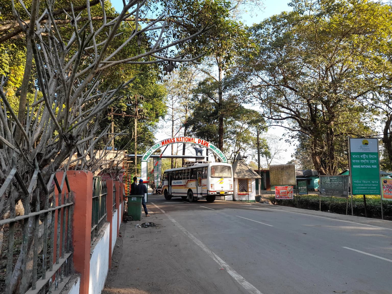
The territory comprising Manas National Park was historically part of the Kingdom of Bhutan until the Duar War of 1865, when it was ceded to British India. Prior to formal protection, the area functioned as a hunting reserve for the Cooch Behar royal family and the Raja of Gauripur. On 1 October 1928, the Manas Wildlife Sanctuary was officially declared with an area of 391 square kilometres, incorporating the former Manas Reserve Forest and North Kamrup Reserve Forest. The park was inscribed as a UNESCO World Heritage Site in 1985, recognizing its outstanding universal value. The Manas Biosphere Reserve was designated in 1989, and in 1990, additional reserve forests including Kahitama R.F., Kokilabari R.F., and Panbari R.F. were incorporated to form the expanded national park. UNESCO placed Manas on the List of World Heritage in Danger in 1992 due to severe poaching and terrorist activities that had decimated wildlife populations, particularly the Indian rhinoceros which was locally extinct by the early 1980s. Following successful conservation efforts and stabilization, the park was removed from the Danger List in 2011. The core zone was expanded to 500 square kilometres in 2008. The park is governed by the Ministry of Environment and Forests and the Government of India, with ongoing conservation partnerships including the Durrell Wildlife Conservation Trust's pygmy hog recovery program.

Manas National Park landscape and geographic character

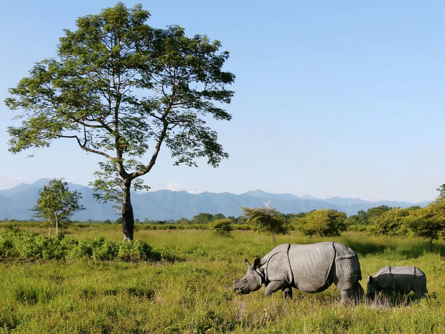
Manas National Park occupies a distinctive position in the Eastern Himalayan biogeographical zone, sitting on a broad, low-lying alluvial terrace that spreads out below the outer Himalayan foothills. The landscape is characterized by a gentle gradient from the steeper foothill slopes in the north descending into the flat alluvial plains of the Brahmaputra Valley. The Manas River, a major tributary of the Brahmaputra, flows through the western portion of the park and divides into the Bwrsi and Bholkaduba rivers as it reaches the plains. Five additional smaller rivers traverse the park, creating an extensive drainage network that supports diverse habitats. The northern areas feature savanna on limestone and sandstone bedrock, while the southern grasslands stand on deep deposits of fine alluvium. The combination of the Sub-Himalayan Bhabar Terai formation with riverine succession continuing up to Sub-Himalayan mountain forest creates a visually varied landscape of dense forest canopy, open grasslands, river channels, and wetlands. Views from the park extend to the Himalayan mountain chain in Bhutan, providing a dramatic backdrop to the lush forest and grassland environments.

Entrance gate structure with 'Manas National Park' signage, a bus on a paved road, trees, and green informational signs
Entrance gate of Manas National Park with signage and a bus

Manas National Park ecosystems, habitats, and plant life

The ecological character of Manas is defined by its position in the Brahmaputra Valley semi-evergreen forests ecoregion, where the interplay between Himalayan subtropical broadleaf forests and alluvial grassland systems produces exceptional biodiversity. The park's vegetation follows a clear succession pattern, with riverine dry deciduous forest in early successional stages near water courses, transitioning to moist deciduous forest away from rivers, and culminating in semi-evergreen climax forest in the northern reaches. The Assam Valley semi-evergreen alluvial grasslands represent the most extensive habitat type, covering nearly half the park and providing critical grazing grounds for large mammals. The 543 plant species recorded in the core zone include 89 tree species among the dicotyledons, along with significant representations of monocotyledons, pteridophytes, and gymnosperms. Common tree species include Aphanamixis polystachya, Anthocephalus chinensis, various Syzygium species, Bombax ceiba, Terminalia species, and large specimens of Dillenia indica. The grasslands are dominated by Imperata cylindrica, Saccharum species, and Phragmites karka, creating the open savanna environment that supports the park's large herbivore populations.

Brown bird with gray head and white underparts perched on a tree branch.
Large Woodshrike (Tephrodornis gularis) perched on a tree branch in Manas National Park.

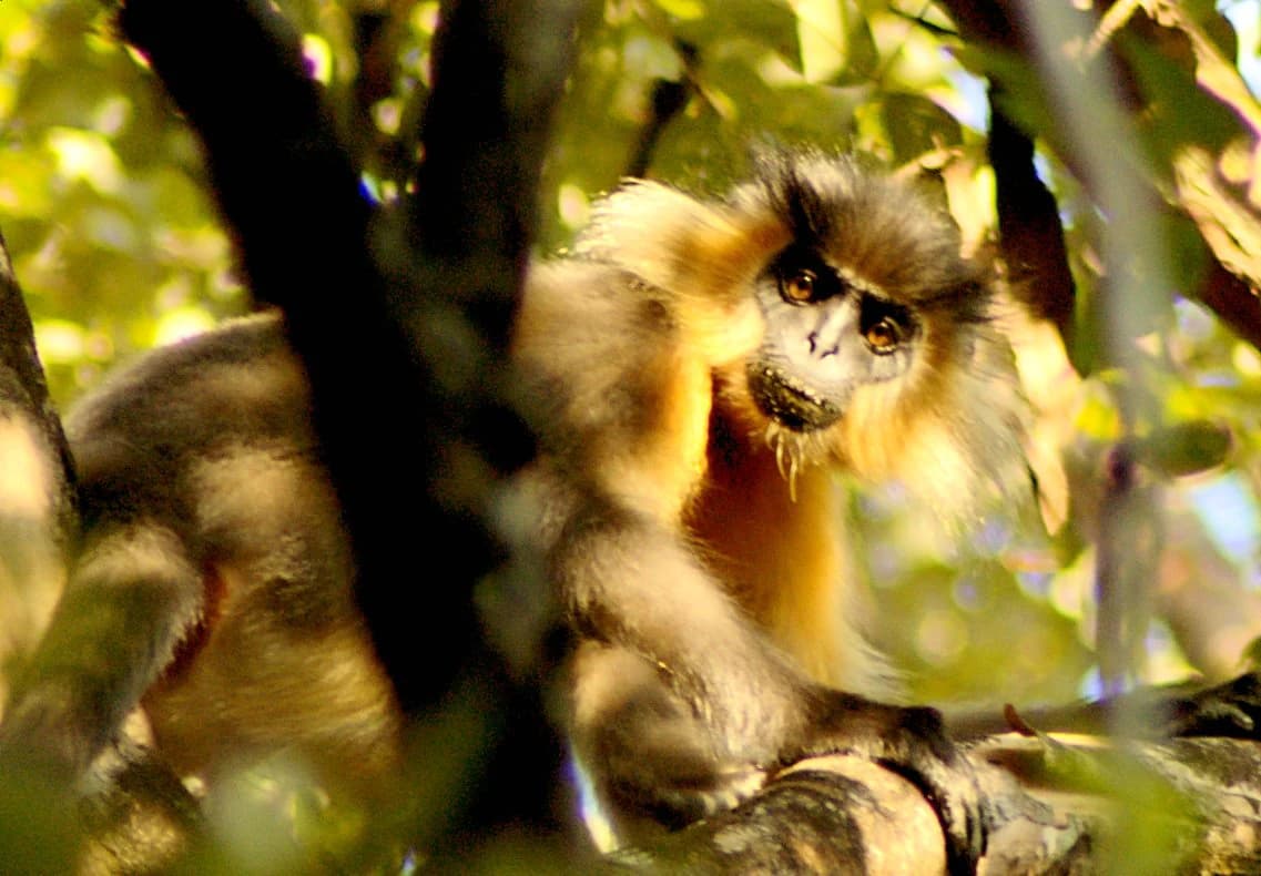
Manas National Park wildlife and species highlights

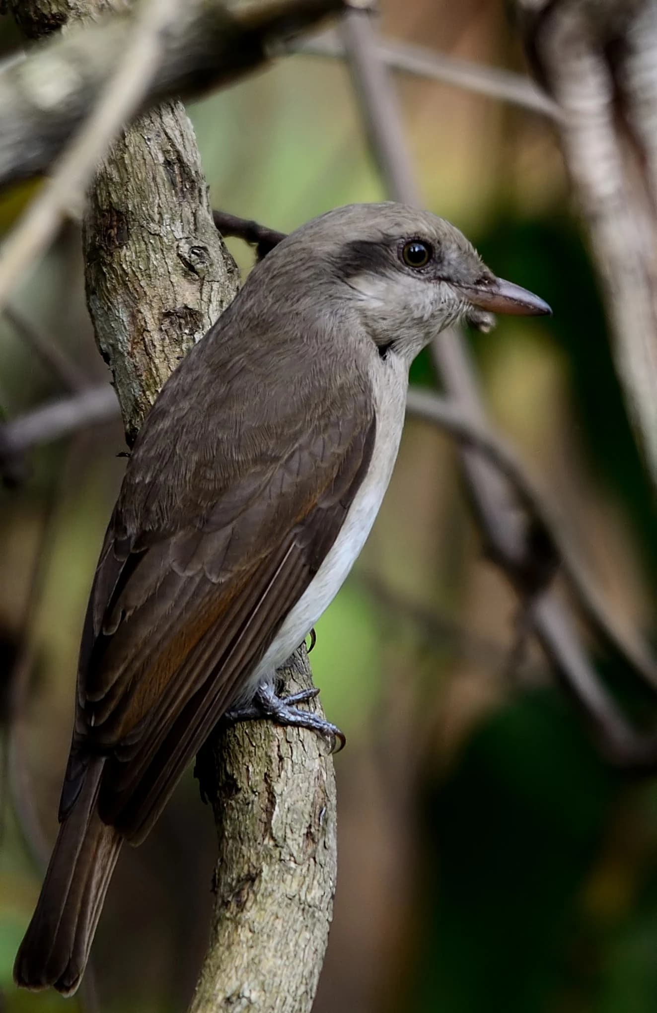
Manas National Park supports an extraordinary concentration of endangered wildlife, with 55 mammal species, over 450 bird species, 50 reptile species, and 3 amphibian species recorded within its boundaries. Twenty-one of the mammal species are listed in India's Schedule I of protected species, and 31 are considered threatened. The park's flagship species include the pygmy hog, the only known wild population of this small wild pig which has been the focus of intensive conservation breeding programs with 63 individuals now existing in the wild following releases. The golden langur, found exclusively in this region of Assam, inhabits the forest canopy, while the Assam roofed turtle is one of several rare reptile species. The wild water buffalo population at Manas is particularly significant, representing one of the few remaining substantial herds of this endangered species. Large mammals include Indian elephant, gaur, barasingha, Bengal tiger, clouded leopard, Asian golden cat, and various deer species including hog deer, sambar, and chital. The bird fauna is equally remarkable, with Manas hosting the largest global population of the endangered Bengal florican. Other notable species include great hornbill, lesser fish eagle, crested serpent-eagle, and Indian peafowl. The Durrell Wildlife Conservation Trust continues active involvement in conservation, with pygmy hog reintroduction efforts ongoing.

Capped langur with brown and black fur sitting on a tree branch surrounded by green foliage
Capped langur perched on a tree branch in Manas National Park

Manas National Park conservation status and protection priorities

Manas National Park holds exceptional conservation significance as a UNESCO World Heritage Site, a biosphere reserve, a Project Tiger reserve, and an Important Bird Area. The park's inclusion on the World Heritage in Danger List from 1992 to 2011 highlighted the severe threats it faced from poaching and civil unrest, which had eliminated the Indian rhinoceros population by the early 1980s. Successful conservation interventions, including the reintroduction of rhinoceros in 2007 and ongoing pygmy hog breeding programs, led to the park's removal from the Danger List in 2011. The transboundary relationship with Bhutan's Royal Manas National Park creates a continuous protected landscape that allows wildlife movement across international boundaries, enhancing genetic exchange and population viability. The park's diverse habitats, from grasslands to semi-evergreen forests, support species with different ecological requirements and provide critical corridors for large mammals. The presence of 21 Schedule I mammals and 31 threatened species underscores the ongoing conservation importance, while the protection of the only wild pygmy hog population represents a global conservation responsibility.

Manas National Park cultural meaning and human context

Manas National Park exists within a landscape shaped by human presence, with one forest village called Pagrang located within the core zone and approximately 56 additional villages surrounding the park boundary. These fringe communities maintain direct and indirect relationships with the park's resources, representing both a conservation challenge and an opportunity for community-based stewardship. Historically, the area served as a royal hunting ground for the Cooch Behar royal family and the Raja of Gauripur before its designation as a protected area. The Manas River holds cultural significance as a major tributary of the Brahmaputra, a river central to the identity and ecology of Assam. The park's location in the Bodoland Territorial Region places it within the homeland of the Bodo people, an indigenous community whose traditional relationship with the landscape predates formal protection. Conservation efforts increasingly recognize the importance of engaging local communities in protection strategies, acknowledging that long-term preservation depends on harmonious human-wildlife coexistence in this densely populated region of Northeastern India.

Top sights and standout views in Manas National Park

Manas National Park offers visitors exceptional wildlife viewing opportunities in one of Asia's most biodiversity-rich protected areas. The grassland ecosystems provide ideal conditions for observing Bengal florican, wild water buffalo herds, and the endangered pygmy hog in its only wild habitat. The forest trails allow encounters with golden langur, capped langur, and the impressive great hornbill, while river channels support smooth-coated otters and diverse waterbird populations. The park's transboundary location along the Bhutan border creates a unique setting where the Himalayan foothills descend into the Assam Valley, offering scenic views and the experience of contiguous protected landscapes across two nations. The successful recovery from previous threats, including the reintroduction of Indian rhinoceros and the growth of the pygmy hog population, demonstrates effective conservation and provides hope for continued species recovery.

Best time to visit Manas National Park

The optimal visiting season for Manas National Park spans from November to April, when the weather is relatively cool and dry, and wildlife visibility improves as vegetation thins. The winter months from December to February offer the best opportunities for viewing large mammals in the open grasslands, as morning mists clear to reveal the park's diverse fauna. The pre-monsoon period in March and April brings warmer temperatures but excellent birdwatching conditions, particularly for observing the Bengal florican's breeding displays. Visitors should note that the monsoon season from May through September brings heavy rainfall exceeding 300 centimetres annually, rendering many areas inaccessible and limiting wildlife viewing. The park experiences temperatures ranging from a minimum of around 15°C in winter to maximums approaching 37°C in summer, with the cool season providing the most comfortable conditions for wildlife exploration.

Park location guide

Geography guide, regional context, and park location map for Manas National Park

Manas National Park park geography, regions, and map view in India
Understand where Manas National Park sits in India through a broader geographic reading of the surrounding landscape, nearby location context, and its mapped position within the national park landscape.

How Manas National Park fits into India

India is a South Asian country bordered by the Indian Ocean, Arabian Sea, and Bay of Bengal. It shares land borders with Pakistan, China, Nepal, Bhutan, Bangladesh, and Myanmar. The country has a population of over 1.4 billion people and operates as a federal parliamentary republic with its capital in New Delhi.

Wider geography shaping Manas National Park in India

India occupies the Indian subcontinent in South Asia, bordered by the Arabian Sea to the southwest, the Bay of Bengal to the southeast, and the Indian Ocean to the south. It shares land borders with Pakistan to the west, China, Nepal, and Bhutan to the north, and Bangladesh and Myanmar to the east. The territory also includes the Andaman and Nicobar Islands in the Indian Ocean.

Map view of Manas National Park

Use this park location map to pinpoint Manas National Park in India, understand its exact geographic position, and read its mapped placement within the surrounding landscape more clearly.

Pigeon | © OpenStreetMap contributors

Location context for Manas National Park

AssamBaksaBodoland Territorial RegionChirang

Trace the distinct terrain, riverine forests, and grasslands that define this UNESCO World Heritage Site's environment.

Manas National Park: Landscape and Habitat Photography for Visual Exploration
Browse extensive photography that reveals the unique visual identity of Manas National Park, including its dense forest canopy, expansive grasslands, and critical riverine ecosystems. Understanding these diverse habitats and the park's terrain through images provides essential context for appreciating its protected-area status and exceptional biodiversity.

A rhinoceros and its calf standing in a grassy field under a tree with mountains in the background.

Close-up of a white tiger with black stripes on its white fur lying on the ground with green grass background

Entrance gate structure with 'Manas National Park' signage, a bus on a paved road, trees, and green informational signs

Brown bird with gray head and white underparts perched on a tree branch.

Capped langur with brown and black fur sitting on a tree branch surrounded by green foliage

A brown and white spotted owl perched on a tree branch with blurred yellow-green foliage background

Park atlas

Browse protected areas and national parks across the Eastern Himalayan foothills and Brahmaputra Valley, building on the geography of Manas National Park.

Discover Other National Parks and Protected Areas Surrounding Manas National Park
Browse national parks and protected areas in the Eastern Himalayan foothills and Brahmaputra Valley, providing geographic context for the unique conservation landscape of Manas National Park. Compare diverse conservation landscapes, regional ecosystems, and transboundary protected areas, enhancing your atlas-style discovery of park geography beyond Manas National Park's immediate boundaries.
National parkBhutan

Phrumsengla National Park: Protected Landscape and Geographic Context in Bhutan

Explore mapped boundaries and diverse Himalayan terrain.

Phrumsengla National Park serves as a vital protected area within Bhutan, characterized by its extensive altitudinal range and varied landscape. Spanning from subtropical valleys to alpine zones, the park showcases a remarkable transition of ecosystems, including significant old-growth fir forests. Its location and unique geographic features make it an important component of any study of the region's protected lands and Himalayan geography, offering rich data for atlas exploration and understanding natural landscapes.

Area
905.05 km²
Established
1998
IUCN
II
Relief
Mountain
National parkTrongsa District

Jigme Singye Wangchuck National Park: Bhutan National Park's Geographic and Landscape Atlas

Mapped protected area within Trongsa District's natural terrain.

Delve into the detailed geographic identity of Jigme Singye Wangchuck National Park, a protected national park situated in Bhutan's Trongsa District. This park provides essential context for understanding Bhutanese geography and conservation landscapes. Examine its mapped boundaries and place within the regional terrain, offering a structured exploration for anyone interested in national park geography and protected natural areas.

Area
1,730 km²
Established
1995
IUCN
II
Relief
Mountain
Wildlife reserveBhutan

Phibsoo Wildlife Sanctuary: Bhutan's Wildlife Reserve Atlas and Geographic Identity

Mapping the protected landscape and natural terrain of this Bhutanese sanctuary.

Delve into the specifics of Phibsoo Wildlife Sanctuary, a protected wildlife reserve situated within the geographic expanse of Bhutan. This park detail page focuses on its identity as a conservation landscape, offering insights into its mapped terrain and its significance within the broader regional geography of the Eastern Himalayas. Understand the protected boundaries and the unique natural context that Phibsoo Wildlife Sanctuary represents.

Area
268.93 km²
Established
2009
IUCN
IV
Relief
Mixed relief
National parkKokrajhar District

Raimona National Park: National Park Protected Landscape and Geographic Atlas Exploration

Discover mapped terrain and regional geography within Raimona National Park.

Raimona National Park, designated as a national park within India's Kokrajhar District, offers rich opportunities for atlas-based geographic discovery. This page details the park's protected landscape, providing insights into its mapped boundaries and the surrounding natural terrain. Understanding Raimona National Park's placement within the regional geography allows for a deeper appreciation of its role as a significant protected area, perfect for detailed map exploration and landscape context.

Area
422 km²
Established
2021
IUCN
II
Relief
Mountain
Wildlife reserveTrashigang District

Sakteng Wildlife Sanctuary: Protected Area and Wildlife Reserve in Bhutan's Trashigang District

Mapping the mountainous terrain and unique temperate ecosystems.

Sakteng Wildlife Sanctuary is a vital protected area in eastern Bhutan, recognized as a wildlife reserve. Spanning approximately 742 square kilometers within Trashigang District, it features a dramatic mountainous terrain characterized by steep valleys and alpine meadows. The sanctuary's landscape transitions from forested slopes to subalpine conifer forests, representing Bhutan's easternmost temperate ecosystems and offering rich geographic context for atlas exploration.

Area
742.46 km²
Established
2003
IUCN
IV
Relief
Mountain
National parkBhutan

Wangchuck Centennial National Park: Bhutan National Park Protected Landscape

Mapped geographic context and park identity in the Eastern Himalayas.

Wangchuck Centennial National Park stands as a protected national park within Bhutan, offering a detailed look at its geographic distribution and landscape characteristics. This page provides essential atlas-level information about its mapped boundaries and its significance as a protected area in the South Asian region.

Area
4,914 km²
Established
2008
IUCN
II
Relief
Mountain
Wildlife reserveTrashiyangtse District

Bumdeling Wildlife Sanctuary: Bhutan Wildlife Reserve with Mapped Protected Boundaries

Explore its regional geography and natural landscape context.

Bumdeling Wildlife Sanctuary is a designated wildlife reserve located in Bhutan's Trashiyangtse District. This page provides detailed atlas-style information on its protected landscape, including its geographic positioning and mapped boundaries. Understand how this reserve contributes to the regional geography and serves as a crucial element of Bhutan's protected areas.

Area
1,520.61 km²
Established
1998
Relief
Mountain
Access
Access unknown
National parkAssam

Orang National Park: Assam's Key Floodplain Protected Landscape

Explore mapped boundaries and terrain context of this national park.

Orang National Park, located in Assam, India, is a significant protected area celebrated for its unique alluvial floodplain terrain and critical role in conservation. This national park provides a focused atlas-style view of grassland and wetland ecosystems, essential habitats for iconic species like the great Indian one-horned rhinoceros and Bengal tiger. Its geographical setting along the Brahmaputra River contributes to a dynamic landscape, offering rich context for understanding protected area distribution and regional natural features. Discover the mapped boundaries and ecological significance of this important protected land.

Area
78.81 km²
Established
1985
IUCN
II
Relief
Lowland

Common questions about visiting, size, designation, and location context for Manas National Park

Manas National Park FAQs for park facts, access, geography, and protected area context
Find quick answers about Manas National Park, including protected-area facts, park geography, trail and visitor context, and how the park fits into its surrounding country and regional landscape.
MoriAtlas Explorer

Continue Your Protected Areas Search Across the Global Atlas

Deepen your exploration by continuing the structured search for national parks and protected areas worldwide. Utilize the comprehensive filtering capabilities to compare different conservation landscapes and refine your understanding of global park geography. Discover more about the distribution and characteristics of protected natural areas.

Global natural geography