
Mori Atlas logo
National parkMarojejy National Park

Understanding the mapped boundaries and regional atlas significance of this national park.

Marojejy National Park: Protected Landscape Identity and Geographic Context in Madagascar

Marojejy National Park stands as a significant protected area within the island nation of Madagascar. As a designated national park, it represents a crucial element of the country's unique biodiversity and geographic landscape. This page serves as an entry point for exploring Marojejy National Park's specific identity, its position within Madagascar's broader regional geography, and its value for structured atlas-based discovery of protected lands.

rainforestmountain wildernessendemic biodiversitylemur habitatWorld Heritage Sitecloud forest
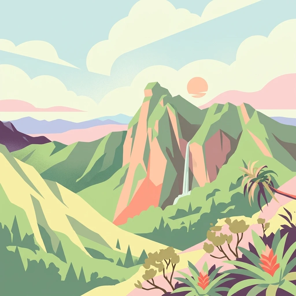
Illustration of green mountains with waterfall, palm trees, and sun in sky

Marojejy National Park

National park

Park overview

Structured park overview, official facts, and landscape profile for Marojejy National Park

Marojejy National Park park facts, protected area profile, and essential visitor context

Review the core facts for Marojejy National Park, including designation, size, terrain, visitor scale, habitats, and operating context in one park-focused overview.

About Marojejy National Park

Marojejy National Park represents one of Madagascar's most significant conservation areas, protecting a dramatically rugged mountain landscape that rises steeply from the eastern coast to create a unique island of biodiversity. The park's defining feature is the Marojejy Massif, a mountain chain that forms part of a larger system stretching from Tsaratanana in the northwest to the Masoala Peninsula in the south. The terrain is exceptionally steep, with the massif rising 2,000 meters over as little as eight kilometers, creating some of the most precipitous terrain in Madagascar. This dramatic topography generates multiple microclimates and habitat types that change rapidly with altitude, making Marojejy one of the few places in the world where cloud-covered rainforest transitions to high mountain shrubland within a hiking distance. The eastern slopes receive the bulk of the rainfall, with the western slopes experiencing a pronounced dry season in the rain shadow of the mountains. Nearly 90% of the park is covered in forest, with the various forest types creating a complex vegetative mosaic that varies dramatically between crests and even at the same elevations due to the rugged terrain.

Quick facts and research context for Marojejy National Park

Marojejy National Park is located in the Sava region of northeastern Madagascar, approximately 32 kilometers from east to west and 22 kilometers from north to south. The park centers on the Marojejy Massif, which rises from 75 meters to 2,132 meters at the summit, creating dramatic elevation changes over relatively short distances. Temperature ranges from 25°C in February to 19°C in August, with the eastern slopes receiving over 2,300mm of annual rainfall while western slopes lie in a rain shadow. The park contains four distinct forest types: lowland rainforest below 800m, moist montane rainforest between 800-1,400m, sclerophyllous cloud forest at 1,400-1,800m, and montane scrub above 1,800m, the last remaining undisturbed mountain scrub in Madagascar. The park is managed by Madagascar National Parks and is connected to the Anjanaharibe-Sud Special Reserve via the Betaolana corridor.

Protection and recognition

Tracing the terrestrial boundary management and conservation status established in 1998

Marojejy National Park Protected Area Designation and Recognition Details

Evaluating the official protected area designation of Marojejy National Park helps clarify its established terrestrial boundaries and management scope. Verified records from 1998 forward provide the necessary geographic context for tracking international protection standards and regional conservation datasets.

Protection details

Protection scope
Terrestrial
Designated year
1998
Park context

Deeper park guide and search-rich context for Marojejy National Park

Marojejy National Park history, landscape, wildlife, and travel context

Explore Marojejy National Park through its history, landscape character, ecosystems, wildlife, conservation priorities, cultural context, and seasonal travel timing in a structured park guide built for atlas discovery and search intent.

Why Marojejy National Park stands out

Marojejy is best known for protecting the critically endangered silky sifaka, a critically endangered lemur listed among The World's 25 Most Endangered Primates since 2000, with fewer than 1,000 individuals remaining in the wild. The park is also famous for the helmet vanga, considered the iconic bird species, and for its remarkable altitudinal gradient that allows visitors to traverse multiple distinct ecosystems within a single trek. The mountain is celebrated as one of Madagascar's highest but most accessible peaks, with a single trail leading through three camps to the summit. The New York Times and Smithsonian Magazine have both praised Marojejy for its dense jungly rainforests, sheer high cliffs, and endemic plants and animals found nowhere else on Earth.
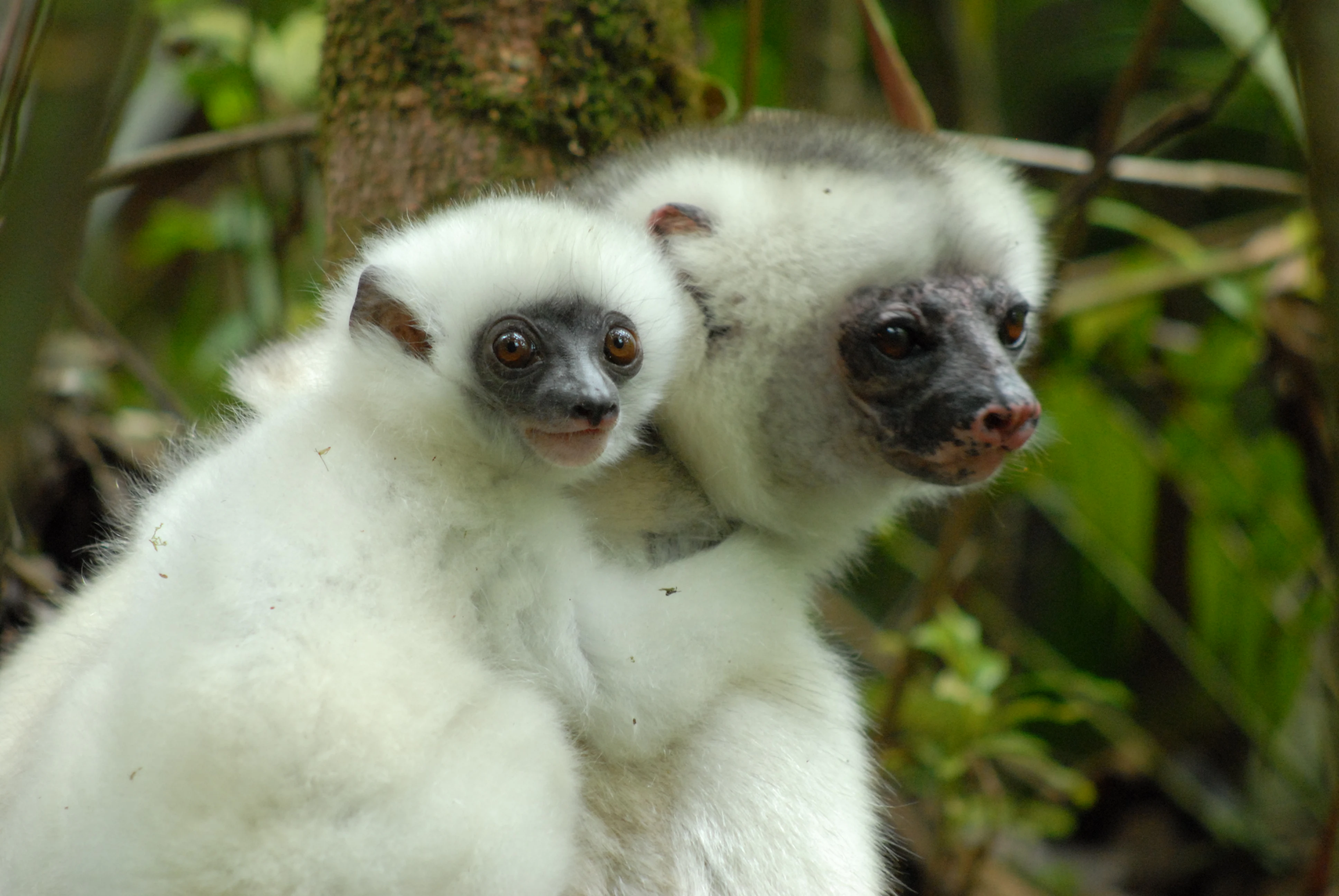
Silky sifaka mother and infant with white fur, dark facial features, and brown eyes in a lush green forest background
Silky sifaka mother and infant clinging together in a forest setting

Marojejy National Park history and protected-area timeline

The scientific history of Marojejy began in 1937 when L.-J. Arragon of the Service Géographique de Madagascar first ascended Marojejy Est, though he conducted no field research during this visit. The massif remained undescribed geologically until 1948 when French botanist Jean-Henri Humbert from the National Museum of Natural History in Paris explored the mountains. Between November 1948 and November 1950, Humbert spent five months collecting 4,039 herbarium specimens, and in 1955 he published the book "A Marvel of Nature" in which he declared the massif the most impressive range in all of Madagascar. His enthusiasm led to Marojejy being set aside as one of Madagascar's strict nature reserves in 1952, with access restricted to research scientists. In 1998, following pressure from conservation organizations including WWF, the reserve was converted to a national park to allow ecotourism as a sustainable alternative to resource extraction. The park was inscribed as part of the World Heritage Site Rainforests of the Atsinanana in 2007, though the site was added to the World Heritage in Danger list in 2010 due to illegal logging pressures.

Marojejy National Park landscape and geographic character

The Marojejy Massif forms the core of the park, with its crests creating an east-west line with distinct peaks along an irregular structure of parallel or divergent crest lines broken by steep slopes. The highest peaks, including Ambatotsondrona, are composed primarily of gneiss bedrock that formed over 500 million years ago during the Precambrian beneath an ancient mountain range. The gneiss consists of alternating bands of light and dark colored minerals, with the light minerals being more resistant to weathering, creating the asymmetric character of the peaks with moderate dips on northern slopes and near-vertical cliffs on southern faces. The mountains feed several drainage basins, including the Lokoho River from western and southern slopes and the Androranga River from northern slopes, both flowing to the Indian Ocean near Sambava. The terrain creates dramatic changes in microclimate and habitat over short distances, with the rapid transition from warm lowland rainforest through montane forest to cloud forest and finally to the unique montane scrub at the highest elevations being a defining characteristic of the landscape.
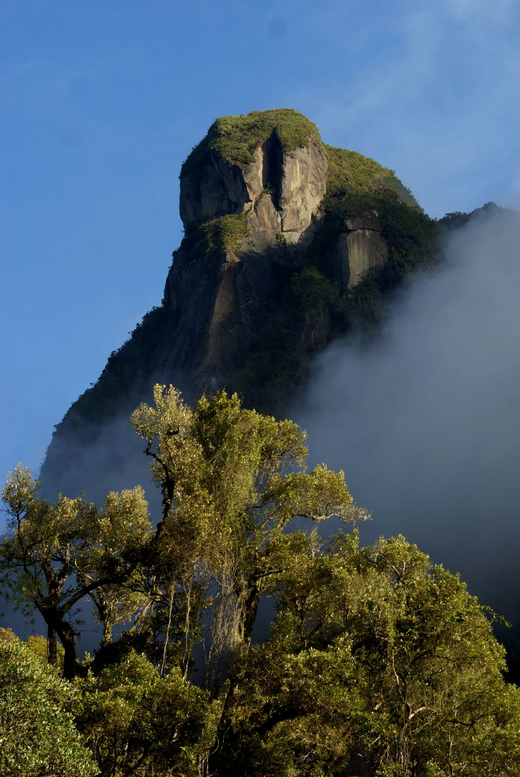
Tall mountain peak with rocky outcrops and vegetation, partially obscured by fog, with dense trees in the foreground under a clear blue sky
Mountain peak with vegetation and fog in Marojejy National Park

Marojejy National Park ecosystems, habitats, and plant life

The vegetation of Marojejy is extraordinarily diverse due to the variety of microclimates created by the steep topography and altitudinal range. Over 2,000 species of flowering plants have been documented in the park, with at least four plant families found at all elevations. The park contains four distinct forest types, each with characteristic species composition and structure. The lowland rainforest below 800 meters supports the highest species diversity with canopy trees reaching 25-35 meters, while the moist montane rainforest between 800-1,400 meters features smaller trees and abundant tree ferns. The sclerophyllous montane cloud forest at 1,400-1,800 meters has gnarled, stunted trees reaching only 10-15 meters maximum, with dense moss and lichen covering branches. Above 1,800 meters, the montane scrub represents the only remaining undisturbed mountain scrub in Madagascar, with vegetation reaching only 2 meters in height due to cool temperatures, high winds, and poor soils. The park contains 35 species of palms, several critically endangered and found only at Marojejy, as well as over 275 fern species including 18 tree ferns.
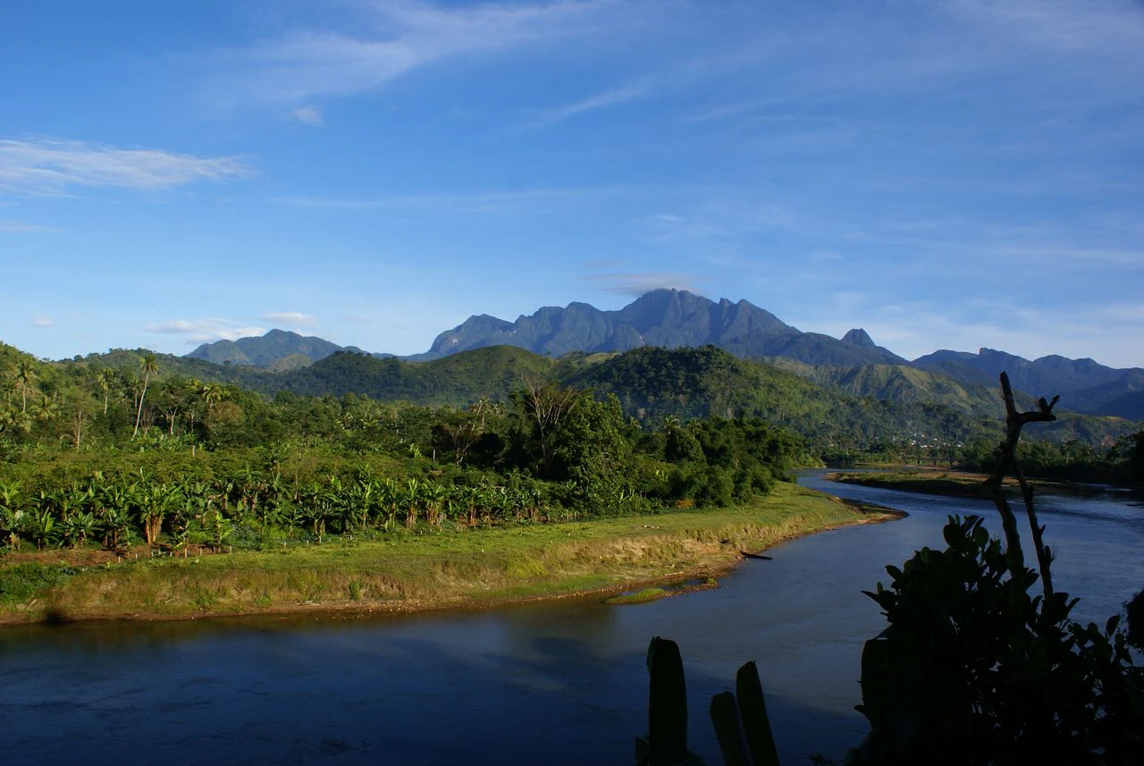
River flowing through lush green valley with mountain ranges in background under clear blue sky
Panoramic view of Marojejy National Park's mountainous landscape with river and forest

Marojejy National Park wildlife and species highlights

Marojejy National Park is home to exceptional biodiversity with at least 118 species of birds, 148 species of reptile and amphibian, and 11 species of lemur documented within its boundaries. The park is most famous for the silky sifaka, a critically endangered lemur listed among The World's 25 Most Endangered Primates since 2000, with fewer than 1,000 individuals remaining in the wild and none in captivity. Ten other lemur species also inhabit the park, including the nocturnal aye-aye, which has only been recorded once. The helmet vanga is considered the iconic bird species of the park, while 75 of the 118 bird species are forest-dwelling birds endemic to Madagascar, a total exceeding any other mountain site in Madagascar. The Madagascar serpent-eagle, not seen since 1932, was rediscovered in Marojejy in 1990. The park also supports the fossa, Madagascar's largest carnivore, at least 15 species of tenrec, seven species of native rodent, and the Madagascar sucker-footed bat. Reptile and amphibian diversity is the highest of any protected area in Madagascar, with 17 species found only in Marojejy including several chameleon species.
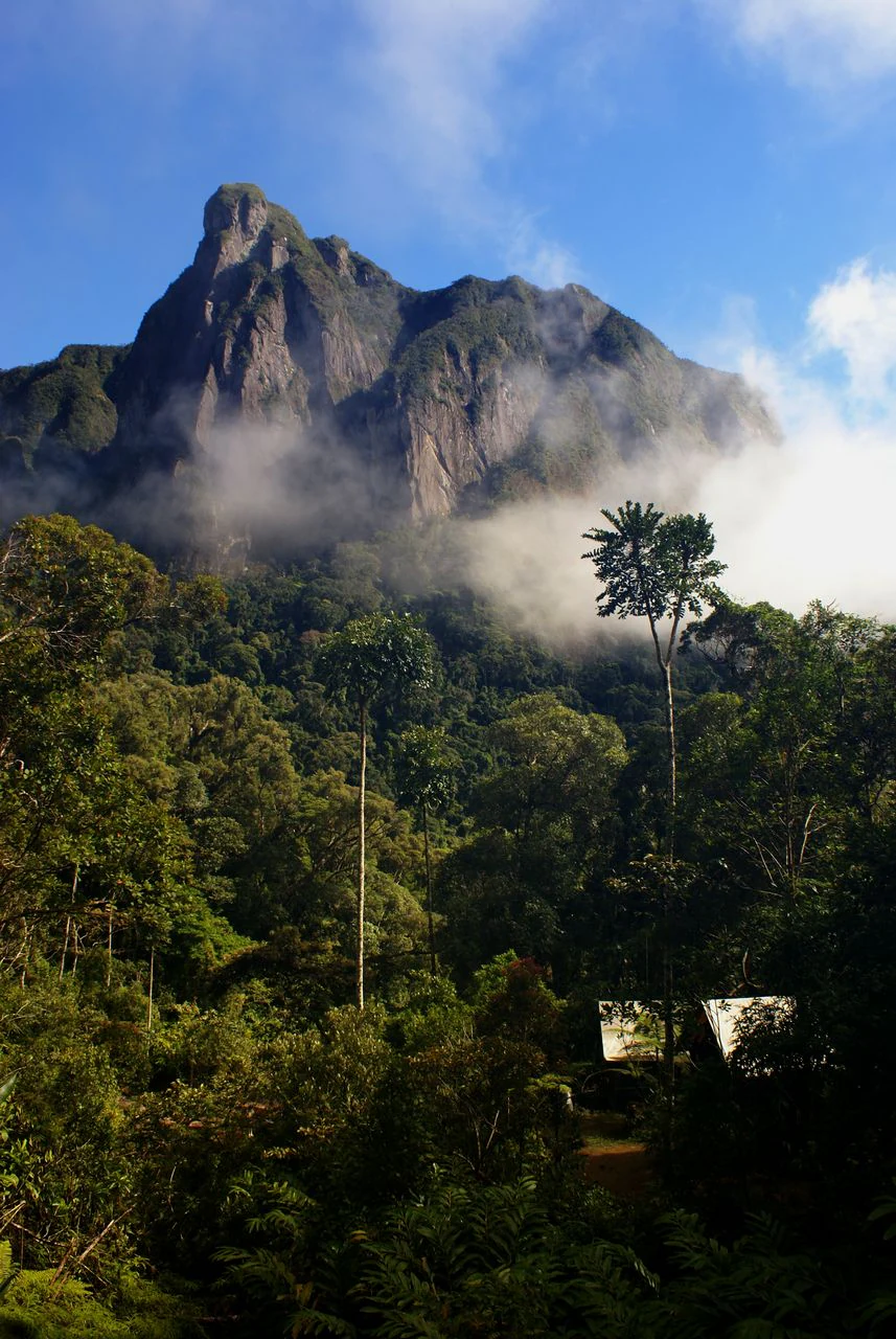
Mountain with mist and dense green forest, with small structures visible in the foreground
Campsite within Marojejy National Park set against misty mountains and dense forest

Marojejy National Park conservation status and protection priorities

Marojejy faces significant conservation challenges despite its protected status. Illegal logging of precious hardwoods, particularly rosewood and palisandre, has been a persistent problem, with an estimated 52,000 tons of rosewood logged in 2009 alone, with roughly one-third coming from Marojejy. The park was briefly closed in 2009 during the political crisis but has since reopened. Slash-and-burn agriculture, hunting of lemurs, mining of semi-precious gemstones, and wood collection continue to pressure the park's boundaries. The population in the surrounding region has tripled over 30 years to over 100,000 people by 2003, with approximately 200,000 people living within 40 kilometers of the park by 2003. Conservation organizations including the Lemur Conservation Foundation, Duke Lemur Center, and Madagascar National Parks have implemented community-based initiatives promoting afforestation and sustainable alternatives to mining, slash-and-burn agriculture, and wood collection. The Sava Region remains the poorest in Madagascar, creating ongoing pressure on natural resources.

Marojejy National Park cultural meaning and human context

The Andapa Basin surrounding Marojejy was extremely remote until the mid-1800s when refugees from the Merina Kingdom settled the area, followed by another wave fleeing French colonists nearly 50 years later and a small group from Réunion after World War I who came to grow vanilla. The population remained small until the early 1970s when the Andapa-Sambava road was completed, connecting the region to the coast and encouraging agricultural development. The dominant ethnic groups are the Tsimihety, the first settlers, and the Betsimisaraka. Local communities traditionally utilize forest materials for architecture, pirogues, fiber for weaving, firewood, traditional medicine, and flavoring drinks. Most residents are subsistence rice farmers practicing both irrigated paddies and slash-and-burn agriculture. The region is among the poorest in Madagascar, with food insecurity particularly severe between January and April before the main rice harvest.
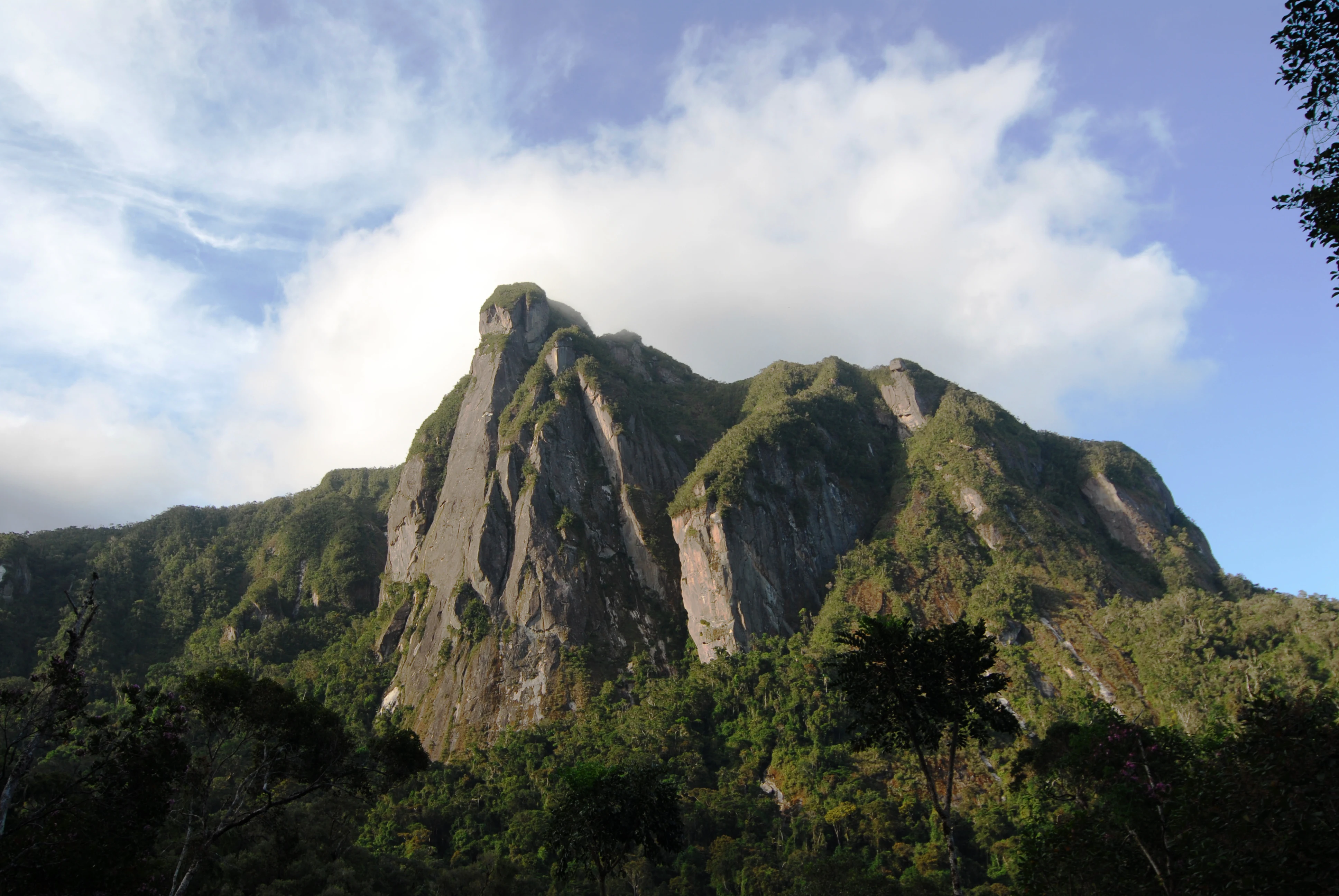
Mountain peak with rocky outcrop and dense forest below under partly cloudy sky
Leaning Rock (Ambatotsondrona) in Marojejy National Park

Top sights and standout views in Marojejy National Park

The park's single trail system offers a remarkable journey through dramatically different ecosystems, from lowland rainforest through montane forest to cloud forest and finally to montane scrub near the summit. The three camps along the route provide opportunities to observe different wildlife at each elevation, with Camp Marojejia reportedly the best location for spotting the silky sifaka. The climb to the summit at 2,132 meters stretches two kilometers and takes four to five hours, rewarding hikers with views of the surrounding mountains and access to the unique high-altitude scrub. The park offers wooden chalets and bungalows at its three camps, a rare feature among Madagascar's national parks, along with kitchen facilities and basic bedding. The helmet vanga and other endemic birds, chameleons including the panther chameleon, and diverse frog species are among the wildlife highlights. The geological features such as Ambatotsondrona, or Leaning Rock, add to the dramatic scenery.
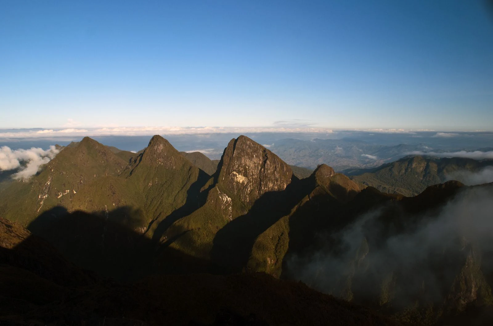
Mountain peaks of Marojejy National Park with clouds in the background and clear blue sky
Three peaks of Marojejy National Park with clouds below and clear blue sky
Monthly climate preview

Analyze long term precipitation patterns and average monthly temperature cycles

Marojejy National Park Monthly Climate Normals and Temperature Trends

Long term data for Marojejy National Park shows average monthly temperatures spanning from mid year lows near 20 degrees Celsius to warmer peaks exceeding 25 degrees. Accessing the complete monthly profile reveals historical precipitation daily averages alongside maximum and minimum temperature variations across the year.
Annual mean23 °C
20 °C25 °C
Jan25°
Feb25°
Mar25°
Apr24°
May23°
Jun21°
Jul20°
Aug20°
Sep21°
Oct23°
Nov24°
Dec25°
Warmest month
January

25.4 °C

Coolest month
August

20.4 °C

Wettest month
March

10.5 mm/day

Driest month
October

2.9 mm/day

Park location guide

Geography guide, regional context, and park location map for Marojejy National Park

Marojejy National Park park geography, regions, and map view in Madagascar

Understand where Marojejy National Park sits in Madagascar through a broader geographic reading of the surrounding landscape, nearby location context, and its mapped position within the national park landscape.

How Marojejy National Park fits into Madagascar

Madagascar is an island nation in the Indian Ocean, positioned off the southeastern coast of Africa. As the world's fourth-largest island and second-largest island country, it stands out for its exceptional biodiversity, over 90% of its wildlife is endemic, making it one of 17 megadiverse countries. The population is approximately 32 million, with Antananarivo as both the capital and largest city.

Wider geography shaping Marojejy National Park in Madagascar

Madagascar lies in the Indian Ocean off the southeastern coast of Africa, separated from the mainland by the Mozambique Channel. The island is situated approximately 400 km from the African continent. As the world's fourth-largest island, it also includes numerous smaller peripheral islands.

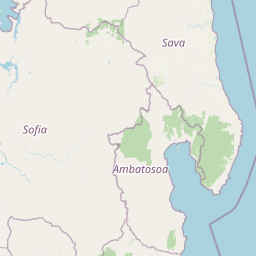
Map view of Marojejy National Park

Use this park location map to pinpoint Marojejy National Park in Madagascar, understand its exact geographic position, and read its mapped placement within the surrounding landscape more clearly.

Pigeon | © OpenStreetMap contributors

Location context for Marojejy National Park

Sava Region

Visualize the diverse habitats and dramatic mountain terrain of this unique Madagascar protected area through imagery.

Explore Marojejy National Park Photos, Landscapes, and Scenery

Review Marojejy National Park photos to understand its distinctive rainforest, cloud forest, and montane scrub environments. These landscape images and protected area views reveal the park's critical biodiversity and dramatic altitudinal gradients, offering a clear visual reference for its complex terrain.

Silky sifaka mother and infant with white fur, dark facial features, and brown eyes in a lush green forest background

Helmet Vanga bird with blue beak and brown plumage tending to chicks in a nest surrounded by green foliage

Tall mountain peak with rocky outcrops and vegetation, partially obscured by fog, with dense trees in the foreground under a clear blue sky

River flowing through lush green valley with mountain ranges in background under clear blue sky

Mountain with mist and dense green forest, with small structures visible in the foreground

Green and white patterned chameleon with spiny back resting on green leaf and stem

Mountain peak with rocky outcrop and dense forest below under partly cloudy sky

Mountain peaks of Marojejy National Park with clouds in the background and clear blue sky

Panoramic view of mountain ranges and cloud-covered sky in Marojejy National Park, Madagascar, with dense forest below

Small huts with green roofs at Camp Mantella in Marojejy National Park, surrounded by lush vegetation and mountains

A bird with blue eye-ring, reddish-brown body, and long tail perched on a natural nest among branches

Large tree stump with fresh cuts and surrounding fallen logs in a dense forest

A campsite shelter with green roof in a forested area, showing hikers with backpacks on a wooden platform, surrounded by dense vegetation

Thatched-roof huts surrounded by dense green foliage in a forested area

Interior of an interpretation center with green walls, orange display stands, and people viewing exhibits

Park atlas

Explore Madagascar's Diverse Protected Landscapes, Comparing Regional Geography and Conservation Efforts

Discover Other National Parks and Protected Areas Near Marojejy National Park

Browse other significant national parks and protected areas situated geographically near Marojejy National Park, tracing a wider network of conservation landscapes across northeastern Madagascar. Compare these diverse park entities, their mapped terrain, and unique altitudinal gradients to deepen your understanding of the island's globally important biodiversity.
Wildlife reserveSava
About 40 km away#1 closest

Southwest

Réserve spéciale d'Anjanaharibe-Sud: Geography and Protected Area Landscape Overview

Deep forest terrain and mountain ridges in the Sava region

Situated in northeastern Madagascar, Réserve spéciale d'Anjanaharibe-Sud encompasses dense evergreen forests and steep mountain terrain. This protected area serves as a significant conservation landscape for rare endemic species, providing a high-elevation habitat that climbs dramatically from 500 meters to peaks above 2,000 meters across the Sava region.

Area
182.56 km²
Established
1958
IUCN
IV
Relief
Mountain
National parkSava Region
About 90 km away#2 closest

South

Masoala National Park: Explore Madagascar's Largest Protected Landscape and Marine Ecosystems

Discover the unique geographic features and rich biodiversity of this Sava Region national park.

Masoala National Park represents a critical protected landscape in Madagascar's Sava Region, spanning the vast Masoala Peninsula. The park's protected territory covers a remarkable range of ecosystems, including lowland and montane rainforests, coastal habitats, and extensive marine areas with coral reefs. Understanding the geographic scope and ecological diversity of Masoala National Park provides essential context for appreciating Madagascar's unique natural heritage and the importance of its conservation efforts.

Area
2,400 km²
Established
1997
IUCN
II
Visitors
3K annual
Nature reserveDiana
About 106 km away#3 closest

Northwest

Réserve naturelle intégrale de Tsaratanana: Highland Massif and Protected Mountain Terrain

High-altitude geography in the Diana region of northern Madagascar

Spanning tens of thousands of hectares, the Réserve naturelle intégrale de Tsaratanana protects the highest mountain terrain in Madagascar. The landscape is defined by the crystalline Vohibory massif, creating a complex topography of deep valleys and dramatic elevation gradients that support endemic primate habitats and montane forest ecosystems.

Area
486.22 km²
Established
1927
IUCN
Ia
National parkMadagascar
About 108 km away#4 closest

South

Makira Natural Park: Exploring the Geography and Forested Terrain of Northeastern Madagascar

A vital protected landscape in the humid northeastern forest belt.

Makira Natural Park serves as a benchmark for integrated tropical conservation in Madagascar. Its humid evergreen forests provide a critical habitat for high lemur diversity and specialized botanical associations linked to unique geological substrates. This protected area connects to a larger regional landscape of community-managed forests, acting as a crucial buffer for the biodiversity of the northeastern coastal regions.

Area
3,724.7 km²
Established
2012
IUCN
II
Relief
Mountain
National parkAmbatosoa
About 116 km away#5 closest

South

Nosy Mangabe National Park: Atlas Overview of the Ambatosoa Island Forest Reserve

Coastal rainforests and protected lemur habitats in Antongil Bay.

Nosy Mangabe stands as a prominent protected island within the Ambatosoa region of Madagascar. The island is defined by its dense lowland rainforest, dramatic bay topography, and its essential role as a sanctuary for rare primates. This overview maps the park boundary and explores the terrain, historical maritime traces, and the connection between the island and the Masoala peninsula ecosystem.

Area
90.47 km²
Established
1965
IUCN
II
Visitors
3K annual
Wildlife reserveDiana
About 155 km away#6 closest

West

Manongarivo Special Reserve: Protected Wildlife and River Landscapes in Northern Madagascar

Examining the humid forest terrain and geographic boundaries of the Diana region

Located in the Diana region, Manongarivo Special Reserve serves as a critical protected area within the northern humid rainforest system of Madagascar. The territory is defined by steep forested hills, narrow river valleys, and diverse ecological niches. By analyzing its specific topographic markers and river systems, this entry details the natural landscape and protected status of this significant biodiversity reserve.

Area
327.35 km²
Established
1956
IUCN
IV
Climate
Tropical
Nature reserveDiana Region
About 170 km away#7 closest

Northwest

Ankarana Special Reserve: A Detailed Geographic Atlas of the Diana Region's Limestone Plateau

Mapping the karst landscape, subterranean rivers, and cliff formations.

Examine the rugged topography of Ankarana Special Reserve, featuring a 25-kilometre-long cliff known as the Wall of Ankarana and 100 kilometres of mapped cave passages. This protected area offers deep insight into Madagascar's geological history and rare endemic lemur habitats within its dense, jagged tsingy ridges.

Area
182 km²
Established
1956
IUCN
IV
Relief
Upland
Wildlife reserveDiana
About 174 km away#8 closest

North

Réserve spéciale d'Analamerana: Mapped Geography and Protected Karst Ecosystems

Northern Madagascar wilderness and dry forest topography

Navigate the rugged limestone corridors and canyon networks of Réserve spéciale d'Analamerana. This protected area showcases a distinctive dry forest landscape shaped by seasonal tropical climates and serves as a critical habitat for rare endemic species within the Diana region.

Area
347 km²
Established
1956
IUCN
IV
Relief
Upland

Common questions about visiting, size, designation, and location context for Marojejy National Park

Marojejy National Park FAQs for park facts, access, geography, and protected area context

Find quick answers about Marojejy National Park, including protected-area facts, park geography, trail and visitor context, and how the park fits into its surrounding country and regional landscape.
MoriAtlas Explorer

Continue Your Protected Areas Search Across the Global Atlas

Deepen your exploration by continuing the structured search for national parks and protected areas worldwide. Utilize the comprehensive filtering capabilities to compare different conservation landscapes and refine your understanding of global park geography. Discover more about the distribution and characteristics of protected natural areas.

Global natural geography