Mori Atlas logo
Nearby park discovery

Explore the regional geography and landscape distribution of nearby protected lands

Protected Areas and Nature Reserves Located in the Vicinity of the Meißner Massif

Examine the geographic distribution of protected areas and nature reserves surrounding the basalt plateau of Meißner in northern Hesse. Identify landscape patterns and spatial relationships between these upland conservation sites and the broader mountain terrain of the region through integrated map data.

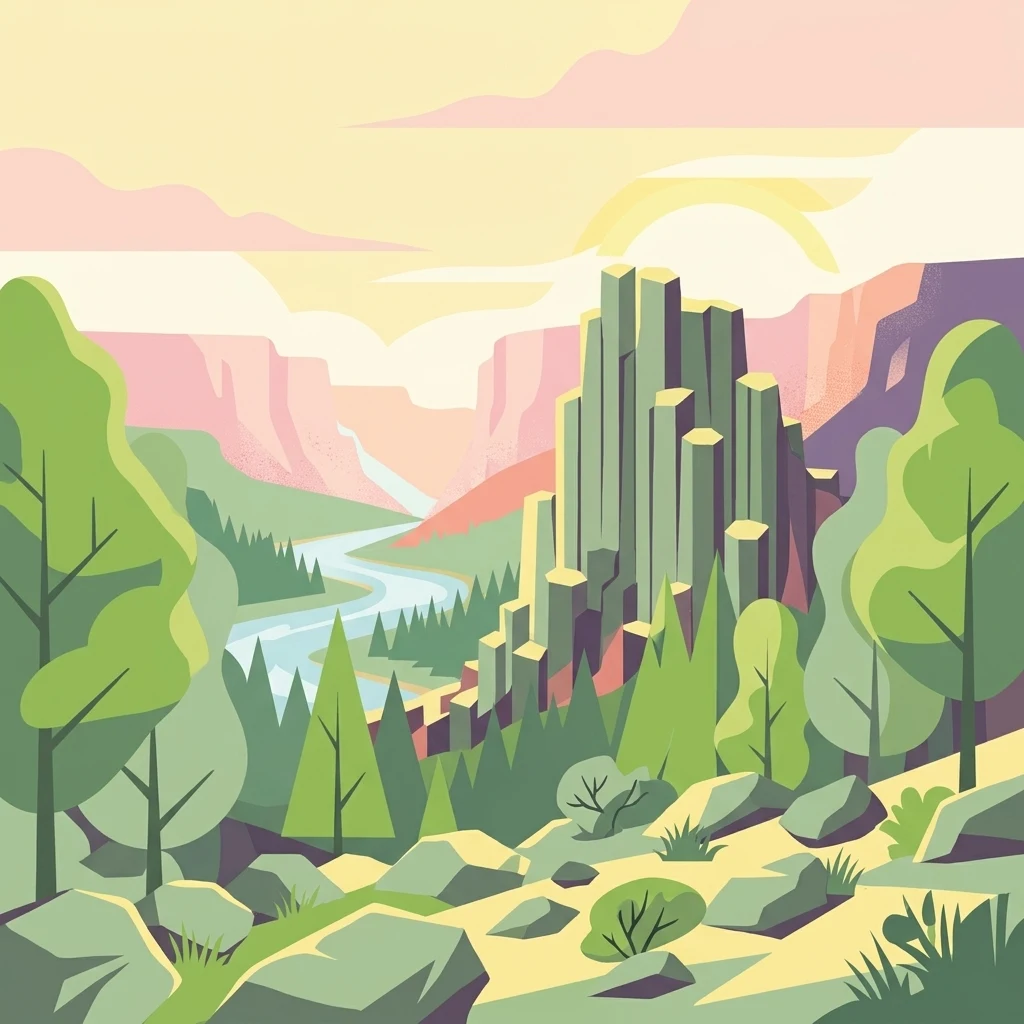
A vibrant, flat-style vector illustration showing a tall basalt rock pillar formation rising above a forest valley with a winding river in the background.

A basalt-mountain forest reserve in northern Hesse with ancient blockfields, hanging bogs, and montane meadows.

Meißner Nature Reserve

The Meißner Nature Reserve protects the steep slopes and significant portions of the plateau of the Hoher Meißner, a roughly 750-meter basalt massif in northern Hesse, Germany. The reserve sits within the Werra-Meißner-Kreis and forms the core of the larger Natura 2000 site 'Meißner und Meißner Vorland' as well as the European bird protection area 'Meißner'. At around 930 hectares, it is one of the largest nature reserves in Hesse and the state's largest forest nature reserve, complemented by species-rich mountain meadows and a hanging spring bog. The protected area is dominated by near-natural deciduous forests, with a strong presence of beechwoods on basaltic, sandstone, and limestone soils. It also encloses remarkable non-forest habitats: ancient basalt blockfields with cold-air microclimates that harbor glacial relicts, three small mires, a natural mountain pond, and traditionally grazed montane meadows with a rich floral heritage. Together, these features make the Meißner one of the ecologically most distinctive upland landscapes in central Germany. Beyond its ecological significance, the reserve carries a layered conservation history. Early protection efforts in the 1920s were followed by designation as a nature reserve in 1970, expanded to its present size in 1989, and formally integrated into the European Natura 2000 network in 2008. A dedicated forest wilderness reserve within the area has been left without forestry intervention since the late 1980s, ensuring an undisturbed reference area for long-term ecological research.

Location
Germany
Park type
Nature reserve
Established
1989
Area
9.3 km²
Highest point
750 m
Meißner Nature Reserve Geography
Regional park map

See the ranked park cluster in its geographic setting

Nearby parks around Meißner Nature Reserve

This regional map shows the same 20 nearby parks ranked below around Meißner Nature Reserve. Select a ranked marker to highlight that park’s boundary where boundary data is available.
Reference park: Meißner Nature ReserveRanked nearby parkSelected boundary: Meißner Nature Reserve20 nearby parks shown
20 nearby parks

Distance-ranked protected landscapes and surrounding terrain relative to the Meißner massif

Ranked Parks and Protected Areas Geographically Near Meißner in Regional Park Geography

Spatial proximity rankings evaluate geographic separation and directional orientation relative to Meißner across the surrounding regional park geography. Structured environmental attributes and country context provide baseline comparison signals for neighboring protected areas without implying identical habitats.
A soft, light-colored watercolor painting of a rolling hilly landscape with sparse trees and open grassy meadows.
Nature reserveWerra-Meißner-Kreis
Mapped location lies within the park boundary#1 closest

Northwest

Bühlchen bei Weißenbach Nature Reserve: Protected Limestone Grasslands in Werra-Meißner-Kreis

Geographic atlas of a historic juniper heath and limestone hilltop.

Bühlchen bei Weißenbach represents a rare, semi-open cultural landscape shaped by centuries of sheep grazing on shell limestone summits. This nature reserve, integrated into the Natura 2000 network, offers a dense concentration of rare orchids and gentians across its rocky, nutrient-poor slopes, serving as a critical site for regional ecological study and landscape preservation.

Area
0.08 km²
Established
1985
IUCN
IV
Relief
Mountain
A watercolor painting showing a soft, green landscape with gentle rolling hills, small clusters of trees, and a small meandering stream, framed by delicate wild flowers in the foreground.
Nature reserveWerra-Meißner-Kreis
About 0.1 km away#2 closest

West

Quellgebiet der Weißen Gelster: Nature Reserve Geography and Protected Area Mapping

Calcareous spring mires and wet meadows in Werra-Meißner-Kreis

Located at the foot of the Meinetsberg, Quellgebiet der Weißen Gelster features a series of groundwater-dependent habitats including Davall's sedge fens and golden oat meadows. The reserve represents a key segment of the regional protected-area network, preserving rare vegetation types on Keuper bedrock within a characteristic upland agricultural valley.

Area
0.115 km²
Established
1991
IUCN
IV
Relief
Upland
Watercolor illustration showing rolling green hills, small clusters of trees, and tall grasses in the foreground against a soft white background.
Nature reserveWerra-Meißner-Kreis
1 km away#3 closest

Southwest

Reichenbacher Kalkberge Nature Reserve: Geographic and Protected Landscape Analysis

Muschelkalk limestone hills and orchid-rich grassland habitats

An essential look at the Reichenbacher Kalkberge protected area, where limestone-based forest stands meet rare semi-dry meadows. Gain geographic insight into the terrain, the medieval castle ruin surroundings, and the protected habitat mosaic that defines this distinctive part of the Geo-Naturpark Frau-Holle-Land.

Area
1.503 km²
Established
1996
IUCN
IV
Relief
Mountain
A horizontal watercolor painting showing a soft, muted landscape with rolling hills, a central open area, and clusters of green trees under a pale sky.
Nature reserveWerra-Meißner-Kreis
About 1.5 km away#4 closest

Northeast

Kripp- und Hielöcher Nature Reserve: Karst Geography and Protected Land in Werra-Meißner-Kreis

Geology-focused nature reserve featuring gypsum sinkholes and dry grasslands.

Kripp- und Hielöcher provides a rare look at Zechstein gypsum karst in Hesse. The reserve is split into two distinct areas, the Kripplöcher and Hielöcher, showcasing natural rock monuments, active karst springs, and a historical cultural landscape maintained through centuries of traditional land use.

Area
0.17 km²
Relief
Upland
Climate
Temperate
Access
Moderate access
A horizontal watercolor illustration depicting rolling green hills, scattered trees, and soft mountain silhouettes against a pale sky.
Protected areaGermany
4.8 km away#5 closest

North

Kalkmagerrasen bei Roßbach: Protected Calcareous Grassland and Juniper Landscape in Germany

Geographic atlas and protected area overview in Hesse

Kalkmagerrasen bei Roßbach consists of five distinct plots that protect rare Enzian Schillergras Rasen communities on shallow Zechstein limestone soils. This site remains a critical stronghold for diverse orchid populations and protected butterfly species within the Werra Meißner region. The mosaic of juniper, flowering herbs, and historic cherry orchards creates a unique Mediterranean character rarely found in central German hill country.

Area
0.551 km²
Established
1996
Relief
Upland
Climate
Temperate
A soft, minimalist watercolor painting of rolling hills and trees set against a white background.
Nature reserveHessen
4.9 km away#6 closest

East

Bilstein im Höllental: Protected Diabase Cliff and Ravine Forest in Hessen

Geological landscape and Natura 2000 protected area

Discover the geographic significance of Bilstein im Höllental, a nature reserve in the Werra-Meißner-Kreis that showcases a rare juxtaposition of warm rock refuges and cool, shaded ravine environments. The reserve protects significant cliff-dwelling plant communities and traces of medieval history upon its 284-meter diabase summit, providing a focused example of geological resistance shaping valley terrain.

Area
0.032 km²
Established
1960
IUCN
IV
Relief
Mountain
Watercolor painting of a pastoral landscape with light green hills in the distance, a field with flowering pink trees, and a pale green meadow in the foreground.
Nature reserveWerra-Meißner-Kreis
6.6 km away#7 closest

North

Ebenhöhe-Liebenberg Nature Reserve: Geography and Protected Habitat Mapping

Protected calcareous forests and dry grassland mosaic

Explore the mapped boundaries and natural terrain of the Ebenhöhe-Liebenberg nature reserve. This site provides a critical habitat mosaic including orchid-rich beech woodlands, nutrient-poor grasslands, and sandstone outcrops that form a significant conservation area within the Hessian highlands.

Area
142.48 km²
Established
1995
IUCN
IV
Relief
Upland
A wide watercolor illustration of a rolling landscape with green fields, patches of pink flowers, and distant purple hills under a pale sky.
Nature reserveWerra-Meißner-Kreis
About 7.5 km away#8 closest

East

Jestädter Weinberg: Protected Zechstein Cliffs and Werra River Valley Mosaic

A botanical and geological hotspot in northern Hesse

Jestädter Weinberg represents a critical protected landscape defined by its steep dolomite rock faces and sun-exposed slopes. This nature reserve provides an essential habitat for orchids and diverse insect populations, bridging the gap between high-altitude limestone ridges and the riparian meadows of the Werra river valley.

Area
0.6 km²
Established
1924
IUCN
IV
Relief
Upland
A horizontal watercolor illustration depicting gentle rolling hills, grassy meadows, and distant mountain silhouettes in muted pastel tones.
Nature reserveThuringia
7.6 km away#9 closest

Northeast

Röhrsberg - Hasenwinkel - Mühlberg: Mapping the Protected Landscapes of Thuringia

Geological ridge systems and native forest habitat networks.

The Röhrsberg - Hasenwinkel - Mühlberg nature reserve represents a significant protected area in Thuringia, characterized by the juxtaposition of Muschelkalk limestone hills and Zechstein dolomite ridges. This site offers a concentrated view of regional terrain, shifting from closed beech forests to open juniper heaths. It serves as an essential geographic reference for understanding the ecological mosaic of the lower Werra hill country.

Area
4.51 km²
Established
1999
IUCN
IV
Relief
Upland
A soft watercolor illustration depicting a winding river landscape with lush trees and rolling hills in the background.
Nature reserveLandkreis Eichsfeld
About 7.9 km away#10 closest

Northeast

Kelle, Teufelskanzel Nature Reserve: Geographic Overview and Protected Area Atlas

Steep slopes and sandstone ridges in Landkreis Eichsfeld

Situated along the Höheberg ridge in Thuringia, Kelle, Teufelskanzel represents a vital 200 hectare nature reserve. Its geography is defined by deep V-shaped valleys, dramatic rock outcrops like the Teufelskanzel, and a dense mix of deciduous forests that form part of the historic Inner German Border conservation zone.

Area
2.002 km²
Established
1996
IUCN
IV
Relief
Mountain
Wide watercolor illustration of green trees and hills with purple mountains in the background under a pale sky.
Nature reserveThuringia
9.2 km away#11 closest

East

Stein, Rachelsberg, Gobert: A Protected Limestone Landscape in Western Thuringia

Mapping a historic nature reserve and beech forest complex

Stein, Rachelsberg, Gobert stands as a key protected area within Thuringia. This nature reserve offers deep insights into limestone ridge geography, historic border woodland continuity, and diverse habitats ranging from dry grasslands to tufa springs and orchid-rich beech forests.

Area
7.16 km²
Established
1999
IUCN
IV
Relief
Mountain
A horizontal watercolor painting showing a winding river flowing through a lush valley with forested hills in the background.
Protected areaHesse
9.7 km away#12 closest

North

Freudenthal bei Witzenhausen Protected Landscape and Wetland Geography in Hesse

A restored gravel pit wetland system in the northern Hesse Werra valley.

Freudenthal bei Witzenhausen represents a high-value conservation landscape within Hesse, serving as a primary site for breeding and migratory waterbirds. The reserve comprises three interconnected quarry lakes surrounded by alluvial woodland, ruderal vegetation, and meadows. This habitat mosaic is part of the Natura 2000 network, providing essential ecological connectivity within the riverine corridor of the lower Werra valley.

Area
0.76 km²
Established
1980
Relief
Lowland
Climate
Temperate
A horizontal watercolor illustration showing a soft, panoramic landscape with rolling green hills, small clumps of trees, and rocky formations on a white background.
Nature reserveLandkreis Eichsfeld
About 9.8 km away#13 closest

Northeast

Hasenwinkel bei Fretterode: Protected Dolomite Ridge and Juniper Heath in Landkreis Eichsfeld

Nature reserve geography and landscape analysis

The Hasenwinkel bei Fretterode nature reserve is characterized by a prominent dolomite ridge rising above the agricultural lands of Landkreis Eichsfeld. This site offers an look at historically grazed calcareous grasslands and rocky outcrops. Our mapping covers its extent as a vital component of the regional protected-area network, showcasing its ecological importance and distinctive geology.

Area
0.062 km²
Established
1939
IUCN
IV
Relief
Upland
A minimalist watercolor painting featuring soft green trees and rolling hills in the background against a light, airy white backdrop.
Nature reserveWerra-Meißner-Kreis
10 km away#14 closest

North

Ermschwerder Heegen Nature Reserve: Muschelkalk Ridge and Floodplain Geography

Protected mosaic of forests, marshes, and meadows in northern Hesse

Ermschwerder Heegen preserves a compact but ecologically significant landscape in the Werra-Meißner-Kreis. Its unique topography features a limestone ridge dropping into the Werra valley, supporting a rich mixture of forest, orchard, and wetland habitats that rank among the most important in the region for biodiversity.

Area
0.37 km²
Established
1985
IUCN
IV
Watercolor painting of a green landscape with rolling hills, a winding path or stream, and trees on both sides against a light background.
Nature reserveWerra-Meißner-Kreis
About 11 km away#15 closest

Northeast

Kalkklippen südlich des Iberges Nature Reserve and Muschelkalk Landscape Atlas

Protected beech forests and active landslide topography

This nature reserve in Werra-Meißner-Kreis reveals an active Muschelkalk ridge characterized by steep limestone cliffs and boulder-strewn talus slopes. Study the site's unique ecological composition, featuring noble hardwood-rich beech forests and native European yew populations that highlight the region's complex natural history and geological significance.

Area
0.473 km²
Established
1995
IUCN
IV
A pale, panoramic watercolor painting depicting a series of rocky outcroppings surrounded by sparse green vegetation against a light, hazy background.
Nature reserveWerra-Meißner-Kreis
About 11 km away#16 closest

Southeast

Blaue Kuppe Nature Reserve: Volcanic Basalt Landscapes in Werra-Meißner-Kreis, Germany

Protected geological monument and habitat zone

Blaue Kuppe is a notable basalt hill near Eschwege, preserved for its rare mineralogical record and exposed contact zones between volcanic lava and sedimentary sandstone. The site serves as a vital geological archive and protected nature reserve in the Werra-Meißner-Kreis, showcasing historical volcanic intrusions that shaped the local terrain.

Area
0.068 km²
Established
1939
IUCN
IV
Relief
Upland
Nature reserveThuringia
About 11 km away#17 closest

Northeast

Stein, Rachelsberg Nature Reserve: Mapped Muschelkalk Terrain in Thuringia

Protected low mountain hills and forested karst landscapes

The Stein, Rachelsberg nature reserve in Thuringia represents a protected mosaic of Muschelkalk ridges and Buntsandstein valleys. Its geography is defined by strongly broken relief, rocky outcrops, and a unique ring of forested summits including the Dieberg and Goburg, forming an essential link in regional conservation networks across the Thuringia and Hesse border.

Area
5.06 km²
Established
2023
Relief
Mountain
Climate
Temperate
A horizontal watercolor painting showing layers of soft green hills and forests against a pale yellow sky.
Nature reserveHessen
12 km away#18 closest

Southeast

Boyneburg und Schickeberg bei Breitau: Protected Nature Reserve and Geological Landmark

Geology, forest habitats, and medieval history in the Ringgau plateau of Hesse.

This nature reserve serves as a critical protected area showcasing the largest active mass-movement zone in Hesse. The landscape features striking Muschelkalk cliffs, diverse orchid-rich beech forests, and cave systems that provide essential habitat for protected bat populations and breeding raptors.

Area
2.115 km²
Established
1988
IUCN
IV
Relief
Upland
A watercolor painting showing a soft, stylized landscape with rolling hills in the background and a variety of bushes and wild vegetation in the foreground.
Nature reserveWerra-Meißner-Kreis
About 13 km away#19 closest

East

Mönchesrieth bei Grebendorf Nature Reserve in Werra-Meißner-Kreis, Germany

A restored wetland refuge in the Werra river floodplain.

Located in northern Hesse, Mönchesrieth bei Grebendorf is a protected nature reserve formed by the flooding of a former gravel extraction site. Its geography features a network of shallow bays and shoreline vegetation that provide essential nesting and foraging grounds for waterbirds within the busy Werra valley corridor. The site represents a successful transition from industrial terrain to a quiet, managed refuge for regional biodiversity.

Area
0.181 km²
Established
1999
IUCN
IV
Relief
Lowland
Protected areaEllerode
15 km away#20 closest

North

Kreideberg bei Ellerode Protected Area: Geography, Boundaries, and Landscape Map

A diverse calcareous forest habitat in northern Hesse

The Kreideberg bei Ellerode reserve showcases a unique geological character with its chalk-influenced substrate and rich botanical communities. This protected landscape encompasses old-growth beech stands, semi-dry grasslands, and rare calcareous spring features. The site represents an essential, compact habitat corridor within the broader Werra-Meißner-Kreis regional geography.

Area
0.571 km²
Established
1995
Relief
Upland
Climate
Temperate
Distance methodology

Geographic measurements, not driving distances

How nearby park distances are calculated

Distances use park boundaries whenever the available geometry allows it. When one or both boundaries are missing, the mapped park locations provide a clearly labelled estimate. Every value represents straight-line geographic separation and does not use roads or routing.

Boundary distance

Calculated between the nearest points of both park boundaries.

Location-to-boundary estimate

Estimated from one mapped park location to the nearest boundary of the other park.

Mapped-location estimate

Estimated between the mapped locations of both parks.

MoriAtlas Explorer

Explore the Mapped Geography and Protected Landscapes of the Meißner Nature Reserve

Continue discovering the unique basaltic terrain and forest ecosystems of the Meißner nature reserve. MoriAtlas provides detailed context on the reserve's protected boundaries, varied mountain habitats, and geological significance within the wider Hessian upland landscape.

Global natural geography