
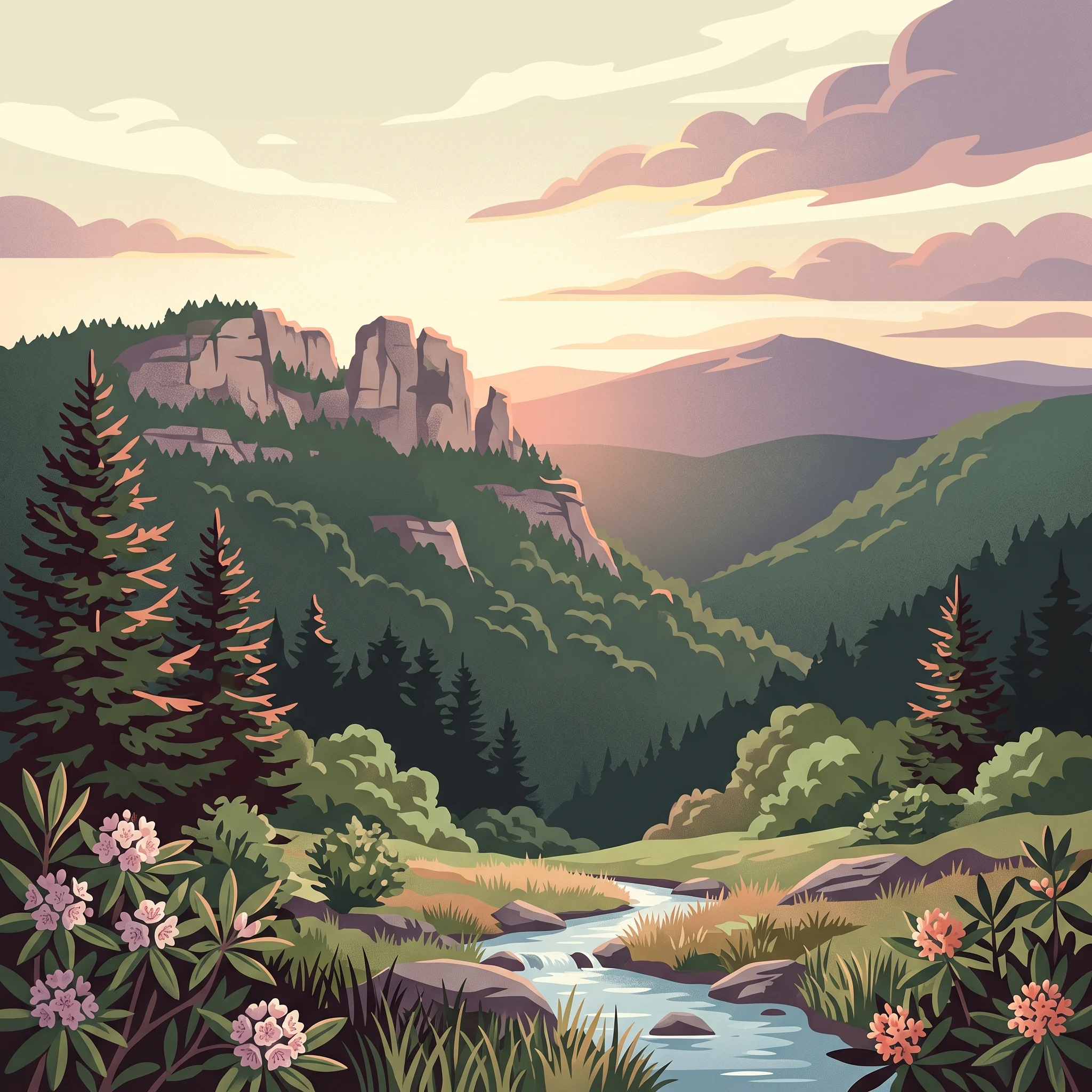
Visit Timing Basics
When to Visit Monongahela National Forest: The Best Time for Your Trip
Deciding on the best time to visit Monongahela National Forest requires balancing the desire for temperate, accessible high-country weather against the reality of a rugged landscape that spans significant elevation changes. Because the forest reaches elevations near 5,000 feet at Spruce Knob, temperature gradients and weather patterns shift rapidly compared to lower-lying regions of West Virginia. For most visitors seeking the widest window of access and standard recreational conditions, the period from late May through early October serves as the primary window for planning a trip. During these months, the forest typically sheds the deep freeze of winter, allowing for more consistent access to trails, scenic overlooks, and high-elevation campgrounds.
Understanding the High-Country Climate Trade-offs
The central challenge for any visitor is the forest's significant internal variability. The Allegheny Front creates a distinct climate divide, meaning conditions on the moist western slopes often differ from the drier eastern ridges. Because the forest functions as a high-altitude sanctuary in the central Appalachians, it remains susceptible to rapid shifts in temperature and moisture throughout the year. Even in the height of summer, nights at higher elevations can remain remarkably cool, and sudden changes in wind or precipitation are common. Visitors who prioritize long daylight hours and stable, warm afternoons often target July and August, while those specifically seeking the vibrant transition of autumn foliage must accept shorter days and the onset of overnight frost.
Managing Expectations for Seasonal Transitions
It is essential to view the forest not as a place with a single ideal time, but as a dynamic environment where the environment dictates the experience. In spring, the lower valleys may appear mild, but the high-country trails can remain muddy or even retain lingering snow until the ground temperatures stabilize in late May. Conversely, the transition into late autumn and winter occurs early at the higher peaks, often bringing wind and plummeting nighttime temperatures well before the calendar year concludes. Planning a trip requires a willingness to adapt to these conditions, as the same trail that provides an effortless experience in September can present a much more demanding, technical challenge in early May or November. By recognizing that climate data represents long-term averages rather than daily forecasts, travellers can prepare for the inherent variability that defines the Allegheny mountain experience. Regardless of the month chosen, success in this landscape is predicated on checking local conditions and being equipped for rapid weather fluctuations that are a signature of this high-elevation terrain.
Seasonal Planning
Best Months to Visit Monongahela National Forest by Visitor Priority
Peak Hiking and High-Elevation Exploration: Late May through September
For visitors whose priority is accessing the highest points of the Allegheny Mountains, including the summit of Spruce Knob and the rugged trails of the Dolly Sods Wilderness, the period from late May through September provides the most reliable window. During these months, the forest experiences its longest daylight hours, peaking in June at nearly 15 hours, which allows for substantial backcountry exploration. Temperatures at higher elevations remain moderate, with average daily highs in the mid-20s to low-30s Celsius. This timing offers a crucial trade-off: while it represents the most comfortable period for physical activity, it also coincides with the highest frequency of precipitation, particularly in the afternoons. Visitors during this window should expect rapid changes in weather and be prepared for humidity levels that often fluctuate between 70 and 80 percent.
Autumn Foliage and Stable Conditions: October
October acts as a distinct bridge period for those prioritising photography and cooler, drier conditions. As the heat of summer recedes, the average maximum temperature drops to roughly 25 degrees Celsius, while average minimums begin to approach the freezing mark. The reduction in precipitation compared to the summer peak makes this a favored time for many who prefer crisp, dry mountain air. The primary trade-off in October is the rapid decline in daylight hours and the onset of erratic night-time temperatures. By late October, the risk of early-season frost or light snow at the highest elevations increases significantly, requiring visitors to shift their preparation toward layering and gear suitable for sub-freezing night conditions.
Early Spring Transitions: April and May
April and May offer a period of rapid environmental change for visitors who can accept unpredictable terrain conditions. These months serve as the transition from winter dormancy to full spring growth. While daylight increases significantly, moving from 13 to 14 hours, the forest remains subject to late-season cold snaps. Average minimum temperatures in April often hover near negative 5 degrees Celsius, and muddy trail conditions are common as snowmelt interacts with spring rain. This window suits those interested in observing the arrival of spring migrants and blooming native flora, though it requires flexibility as access to higher elevations may be complicated by lingering ice or saturated ground long after lower valleys appear to be in full spring.
Winter Backcountry Considerations: November through March
Visiting during the winter months is recommended only for those specifically seeking a rigorous, high-altitude cold-weather experience. From December through February, temperatures remain consistently low, with mean values hovering near freezing or below. The wind speeds at exposed ridges, combined with significant drops in daylight to under 10 hours, create a harsh environment. The trade-off here is the complete lack of crowd density and the transformation of the landscape, but this is balanced against a high degree of difficulty regarding transit and personal safety. Visitors choosing this period must be prepared for winter driving conditions and the potential for rapid, extreme weather shifts.
Annual Climate Overview
Understanding Monongahela National Forest Weather and Climate by Month
The Annual Temperature Cycle and Thermal Extremes
The climate of Monongahela National Forest is defined by a pronounced thermal rhythm that directly shapes the viability of outdoor activities. Throughout the year, mean temperatures oscillate from a low of negative 2.39 degrees Celsius in January to a peak of 21.49 degrees Celsius in July. Visitors must note that these long-term climate normals represent the general environment at a specific reference elevation and do not function as daily weather forecasts. Because the forest encompasses vast elevation changes, including the high-altitude terrain of Spruce Knob, thermal conditions at the summits are consistently more extreme than these baseline averages suggest.
Winter months, specifically December through February, see mean temperatures hovering near the freezing point, with average minimums dropping well into negative double digits. During these periods, the forest experiences significant cold stress, which is often magnified by wind exposure on open ridges. Conversely, summer temperatures are moderate, rarely reaching heat levels seen in lower-altitude regions. By August, the average maximum temperature is approximately 31.39 degrees Celsius, providing a brief window where high-elevation areas remain remarkably cool compared to surrounding valleys.
Precipitation Patterns and Humidity Shifts
Rainfall is a persistent feature of the forest, though it follows a subtle seasonal pattern rather than a stark rainy season. The data indicates that late spring and early summer, particularly May and July, experience the highest precipitation, averaging roughly 3.8 to 4.0 millimeters per day. This moisture is vital for the health of the park's dense hardwood forests and rhododendron coves, but it can also manifest as frequent cloud cover and mist in the high country.
As the year progresses into late summer and early autumn, precipitation levels begin to taper. September and October are statistically among the drier months of the year, providing more stable conditions for backcountry exploration. Humidity levels mirror this trend, peaking during the coldest months when air saturation is naturally higher and during the damp, active growth phase of early summer, then dropping to their lowest points in September. Visitors planning trips should anticipate that these normals provide a baseline for likely conditions rather than specific daily expectations, as the complex topography of the Allegheny Front can trap moisture and trigger localized precipitation at any time.
Daylight Variance and Solar Exposure
The annual cycle of daylight in this region of West Virginia influences both travel pacing and the window of time available for outdoor pursuits. Daylight hours peak in June at 14.68 hours, offering long, productive days for hiking and photography. This stands in sharp contrast to the winter solstice period, where daylight hours diminish to approximately 9.31 hours in December. This reduction in available sunlight significantly restricts the feasible timeframe for deep-wilderness navigation or strenuous mountain treks during the colder months, making careful time management a necessity for winter travelers.
Seasonal Dynamics
Seasonal Patterns and Weather Transitions in Monongahela National Forest
The High-Elevation Influence on Seasonal Transitions
The climate of Monongahela National Forest is defined less by traditional calendar cycles and more by its vertical relief. Because the forest spans thousands of feet in elevation, rising from valley floors to the 4,863-foot peak of Spruce Knob, seasonal transitions often happen in staggered phases. While lower-elevation regions may experience early spring conditions in late March, the high-country bogs and spruce-fir forests frequently hold onto winter temperatures for weeks longer. Visitors should expect atmospheric behavior to shift noticeably as they ascend the Allegheny Front, where moisture-laden air from the west is forced upward, frequently resulting in abrupt changes in visibility and wind patterns regardless of the calendar month.
The Late Spring Thaw and Early Summer Growth Phase
Starting in late May and continuing through June, the forest emerges from the lingering effects of high-elevation frost. This period is marked by a rapid expansion of daylight hours and the stabilization of average mean temperatures toward the 15°C to 19°C range. The ground, saturated by spring precipitation, supports significant vegetation growth, particularly in the damp coves and high-altitude spruce communities. Unlike lowland forests, this phase in the Monongahela is characterized by cool nights and erratic shifts between sunshine and mist. Humidity levels remain relatively stable as the forest canopy develops, creating a lush, cool environment that provides a stark contrast to the warmer, drier valleys of the surrounding region.
The Peak Summer Climatic Plateau
July and August represent the most consistent weather phase of the year. During this window, average maximum temperatures hover around the low 30s°C, yet the high-elevation areas remain markedly more temperate than the surrounding Appalachian lowlands. This is the period of lowest wind intensity and highest daylight stability. While thunderstorms can occur, the regional climate settles into a reliable rhythm. Visitors will find that the daily temperature range is narrow, making this the most predictable time for multi-day backcountry trips where managing thermal extremes is a priority. Even in the height of this period, the dense forest cover and high elevation prevent the stifling heat waves common in lower latitudes.
The Autumn Cooling Transition
September acts as a bridge, maintaining the warmth of summer while introducing a noticeable decline in humidity and a rapid shortening of daylight hours. By October, the forest enters a distinct cooling phase. As the mean temperature drops to roughly 11°C, the landscape undergoes a transformation driven by the first widespread frosts. This period is defined by drier, crisper air as the forest sheds its leaves. Unlike the gradual warming of spring, this transition is often punctuated by sharper drops in overnight minimums, which can fall below freezing with little warning. The moisture patterns also shift during this time, with reduced precipitation leading to clearer, more stable air quality that favors long-distance visibility from high-altitude outcrops.
The Winter Meteorological Period
From November through April, the forest enters a cycle governed by low light, high humidity, and the persistence of freezing or sub-freezing mean temperatures. January and February are the most rigorous months, with mean temperatures often dipping below 0°C. During this phase, the forest environment is sensitive to arctic air masses that can drastically alter conditions over a few hours. The distinction between a mild winter day and a severe weather event is thin, particularly on exposed ridges and high-altitude wilderness areas. Precipitation is frequent, and at the highest elevations, this frequently manifests as snow, ice, or rime accretion, creating a landscape that is both volatile and significantly more difficult to navigate than during the growth or cooling seasons.
Seasonal Experiences
Experiencing Monongahela National Forest Landscapes Throughout the Year
The timing of your trip to Monongahela National Forest significantly shifts the nature of the terrain and the types of outdoor experiences available. Because the forest spans such a wide range of elevations and includes distinct ecosystems, from high-altitude red spruce forests to drier shale barrens, the landscape reacts uniquely to seasonal shifts in temperature and moisture levels. High-country areas, such as the Spruce Knob summit or the expansive backcountry of the Dolly Sods Wilderness, remain subject to volatile conditions long after lower valleys show signs of transition. Visitors planning for high-elevation hiking or remote exploration should recognize that the comfortable, mid-teen average temperatures seen in May and June are often accompanied by higher moisture levels, which can make ridge-top trails muddy and prone to sudden temperature drops.
Accessing High-Altitude Wilderness Areas
Wilderness areas in the forest offer some of the most extensive protected backcountry in the eastern United States, but their accessibility is deeply tied to the seasonal calendar. During the late spring and summer months, the daylight window expands significantly, providing more time to navigate the rugged trails that wind through these remote sectors. The higher elevations of the Allegheny Front often hold onto cool temperatures well into early June, making this period more suitable for those who prioritize active movement over lounging. Conversely, as the calendar moves toward the autumn cooling phase, these exposed areas become particularly susceptible to wind. The drier conditions observed in late September and October often create more stable walking environments on trails that are otherwise seasonally saturated by the higher precipitation normals recorded in the spring and early summer.
Experiences at Iconic Landmarks
Landmarks such as Seneca Rocks are defined by their rugged sandstone outcrops, which attract climbers and hikers throughout the year. The timing of a visit here changes the experiential quality of the site significantly. During the summer months, the focus is often on longer days that allow for extended climbing sessions and base-level hiking. However, climbers should be aware that high-elevation mountain weather is non-linear. The transition from the warm, stable days of July and August to the sharper, lower-sunlight days of October changes the thermal comfort levels, particularly for those on exposed cliff faces. Visitors interested in the botanical diversity of the forest, ranging from rhododendron coves to rare shale barren plants, will find that these ecosystems exhibit their distinct characteristics at different rates. Because the forest lacks a singular, universal visiting season, it is essential to align your specific interest, whether it is remote backcountry navigation or visiting established scenic overlooks, with the reality that higher elevations remain sensitive to thermal and moisture variations throughout the year. Always verify current trail conditions and facility status before departure, as winter-like conditions can periodically extend into the shoulder seasons, affecting route safety and access to high-mountain trailheads.
Visitor Priorities
Choosing the Best Time to Visit Monongahela National Forest for Your Travel Goals
Choosing Periods for Milder Temperatures and Longer Daylight
Visitors prioritizing comfortable walking temperatures and extended daylight should focus on the transition from late June through August. This window offers the year's longest daylight hours, peaking in June with nearly 14.7 hours. During this time, the mean temperatures hover between 19.3 degrees Celsius and 21.5 degrees Celsius, providing the most consistent thermal environment for high-elevation recreation. The compromise for these mild conditions is that July represents the month with the highest daily precipitation average at approximately 4.01 mm per day. Hikers should anticipate sudden afternoon thunderstorms, which are a characteristic feature of the Allegheny Front as moisture is pushed against the higher peaks.
Targeting Drier Conditions for Backcountry Exploration
If your priority is minimizing rain exposure while navigating the forest's extensive trail network, the period spanning September and October is significantly more favorable than the midsummer peak. Precipitation levels drop notably during these months, with September averaging 2.91 mm per day and October reaching 2.58 mm per day. This shift in weather patterns offers more stable conditions for reaching remote areas like the Dolly Sods or the backcountry interior. The trade-off is a measurable reduction in daylight as the season progresses, dropping from over 12 hours in September to under 11 hours by late October. Additionally, travellers must prepare for a significant drop in nocturnal temperatures during this period, with mean lows dipping below freezing as early as October.
Prioritizing Cool-Weather Recreation and Physical Comfort
For those who prefer cooler, crisp conditions for strenuous activities such as climbing at Seneca Rocks or hiking the steep inclines of the Allegheny Mountains, the late spring window in May and the early autumn window in late September offer the best balance. In May, the mean temperature is a moderate 15.04 degrees Celsius, which is ideal for avoiding the heat-related fatigue that can occur during the 30-plus degree Celsius peak maximums seen in July and August. While early autumn provides the benefit of drier air, May is often subject to more variable moisture and unpredictable late-season cold snaps. Choosing these months requires a flexible approach to gear, as the high-altitude microclimates can experience sharp thermal shifts that differ significantly from the lower valley weather. Regardless of your preference, always prioritize current forecasts over these seasonal averages, as mountain weather in the Potomac Highlands is frequently subject to localized, rapid-onset changes.
Access and Logistics
Seasonal Access and Operational Planning for Monongahela National Forest
Accessing the High Country and Wilderness Areas
Navigating Monongahela National Forest requires an awareness of its diverse geography, which spans over 921,000 acres. While primary corridors like those accessible from Elkins via US-33 offer reliable entry, high-elevation points such as the summit of Spruce Knob or the expansive plateaus of Dolly Sods involve traveling on secondary roads that can experience significant weather-related constraints. These routes are not monitored as high-priority highways, meaning snow, ice, or storm debris can temporarily restrict access even when lower-elevation areas appear clear. Always consult the official forest service alerts and local road condition reports before heading toward remote trailheads.
Verifying Operational Status for Facilities
The infrastructure within the forest, including visitor centers, designated campgrounds, and picnic areas, often follows seasonal operating schedules that are subject to change based on staffing, maintenance needs, or environmental conditions. Facilities that offer basic amenities during the peak summer months frequently transition to primitive status or close entirely during the late autumn and winter. Because operating dates are not evergreen and can be affected by budget or logistical adjustments, you must confirm the status of your intended destination through the official forest website before finalizing your trip. Do not assume a facility is open simply because the calendar indicates a typical operating season.
Wilderness Permits and Backcountry Considerations
For those planning to explore any of the eight congressionally designated wilderness areas, preparation involves more than just selecting a date. While some regions currently allow for open access, regulations regarding overnight stays, group sizes, and specialized activities like hunting or fishing can vary. Specific permit requirements or area-wide restrictions are updated by the forest authority based on ecological monitoring or safety directives. Before you pack your gear, check the most recent notices provided by the local ranger district to ensure you comply with current regulations. This is particularly important if you intend to visit during the busier summer or autumn foliage periods when localized use restrictions may be more strictly enforced.
Evaluating Transport and Route Logistics
The vast majority of the forest is accessed via private vehicle, as there is no internal public transportation network. Distances between popular landmarks like Seneca Rocks and the interior highlands are deceptive due to the rugged, winding nature of mountain roads. When planning your visit, factor in slower travel speeds and the potential for limited cellular service. Relying on digital maps alone is discouraged; carry physical topographic maps to assist with navigation in areas where infrastructure is minimal. If your visit involves commercial transport or specialized group travel, verify any route-specific vehicle length or weight limitations that may apply to the forest's secondary mountain roads.
Safety and Preparation
Seasonal Safety and Packing Tips for Monongahela National Forest
Preparing for High Altitude Variability
Preparation for Monongahela National Forest relies heavily on understanding the impact of elevation on local weather. Because the forest spans a significant range from valley floors to peaks like Spruce Knob at 4,863 feet, temperatures can drop rapidly as you ascend. Even during mid-summer months when valley temperatures are warm, summits often remain cool, and wind speeds increase noticeably. Planning requires layering clothing that can handle sudden temperature fluctuations, as the difference between a sunny afternoon and a chilly mountain evening can be extreme. Visitors should prioritize moisture-wicking base layers, insulating mid-layers, and a reliable outer shell regardless of the season, as high-elevation humidity and persistent mountain breezes often make ambient conditions feel colder than temperature averages suggest.
Managing Seasonal Weather Shifts
Weather patterns in the forest are defined by periods of increased moisture and transitions between seasons. Spring, particularly from late March through May, is characterized by unpredictable weather where lingering cold can collide with warming trends. Hikers should anticipate wet, muddy trails and remain prepared for unexpected temperature dips. Summer, while generally the most temperate period, brings the potential for localized thunderstorms that can quickly alter visibility and trail conditions. As the forest moves into autumn, daylight hours decrease, and the risk of frost increases by late October, especially in higher backcountry zones. Always consult the latest weather forecasts for specific high-elevation areas rather than relying solely on regional valley reports, as the latter rarely captures the specific climate nuances of the Allegheny Front.
Essential Safety Considerations for Backcountry Travel
Safety in the forest depends on proactive planning and recognition of terrain limitations. Since a significant portion of the forest consists of wilderness areas and remote backcountry, cellular service is inconsistent or non-existent in many deep valleys and high ridges. You should carry physical maps and compasses and understand your planned route before arrival. Daylight availability is a critical planning factor, particularly as the days shorten significantly between late autumn and early winter. Always inform a reliable person of your itinerary and expected return time. Because conditions can shift without warning, verify the status of access roads and trailheads via official forest service alerts before your departure. If a weather event occurs that challenges your planned activity, be prepared to adjust your route or delay your trip, as emergency response in remote sections of the forest can be substantially delayed by rugged geography and limited accessibility.
Trip Synthesis
Deciding on the Right Time for Your Monongahela National Forest Visit
Choosing the right time for your visit to Monongahela National Forest requires reconciling your personal recreational goals with the reality of high-elevation mountain weather. Because the forest spans such a wide range of topography, from rugged river valleys to the exposed peaks of the Allegheny Front, there is no single ideal window that satisfies every type of traveler. Instead, the most effective planning approach prioritizes your specific objectives, such as backcountry solitude, moderate hiking temperatures, or scenic mountain vistas, against the inherent trade-offs of seasonal volatility. If you are seeking the most reliable conditions for reaching high-altitude areas like Spruce Knob or navigating forest trails, the period from late May through early October provides the most consistent access. During these months, the risk of frozen roads and unpredictable snowstorms diminishes, offering the daylight hours and moderate thermal comfort necessary for longer wilderness excursions. However, choosing this window means accepting the reality of peak visitor interest and the occasional humid, wet cycle that characterizes the Appalachian summer. For those whose priorities lean toward cooler, crisp hiking conditions or the vibrant colors of the forest in autumn, late September and October represent a unique trade-off. While the temperatures are more pleasant for strenuous activity, the shift toward shorter days and the possibility of early frosts require a higher level of preparation and more flexible scheduling. Winter presents a final category of experience, suited only for those who are highly experienced in cold-weather navigation and prepared for the rigors of a true mountain winter, where road closures and limited daylight fundamentally change the nature of access. Ultimately, the best time for your trip is defined by your willingness to adapt to the mountain environment. Do not treat climate normals as a guarantee for your specific travel dates. Before finalizing your plans, always verify the most recent alerts regarding road closures, trail conditions, and facility status through official forest sources. By aligning your expectations with these seasonal realities and confirming current conditions close to your departure, you ensure a trip that is both rewarding and safe within the complex landscape of the Allegheny Mountains.