

Mori Atlas logo
Protected landscapeMonongahela National Forest

Mapping the geographic diversity and dramatic Allegheny Front terrain of West Virginia

Monongahela National Forest: An Extensive Protected Landscape within the Allegheny Mountains Range

Monongahela National Forest serves as a major protected landscape in the central Appalachians, encompassing over 921,000 acres of rugged mountain terrain. This vast territory spans the Allegheny Front, featuring a pronounced climatic divide that supports diverse environments, from moisture-rich spruce forests to windswept high-country plateaus and rare highland bogs. The area acts as a crucial watershed, shielding the headwaters of six major river systems and protecting expansive tracts of the Allegheny and Ridge-and-valley Appalachian chains.

Appalachian mountainsAllegheny Mountainsnational foresthighland bogssecond growth forestold growth remnants

Monongahela National Forest

Protected landscape

Park overview

Structured park overview, official facts, and landscape profile for Monongahela National Forest

Monongahela National Forest park facts, protected area profile, and essential visitor context

Review the core facts for Monongahela National Forest, including designation, size, terrain, visitor scale, habitats, and operating context in one park-focused overview.

About Monongahela National Forest

Monongahela National Forest is the largest and most ecologically significant national forest in West Virginia, encompassing a vast swath of the Allegheny Mountains in the eastern part of the state. It spans ten counties across the Potomac Highlands region and represents one of the great eastern forest restoration efforts of the 20th century. Most of today's forest is second growth, having regenerated after the heavy logging of the late 19th and early 20th centuries had stripped the landscape bare.

The forest's identity is shaped by the Allegheny Front, a major Appalachian escarpment that runs through the heart of the protected area. West-facing slopes receive abundant moisture, supporting dense hardwood forests, rhododendron, mountain laurel, and high-elevation red spruce communities. East-facing slopes fall into a marked rain shadow, producing drier forests, exposed rock, and unusual habitats such as shale barrens where drought-tolerant species like cactus grow alongside Appalachian endemics.

Beyond its ecological value, Monongahela plays a major role in watershed protection, supplying the headwaters of six major river systems: the Monongahela, Potomac, Greenbrier, Elk, Tygart, and Gauley. Twelve of its rivers are under study for inclusion in the National Wild and Scenic Rivers System. The forest is also a premier outdoor recreation destination, offering developed campgrounds, miles of hiking and biking trails, climbing at Seneca Rocks, and expansive wilderness backpacking in areas like the Cranberry and Dolly Sods Wildernesses.

Its inclusion of eight congressionally designated Wilderness Areas, a National Recreation Area, two visitor centers, and an extensive network of over 800 miles of trails makes Monongahela a cornerstone of Appalachian conservation and one of the most complex federally managed landscapes east of the Mississippi River.

Quick facts and research context for Monongahela National Forest

Monongahela National Forest is located entirely within West Virginia and covers most of the southern end of the Allegheny Mountains. It was established on April 28, 1920, following the Weeks Act of 1911, in response to widespread deforestation and watershed degradation across the eastern United States. The forest's name comes from the Monongahela River, in whose watershed much of the original land base was acquired.

It includes the highest peaks in West Virginia, most notably Spruce Knob at 4,863 feet, and houses eight official U.S. Wilderness Areas, a national recreation area, scenic byways, old-growth remnants, and 825 miles of trails. Six major river systems originate in the forest, and roughly 90 percent of West Virginia's trout waters lie within its boundaries.

Protection and recognition

Examine documented conservation frameworks and administrative designations

Monongahela National Forest Protection Status and Terrestrial Management Scope

Monongahela National Forest maintains a terrestrial protection scope within its designated conservation framework. Review the recorded administrative status and management parameters governing this protected landscape.

Protection details

Protection scope
Terrestrial
Park context

Deeper park guide and search-rich context for Monongahela National Forest

Monongahela National Forest history, landscape, wildlife, and travel context

Explore Monongahela National Forest through its history, landscape character, ecosystems, wildlife, conservation priorities, cultural context, and seasonal travel timing in a structured park guide built for atlas discovery and search intent.

Why Monongahela National Forest stands out

Monongahela National Forest is best known for its rugged Appalachian mountain scenery, the high-elevation Spruce Knob summit, and the iconic sandstone cliffs of Seneca Rocks. It is recognized for protecting the headwaters of six major river systems, holding roughly 90 percent of West Virginia's trout waters, and hosting eight Congressional Wilderness Areas that collectively form one of the most extensive protected backcountry networks in the eastern United States. The forest is also defined by its ecological contrasts across the Allegheny Front, from moist western slopes draped in rhododendron and laurel to drier eastern ridges featuring shale barrens, cactus, and rare endemic plant communities. Few other places in the central Appalachians combine such a concentration of high-country bogs, sandstone outcrops, old-growth remnants, and broad mixed-age forests within a single federally managed landscape.
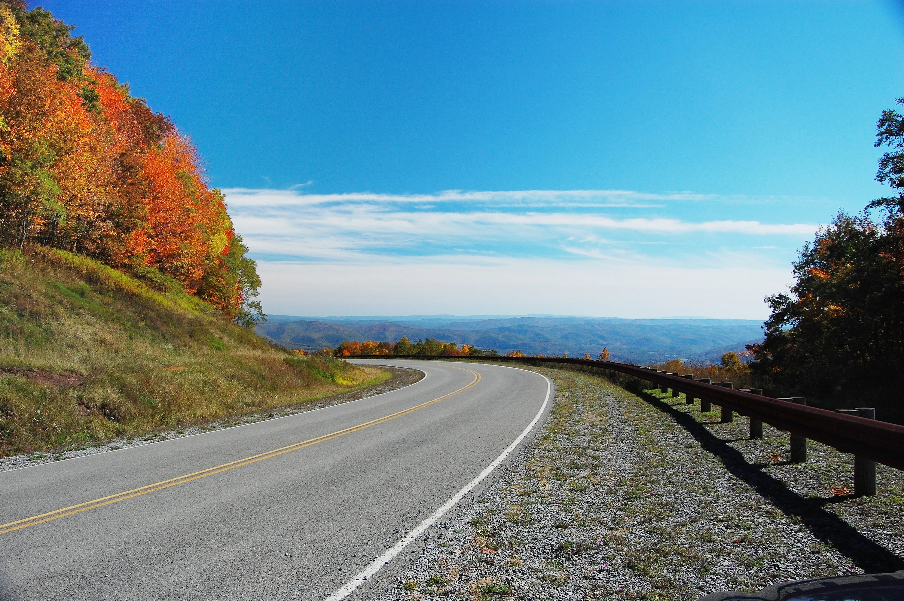
Highland Scenic Highway
A view of the Highland Scenic Highway section between State Route 39 and US Route 219

Monongahela National Forest history and protected-area timeline

The Monongahela National Forest was created as a direct response to the near-total deforestation of the central Appalachians by the early 1900s. The Weeks Act of 1911 authorized the federal purchase of private land for watershed protection and restoration of forest resources. In 1915, the initial 7,200 acre Monongahela Purchase laid the foundation, and on April 28, 1920, the area was formally designated Monongahela National Forest. By the end of 1924, federal ownership had grown to roughly 150,000 acres.

Throughout the 20th century, the forest became a focal point for wildlife restoration, military training, and cultural heritage. White-tailed deer, heavily reduced by the early 1900s, were restocked with animals from Michigan beginning in 1930, eventually rebuilding healthy breeding populations. The fisher, believed extinct in West Virginia by 1912, was reintroduced in 1969 using animals from New Hampshire, releasing them at Canaan Mountain and Cranberry Glades.

During World War II, substantial portions of the forest were used as the West Virginia Maneuver Area, where the U.S. Army trained troops in artillery, mortars, and low-altitude rock climbing at Seneca Rocks. The forest has also hosted gatherings of the annual Rainbow Gathering, and several prehistoric rock shelters within its boundaries have been listed on the National Register of Historic Places. In 2011 and 2012, debates emerged over whether portions of the forest, including the Spruce Knob-Seneca Rocks National Recreation Area, should be transferred to the National Park System as a proposed High Allegheny National Park and Preserve, although the proposal was ultimately withdrawn.

Monongahela National Forest landscape and geographic character

The landscape of Monongahela National Forest is dominated by the Allegheny Mountains, a subsection of the broader Appalachian system. Elevations stretch from roughly 900 feet near Petersburg up to 4,863 feet at Spruce Knob, the highest point in both West Virginia and the entire Allegheny range. The forest also includes large portions of the Ridge-and-valley Appalachians to the west.

The Allegheny Front, a long escarpment that runs through the forest, creates one of the most striking climatic divides in eastern North America. Westward-facing slopes are bathed in moisture, while eastern slopes fall under the influence of a pronounced rain shadow. This climatic contrast, combined with steep ridges, deep gorges, and exposed high plateaus, gives the forest a remarkably varied terrain, including sandstone cliffs at Seneca Rocks, windswept plains at Dolly Sods, karst valleys, and highland bogs.
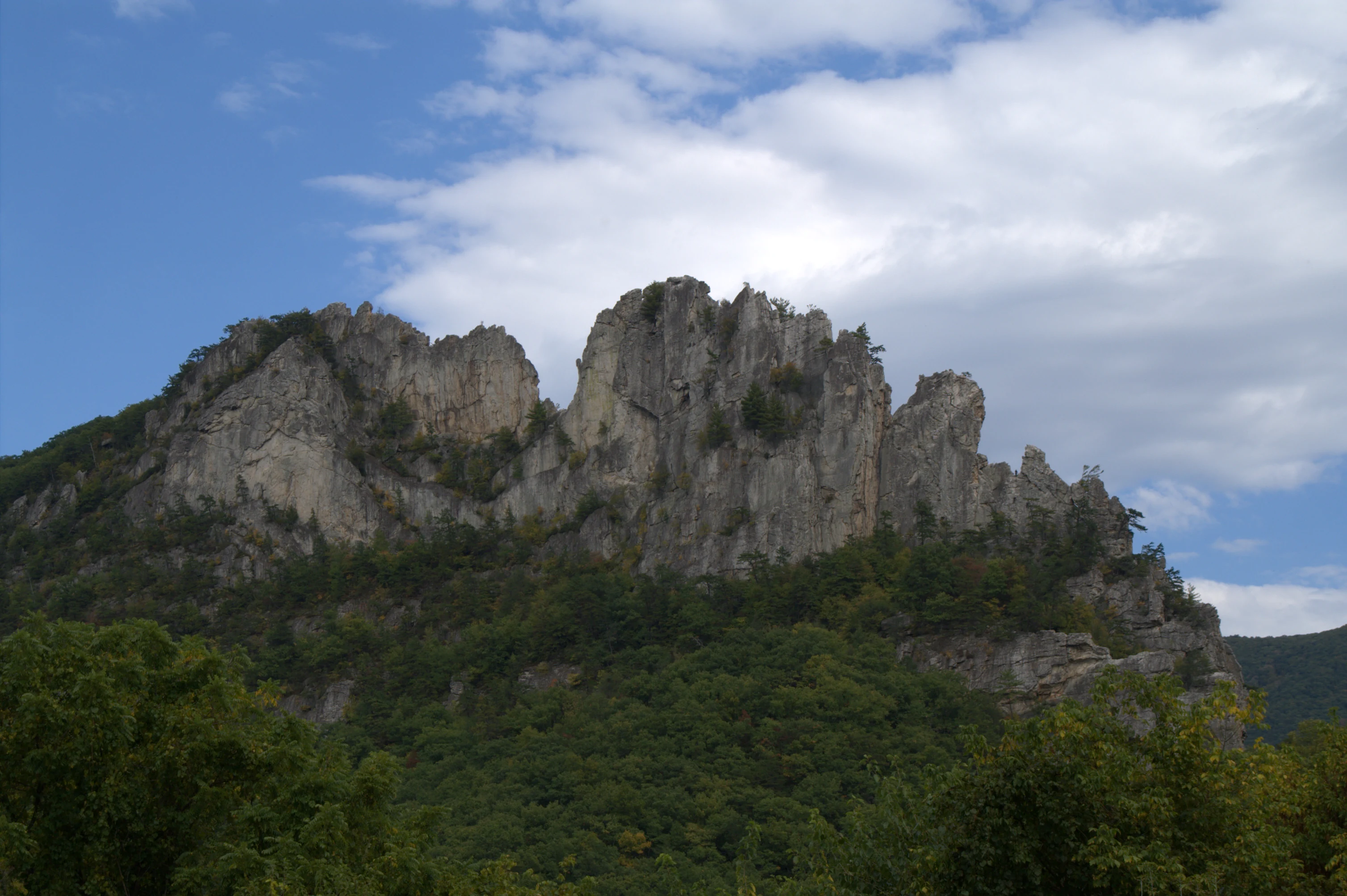
Seneca Rocks View
A view of the Seneca Rocks formation from the Discovery Center parking area in Monongahela National Forest, showing the hiking trail observation platform.

Monongahela National Forest ecosystems, habitats, and plant life

Monongahela National Forest encompasses a wide range of Appalachian ecosystems over its more than 900,000 acres of forested land. Approximately 75 tree species occur in the forest, with most stands regarded as second growth that regenerated after early 20th century logging. Northern and high-elevation forests feature red spruce, balsam fir, and mountain ash, while lower and mid-elevation zones are dominated by mixed hardwoods such as oak and black cherry.

The contrast between the moist west side and the dry east side of the Allegheny Front creates unmatched plant diversity within the forest. Moist coves and western slopes host rhododendron and laurel, while eastern shale barrens support cactus and rare endemic plant communities. The forest also contains several distinct natural community types, including highland bogs, open rocky plains known as socs, blueberry thickets, old-growth hemlock and red spruce stands, and karst landscapes with caves and disappearing streams. National Natural Landmarks within the forest include bogs, glades, scenic spruce stands, and the Germany Valley karst area.
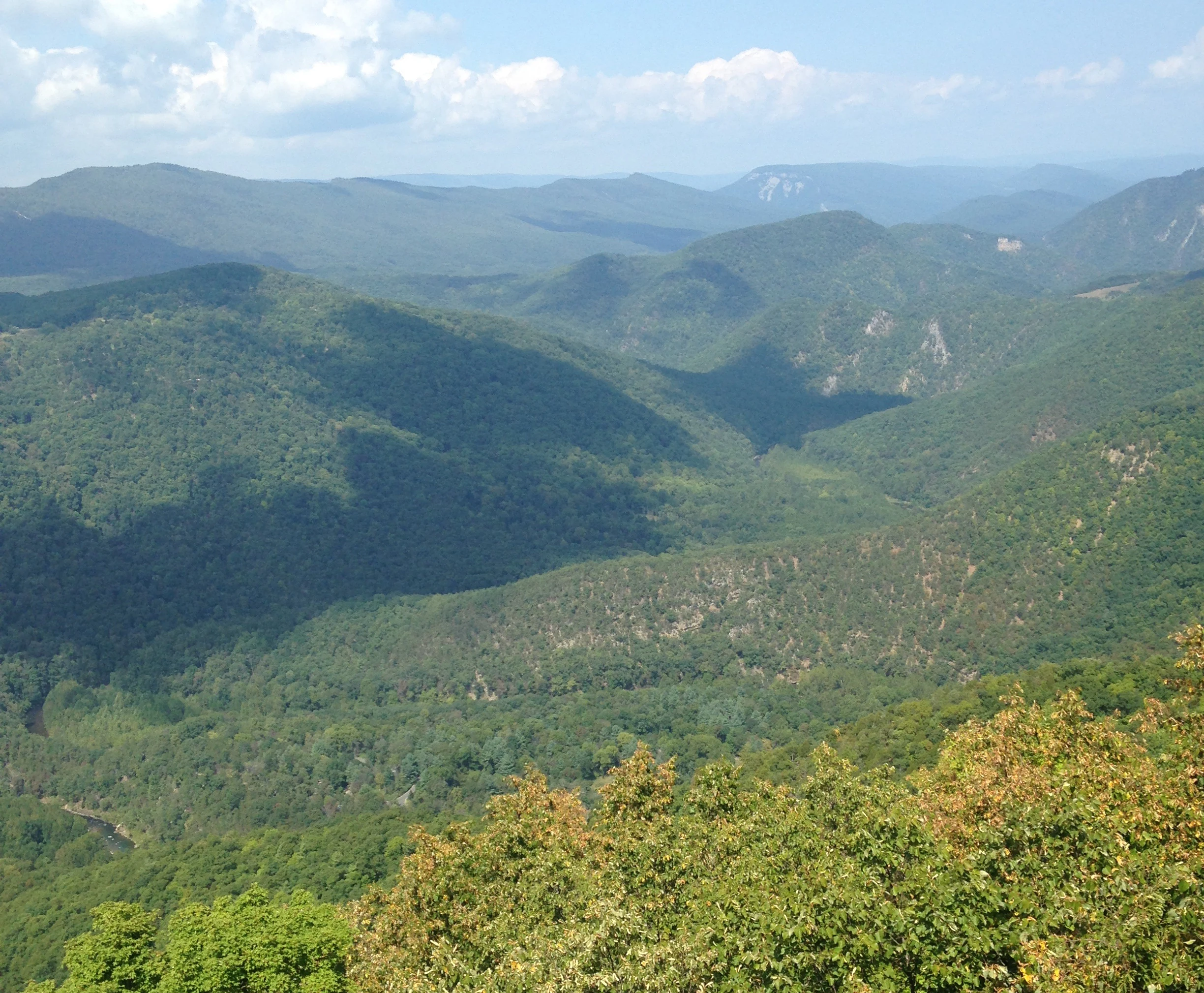
Smoke Hole Gorge view
View of Smoke Hole Canyon from atop Cave Mountain, featuring the South Branch Potomac River, the Big Bend, Castle Rock, and North Fork Gap.

Monongahela National Forest wildlife and species highlights

Monongahela National Forest supports an exceptionally rich wildlife community, reflecting its broad range of habitats and elevation gradients. Roughly 230 species of birds have been documented in the forest, including 159 breeding species and a significant number of Neotropical migrants. The Brooks Bird Club operates seasonal bird banding stations in the Dolly Sods area during migration.

Larger mammals include black bear, white-tailed deer, wild turkey, and reintroduced fisher, along with smaller furbearers such as beaver, bobcat, river otter, raccoon, mink, and both red and gray fox. Snowshoe hare, ruffed grouse, woodcock, and cottontail rabbits thrive in higher elevations and brushy habitats. The forest also hosts nine federally listed threatened or endangered species, including bats, a flying squirrel subspecies, a salamander, and several rare plants, as well as dozens of other sensitive species. Its cold, high-quality streams and rivers support the majority of West Virginia's trout populations, alongside numerous warm-water and forage fish species.

Olson Observation Tower
The Olson Observation Tower located in Monongahela National Forest, Tucker County, West Virginia.

Monongahela National Forest conservation status and protection priorities

Monongahela National Forest plays a central role in the conservation of Appalachian natural systems. It protects vast tracts of regenerating forest along with smaller but ecologically critical stands of old growth, including hemlock, red spruce, and white pine groves documented as National Natural Landmarks. These old-growth remnants provide benchmarks for understanding what the original Appalachian forests looked like and support species that depend on mature, undisturbed forest conditions.

Beyond forest preservation, the forest is significant for watershed protection and aquatic conservation. The headwaters of six major river systems originate here, and approximately 90 percent of West Virginia's trout waters occur within its boundaries. Its eight congressionally designated Wilderness Areas, multiple scenic areas, and unique natural features such as highland bogs and shale barrens contribute heavily to the protection of rare and endemic species, including several federally listed plants and animals.

Monongahela National Forest cultural meaning and human context

Monongahela National Forest lies within a region of Appalachian West Virginia long defined by extractive industries, including coal, timber, and railroad use. Its modern landscape is the product of intensive early logging, which stripped the high country of most of its forest cover before the Weeks Act set the stage for federal restoration. The forest also preserves prehistoric rock shelters, historic homesteads, and Civil War-era sites such as Rich Mountain Battlefield, Camp Bartow, Cheat Summit Fort, and Beverly Historic District.

The Seneca Rocks area carries enduring significance as both a natural landmark and a wartime training site where the U.S. Army conducted rock-climbing instruction during World War II. Cultural gatherings, including annual Rainbow Gatherings, have also become part of the forest's modern identity, while traditional forestry, grazing, and small-scale mining continue under controlled programs that reflect the balance between conservation and the region's economic heritage.
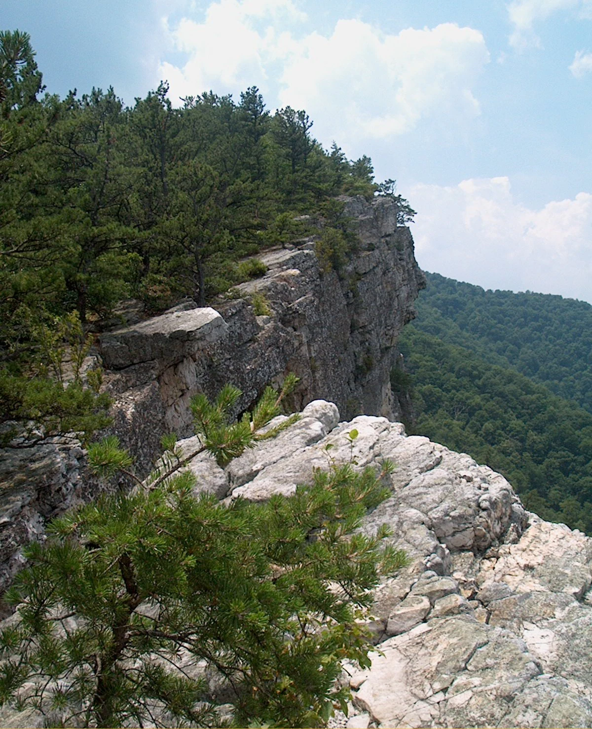
North Fork Mountain
View looking south from Shelby's Cliffs on the North Fork Mountain Trail in Grant County, West Virginia.

Top sights and standout views in Monongahela National Forest

Monongahela National Forest offers an unmatched concentration of Appalachian natural landmarks, including Spruce Knob, the highest point in the Allegheny Mountains, and Seneca Rocks, one of the most recognized climbing destinations in the East. The forest includes eight Wilderness Areas, hundreds of miles of trails, and extensive cold-water fisheries that comprise nearly all of West Virginia's trout waters.

Its broad ecological contrasts, ranging from moist spruce-fir highlands and rhodedendron coves to dry shale barrens and karst valleys, give the protected area extraordinary botanical and scenic diversity. Combined with its deep historic ties to Appalachian settlement, wartime training, and modern outdoor recreation, Monongahela stands as one of the most complex and varied national forests east of the Mississippi.
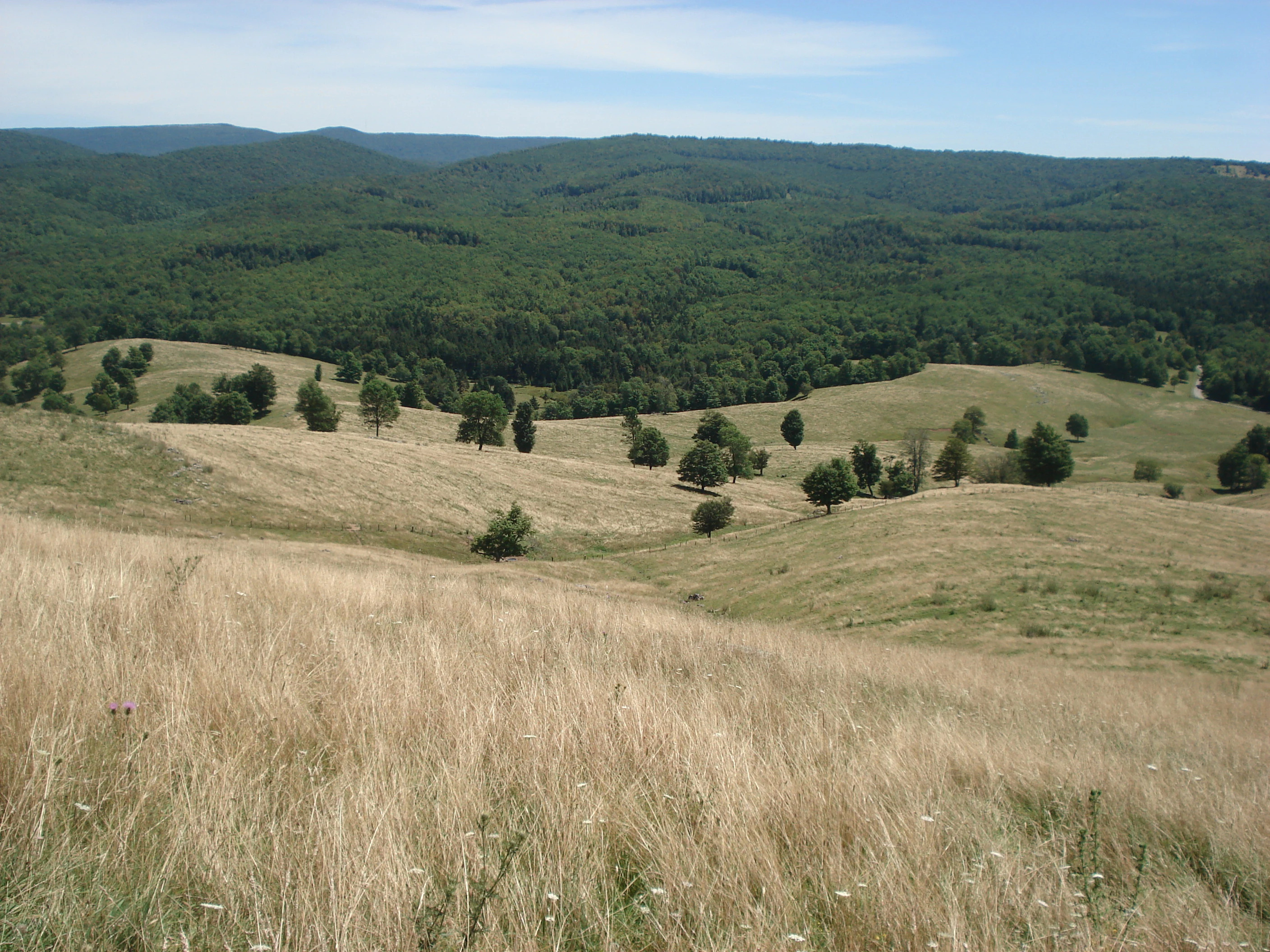
Yokum Knob view
View from the summit of Yokum Knob, Randolph County, West Virginia

Best time to visit Monongahela National Forest

Monongahela National Forest is a year-round destination whose character shifts dramatically with the seasons. Spring brings wildflower blooms, swelling rivers, and vigorous waterfalls, as well as warming temperatures that make mid-elevation hiking especially rewarding. Summer offers the fullest access to high-country trails, but visitors should expect cooler conditions at higher elevations, including popular areas like Spruce Knob, Dolly Sods, and the Cranberry Wilderness.

Autumn is widely considered the prime time to visit, when the hardwood forests across the Allegheny Front and the Potomac Highlands turn vivid shades of red, orange, and gold, drawing large numbers of leaf-peepers and motorists along the Highland Scenic Highway. Winter transforms the landscape into a quieter, snow-covered backcountry suitable for cross-country skiing, snowshoeing, and wildlife observation, though access to higher elevations and remote roads can become limited.

Monthly climate preview

Long-term temperature and precipitation patterns sampled from representative coordinates in West Virginia

Monongahela National Forest Climate Normals and Monthly Weather Records

Monongahela National Forest records measured monthly temperature ranges and steady precipitation rates across a representative coordinate baseline from 1991 to 2020. Examining the complete twelve-month profile provides deeper context on long-term climate normals and seasonal weather variations.
Annual mean10 °C
-2 °C21 °C
Jan-2°
Feb-1°
Mar
Apr10°
May15°
Jun19°
Jul21°
Aug21°
Sep18°
Oct11°
Nov
Dec
Warmest month
July

21.5 °C

Coolest month
January

-2.4 °C

Wettest month
July

4 mm/day

Driest month
October

2.6 mm/day

Park location guide

Geography guide, regional context, and park location map for Monongahela National Forest

Monongahela National Forest park geography, regions, and map view in United States of America

Understand where Monongahela National Forest sits in United States of America through a broader geographic reading of the surrounding landscape, nearby location context, and its mapped position within the national park landscape.

How Monongahela National Forest fits into United States of America

The United States of America is a federal presidential republic and one of the world's largest countries by area and population. It consists of 50 states across a vast territory spanning multiple time zones, with its capital in Washington, D.C. and largest city in New York City. The nation has a diverse economy, influential political system, and significant cultural and military presence globally.

Wider geography shaping Monongahela National Forest in United States of America

The United States occupies a vast territory in North America, bordered by Canada to the north and Mexico to the south. The 48 contiguous states stretch from the Atlantic to the Pacific Ocean, while Alaska occupies the northwestern region and Hawaii is an archipelago in the Pacific. The country encompasses diverse terrain including the Rocky Mountains, Appalachian Mountains, Great Plains, and extensive river systems.

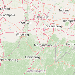
Map view of Monongahela National Forest

Use this park location map to pinpoint Monongahela National Forest in United States of America, understand its exact geographic position, and read its mapped placement within the surrounding landscape more clearly.

Pigeon | © OpenStreetMap contributors

Location context for Monongahela National Forest

West Virginia
Recorded earthquake history

View the Recorded Earthquake History for Monongahela National Forest

Examine a detailed collection of recorded seismic events linked by location to Monongahela National Forest. This catalogue, powered by MoriAtlas, enables researchers and geography enthusiasts to review documented earthquake data, magnitudes, and epicentre proximity within the broader Allegheny Mountains region.

Monongahela National Forest Earthquake History

Catalogued events

6 events

Strongest magnitude

Magnitude 3.6

Most recent event

Mar 31, 2013

This history includes earthquakes recorded inside the park or within 50 km of its borders

Visual reference of Appalachian terrain, habitats, and protected ecosystems

Monongahela National Forest Photos and Scenery: Exploring the Landscape

Photographic records reveal the rugged topography, dramatic escarpments, and diverse habitats spanning the Allegheny Mountains. Visual exploration provides deep insight into the environmental gradients, high-elevation ecosystems, and protected character defining the region.

Highland Scenic Highway

River Knobs and Nelson Rocks

Seneca Rocks View

Smoke Hole Gorge view

Olson Observation Tower

Douglas Falls

North Fork Mountain

Yokum Knob view

Blackwater Canyon

Middle Mountain Cabins

Roaring Plains Wilderness view

Lake Sherwood

Monongahela National Forest view

Monongahela National Forest entrance gate

Back Allegheny Mountain

Sinks of Gandy Creek entrance

Park atlas

Compare surrounding Appalachian mountain terrain and connected regional conservation landscapes

Other Parks and Protected Areas Near Monongahela National Forest

Browsing other parks near Monongahela National Forest reveals shared Appalachian mountain terrain and connected conservation landscapes across the region. Extending the geographic comparison helps trace broader protected-area networks and regional ecological corridors.
Wildlife reserveWest Virginia
Park boundaries overlap#1 closest

East

Dolly Sods Wilderness: Geography and Protected Landscape Analysis for West Virginia

High-altitude plateaus and sub-arctic Appalachian terrain.

Trace the boundaries and protected landscape of Dolly Sods Wilderness, a 17,000-acre wildlife reserve in West Virginia. This atlas-focused look highlights the area's geological elevation near 4,000 feet, its unique plant communities including sphagnum bogs, and the distinct role of its recovering ecosystems within the larger Monongahela National Forest.

Area
71.94 km²
Established
1975
IUCN
Ib
Visitors
7.5K annual
Wildlife reserveWest Virginia
Park boundaries overlap#2 closest

Southeast

Laurel Fork North Wilderness: Mapping Appalachian Forest and Mountain Terrain

Protected wilderness landscape in the West Virginia highlands.

Laurel Fork North Wilderness sits as a key conservation unit within the Monongahela National Forest. This protected territory preserves a complex of high-elevation hardwood forests and the stream-cut valley of Laurel Fork. By examining this region, users gain insight into the geography of Allegheny mountain wilderness and the persistent character of recovery-focused Appalachian landscapes.

Area
24.5 km²
Established
1983
IUCN
Ib
Relief
Mountain
Wildlife reserveWest Virginia
Park boundaries overlap#3 closest

Southeast

Laurel Fork South Wilderness: Protected Appalachian Highlands and Forested Terrain

High elevation forest and creek drainage geography

Laurel Fork South Wilderness features a dense, unbroken stretch of Appalachian forest within West Virginia. This protected landscape is defined by its deep narrow hollows and high ridgelines, representing a vital example of mid elevation mountain terrain and recovering forest ecosystems within the Monongahela National Forest.

Area
23.41 km²
Established
1983
IUCN
Ib
Relief
Mountain
Wildlife reserveWest Virginia
Park boundaries overlap#4 closest

East

Roaring Plains West Wilderness: Geographic Overview and Protected Plateau Mapping

High-altitude wilderness and Appalachian watershed geography

Roaring Plains West Wilderness encompasses one of the largest high-elevation plateaus in the eastern United States. This protected area within West Virginia hosts dramatic rim-rock vistas and extensive sphagnum bogs, standing as a primary ecological feature along the Eastern Continental Divide. Examine the mapped terrain and environmental boundaries of this significant Allegheny Mountain preserve.

Area
27.6 km²
Established
2009
IUCN
Ib
Relief
Highland
Protected landscapeWest Virginia
Mapped location lies within the park boundary#5 closest

East

Spruce Knob-Seneca Rocks National Recreation Area: West Virginia Mountain Landscapes

Mapped terrain of summits, cliffs, and river corridors

Spruce Knob-Seneca Rocks National Recreation Area stands as a unique protected landscape in eastern West Virginia. This area connects the high-elevation spruce forests of Spruce Knob with the vertical quartzite cliffs of Seneca Rocks and the remote depths of Smoke Hole Canyon. It remains a primary example of Appalachian high-country geography, offering a dense concentration of distinct natural features within the Monongahela National Forest.

Area
400 km²
Established
1965
Relief
Mountain
Climate
Temperate
Protected landscapeWest Virginia
About 23 km away#6 closest

Southwest

Gauley River National Recreation Area: Appalachian Gorge and Protected River Landscape

Mapped terrain, remote forest corridors, and river-centered geography in West Virginia.

Gauley River National Recreation Area protects a rugged corridor defined by high-volume river channels, sheer rock outcrops, and dense Appalachian hardwood forests. This documentation covers the park's distinct river-centered geography, the interplay of tributary hollows with main river flows, and its status as a critical piece of the broader southern West Virginia mountain landscape.

Area
46.57 km²
Established
1988
IUCN
V
Visitors
213.6K annual
Wildlife reserveVirginia
25 km away#7 closest

South

Rough Mountain Wilderness: Mapping Appalachian Ridges and Protected Terrain

Remote wildlife reserve in western Virginia

Spanning over 9,000 acres, Rough Mountain Wilderness provides a rare example of undisturbed Appalachian forest. The area is characterized by consistently steep slopes, sharp ridgeline topography, and a deep sense of isolation within the George Washington and Jefferson National Forests of western Virginia.

Area
38 km²
Established
1987
IUCN
Ib
Relief
Mountain
Wildlife reserveUnited States of America
About 32 km away#8 closest

Southeast

Ramseys Draft Wilderness: Appalachian Ridge and Valley Protected Landscape and Map Atlas

Examining wilderness boundaries and mountain stream geography in Virginia

Located in western Virginia, Ramseys Draft Wilderness is a federal protected area characterized by its extreme vertical relief and rugged Appalachian topography. Spanning from the main crest of Shenandoah Mountain to the valley floor, this wilderness serves as a vital corridor for high-elevation forest ecosystems, native brook trout, and neotropical migrant birds.

Area
26.38 km²
Established
1984
Relief
Mountain
Climate
Temperate

Common questions about visiting, size, designation, and location context for Monongahela National Forest

Monongahela National Forest FAQs for park facts, access, geography, and protected area context

Find quick answers about Monongahela National Forest, including protected-area facts, park geography, trail and visitor context, and how the park fits into its surrounding country and regional landscape.
MoriAtlas Explorer

Continue Your Protected Areas Search Across the Global Atlas

Deepen your exploration by continuing the structured search for national parks and protected areas worldwide. Utilize the comprehensive filtering capabilities to compare different conservation landscapes and refine your understanding of global park geography. Discover more about the distribution and characteristics of protected natural areas.

Global natural geography