
Ridges
Park geography
Analyzing regional terrain, elevation statistics, and distinct natural landforms
Comprehensive Geographic Profile and Mapped Boundaries of Mount Baker Wilderness
This geographic profile details the physical scope and natural landscape of Mount Baker Wilderness in Washington. The recorded boundary encompasses 485.58 square kilometers of mountain terrain, featuring varied peaks, glaciers, and stream systems. Explore structured data regarding the highest recorded elevation of 3285 meters and the distribution of internal features like Nooksack Ridge and Coleman Glacier.
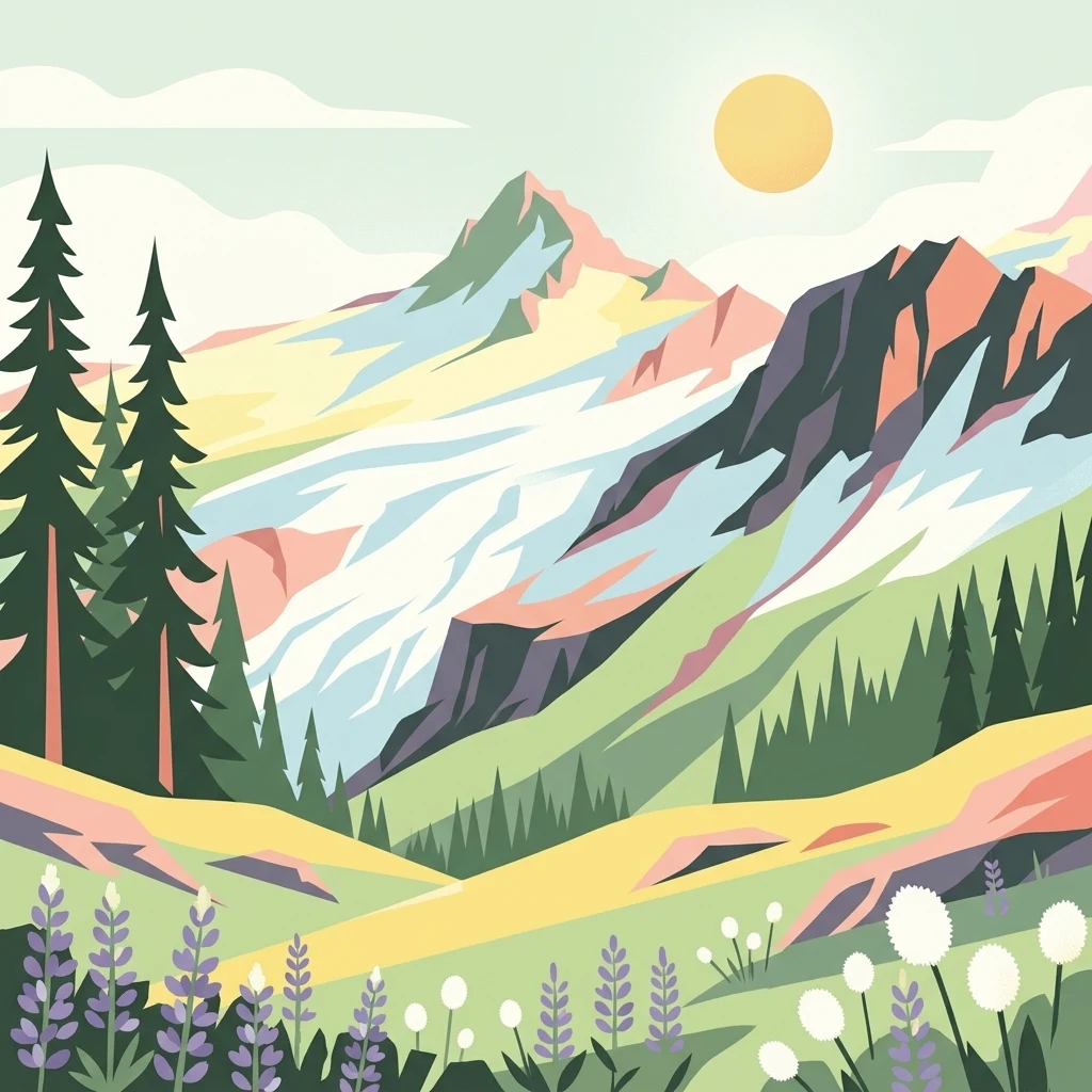
A wild Cascade landscape dominated by an active stratovolcano, glaciers, and old-growth forests.
Mount Baker Wilderness
Mount Baker Wilderness is a federally designated wilderness area in the western Cascade Range of northern Washington, almost entirely within Whatcom County. Established in 1984, it spans roughly 120,000 acres within the larger Mount Baker-Snoqualmie National Forest and runs from State Route 20 in the south to the Canada-United States border in the north. Its eastern boundary runs alongside North Cascades National Park and the Stephen Mather Wilderness for about 40 miles, creating a large contiguous block of protected mountain terrain in the North Cascades ecosystem. The wilderness is defined by the volcanic presence of Mount Baker, one of the most active volcanoes in the Cascade Range and the northernmost active volcano in Washington state. Glaciers, rugged ridges, alpine meadows, and old-growth conifer forests combine with deep river valleys formed by the three forks of the Nooksack River and the Baker River. Together, these features create a transition zone between the maritime climate of the Pacific Northwest and the high-elevation environments of the North Cascades. Mount Baker Wilderness is managed by the U.S. Forest Service under the National Wilderness Preservation System, providing a high level of protection for its ecosystems, geological features, and recreational character. The area is valued for hiking, climbing, and backcountry experience in a setting shaped by ongoing volcanic and glacial processes.
- Location
- United States of America
- Park type
- Wildlife reserve
- Established
- 1984
- Area
- 485.6 km²
- Highest point
- 3,285 m
Location overview
Recorded country memberships and administrative territorial scope
Mount Baker Wilderness Geography and Regional Setting in Washington
Mount Baker Wilderness is located within the United States of America and the state of Washington. Recorded administrative memberships establish regional context for the protected area.
- Countries
- United States of America
- Regions
- Washington
- Primary location
- Washington
Boundary and coordinates
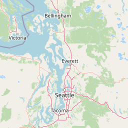
Mount Baker Wilderness’s stored boundary frames 485.58 km²
Mount Baker Wilderness mapped boundary and 485.58 km² area
Mount Baker Wilderness is represented by mapped geometry across its recorded 485.58 km² extent. The footprint supports geographic orientation to the wilderness without claiming survey-grade precision.
- Boundary area
- 482 km²
- Boundary perimeter
- 240 km
- Northernmost point
- 48.9995° N
- Southernmost point
- 48.6366° N
- Easternmost point
- 121.5233° W
- Westernmost point
- 121.9983° W
- Geographic centre
- 48.847° N, 121.736° W
- North–south span
- 40.4 km
- East–west span
- 34.9 km
Elevation and terrain
Mountain relief metrics and mapped natural features
Mount Baker Wilderness Terrain and Elevation Geography
Recorded elevation metrics outline the mountain terrain profile across the protected area. Structured feature cards detail individual ridges, glaciers, streams, and peaks located within the boundaries.
- Highest point
- 3,285 m
Selected named natural features
Ridges
Nooksack Ridge
Peaks
Tomyhoi Peak
2,266.2 m
Streams
Wells Creek
Glaciers
Coleman Glacier
2,250 m
Streams
Bar Creek
Environmental setting
Interpreting stored relief types and major water presence across protected terrain
Mount Baker Wilderness Environmental Classifications and Physical Setting Profile
Recorded physical classifications frame the mountain relief and major water presence of Mount Baker Wilderness as complementary facets of its overall terrain. Structured categories link directly to related protected area destinations throughout the geographic atlas.
- Relief
- Mountain
- Water
- Major water bodies
Park atlas
Compare connected alpine terrain, volcanic peaks, and regional wilderness areas across the northern Cascades
Explore Parks Near Mount Baker Wilderness and Adjacent Protected Mountain Landscapes
Discover related protected areas situated across the surrounding mountain terrain near Mount Baker Wilderness. Compare adjacent volcanic geography and contiguous forest reserves to expand regional park exploration.
Protected landscapeWashington
Park boundaries overlap#1 closest
Southwest

Mount Baker National Recreation Area: An Atlas of Washington's Volcanic Terrain
Exploration of a remote, roadless Cascade protected landscape
The Mount Baker National Recreation Area provides a unique geographic window into the volcanic heart of the Pacific Northwest. Characterized by its glacier-clad massif and network of subalpine trails, the area serves as a vital protected habitat for elk, mountain goats, and diverse conifer forests. This record details the park's topography, ranging from deep glacial valleys to high-elevation ridges that overlook the broader North Cascades region.
- Area
- 34.29 km²
- Established
- 1984
- Relief
- Mountain
- Climate
- Alpine

Protected landscapeWashington
Park boundaries overlap#2 closest
South
Mount Baker, Snoqualmie National Forest: Mapped Geography and Protected Landscape Analysis
Exploratory atlas of Washington's primary Cascade Range wilderness
Delve into the structural geography of Mount Baker, Snoqualmie National Forest. This protected area corridor serves as a major ecological transition zone between the Puget Sound lowlands and the interior Cascades, characterized by extensive glaciers, wild river systems, and iconic stratovolcanoes that define the regional landscape of Washington state.
- Area
- 6,978 km²
- Established
- 1974
- Relief
- Mountain
- Climate
- Alpine
National parkWashington
Park boundaries overlap#3 closest
East
North Cascades National Park: US National Park Protected Landscape and Geographic Context
Explore mapped boundaries and regional Washington geography.
Gain insight into North Cascades National Park, a vital US National Park located in Washington. This entry focuses on its protected land status, mapped geographic extent, and its role within the regional atlas. Users seeking to understand the park's landscape character, natural terrain, and its specific location in Washington will find this an essential point for detailed park geography exploration and protected area discovery.
- Area
- 2,042.26 km²
- Established
- 1968
- IUCN
- II
- Visitors
- 16.5K annual
State or regional parkBritish Columbia
About 23 km away#4 closest
North

Ferry Island Provincial Park: Geography, Riparian Terrain, and Protected River Boundaries
A study of Fraser River alluvial landscapes and provincial park land use
Ferry Island Provincial Park provides a rare protected island setting along the Fraser River in British Columbia. Spanning 29 hectares near the Agassiz-Rosedale Bridge, this Class C park represents an important alluvial riparian ecosystem within the heavily cultivated Fraser Valley, offering key insights into regional river-corridor geography and protected land management.
- Area
- 0.29 km²
- Established
- 1963
- IUCN
- II
- Access
- Access unknown

Protected landscapeWashington
25 km away#5 closest
East
Ross Lake National Recreation Area: A Glacial Reservoir Landscape in Washington
Mapping the Skagit River and North Cascades alpine corridor
Located in the heart of Washington, Ross Lake National Recreation Area preserves a unique landscape of connected reservoirs and deep, glacier-cut valleys. This protected area acts as a vital geographic link within the North Cascades, offering access to high-altitude peaks, riverine forests, and the distinct turquoise waters of Diablo Lake.
- Area
- 475.81 km²
- Established
- 1968
- IUCN
- V
- Visitors
- 998K annual
State or regional parkBritish Columbia
About 31 km away#6 closest
North
Kilby Provincial Park: Protected Riverfront Geography and Historic Sites in BC
A unique riparian landscape along the Harrison River
Kilby Provincial Park offers an intimate look at the flood plain geography of the Harrison River. The site features an elevated, boardwalk-linked heritage environment integrated with sandy riverfronts and seasonal wildlife corridors. This protected area stands out for its combination of historical pioneer preservation and river-based ecosystem monitoring within the Upper Fraser Valley region of British Columbia.
- Area
- 0.03 km²
- Established
- 1973
- IUCN
- II
- Relief
- Lowland

State or regional parkBritish Columbia
36 km away#7 closest
Northeast
E. C. Manning Provincial Park: A Comprehensive Geographic Atlas and Protected Area Overview
Mountainous terrain and ecological transitions in southern British Columbia
Spanning the cross section of the Canadian Cascades, E. C. Manning Provincial Park preserves a high-elevation landscape of wildflowers, glacial valleys, and mountain ridges. The protected area links temperate coastal rainforests with the arid interior, providing a study in regional hydrology and subalpine ecology defined by the Hozameen Range and the northern reaches of the Pacific Crest Trail.
- Area
- 836.71 km²
- Established
- 1941
- IUCN
- II
- Visitors
- 1.1M annual

Protected landscapeWashington
37 km away#8 closest
East
Okanogan, Wenatchee National Forest: A Comprehensive Look at Washington's Protected Mountain Landscapes
Mapping ecological gradients and wilderness boundaries across the eastern Cascade Range
Spanning from the moist coniferous forests of the western Cascades to the arid plateaus of the Okanogan, this massive national forest protects an unmatched diversity of terrain. Explore the intricate geography of river-carved valleys, glacial cirques, and remote wilderness areas that characterize this critical environmental corridor in the Pacific Northwest.
- Area
- 6,066.33 km²
- Established
- 1911
- Visitors
- 397K annual
- Relief
- Mountain
MoriAtlas Explorer
Explore the Mapped Geography and Volcanic Terrain of Mount Baker Wilderness
Examine the protected boundaries and natural features of Mount Baker Wilderness through our structured atlas perspective. Gain a deeper understanding of this Washington wildlife reserve and its role within the North Cascades ecosystem. MoriAtlas provides the essential geographic context for this significant mountain landscape.
Browse next
Global natural geography
Explore related park routes
Explore MoriAtlas Global ParksBrowse All MoriAtlas ParksGlobal Park Map DiscoveryMoriAtlas: Browse All CountriesBrowse All MoriAtlas ContinentsNational Park Environment AtlasGrand Canyon National Park AtlasYellowstone National Park AtlasYosemite National Park Atlas and GeographySerengeti National Park AtlasGalápagos National Park Protected LandscapeBanff National Park Geography and AtlasKruger National Park Atlas EntryUluṟu-Kata Tjuṯa National Park AtlasExplore Uluru-Kata Tjuta National Park GeographyPlitvice Lakes National Park AtlasFiordland National Park Protected LandscapeGreat Smoky Mountains National Park AtlasAfghanistan National Parks and Protected AreasAlbania National Parks and Protected AreasAlgeria National Parks and Protected AreasAmerican Samoa National Parks and Protected AreasAndorra National Parks and Protected AreasAngola National Parks and Protected AreasAntarctica National Parks and Protected AreasAntigua and Barbuda Park List