

Mori Atlas logo
Wildlife reserveMount Baker Wilderness

Tracing the boundaries of high alpine ridges, deep river valleys, and active glacial geography

Mount Baker Wilderness: Mapped Protected Landscapes and Volcanic Terrain in Northern Washington

Mount Baker Wilderness comprises a significant protected area within the northern Cascade Range of Washington, defined by its rugged volcanic terrain and expansive glacier coverage. Spanning from the Canadian border to the southern reaches of the North Cascades ecosystem, this wilderness area preserves a complex transition of old growth conifer forests and subalpine meadows. Understanding its geography reveals the interplay between active volcanic processes and the dense hydrological networks of the Nooksack and Baker river systems.

wilderness areaCascade Rangevolcanic landscapeglaciersalpine meadowsold-growth forest
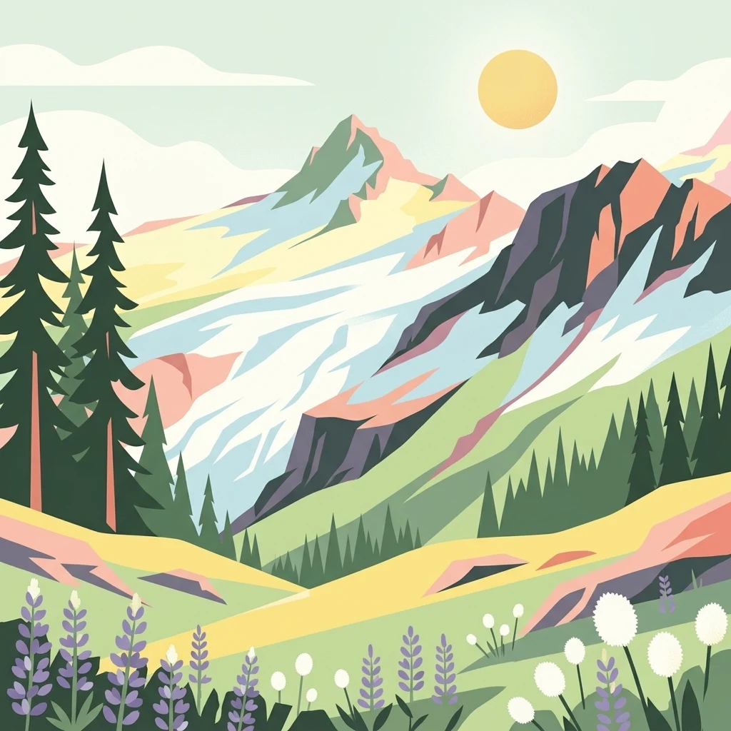
A flat-style digital illustration of a jagged mountain peak with snowy slopes, dense evergreen forests on the left, and a field of purple and white alpine wildflowers in the foreground under a yellow sun.

Mount Baker Wilderness

Wildlife reserve

Park overview

Structured park overview, official facts, and landscape profile for Mount Baker Wilderness

Mount Baker Wilderness park facts, protected area profile, and essential visitor context

Review the core facts for Mount Baker Wilderness, including designation, size, terrain, visitor scale, habitats, and operating context in one park-focused overview.

About Mount Baker Wilderness

Mount Baker Wilderness sits in the heart of the North Cascades region of Washington, occupying a vast block of protected terrain that connects the marine-influenced lowlands of the Puget Sound region with the high peaks of the Cascade Range. As a component of the Mount Baker-Snoqualmie National Forest, it is managed by the U.S. Forest Service, but its wilderness designation places it under the stricter protections of the National Wilderness Preservation System, prioritizing ecological preservation, primitive recreation, and minimal human impact.

The wilderness's geography is shaped by extraordinary elevation change and a west-side Cascade climate marked by heavy snowfall and rainfall. Drainage from the area is funneled into the three forks of the Nooksack River and the Baker River, both of which carve deep glacial and forested valleys. These river systems are central to the regional hydrology and support aquatic and riparian habitats that complement the surrounding forest and alpine environments.

Mount Baker itself is the central icon of the area. As the northernmost active volcano in Washington, it exhibits periodic thermal activity and is surrounded by one of the largest glacier systems in the contiguous United States outside Alaska. The mountain's presence gives the wilderness a distinctive geological character, with active volcanic processes working alongside erosion by glaciers, snowmelt, and rivers. This dynamic setting is reinforced by surrounding peaks such as the Twin Sisters, Tomyhoi Peak, American Border Peak, Mount Larrabee, Mount Sefrit, Ruth Mountain, Hadley Peak, and Goat Mountain, each contributing to the rugged ridge-and-valley topography of the area.

Because the wilderness borders North Cascades National Park and the Stephen Mather Wilderness, Mount Baker Wilderness is part of a larger landscape of contiguous protected land. This continuity enhances the ecological value of the area, allowing wildlife and natural processes to operate across boundaries that are fluid in ecological terms even though they are administratively distinct. Visitors come to the wilderness for backpacking, alpine climbing, glacier exploration, and solitude in a setting where the forces that built the Cascades are still active and visible.

The U.S. Forest Service website for the Mount Baker-Snoqualmie National Forest provides the primary public reference point for accessing current information about trails, routes, and stewardship of the wilderness area.

Quick facts and research context for Mount Baker Wilderness

Mount Baker Wilderness is located in Whatcom County in northern Washington, in the western Cascade Range. It is part of the Mount Baker-Snoqualmie National Forest and is managed as a federally designated wilderness area under the National Wilderness Preservation System.

The wilderness covers nearly 120,000 acres, with terrain extending from State Route 20 northward to the Canada-United States border. It borders North Cascades National Park and the Stephen Mather Wilderness for about 40 miles to the east, and its western edge meets the foothills of the Puget Sound lowlands.

The defining landmarks are Mount Baker, an active stratovolcano that periodically shows thermal activity, twin glaciated peaks, and surrounding ridgelines including Tomyhoi Peak, American Border Peak, Mount Larrabee, Ruth Mountain, and the Twin Sisters. More than 10,000 acres of glaciers and permanent snowfields occur at higher elevations, and the major drainages are the three forks of the Nooksack River and the Baker River.

Protection and recognition

Documented terrestrial protection parameters for the alpine landscape

Mount Baker Wilderness Protection Status and Territorial Management Records

Mount Baker Wilderness maintains a recorded terrestrial protection status outlining its administrative scope within the protected area network. Structured conservation records provide verified administrative parameters for evaluating regional natural preservation efforts.

Protection details

Protection scope
Terrestrial
Park context

Deeper park guide and search-rich context for Mount Baker Wilderness

Mount Baker Wilderness history, landscape, wildlife, and travel context

Explore Mount Baker Wilderness through its history, landscape character, ecosystems, wildlife, conservation priorities, cultural context, and seasonal travel timing in a structured park guide built for atlas discovery and search intent.

Why Mount Baker Wilderness stands out

Mount Baker Wilderness is best known for its dramatic combination of an active Cascade stratovolcano, extensive glacier coverage, and intact west-side Cascade forests. The presence of Mount Baker, with its long history of volcanic activity and visible thermal features, anchors the wilderness's identity as a place where volcanic and glacial processes continue to shape the landscape in real time. Equally important to the wilderness's character is its ecological richness. The terrain spans dense conifer forests of western redcedar, coast Douglas-fir, and western hemlock at lower elevations, transitions through montane forests of noble fir and Pacific silver fir, and rises to subalpine fir stands, alpine meadows, and rock and ice above tree line. This vertical gradient, combined with heavy precipitation typical of the west Cascades, supports a diverse range of habitats and species within a relatively compact area.
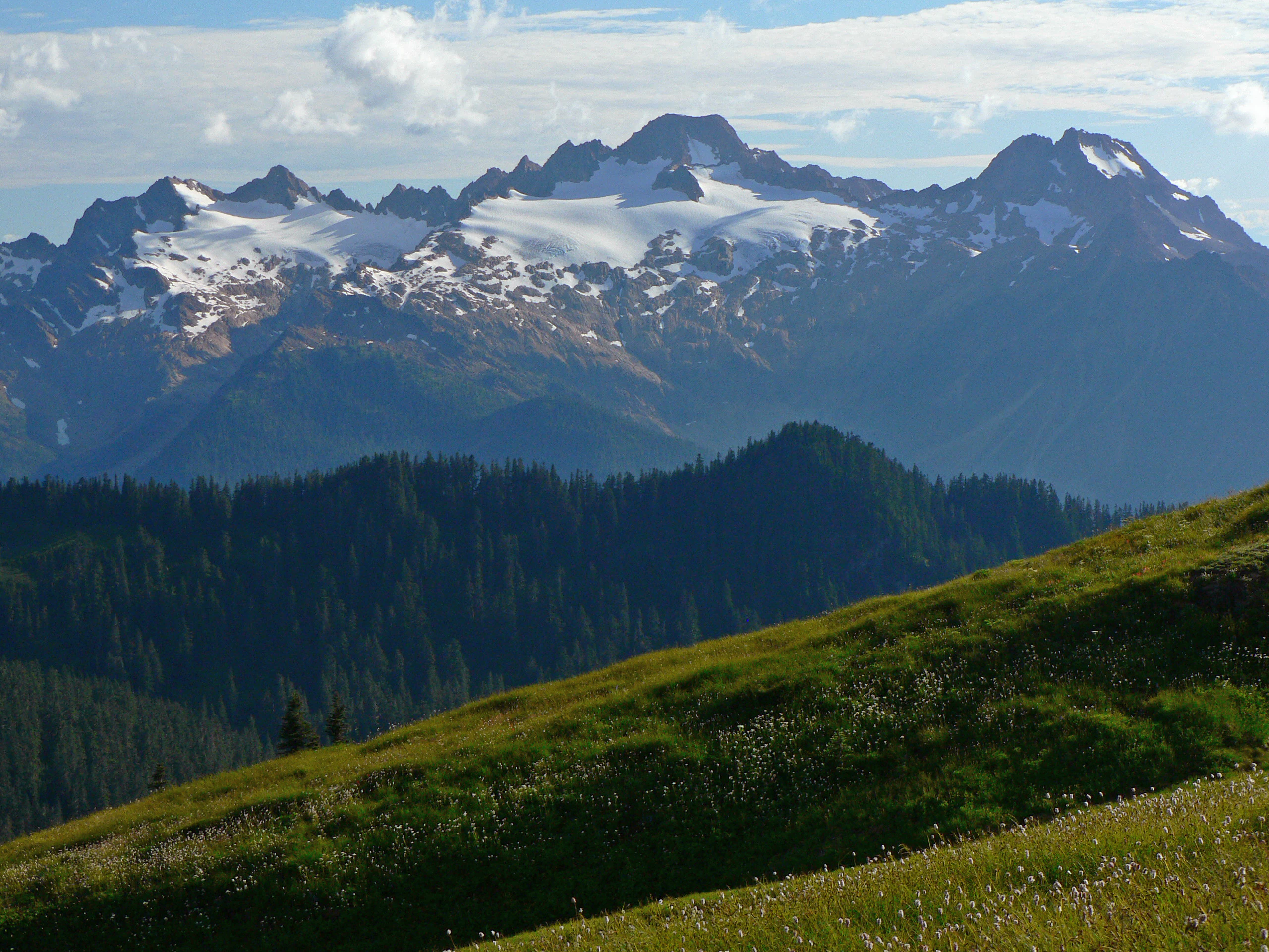
A wide mountain landscape featuring snow-covered peaks, a forested valley, and a grassy meadow in the foreground.
A view of the Twin Sisters Mountain range within the Mount Baker Wilderness.

Mount Baker Wilderness history and protected-area timeline

Mount Baker Wilderness was formally established in 1984 as part of the National Wilderness Preservation System, granting it elevated protection status within the United States' broader system of public lands. Its creation recognized the outstanding natural values of the Mount Baker area, including its volcanic landscape, glaciers, and old-growth west-side Cascade ecosystems.

The wilderness lies within the Mount Baker-Snoqualmie National Forest, whose management jurisdiction predates the wilderness designation by decades. The surrounding national forest has long supported timber management, recreation, and watershed protection, while the wilderness component has been reserved for more restrictive, conservation-oriented use. Adjacent public lands, including the Mount Baker National Recreation Area, reflect the layered approach to managing recreation, conservation, and resource use in the region.

The naming of peaks within and around the wilderness, including the renaming of the former Red Mountain to Mount Larrabee, indicates an evolving intentionality in how the landscape is recognized and identified, blending natural and cultural landmarks into the broader story of the area's identity as protected public land.

Mount Baker Wilderness landscape and geographic character

The landscape of Mount Baker Wilderness is defined by a deeply incised, rugged topography typical of the western Cascades. Steep slopes, narrow ridges, and a dense network of small intermittent and permanent drainages carve the terrain into a complex pattern of basins and peaks. The foothills of the Puget Sound lowlands form a clear western boundary, giving way rapidly to forested slopes, river gorges, and eventually the high volcanic and glacial country near the wilderness core.

At the center of this landscape is Mount Baker, an active stratovolcano that dominates the surrounding terrain. Its slopes and summit area carry extensive snow and ice, contributing directly to the wilderness's glacier cover and to seasonal runoff that feeds the Baker River and the Nooksack River system. The presence of more than 10,000 acres of glaciers and permanent snowfields is one of the most striking physical attributes of the area, and it shapes both the scenery and the hydrology of the region.

Surrounding Mount Baker is a constellation of notable peaks. The Twin Sisters form a distinctive twin-summit massif, with North Twin and South Twin rising above the surrounding ridges. Further north, American Border Peak and Mount Larrabee mark the international boundary area, while Tomyhoi Peak, Mount Sefrit, Goat Mountain, Ruth Mountain, and Hadley Peak offer additional high points distributed across the wilderness. Together, these peaks create a skyline of jagged summits and ridgelines, framed by glacial cirques and forested valleys below.

The transition from low-elevation forest to high alpine terrain is rapid, producing a landscape where dense conifer stands, open subalpine forests, exposed rock, permanent ice, and seasonal wildflower meadows can all be encountered within relatively short distances. This compressed ecological gradient is one of the defining visual and geographic features of Mount Baker Wilderness.

Mount Baker Wilderness ecosystems, habitats, and plant life

Mount Baker Wilderness sits within the west-side Cascades, where a wet, temperate climate supports some of the most productive temperate forests in North America. Vegetation patterns follow a classic elevational sequence, beginning with low-elevation forests of western redcedar, coast Douglas-fir, and western hemlock, and rising into montane forests dominated by noble fir and Pacific silver fir. Mountain hemlock and subalpine fir take over as elevation increases, eventually giving way to open alpine meadows, bare rock, and permanent snow and ice near the highest peaks.

This vertical zonation creates a layered ecosystem structure that is especially visible in the transition from valley forests to high ridges. Areas such as Cougar Divide showcase the colorful seasonal character of the subalpine zone, with wildflower blooms of bistort and lupine appearing on open slopes during the short summer season.

The wilderness's position on the western slopes of the Cascades gives it a strong maritime influence, with heavy winter snowfall and abundant year-round precipitation. These conditions sustain the extensive glacier cover and feed the river systems that originate in the wilderness. The combination of moisture, elevation change, and varied substrate produces a rich mosaic of forest, meadow, riparian, alpine, and glacial habitats within a relatively compact area.

Mount Baker Wilderness wildlife and species highlights

Wildlife in Mount Baker Wilderness reflects the vertical ecological gradient typical of the North Cascades, with different species assemblages inhabiting the lowland forests, montane forests, subalpine zones, and high alpine ridges. Mountain goats are among the most characteristic mammals of the high country, moving with ease across the rugged cliffs and rocky summits that characterize much of the wilderness. Hoary marmots occupy talus slopes and alpine meadows, where their whistled calls are a familiar sound in summer.

Mount Baker Wilderness conservation status and protection priorities

As a designated wilderness area, Mount Baker Wilderness represents one of the most protective land classifications available under U.S. federal law. Within the Mount Baker-Snoqualmie National Forest, the wilderness designation restricts road construction, motorized access, and most forms of development, prioritizing ecological integrity and primitive recreation. This level of protection helps preserve the area's old-growth forests, glacier systems, and volcanic features in a near-natural state.

The wilderness's ecological value is amplified by its adjacency to North Cascades National Park and the Stephen Mather Wilderness, with which it shares a roughly 40-mile eastern boundary. Together, these protected lands form one of the largest continuous blocks of conserved mountain terrain in the lower 48 states, supporting landscape-scale ecological processes that would be harder to maintain within smaller, isolated reserves. The combination of volcanic activity, glacial processes, and intact forest cover makes the area an important reference point for understanding the dynamics of Cascade ecosystems under long-term protection.

Top sights and standout views in Mount Baker Wilderness

Mount Baker Wilderness stands out for the direct coexistence of an active volcano, extensive glaciers, and intact west-side Cascade forests within a single protected area. The vertical journey from riverside cedar and Douglas-fir forests to bare volcanic ridges and ice fields is one of its defining attributes, and it is accessible within a relatively small geographic footprint compared to many other wilderness areas.

The wilderness's connection to North Cascades National Park and the Stephen Mather Wilderness creates a vast, contiguous protected landscape. This continuity, combined with the area's natural scenic and geological diversity, makes Mount Baker Wilderness a significant destination for those interested in the volcanic and glacial history of the Cascades and in the ecological richness of the Pacific Northwest's mountain country.

Best time to visit Mount Baker Wilderness

Summer and early fall are the most practical times to visit Mount Baker Wilderness, when the extensive snowpack has melted back enough to expose trails, ridges, and climbing routes. During this season, subalpine meadows come alive with wildflower blooms, including species such as bistort and lupine on open ridges and divides. Views of Mount Baker and surrounding peaks are generally clearest in the early morning, before afternoon clouds develop in the moist Pacific Northwest air.

Winter brings deep snow and covers most of the wilderness in heavy seasonal snowpack, transforming the terrain into a snow-based environment suited to experienced winter travelers rather than general visitors. Because the west-side Cascades receive significant precipitation year-round, weather conditions can change rapidly in any season, and visitors should expect highly variable conditions whether they arrive in summer or shoulder seasons.
Monthly climate preview

Long-term representative temperature and precipitation averages for Mount Baker Wilderness

Mount Baker Wilderness Climate Normals and Monthly Weather Patterns

Representative coordinates record measured monthly temperature ranges alongside daily precipitation rates across a multi-year climatology span. Comprehensive twelve-month meteorological profiles provide deeper comparison data for long-term regional patterns.
Annual mean6 °C
-2 °C16 °C
Jan-2°
Feb-1°
Mar
Apr
May10°
Jun12°
Jul16°
Aug16°
Sep13°
Oct
Nov
Dec-2°
Warmest month
August

15.8 °C

Coolest month
December

-2 °C

Wettest month
November

9.1 mm/day

Driest month
July

1.6 mm/day

Park location guide

Geography guide, regional context, and park location map for Mount Baker Wilderness

Mount Baker Wilderness park geography, regions, and map view in United States of America

Understand where Mount Baker Wilderness sits in United States of America through a broader geographic reading of the surrounding landscape, nearby location context, and its mapped position within the national park landscape.

How Mount Baker Wilderness fits into United States of America

The United States of America is a federal presidential republic and one of the world's largest countries by area and population. It consists of 50 states across a vast territory spanning multiple time zones, with its capital in Washington, D.C. and largest city in New York City. The nation has a diverse economy, influential political system, and significant cultural and military presence globally.

Wider geography shaping Mount Baker Wilderness in United States of America

The United States occupies a vast territory in North America, bordered by Canada to the north and Mexico to the south. The 48 contiguous states stretch from the Atlantic to the Pacific Ocean, while Alaska occupies the northwestern region and Hawaii is an archipelago in the Pacific. The country encompasses diverse terrain including the Rocky Mountains, Appalachian Mountains, Great Plains, and extensive river systems.

Map view of Mount Baker Wilderness

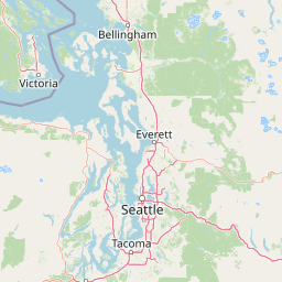
Use this park location map to pinpoint Mount Baker Wilderness in United States of America, understand its exact geographic position, and read its mapped placement within the surrounding landscape more clearly.

Pigeon | © OpenStreetMap contributors

Location context for Mount Baker Wilderness

Washington
Natural feature types

Examine the Named Natural Features of the Mount Baker Wilderness

Continue geographic discovery by browsing the natural landmarks, glacial systems, and mountain peaks associated with the Mount Baker Wilderness. This collection provides an atlas-style view of the protected landscape and its core physical geography.
Recorded earthquake history

Explore Historical Earthquake Records Near Mount Baker Wilderness

Review the recorded history of seismic activity in the vicinity of Mount Baker Wilderness. This catalogue allows for the examination of historical earthquake data, including magnitudes and epicentre locations, providing a clear reference for regional seismic movement within the Cascade Range.

Mount Baker Wilderness Earthquake History

Catalogued events

71 events

Strongest magnitude

Magnitude 5

Most recent event

May 17, 2022

This history includes earthquakes recorded inside the park or within 50 km of its borders

Explore photographic records of active volcanoes, glaciers, and old growth forests.

Mount Baker Wilderness Photos and Landscapes, Visualizing Cascade Scenery

Visual documentation reveals the rugged topography, permanent ice fields, and dense conifer forests that define the protected mountain terrain. Examining authentic imagery provides a clearer understanding of the vertical ecological gradients and geological formations shaping the region.

A wide mountain landscape featuring snow-covered peaks, a forested valley, and a grassy meadow in the foreground.

A view of a rugged, snow-covered mountain peak and glacier rising above an alpine meadow filled with small white and purple wildflowers under a clear blue sky.

Park atlas

Compare connected alpine terrain, volcanic peaks, and regional wilderness areas across the northern Cascades

Explore Parks Near Mount Baker Wilderness and Adjacent Protected Mountain Landscapes

Discover related protected areas situated across the surrounding mountain terrain near Mount Baker Wilderness. Compare adjacent volcanic geography and contiguous forest reserves to expand regional park exploration.
A watercolor painting showing a range of mountains in the background with soft pink, green, and yellow hues, with forest vegetation in the midground and foreground on a white background.
Protected landscapeWashington
Park boundaries overlap#1 closest

Southwest

Mount Baker National Recreation Area: An Atlas of Washington's Volcanic Terrain

Exploration of a remote, roadless Cascade protected landscape

The Mount Baker National Recreation Area provides a unique geographic window into the volcanic heart of the Pacific Northwest. Characterized by its glacier-clad massif and network of subalpine trails, the area serves as a vital protected habitat for elk, mountain goats, and diverse conifer forests. This record details the park's topography, ranging from deep glacial valleys to high-elevation ridges that overlook the broader North Cascades region.

Area
34.29 km²
Established
1984
Relief
Mountain
Climate
Alpine
A watercolor painting showing a panoramic view of mountain peaks in the distance above green foothills and plains.
Protected landscapeWashington
Park boundaries overlap#2 closest

South

Mount Baker, Snoqualmie National Forest: Mapped Geography and Protected Landscape Analysis

Exploratory atlas of Washington's primary Cascade Range wilderness

Delve into the structural geography of Mount Baker, Snoqualmie National Forest. This protected area corridor serves as a major ecological transition zone between the Puget Sound lowlands and the interior Cascades, characterized by extensive glaciers, wild river systems, and iconic stratovolcanoes that define the regional landscape of Washington state.

Area
6,978 km²
Established
1974
Relief
Mountain
Climate
Alpine
National parkWashington
Park boundaries overlap#3 closest

East

North Cascades National Park: US National Park Protected Landscape and Geographic Context

Explore mapped boundaries and regional Washington geography.

Gain insight into North Cascades National Park, a vital US National Park located in Washington. This entry focuses on its protected land status, mapped geographic extent, and its role within the regional atlas. Users seeking to understand the park's landscape character, natural terrain, and its specific location in Washington will find this an essential point for detailed park geography exploration and protected area discovery.

Area
2,042.26 km²
Established
1968
IUCN
II
Visitors
16.5K annual
State or regional parkBritish Columbia
About 23 km away#4 closest

North

Ferry Island Provincial Park: Geography, Riparian Terrain, and Protected River Boundaries

A study of Fraser River alluvial landscapes and provincial park land use

Ferry Island Provincial Park provides a rare protected island setting along the Fraser River in British Columbia. Spanning 29 hectares near the Agassiz-Rosedale Bridge, this Class C park represents an important alluvial riparian ecosystem within the heavily cultivated Fraser Valley, offering key insights into regional river-corridor geography and protected land management.

Area
0.29 km²
Established
1963
IUCN
II
Access
Access unknown
A soft watercolor painting of a calm river or lake flowing through a green meadow with a forest and mountain range in the background.
Protected landscapeWashington
25 km away#5 closest

East

Ross Lake National Recreation Area: A Glacial Reservoir Landscape in Washington

Mapping the Skagit River and North Cascades alpine corridor

Located in the heart of Washington, Ross Lake National Recreation Area preserves a unique landscape of connected reservoirs and deep, glacier-cut valleys. This protected area acts as a vital geographic link within the North Cascades, offering access to high-altitude peaks, riverine forests, and the distinct turquoise waters of Diablo Lake.

Area
475.81 km²
Established
1968
IUCN
V
Visitors
998K annual
State or regional parkBritish Columbia
About 31 km away#6 closest

North

Kilby Provincial Park: Protected Riverfront Geography and Historic Sites in BC

A unique riparian landscape along the Harrison River

Kilby Provincial Park offers an intimate look at the flood plain geography of the Harrison River. The site features an elevated, boardwalk-linked heritage environment integrated with sandy riverfronts and seasonal wildlife corridors. This protected area stands out for its combination of historical pioneer preservation and river-based ecosystem monitoring within the Upper Fraser Valley region of British Columbia.

Area
0.03 km²
Established
1973
IUCN
II
Relief
Lowland
A horizontal watercolor painting depicting a soft-focus mountain landscape with rolling green meadows, patches of coniferous forest, and distant pale mountains under a white sky.
State or regional parkBritish Columbia
36 km away#7 closest

Northeast

E. C. Manning Provincial Park: A Comprehensive Geographic Atlas and Protected Area Overview

Mountainous terrain and ecological transitions in southern British Columbia

Spanning the cross section of the Canadian Cascades, E. C. Manning Provincial Park preserves a high-elevation landscape of wildflowers, glacial valleys, and mountain ridges. The protected area links temperate coastal rainforests with the arid interior, providing a study in regional hydrology and subalpine ecology defined by the Hozameen Range and the northern reaches of the Pacific Crest Trail.

Area
836.71 km²
Established
1941
IUCN
II
Visitors
1.1M annual
A watercolor painting of a mountain landscape with soft-colored rolling hills, a green forest line, and foreground vegetation on a white background.
Protected landscapeWashington
37 km away#8 closest

East

Okanogan, Wenatchee National Forest: A Comprehensive Look at Washington's Protected Mountain Landscapes

Mapping ecological gradients and wilderness boundaries across the eastern Cascade Range

Spanning from the moist coniferous forests of the western Cascades to the arid plateaus of the Okanogan, this massive national forest protects an unmatched diversity of terrain. Explore the intricate geography of river-carved valleys, glacial cirques, and remote wilderness areas that characterize this critical environmental corridor in the Pacific Northwest.

Area
6,066.33 km²
Established
1911
Visitors
397K annual
Relief
Mountain

Common questions about visiting, size, designation, and location context for Mount Baker Wilderness

Mount Baker Wilderness FAQs for park facts, access, geography, and protected area context

Find quick answers about Mount Baker Wilderness, including protected-area facts, park geography, trail and visitor context, and how the park fits into its surrounding country and regional landscape.
MoriAtlas Explorer

Continue Your Protected Areas Search Across the Global Atlas

Deepen your exploration by continuing the structured search for national parks and protected areas worldwide. Utilize the comprehensive filtering capabilities to compare different conservation landscapes and refine your understanding of global park geography. Discover more about the distribution and characteristics of protected natural areas.

Global natural geography




