
Mori Atlas logo
State or regional parkMunmorah State Conservation Area

Mapping the dunes, shorelines, and wetland habitats of this New South Wales coastal reserve

Munmorah State Conservation Area: A Detailed Geographic Atlas of Coastal Protected Landscapes

Munmorah State Conservation Area serves as a vital protected corridor on the Central Coast of New South Wales, situated strategically between the Pacific Ocean and the Tuggerah Lakes system. This geographic profile details the park's distinct topography, ranging from elevated perched sand dunes and rocky headlands to expansive beach stretches and diverse woodland mosaics. By integrating habitat data with regional terrain context, this resource provides an essential look at the ecological boundaries and land-sea interfaces defining this important bird sanctuary.

coastal reservesand dunesperched dunesbeachbird habitatimportant bird area
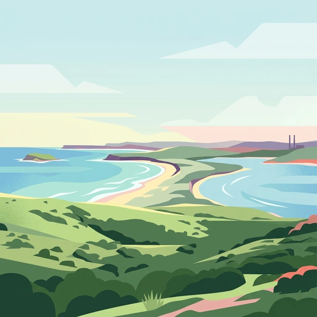
A minimalist flat illustration showing a coastal scene with green rolling hills, a sandy beach, blue water, and a distant industrial chimney stack on the horizon.

Munmorah State Conservation Area

State or regional park

Park overview

Structured park overview, official facts, and landscape profile for Munmorah State Conservation Area

Munmorah State Conservation Area park facts, protected area profile, and essential visitor context

Review the core facts for Munmorah State Conservation Area, including designation, size, terrain, visitor scale, habitats, and operating context in one park-focused overview.

About Munmorah State Conservation Area

Munmorah State Conservation Area lies on a narrow coastal strip between the Pacific Ocean and the Tuggerah Lakes on the Central Coast of New South Wales, just north of the town of Wyong. Despite its modest size, the reserve captures a remarkable diversity of coastal environments, from frontal surf beaches and rocky headlands to perched sand dunes, freshwater wetlands, heaths, and small pockets of coastal woodland. The juxtaposition of boulder-strewn shoreline, sweeping beaches, and elevated dune ridges gives the park both scenic appeal and ecological variety.

The conservation area was created specifically for its coastal setting, panoramic views, perched sand dunes, diverse vegetation communities, protected threatened species, and migratory bird habitats, alongside opportunities for nature-based recreation and environmental education. These values were cited as the central reasons for its 1977 establishment. Its position between the ocean and a major coastal lake system means that the same small reserve supports marine shoreline ecosystems, dune transitions, and wetland-influenced habitats, a combination that is ecologically uncommon along this otherwise heavily developed stretch of coast.

Recognition as part of the Tuggerah Important Bird Area by BirdLife International highlights the reserve's larger regional importance. The park functions as a refuge within a wider landscape that has otherwise seen substantial suburban and tourism development, providing breeding, feeding, and resting habitat for waterbirds and woodland birds. For visitors, the park offers a compact but authentic coastal experience through beaches such as Birdie Beach and Frazer Beach, lookout points such as Wybung Trig, and short walking tracks that thread between vegetation communities rather than through developed townships.

The overall character of Munmorah is shaped by this balancing of ecological purpose and public access. It is not a remote wilderness, but it retains the qualities of an undeveloped coastal landscape at a scale that allows visitors to move between multiple habitats within a single visit. That combination of accessibility and ecological integrity sits at the core of the reserve's contemporary identity.

Quick facts and research context for Munmorah State Conservation Area

Munmorah State Conservation Area is a small coastal reserve of roughly 15 square kilometres on the New South Wales Central Coast, near the town of Wyong. Established in 1977, it is managed by the NSW National Parks and Wildlife Service as a habitat and species management area under IUCN category IV protection. The reserve lies within the Tuggerah Important Bird Area, recognized by BirdLife International for its waterbird and woodland bird values, and includes perched sand dunes, beaches, wetlands, and heathland vegetation communities that support threatened and migratory species.

Protection and recognition

Documented terrestrial protection scope and international recognition records

Munmorah State Conservation Area Protection Status and Regional Recognition Data

Munmorah State Conservation Area maintains a documented terrestrial protection scope within its regional landscape. Official records track international recognition data and designation history without external conservation assumptions.

Protection details

Protection scope
Terrestrial
Transboundary protection
No
Park context

Deeper park guide and search-rich context for Munmorah State Conservation Area

Munmorah State Conservation Area history, landscape, wildlife, and travel context

Explore Munmorah State Conservation Area through its history, landscape character, ecosystems, wildlife, conservation priorities, cultural context, and seasonal travel timing in a structured park guide built for atlas discovery and search intent.

Why Munmorah State Conservation Area stands out

Munmorah is best known for its coastal perched sand dune systems, which rise behind long surf beaches and are among the more distinctive dune landscapes on the New South Wales coast. The reserve is also recognized for its role as part of the Tuggerah Important Bird Area, providing habitat for waterbirds, woodland birds, and migratory shorebirds that rely on the Tuggerah Lakes and adjacent ocean shoreline. Combined with its accessible beaches, lookouts, and walking tracks, these ecological attributes define the park as both a refuge for wildlife and a place where visitors can experience an unusually undeveloped stretch of Central Coast coastline.
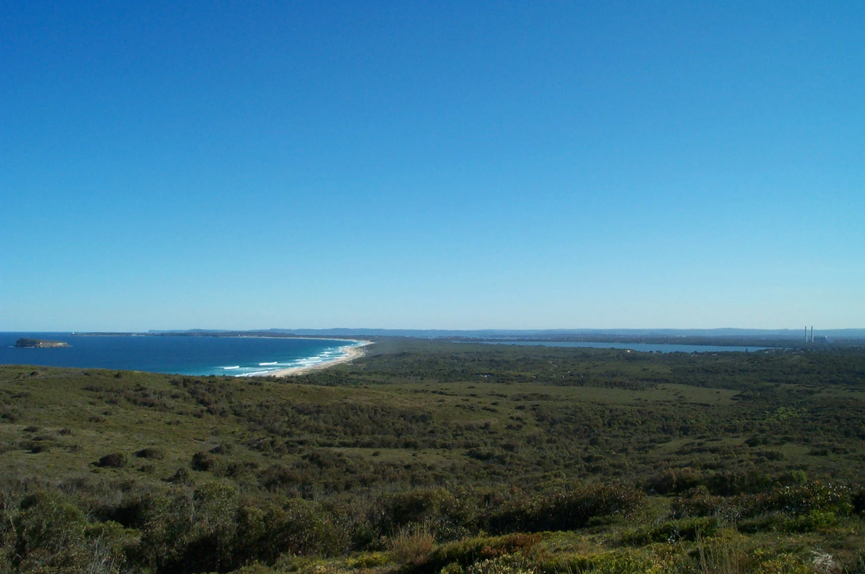
Panoramic landscape view featuring a coastal park with low scrubby vegetation in the foreground, stretching toward a beach along the blue ocean on the left, with a large lake visible inland.
A wide coastal view looking across the vegetation and sand dunes toward Birdie Beach and the surrounding water at Munmorah State Conservation Area.

Munmorah State Conservation Area history and protected-area timeline

The land now making up Munmorah State Conservation Area has a long indigenous history. It was originally inhabited by the Guringai, also referred to as Wannangine, people in the southern portion of what is now the reserve, and by the Awabakal people in the northern section. These traditional custodial groups maintained continuous connections with the coastal lakes, dunes, and forest systems that still define the park today.

European exploration of the broader region began in 1796, when Colonel David Collins, a former Governor of Tasmania who had arrived with the First Fleet, reportedly passed through the Tuggerah Lakes area during the search for Mary Morgan, an escaped convict said to be living with Aboriginal people north of the Hawkesbury River. While the conservation area itself was not established until the late twentieth century, this early European contact marks the beginning of recorded interaction with the surrounding coastal landscape.

Munmorah State Conservation Area was formally established on 1 January 1977, recognizing the outstanding coastal, ecological, and recreational values of the area. The reserve has been managed since then by the NSW National Parks and Wildlife Service as a habitat and species management area. A significant event in the park's recent history occurred during the October 2013 bushfires in New South Wales, when large areas of forest within the conservation area were burnt, leaving a lasting imprint on the vegetation and reshaping parts of the landscape that the reserve was established to protect.

Munmorah State Conservation Area landscape and geographic character

Munmorah's landscape is defined by its narrow but sharply varied coastal corridor. The ocean side of the reserve features long sandy beaches, including Birdie Beach and Frazer Beach, interspersed with rocky headlands and small inlets that create a shifting interface between land and sea. These beaches sit below an elevated dune system, with perched sand dunes forming a notable backdrop that distinguishes Munmorah from many neighbouring stretches of the New South Wales coast.

Behind the dunes, the terrain transitions into a mosaic of coastal vegetation, low woodland, and wetland-influenced flats that connect to the larger Tuggerah Lakes system. Small freshwater features, localized swampy areas, and seasonal drainage patterns add subtlety to an otherwise dune- and beach-dominated scene. Headlands such as Snapper Point and elevated vantage points, including the Wybung Trig Lookout, give the reserve its characteristic panoramic viewpoints.

The overall impression is of a tightly packed sequence of coastal environments, where dunes, forest, wetland, and ocean are all within easy reach of one another. This compression of multiple landscape types into a relatively small area gives Munmorah a scenic diversity that exceeds what its size alone might suggest.

Munmorah State Conservation Area ecosystems, habitats, and plant life

The ecological identity of Munmorah State Conservation Area centers on its perched dune vegetation communities, coastal heathlands, and the wetland connections to the Tuggerah Lakes. The perched sand dunes, in particular, support distinctive plant assemblages adapted to free-draining, nutrient-poor sands, and these communities are among the primary reasons the reserve was set aside for protection. Stands of coastal woodland and pockets of tea tree and palm-dominated vegetation add further variety to the habitat mosaic.

At the broader ecosystem scale, the reserve functions as a transitional zone linking marine shoreline, dune systems, terrestrial forest patches, and freshwater-influenced wetlands. This linkage is ecologically important because it allows species to move between habitat types and because it preserves ecological processes that are increasingly rare along the heavily developed Central Coast.

The area's role within the Tuggerah Important Bird Area reinforces its broader ecological significance. The combination of shoreline, dune, woodland, and freshwater habitats supports different ecological communities in close proximity, giving Munmorah an ecological richness that contrasts with its setting within a largely urbanized regional landscape.

Munmorah State Conservation Area wildlife and species highlights

Wildlife values are central to Munmorah State Conservation Area, particularly its importance for birds. As a component of the Tuggerah Important Bird Area, the reserve supports a significant range of waterbirds, woodland birds, and migratory species that travel along the New South Wales coast. Saltwater and freshwater influences, combined with woodland patches, provide habitat for species that depend on shoreline feeding areas, roosting sites, and wooded refuge.

Beyond birds, the park's mosaic of dunes, forests, and wetlands provides habitat for a variety of small mammals, reptiles, and invertebrates typical of the New South Wales Central Coast. The disturbed post-fire forest areas, regenerating after the 2013 bushfires, continue to develop as habitat for species adapted to successional vegetation, illustrating how wildlife patterns in the reserve are dynamic rather than static.

The reserve's role as a refuge for threatened species, as well as for migratory bird populations that link it to broader flyways, gives Munmorah a regional and even international dimension in addition to its local ecological character. Its wildlife is shaped as much by connections to the wider Tuggerah landscape as by the habitats within the reserve's boundaries.

Munmorah State Conservation Area conservation status and protection priorities

Munmorah State Conservation Area was established specifically to conserve coastal habitat, perched dune vegetation, and species of conservation concern, including threatened flora and fauna and migratory bird populations. Its IUCN category IV designation as a habitat and species management area reflects this focus on active protection of specific ecological values rather than full wilderness preservation. The reserve's inclusion within the Tuggerah Important Bird Area underscores its conservation importance at a scale that extends beyond local or state boundaries.

From a regional perspective, the conservation significance of Munmorah is heightened by its position within an otherwise heavily developed coastal landscape. Suburban expansion, tourism infrastructure, and historical land use around the Central Coast have reduced the availability of intact coastal habitat, and Munmorah functions as one of the few protected places where dune, forest, and wetland communities persist in a relatively continuous condition. This makes its conservation role disproportionately important compared to its modest size.

The impact of the 2013 bushfires, which burnt large areas of forest within the reserve, illustrates that the park is not immune to wider environmental pressures. Conservation management in Munmorah must address the interaction between protection, regeneration, fire history, and ongoing recreational use, making it a working example of how small coastal protected areas are managed in New South Wales.

Munmorah State Conservation Area cultural meaning and human context

Munmorah State Conservation Area carries significant indigenous cultural heritage tied to the Guringai, or Wannangine, and Awabakal peoples, whose traditional lands included the southern and northern sections of what is now the reserve. Their long relationship with the dunes, lakes, and forests of the Central Coast underpins the deep cultural foundation of the landscape, even where the land is now managed under a different framework.

The broader regional landscape also has a layered European and colonial history, including the 1796 European encounter with the Tuggerah Lakes during the search for an escaped convict. While this history is less prominent in the park's contemporary public presentation, it connects the reserve to the early colonial period of New South Wales and to the wider history of European contact along the Central Coast. Together, these cultural layers give Munmorah a human context that extends beyond its ecological identity.

Top sights and standout views in Munmorah State Conservation Area

Munmorah State Conservation Area's most distinctive features are its perched coastal sand dunes, which rise behind long surf beaches and support unusual vegetation communities. The reserve's status within the Tuggerah Important Bird Area makes it a regionally important site for migratory and waterbird conservation, while shorter highlights include accessible beaches such as Birdie Beach and Frazer Beach, elevated lookouts like Wybung Trig, and walking tracks that allow visitors to move between dunes, woodland, and shoreline within a relatively compact area. Its juxtaposition with a heavily urbanized Central Coast gives Munmorah an outsized conservation and experiential value.

Best time to visit Munmorah State Conservation Area

The character of Munmorah State Conservation Area shifts meaningfully with the seasons, in ways that matter for both wildlife interest and visitor experience. Spring and early summer typically bring milder weather, active wildflower displays in heath and dune vegetation, and increased bird activity, making this a particularly rewarding period for those interested in natural history. Autumn offers quieter conditions and stable coastal weather, along with the sense of a transition into the busier summer visitor period.

Summer draws the largest number of visitors because of the area's beaches and ocean swimming conditions, though it is also the period when coastal heat and holiday crowds are most intense. Winter tends to be the calmest time, with cooler temperatures, reduced crowds, and continuing opportunities for bird observation, especially for migratory species present during the cooler months. Choosing a time to visit largely depends on whether the priority is beach recreation, ecological exploration, or quiet coastal scenery.

Monthly climate preview

Long-term representative point measurements tracking monthly temperature and precipitation rhythms

Munmorah State Conservation Area Climate Normals and Annual Weather Patterns

Munmorah State Conservation Area records average monthly temperatures ranging from fourteen to twenty-three degrees Celsius alongside varying daily precipitation levels across the year. Reviewing the complete twelve-month climate profile provides detailed historical baseline data for analytical comparisons.
Annual mean19 °C
14 °C23 °C
Jan23°
Feb23°
Mar22°
Apr20°
May17°
Jun15°
Jul14°
Aug15°
Sep17°
Oct19°
Nov20°
Dec22°
Warmest month
January

23.5 °C

Coolest month
July

14.2 °C

Wettest month
February

4.3 mm/day

Driest month
August

1.8 mm/day

Park location guide

Geography guide, regional context, and park location map for Munmorah State Conservation Area

Munmorah State Conservation Area park geography, regions, and map view in Australia

Understand where Munmorah State Conservation Area sits in Australia through a broader geographic reading of the surrounding landscape, nearby location context, and its mapped position within the national park landscape.

How Munmorah State Conservation Area fits into Australia

Australia is a constitutional monarchy and federal parliamentary democracy comprising six states and ten territories. With a population of nearly 28 million, it is one of the world's most urbanised countries, with most people concentrated on the eastern seaboard. The country has a high Human Development Index and is known for its cultural diversity, ancient Aboriginal heritage, and unique wildlife.

Wider geography shaping Munmorah State Conservation Area in Australia

Australia occupies the entire Australian continent, the island of Tasmania, and numerous smaller islands. It is the world's flattest and driest inhabited continent, featuring vast deserts in the interior (the Outback), tropical rainforests along the eastern coast, and a coastline bordering the Indian and Pacific Oceans.

Map view of Munmorah State Conservation Area

Use this park location map to pinpoint Munmorah State Conservation Area in Australia, understand its exact geographic position, and read its mapped placement within the surrounding landscape more clearly.

Pigeon | © OpenStreetMap contributors

Location context for Munmorah State Conservation Area

New South Wales
Recorded earthquake history

Explore Historical Earthquake Records for Munmorah State Conservation Area

Examine the seismic catalogue associated with Munmorah State Conservation Area to view recorded historical activity. This MoriAtlas resource identifies earthquakes by distance from the park, providing a factual reference for regional seismic patterns and historical event documentation.

Munmorah State Conservation Area Earthquake History

Catalogued events

3 events

Strongest magnitude

Magnitude 5.4

Most recent event

Sep 10, 2012

This history includes earthquakes recorded inside the park or within 50 km of its borders

Visual reference collection highlighting perched dunes, coastal vegetation, and protected habitats

Munmorah State Conservation Area Photos, Landscapes, and Coastal Scenery

Visual documentation captures the varied terrain and coastal environments of Munmorah State Conservation Area across undeveloped beaches, headlands, and wetland fringes. Examining field photography reveals the ecological composition of perched dunes, native woodland, and vital bird habitats within the reserve.

Panoramic landscape view featuring a coastal park with low scrubby vegetation in the foreground, stretching toward a beach along the blue ocean on the left, with a large lake visible inland.

Park atlas

Compare adjacent coastal landscapes, dunes, and protected habitats across the region

Other Parks Near Munmorah State Conservation Area and Surrounding Coastal Reserves

Browse nearby national parks and protected areas sharing the coastal geography of Munmorah State Conservation Area. Comparing these surrounding reserves reveals broader patterns in regional dune ecosystems and protected habitats.
Protected areaNew South Wales
0.1 km away#1 closest

North

Lake Macquarie State Conservation Area: Geography and Protected Landscape Map Details

Coastal lagoon bushland across six protected foreshore sections

Situated along the saltwater shores of a major coastal lagoon in New South Wales, this protected area features a distinctive fragmented design. The reserve safeguards rare coastal forest and wetland vegetation, providing a vital snapshot of the region's original shoreline ecosystem. Through its unique distribution of six shoreline blocks, the park offers significant insight into the interplay between protected bushland and the surrounding developed landscape.

Area
7.6 km²
Established
1996
IUCN
II
Scope
Terrestrial
A soft watercolor painting of a serene coastal scene with rolling green hills in the distance, a calm body of water in the middle ground, and small rocky islands.
Nature reserveNew South Wales
About 1.5 km away#2 closest

South

Bird Island Nature Reserve: Protected Offshore Landscapes and Tasman Sea Geographic Context

A sedimentary nature reserve off the Central Coast of New South Wales.

Bird Island Nature Reserve represents a key protected area of the New South Wales coastline, characterized by steep sedimentary cliffs and limited accessibility. The island serves as a vital refuge for shearwater breeding colonies and diverse marine life. Its unique geological history as a once-attached mainland landform and its current isolation create a specialized protected environment for shorebirds, migratory species, and offshore marine ecosystems.

Established
1960
IUCN
Ia
Relief
Lowland
Climate
Temperate
National parkNew South Wales
6 km away#3 closest

Southwest

Wyrrabalong National Park National Park: Protected Littoral Rainforest and Coastal Geography

Explore mapped terrain and vital bird habitats in New South Wales.

Wyrrabalong National Park on New South Wales' Central Coast is an essential protected landscape, noted for safeguarding the last significant coastal littoral rainforest of its kind. This park entry details the mapped geography across its peninsula, island, and beachfront sections, revealing a compact yet ecologically rich environment. It highlights the park's importance as part of an Important Bird Area, supporting significant waterbird and woodland bird populations within its protected boundaries, offering a unique glimpse into a vanishing coastal ecosystem.

Area
6.2 km²
Established
1991
IUCN
II
Relief
Lowland
Watercolor painting of rolling green hills, grassy foreground, and soft, hazy mountains in the background, set against a plain white background.
State or regional parkNew South Wales
18 km away#4 closest

Northeast

Glenrock State Conservation Area: Coastal Reserve and Geological Atlas Exploration

Protected coastal landscapes and rare remnant vegetation near Newcastle

Glenrock State Conservation Area encompasses 534 hectares of protected coastline, ranging from steep cliffs and exposed headlands to sheltered forested gullies and lagoon systems. This reserve functions as a critical ecological refuge, housing nationally significant plant communities and unique Permian-aged soil substrates. Its terrain documents both deep geological history and the cultural heritage of the Awabakal people, balanced with early industrial relics that reflect the colonial history of the lower Hunter region.

Area
5.34 km²
Established
1974
Relief
Upland
Climate
Temperate
State or regional parkNew South Wales
18 km away#5 closest

Northwest

Jilliby State Conservation Area: Geographic Boundaries and Regional Protected Landscapes

Forested hinterland and protected bushland in New South Wales

Jilliby State Conservation Area encompasses a rich bushland environment behind the New South Wales Central Coast. The protected territory features a contrast between ridge-top forests and deep, moisture-rich rainforest gullies. Beyond its natural terrain, the area holds cultural significance and provides a vital habitat for diverse birdlife within the broader regional landscape.

Area
121.59 km²
Scope
Terrestrial
National parkNew South Wales
20 km away#6 closest

Northwest

Watagans National Park: National Park Protected Landscape in New South Wales

Explore its mapped boundaries and regional geography.

Watagans National Park stands as a key protected area within New South Wales, Australia. This detail page focuses on its specific role as a national park, offering insights into its mapped geographic boundaries and its place within the regional landscape. Understand the protected natural identity of Watagans National Park through a structured, atlas-informed lens.

Area
77.51 km²
Established
1999
IUCN
II
Climate
Temperate
Nature reserveNew South Wales
About 23 km away#7 closest

North

Blackbutt Reserve: Protected Eucalyptus Woodland and Urban Nature Reserve in Newcastle

Geography and landscape mapping of a New South Wales nature reserve

Blackbutt Reserve stands as a notable 182-hectare nature reserve within Newcastle, New South Wales, protecting a diverse stretch of undulating eucalyptus forest. This protected area serves as an essential green space, offering a unique look at local topography and regenerating woodland ecosystems preserved through decades of community effort.

Area
1.82 km²
Established
1938
Relief
Upland
Climate
Temperate
National parkNew South Wales
30 km away#8 closest

Southwest

Brisbane Water National Park: A Protected Landscape in New South Wales' Sydney Basin Bioregion

Explore mapped terrain, endangered ecosystems, and coastal waterway geography.

Brisbane Water National Park, located in New South Wales, Australia, is a vital protected area safeguarding critical ecosystems within the Sydney Basin bioregion. This national park features a diverse landscape encompassing rugged escarpments, fertile valleys, and important coastal waterways. Its protected status makes it a crucial conservation refuge, offering insights into unique natural terrain and regional geography for those seeking detailed, map-centric exploration.

Area
115.06 km²
Established
1959
IUCN
II
Relief
Mixed relief

Common questions about visiting, size, designation, and location context for Munmorah State Conservation Area

Munmorah State Conservation Area FAQs for park facts, access, geography, and protected area context

Find quick answers about Munmorah State Conservation Area, including protected-area facts, park geography, trail and visitor context, and how the park fits into its surrounding country and regional landscape.
MoriAtlas Explorer

Continue Your Protected Areas Search Across the Global Atlas

Deepen your exploration by continuing the structured search for national parks and protected areas worldwide. Utilize the comprehensive filtering capabilities to compare different conservation landscapes and refine your understanding of global park geography. Discover more about the distribution and characteristics of protected natural areas.

Global natural geography